Regional overview
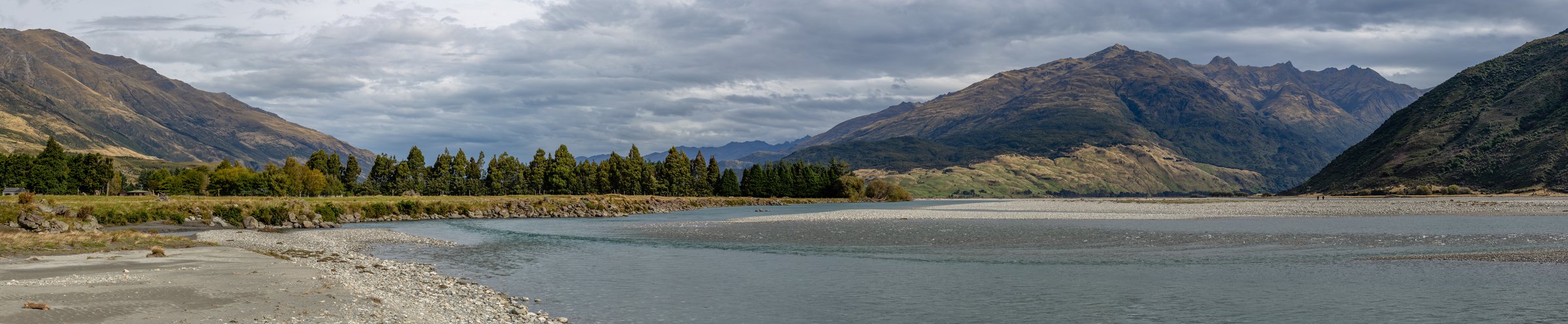
Young Valley is the eastern half of the Gillespie Pass Circuit in Mount Aspiring National Park, reached from the Makarora / Blue Pools side. It combines Blue Pools access, the Young River Link Track, the long Young River valley, Young Forks, Young Hut, and the alpine crossing toward Gillespie Pass and Siberia Hut.
The walking character changes quickly: an easy tourist track at Blue Pools, a formed link track to the Young/Makarora confluence, then backcountry tramping beside the Young River and across unstable slips toward Young Hut. Above Young Hut, the route climbs into alpine terrain toward Gillespie Pass, snow grass, and exposed high-country weather.
DOC warns that parties need river-crossing skills for the full Gillespie Pass Circuit. A natural dam formed in the North Branch of the Young valley in 2007 and remains a hazard; the valley should be avoided during heavy rain, and camping on the valley floor in heavy rain is unsafe. The circuit is not recommended in winter because of snow, ice, and avalanche risk.
Selection rationale
The five hikes represent the full Young Valley progression: Blue Pools as the access gateway, the Young River Link Track, the lower Young valley to Young Forks, the upper approach to Young Hut, and the alpine day section over Gillespie Pass toward Siberia.
Summary table
| # | Hike | Country | Route type | Distance | Gain | Max elevation | Difficulty |
|---|---|---|---|---|---|---|---|
| 1 | Blue Pools Track | New Zealand | Out-and-back | 3 km return | ±30 m | Easy | |
| 2 | Young River Link Track | New Zealand | Out-and-back / access section | 14 km return or 7 km one way | 143 m gain / 174 m loss on RouteGuides segment | 415 m | Moderate |
| 3 | Young/Makarora confluence to Young Forks Campsite | New Zealand | Out-and-back or point-to-point section | 9.4 km one way; 18.8 km return from confluence | 206 m gain / 114 m loss | 432 m | Moderate-hard |
| 4 | Young Forks Campsite to Young Hut | New Zealand | Out-and-back hut/valley section | 5.7 km one way; 11.4 km return | 374 m gain / 49 m loss | 731 m | Moderate-hard |
| 5 | Young Hut to Siberia Hut via Gillespie Pass | New Zealand | Point-to-point alpine section | 10.7-12 km one way | 919 m gain / 1,030 m loss from RouteGuides | 1,610 m | Hard / advanced |
1. Blue Pools Track
Snapshot
Itinerary
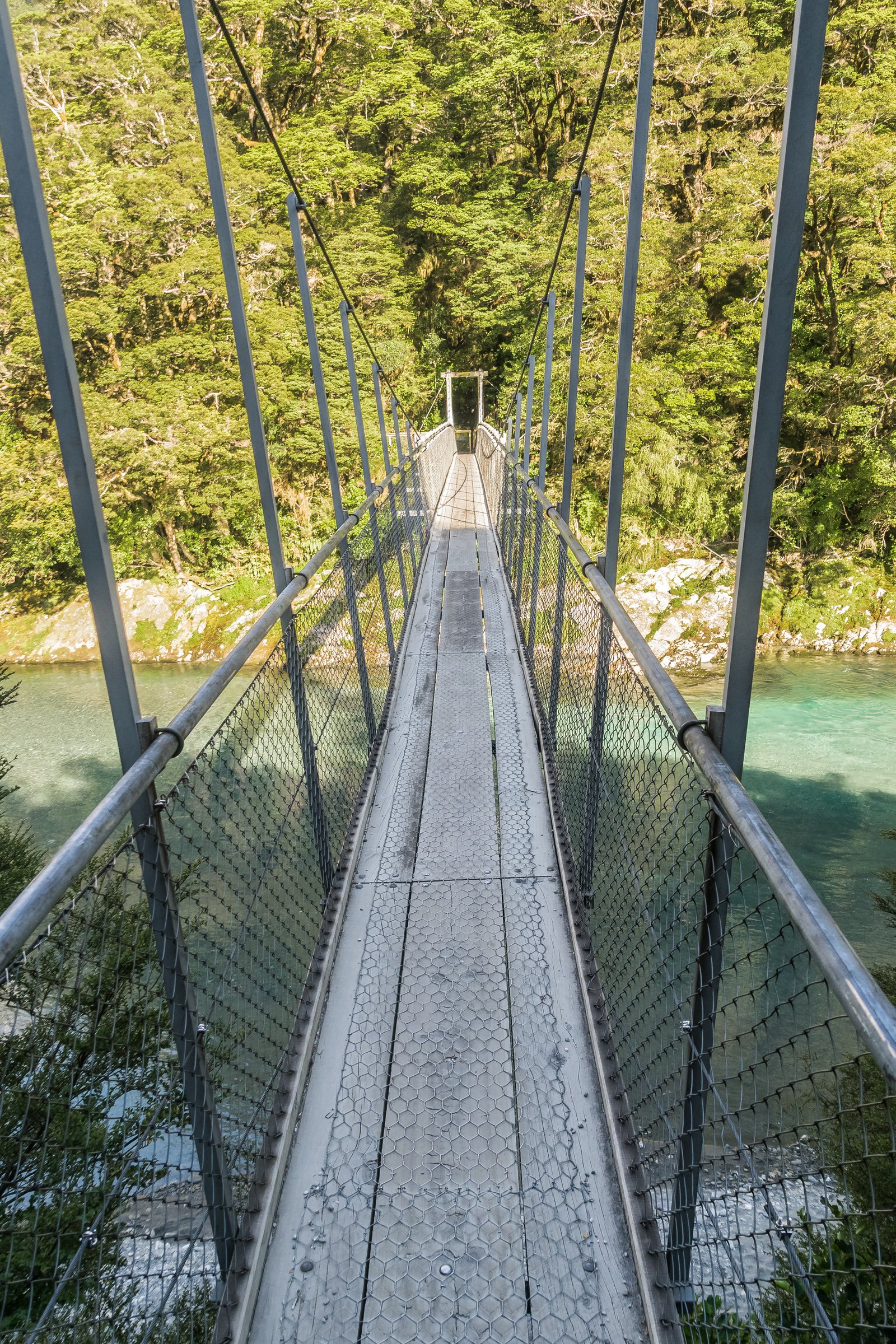
From the Blue Pools car park, the track passes through mature beech and podocarp forest to the Makarora River swing bridge, continues on boardwalk, and reaches the Blue Pools viewing bridge over the clear river gorge. Return on the same track.
Why it is essential
Blue Pools is the accessible gateway to the Young River Link Track and one of the best-known short walks on the Makarora side of Mount Aspiring National Park. Its bridges also form the high-water access system for Young Valley approaches.
Equipment
Standard hiking equipment for a short walk: walking shoes, weather layer, water, and sun/insect protection.
Hazards and notes
DOC reopened the upgraded Blue Pools and Makarora bridges in 2025 after a long safety closure. Bridge capacity signs should be followed. No dogs are allowed in the national park, and drones require DOC authorisation.
GPX / KML links
| Source | URL | Format / access | Reuse status |
|---|---|---|---|
| DOC Blue Pools Track | doc.govt.nz | Official route page / source map | DOC website material generally CC BY 4.0 unless otherwise stated; route geometry reuse not separately confirmed; no DOC GPX found |
| RouteGuides: Blue Pools car park to bridge area | routeguides.co.nz | Route page with Download GPX link | Site licence/terms not located in this pass; GPX link exposed; reuse unclear |
External links
- DOC — Blue Pools Track
- DOC — Wanaka bridges reopening media release, 30 May 2025
- RouteGuides — Blue Pools Walk
2. Young River Link Track
Snapshot
Itinerary
From Blue Pools car park, follow the Blue Pools Track for about 10 minutes and branch left just after the first swing bridge. The track uses the Blue Pools bridge system, continues through beech/tawhero forest to Rainy Flat, then crosses sections of farmland and bush to reach the mouth of the Young River.
Why it is essential
This track provides the safer high-river access alternative to the Young/Makarora confluence and is a key modern gateway to the Gillespie Pass Circuit.
Equipment
Standard hiking equipment for the link track; mountain hiking equipment if continuing into Young Valley. Carry water, warm layer, waterproof layer, food, map/GPS, and headtorch if using it as part of a longer day.
Hazards and notes
The last 30 m before the Young River is steep and unformed. Parties continuing up the Young Valley need backcountry skills and fitness. DOC notes that the link removes one Makarora crossing, but parties completing the circuit may still need to cross the Makarora at the Wilkin confluence or use jet boat transport.
GPX / KML links
| Source | URL | Format / access | Reuse status |
|---|---|---|---|
| DOC Young River Link Track | doc.govt.nz | Official route page / source map | DOC website material generally CC BY 4.0 unless otherwise stated; route geometry reuse not separately confirmed; no DOC GPX found |
| RouteGuides: Blue-Young Link Track | routeguides.co.nz | Route page with Download GPX link | Site licence/terms not located in this pass; GPX link exposed; reuse unclear |
External links
3. Young/Makarora confluence to Young Forks Campsite
Snapshot
Itinerary
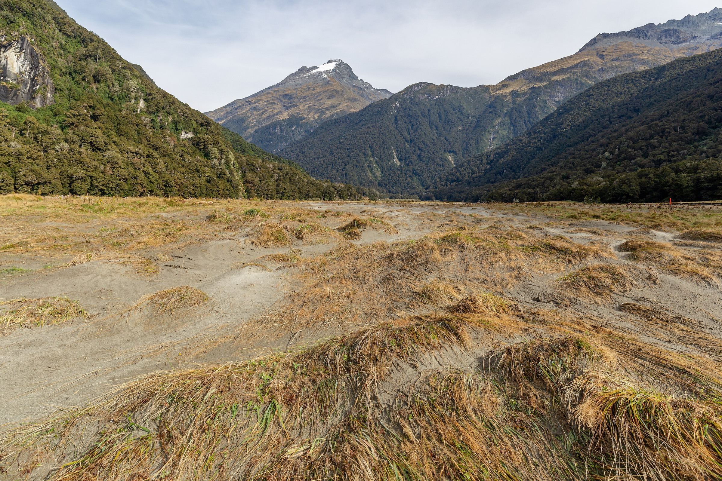
From the Young/Makarora confluence, follow the Young River on its true left through bush and grass flats. The track reaches the swing bridge at the junction of the North and South branches; Young Forks Campsite lies about 200 m upstream and has an open shelter and toilet.
Why it is essential
This is the lower Young valley day section and the first true backcountry stage of the Gillespie Pass route. It introduces the river, beech flats, and forked-valley geography that define the area.
Equipment
Mountain hiking equipment: sturdy boots, waterproof and warm layers, food, water, map/GPS, headtorch, and emergency shelter. River-crossing skills are needed for access if not using the Young River Link Track/bridge system.
Hazards and notes
DOC warns that trampers have drowned attempting the Makarora crossing. The natural dam in the Young North Branch poses a hazard in heavy rain; avoid the Young Valley during or immediately after heavy rain and do not camp on the valley floor in such conditions.
GPX / KML links
| Source | URL | Format / access | Reuse status |
|---|---|---|---|
| DOC Gillespie Pass Circuit | doc.govt.nz | Official route page / source map | DOC website material generally CC BY 4.0 unless otherwise stated; route geometry reuse not separately confirmed; no DOC GPX found |
| RouteGuides: Young/Makarora Confluence to Young North Branch Campsite | routeguides.co.nz | Route page with Download GPX link | Site licence/terms not located in this pass; GPX link exposed; reuse unclear |
External links
- DOC — Gillespie Pass Circuit
- DOC — Young Forks Campsite
- RouteGuides — Young/Makarora Confluence to Young North Branch Campsite
4. Young Forks Campsite to Young Hut
Snapshot
Itinerary
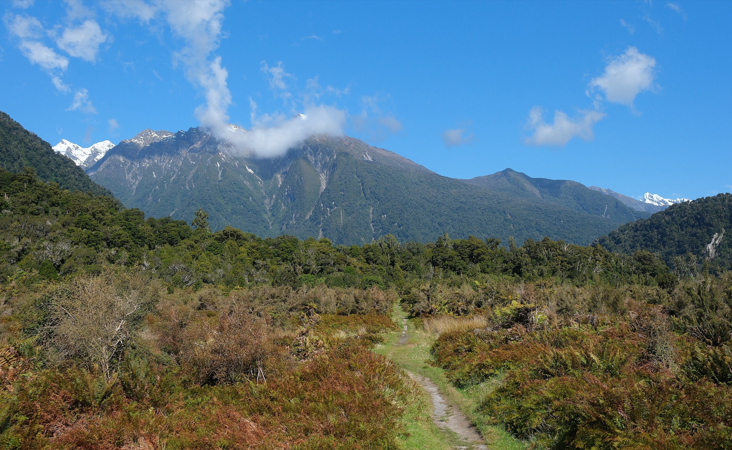
From the Young Forks area, the track continues toward the South Branch, crosses a grassy flat, enters forest, and climbs steeply for about 100 m. It then sidles through unstable slip areas toward Stag Creek and continues steadily to Young Hut.
Why it is essential
Young Hut is the principal base in the Young Valley and the launch point for Gillespie Pass. This section shows the transition from lower river flats to the more enclosed upper valley and hut terrain.
Equipment
Mountain hiking equipment: sturdy boots, waterproof and warm layers, food, water, map/GPS, headtorch, and emergency shelter. Hut users need booking/fee confirmation and overnight equipment.
Hazards and notes
DOC states that camping is not allowed around Young Hut because the cleared area is a helicopter landing site. Unstable slips, heavy rain, and the North Branch dam hazard require conservative decisions. Young Hut bookings are required during the summer booking season.
GPX / KML links
| Source | URL | Format / access | Reuse status |
|---|---|---|---|
| DOC Young Hut | doc.govt.nz | Official hut/access page / source map | DOC website material generally CC BY 4.0 unless otherwise stated; route geometry reuse not separately confirmed; no DOC GPX found |
| RouteGuides: Young North Branch Campsite to Young Hut | routeguides.co.nz | Route page with Download GPX link | Site licence/terms not located in this pass; GPX link exposed; reuse unclear |
External links
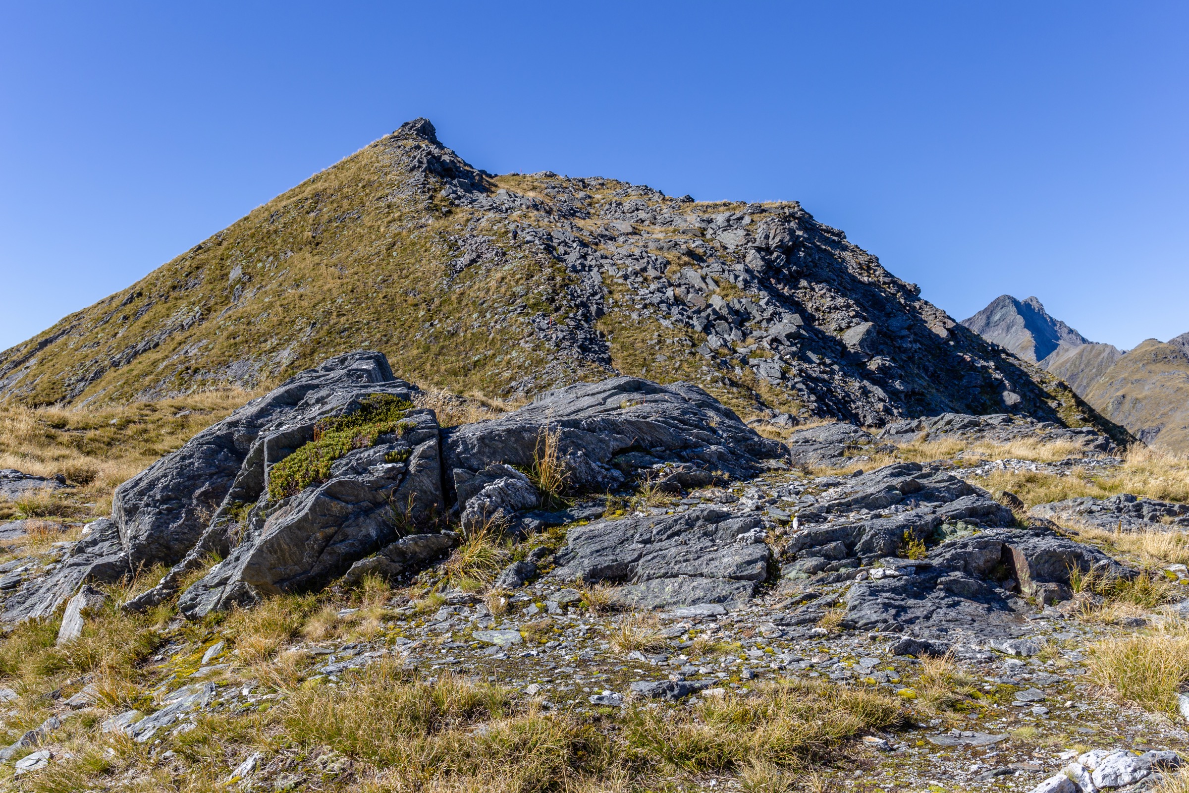
5. Young Hut to Siberia Hut via Gillespie Pass
Snapshot
Itinerary
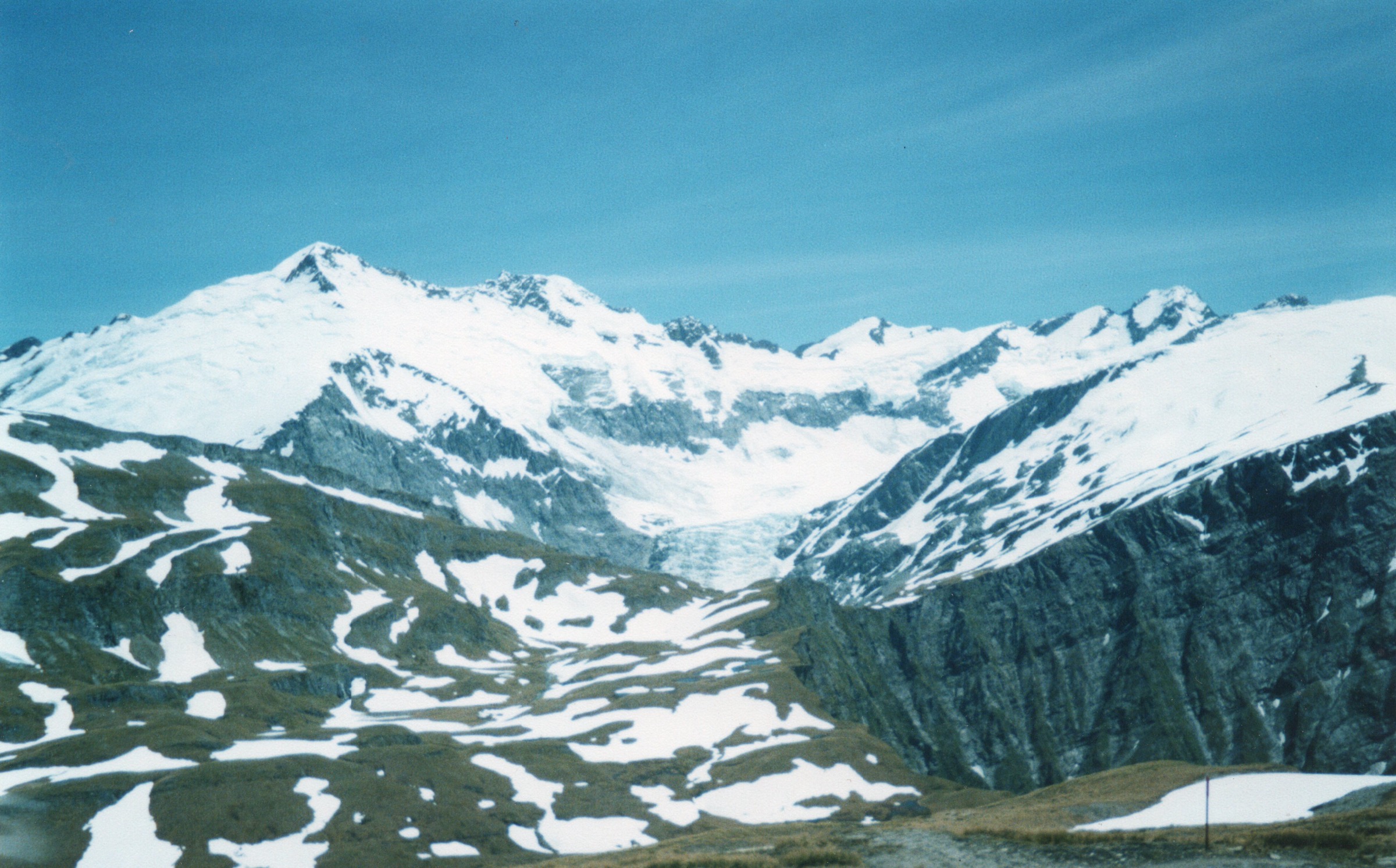
From Young Hut, climb for about one hour to the bushline, cross the bridge over the upper Young, and follow the valley floor to the start of the Gillespie Pass climb. The track ascends steeply beside a rock bluff onto a snow-grass spur, reaches high ridge terrain around 1,600 m, then descends steeply through snow-grass basins into forest above Gillespie Stream. It continues down to Siberia Stream and follows the valley floor to Siberia Hut.
Why it is essential
This is the alpine heart of the Gillespie Pass Circuit and the most important high crossing associated with Young Valley. It gives the region’s signature views toward Mount Awful and the Siberia side of the range.
Equipment
Mountain hiking equipment: sturdy boots, warm and waterproof layers, navigation backup, headtorch, food, water, and emergency shelter. Conditional: alpine and avalanche equipment may be required in snow conditions; only experienced parties should consider it outside normal summer conditions.
Hazards and notes
DOC notes that the section is snow-covered in winter/spring and should only be attempted then by parties with alpine and avalanche experience. Snow grass can be very slippery when wet, and water availability is limited after leaving the upper Young valley until well over the pass. An unnamed creek near Siberia Hut can become uncrossable during high rainfall.
GPX / KML links
| Source | URL | Format / access | Reuse status |
|---|---|---|---|
| DOC Gillespie Pass Circuit | doc.govt.nz | Official route page / source map | DOC website material generally CC BY 4.0 unless otherwise stated; route geometry reuse not separately confirmed; no DOC GPX found |
| RouteGuides: Young Hut to Siberia Hut via Gillespie Pass | routeguides.co.nz | Route page with Download GPX link | Site licence/terms not located in this pass; GPX link exposed; reuse unclear |
External links
- DOC — Gillespie Pass Circuit
- DOC — Gillespie Pass, Wilkin Valley tracks brochure
- DOC — Young Hut
- RouteGuides — Young Hut to Siberia Hut via Gillespie Pass
External links
| Source | URL |
|---|---|
| DOC — Blue Pools Track | doc.govt.nz |
| DOC — Young River Link Track | doc.govt.nz |
| DOC — Gillespie Pass Circuit | doc.govt.nz |
| DOC — Gillespie Pass, Wilkin Valley tracks brochure | doc.govt.nz |
| DOC — Young Hut | doc.govt.nz |
| DOC — Young Forks Campsite | doc.govt.nz |
| DOC — Wanaka bridges reopening media release, 30 May 2025 | doc.govt.nz |
| RouteGuides — Blue Pools Walk | routeguides.co.nz |
| RouteGuides — Blue-Young Link Track | routeguides.co.nz |
| RouteGuides — Young/Makarora Confluence to Young North Branch Campsite | routeguides.co.nz |
| RouteGuides — Young North Branch Campsite to Young Hut | routeguides.co.nz |
| RouteGuides — Young Hut to Siberia Hut via Gillespie Pass | routeguides.co.nz |