Regional overview
Welcome Flat is the hut-and-hot-pools focus of the Copland Track in Westland Tai Poutini National Park. It sits deep in the Copland Valley, normally reached by an 18 km, 7 hr one-way tramp from the SH6 road end. The immediate area is not a conventional day-walk hub: it is a backcountry base, with local hot pools, river flats, the Sierra Range above, and the continuation of the Upper Copland Valley Track toward Douglas Rock Hut.
For this catalogue entry, “day-hikes” means routes and route sections that can be walked from a Welcome Flat base in a day, plus the standard exit stage. The selections are intentionally honest about the setting: one short local hot-pool/meadow walk, two upper-valley options, one middle-valley out-and-back to Architect Creek, and the full return/exit down the Copland Track.
Welcome Flat Hut, the Sierra Room, and the campsite must be booked year-round. DOC warns that the Copland Valley can flood at any time, that the track may close during heavy rain, that side creeks can become impassable, and that only experienced trampers should continue beyond Welcome Flat into the upper valley.
Selection rationale
The five selections cover the usable Welcome Flat day-hike set: the essential hot pools, the classic day return to Douglas Rock, a shorter upper-valley river-flats objective toward Scott Creek, a middle-valley return toward Architect Creek, and the full exit to the Copland road end. Several are sections of the same DOC corridor because Welcome Flat is a backcountry base rather than a trailhead town.
Summary table
| # | Hike | Country | Route type | Distance | Gain | Max elevation | Difficulty |
|---|---|---|---|---|---|---|---|
| 1 | Welcome Flat Hut, hot pools and Sierra Range view stroll | New Zealand | Short out-and-back / informal local stroll | DOC says hot pools are a short stroll from hut | Minimal | Easy locally, but only after a backcountry approach | |
| 2 | Welcome Flat Hut to Douglas Rock Hut and return | New Zealand | Out-and-back | 14 km return (DOC); 15.8 km (AllTrails) | About 369 m one-way gain (AllTrails) | Advanced tramping track | |
| 3 | Welcome Flat Hut to Scott Creek flats / upper Copland meadows | New Zealand | Out-and-back partial upper-valley objective | Advanced tramping track | |||
| 4 | Welcome Flat Hut to Architect Creek Hut and return | New Zealand | Out-and-back middle-valley day hike | 13.8 km return (AllTrails) | c. 436 m one-way (AllTrails) | Just under 500 m on DOC profile near Welcome Flat | Intermediate / hard day |
| 5 | Welcome Flat Hut to Copland Track car park | New Zealand | Point-to-point exit day stage | 18 km (DOC); 17.2 km (AllTrails) | Mostly descent; AllTrails 727 m uphill direction | DOC profile stays below 500 m | Intermediate tramping track |
1. Welcome Flat Hut, Hot Pools and Sierra Range View Stroll
Snapshot
Itinerary
From Welcome Flat Hut, walk to the natural hot pools on the open flat with views toward the Sierra Range. DOC identifies the pools as fragile and specifically asks visitors not to use soaps or shampoo and not to dig more pools. The local stroll can be combined with a hut-area rest day after the long approach.
Why it is essential
The hot pools are the reason Welcome Flat became the Copland Valley’s classic destination. They connect the area’s tourist-route history, geothermal feature, mountain view, and hut culture in the smallest possible walk.
Equipment
- Hut-area clothing
- Waterproof shell and warm layer
- Sandals or shoes for wet ground
- Headtorch if visiting near dusk
Hazards and notes
- Keep your head above the water to reduce the risk of amoebic meningitis.
- Do not use soap or shampoo in the pools.
- Do not dig or modify pools.
- Welcome Flat Hut, Sierra Room, and campsite must be booked year-round.
- No dogs; no drones.
GPX / KML links
| Source | URL | Format / access | Reuse status |
|---|---|---|---|
| DOC: Copland Track to Welcome Flat Hut | doc.govt.nz | Official route page / local description | DOC copyright terms; no GPX for local hot-pool stroll found |
External links
2. Welcome Flat Hut to Douglas Rock Hut and Return
Snapshot
Itinerary
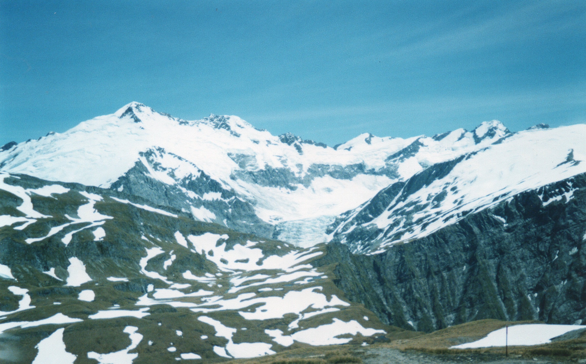
Cross the suspension bridge near Welcome Flat Hut to the true left of the Copland River, then follow grassy river flats with views into the Ruera Valley and Navigator Range. The route moves in and out of low forest, crosses Scott Creek’s multiple channels, climbs above the upper gorge, traverses open slips, and reaches the swing bridge over Tekano Creek. Douglas Rock Hut is just beyond, in a forest glade.
Why it is essential
This is the classic Welcome Flat day objective for experienced trampers: it reaches the rougher upper valley, gives bigger views of Mount Sefton, the Footstool, and the Sierra Range, and returns to the comfort of Welcome Flat in a full but feasible day.
Equipment
- Full day-tramping kit
- Boots, waterproofs, warm layers
- Food and water treatment
- Map / GPS
- Headtorch
- First aid
- PLB
- River-crossing judgement
Hazards and notes
- DOC states only experienced trampers should proceed beyond Welcome Flat.
- Scott Creek can be extremely hazardous in wet weather.
- Creeks beyond Welcome Flat are rougher and may be unbridged or impassable after rain.
- Flooding, rockfall, and avalanche are listed hazards.
- No dogs; no drones.
GPX / KML links
| Source | URL | Format / access | Reuse status |
|---|---|---|---|
| DOC: Upper Copland Valley Track | doc.govt.nz | Official route page / interactive map | DOC copyright terms; no GPX found |
| DOC: Upper Copland valley route guide (PDF) | doc.govt.nz | PDF route guide | DOC copyright terms |
| AllTrails: Welcome Flat Hut to Douglas Rock Hut | alltrails.com | Source route page; GPX usually service-controlled | AllTrails terms apply |
External links
- DOC — Upper Copland Valley Track
- DOC — Upper Copland valley route guide (PDF)
- AllTrails — Welcome Flat Hut to Douglas Rock Hut
3. Welcome Flat Hut to Scott Creek Flats / Upper Copland Meadows
Snapshot
Itinerary
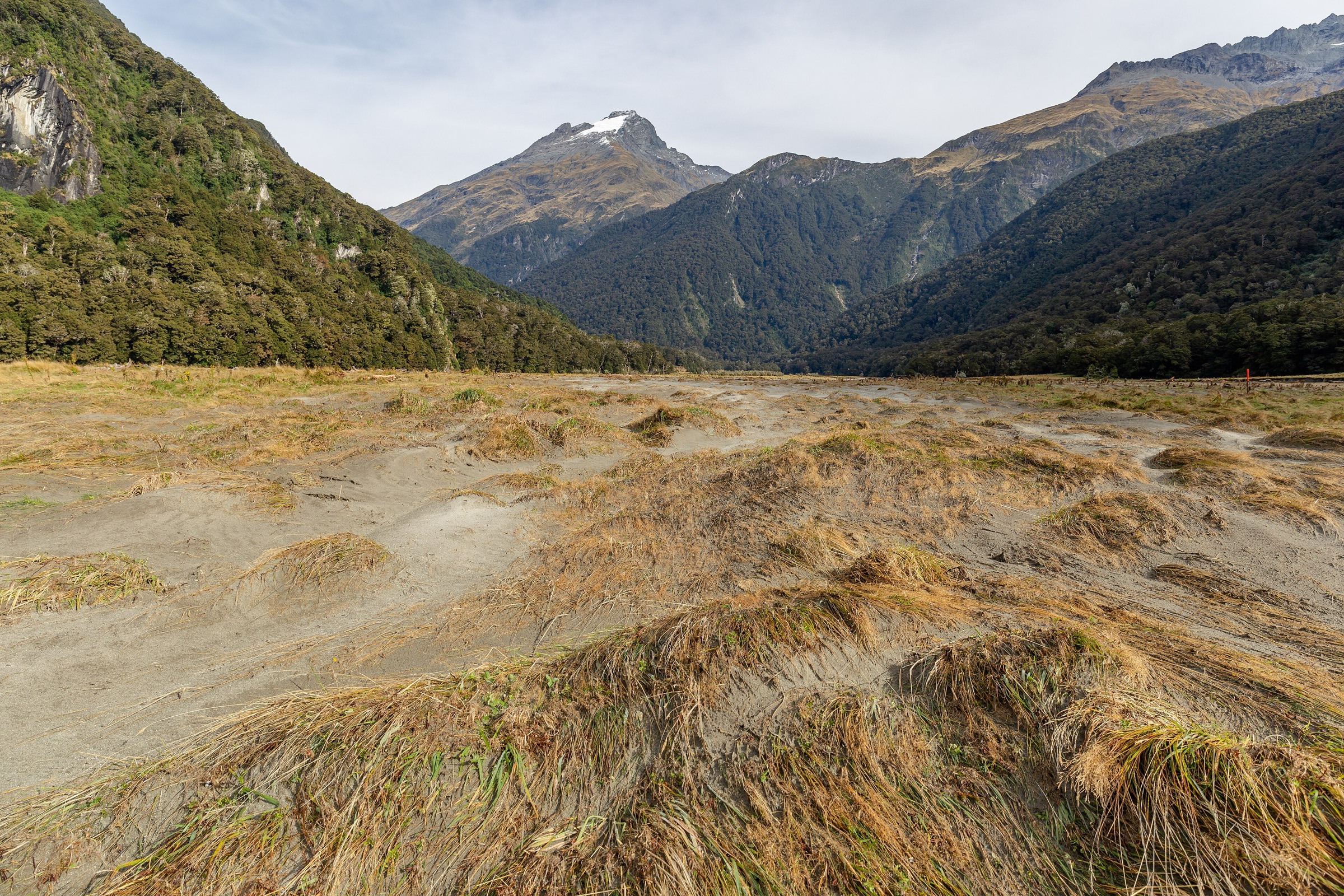
From Welcome Flat, follow the Douglas Rock route across the suspension bridge and onto the true left of the Copland River. Continue along the open grassy flats with views into the Ruera Valley, Navigator Range, Mount Sefton, the Footstool, and the Sierra Range. Turn around before committing to hazardous Scott Creek channels if water levels or weather are unsuitable.
Why it is essential
This is the sensible shorter upper-valley option from Welcome Flat: it gives the meadow-and-mountain character of the upper Copland without requiring the full return to Douglas Rock Hut.
Equipment
- Full day-tramping kit
- Waterproofs and warm layers
- Map / GPS
- Headtorch
- Food and water treatment
- First aid
- PLB recommended
Hazards and notes
- Scott Creek can be extremely hazardous in wet weather.
- Do not cross if the creek is flooded, discoloured, or unsafe.
- Weather can change rapidly; this is still backcountry travel despite the shorter target.
- No dogs; no drones.
GPX / KML links
| Source | URL | Format / access | Reuse status |
|---|---|---|---|
| DOC: Upper Copland Valley Track | doc.govt.nz | Official route page / route description | DOC copyright terms; no separate GPX found |
| DOC: Upper Copland valley route guide (PDF) | doc.govt.nz | PDF route guide | DOC copyright terms |
External links
4. Welcome Flat Hut to Architect Creek Hut and Return
Snapshot
Itinerary
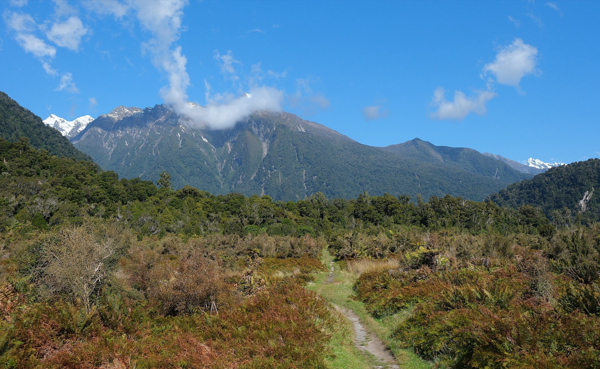
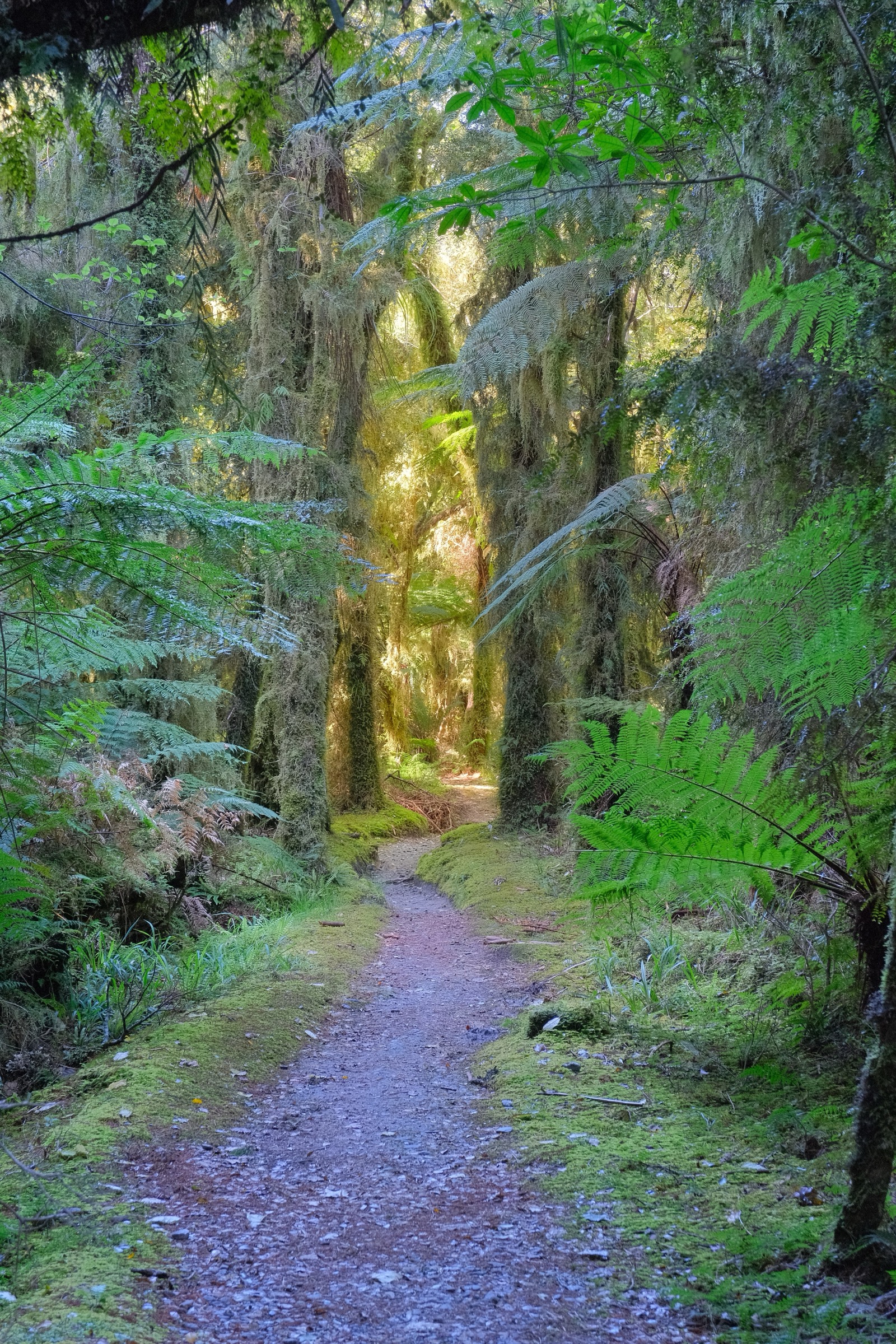
From Welcome Flat, retrace the Copland Track down through forest from the hut, over the highest point of the lower track, and across the Shiels Creek and Open Creek sections toward Architect Creek. This out-and-back samples the middle Copland without exiting the valley and gives a useful bad-weather-limited alternative if the upper valley is not appropriate.
Why it is essential
From a Welcome Flat base, Architect Creek is the natural down-valley day objective: it revisits the landslide and side-creek terrain that defines the Copland approach and gives a strong sense of how isolated Welcome Flat is.
Equipment
- Full day-tramping kit
- Boots, waterproofs, warm layers
- Food and water treatment
- Map / GPS
- Headtorch
- First aid
- PLB recommended
Hazards and notes
- DOC identifies active landslide areas near Shiels Creek and upstream of Architect Creek.
- Do not cross flooded side creeks.
- Wet rock, boulder sections, and muddy forest can slow travel.
- Carry a headtorch even if planning a daylight return.
GPX / KML links
| Source | URL | Format / access | Reuse status |
|---|---|---|---|
| DOC: Copland Track to Welcome Flat Hut | doc.govt.nz | Official route page / interactive map | DOC copyright terms; no GPX found |
| AllTrails: Architect Creek Hut to Welcome Flat Campsite | alltrails.com | Source route page; GPX usually service-controlled | AllTrails terms apply |
| Wilderness GPX: Welcome Flat Hut | wildernessmag.co.nz | GPX for broader road-end to Welcome Flat route | Licence not stated; reuse not confirmed |
External links
- DOC — Copland Track to Welcome Flat Hut
- AllTrails — Architect Creek Hut to Welcome Flat Campsite
- Wilderness Magazine — Welcome Flat Hut
5. Welcome Flat Hut to Copland Track Car Park
Snapshot
Itinerary
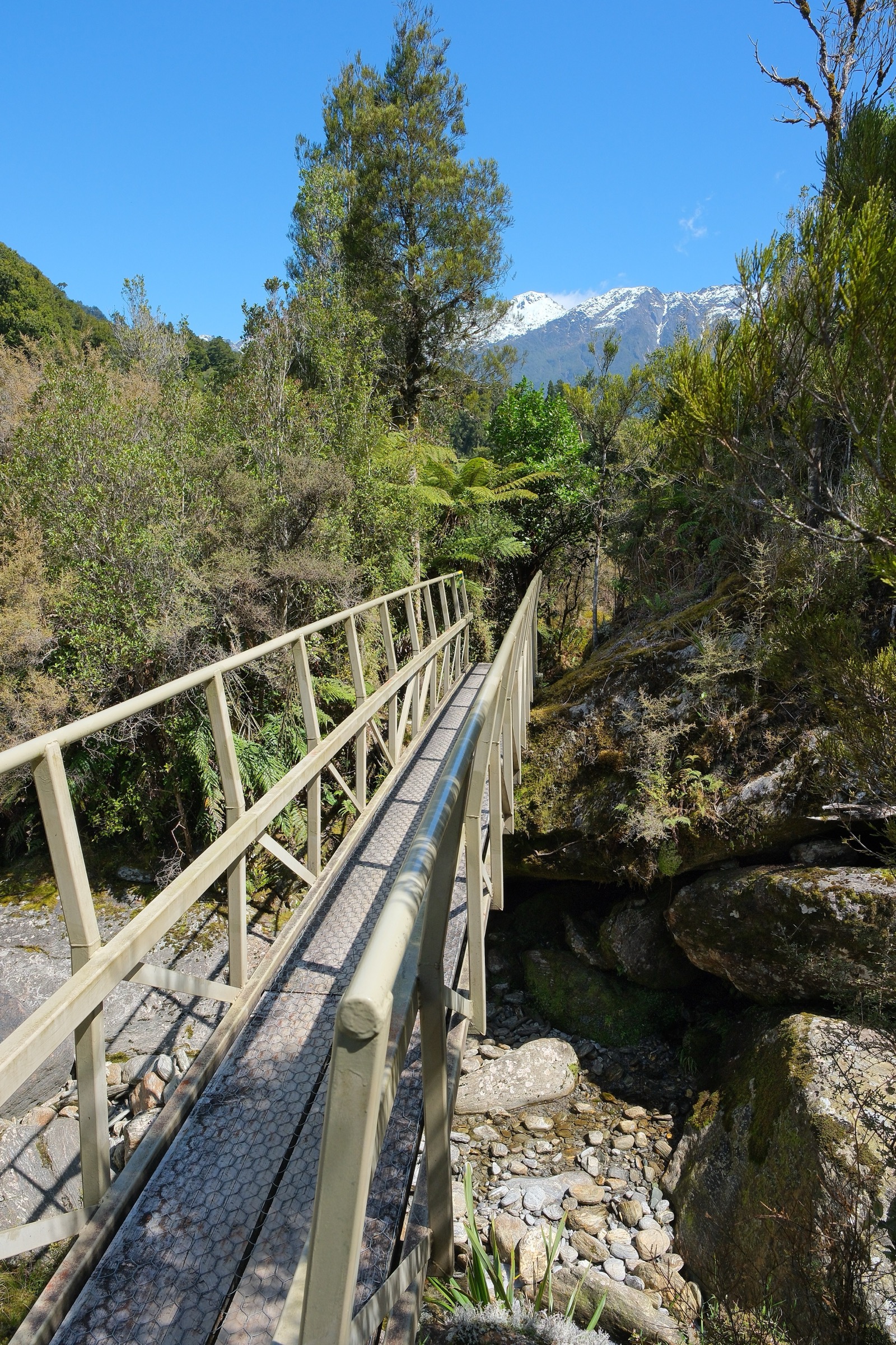
Leave Welcome Flat and climb back to the high point of the lower Copland Track before descending through forest past Shiels Creek, Open Creek, Palaver Creek, and Architect Creek. The lower route alternates between forest, rocky riverbed, boulder hopping, grassy clearings, and orange-triangle-marked river crossings before Rough Creek and the car park.
Why it is essential
For most walkers, this is the practical final day of a Welcome Flat trip. It is also an essential catalogue route because it contains the whole Copland Valley sequence in reverse: hut, hot pools, middle-valley creeks, lower river flats, forest, and the return to SH6.
Equipment
- Full tramping kit
- Waterproofs and warm layers
- Food and water treatment
- Map / GPS
- Headtorch
- First aid
- PLB recommended
Hazards and notes
- Do not leave Welcome Flat if the track is closed or heavy rain is forecast.
- Side creeks can become impassable, and the Copland River can flood track sections.
- There are signed active landslide areas near Shiels Creek and upstream of Architect Creek.
- The road end has no camping facilities.
- Kea are present at the car park; pack away loose items and do not feed them.
GPX / KML links
| Source | URL | Format / access | Reuse status |
|---|---|---|---|
| DOC: Copland Track to Welcome Flat Hut | doc.govt.nz | Official route page / interactive map | DOC copyright terms; no GPX found |
| DOC: Copland Track brochure (PDF) | doc.govt.nz | PDF map / elevation profile | DOC copyright terms |
| Wilderness GPX: Welcome Flat Hut | wildernessmag.co.nz | GPX | Licence not stated; reuse not confirmed |
| AllTrails: Copland Track to Welcome Flat Hut | alltrails.com | Source route page; GPX usually service-controlled | AllTrails terms apply |
External links
- DOC — Copland Track to Welcome Flat Hut
- DOC — Copland Track brochure (PDF)
- Wilderness Magazine — Welcome Flat Hut
- AllTrails — Copland Track to Welcome Flat Hut
External links
| Source | URL |
|---|---|
| DOC — Copland Track to Welcome Flat Hut | doc.govt.nz |
| DOC — Copland Track brochure (PDF) | doc.govt.nz |
| DOC — Upper Copland Valley Track | doc.govt.nz |
| DOC — Upper Copland valley route guide (PDF) | doc.govt.nz |
| AllTrails — Welcome Flat Hut to Douglas Rock Hut | alltrails.com |
| AllTrails — Architect Creek Hut to Welcome Flat Campsite | alltrails.com |
| AllTrails — Copland Track to Welcome Flat Hut | alltrails.com |
| Wilderness Magazine — Welcome Flat Hut | wildernessmag.co.nz |
| Wilderness GPX — Welcome Flat Hut | wildernessmag.co.nz |