Regional overview
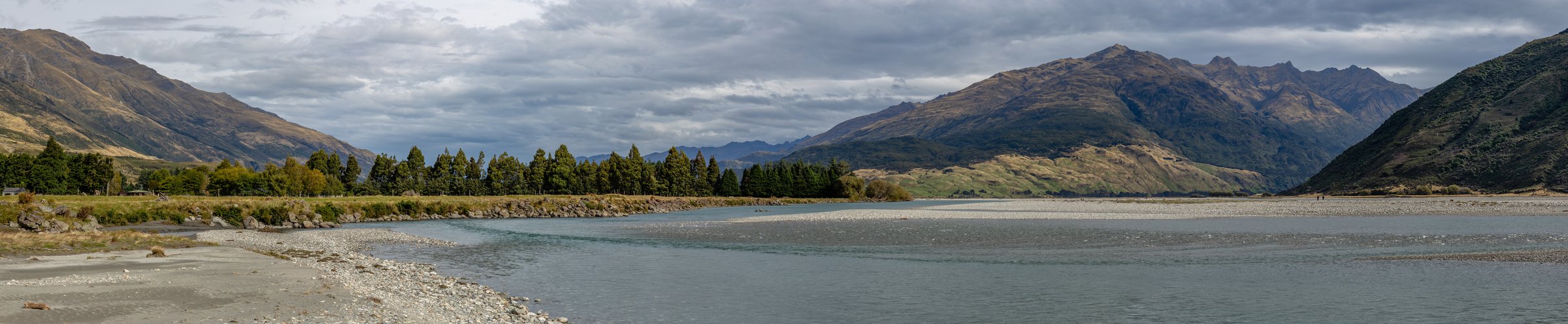
The Wilkin Valley lies in the Makarora side of Mount Aspiring National Park and forms the western half of the Gillespie Pass/Wilkin-Young tramping network. The area is known for silver beech valleys, jet-boat access to Kerin Forks, the Siberia Valley fly-walk, Lake Crucible, and the remote upper Wilkin lakes near Top Forks Hut.
The walking character is backcountry tramping rather than casual day walking. Some routes are logical day hikes only when based at Siberia Hut, Kerin Forks Hut, or Top Forks Hut; they are included because the region’s essential walking is hut-based and section-based. River crossings are central to the area, and DOC warns that the Wilkin, Makarora, Gillespie, Siberia, and Crucible streams can become impassable after rain.
The usual season is summer to autumn. DOC does not recommend the Gillespie Pass Circuit in winter because of snow, ice, and avalanche risk, and the upper Wilkin lakes have complex avalanche terrain from May to November. Transport by jet boat, fixed-wing aircraft, or helicopter may be part of access, but all transport must be pre-arranged.
Selection rationale
The five hikes cover the core Wilkin walking pattern: the famous Crucible Lake day trip from Siberia Hut, the Siberia-to-Wilkin descent, the lower-to-upper Wilkin valley section, and the two classic Top Forks lake objectives.
Summary table
| # | Hike | Country | Route type | Distance | Gain | Max elevation | Difficulty |
|---|---|---|---|---|---|---|---|
| 1 | Siberia Hut to Crucible Lake | New Zealand | Out-and-back hut-based | 14 km return | ca. 590 m return from RouteGuides | 1,166 m | Hard |
| 2 | Siberia Hut to Kerin Forks / Wilkin River | New Zealand | Point-to-point or out-and-back | 7 km one way / 14 km return | RouteGuides: 61 m gain, 363 m loss one way | 618 m | Moderate |
| 3 | Kerin Forks Hut to Top Forks Hut | New Zealand | Point-to-point hut section | 14.1–15 km one way | 382 m gain / 117 m loss from RouteGuides | 613 m | Moderate-hard |
| 4 | Top Forks Hut to Lake Diana and Lake Lucidus | New Zealand | Out-and-back hut-based | ca. 7 km return to Lake Lucidus | Moderate-hard | ||
| 5 | Top Forks Hut to Lake Castalia via North Branch lakes | New Zealand | Out-and-back / hut-based loop-style route | 15.1–16 km return | 642 m gain / 637 m loss from RouteGuides | 1,127 m | Hard |
1. Siberia Hut to Crucible Lake
Snapshot
Itinerary
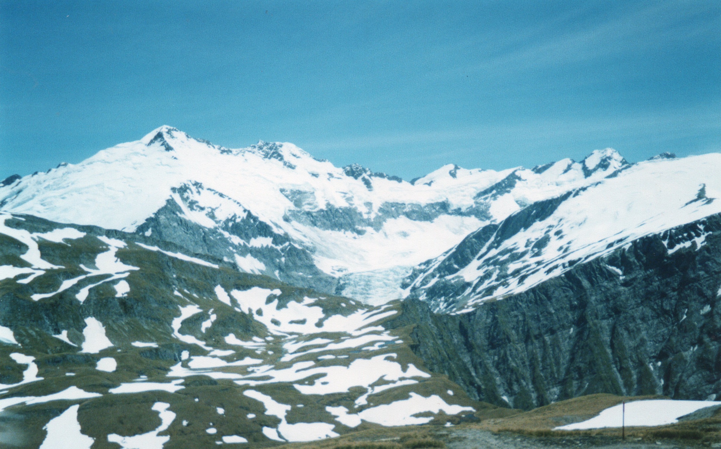
From Siberia Hut, follow the valley flats toward Crucible Stream. After crossing Siberia Stream, the track enters forest on the true left, climbs a narrow spur, sidles around, crosses Crucible Stream, and emerges onto snow grass flats. Pole markers lead through the upper basin and up moraine to Lake Crucible below Mount Alba.
Why it is essential
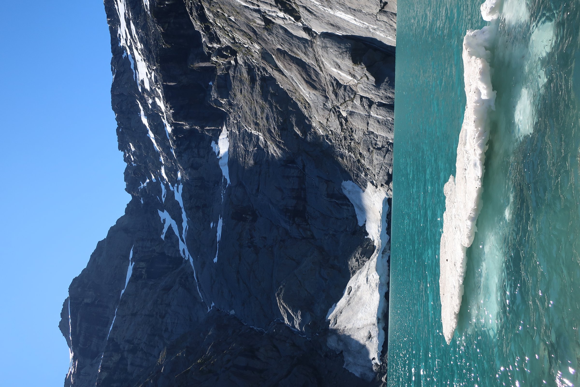
Lake Crucible is the best-known high lake objective in the Wilkin/Siberia system and a classic reason to spend an extra night at Siberia Hut.
Equipment
- Sturdy boots
- Waterproof and warm layers
- Navigation backup
- Headtorch
- Water, food
- Emergency shelter
- Avalanche equipment and alpine judgement required if snow conditions are present
Hazards and notes
- Gillespie, Siberia, and Crucible streams can become impassable after rain
- DOC notes complex avalanche terrain in Crucible Basin from May to November
- Camping is not allowed in Crucible Basin because of fragile alpine herb fields
GPX / KML links
| Source | URL | Format / access | Reuse status |
|---|---|---|---|
| DOC: Gillespie Pass Circuit | doc.govt.nz | Official route page / source map | DOC website terms; no GPX found |
| DOC: Gillespie Pass, Wilkin Valley tracks brochure | doc.govt.nz | Official PDF map | DOC publication terms; route geometry reuse not separately confirmed |
| RouteGuides: Siberia Hut to Crucible Lake | routeguides.co.nz | Route page with Download GPX link | Site licence/terms not located in this pass |
External links
- DOC — Gillespie Pass Circuit
- DOC — Gillespie Pass, Wilkin Valley tracks brochure
- RouteGuides — Siberia Hut to Crucible Lake
2. Siberia Hut to Kerin Forks / Wilkin River
Snapshot
Itinerary
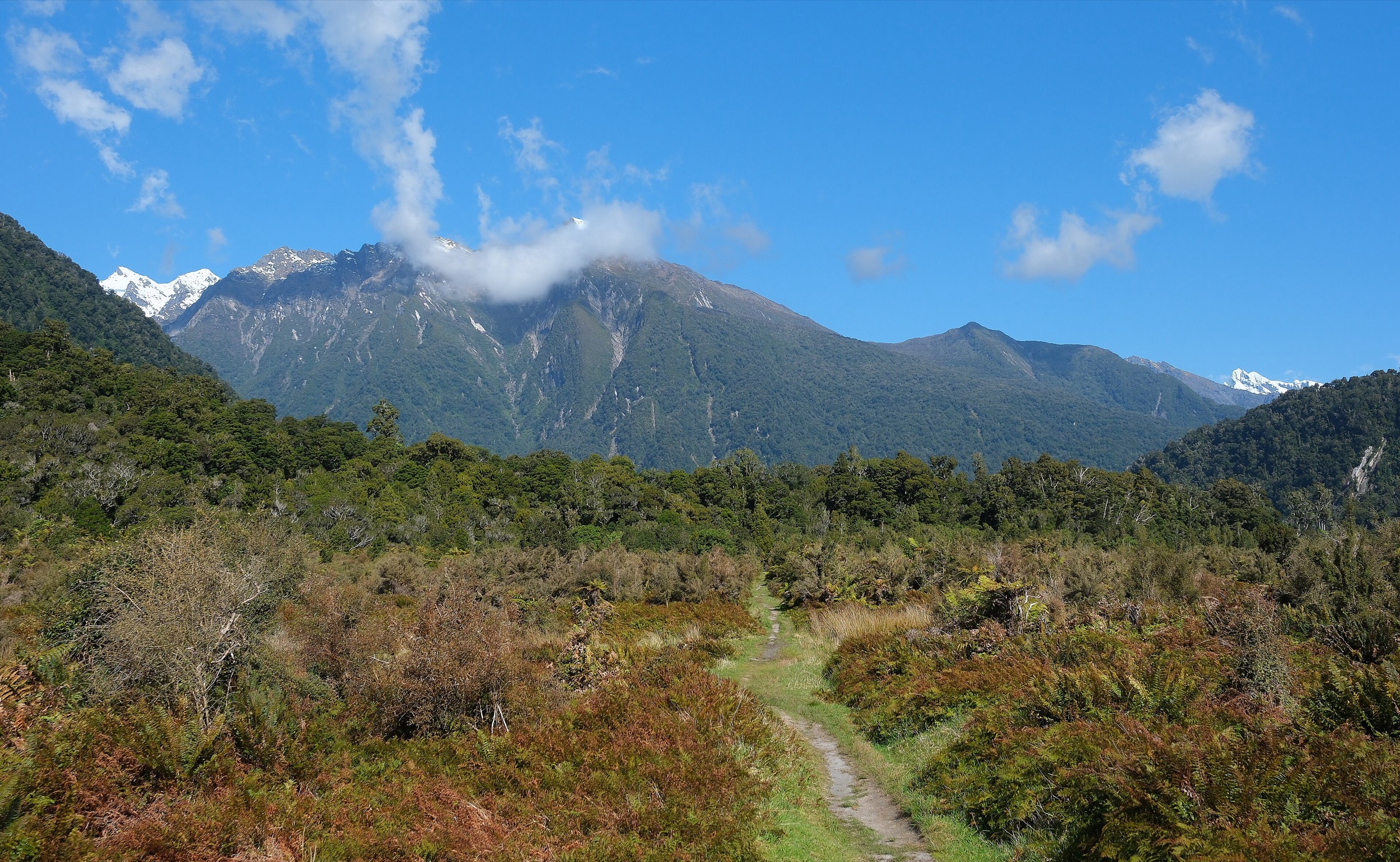
From Siberia Hut, descend the Siberia flats. About 30 minutes down-valley, the Wilkin Valley track enters forest at the southern end of Siberia Flat, sidles above Siberia Gorge, and descends in zigzags to the Wilkin River near Kerin Forks. Kerin Forks Hut lies across the Wilkin River and requires a river crossing.
Why it is essential
This section is the classic “fly in to Siberia, walk out to Wilkin” day-walk component and the practical link between Siberia Hut and the Wilkin River.
Equipment
- Sturdy footwear
- Waterproof layer and warm layer
- Water, food
- Map/GPS
- Headtorch
- Emergency shelter and spare food if relying on river or jet-boat timing
Hazards and notes
- The Wilkin River can be uncrossable after rain
- If access to Kerin Forks Hut or the upper Wilkin is needed, the river crossing must be judged carefully
- A delayed jet boat or flooded stream can leave walkers waiting in remote terrain
GPX / KML links
| Source | URL | Format / access | Reuse status |
|---|---|---|---|
| DOC: Gillespie Pass Circuit | doc.govt.nz | Official route page / source map | DOC website terms; no GPX found |
| RouteGuides: Siberia Hut to Kerin Forks jet boat catching site | routeguides.co.nz | Route page with Download GPX link | Site licence/terms not located in this pass |
External links
- DOC — Gillespie Pass Circuit
- DOC — Gillespie Pass, Wilkin Valley tracks brochure
- RouteGuides — Siberia Hut to Kerin Forks jet boat catching site
3. Kerin Forks Hut to Top Forks Hut
Snapshot
Itinerary
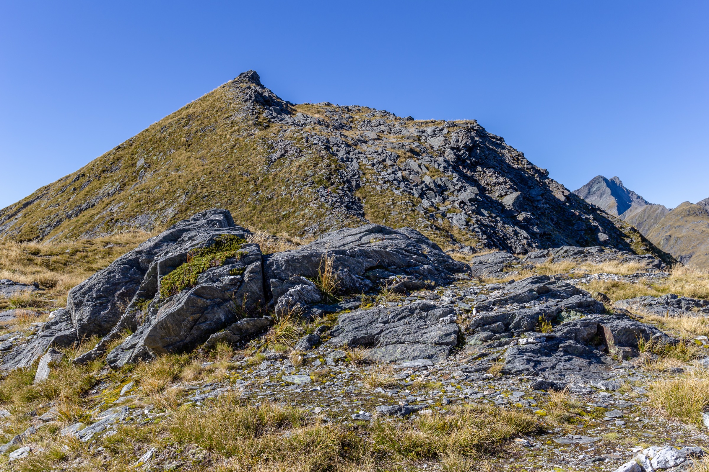
From Kerin Forks Hut, the track passes through beech forest beside the Wilkin River, crossing slips and steep-sided ravines. It reaches Wonderland Flats, a natural lunch stop roughly halfway, then re-enters forest, climbs and sidles above the river, and descends toward Jumboland Flats. The upper section becomes less straightforward near the north/south branch junction before reaching Top Forks Hut.
Why it is essential
This is the main lower-to-upper Wilkin valley section and the approach to the remote North Branch lake day trips. It represents the valley’s long beech-river tramping character.
Equipment
- Sturdy boots
- Waterproof and warm layers
- Navigation backup
- Water, food
- Headtorch
- Emergency shelter
- Extra food because side streams and rivers can delay travel
Hazards and notes
- Side streams can become uncrossable after rain
- The Wilkin River crossing near Kerin Forks and onward crossings must be treated conservatively
- The track includes slips, ravines, and route choices around upper flats; navigation and river judgement are required
GPX / KML links
| Source | URL | Format / access | Reuse status |
|---|---|---|---|
| DOC: Gillespie Pass, Wilkin Valley tracks brochure | doc.govt.nz | Official PDF map | DOC publication terms; route geometry reuse not separately confirmed |
| RouteGuides: Kerin Forks Hut to Top Forks Hut | routeguides.co.nz | Route page with Download GPX link | Site licence/terms not located in this pass |
External links
4. Top Forks Hut to Lake Diana and Lake Lucidus
Snapshot
Itinerary
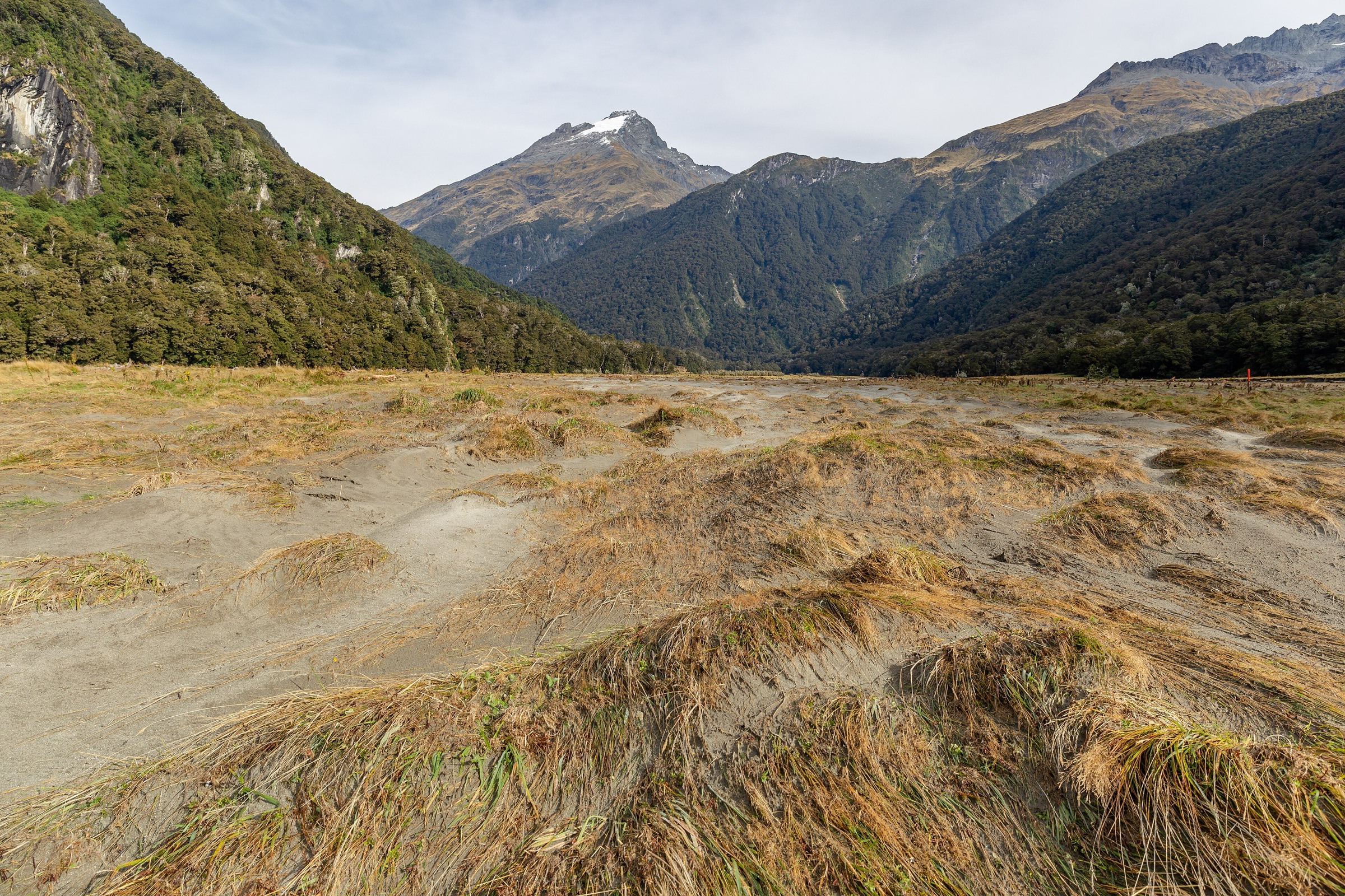
From Top Forks Hut, follow the North Branch Wilkin route toward Lake Diana and Lake Lucidus. DOC lists Lake Diana as 2.5 km / 1 hr and Lake Lucidus as 3.5 km / 1 hr 30 min from Top Forks Hut. The return follows the same line unless combined with the longer Lake Castalia route.
Why it is essential
The North Branch lakes are the defining side trips from Top Forks Hut. Lake Diana and Lake Lucidus give the shorter, more achievable version of the upper Wilkin lake landscape.
Equipment
- Sturdy boots
- Waterproof and warm layers
- Navigation backup
- Water, food
- Headtorch
- Emergency shelter
- Map and GPS; the route is more remote than its short distance suggests
Hazards and notes
- DOC notes complex avalanche terrain beyond Lake Diana from May to November
- Streams and boggy ground can become difficult after rain
- The route is remote with no quick exit
GPX / KML links
| Source | URL | Format / access | Reuse status |
|---|---|---|---|
| DOC: Gillespie Pass, Wilkin Valley tracks brochure | doc.govt.nz | Official PDF map | DOC publication terms; route geometry reuse not separately confirmed |
| RouteGuides: Top Forks Hut via Wilkin North Branch Lakes | routeguides.co.nz | Route page with Download GPX link for longer lakes route | Site licence/terms not located in this pass |
External links
- DOC — Gillespie Pass, Wilkin Valley tracks brochure
- RouteGuides — Top Forks Hut via Wilkin North Branch Lakes
5. Top Forks Hut to Lake Castalia via North Branch lakes
Snapshot
Itinerary
From Top Forks Hut, follow the North Branch Wilkin route past the Lake Diana/Lucidus side objectives. The route continues through upper valley terrain, with river crossings and cairned sections leading toward Lake Castalia. The return backtracks to Top Forks Hut.
Why it is essential
Lake Castalia is the longer, more committing upper-Wilkin lake objective. It completes the North Branch lake sequence and is one of the most distinctive hut-based day trips in the Wilkin.
Equipment
- Mountain hiking equipment
- Navigation backup
- Emergency shelter, spare food
- Headtorch
- Warm and waterproof clothing
- Distress beacon
- Avalanche equipment and alpine judgement required if snow is present
Hazards and notes
- The route involves remote terrain, river crossings, boggy sections, moraine and boulder travel, and complex avalanche terrain in season
- Side streams can become uncrossable after rain
- Retreat may take as long as the approach
GPX / KML links
| Source | URL | Format / access | Reuse status |
|---|---|---|---|
| DOC: Gillespie Pass, Wilkin Valley tracks brochure | doc.govt.nz | Official PDF map | DOC publication terms; route geometry reuse not separately confirmed |
| RouteGuides: Top Forks Hut via Wilkin North Branch Lakes | routeguides.co.nz | Route page with Download GPX link | Site licence/terms not located in this pass |
External links
- DOC — Gillespie Pass, Wilkin Valley tracks brochure
- RouteGuides — Top Forks Hut via Wilkin North Branch Lakes
Missing data and follow-up
- Official DOC GPX downloads were not found for the Wilkin/Gillespie pages in this pass.
- RouteGuides exposes GPX downloads, but reuse terms were not located.
- Exact open images for Kerin Forks to Top Forks and the upper Wilkin lakes were not found.
- Elevation gain/loss for Lake Diana/Lucidus-only variants remains unresolved.
- Current jet-boat, aircraft, hut booking, and river condition logistics need date-specific checks before publication.
External links
| Source | URL |
|---|---|
| DOC — Gillespie Pass Circuit | doc.govt.nz |
| DOC — Gillespie Pass, Wilkin Valley tracks brochure | doc.govt.nz |
| DOC — Siberia Hut | doc.govt.nz |
| RouteGuides — Siberia Hut to Crucible Lake | routeguides.co.nz |
| RouteGuides — Siberia Hut to Kerin Forks jet boat catching site | routeguides.co.nz |
| RouteGuides — Kerin Forks Hut to Top Forks Hut | routeguides.co.nz |
| RouteGuides — Top Forks Hut via Wilkin North Branch Lakes | routeguides.co.nz |