Regional overview
Cascade Saddle is an alpine crossing area linking the West Matukituki Valley with the upper Dart/Rees tramping network in Mount Aspiring National Park. It is famous for views of Mount Aspiring/Tititea, the Dart Glacier, the West Matukituki, and the upper Dart valley, but it is also one of the most serious non-climbing tramping objectives in the region.
The walking character is steep and exposed. The Matukituki side climbs from Aspiring Hut through forest to steep snow-grass, tussock, bluffs, and ledges, then reaches the pylon area and easier slopes toward Cascade Creek and the saddle. The Dart side involves moraine, side streams, glacier-edge terrain, exposed weather, and a long hut-based approach.
DOC recommends attempting the crossing only in fine-weather summer conditions, with high-level backcountry skills. Multiple fatalities have occurred. Snow, wet snow grass, high wind, poor visibility, flooded streams, and avalanche conditions can quickly make the route unsafe. The day-hikes below are best understood as day sections or hut-based day objectives within a serious tramping area, not casual road-end walks.
Selection rationale
The selection covers the essential Cascade Saddle access pattern: the West Matukituki approach, the steep Aspiring Hut-to-pylon/saddle climb, the Dart Hut side trip to the glacier and saddle, the Cascade Saddle-to-Dart Hut traverse section, and the Rees Saddle approach stage that links the area into the Rees-Dart system.
Summary table
| # | Hike | Country | Route type | Distance | Gain | Max elevation | Difficulty |
|---|---|---|---|---|---|---|---|
| 1 | Raspberry Creek to Aspiring Hut | New Zealand | Out-and-back | 18 km return | ca. 244 m return | 467 m | Moderate |
| 2 | Aspiring Hut to Pylon and Cascade Saddle | New Zealand | Out-and-back / route section | 12 km return to saddle from Aspiring Hut | ca. 1,300+ m to pylon | 1,835 m pylon area per DOC | Expert |
| 3 | Dart Hut to Dart Glacier and Cascade Saddle | New Zealand | Out-and-back hut-based side trip | 20 km return | ca. 800+ m depending on line | ca. 1,536 m / 1,524 m saddle | Expert |
| 4 | Cascade Saddle to Dart Hut | New Zealand | Point-to-point section | 10 km one way | RouteGuides: 812 m gain / 222 m loss toward saddle | 1,536 m | Expert |
| 5 | Shelter Rock Hut to Dart Hut via Rees Saddle | New Zealand | Point-to-point section | 10 km one way | 1,471 m Rees Saddle | Advanced |
1. Raspberry Creek to Aspiring Hut
Snapshot
Itinerary
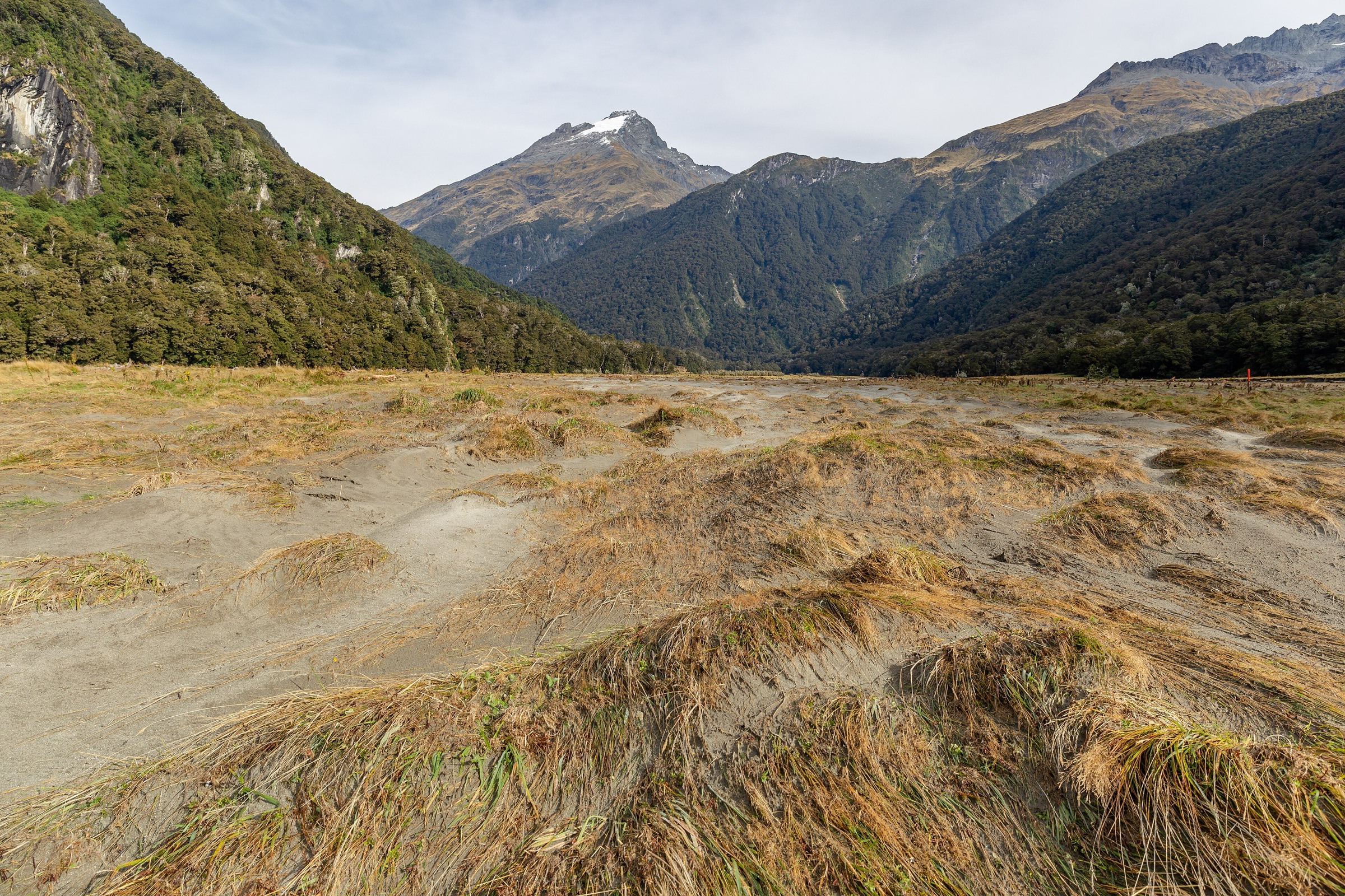
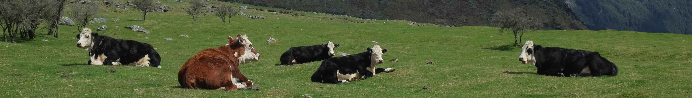
From Raspberry Creek, follow the West Matukituki Track up the open valley, passing the Rob Roy side-track area, farm flats, small bluffs, and the locked Cascade Hut before reaching Aspiring Hut. The return follows the same track.
Why it is essential
Aspiring Hut is the safest and most common base for attempting Cascade Saddle from the Matukituki side. As a day walk it gives the approach valley and the scale of the terrain before the route steepens above the hut.
Equipment
- Standard hiking equipment for the valley walk
- If continuing toward Cascade Saddle: mountain hiking equipment
- Emergency shelter, spare food, headtorch
- Navigation backup
- Distress beacon strongly recommended for continuation routes
Hazards and notes
- The Wanaka-Mount Aspiring Road is unsealed near the end and subject to washouts and flooded creeks
- The valley track crosses farmland; respect gates and livestock
- Aspiring Hut bookings/fees should be checked if staying overnight
GPX / KML links
| Source | URL | Format / access | Reuse status |
|---|---|---|---|
| DOC: West Matukituki Track | doc.govt.nz | Official route page / source map | DOC website terms; no GPX found |
| RouteGuides: Raspberry Flat car park to Aspiring Hut | routeguides.co.nz | Route page with Download GPX link | Site licence/terms not located in this pass |
External links
2. Aspiring Hut to Pylon and Cascade Saddle

Snapshot
Itinerary
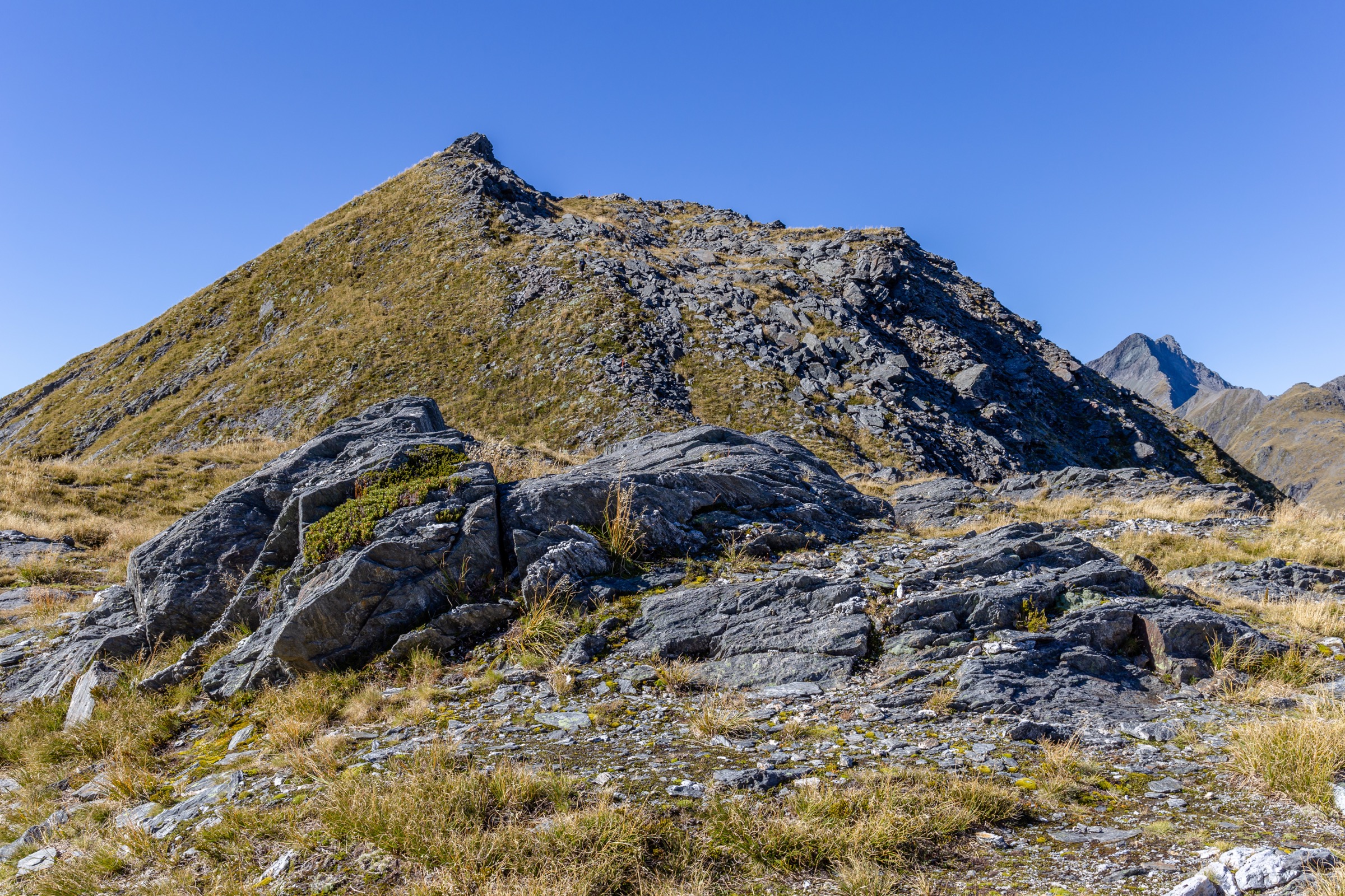
From Aspiring Hut, the route climbs through mixed beech forest and crosses an unbridged stream near the top of the bush. Above the bushline, it becomes an orange-poled route on steep snow grass and tussock, with rocky outcrops and ledges. The route reaches the pylon area at the top of the ridge, then follows poles down toward Cascade Creek and the easier flats leading to Cascade Saddle.
Why it is essential
This is the defining Cascade Saddle climb from the Matukituki side, with major views over the West Matukituki, Mount Aspiring/Tititea, and the route toward Dart Glacier. It is essential because of its regional importance, not because it is suitable for all walkers.
Equipment
- Mountain hiking equipment
- Emergency shelter, spare food, headtorch
- Navigation backup
- First-aid kit
- Distress beacon
- Crampons and ice axe may be required in early summer or any snow/ice conditions
- Route should only be attempted by parties with the skills to use snow/ice equipment
Hazards and notes
- DOC states that multiple fatalities have occurred here
- Wet snow grass, snow, ice, strong wind, and poor visibility can make slips fatal
- The final pylon-area gully holds snow for much of the year and leaves little margin for error
- Cascade Creek and other streams can flood from rain or snowmelt
- Turn back at the bushline, pylon, or saddle if weather, time, or conditions are not favourable
GPX / KML links
| Source | URL | Format / access | Reuse status |
|---|---|---|---|
| DOC: Cascade Saddle Route | doc.govt.nz | Official route page / source map | DOC website terms; no GPX found |
| DOC: Cascade Saddle route brochure | doc.govt.nz | Official PDF map | DOC publication terms; route geometry reuse not separately confirmed |
| RouteGuides: Aspiring Hut to Pylon | routeguides.co.nz | Route page with Download GPX link | Site licence/terms not located in this pass |
External links
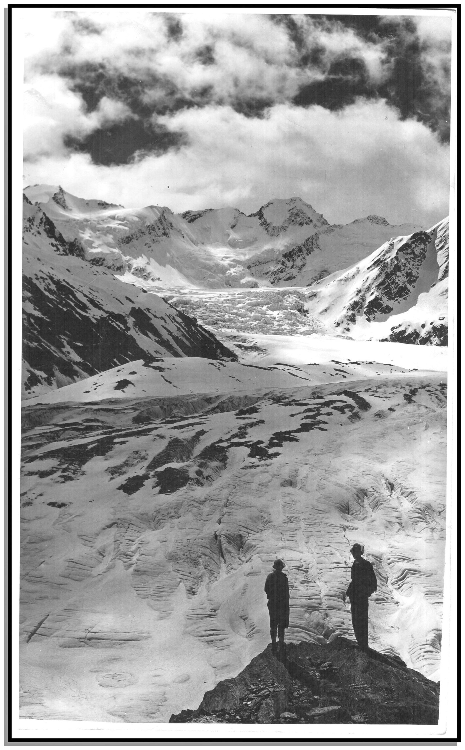
3. Dart Hut to Dart Glacier and Cascade Saddle
Snapshot
Itinerary
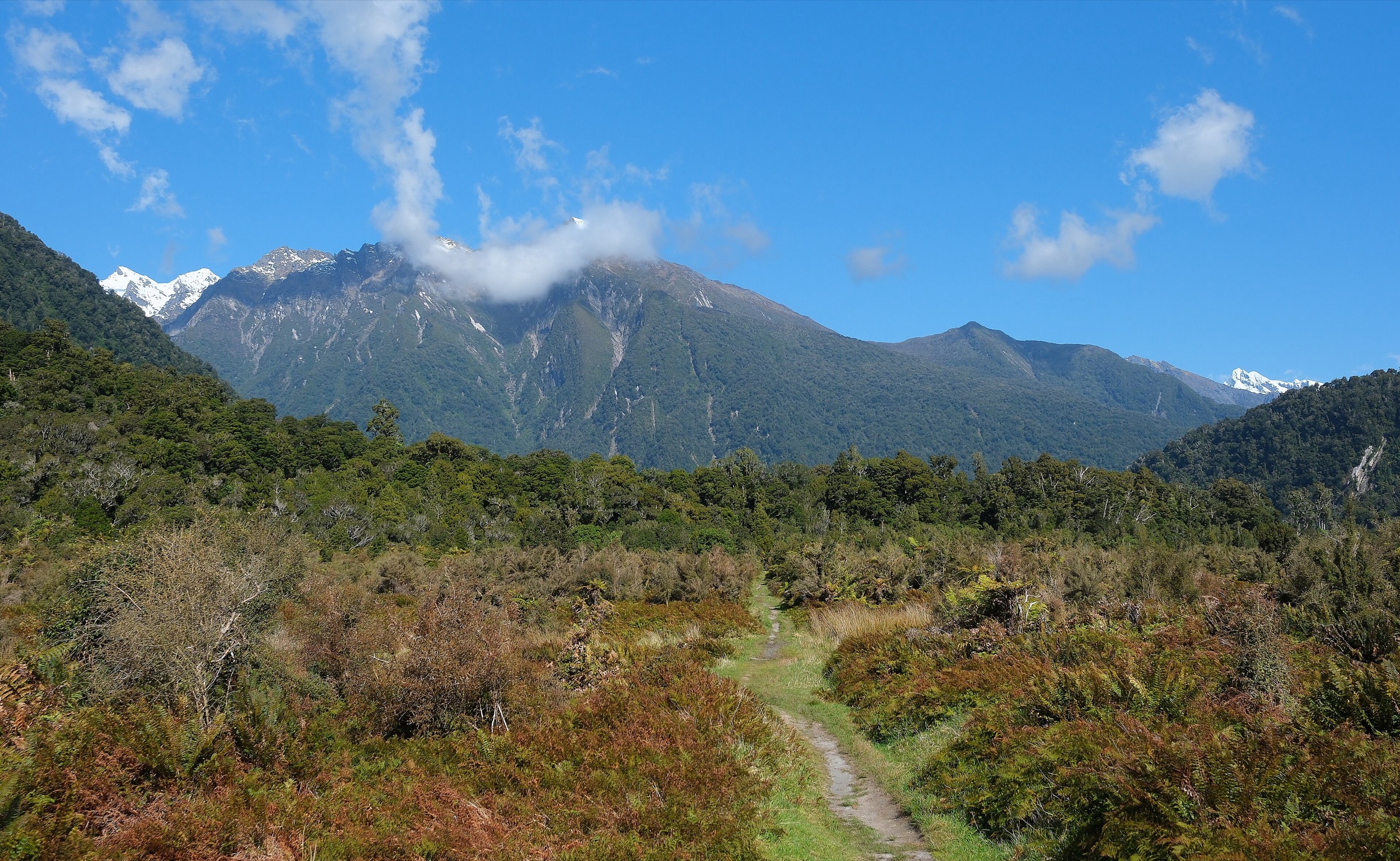
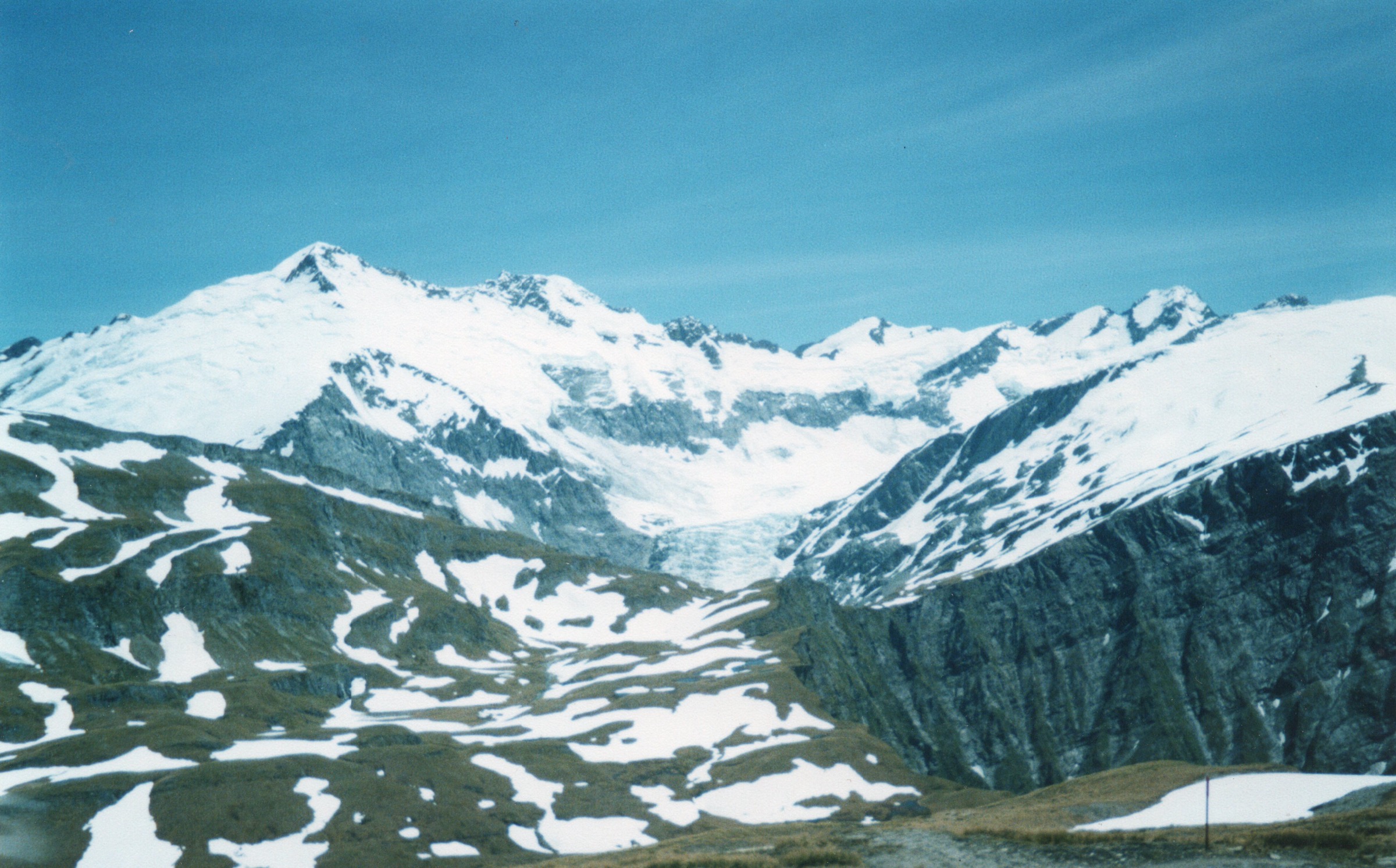
From Dart Hut, cross the swing bridge and follow poles and cairns north along the Dart River/Te Awa Whakatipu toward the edge of the Dart Glacier. Near the glacier, the route climbs steeply before continuing toward Cascade Saddle and the views into the West Matukituki. The return follows the same route to Dart Hut.
Why it is essential
This is the classic Rees-Dart side trip for seeing Dart Glacier and Cascade Saddle without descending the more hazardous Matukituki side. It gives the glacier-moraine and saddle-view half of the Cascade Saddle experience.
Equipment
- Mountain hiking equipment
- Emergency shelter, spare food, headtorch
- Navigation backup
- Warm and waterproof layers
- Distress beacon
- Alpine equipment may be required in snow or ice conditions
Hazards and notes
- DOC describes this as a highly advanced trip suitable only for very experienced trampers and good weather
- Side streams near Dart Hut can rise quickly from rain or hot-weather snowmelt and can trap parties between crossings
- Icefall hazard exists near the glacier face; do not approach unstable ice
GPX / KML links
| Source | URL | Format / access | Reuse status |
|---|---|---|---|
| DOC: Rees-Dart Track side trip | doc.govt.nz | Official route page / source map | DOC website terms; no GPX found |
| RouteGuides: Dart Hut to Cascade Saddle via Dart River | routeguides.co.nz | Route page with Download GPX link | Site licence/terms not located in this pass |
External links
- DOC — Rees-Dart Track
- DOC — Cascade Saddle Route
- RouteGuides — Dart Hut to Cascade Saddle via Dart River
4. Cascade Saddle to Dart Hut
Snapshot
Itinerary
From near Cascade Saddle, the route toward the Dart and Rees valleys branches left before the saddle. It follows orange poles along a ridge, then cairns through steep, unstable slopes down to the Dart Glacier valley floor. The route stays on the true left bank of the Dart River/Te Awa Whakatipu, fords side streams, and reaches Dart Hut via the Snowy Creek bridge.
Why it is essential
This section is the eastward half of the Cascade Saddle crossing, linking the high Matukituki viewpoint country to the Dart Glacier and the Rees-Dart tramping system.
Equipment
- Mountain hiking equipment
- Emergency shelter, spare food
- Navigation backup, headtorch
- Warm and waterproof clothing
- Distress beacon
- Snow equipment required if snow or ice is present
Hazards and notes
- The descent to the Dart valley is unstable and exposed to weather
- Several side streams must be forded, and water levels can rise quickly with rain or afternoon snowmelt
- The route becomes slippery in wet conditions and a fall can be fatal
GPX / KML links
| Source | URL | Format / access | Reuse status |
|---|---|---|---|
| DOC: Cascade Saddle Route | doc.govt.nz | Official route page / source map | DOC website terms; no GPX found |
| RouteGuides: Dart Hut to Cascade Saddle via Dart River | routeguides.co.nz | Route page with Download GPX link | Site licence/terms not located in this pass |
External links
- DOC — Cascade Saddle Route
- DOC — Cascade Saddle route brochure
- RouteGuides — Dart Hut to Cascade Saddle via Dart River
5. Shelter Rock Hut to Dart Hut via Rees Saddle
Snapshot
Itinerary
From Shelter Rock Hut, the route continues through the upper Rees basin and climbs to Rees Saddle. It then follows orange markers past tarns to a tussock bench above Snowy Creek, traverses steep slopes, crosses upper Snowy Creek by bridge when installed, and descends to Dart Hut on Snowy Creek.
Why it is essential
This is the approach stage that brings trampers from the Rees valley into the Dart Hut base for the Cascade Saddle/Dart Glacier side trip. It is the practical eastern gateway to the Cascade Saddle area.
Equipment
- Sturdy boots
- Waterproof and warm layers
- Navigation backup
- Water, food
- Headtorch
- Emergency shelter
- In winter or bridge-removed conditions, alpine and avalanche equipment may be required by experienced parties only
Hazards and notes
- DOC notes steep drop-offs, avalanche paths, creek flooding, and the seasonal removal of the upper Snowy Creek bridge
- The track between Shelter Rock and Dart Hut is narrow in places, especially near upper Snowy Creek
- Going off track has caused injuries
GPX / KML links
| Source | URL | Format / access | Reuse status |
|---|---|---|---|
| DOC: Rees-Dart Track | doc.govt.nz | Official route page / source map | DOC website terms; no GPX found |
| DOC: Rees and Dart Track brochure | doc.govt.nz | Official PDF map | DOC publication terms; route geometry reuse not separately confirmed |
External links
Missing data and follow-up
- No official DOC GPX download was found for the Cascade Saddle, Rees-Dart, or West Matukituki pages in this pass.
- RouteGuides exposes several GPX downloads, but reuse terms were not located.
- Exact elevation gain/loss for DOC-only sections remains unresolved.
- Shelter Rock to Dart Hut needs an open exact photo candidate before publication.
- Current Snowy Creek bridge installation/removal status and hut/transport logistics must be checked close to travel.
External links
| Source | URL |
|---|---|
| DOC — Cascade Saddle Route | doc.govt.nz |
| DOC — Cascade Saddle route brochure | doc.govt.nz |
| DOC — Rees-Dart Track | doc.govt.nz |
| DOC — Rees and Dart Track brochure | doc.govt.nz |
| DOC — West Matukituki Track | doc.govt.nz |
| RouteGuides — Aspiring Hut to Raspberry Flat | routeguides.co.nz |
| RouteGuides — Aspiring Hut to Pylon | routeguides.co.nz |
| RouteGuides — Dart Hut to Cascade Saddle via Dart River | routeguides.co.nz |