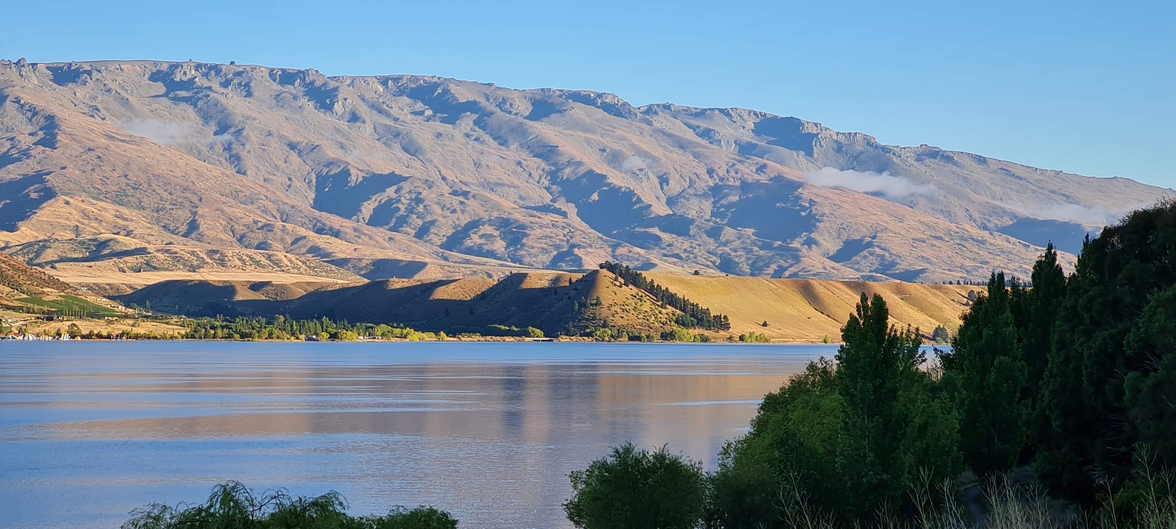
Regional overview
The southern Pisa Range is the Crown Saddle, Rock Peak, Tuohys Saddle, Roaring Meg / Te Wai a Korokio, Meg Hut and Cardrona-Cromwell Pack Track side of the Pisa Conservation Area. It is the most road-accessible high part of the range because the Crown Range Road reaches the saddle between Queenstown and Wanaka.
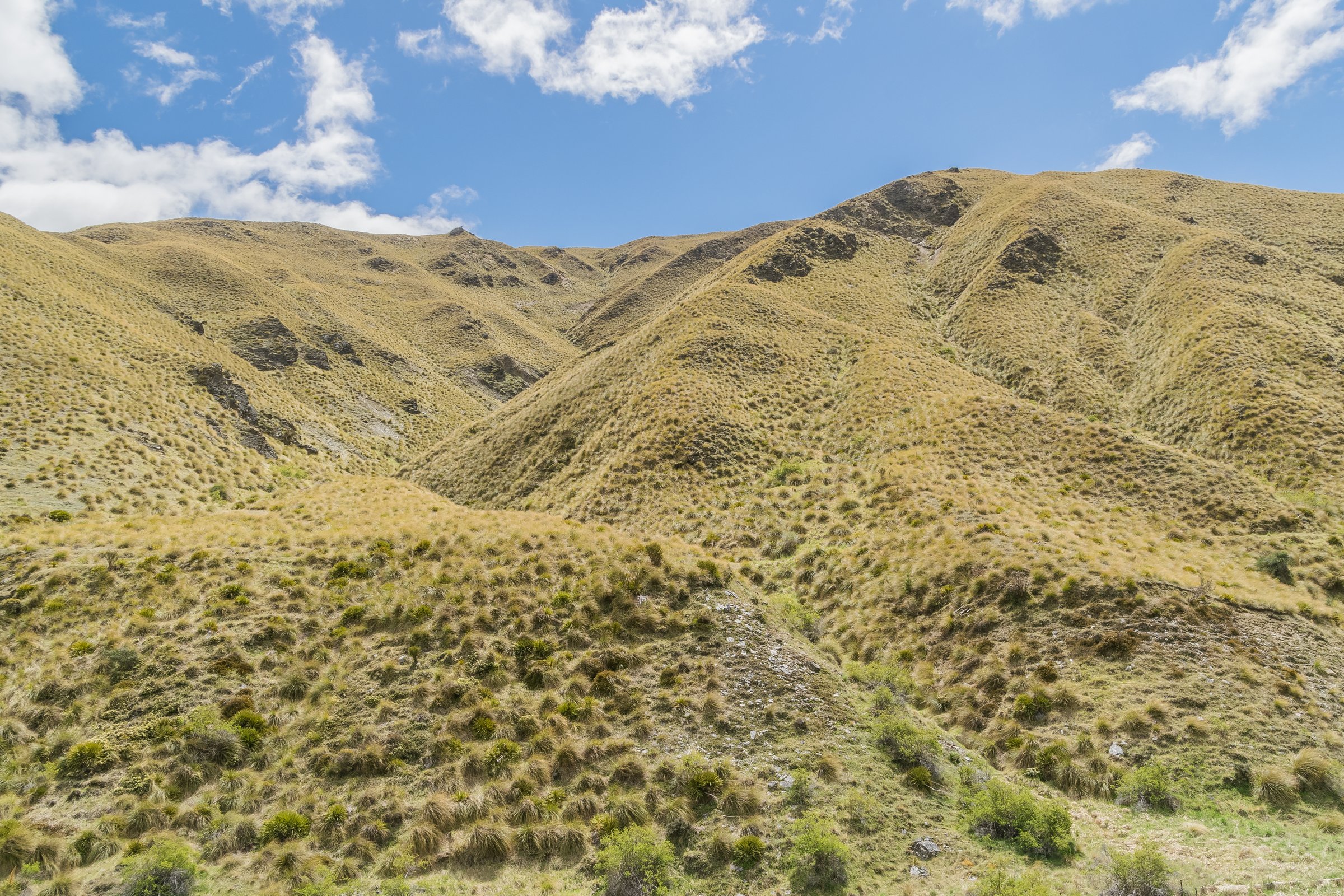
Walking ranges from a short exposed 4WD-track climb to Rock Peak to long point-to-point traverses across open tops and down historic pack-track lines. The terrain is dry, windy, exposed and often water-poor, with working-farm easements at several access points.
The normal hiking season is late spring to autumn. DOC warns that winter conditions require mountaineering experience and avalanche knowledge, and that snow or low cloud can create whiteout. Stream crossings on the Roaring Meg side may be unsafe after rain, and private-land conditions are essential for continued access.
Selection rationale
The five hikes below cover the southern range’s main official day-hike types: the short Rock Peak viewpoint, the Crown Range Road to Tuohys Gully tops traverse, the full Roaring Meg historic pack route, the Meg Hut day objective, and the long Cardrona-Cromwell Pack Track traverse. Several routes can be overnight trips, but each has a clear one-day version for fit parties.
Summary table
| # | Hike | Country | Route type | Distance | Gain | Max elevation | Difficulty | Photo status |
|---|---|---|---|---|---|---|---|---|
| 1 | Rock Peak Track | New Zealand | Out-and-back | 7.7-8.0 km return | 425 m from AllTrails | 1,490 m | Moderate-hard | Commons Crown Range images verified |
| 2 | Crown Range Road Summit to Tuohys Gully | New Zealand | Point-to-point traverse | 21 km | 1,593 m at Quartz Knoll | Hard | Commons Crown/Pisa images verified | |
| 3 | Roaring Meg Pack Track | New Zealand | Point-to-point traverse | 18 km | Tuohys Saddle 1,140 m | Hard | Commons Roaring Meg image verified | |
| 4 | Meg Hut from Tuohys Gully | New Zealand | Out-and-back | 14 km return | 863 m from AllTrails | 1,140-1,192 m depending on source/variant | Hard | Commons Pisa images verified |
| 5 | Cardrona-Cromwell Pack Track | New Zealand | Point-to-point traverse | 25 km | Approx. 1,300 m from secondary guide; official gain unresolved | Above 1,400 m; exact high point unresolved | Hard | Commons Pisa images verified |
1. Rock Peak Track
Snapshot
Itinerary
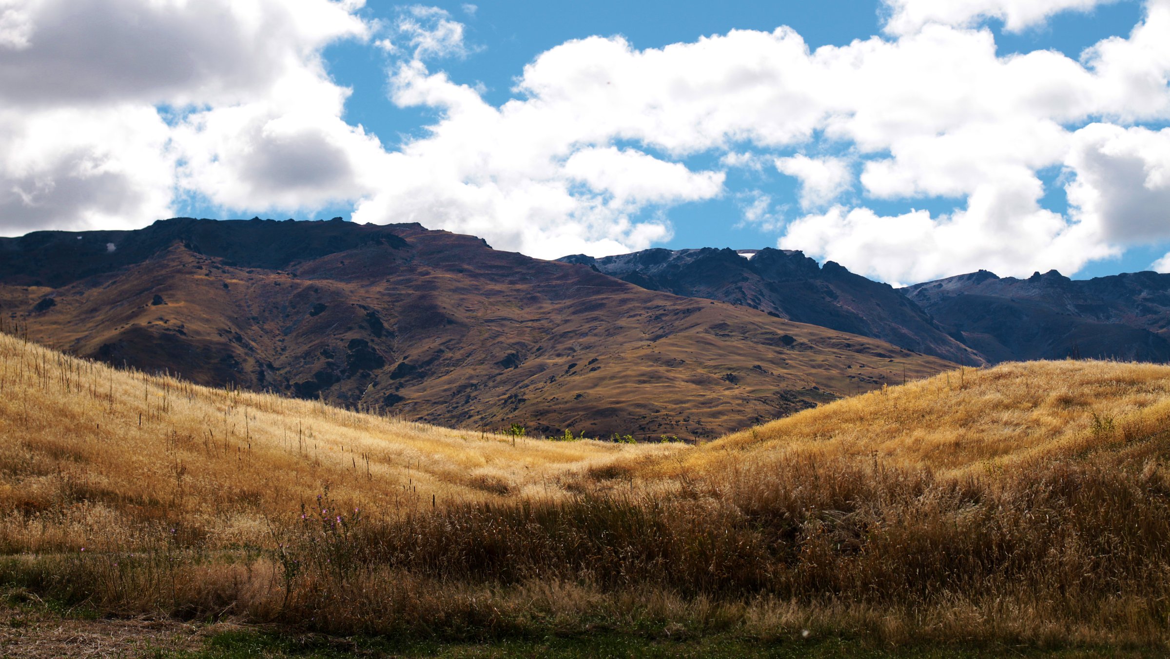
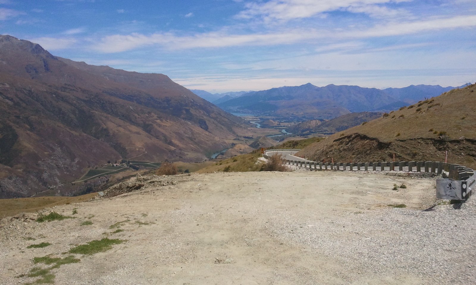
From the Crown Saddle car park, follow the old 4WD track as it climbs by broad zigzags toward the transmitter station and Rock Peak. The route is open and exposed throughout, with views toward the Crown Range Road, Cardrona Valley, Queenstown basin, Gibbston and the southern Pisa tops. Return the same way.
Why it is essential
Rock Peak is the southern Pisa Range’s best short high viewpoint. It is the most accessible way to step from the Crown Range Road into the range’s alpine-tussock environment.
Equipment
Standard-to-mountain hiking equipment: sturdy shoes or boots, windproof layer, warm layer, waterproof shell, water, sun protection, food and map/GPS.
Hazards and notes
DOC warns of hot, dry summer conditions, winter avalanche terrain, rapid weather change, hypothermia risk and whiteout. Dogs are allowed via the Crown Saddle access, but other entry/exit points involve private easements and different restrictions.
GPX / KML links
| Source | URL | Format / access | Reuse status |
|---|---|---|---|
| DOC Rock Peak Track | doc.govt.nz | Official route page / map source | DOC terms; geometry reuse not stated; source-map reference only |
| Plan My Walk: Rock Peak Track | planmywalk.nz | Secondary map source | Terms not checked; source-map reference only |
| AllTrails: Rock Peak Track | alltrails.com | Secondary route page / app map | AllTrails terms apply; GPX export terms not verified; source-map reference only |
| Trailforks: Rock Peak Track | trailforks.com | Secondary route page; GPX/KML login-gated | Trailforks terms apply; secondary source only |
External links
- DOC — Rock Peak Track
- Plan My Walk — Rock Peak Track
- AllTrails — Rock Peak Track
- Trailforks — Rock Peak Track
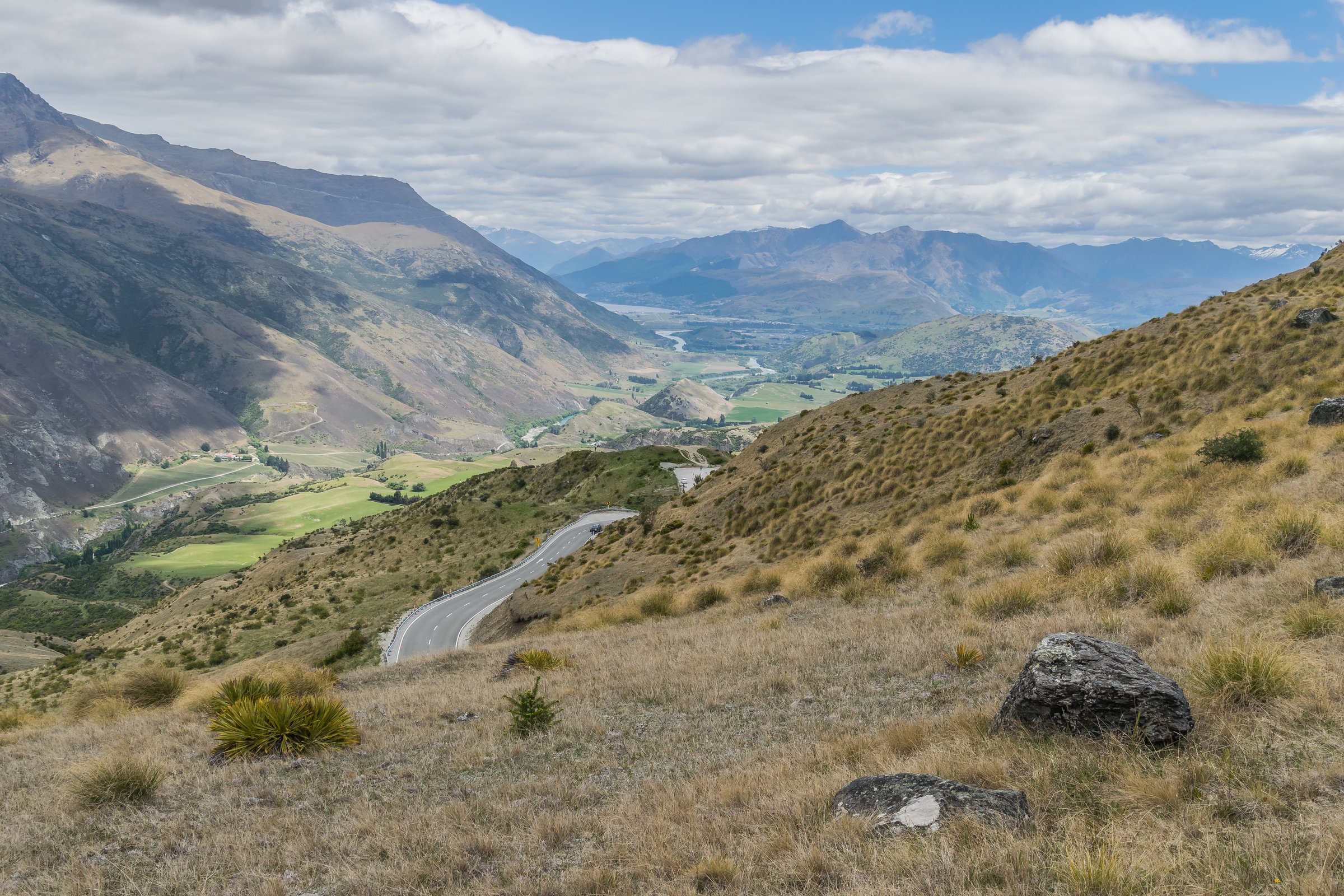
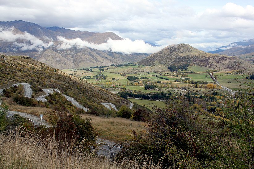
2. Crown Range Road Summit to Tuohys Gully

Snapshot
Itinerary
From Crown Range summit, climb the Rock Peak track to the transmitter station, then continue along the ridge over Mount Allen, Quartz Knoll and Queensberry Hill. From Quartz Knoll, the route continues to Tuohys Saddle and then descends via the Roaring Meg Pack Track to Tuohys Gully car park.
Why it is essential
This is the classic southern Pisa tops traverse: a full-day, road-accessed ridge route that links Rock Peak with the Roaring Meg / Tuohys Gully access system.
Equipment
Mountain hiking equipment: sturdy boots, warm and waterproof layers, windproof shell, sun protection, food, high water capacity, map/GPS, navigation backup, headtorch, emergency shelter and a distress beacon recommended.
Hazards and notes
DOC recommends walking from the Crown Range summit toward Tuohys Gully because it starts higher and finishes lower. The route is exposed to wind, heat, snow, low cloud and avalanche conditions. Dogs and firearms are restricted outside the Crown Saddle access.
GPX / KML links
| Source | URL | Format / access | Reuse status |
|---|---|---|---|
| DOC Crown Range Road summit to Tuohys Gully | doc.govt.nz | Official route page / map source | DOC terms; geometry reuse not stated; source-map reference only |
| DOC Wānaka outdoor pursuits brochure | doc.govt.nz | Official PDF map | DOC terms; geometry reuse not stated; source-map reference only |
External links
- DOC — Crown Range Road summit to Tuohys Gully
- DOC — Roaring Meg Pack Track
- DOC — Wānaka outdoor pursuits brochure
3. Roaring Meg Pack Track
Snapshot
Itinerary
From Tuohys Gully car park, climb steadily to Tuohys Saddle. At the saddle, take the right fork for the Roaring Meg route rather than the Meg Hut side trip. The poled route descends past private Miners Hut, crosses Plank Creek and the Roaring Meg stream, then narrows as it sidles above the gorge. It crosses Skeleton Stream and uses an unmarked private-land 4WD road to reach the Roaring Meg power station area.
Why it is essential
This is the historic pack-track crossing of the southern Pisa Range, linking Cardrona Valley to the Kawarau Gorge and representing the range’s old travel and goldfields landscape.
Equipment
Mountain hiking equipment: sturdy boots, windproof/waterproof layers, warm layer, sun protection, food, high water capacity, map/GPS, navigation backup, headtorch and emergency shelter.
Hazards and notes
DOC notes that the Roaring Meg crossing may be impassable during or after heavy rain, and the lower section is not maintained by DOC or highlighted on its map. Private working-farm conditions include no dogs, no mountain bikes and no firearms on the lower section.
GPX / KML links
| Source | URL | Format / access | Reuse status |
|---|---|---|---|
| DOC Roaring Meg Pack Track | doc.govt.nz | Official route page / map source | DOC terms; geometry reuse not stated; source-map reference only |
| Trailforks: Roaring Meg Pack Track | trailforks.com | Secondary route page; login-gated GPX/KML noted | Trailforks terms apply; secondary source only |
| Wild Things: Roaring Meg Pack Track | wildthings.club | Secondary route page with GPX file label | Site terms not checked; some content login-limited; secondary GPX/source reference only |
External links
- DOC — Roaring Meg Pack Track
- Trailforks — Roaring Meg Pack Track
- Wild Things — Roaring Meg Pack Track
4. Meg Hut from Tuohys Gully
Snapshot
Itinerary
From Tuohys Gully, climb the 4WD track to Tuohys Saddle. At the fork, turn left and descend about 200 m to Meg Hut. The return re-climbs to Tuohys Saddle before descending to the car park.
Why it is essential
Meg Hut is the most practical hut-based day objective in the southern Pisa Range. It gives a shorter alternative to the full Roaring Meg or Cardrona-Cromwell traverses while retaining the high-country hut experience.
Equipment
Mountain hiking equipment: sturdy boots, windproof/waterproof layers, warm layer, sun protection, food, water, map/GPS and navigation backup. Carry a headtorch because the return climb from the hut can be slower than expected.
Hazards and notes
DOC identifies this as part of the Roaring Meg / Cardrona-Cromwell access network. The area is exposed to heat, wind, low cloud, snow and avalanche danger. Dogs are not permitted via this private-land access without landowner permission.
GPX / KML links
| Source | URL | Format / access | Reuse status |
|---|---|---|---|
| DOC Cardrona-Cromwell Pack Track | doc.govt.nz | Official route page / map source | DOC terms; geometry reuse not stated; source-map reference only |
| DOC Roaring Meg Pack Track | doc.govt.nz | Official route page / map source | DOC terms; geometry reuse not stated; source-map reference only |
| AllTrails: Meg Hut Track | alltrails.com | Secondary route page / app map | AllTrails terms apply; GPX export terms not verified; source-map reference only |
External links
5. Cardrona-Cromwell Pack Track
Snapshot
Itinerary
From Tuohys Gully, climb to Tuohys Saddle and descend to Meg Hut. Cross the Roaring Meg stream near the hut, then follow the poled track through open tussock and above side creeks toward Deep Creek Hut. From Deep Creek Hut, the route crosses Lowburn Station on the poled access line, descends to the valley floor, crosses Low Burn and finishes at Swann Road.
Why it is essential
This is the major historic through-route across the southern/central Pisa Range, linking Cardrona Valley with Lowburn and Lake Dunstan. It is normally an overnight tramp but can be completed as a very long day by fit, well-prepared parties.
Equipment
Mountain hiking equipment for a long remote traverse: sturdy boots, poles, windproof/waterproof layers, warm layer, sun protection, food, high water capacity, map/GPS, navigation backup, headtorch, emergency shelter and a distress beacon recommended.
Hazards and notes
DOC warns that the Deep Creek to Lowburn section is not maintained by DOC and visitors must follow the orange-poled route, not the farm road shown on some maps. The Roaring Meg crossing near Meg Hut may be impassable during or after heavy rain. The earlier DOC-mapped connection from Deep Creek toward Mitre Rocks crossed private land and must not be used.
GPX / KML links
| Source | URL | Format / access | Reuse status |
|---|---|---|---|
| DOC Cardrona-Cromwell Pack Track | doc.govt.nz | Official route page / map source | DOC terms; geometry reuse not stated; source-map reference only |
| RouteGuides: Meg Hut to Swann Road via Cardrona-Cromwell Pack Track | routeguides.co.nz | Secondary route with Download GPX label | RouteGuides terms not checked; secondary GPX/source reference only |
| Chur New Zealand: Cardrona-Cromwell Pack Track | churnewzealand.com | Guide page with downloadable GPX described | Blog copyright/terms not checked; secondary GPX/source reference only |
| Hiiker: Cardrona-Cromwell Pack Track stages | hiiker.app | Secondary staged route with Export GPX label | Hiiker terms apply; secondary GPX/source reference only |
External links
- DOC — Cardrona-Cromwell Pack Track
- DOC — Roaring Meg Pack Track
- RouteGuides — Meg Hut to Swann Road
- Chur New Zealand — Cardrona-Cromwell Pack Track
- Hiiker — Cardrona-Cromwell Pack Track stages
Missing data / follow-up work
- Official elevation gain/loss is missing for Crown Range summit to Tuohys Gully, Roaring Meg Pack Track and Cardrona-Cromwell Pack Track.
- Cardrona-Cromwell GPX sources are secondary; terms and coordinate derivation need review before reuse.
- Rock Peak distance varies slightly by source because DOC gives time, Plan My Walk gives one-way distance, and AllTrails gives the return route.
- Private-land access, dog restrictions and farm-route instructions need checking immediately before publication.
- Avalanche forecasts and current track/road conditions must be checked for any snow-season use.
External links
| Source | URL |
|---|---|
| DOC — Pisa Conservation Area | doc.govt.nz |
| DOC — Rock Peak Track | doc.govt.nz |
| DOC — Crown Range Road summit to Tuohys Gully | doc.govt.nz |
| DOC — Roaring Meg Pack Track | doc.govt.nz |
| DOC — Cardrona-Cromwell Pack Track | doc.govt.nz |
| DOC — Wānaka outdoor pursuits brochure | doc.govt.nz |
| Plan My Walk — Rock Peak Track | planmywalk.nz |
| AllTrails — Rock Peak Track | alltrails.com |
| AllTrails — Meg Hut Track | alltrails.com |
| Trailforks — Rock Peak Track | trailforks.com |
| Trailforks — Roaring Meg Pack Track | trailforks.com |
| Wild Things — Roaring Meg Pack Track | wildthings.club |
| RouteGuides — Meg Hut to Swann Road | routeguides.co.nz |
| Chur New Zealand — Cardrona-Cromwell Pack Track | churnewzealand.com |
| Hiiker — Cardrona-Cromwell Pack Track stages | hiiker.app |