Regional overview
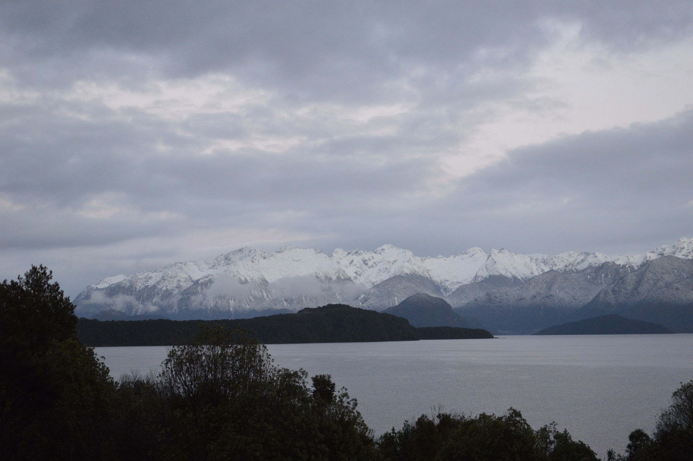
The Franklin Mountains, also known as Te Ahi-a-Mahuika, form a remote Fiordland range between Bligh Sound and Lake Te Anau. The core range is roadless, wet, forested, and difficult: practical walking access is mainly by boat on Lake Te Anau, by the Milford Track corridor at the head of the lake, or by expert routes such as Dore Pass. This entry therefore treats the Franklin Mountains as the Lake Te Anau western and northern mountain fringe, not as a collection of simple roadside summit walks.
The walking character is classic Fiordland: beech forest, glacial valleys, lake-edge approaches, river flats, high rainfall, avalanche paths, and access logistics that matter as much as the footpath. The most famous public route in the area is the Milford Track. The George Sound Route and Dore Pass Route give rougher, more remote links across the same Lake Te Anau/Franklin country.
Normal hiking season is late spring to autumn, with the safest conditions usually in summer. Winter and spring bring avalanche risk, short daylight, cold storms, and route-finding difficulty. Many of the hikes below require boat transport, Great Walk booking rules, hut bookings, or experienced backcountry judgement.
Selection rationale
The five selections represent the essential public walking experiences on the Franklin Mountains side of Fiordland: an expert high-pass route, three iconic Milford Track day sections, and a remote George Sound Route lake-and-valley section. Because the Franklin core has limited maintained day-walk infrastructure, several entries are best treated as day sections within a booked multi-day tramp or boat-supported itinerary.
Summary table
| # | Hike | Route type | Distance | Elevation gain | Max elevation | Difficulty |
|---|---|---|---|---|---|---|
| 1 | Dore Pass Route, Kiosk Creek to Glade House | Point-to-point | 10.9–13.5 km depending on source/start | 1,138 m on AllTrails variant | Expert / hard | |
| 2 | Milford Track: Glade Wharf to Clinton Hut | Out-and-back or Great Walk day section | 5 km one way / 10 km return | Minimal | Easy–moderate | |
| 3 | Milford Track: Clinton Hut to Mintaro Hut | Great Walk day section | 17.5 km | Moderate | ||
| 4 | Milford Track: Mintaro Hut to Dumpling Hut via Mackinnon Pass | Great Walk day section | 14 km plus optional Sutherland Falls side trip | 1,154 m at Mackinnon Pass | Hard | |
| 5 | George Sound Route: Hankinson Hut to Lake Thomson / Thomson Hut | Out-and-back day section | Distance unresolved; 5 hr return by DOC times | Advanced |
Before you go
Permits and access
Three of the five day sections sit inside the Milford Track Great Walk system. The Glade Wharf, Clinton Valley, and Mackinnon Pass sections require Milford Track hut or boat bookings, follow Great Walk direction rules in season, and depend on boat transport from Te Anau Downs to Glade Wharf. Camping is not allowed on the Milford Track, and dogs are not allowed on DOC conservation land here. The Dore Pass Route uses Milford Road transport or private vehicle to Kiosk Creek, with onward access from Glade House normally requiring Milford Track logistics. The George Sound Route requires boat transport across Lake Te Anau and Lake Hankinson or a full George Sound Route itinerary. Current Milford Track booking rules, boat timetables, hut availability, and any closure alerts must be checked before publication or field use.
Standard Fiordland day-hiking kit
For all five routes, carry:
- Mountain hiking equipment: sturdy boots, waterproof jacket and trousers, warm layers, gloves/hat, food, water, headtorch, first-aid kit, emergency shelter, and navigation backup.
- A personal locator beacon. Phone coverage should not be assumed.
- Insect repellent for sandflies and enough warm/dry clothing for sudden Fiordland weather changes.
- Full Great Walk overnight equipment and confirmed bookings if continuing beyond a day walk.
- Conditional: avalanche transceiver, shovel, probe, ice axe, crampons, and the skills to use them when snow is present.
Common hazards
Across all five routes, expect Fiordland weather: heavy rain, flooding, rapid river rise, cold storms, and rapidly changing visibility. Avalanche terrain is present outside the main managed Great Walk season. River and three-wire crossings, mist, snow, and route-finding difficulty can all make a route unsuitable. Boat timing and Great Walk booking rules control much of the access; missing transport or a hut booking can become a serious problem. Rescue and communications are limited in remote sections.
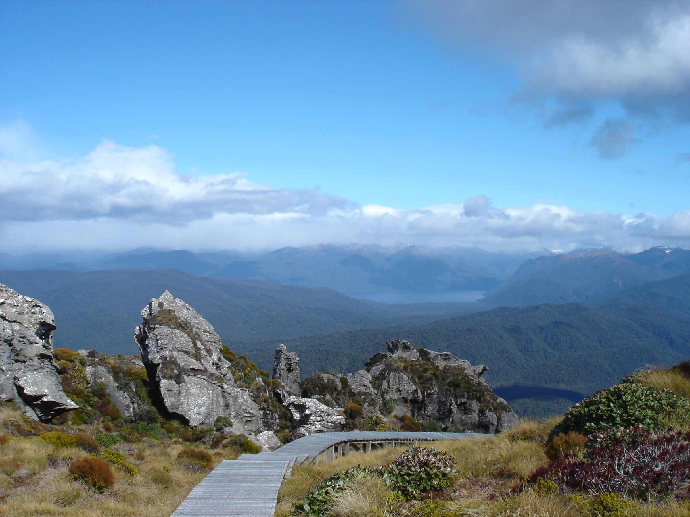
1. Dore Pass Route, Kiosk Creek to Glade House
Snapshot
Itinerary
The route leaves the Milford Road near Kiosk Creek and climbs through rough Fiordland forest and open country toward Dore Pass. DOC notes that the original Dore Pass car park was washed out, so the current start is from Kiosk Creek Campsite and adds about 3 km to the older route. Orange markers indicate the general direction from the road, but the reroute is not a formed track and walkers must be able to self-navigate.
Beyond the pass, the route descends toward Glade House and the start of the Milford Track. In good weather it gives views over the head of Lake Te Anau and the Clinton Valley. In mist, heavy rain, snow, or poor visibility it becomes much more serious.
Why it is essential
Dore Pass is the most direct public high-route link between the Milford Road and the head of Lake Te Anau. It is the Franklin-side route that best expresses the region’s harder tramping character: steep forest, rough pass travel, lake-and-valley views, and serious Fiordland weather exposure.
Hazards and notes
- DOC describes this as a challenging route requiring route finding, river crossing, and alpine experience.
- The washed-out original start has changed the route; older GPS files may not match current access.
- Mist, heavy rain, river rise, snow, and avalanche terrain can make the route unsuitable.
- If connecting with the Milford Track, prior hut bookings are required.
GPX / KML links
| Source | URL | Format | Notes |
|---|---|---|---|
| DOC: Dore Pass Route | doc.govt.nz | Official route page / source map | No GPX located on page; downloadable reuse unresolved |
| AllTrails: Dore Pass Route | alltrails.com | Source route page / GPX availability via service | Secondary stats and route source; reuse not confirmed |
| Gaia GPS: Glade House via Dore Pass Route | gaiagps.com | GPX/KML listed by service | Reuse not confirmed |
| Backpack New Zealand: Dore Pass Route map | backpack-newzealand.com | KML/GPX/TXC downloads advertised | Licence unresolved |
External links
- DOC Dore Pass Route
- AllTrails Dore Pass Route
- Gaia GPS Glade House via Dore Pass Route
- DOC copyright guidance for DOC-labelled and Creative Commons images
2. Milford Track: Glade Wharf to Clinton Hut
Snapshot
Itinerary
From Glade Wharf, the first Milford Track section follows the lower Clinton Valley through beech forest and river flats to Clinton Hut. It is the gentle opening day of the Milford Track and can be treated as a short day section only when boat timing and access rules allow.
The route is not a casual roadside walk. It starts on the far side of Lake Te Anau and is embedded in the Milford Track booking system during the Great Walk season.
Why it is essential
This is the historic gateway to the Milford Track, one of New Zealand’s most famous tramps. It introduces the Franklin/Clinton side of Fiordland without committing to the higher Mackinnon Pass terrain.
Hazards and notes
- Boat timing controls the day; missing transport can become a serious problem.
- Flooding, track closures, and Great Walk booking rules must be checked with DOC and the transport provider.
GPX / KML links
| Source | URL | Format | Notes |
|---|---|---|---|
| DOC: Milford Track | doc.govt.nz | Official route page / source map | No GPX located on page |
| DOC Milford Track brochure | doc.govt.nz | PDF route guide and map | Source map and official section distances; no GPX found |
External links
- DOC Milford Track
- DOC Milford Track brochure (PDF)
- DOC Lake Te Anau area transport operators and access context
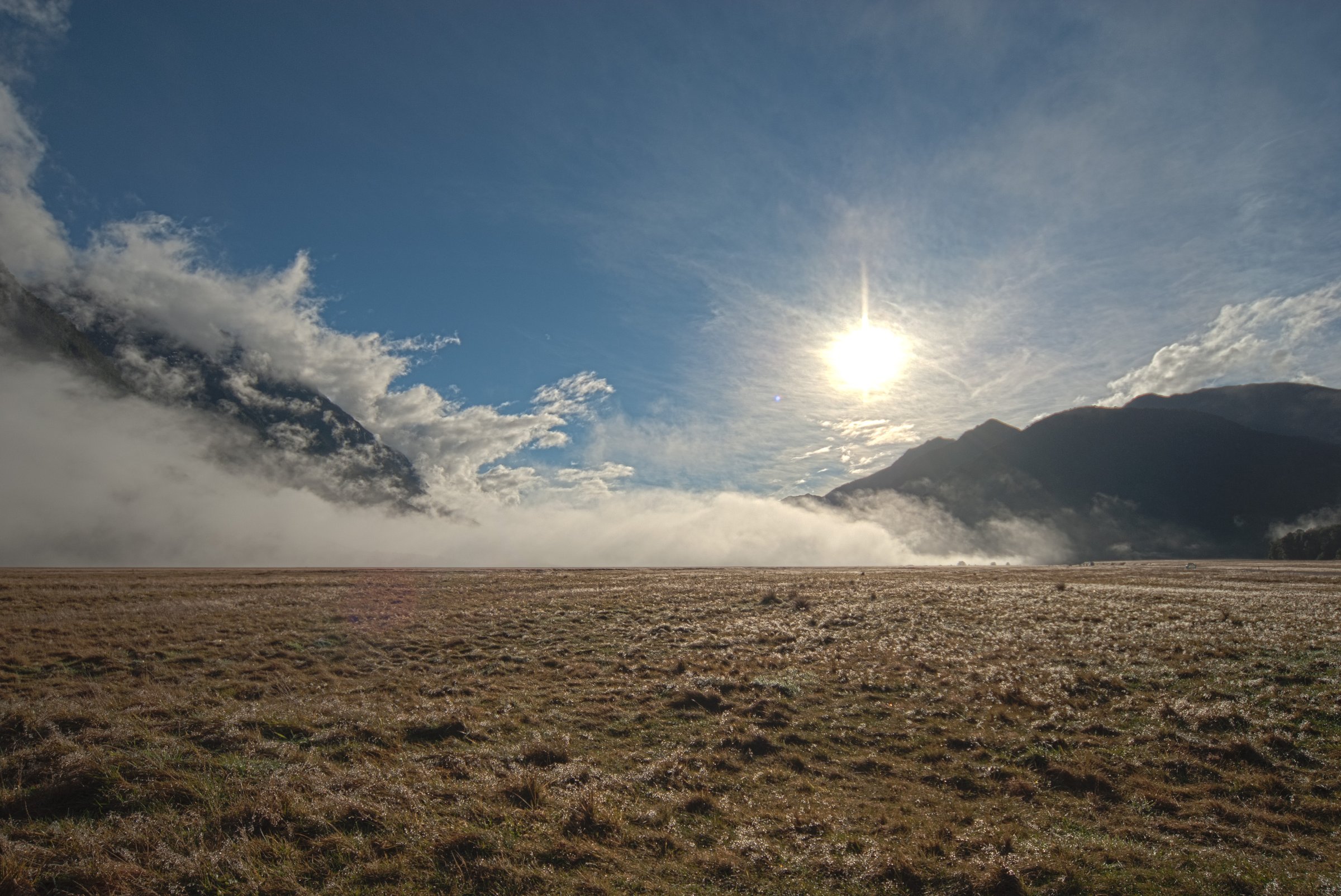
3. Milford Track: Clinton Hut to Mintaro Hut
Snapshot
Itinerary
This day section continues up the Clinton Valley from Clinton Hut toward Mintaro Hut. The track follows the river through forest, open valley sections, and glacial scenery below the higher pass country. It is normally walked as day two of the Milford Track.
As a catalogue day hike, it is best understood as a one-day section within a booked Milford Track itinerary. Independent out-and-back day use from Glade Wharf would be too long for most walkers once boat access is included.
Why it is essential
The Clinton Valley is one of Fiordland’s classic glacier-carved walking valleys. This section gives the sustained river, forest, waterfall, and mountain-wall scenery that made the Milford Track internationally famous.
Hazards and notes
- Fiordland rain can cause flooding and track disruption.
- Great Walk direction, hut booking, and transport rules apply in season.
- Avalanche and winter hazards must be checked outside the main season.
GPX / KML links
| Source | URL | Format | Notes |
|---|---|---|---|
| DOC: Milford Track | doc.govt.nz | Official route page / source map | No GPX located on page |
| DOC Milford Track brochure | doc.govt.nz | PDF map and route guide | Official section source; no GPX found |
External links
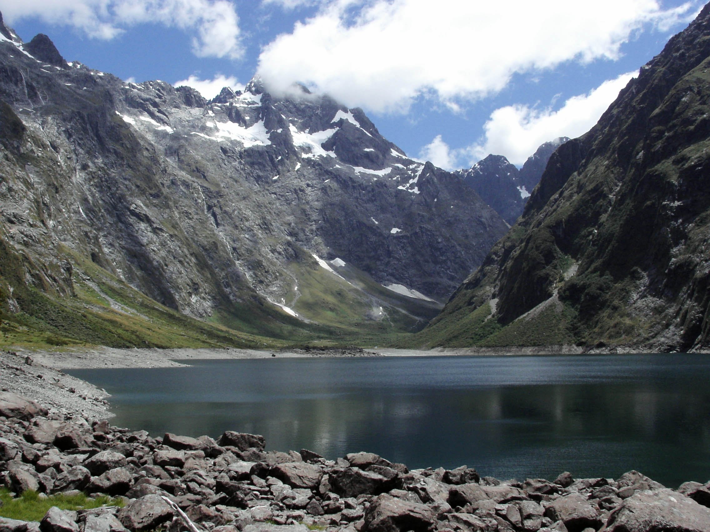
4. Milford Track: Mintaro Hut to Dumpling Hut via Mackinnon Pass
Snapshot
Itinerary
From Mintaro Hut, the Milford Track climbs to Mackinnon Pass, the high crossing between the Clinton and Arthur valleys. The route passes the pass memorial and shelter area before descending toward the Arthur Valley and Dumpling Hut. The Sutherland Falls side trip is often made from this day section where time, weather, and energy allow.
This is the alpine centrepiece of the Milford Track. It should be walked only within the permitted Milford Track sequence unless a specific off-season plan has been checked with DOC.
Why it is essential
Mackinnon Pass is the historic and scenic high point of the Milford Track. It gives the Franklin/Milford region its classic pass crossing and connects the lake-accessed Clinton Valley to the wetter western valley system.
Hazards and notes
- Pass weather can change rapidly; wind, snow, low cloud, and cold rain are serious hazards.
- Avalanche terrain is present outside the main managed season.
- The route must be walked in accordance with Milford Track booking and direction rules during the Great Walk season.
- Sutherland Falls side trip timing should be assessed against weather, daylight, and hut arrival obligations.
GPX / KML links
| Source | URL | Format | Notes |
|---|---|---|---|
| DOC: Milford Track | doc.govt.nz | Official route page / source map | No GPX located on page |
| DOC Milford Track brochure | doc.govt.nz | PDF map and route guide | Official map source; no GPX found |
External links
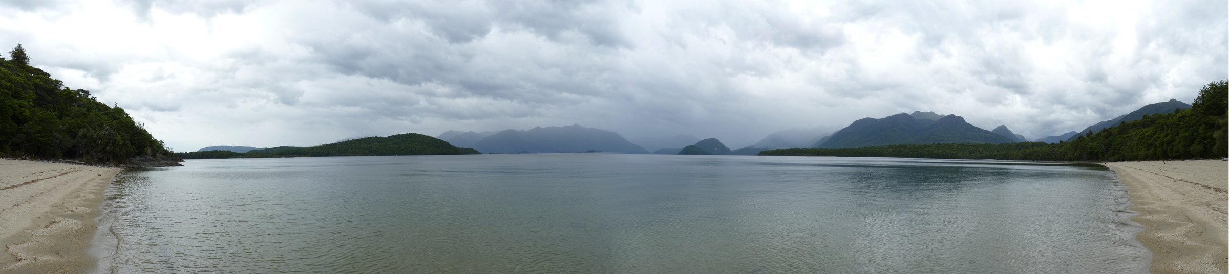
5. George Sound Route: Hankinson Hut to Lake Thomson / Thomson Hut
Snapshot
Itinerary
From Hankinson Hut, the George Sound Route crosses a three-wire crossing soon after leaving the hut, then continues toward Lake Thomson and Thomson Hut. DOC describes a second three-wire crossing, a route around the north side of Lake Thomson, and open flats toward the Wapiti River and Thomson Hut.
As a day hike, this is realistic only for parties already based at Hankinson Hut or using arranged boat logistics. It is not a roadside day walk.
Why it is essential
The George Sound Route gives access to the remote western side of Lake Te Anau and the Franklin Mountains backcountry. This day section captures the region’s lake, forest, river-crossing, and remote-hut character without committing to the full George Sound crossing.
Hazards and notes
- Lake Hankinson is 4.5 km long and can be affected by strong winds; DOC notes few landing beaches.
- Three-wire crossings and side streams require judgement.
- Heavy rain can raise water levels rapidly.
- This is remote country; rescue and communications are limited.
GPX / KML links
| Source | URL | Format | Notes |
|---|---|---|---|
| DOC: George Sound Route | doc.govt.nz | Official route page / source map | No GPX located on page |
| DOC George Sound Route brochure | doc.govt.nz | PDF route guide and map | Source map; GPX not found |
External links
External links
| Source | URL |
|---|---|
| DOC Dore Pass Route | doc.govt.nz |
| DOC Milford Track | doc.govt.nz |
| DOC Milford Track brochure | doc.govt.nz |
| DOC George Sound Route | doc.govt.nz |
| DOC Lake Te Anau area | doc.govt.nz |
| DOC copyright and image reuse | doc.govt.nz |
| AllTrails Dore Pass Route | alltrails.com |
| Gaia GPS Glade House via Dore Pass Route | gaiagps.com |