Regional overview
The Hunter Mountains form the rugged Fiordland backdrop west of Lake Monowai and south-west of Lake Manapouri. The practical walking gateway is the Lake Monowai/Borland Road area, where an unsealed powerline road climbs to Borland Saddle and gives unusually direct access to Fiordland bush, limestone, alpine tarns, granite tops, and remote lake basins.
This is quieter and more self-reliant country than the Great Walk corridors. DOC describes the area as “off the beaten track”, with tramping, hunting, boating, fishing, and road access into a different part of Fiordland National Park. The Borland Road reaches treeline at Borland Saddle, but it is narrow, steep, unsealed, and subject to slips, snow, ice, high winds, washouts, and fallen trees.
The best season is usually summer to early autumn, with spring flowers and alpine plants around Mt Burns but lingering snow and avalanche issues possible outside settled summer conditions. There is no fuel, cell coverage, or emergency service along the Borland Road, so even short walks require conservative planning.
Selection rationale
The selected hikes represent the main Hunter/Borland walking types: the short alpine tarn route on Mt Burns, the steep Eldrig Peak tops route, a Green Lake day tramp, a limestone-valley tramp to Rock Bivvy on North Borland Track, and a longer heritage/lake section toward Clark Hut and Island Lake.
Summary table
| # | Hike | Country | Route type | Distance | Gain | Max elevation | Difficulty |
|---|---|---|---|---|---|---|---|
| 1 | Mt Burns Tarns Track | New Zealand | Out-and-back | 1.0–1.6 km depending on source | 191 m on AllTrails | Borland Saddle 990 m; tarns above saddle | Moderate |
| 2 | Eldrig Peak Route | New Zealand | Out-and-back | 4 km return (DOC brochure); 13.0 km AllTrails longer variant | 1,301 m on AllTrails longer variant | Hard / strenuous | |
| 3 | Green Lake Track from Borland Road | New Zealand | Out-and-back | 16 km return using DOC 8 km one-way distance | AllTrails variants 295–359 m | Advanced / hard | |
| 4 | North Borland Track to Rock Bivvy | New Zealand | Out-and-back | Distance unresolved; about 5 hr return by DOC section times | Advanced | ||
| 5 | Borland Saddle to Clark Hut / Island Lake | New Zealand | Out-and-back | 20 km return to Clark Hut using DOC 10 km one-way distance | Advanced |
1. Mt Burns Tarns Track
Snapshot
Itinerary
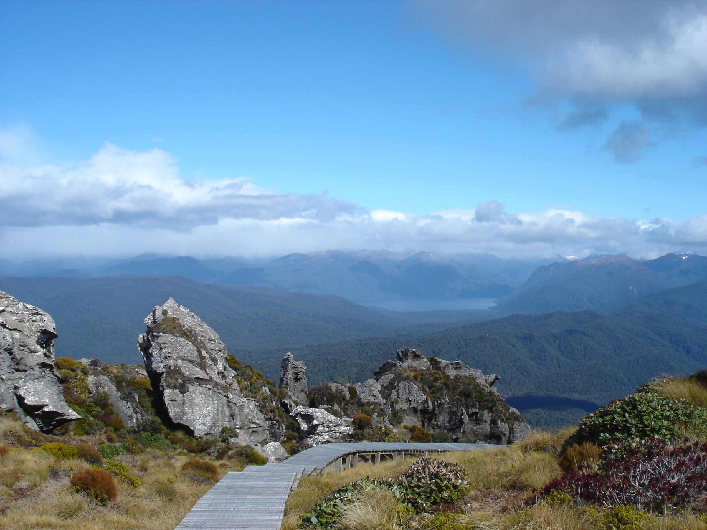
From the Borland Saddle car park, the track climbs through a short section of bush to open, tussock-covered tops and tarns on Mt Burns. The walk is short, but the terrain gives immediate alpine character: tarns, Fiordland plants, and views from the Borland Saddle high country.
The route can be extended beyond the tarns toward Mount Burns only by experienced parties. NZ Mountain Safety Council describes the continuation to Mount Burns as an unmarked, challenging route of about 10 km and 6–7 hr return.
Why it is essential
Mt Burns Tarns is the most accessible alpine day walk in the Hunter Mountains. It gives a compact introduction to Borland Road’s high Fiordland terrain without committing to a full remote tramp.
Equipment
- Standard hiking equipment for the tarns: hiking shoes or boots, waterproof layer, warm layer, water, food, sun protection, and navigation backup.
- For extensions beyond the tarns: mountain hiking equipment, map/GPS, emergency shelter, and strong navigation skills.
- Carry insect repellent and clothing for sudden cold wind.
Hazards and notes
- Borland Road can close at any time and is exposed to slips, snow, ice, high winds, washouts, and fallen trees.
- The tarn area is fragile alpine habitat; keep to durable surfaces and avoid damaging plants.
- The unmarked Mount Burns continuation should not be treated as the same difficulty as the short tarn track.
- No dogs are allowed.
GPX / KML links
| Source | URL | Format / access | Reuse status |
|---|---|---|---|
| DOC: Mt Burns Tarns Track | doc.govt.nz | Official route page / source map | DOC terms; no GPX located on page |
| AllTrails: Mount Burns Tarns Track | alltrails.com | Source route page / GPX via service | AllTrails terms apply; reuse not confirmed |
External links
- DOC — Mt Burns Tarns Track
- DOC — Lake Monowai/Borland Road area
- NZ Mountain Safety Council — Places to explore: Mt Burns
- AllTrails — Mount Burns Tarns Track
2. Eldrig Peak Route
Snapshot
Itinerary
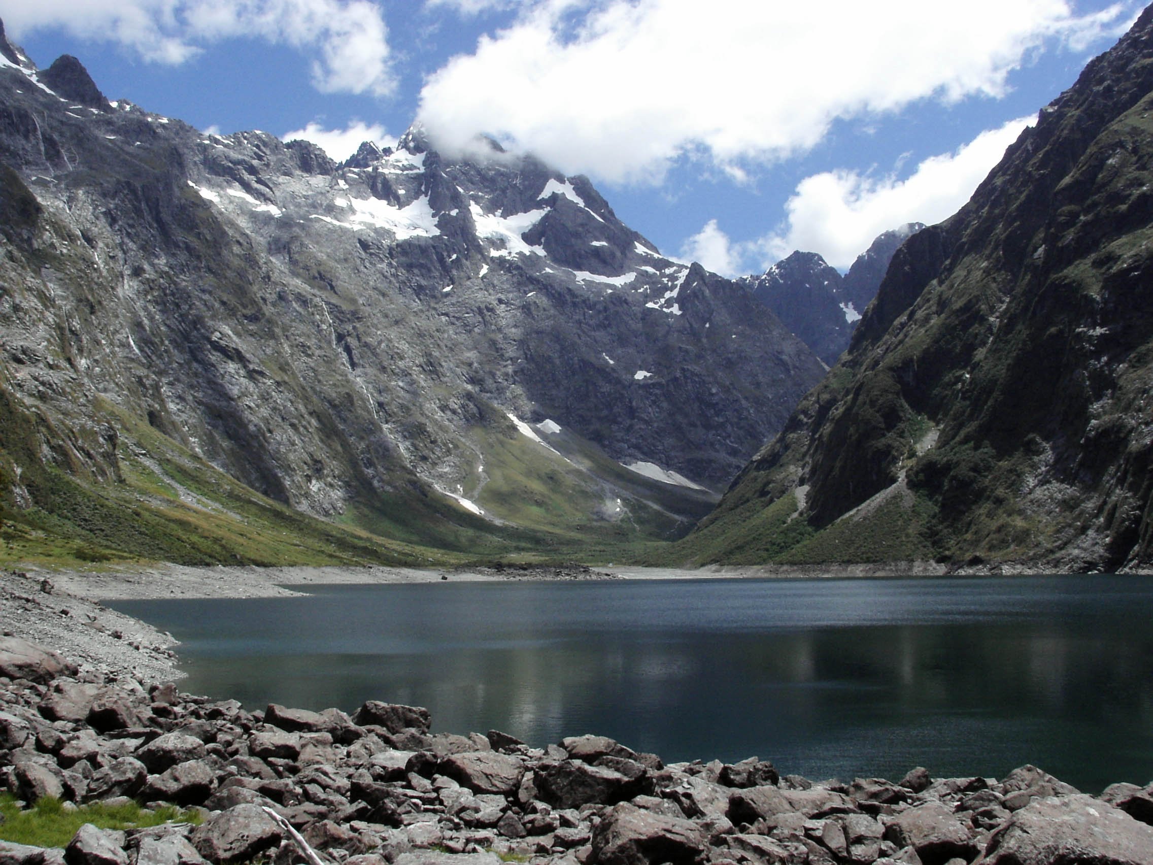
From the Borland Road parking area, follow the pylon access road for about an hour to the DOC sign for Eldrig Peak. The marked route then climbs steeply through beech forest and scrub for roughly 2 km to open tussock tops. Snow poles continue onto the slopes below Eldrig Peak, where granite rock formations and Fiordland views are the main objective.
The AllTrails route appears to record a longer start/finish variant, likely including more lower-road or lodge access. The DOC brochure distance is therefore kept separate from the AllTrails distance.
Why it is essential
Eldrig Peak Route is the classic harder day objective from Borland Road. It gives the Hunter Mountains a steep tops route, with forest transition, open tussock, rock formations, and broad views.
Equipment
- Mountain hiking equipment: boots, poles, waterproofs, warm layers, hat/gloves, food, water, headtorch, and navigation backup.
- Carry emergency shelter and a personal locator beacon.
- Conditional: snow and ice equipment may be needed outside dry summer conditions.
Hazards and notes
- The climb is steep and can be slippery.
- Above the bushline, weather exposure and navigation difficulty increase quickly.
- Borland Road access is itself a risk factor; check road alerts and vehicle suitability.
- No dogs are allowed.
GPX / KML links
| Source | URL | Format / access | Reuse status |
|---|---|---|---|
| DOC: Eldrig Peak Route | doc.govt.nz | Official route page / source map | DOC terms; no GPX located on page |
| AllTrails: Eldrig Peak Track | alltrails.com | Source route page / GPX via service | AllTrails terms apply; reuse not confirmed |
External links
- DOC — Eldrig Peak Route
- DOC — Lake Monowai, Borland and Grebe Valley tracks brochure (PDF)
- AllTrails — Eldrig Peak Track
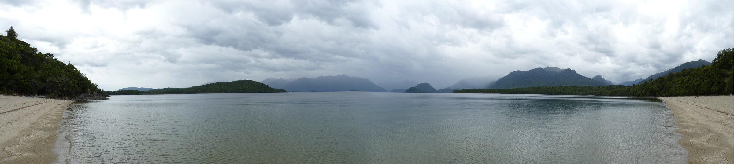
3. Green Lake Track from Borland Road
Snapshot
Itinerary
From Borland Road, the track passes Borland Bivvy, low tussock areas, small lakes, and beech-covered saddles. At the Green Lake junction it climbs a steep bush-clad hill, then descends to the shore of Green Lake. Green Lake Hut is at the far end of the tussock-covered shoreline.
For a day hike, return by the same route. The through-route to Lake Monowai car park is a longer point-to-point tramp and needs transport planning.
Why it is essential
Green Lake is one of the defining features of the Hunter Mountains/Borland walking area. The route gives a long but manageable day into lake, forest, tussock, and remote hut terrain.
Equipment
- Mountain hiking equipment: boots, waterproofs, warm layers, food, water, map/GPS, headtorch, and first-aid kit.
- Carry emergency shelter and a personal locator beacon.
- Fishing or water-contact gear must be cleaned to avoid spreading didymo and other freshwater pests.
Hazards and notes
- Mud, windfall, wet roots, and heavy rain can slow travel.
- DOC notes didymo in Lake Monowai and asks visitors to prevent freshwater pest spread; Green Lake/Borland Burn/Grebe River are treated as pristine in DOC hut notes.
- Borland Road access may close without much warning.
- No dogs are allowed.
GPX / KML links
| Source | URL | Format / access | Reuse status |
|---|---|---|---|
| DOC: Green Lake Track | doc.govt.nz | Official route page / source map | DOC terms; no GPX located on page |
| AllTrails: Borland Bivouac to Green Lake Hut via Green Lake Track | alltrails.com | Source route page / GPX via service | AllTrails terms apply; reuse not confirmed |
| AllTrails: Green Lake Hut to Borland Bivouac via Green Lake Track | alltrails.com | Reverse-direction secondary source | AllTrails terms apply; reuse not confirmed |
External links
- DOC — Green Lake Track
- DOC — Green Lake Hut
- AllTrails — Borland Bivouac to Green Lake Hut
- AllTrails — Green Lake Hut to Borland Bivouac
4. North Borland Track to Rock Bivvy
Snapshot
Itinerary
From the gate near Borland Lodge, enter the Borland Nature Walk, cross the Borland Burn suspension bridge, and follow the sign to the North Borland Track. DOC describes 1 hr 45 min of travel along the river to the South Borland intersection, then another 45 min along the North Borland terrace to a large limestone Rock Bivvy with shelter and a pit toilet.
The full track continues toward North Borland Hut, but that is a 12 km one-way tramp taking 6–8 hr to the hut and is too long for a normal return day. Rock Bivvy is the practical day-hike objective.
Why it is essential
This route represents the Hunter Mountains’ lower valley character: limestone features, beech forest, river terraces, and a sense of entering quieter Fiordland backcountry from the Borland Lodge gateway.
Equipment
- Mountain hiking equipment: boots, waterproofs, warm layer, food, water, headtorch, map/GPS, and first-aid kit.
- Carry a personal locator beacon and know river-crossing basics.
- Poles are useful on muddy or uneven sections.
Hazards and notes
- River levels can rise rapidly after heavy rain; DOC specifically warns about the Middle Branch of the Borland Burn beyond Rock Bivvy.
- Track surfaces may be muddy, rooty, and slow.
- The full North Borland Hut tramp is not the same commitment as the Rock Bivvy day section.
- No dogs are allowed.
GPX / KML links
| Source | URL | Format / access | Reuse status |
|---|---|---|---|
| DOC: North Borland Track | doc.govt.nz | Official route page / source map | DOC terms; no GPX located on page |
External links
5. Borland Saddle to Clark Hut / Island Lake
Snapshot
Itinerary
From Borland Saddle, the track heads south from the road and passes Island Lake, Historic Clark Hut, Clark Hut, and then continues toward Monowai Hut at the northern end of Lake Monowai. For a day hike, Clark Hut and Island Lake form a long return objective; the full continuation to Monowai Hut is better treated as an overnight or through-tramp.
DOC notes windfalls on the track, so stated times may stretch.
Why it is essential
This is the Hunter Mountains’ longer heritage-and-lake day option. It combines Borland Saddle access, Island Lake, and the historic Clark Hut corridor, giving a deeper sense of the Lake Monowai backcountry than the short tarn walks.
Equipment
- Mountain hiking equipment for a long day: boots, waterproofs, warm layers, food, water, headtorch, map/GPS, first-aid kit, and emergency shelter.
- Carry a personal locator beacon.
- Start early and plan turnaround times conservatively.
Hazards and notes
- This is a long out-and-back day; parties should be comfortable walking into evening if delayed.
- Windfalls, mud, heavy rain, and low visibility can slow progress.
- Borland Road access and closure status must be checked before departure.
- No dogs are allowed.
GPX / KML links
| Source | URL | Format / access | Reuse status |
|---|---|---|---|
| DOC: Borland Road to Monowai Hut Track | doc.govt.nz | Official route page / source map | DOC terms; no GPX located on page |
| DOC: Lake Monowai/Borland brochure | doc.govt.nz | PDF map and route guide | DOC terms; no GPX found |
External links
- DOC — Borland Road to Monowai Hut Track
- DOC — Lake Monowai/Borland Road area
- DOC — Lake Monowai, Borland and Grebe Valley tracks brochure (PDF)
External links
| Source | URL |
|---|---|
| DOC — Lake Monowai/Borland Road area | doc.govt.nz |
| DOC — Lake Monowai, Borland and Grebe Valley tracks brochure (PDF) | doc.govt.nz |
| DOC — Borland Nature Walk | doc.govt.nz |
| DOC — Mt Burns Tarns Track | doc.govt.nz |
| DOC — Green Lake Track | doc.govt.nz |
| DOC — Green Lake Hut | doc.govt.nz |
| DOC — Eldrig Peak Route | doc.govt.nz |
| DOC — North Borland Track | doc.govt.nz |
| DOC — Borland Road to Monowai Hut Track | doc.govt.nz |
| DOC — Copyright and image reuse | doc.govt.nz |
| NZ Mountain Safety Council — Mt Burns | mountainsafety.org.nz |
| AllTrails — Mount Burns Tarns Track | alltrails.com |
| AllTrails — Eldrig Peak Track | alltrails.com |
| AllTrails — Borland Bivouac to Green Lake Hut | alltrails.com |
| AllTrails — Green Lake Hut to Borland Bivouac | alltrails.com |