Regional overview
The Kepler Mountains sit immediately west and south-west of Te Anau, between Lake Te Anau, the Waiau River, and Lake Manapouri. Unlike much of Fiordland, they have a well-built public walking spine: the Kepler Track, one of New Zealand’s Great Walks. DOC explicitly identifies several day-walk options on the Kepler Track, ranging from easy lake-edge walks to the strenuous full-day climb to Luxmore Hut.
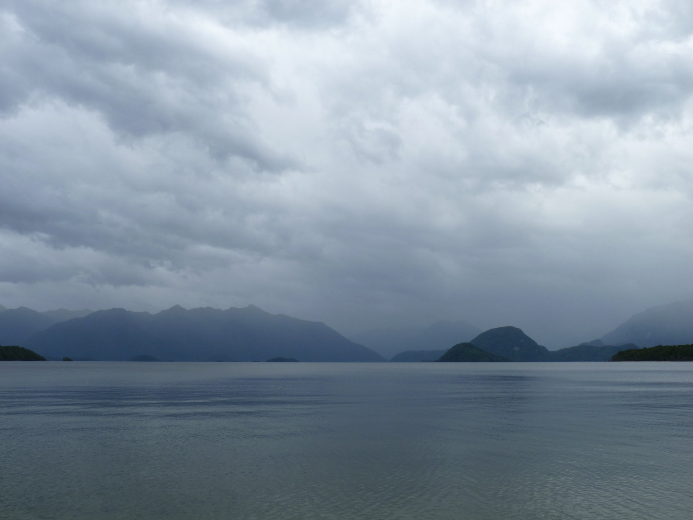
The walking character is lake shore, beech forest, river terraces, wetlands, limestone bluffs, alpine tussock, and wide views over Lakes Te Anau and Manapouri toward the Murchison and Fiordland ranges. The normal Great Walks season for 2026/27 is 27 October 2026 to 30 April 2027. Outside the Great Walks season, DOC warns of reduced facilities, snow, short daylight, avalanche terrain, and more demanding self-sufficiency.
Selection rationale
The five selections use the practical public day-walk options around the Kepler Mountains: the Te Anau access walk, two lower Kepler forest/lake sections, the Manapouri-side wetland/lake section, and the iconic strenuous ascent to Luxmore Hut and optional Luxmore summit/cave side trips. Because the Kepler region is compact and dominated by a single Great Walk corridor, several entries share the same track system.
Summary table
| # | Hike | Country | Route type | Distance | Gain | Max elevation | Difficulty | Photo status |
|---|---|---|---|---|---|---|---|---|
| 1 | Visitor Centre to Kepler Track Carpark / Control Gates | New Zealand | Out-and-back or access walk | 3.5 km one way / 7 km return | Low lake-edge route | Easy-intermediate | DOC/CC candidate found | |
| 2 | Kepler Track Carpark to Dock Bay and Brod Bay | New Zealand | Return via same track | 5.6 km return | AllTrails segment approx. 84 m to Brod Bay one way | Low lake-edge route | Easy-intermediate | DOC/CC candidate found |
| 3 | Kepler Track Carpark to Rainbow Reach | New Zealand | Point-to-point or return | 9.5 km one way / 19 km return | Low river-terrace route | Intermediate | DOC/CC candidate found | |
| 4 | Rainbow Reach to Shallow Bay / Moturau Hut | New Zealand | Return via same track | 12 km return | Low wetland/lake route | Intermediate | DOC/CC candidate found | |
| 5 | Kepler Track Carpark to Luxmore Hut, with optional Luxmore summit/cave | New Zealand | Return via same track | 27.6 km return to hut, plus optional side trips | AllTrails: 939 m to hut one way | 1,085 m hut; 1,472 m Luxmore summit side trip | Hard / strenuous | Wikimedia candidates found |
1. Visitor Centre to Kepler Track Carpark / Control Gates
Snapshot
Itinerary
Follow the lake-edge path south from the Fiordland National Park Visitor Centre, passing the Te Anau Bird Sanctuary and open lakefront ground below the golf course. The walk reaches the Kepler Track carpark and the Control Gates, where water flows from Lake Te Anau into the Waiau River for the Manapouri hydro system.
Why it is essential
This is the natural Te Anau gateway into the Kepler Mountains. It gives lake and mountain views, links the town directly to the Great Walk, and works as the first or last section of longer Kepler day walks.
Equipment
Comfortable walking shoes, rain layer, warm layer, water, sun protection, insect repellent.
Hazards and notes
Shared-use lakefront path in places; no dogs past the Control Gates into national-park track sections.
Photos
| Image | Source | Author | Licence | Reuse notes | Attribution |
|---|---|---|---|---|---|
| Birds in the Te Anau Bird Sanctuary | doc.govt.nz | BackpackersGuide.NZ | Creative Commons; exact variant not captured in DOC text | Potentially reusable; verify exact CC terms before publication | Image by BackpackersGuide.NZ via DOC page, Creative Commons |
GPX / KML links
| Source | URL | Format | Licence / terms | Reuse status |
|---|---|---|---|---|
| DOC: Visitor Centre to Kepler Track Carpark Walk | doc.govt.nz | Official route page / source map | DOC terms; no GPX found | Official source checked |
External links
2. Kepler Track Carpark to Dock Bay and Brod Bay
Snapshot
Itinerary
From the Kepler Track carpark, follow the first part of the Kepler Track along Lake Te Anau through mountain and red beech forest, passing fern groves to Dock Bay. Continue across Coal Creek Bridge to Brod Bay, a swimming and picnic spot with toilets and a Great Walk campsite.
Why it is essential
This is the easiest way to sample the Kepler Track proper: lake shore, beech forest, swimming beaches, and a family-friendly first taste of the Great Walk.
Equipment
Walking shoes, rain layer, water, insect repellent; swim/picnic gear optional.
Hazards and notes
Sandflies, slippery wet forest track, lake-edge weather; no dogs.
Photos
| Image | Source | Author | Licence | Reuse notes | Attribution |
|---|---|---|---|---|---|
| Kepler track: Carpark to Dock Bay and Brod Bay | doc.govt.nz | Kirsten Brown | Creative Commons; exact variant not captured in DOC text | Potentially reusable; verify exact CC terms before publication | Image by Kirsten Brown via DOC page, Creative Commons |
GPX / KML links
| Source | URL | Format | Licence / terms | Reuse status |
|---|---|---|---|---|
| DOC: Kepler Track carpark to Dock Bay and Brod Bay | doc.govt.nz | Official route page / source map | DOC terms; no GPX found | Official source checked |
| AllTrails: Kepler Track Carpark to Brod Bay Campsite | alltrails.com | Source route page / GPX via service | AllTrails terms apply | Secondary geometry source found; reuse not confirmed |
External links
- DOC — Kepler Track carpark to Dock Bay and Brod Bay
- AllTrails — Kepler Track Carpark to Brod Bay Campsite
3. Kepler Track Carpark to Rainbow Reach
Snapshot
Itinerary
From the Kepler Track carpark, follow the Kepler Track along red and mountain beech forest terraces beside the Waiau River. The track reaches Rainbow Reach, where a swingbridge crosses the river and provides a practical pickup/turnaround point.
Why it is essential
This section represents the Kepler’s river-terrace landscape and gives a longer lower-level day without committing to the alpine climb. It also connects two of the main Kepler access points.
Equipment
Hiking shoes, waterproof layer, warm layer, water, food, insect repellent.
Hazards and notes
Wet roots, river/lake weather, sandflies; no dogs.
Photos
| Image | Source | Author | Licence | Reuse notes | Attribution |
|---|---|---|---|---|---|
| Kayaker on Kepler track | doc.govt.nz | BackpackerGuide.NZ | Creative Commons; exact variant not captured in DOC text | Potentially reusable; verify exact CC terms before publication | Image by BackpackerGuide.NZ via DOC page, Creative Commons |
| Waiau River at Rainbow Reach | commons.wikimedia.org | Oren Rozen | Creative Commons, exact variant to confirm on Commons page | Likely reusable under stated Commons licence; verify exact terms | “NZ180315 Waiau River Rainbow Reach 01” by Oren Rozen |
GPX / KML links
| Source | URL | Format | Licence / terms | Reuse status |
|---|---|---|---|---|
| DOC: Kepler Track carpark to Rainbow Reach | doc.govt.nz | Official route page / source map | DOC terms; no GPX found | Official source checked |
| OpenStreetMap relation: Kepler Track | openstreetmap.org | OSM relation / extractable geometry | ODbL | Reusable under ODbL with attribution/share-alike database obligations |
| Waymarked Trails: Kepler Track relation | hiking.waymarkedtrails.org | OSM-derived route map / export tools | ODbL via OSM data | Source route found; check export and attribution requirements |
External links
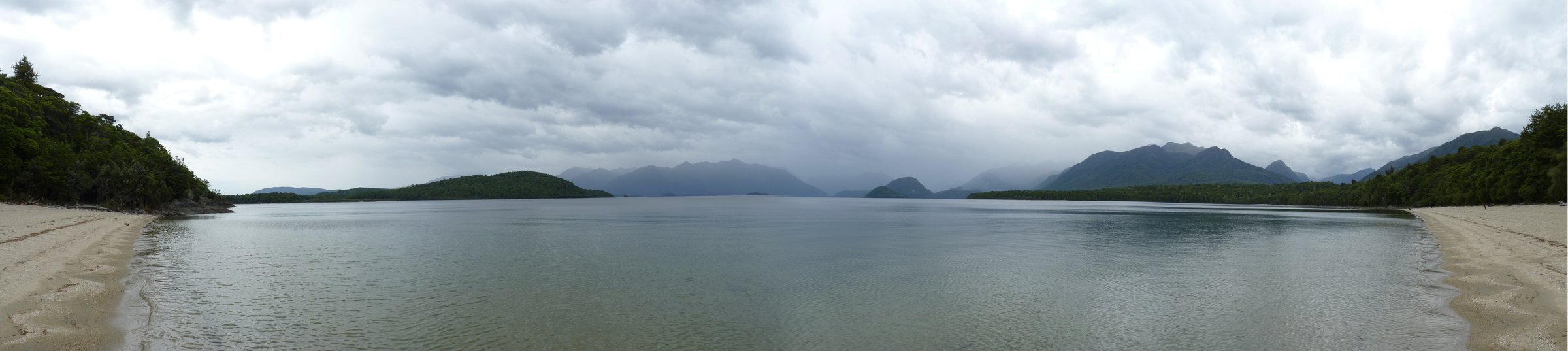
4. Rainbow Reach to Shallow Bay / Moturau Hut
Snapshot
Itinerary
Cross the Rainbow Reach swingbridge, follow the Kepler Track briefly toward the Control Gates, then turn left for Moturau Hut and Shallow Bay. The route undulates through mountain beech forest, crosses kettle-bog country and reaches Lake Manapouri near Moturau and Shallow Bay Huts.
Why it is essential
This is the Kepler’s Manapouri-side day walk: river views, beech forest, wetland ecology, and a lake-shore finish without the long alpine climb.
Equipment
Hiking shoes, rain layer, warm layer, water, snacks, insect repellent.
Hazards and notes
Sandflies, slippery track, bog/wetland sections, lake weather; no dogs.
Photos
| Image | Source | Author | Licence | Reuse notes | Attribution |
|---|---|---|---|---|---|
| Bridge at Rainbow Reach | doc.govt.nz | Nicola Ponsonby | Creative Commons; exact variant not captured in DOC text | Potentially reusable; verify exact CC terms before publication | Image by Nicola Ponsonby via DOC page, Creative Commons |
GPX / KML links
| Source | URL | Format | Licence / terms | Reuse status |
|---|---|---|---|---|
| DOC: Rainbow Reach to Shallow Bay or Moturau Hut | doc.govt.nz | Official route page / source map | DOC terms; no GPX found | Official source checked |
| AllTrails: Rainbow Reach to Spirit Lake | alltrails.com | Nearby source route page / GPX via service | AllTrails terms apply | Secondary route source found; exact overlap with DOC Shallow Bay route requires manual check |
External links
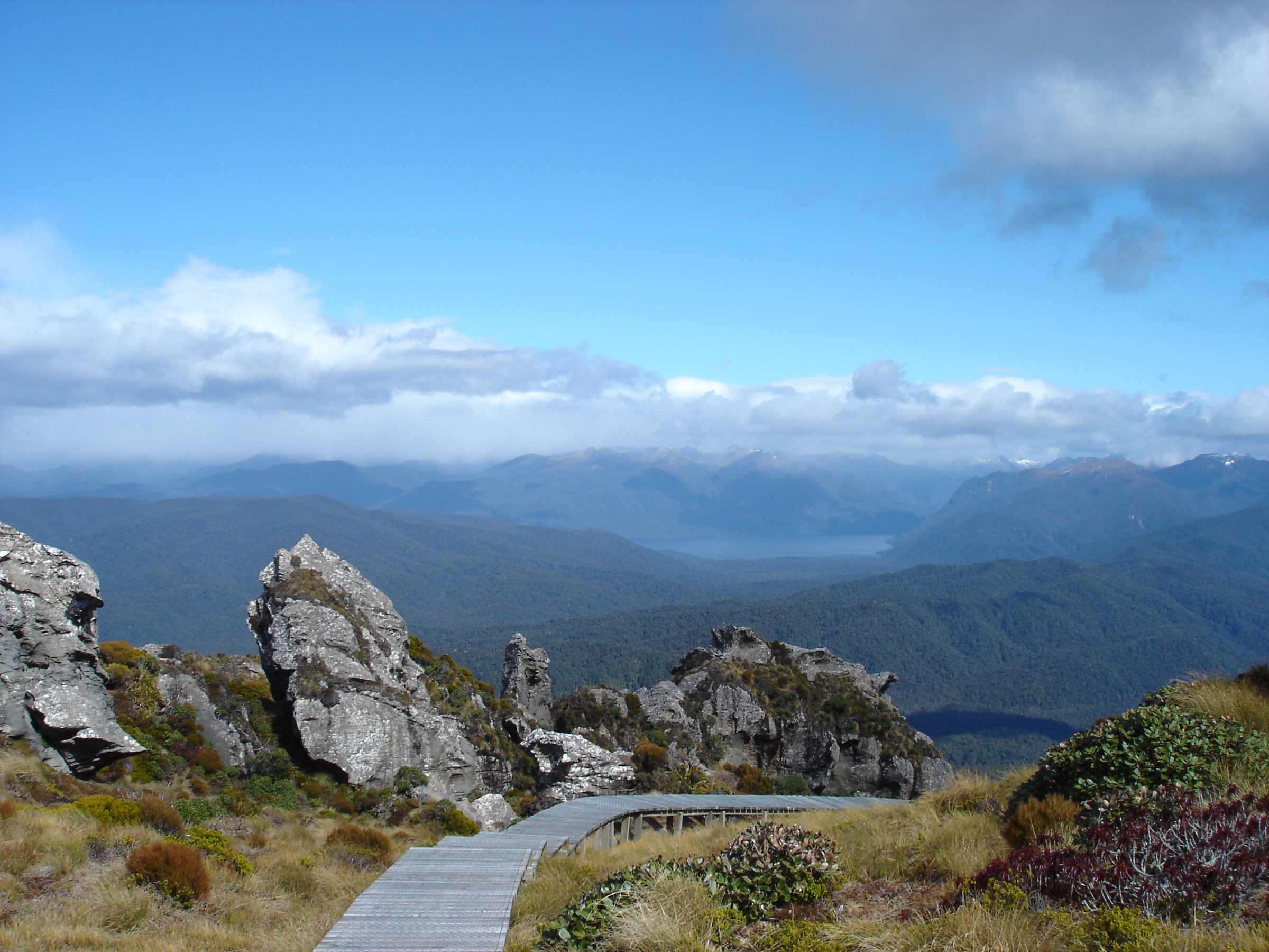
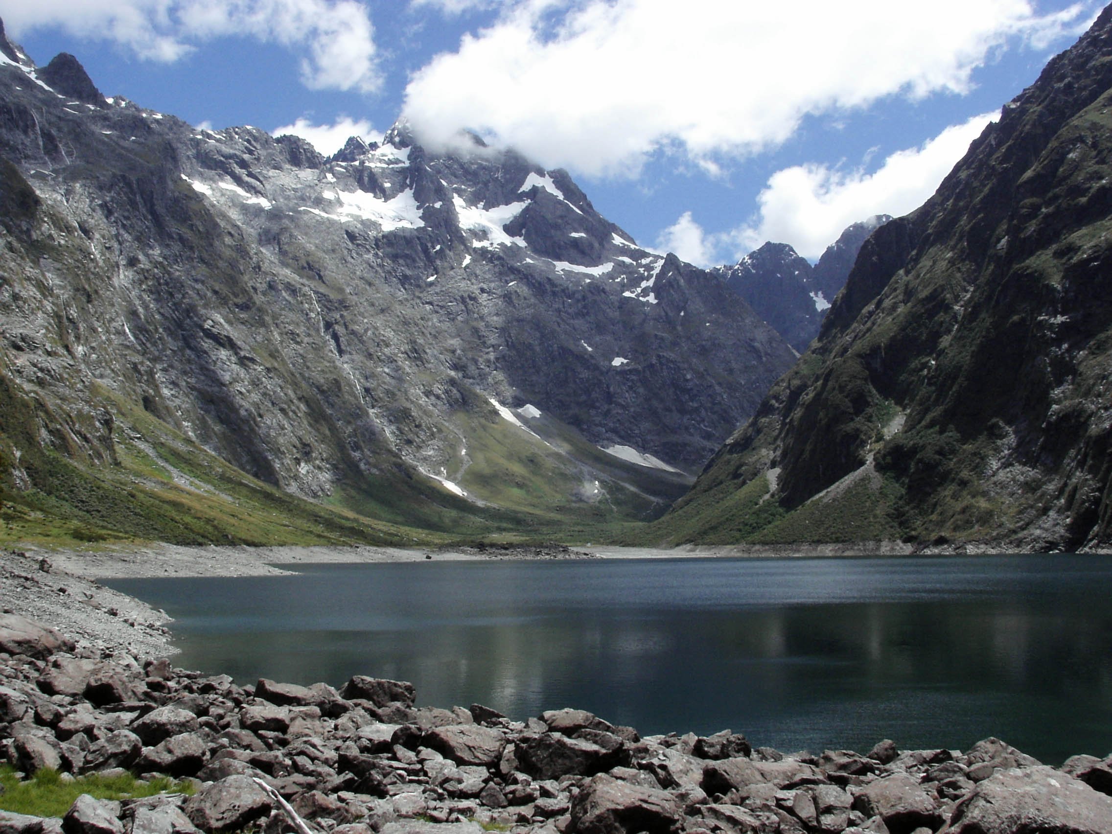
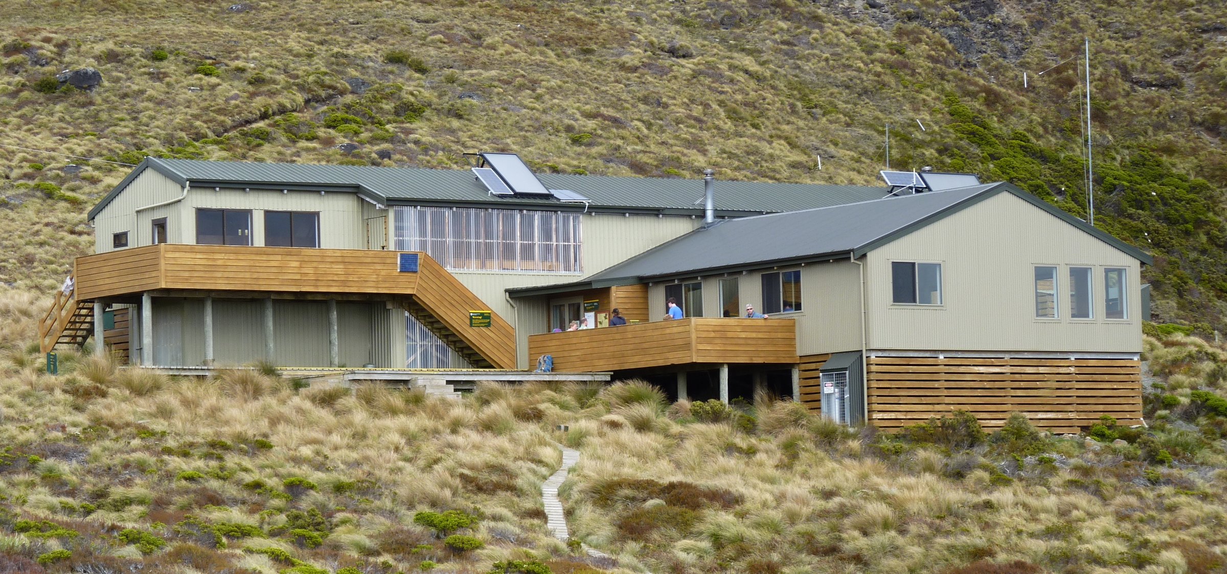
5. Kepler Track Carpark to Luxmore Hut, with Optional Luxmore Summit / Cave

Snapshot
Itinerary
From the Kepler Track carpark, follow the lake shore via Dock Bay and Brod Bay. Beyond Brod Bay the track climbs steeply through mountain and silver beech forest, passes beneath limestone bluffs, reaches the bushline, and continues to Luxmore Hut at 1,085 m. From the hut area, signposted side trips lead to Luxmore Cave and, in fine weather, toward the highest point on the Kepler Track at Luxmore summit.
Why it is essential
This is the iconic Kepler day objective: the full transition from Lake Te Anau to limestone bluffs, beech forest, open alpine country and huge Fiordland views.
Equipment
Mountain hiking equipment, waterproofs, warm layers, food, water, headtorch, map/GPS, emergency layer; torch for cave; PLB strongly recommended.
Hazards and notes
Long day, steep climb, limestone bluffs, alpine weather, snow/ice/avalanche risk outside normal season, no reliable water on alpine section beyond hut context; no dogs.
Photos
| Image | Source | Author | Licence | Reuse notes | Attribution |
|---|---|---|---|---|---|
| Kepler Track - Lake Manapouri - Sunset | commons.wikimedia.org | Robert (Bic) Bicknell | CC BY-SA 4.0 | Yes, with attribution and share-alike | “Kepler Track - Lake Manapouri - Sunset” by Robert (Bic) Bicknell, CC BY-SA 4.0 |
GPX / KML links
| Source | URL | Format | Licence / terms | Reuse status |
|---|---|---|---|---|
| DOC: Kepler Track carpark to Luxmore Hut | doc.govt.nz | Official route page / source map | DOC terms; no GPX found | Official source checked |
| DOC: Kepler Track brochure | doc.govt.nz | PDF map/profile | DOC terms | Official route-map source found; no GPX found |
| OpenStreetMap relation: Kepler Track | openstreetmap.org | OSM relation / extractable geometry | ODbL | Reusable under ODbL with attribution/share-alike database obligations |
| AllTrails: Kepler Track Carpark to Luxmore Hut | alltrails.com | Source route page / GPX via service | AllTrails terms apply | Secondary route source found; reuse not confirmed |
External links
- DOC — Kepler Track carpark to Luxmore Hut
- DOC — Kepler Track brochure (PDF)
- AllTrails — Kepler Track Carpark to Luxmore Hut
External links
| Source | URL |
|---|---|
| DOC — Kepler Track | doc.govt.nz |
| DOC — Visitor Centre to Kepler Track Carpark Walk | doc.govt.nz |
| DOC — Kepler Track carpark to Dock Bay and Brod Bay | doc.govt.nz |
| DOC — Kepler Track carpark to Rainbow Reach | doc.govt.nz |
| DOC — Rainbow Reach to Shallow Bay or Moturau Hut | doc.govt.nz |
| DOC — Kepler Track carpark to Luxmore Hut | doc.govt.nz |
| DOC — copyright guidance | doc.govt.nz |