New Zealand — Fiordland, Earl Mountains: Essential Day-Hikes
Five essential Earl Mountains day-objectives — the Key Summit Track from The Divide, the historic Dore Pass Route to Glade House, the Mistake Creek Track.
By James Nicolas··
Updated
Regional overview
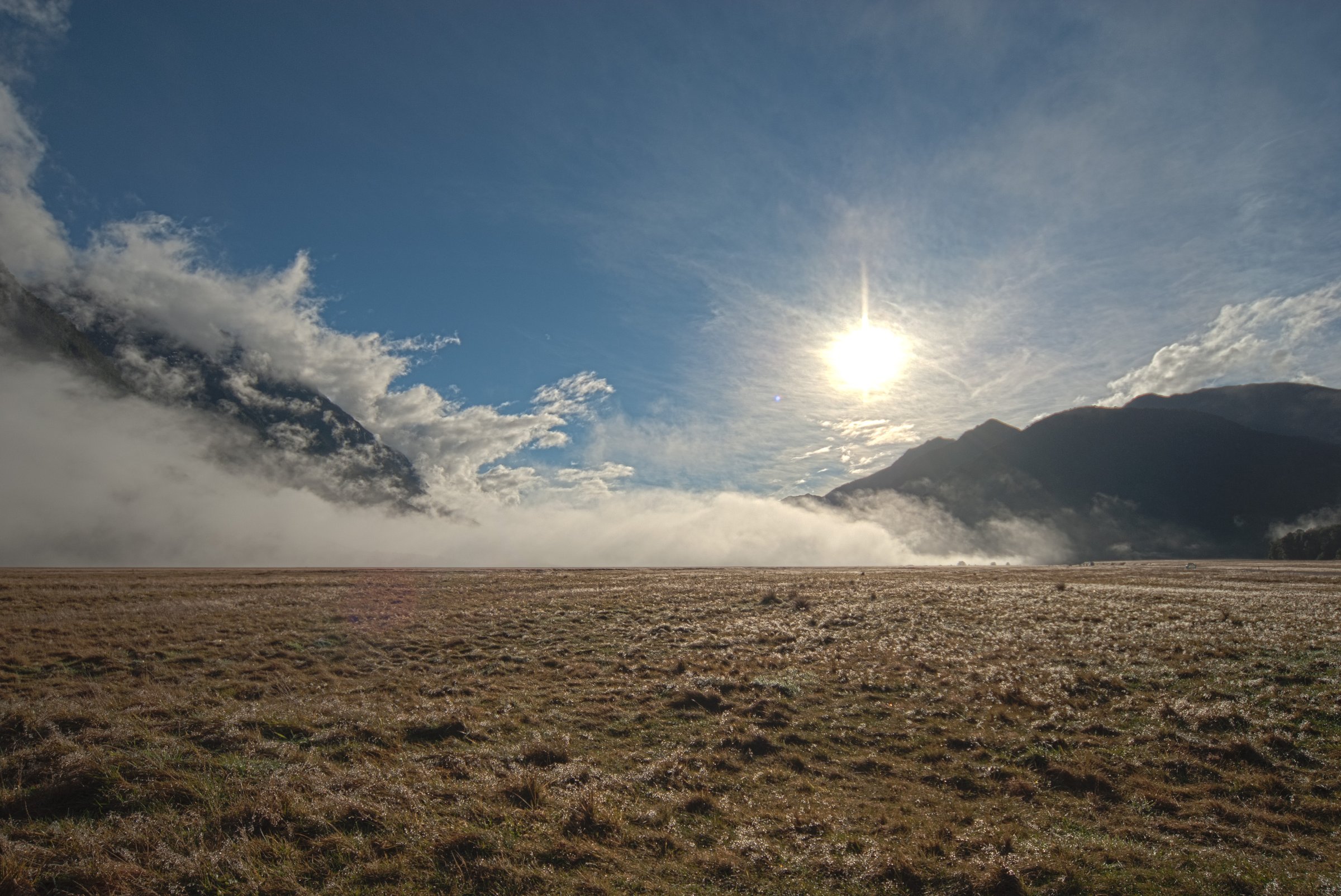
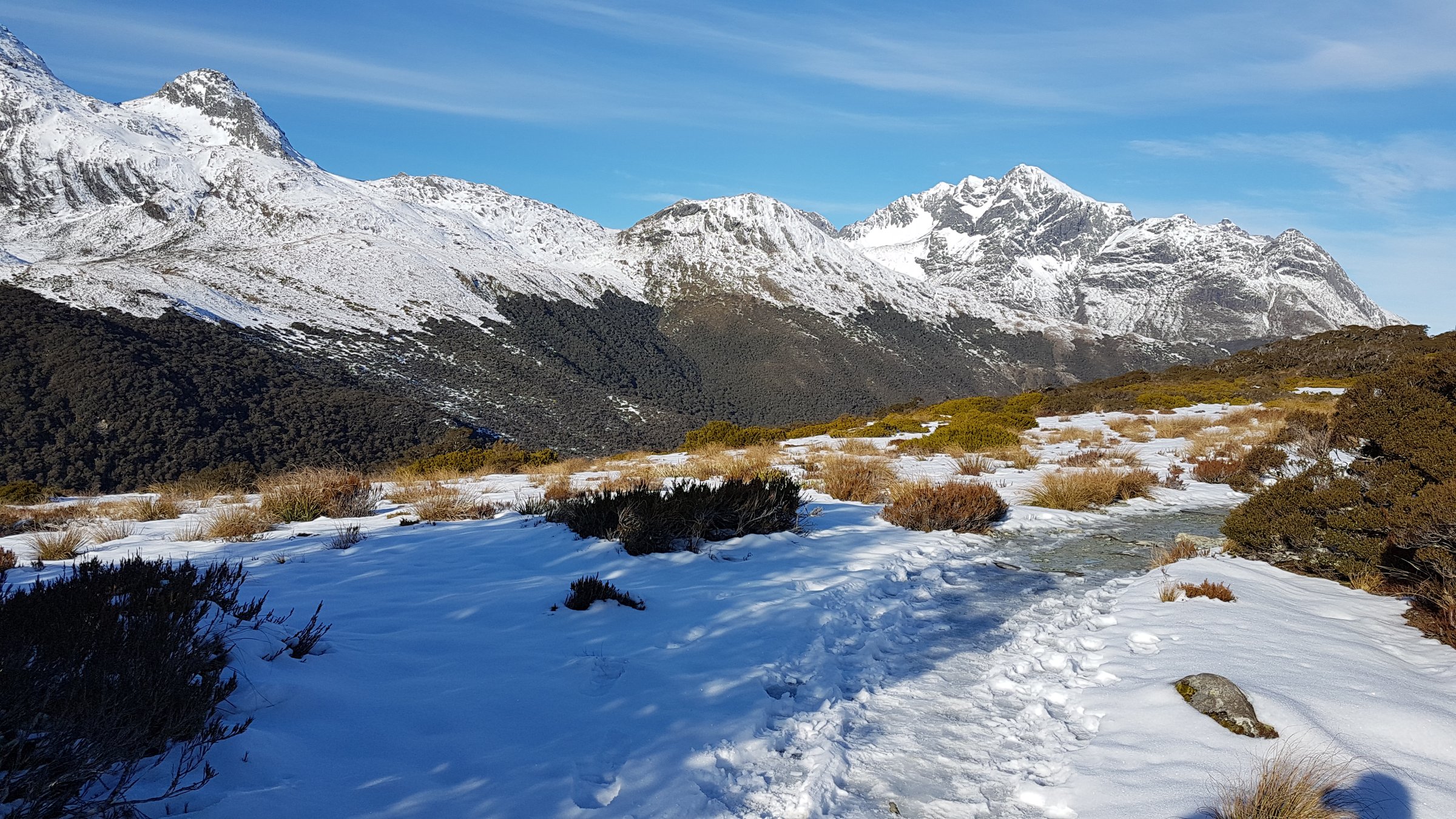
The Earl Mountains line the western side of the Eglinton Valley and merge northward toward the Darrans and upper Hollyford. Compared with the wet western Darrans, the Earl Mountains are somewhat drier but still serious: steep forest approaches, open alpine basins, river crossings, and remote-feeling passes only a short distance from Milford Road. The catalogue balances one famous formed track at The Divide with the classic Earl Mountain valleys and Dore Pass, the historic foot access toward the Milford Track.
Summary table
#
Hike
Country
Route type
Distance
Time
Difficulty
1
Key Summit Track
New Zealand
Out-and-back half-day walk on the Routeburn Track plus side track
3.4 km one way / 6.8 km return
3 hr return
Intermediate tramping track
2
Dore Pass Route
New Zealand
Expert point-to-point alpine route
13.5 km one way (DOC current)
9 hr (DOC current)
Expert route
3
Mistake Creek Track
New Zealand
Out-and-back advanced tramping track
5 km one way / 10 km return
3 hr one way to bush edge
Advanced tramping track
4
Hut Creek Track
New Zealand
Out-and-back advanced tramping track
2.7 km one way / 5.4 km return
3 hr one way to bush edge
Advanced tramping track
5
Falls Creek Route
New Zealand
Expert out-and-back tramping route
21 km return
4 hr to bush edge / 6–8 hr to rock bivvy
Expert route
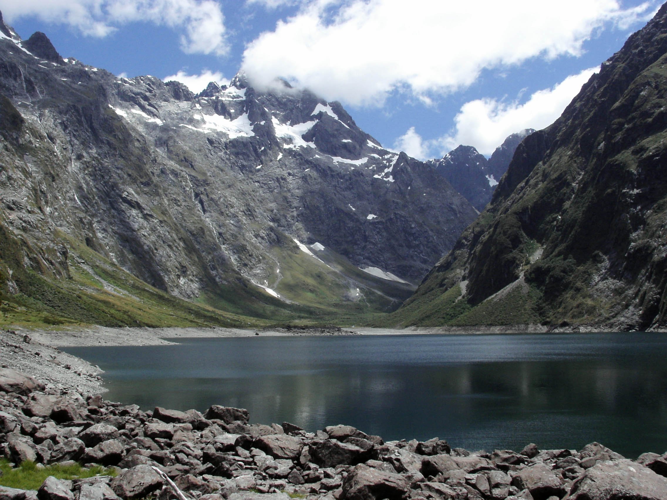
The Earl Mountains above the Eglinton Valley. Photo: Steve Collis / Wikimedia Commons (CC BY 2.0).
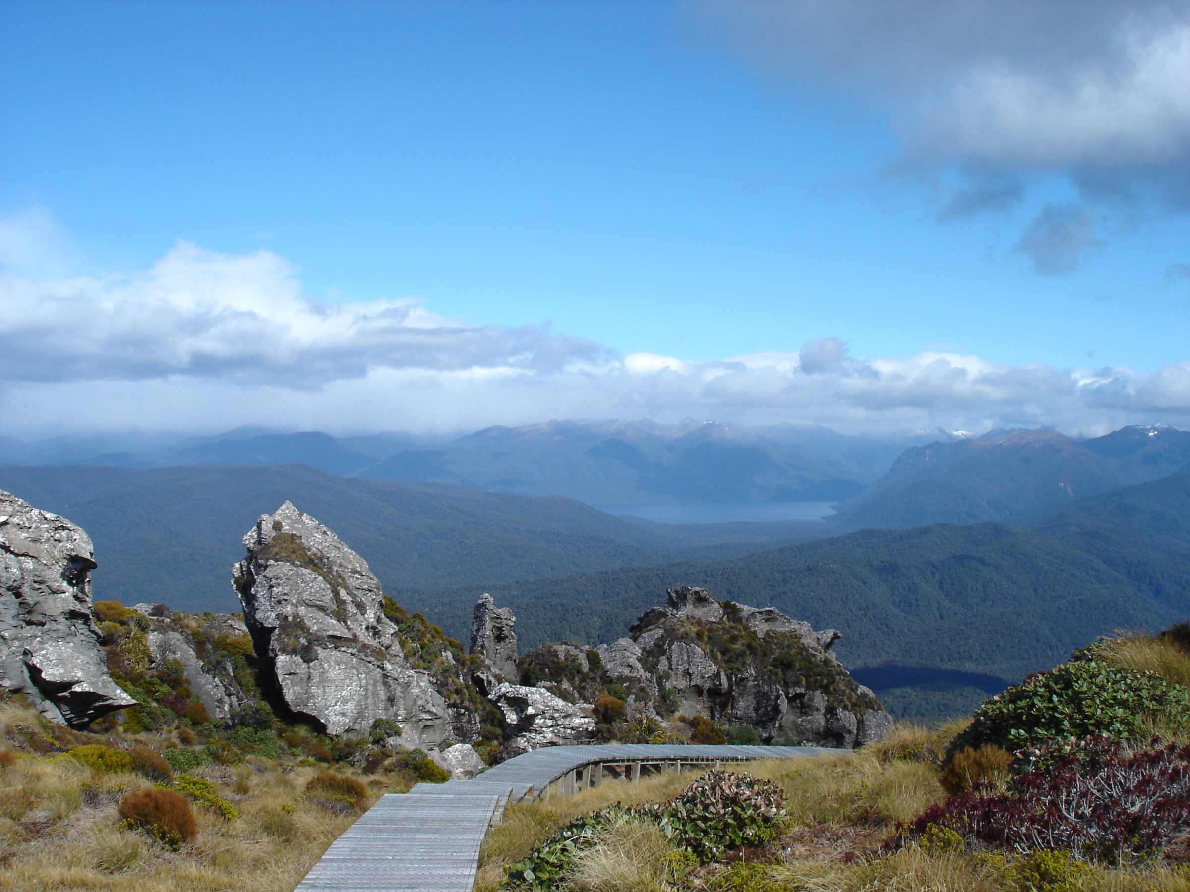
1. Key Summit Track
Snapshot
CountryNew Zealand
Sub-regionThe Divide / Routeburn Track edge of the Earl Mountains
StartThe Divide car park on Milford Road
FinishKey Summit alpine wetland/viewpoint; return same way
Route typeOut-and-back half-day walk using the Routeburn Track plus side track
Distance3.4 km one way / 6.8 km return, verified by DOC
Elevation gainNot stated by DOC
Elevation lossNot stated
Maximum elevationNot stated by DOC
Estimated time3 hr return, verified by DOC
DifficultyIntermediate tramping track, verified by DOC
Required equipmentWaterproof/warm layers, shoes or boots with grip; winter/spring travellers need snow/avalanche awareness if conditions warrant
Seasonal notesBest in clear summer/autumn weather; DOC avalanche page lists Key Summit as simple avalanche terrain, but weather can change quickly
Hazards / exposureFragile alpine soils and wetlands, weather exposure, snow/ice in colder months
Public transport / accessThe Divide is about 85 km along Milford Road from Te Anau; scheduled Milford Road transport may stop by arrangement
Verification statusOfficial distance/time/grade/access verified; elevation and specific GPX/KML unresolved
Itinerary
Follow the Routeburn Track from The Divide for about an hour to the signed Key Summit turnoff, then climb about 20 min to alpine tarns, bogs, and panoramic viewpoints over the Humboldt and Darran Mountains.
Why it is essential
The most famous accessible alpine viewpoint on Milford Road and DOC’s “if you only have time for one walk” recommendation.
Sub-regionEglinton Valley to Clinton Valley / Milford Track
StartCurrent access from Kiosk Creek Campsite area on Milford Road, per current DOC snippet; original Dore Pass car park washed out
FinishGlade House on the Milford Track; boat exit from Glade Wharf normally required unless continuing the Milford Track with bookings
Route typeExpert point-to-point alpine route
DistanceCurrent DOC search result states 13.5 km one way after re-route; older opened DOC page text still showed 10.5 km. Use 13.5 km as current and mark old conflict
Elevation gainSecondary sources give about 1,135–1,155 m gain; not confirmed by DOC
Elevation lossSubstantial descent to Glade House
Maximum elevationDore Pass elevation not verified in official source during this pass
Estimated timeCurrent DOC search result states 9 hr; older opened DOC page text showed 8 hr. Use 9 hr as current and mark conflict
DifficultyExpert route, verified by DOC
Required equipmentBoots, full waterproof/warm layers, map/compass/GPS, PLB, river-crossing competence; avalanche gear/skills in winter/spring
Seasonal notesDOC says winter/spring likely require alpine skills/equipment and avalanche assessment; avoid mist and high river levels
Hazards / exposureRoute-finding, unbridged Eglinton River crossing, no formed re-route from Kiosk Creek, mist navigation, avalanche terrain
Public transport / accessMilford Road access plus boat logistics from Glade Wharf if finishing at the Milford Track start; Milford Track hut bookings required if continuing, and camping is not allowed on the Milford Track
Verification statusOfficial route, grade, hazards, and changed access verified via DOC snippets/pages; distance/time conflict noted; route-file source found but licence unresolved
Itinerary
From the Milford Road side, navigate toward Dore Pass, cross/ford rivers, climb to the pass, then descend into the Clinton Valley near Glade House. DOC states the re-route from Kiosk Creek has no formed track and requires self-navigation.
Why it is essential
Historic independent foot access to the start of the Milford Track and the Earl Mountains’ classic pass crossing.
Seasonal notesAvoid heavy rain; DOC says rivers can run fast and high and should not be crossed until levels drop. Avalanche usually occurs May–Nov and can occur outside this period with snow
Hazards / exposureEglinton walk wire, river crossings, rough/muddy track, navigation, complex avalanche terrain per DOC avalanche page
Public transport / accessSmall Milford Road car park; no dogs; limited mobile coverage
Verification statusOfficial distance/time/grade/access/hazards verified; elevation and route-file unresolved
Itinerary
From the sign, walk to the Eglinton River walk wire, follow the sign hard right to Mistake Creek, travel about 1.5 hr on the true left, cross to the true right, and continue to the open flat at the bush edge.
Why it is essential
One of the principal Earl Mountain valley approaches, giving a true backcountry feel directly from Milford Road.
From the Earl Mountain Tracks sign, walk to the Eglinton River walk wire, then follow the Hut Creek sign. After crossing Mistake Creek, follow the true left of Hut Creek, cross to the true right after a clearing, and continue to open river flats.
Why it is essential
A compact but demanding Earl Mountain valley route, often paired with Mistake Creek by experienced parties.
Public transport / accessMilford Road car park near Falls Creek bridge and Hollyford Road turnoff; no dogs
Verification statusOfficial distance/time/grade/access/hazards verified; elevation and route-file unresolved
Itinerary
From the car park, climb steeply for about 45 min on the leading spur on the true right of Falls Creek. The gradient then eases; open flats toward the valley head are reached in about 2 hr. The route becomes more challenging farther up-valley toward a rock bivvy below Mount Ngatimamoe and Mount Pyramid.
Why it is essential
The main official route into the northern Earl Mountains from the Hollyford/Milford Road corner, with direct views into the range’s high headwalls.