New Zealand — Fiordland, Darran Mountains: Essential Day-Hikes
Five essential Darran Mountains day-objectives — the Gertrude Saddle Route, Lake Marian Track, Homer Saddle Route, Tūtoko Valley Route.
By James Nicolas··
Updated
Regional overview
The Darran Mountains form Fiordland’s steepest and most alpine-feeling accessible front country around Homer Tunnel, Gertrude Valley, Lake Marian, the Hollyford headwaters, and Mount Tūtoko. The walking character is more serious than the short Milford walks: many routes are advanced or expert, unformed above bushline, and exposed to wet granite slabs, river crossings, avalanches, rockfall, and fast weather changes. In normal summer weather, the selected routes are day objectives for appropriately experienced walkers, but several are not casual tourist walks.
Summary table
#
Hike
Country
Route type
Distance
Gain
Max elevation
Difficulty
1
Gertrude Saddle Route
New Zealand
Advanced alpine out-and-back
7 km return
646 m
Wikiloc 1,444 m (unresolved against DOC)
Expert
2
Lake Marian Track
New Zealand
Out-and-back tramping track
3.1 km one way / 6.2 km return
~430 m (secondary)
Lake 695 m / 730 m secondary
Advanced tramping
3
Homer Saddle Route
New Zealand
Unformed alpine scramble / out-and-back
2.6 km return (AllTrails)
419–480 m (conflicting secondary)
~1,375 m (AllTrails)
Hard/expert
4
Tūtoko Valley Route
New Zealand
Rough out-and-back tramping route
4 km return
Not stated
Not stated
Expert
5
Hollyford Track: Hidden Falls Track
New Zealand
Valley out-and-back day walk on the Hollyford Track
18 km return
Not stated
Not stated
Advanced tramping
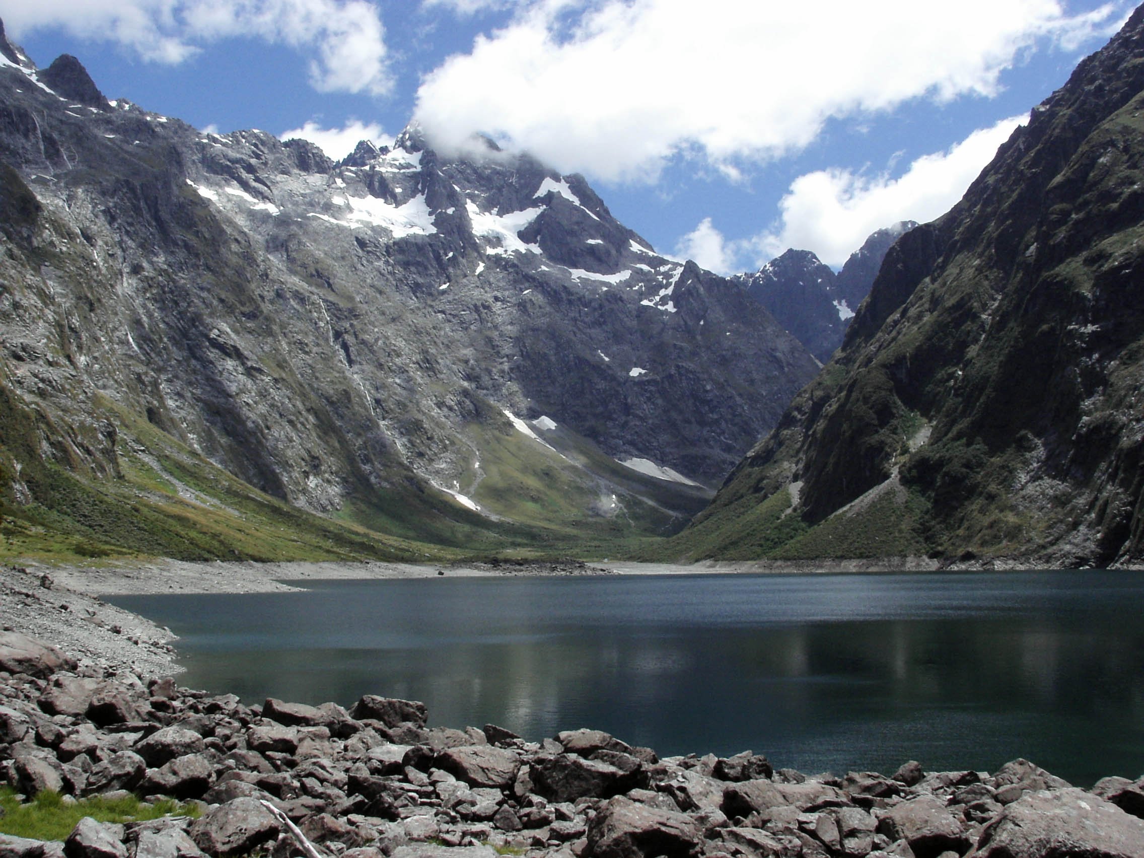
Lake Marian / Hinepipiwai below the Darran Mountains. Photo: Thorney / Wikimedia Commons (CC BY-SA 3.0).
1. Gertrude Saddle Route
Snapshot
CountryNew Zealand
Sub-regionGertrude Valley, Darran Mountains
StartGertrude Valley car park, about 98 km along Milford Road from Te Anau
FinishGertrude Saddle; return same way
Route typeAdvanced alpine out-and-back route
Distance7 km return, verified by DOC
Elevation gain646 m ascent, verified by DOC safety handout; out-and-back loss is similar
Elevation lossSimilar to gain
Maximum elevationNot stated by DOC route page; secondary Wikiloc listing gives max 4,739 ft / 1,444 m, unresolved against official source
Estimated time4–6 hr, verified by DOC
DifficultyExpert route, verified by DOC
Required equipmentBoots, waterproof/warm layers, gloves useful on cables/slabs, map/navigation, PLB strongly recommended by DOC, extra food; avalanche kit/skills when snow is present
Seasonal notesDOC says not recommended in winter due to avalanche danger; wet weather, snow, or ice can be treacherous in any season
Public transport / accessMilford Road access; practical by car or Milford Road transport only. Check weather/road and consult Fiordland National Park Visitor Centre
Verification statusOfficial distance/time/grade/ascent/hazards verified; max elevation and reusable route file unresolved
Itinerary
Follow the marked valley route through alpine vegetation to the head of Gertrude Valley. Above the valley head there are no permanent markers; cross Gertrude Stream below the waterfall area, climb toward Black Lake, then continue over steep slabs, boulders, and cable-assisted sections to the saddle.
Why it is essential
The classic Darrans alpine day route, with high views down valley toward Milford Sound / Piopiotahi.
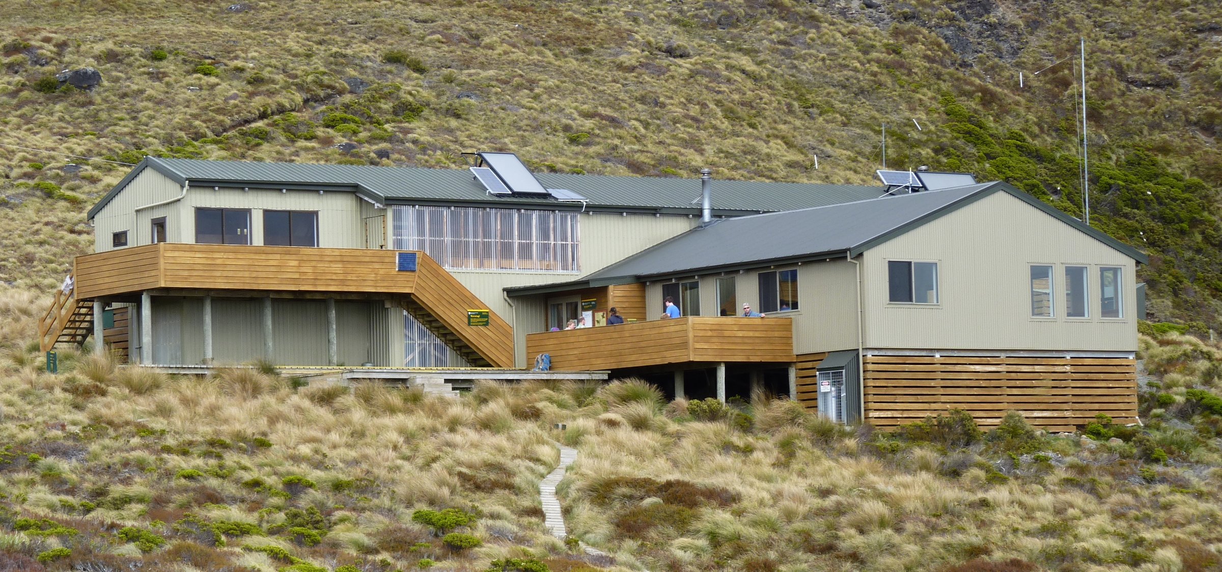
StartLake Marian car park, 1 km down unsealed Hollyford Road from Marian Corner
FinishLake Marian / Hinepipiwai; return same way
Route typeOut-and-back tramping track
Distance3.1 km one way / 6.2 km return, verified by DOC
Elevation gainApprox. 430 m gain/loss, from secondary guide Tracks Less Travelled; not stated by DOC
Elevation lossSimilar to gain
Maximum elevationLake elevation 695 m on Wikimedia Commons Category:Lake Marian; secondary guide lists highest elevation 730 m. Treat as approximate
Estimated timeDOC: 1 hr 30 min one way; 3 hr return, with longer realistic time for stops
DifficultyAdvanced tramping track, verified by DOC
Required equipmentBoots, rain gear, warm layer, food/water, navigation basics, long trousers for ongaonga / stinging nettle
Seasonal notesDOC says do not walk around the lake edge during snow/avalanche season, winter and spring
Hazards / exposureSteep muddy track, route markers can be missed, stinging nettle, avalanche exposure in winter/spring, slippery rocks near Marian Creek/falls
Public transport / accessCar access via Hollyford Road off SH94 at Marian Corner; about 87 km from Te Anau. No dogs
Verification statusOfficial distance/time/grade/access/hazards verified; elevation from secondary/open data; route-file unresolved
Itinerary
Cross the swing bridge from the car park, continue to the Marian Falls gantry, then climb steep, sometimes muddy forest track to the hanging valley and alpine lake above bushline.
Why it is essential
The Darrans’ most approachable lake-and-cirque hike, with reflections below Mount Christina, Mount Crosscut, and Mount Gunn in calm weather.
Sub-regionHomer Tunnel east portal area, Darran Mountains
StartHomer Tunnel east portal / Homer Tunnel car park area
FinishHomer Saddle; return same way
Route typeUnformed alpine scramble / out-and-back
Distance1.6 mi / 2.6 km return, from AllTrails and The Outbound
Elevation gainAllTrails gives 1,374 ft / 419 m; The Outbound gives 1,574.8 ft / 480 m. Treat as conflicting secondary data
Elevation lossSimilar to gain
Maximum elevationAllTrails description gives Homer Saddle at 1,375 m; secondary, not official
Estimated timeNot resolved from official source; allow conservative half-day due to terrain and weather
DifficultyHard/expert alpine scramble; not a formed DOC day track
Required equipmentHelmet strongly prudent due to rockfall/loose terrain, boots, navigation, warm/waterproof layers, PLB; ice axe/crampons and avalanche equipment may be required with snow
Seasonal notesAvoid winter/spring avalanche conditions and any snow/ice unless equipped and experienced; do not attempt in poor visibility or wet conditions
Hazards / exposureNo formed trail, loose rock, rockfall, snow patches, fatal fall potential, avalanche terrain; DOC avalanche page classifies Homer Saddle Nature Walk as complex terrain
Public transport / accessMilford Road / Homer Tunnel area; parking may be restricted by avalanche/road operations. Check current road status
Verification statusIncluded with caveat; stats and route description from secondary sources only; official DOC route page not found
Itinerary
From the Homer Tunnel car park area, scramble up boulders and talus toward Homer Saddle. Secondary route descriptions emphasize that there is no set trail and that the terrain is loose, steep, and exposed.
Why it is essential
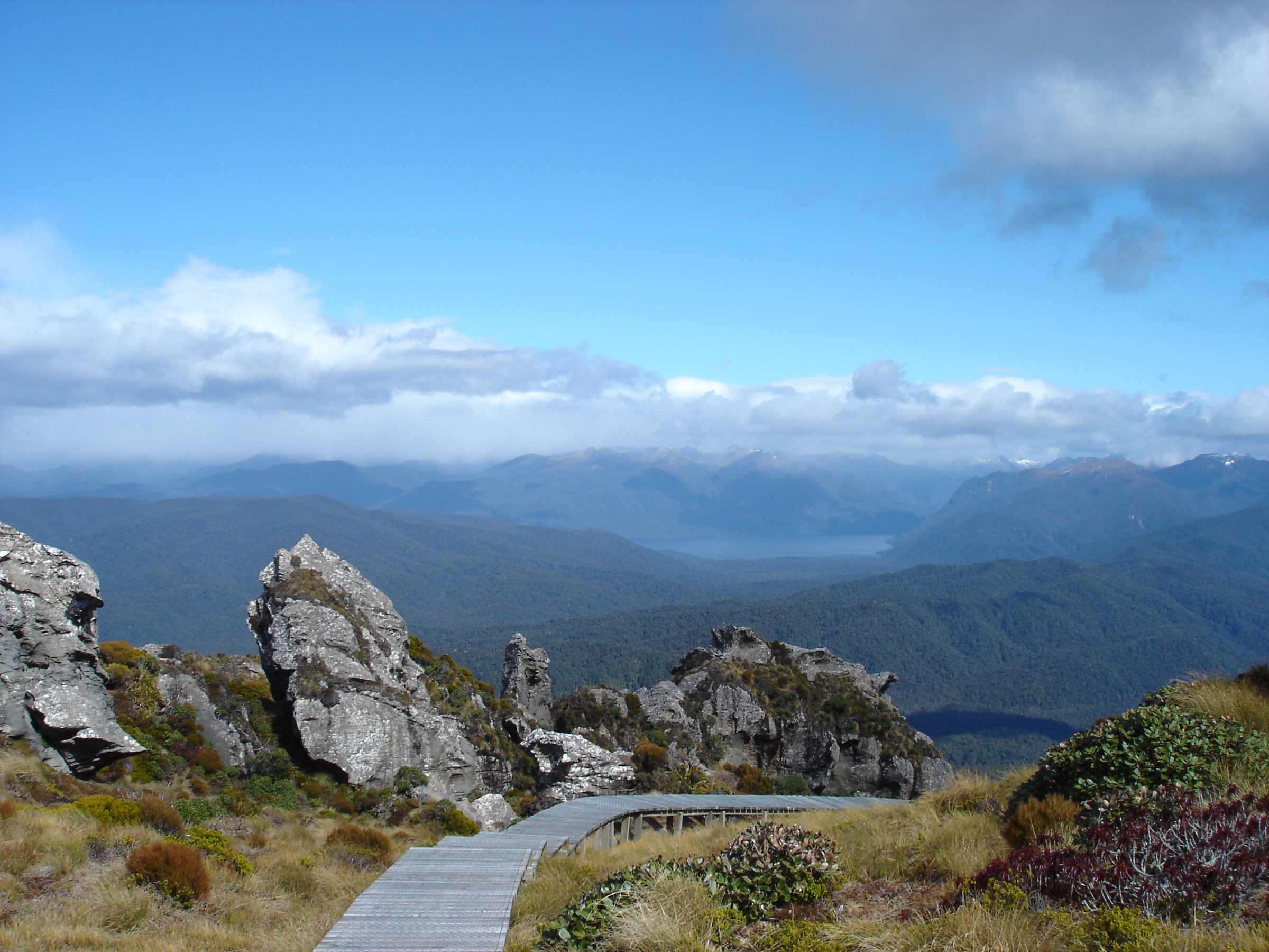
A historic, severe-feeling Darrans pass viewpoint above the road and tunnel, suitable only for experienced parties in stable conditions.
Sub-regionMilford Road near Mount Tūtoko, western Darran Mountains
StartTūtoko River bridge car park on Milford Road
FinishSwamp/open clearings up the Tūtoko valley; return same way
Route typeRough out-and-back tramping route
Distance4 km return, verified by DOC
Elevation gainNot stated by DOC
Elevation lossNot stated
Maximum elevationRoute maximum not stated; Mount Tūtoko height in DOC text is 2,745 m
Estimated time5 hr return, verified by DOC
DifficultyExpert route, verified by DOC
Required equipmentBoots, waterproofs, map/navigation, PLB, extra food; gaiters useful for swamp/mud
Seasonal notesValley route, but DOC avalanche page lists Tūtoko Valley only as simple up to Leader Creek Junction; check conditions after rain and in snow season
Hazards / exposureRough route, mud/swamp, navigation, high rainfall, river valley conditions, limited mobile coverage
Public transport / accessCar park only a few minutes' drive from Milford Sound, about 114 km from Te Anau by Milford Road
From the Tūtoko River bridge car park, follow the marked route up the true right of the Tūtoko River through beech forest to swamp and open clearings below major peaks.
Why it is essential
The nearest official day route under Mount Tūtoko, Fiordland’s highest mountain, giving a raw valley perspective on the Darrans.
Sub-regionHollyford Valley at the northern foot of the Darran Mountains
StartHollyford Road end
FinishHidden Falls / Hidden Falls Hut area; return same way
Route typeValley out-and-back day walk on the Hollyford Track
Distance18 km return, verified by DOC
Elevation gainNot stated by DOC
Elevation lossNot stated
Maximum elevationNot stated
Estimated time4–6 hr, verified by DOC
DifficultyAdvanced tramping track, verified by DOC; DOC also describes it as a good valley-based walk for families when exposed areas are unsuitable, so grade should be read in NZ tramping context
Public transport / accessLower Hollyford Road from Marian Corner; DOC says allow 2 hr from Te Anau to the road end
Verification statusOfficial route facts verified; elevation and GPX/KML unresolved
Itinerary
Cross Humboldt Creek, follow the old road and track along bluffs, boardwalked swamp sections, and Hollyford River banks, pass Sunshine Hut, then continue to the Hidden Falls Creek swing bridge and falls viewpoint. Hidden Falls Hut is just beyond.
Why it is essential
The best long bad-weather valley day walk in the Darran setting, with rainforest, river, and views toward Mount Madeline.