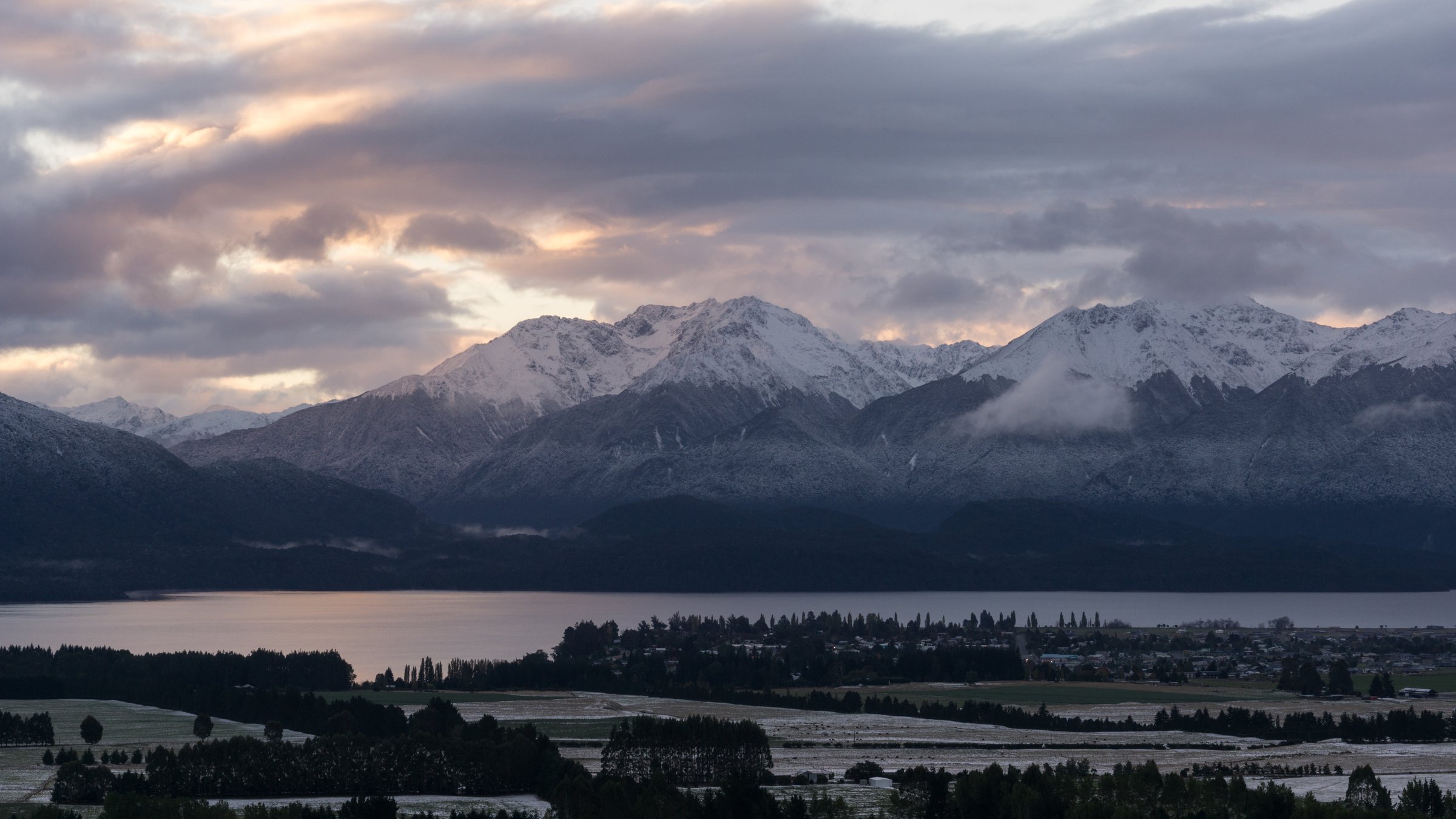
Regional overview
The Stuart Mountains are part of central/northern Fiordland’s roadless interior, west of Lake Te Anau and around the Wapiti, Glaisnock, Worsley, Hankinson, Thomson, Katherine and George Sound country. This is not a roadside day-walk region. Access is mainly by boat across Lake Te Anau, by packraft/kayak with freshwater-pest controls, or by aircraft/boat at the fiord end where permitted.
The only clearly documented public tramping route crossing the area in this pass is the George Sound Route. DOC describes it as a very challenging 17.8 km one-way route taking 3-4 days, crossing two major valley systems and one mountain range, and recommended only for experienced, well-equipped groups with navigation, river-crossing and survival skills. The five selections below are therefore day sections or objectives within that remote route system, not casual public day walks.
Selection rationale
The Stuart Mountains do not provide five ordinary public day hikes. The selections below represent the best verified, legally described walking sections in the Stuart/George Sound area: the Lake Hankinson gateway, Wapiti River and Lake Thomson, Henry Pass, the Lake Katherine/George Sound descent, and the historic Mt Elwood mica-mine side route. Every entry is access-dependent and several require being positioned at a hut by a previous day’s travel.
Summary table
| # | Hike | Country | Route type | Distance | Gain | Max elevation | Difficulty |
|---|---|---|---|---|---|---|---|
| 1 | Middle Fiord landing to Lake Hankinson / Hankinson Hut approach | New Zealand | Short access walk plus mandatory boat/kayak lake crossing | Walking distance unresolved; DOC time 15 min to Lake Hankinson plus 5 min to hut after boat crossing | Low lake route | Expert logistics despite short walking | |
| 2 | Hankinson Hut to Lake Thomson / Thomson Hut | New Zealand | Out-and-back day section | RouteGuides: 4.4 km one way / 8.8 km return | RouteGuides reverse: 108 m gain, 40 m loss one way | 305 m on RouteGuides reverse | Advanced remote tramping |
| 3 | Thomson Hut to Henry Pass | New Zealand | Out-and-back day section | RouteGuides: about 6 km one way / 12 km return | Unresolved for split | DOC Henry Pass 830 m; RouteGuides max 863 m on full Thomson-George route | Expert / hard |
| 4 | Henry Pass / Lake Katherine to George Sound Hut | New Zealand | One-way remote day section | Approx. 9 km from RouteGuides subsegments, but split distance unresolved | Henry Pass 830 m / RouteGuides full-route max 863 m | Expert | |
| 5 | Thomson Hut to Mt Elwood mica mine side route | New Zealand | Out-and-back historic side route | Distance unresolved | Expert; unmaintained route |
1. Middle Fiord landing to Lake Hankinson / Hankinson Hut approach
Snapshot
Itinerary
From the Middle Fiord landing on Lake Te Anau, follow the signposted track from the beach to Lake Hankinson. DOC states it is not possible to walk around Lake Hankinson, so a boat or kayak crossing is required. Hankinson Hut is a short walk from the head of the lake.
Why it is essential
This is the inland gateway to the George Sound Route and the practical threshold of the Stuart Mountains’ remote tramping country.
GPX / KML links
| Source | URL | Format / access | Reuse status |
|---|---|---|---|
| DOC: George Sound Route | doc.govt.nz | Official route page / source map | DOC terms; no GPX found; official source checked |
| DOC George Sound Route brochure | doc.govt.nz | PDF route guide and map | DOC terms; official source-map found |
External links
2. Hankinson Hut to Lake Thomson / Thomson Hut
Snapshot
Itinerary
From Hankinson Hut, the route reaches the first three-wire crossing in a few minutes, then another crossing after about an hour. It follows the north side of Lake Thomson to the lake head and continues across Wapiti River flats to Thomson Hut.
Why it is essential
This is the most manageable real walking section of the George Sound Route: lake, river flats, historic huts, and classic damp Fiordland forest without the full Henry Pass commitment.
GPX / KML links
| Source | URL | Format / access | Reuse status |
|---|---|---|---|
| DOC: George Sound Route | doc.govt.nz | Official route page / source map | DOC terms; no GPX found; official source checked |
| RouteGuides: Lake Thomson Hut to Lake Hankinson Hut via George Sound Track | routeguides.co.nz | Route page with “Download GPX” | RouteGuides/user and source-data terms unclear; GPX source found |
External links
3. Thomson Hut to Henry Pass
Snapshot
Itinerary
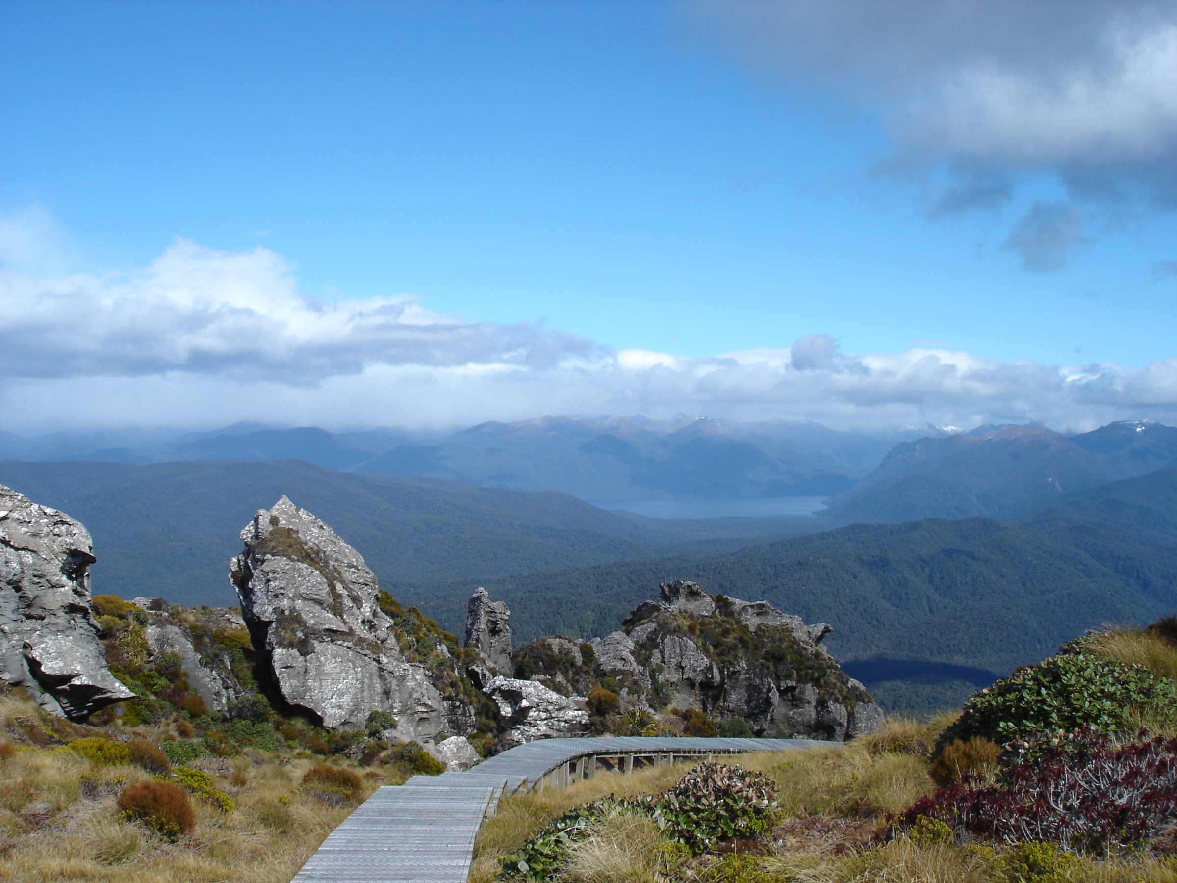
From Thomson Hut, follow the marked George Sound Route up-valley past the old side-route markers to the Mt Elwood mica mine, continuing toward Rugged Burn and Henry Pass. DOC gives Henry Pass at 830 m. The pass is the high point between the Lake Thomson/Wapiti side and the Lake Katherine/George Sound descent.
Why it is essential
Henry Pass is the mountain crossing that defines the George Sound Route and the most explicit Stuart Mountains pass objective in the verified route set.
GPX / KML links
| Source | URL | Format / access | Reuse status |
|---|---|---|---|
| DOC: George Sound Route | doc.govt.nz | Official route page / source map | DOC terms; no GPX found; official source checked |
| RouteGuides: Lake Thomson Hut to George Sound Hut via George Sound Track | routeguides.co.nz | Route page with “Download GPX” | RouteGuides/user and source-data terms unclear; GPX source found for broader section |
External links
4. Henry Pass / Lake Katherine to George Sound Hut
Snapshot
Itinerary
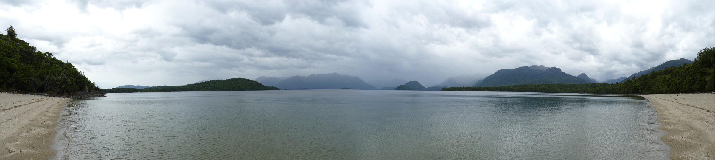
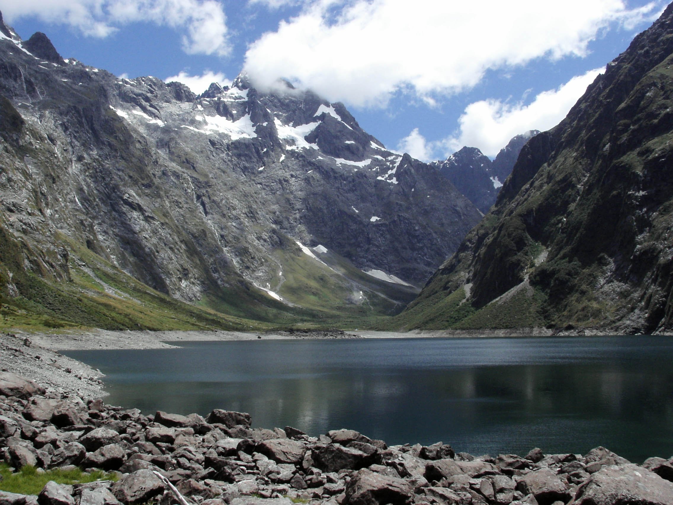
From Henry Pass the route drops steeply toward Katherine Creek and Lake Katherine. DOC notes that Katherine Creek is unbridged and can be impassable after rain, and that one place requires wading into the lake with safety chains in some sections. The final route from Lake Katherine to George Sound Hut takes another 1-2 hours and involves multiple creek crossings.
Why it is essential
This is the dramatic westward descent from the Stuart Mountains into a remote Fiordland fiord, combining high pass, hanging-valley/lake terrain, and sea-level George Sound.
GPX / KML links
| Source | URL | Format / access | Reuse status |
|---|---|---|---|
| DOC: George Sound Route | doc.govt.nz | Official route page / source map | DOC terms; no GPX found; official source checked |
| RouteGuides: Lake Thomson Hut to George Sound Hut via George Sound Track | routeguides.co.nz | Route page with “Download GPX” | RouteGuides/user and source-data terms unclear; GPX source found |
| RouteGuides: George Sound Hut place | routeguides.co.nz | Place page with “Download GPX” | RouteGuides/user and source-data terms unclear; point/route source found |
External links
- DOC — George Sound Route
- RouteGuides — Lake Thomson Hut to George Sound Hut
- RouteGuides — George Sound Hut
5. Thomson Hut to Mt Elwood Mica Mine Side Route
Snapshot
Itinerary
From Thomson Hut, follow the old marked side route toward the Mt Elwood mica mine. DOC notes that the route is not maintained but has old markers still in place and takes about 4 hr 30 min from Thomson Hut to the mine.
Why it is essential
This is the main verified historical side objective on the George Sound Route. It connects the Stuart Mountains’ tramping story with Fiordland’s short-lived mining and route-building history.
GPX / KML links
| Source | URL | Format / access | Reuse status |
|---|---|---|---|
| DOC: George Sound Route | doc.govt.nz | Official route page / source note | DOC terms; no GPX found; official source checked; no downloadable route file found |
External links
External links
| Source | URL |
|---|---|
| DOC — George Sound Route | doc.govt.nz |
| DOC — George Sound Route brochure (PDF) | doc.govt.nz |
| DOC — Kayaking / packrafting in Fiordland | doc.govt.nz |
| DOC — Glaisnock Hut | doc.govt.nz |
| DOC — Worsley Hut | doc.govt.nz |
| RouteGuides — Lake Thomson Hut to Lake Hankinson Hut | routeguides.co.nz |
| RouteGuides — Lake Thomson Hut to George Sound Hut | routeguides.co.nz |
| RouteGuides — George Sound Hut | routeguides.co.nz |
| DOC — Copyright guidance | doc.govt.nz |