Regional overview
The Fuji / Hakone / Izu volcanic region is one of Japan’s most varied mountain walking areas: a high standalone stratovolcano, a caldera-and-lake landscape at Hakone, the forested Amagi volcanic massif, and the lava-cliff coastline of eastern Izu. The region sits inside or around Fuji-Hakone-Izu National Park, with trails ranging from short volcanic coast walks to long, high-altitude summit climbs.
The main hiking centres are the Fuji Five Lakes and Fuji Subaru Line 5th Station for Mount Fuji, Hakone for caldera-rim and historical roads, and Ito / Izu-Kogen / Amagi Kogen for Izu Peninsula walks. Access is unusually good by Japanese mountain standards, but many routes still depend on seasonal buses, private-vehicle restrictions, ropeways, or volcanic-gas closures.
The normal summer hiking season varies sharply by altitude. Mount Fuji has a short official climbing season, usually July to early September, and should be treated as a regulated high-mountain route. Hakone and the Izu coast are often walkable across much of the year in suitable weather, while Amagi is best in spring to autumn outside heavy rain, typhoon conditions, and winter snow or ice.
Special issues include Mount Fuji crowding rules and mandatory fees/reservations, volcanic-gas and closure notices in Hakone, slippery stone paving on the Old Tokaido, exposed coastal cliffs at Jogasaki, and poor visibility on forested or high volcanic ground.
Selection rationale
These five hikes cover the region’s defining walking identities: Japan’s highest summit, Hakone’s caldera-rim viewpoint, Izu’s highest forested volcanic ridge, a coastal lava-cliff trail, and the historical Old Tokaido mountain road.
Summary table
| # | Hike | Country | Route type | Distance | Gain | Max elevation | Difficulty |
|---|---|---|---|---|---|---|---|
| 1 | Mount Fuji — Yoshida Trail from Fuji Subaru Line 5th Station | Japan | Out-and-back / separated ascent–descent line | 14.5–17.4 km depending variant | 1,430–1,570 m | 3,776 m | Hard |
| 2 | Mount Kintoki Hiking Trail | Japan | Point-to-point | 4.6–5.1 km | 490–550 m | 1,213 m | Moderate |
| 3 | Mount Amagi — Banzaburo and Banjiro Loop | Japan | Loop | 7.4–8.4 km | ca. 590 m | 1,406 m | Moderate |
| 4 | Jogasaki Coast Picnical Course / Coast Walk | Japan | Point-to-point coastal walk | ca. 9 km | Low; exact gain unresolved | ca. 100 m | Easy–moderate |
| 5 | Old Tokaido Road — Hakone Sekisho to Hatajuku | Japan | Point-to-point | 6.4 km | 463 m | ca. 725 m | Moderate |
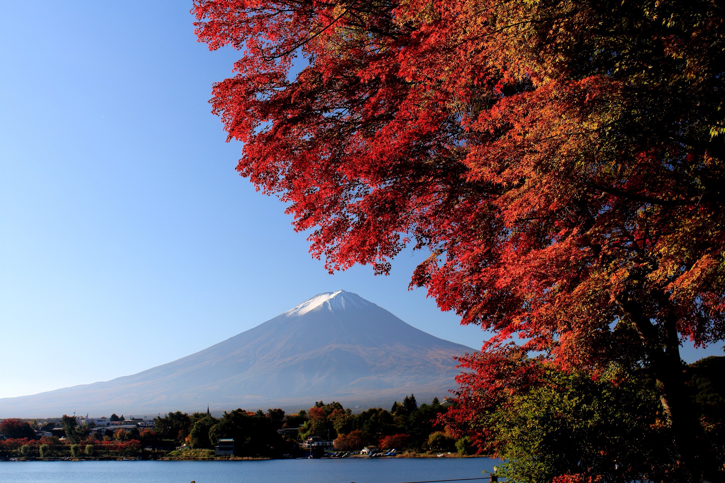
1. Mount Fuji — Yoshida Trail from Fuji Subaru Line 5th Station
Snapshot
Itinerary
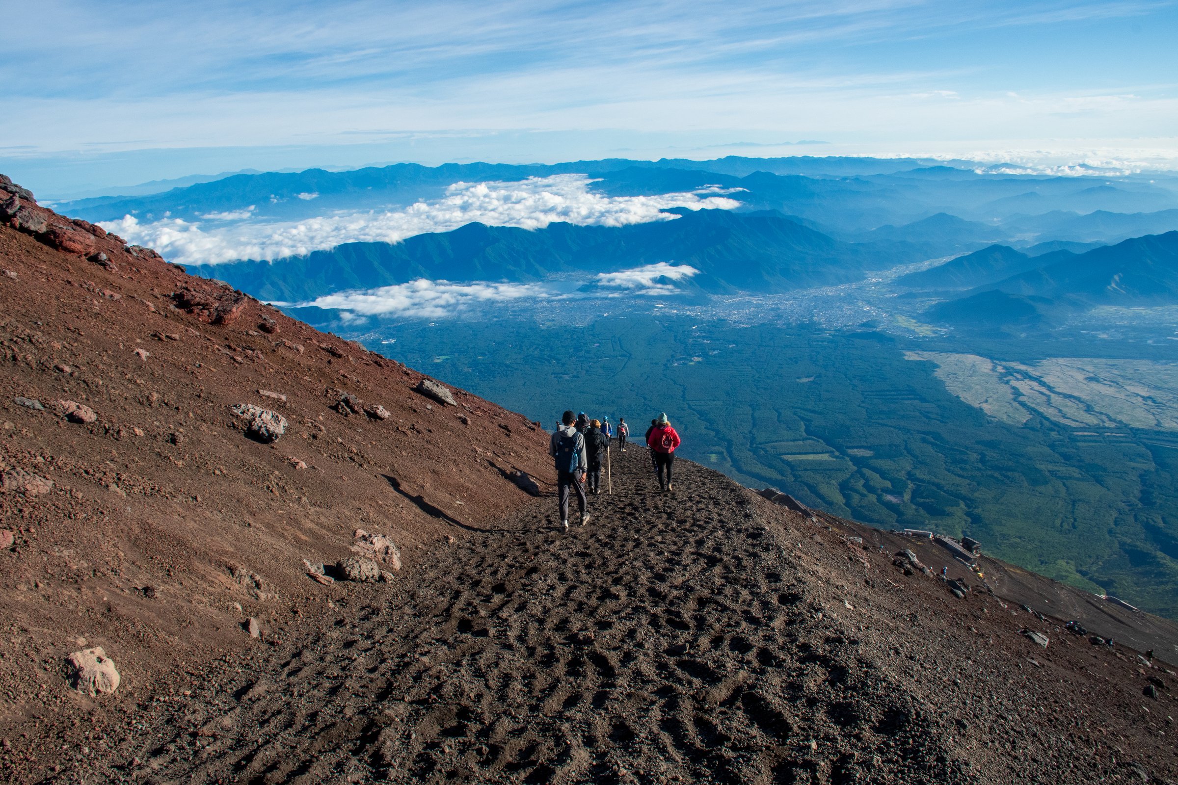
The route starts at Fuji Subaru Line 5th Station and follows the Yoshida Trail through the 6th Station checkpoint area into open volcanic terrain. The climb passes a series of mountain huts and steepens through switchbacks and rocky sections toward the 8th Station and original 8th Station. The final ascent reaches the summit crater rim near Kusushi-jinja. If conditions, rules, and time allow, the highest point at Kengamine is reached by the summit crater circuit; otherwise the day-hike objective is the Yoshida-side crater rim. The descent uses the signed Yoshida descending route before rejoining the lower trail back to the 5th Station.
Why it is essential
Mount Fuji is Japan’s highest mountain and the defining volcanic summit of the region. The Yoshida Trail is the most used modern ascent line from Yamanashi and gives the classic non-technical way to experience Fuji’s altitude, hut culture, volcanic slopes, and summit crater.
Equipment
- Mountain hiking equipment: sturdy boots, warm layer, waterproof shell, hat and gloves
- Sun protection
- Headtorch
- Water and food
- Cash/payment method for services
- Map/GPS and navigation backup
- Trekking poles are useful on the descent
- Hut booking and official climbing reservation/fee handling may be required in the current season
Hazards and notes
- Altitude, cold wind, thunderstorms, darkness, crowding, dehydration, volcanic dust, and loose descent gravel are the main hazards.
- Off-season Fuji is a serious snow-and-ice mountain and should not be treated as a normal hike.
- Current official rules for the Yoshida Trail book/reservation system, hiking fee, gate hours, mountain huts, and trail closures must be checked before departure.
GPX / KML links
| Source | URL | Format / access | Reuse status |
|---|---|---|---|
| Official Mt. Fuji Climbing — route comparison / map source | fujisan-climb.jp | Official route-map/source page | Website terms not fully checked; route source checked, downloadable GPX not found |
| JNTO Yoshida Trail guide | japan.travel | Official guide/source page | Route description and access checked; no GPX |
| AllTrails: Mt. Fuji Yoshida Route | alltrails.com | Source route page / app track | AllTrails terms apply; source route found, route-file reuse not confirmed |
External links
- Official Website for Mt. Fuji Climbing — route comparison and current rules
- Official Website for Mt. Fuji Climbing — current information index
- JNTO Fuji Guide — Yoshida Trail
- AllTrails — Mt. Fuji Yoshida Route
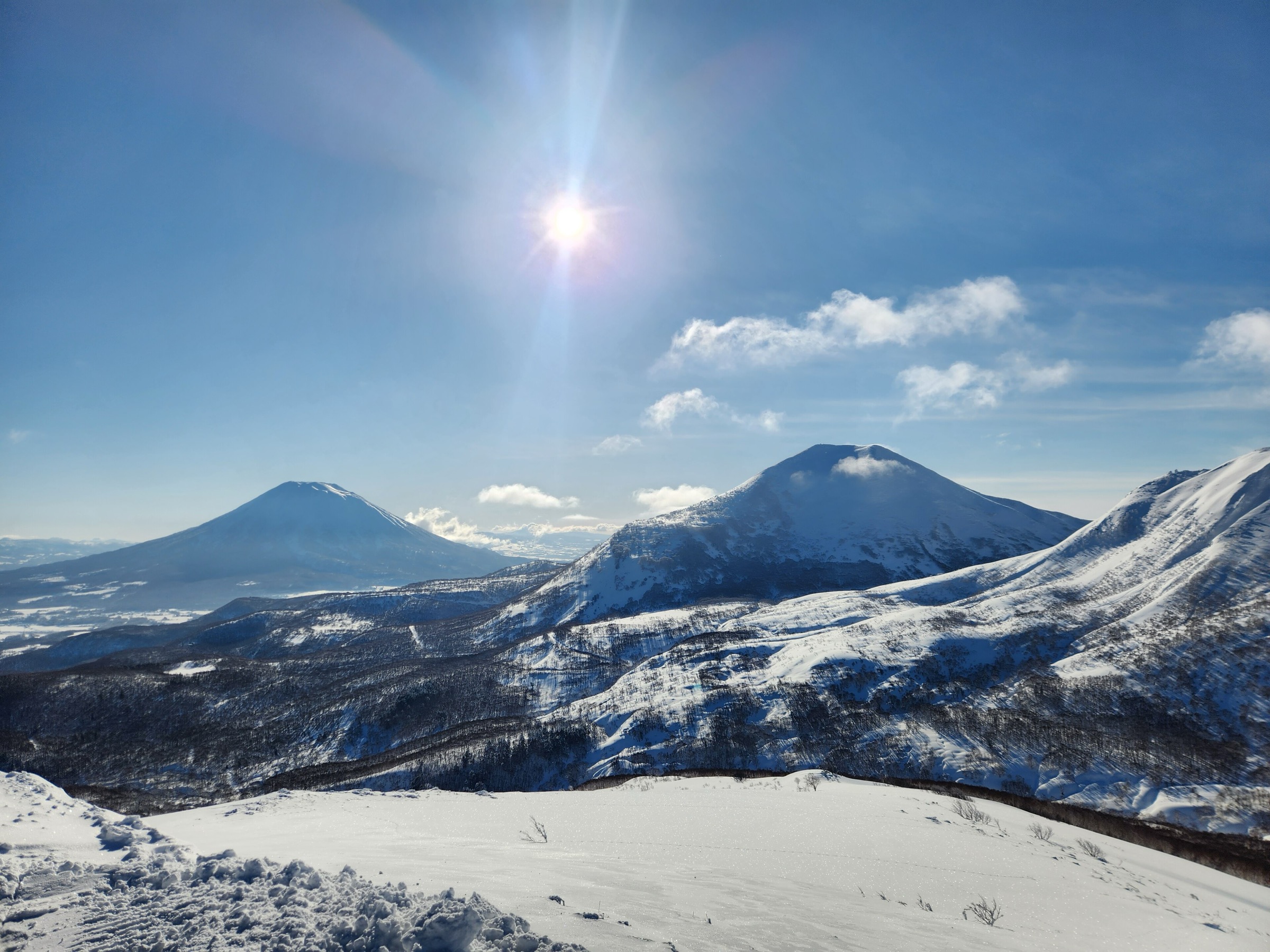
2. Mount Kintoki Hiking Trail
Snapshot
Itinerary
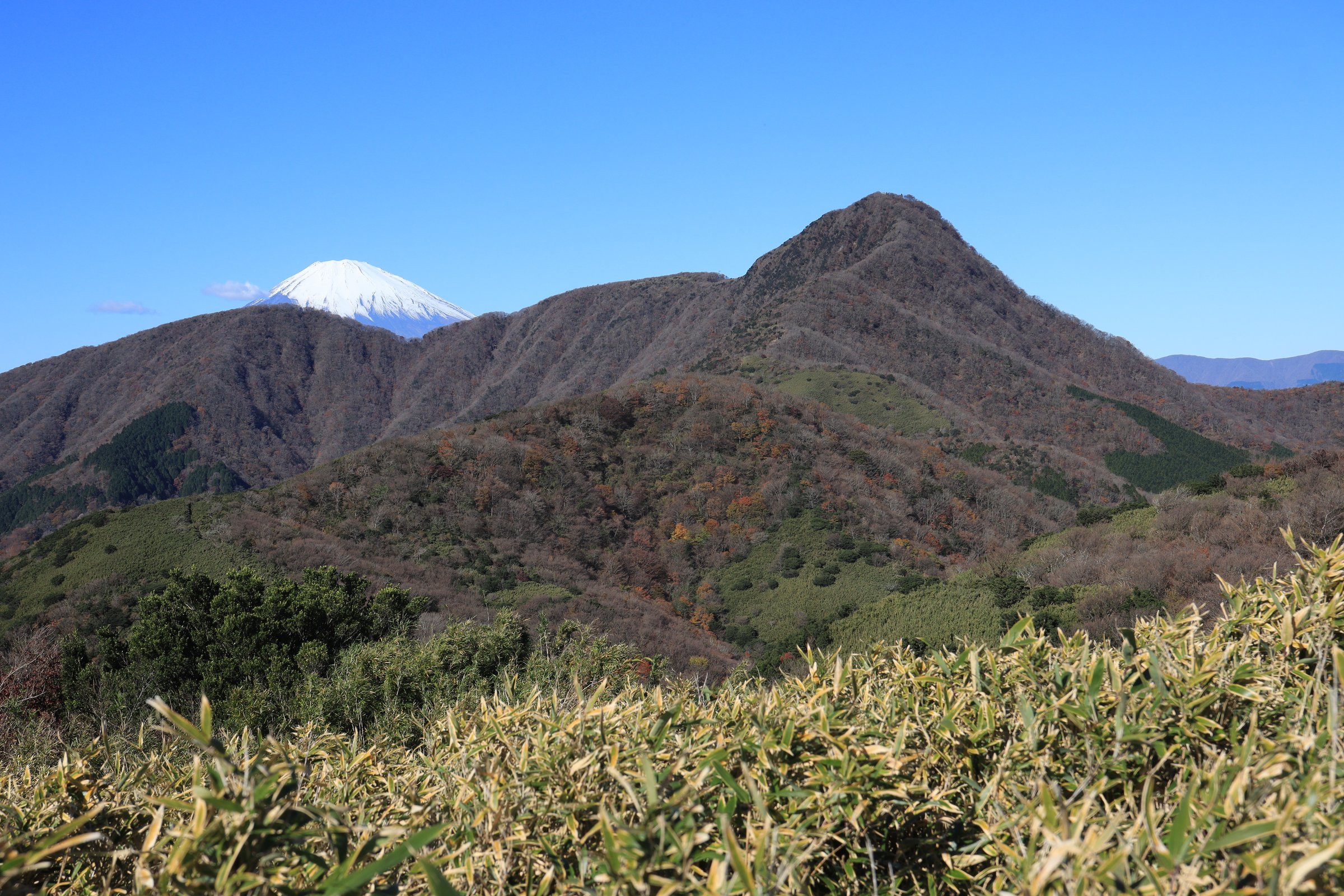
The official route starts near Kintoki-jinja-iriguchi, passes Kintoki Shrine, and climbs through forest toward Kintoki-yadori-ishi rock. The path steepens as it gains the upper ridge and reaches the summit of Mount Kintoki, where teahouses and open views face Mount Fuji, Owakudani, Hakone, and Lake Ashi. The descent follows the Yagurazawa Pass side toward Kintoki-tozanguchi, or can be adapted as a short loop using local trail links.
Why it is essential
Mount Kintoki is the classic accessible Hakone summit: a caldera-rim viewpoint, a Fuji panorama, and a trail tied to the Kintaro legend. It balances the Fuji ascent with a lower, highly representative Hakone hike.
Equipment
- Hiking shoes or boots
- Weatherproof layer
- Warm layer outside summer
- Water and food
- Sun protection
- Map/GPS
- Trekking poles are useful on muddy or eroded sections
Hazards and notes
- The route is short but steep in places, with roots, rocks, mud, and possible winter ice.
- Cloud often hides Fuji views.
- Check for Hakone volcanic-gas advisories and local trail closures if combining this with Owakudani or central Hakone routes.
GPX / KML links
| Source | URL | Format / access | Reuse status |
|---|---|---|---|
| National Parks of Japan: Mount Kintoki Hiking Trail | japan.travel | Official route page / map source | Website terms not fully checked; route map checked, downloadable GPX not found |
| AllTrails: Mount Kintoki — Kintoki Shrine | alltrails.com | Source route page / app track | AllTrails terms apply; source route found, route-file reuse not confirmed |
| Hakone visitor trail PDF | hakonevc.sunnyday.jp | PDF map/source route | Website terms not fully checked; useful map source, GPX not found |
External links
- National Parks of Japan — Mount Kintoki Hiking Trail
- Hakone Japan — Mt. Kintoki Hiking Trail
- AllTrails — Mount Kintoki
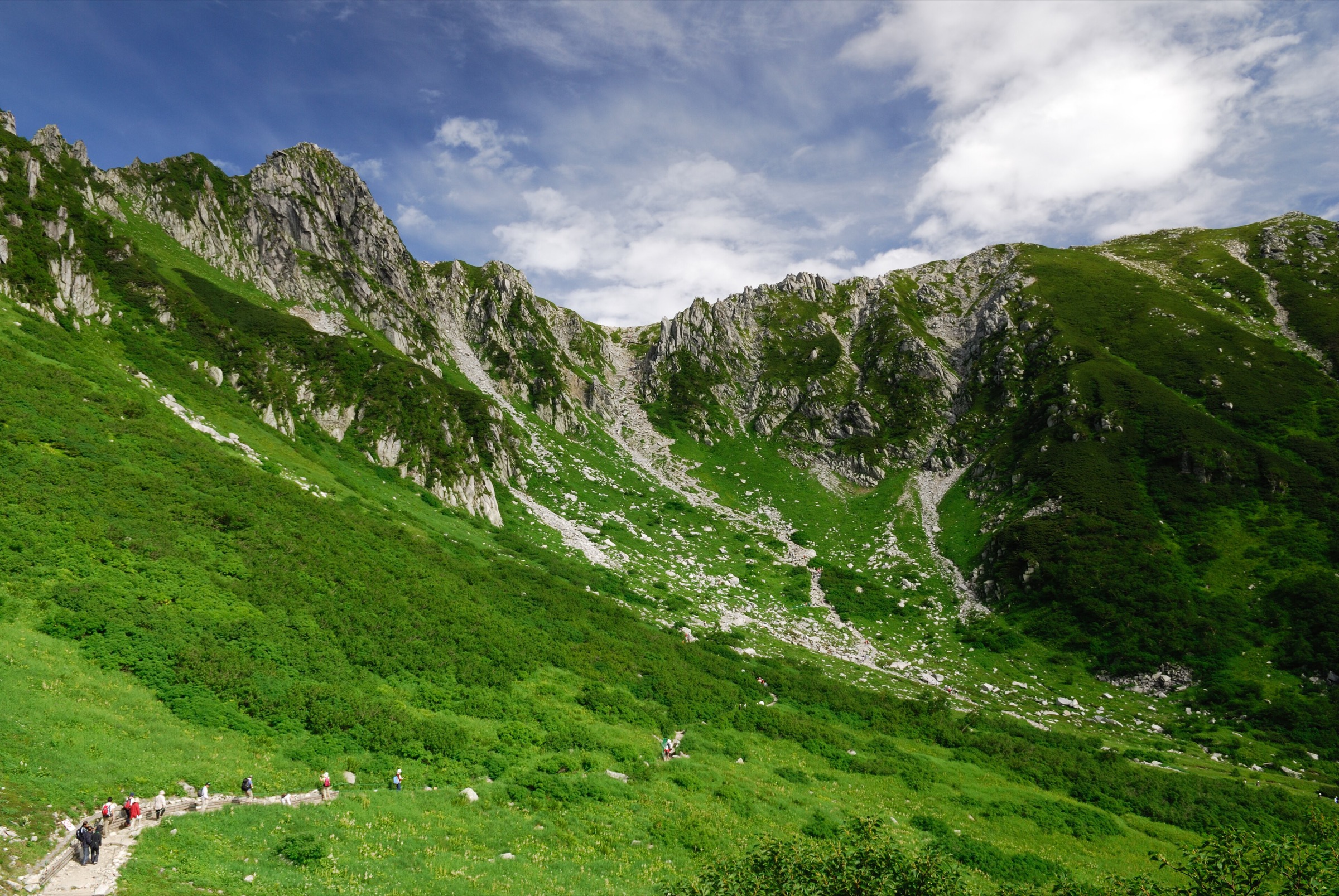
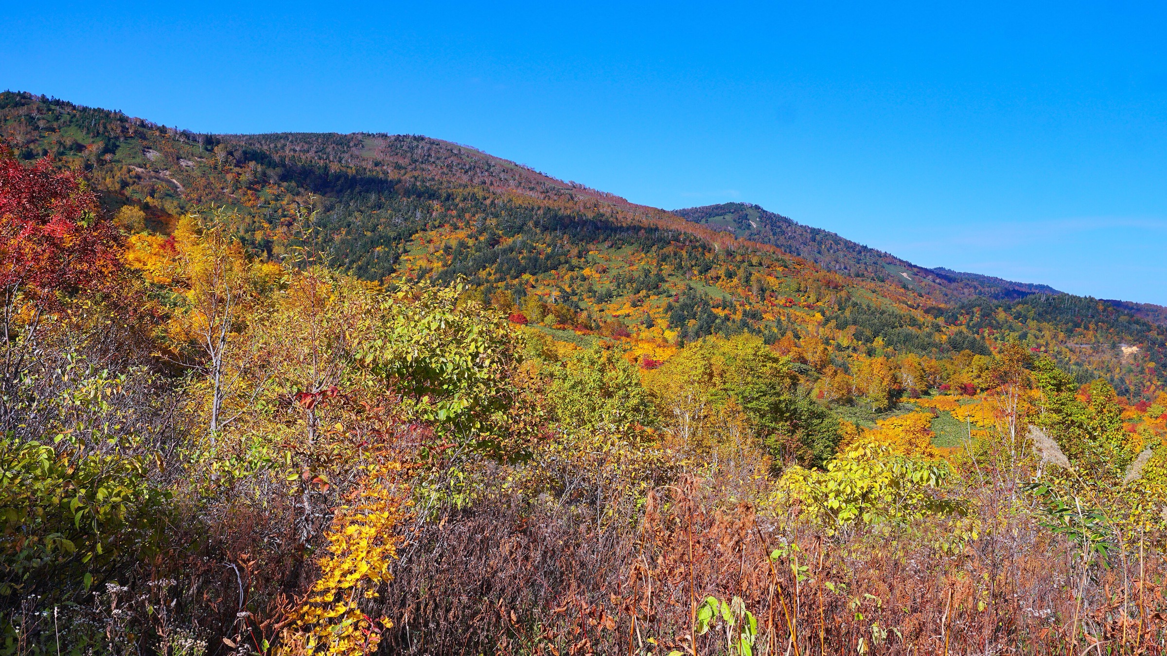
3. Mount Amagi — Banzaburo and Banjiro Loop
Snapshot
Itinerary
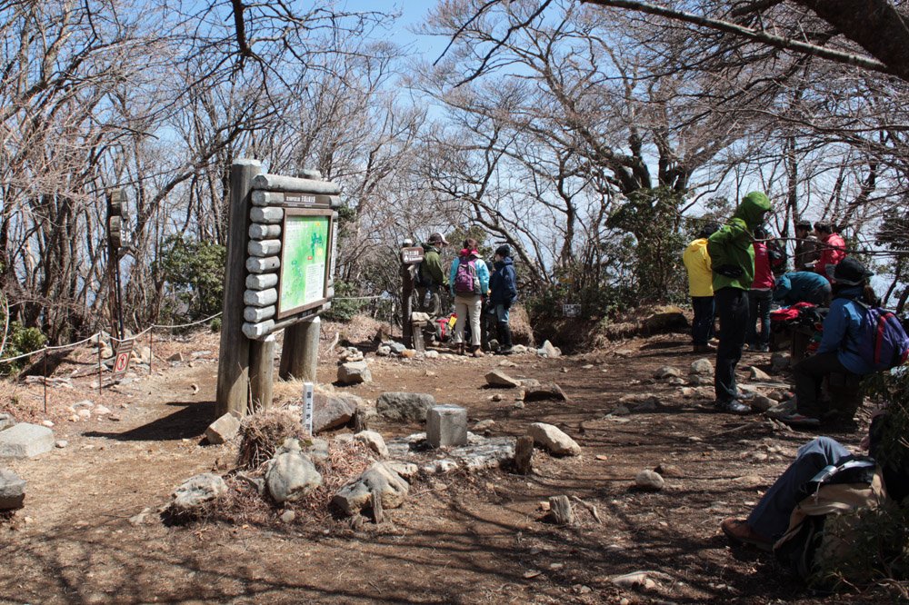
The loop starts at the Amagi Kogen side of the massif and reaches the Yotsuji junction before climbing toward Banjiro-dake. It continues along the wooded volcanic ridge through beech, rhododendron, and mossy forest to Banzaburo-dake, the highest point of Mount Amagi. The return drops through forested side paths and rejoins the lower junction before returning to the trailhead.
Why it is essential
Mount Amagi gives the Izu Peninsula its main inland mountain walk: a famous Hyakumeizan volcanic massif with old beech forest, rhododendrons, and a very different atmosphere from Fuji, Hakone, and the Izu coast.
Equipment
- Boots or grippy hiking shoes
- Weatherproof layer
- Warm layer outside midsummer
- Water and food
- Map/GPS
- Trekking poles if desired
- Headtorch if starting late or in short daylight
Hazards and notes
- The forest can be slippery after rain, and navigation is less obvious in mist than on open coastal or summit routes.
- Typhoon damage, fallen trees, and winter ice can affect the loop.
- Water availability on the ridge should not be assumed.
GPX / KML links
| Source | URL | Format / access | Reuse status |
|---|---|---|---|
| Amagi Kogen official Mount Amagi page | amagikogen.co.jp | Official local source / route description | Website terms not fully checked; route details checked, GPX not found |
| Niigata route-grading PDF including Amagi stats | pref.niigata.lg.jp | Official route-grading/stat source | Government PDF terms not fully checked; statistics checked, not a GPX |
| AllTrails: Mount Amagi — Amagi Kogen Loop | alltrails.com | Source route page / app track | AllTrails terms apply; source route found, reuse not confirmed |
| Yamareco: Amagi loop route | yamareco.com | Source route page | Yamareco terms apply; source route found, reuse not confirmed |
External links
- Amagi Kogen — Mount Amagi page
- Izu City / Amagi tourism — hiking page
- Niigata prefectural route-grading PDF
- AllTrails — Mount Amagi Amagi Kogen Loop
- Yamareco — Amagi loop route
4. Jogasaki Coast Picnical Course / Coast Walk
Snapshot
Itinerary
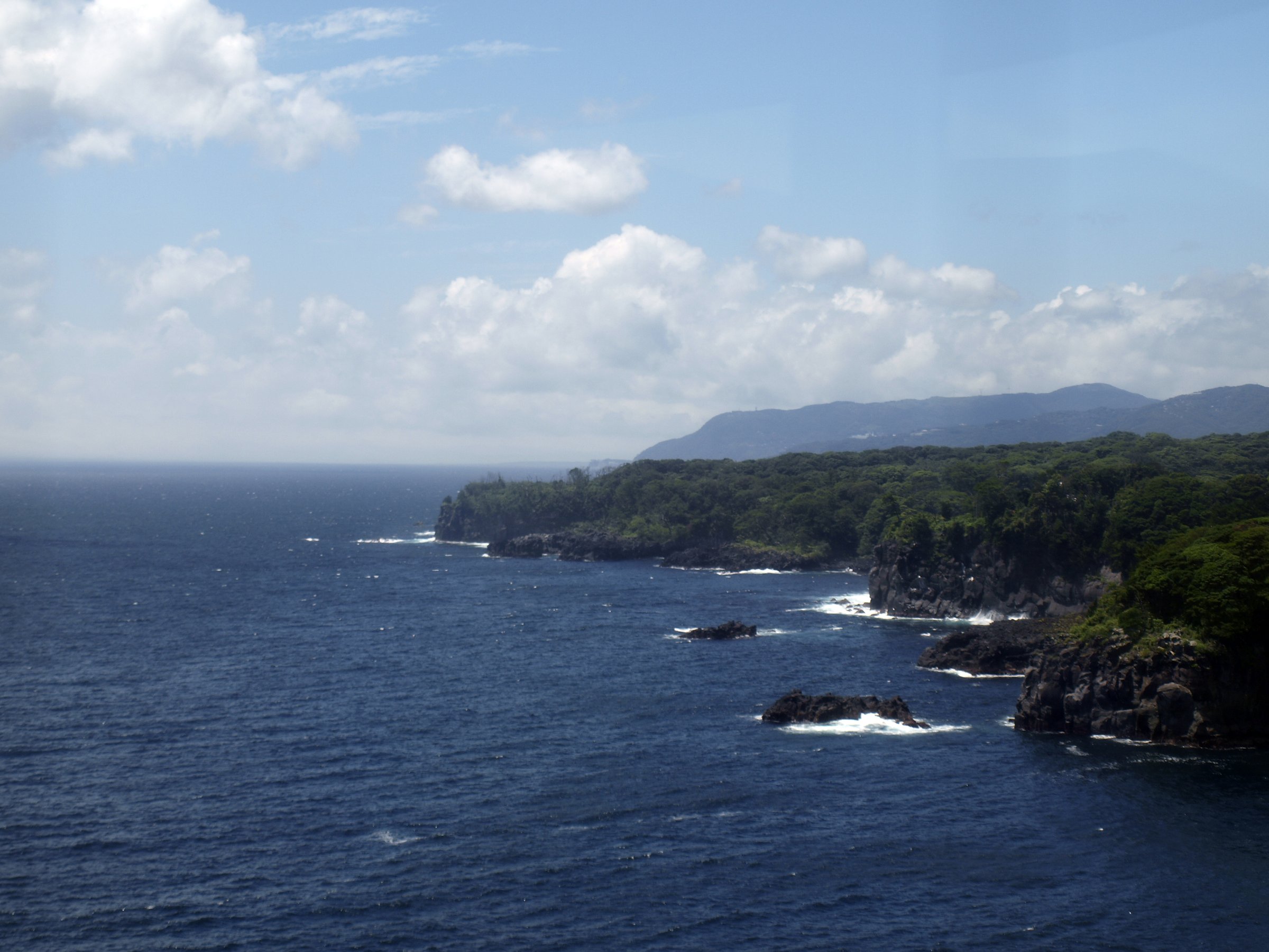
The walk follows the lava-cliff coast of eastern Izu, linking viewpoints, woodland sections, the Kadowaki Suspension Bridge and lighthouse area, and black volcanic rock platforms above the Pacific. The line can be walked north to south or south to north, with access possible from Jogasaki Kaigan Station or Izu-Kogen Station depending the chosen section.
Why it is essential
Jogasaki is the region’s key volcanic coastline hike. It shows the sea-facing side of Fuji-Hakone-Izu National Park: lava flows, columnar rock, cliff vegetation, ocean views, and an easy rail-access contrast to the inland volcanoes.
Equipment
- Grippy shoes
- Water (extra in warm weather)
- Sun protection
- Rain layer
- Map/GPS
Hazards and notes
- Stay on marked paths and behind barriers near cliffs.
- Wet rock, high wind, typhoon swell, and summer heat can make the route more serious than its low elevation suggests.
- Some sections may be closed after storm damage.
GPX / KML links
| Source | URL | Format / access | Reuse status |
|---|---|---|---|
| JNTO Jogasaki Coast page | japan.travel | Official route description | Website terms not fully checked; route corridor and distance checked, GPX not found |
| AllTrails: Jogasaki Coast Walk | alltrails.com | Source route page / app track | AllTrails terms apply; source route found, route-file reuse not confirmed |
| Discover Izu Jogasaki walking PDF | exploreshizuoka.jp | Tourist walking-map PDF | Terms not fully checked; useful source-map, GPX not found |
External links
- JNTO — Jogasaki Coast
- Japan Guide — Jogasaki Coast
- Discover Izu — Jogasaki Walking Tour PDF
- AllTrails — Jogasaki Coast Walk
5. Old Tokaido Road — Hakone Sekisho to Hatajuku
Snapshot
Itinerary
The route follows the preserved mountain section of the Old Tokaido between the Lake Ashi / Hakone Sekisho area and Hatajuku. It passes cedar avenues, stone-paved sections, forest, historical markers, and the Amazake-chaya area before descending toward Hatajuku. The route can be extended east toward Hakone-Yumoto for a longer historical traverse.
Why it is essential
This is the cultural counterpart to the region’s volcano hikes: a mountain crossing on the Edo-period Tokaido road, linking Hakone’s lake, pass, cedar avenues, teahouse tradition, and stone-paved travel history.
Equipment
- Grippy walking shoes or boots
- Rain layer
- Water and snacks
- Sun protection
- Map/GPS
- Trekking poles can help on wet stone descents but should be used carefully on paving
Hazards and notes
- The old stone paving is slippery when wet, and traffic crossings or road-linked sections require attention.
- Some sections are shaded and mossy.
- Check bus times before committing to a one-way finish.
GPX / KML links
| Source | URL | Format / access | Reuse status |
|---|---|---|---|
| AllTrails: Old Tokaido Road Hakone Sekisho — Hatajuku | alltrails.com | Source route page / app track | AllTrails terms apply; source route found, route-file reuse not confirmed |
| Hakone Japan hiking overview | hakone-japan.com | Official tourism route context | Website terms not fully checked; context checked, no GPX |
| Hakone Hachiri heritage site | hakone-hachiri.jp | Official heritage/source site | Website terms not fully checked; historical route context checked, no GPX selected |
External links
- AllTrails — Old Tokaido Road Hakone Sekisho to Hatajuku
- Hakone Japan — hiking overview
- Hakone Hachiri heritage site
- Japan Guide — Hakone Old Tokaido
Missing data and follow-up
- No official downloadable GPX/KML file was found for any of the five hikes in this pass.
- Mount Fuji route distance varies by whether the descent line and crater circuit are included; current-year official rules must be checked before publication.
- Jogasaki cumulative elevation gain remains unresolved; official sources verify the coastal route length but not a full elevation profile.
- Hakone Old Tokaido statistics are from AllTrails for one section; longer Hakone-Yumoto variants need separate mapping.
- Public transport timetables and volcanic-gas/closure notices require date-specific confirmation.
External links
| Source | URL |
|---|---|
| Official Website for Mt. Fuji Climbing | fujisan-climb.jp |
| Official Mt. Fuji Climbing — route comparison | fujisan-climb.jp |
| JNTO / National Parks of Japan — Fuji-Hakone-Izu National Park | japan.travel |
| JNTO Fuji Guide — Yoshida Trail | japan.travel |
| National Parks of Japan — Mount Kintoki Hiking Trail | japan.travel |
| Hakone Japan — official tourism | hakone-japan.com |
| Hakone Japan — Mt. Kintoki Hiking Trail | hakone-japan.com |
| Hakone Hachiri heritage site | hakone-hachiri.jp |
| Hakone visitor trail PDF — Mt. Kintoki | hakonevc.sunnyday.jp |
| Amagi Kogen — Mount Amagi page | amagikogen.co.jp |
| Izu / Amagi tourism — hiking page | amagigoe.jp |
| Niigata prefectural route-grading PDF | pref.niigata.lg.jp |
| JNTO — Jogasaki Coast | japan.travel |
| Japan Guide — Jogasaki Coast | japan-guide.com |
| Discover Izu — Jogasaki Walking Tour PDF | exploreshizuoka.jp |
| Japan Guide — Hakone Old Tokaido | japan-guide.com |
| AllTrails — Mt. Fuji Yoshida Route | alltrails.com |
| AllTrails — Mount Kintoki | alltrails.com |
| AllTrails — Mount Amagi Amagi Kogen Loop | alltrails.com |
| AllTrails — Jogasaki Coast Walk | alltrails.com |
| AllTrails — Old Tokaido Road Hakone Sekisho to Hatajuku | alltrails.com |
| Yamareco — Amagi loop route | yamareco.com |