Regional overview
Tohoku’s mountain walking is dominated by volcanic massifs, hot-spring trailheads, sacred summit routes, crater lakes, snow country, and long forest ascents. Compared with the Japanese Alps, the summits are lower but often isolated, weather-exposed, and snow-influenced well into spring. Many mountains are part of national or quasi-national parks, including Towada-Hachimantai, Chokai, Zao, and Bandai-Asahi.
The main hiking centres for this selection are Sukayu / Hakkoda Ropeway in Aomori, Umagaeshi near Morioka for Mount Iwate, Hokodate on the Chokai Blue Line, the Zao Onsen / Okama area, and Happodai on Mount Bandai. Public transport exists to some trailheads, but buses may be seasonal or infrequent.
The typical hiking season is late spring or summer to autumn, with high-snow years changing the calendar. Snowfields, volcanic gases, sudden fog, typhoon rain, thunderstorms, and route closures are important planning factors. Several routes include shrine or mountain-worship history, and hikers should respect protected-area and local cultural sites.
Selection rationale
The five hikes were selected to represent the essential northern Honshu mountain types: Hakkoda’s volcanic wetlands and highest summit, the sacred cone of Mount Iwate, the high sea-facing volcano of Mount Chokai, Zao’s Okama crater and Kumanodake, and the Bandai-Asahi volcanic landscape of Mount Bandai.
Summary table
| # | Hike | Country | Route type | Distance | Gain | Max elevation | Difficulty |
|---|---|---|---|---|---|---|---|
| 1 | Hakkoda O-dake Loop / Northern Hakkoda Course | Japan | Loop / point-to-point variant | 8.0–9.3 km | 696 m on loop source | 1,585 m | Hard |
| 2 | Mount Iwate — Yanagisawa Trail from Umagaeshi | Japan | Out-and-back | 11.0 km | ca. 1,405 m elevation difference | 2,038 m | Hard |
| 3 | Mount Chokai — Hokodate Route | Japan | Out-and-back | 15.1 km round trip | 1,139 m | 2,236 m | Hard |
| 4 | Mount Zao — Okama and Kumanodake | Japan | Loop / traverse variant | 4.7–13.5 km depending start | 300–726 m | 1,841 m | Moderate–hard |
| 5 | Mount Bandai from Happodai | Japan | Out-and-back | 7.7 km | 644 m | 1,816 m | Hard |
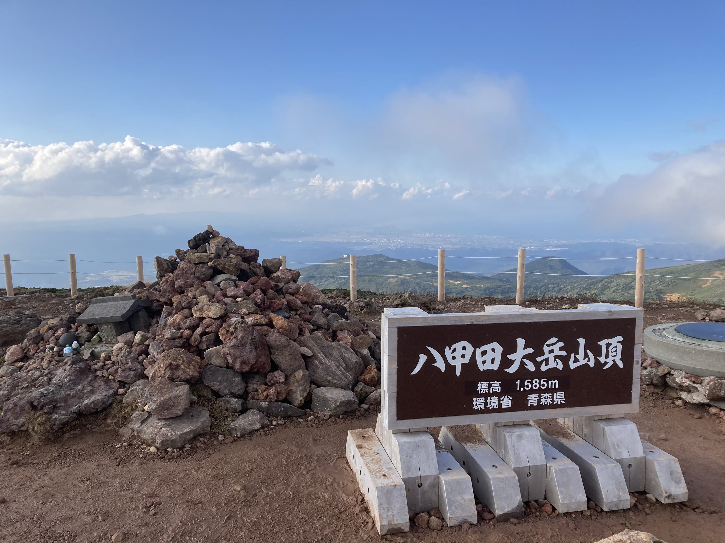
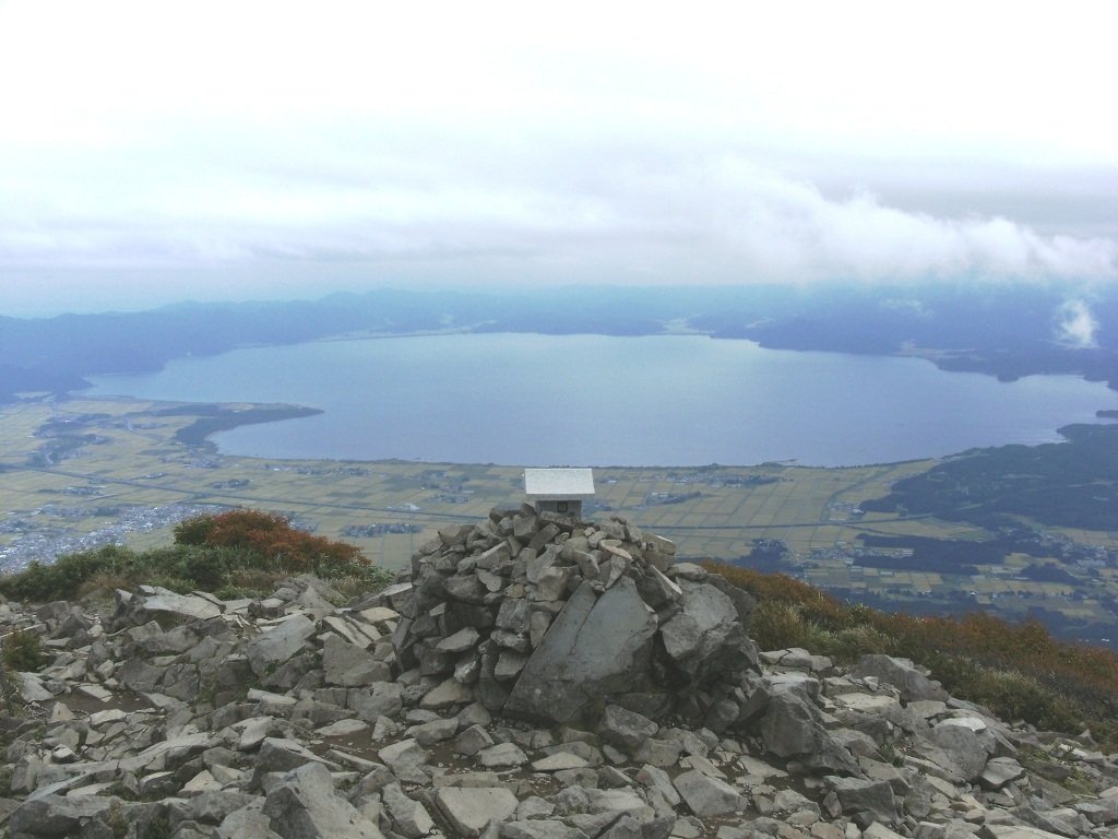
1. Hakkoda O-dake Loop / Northern Hakkoda Course
Snapshot
Itinerary
The route can be walked as the official northern Hakkoda course from Hakkoda Ropeway Summit Park Station to Sukayu Onsen via O-dake, or as a Sukayu-based loop. The walking crosses marshland and volcanic upland, climbs toward O-dake, the highest Hakkoda summit, and descends by wetland and hot-spring terrain toward Sukayu. The route combines open alpine views, volcanic features, and classic Tohoku hot-spring access.
Why it is essential
Hakkoda is a defining Aomori mountain massif, famous for volcanic wetlands, heavy snow, autumn colour, and the O-dake high point. It gives the northernmost essential Tohoku hiking character in one day.
Equipment
- Mountain hiking boots
- Waterproof and warm layers
- Map/GPS and navigation backup
- Water and food
- Trekking poles for wet or uneven ground
- Snow equipment is needed outside the normal snow-free hiking season
Hazards and notes
- Hakkoda is foggy, wet, and snow-prone.
- Boardwalks and rocks can be slippery, and route-finding can be difficult in poor visibility.
- The ropeway is weather-dependent, and winter/spring routes should be treated as snow-mountain travel.
GPX / KML links
| Source | URL | Format / access | Reuse status |
|---|---|---|---|
| MLIT/Japan Tourism Agency: O-dake Hiking Course PDF | mlit.go.jp | Official PDF route description | Government PDF terms not fully checked; official distance/time checked, GPX not found |
| National Parks of Japan: Hakkoda Ropeway and Kenashitai Trail | japan.travel | Official route page/source map | Website terms not fully checked; route/access context checked, GPX not found |
| AllTrails: Hakkoda Mt. O-dake Loop | alltrails.com | Source route page / app track | AllTrails terms apply; source route found, route-file reuse not confirmed |
External links
- MLIT/Japan Tourism Agency — O-dake Hiking Course PDF
- National Parks of Japan — Hakkoda Ropeway and Kenashitai Marshlands Trail
- AllTrails — Hakkoda Mt. O-dake Loop
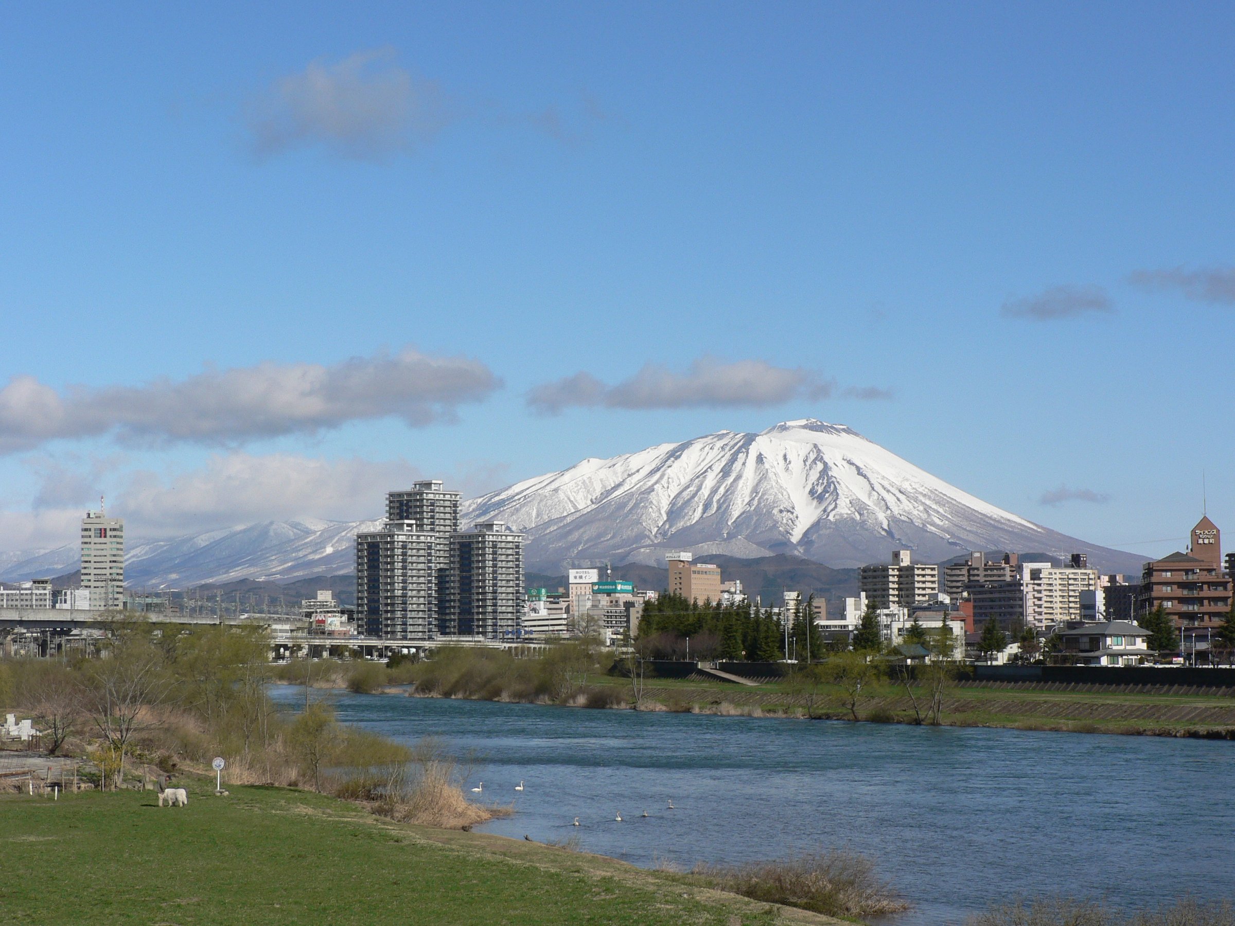
2. Mount Iwate — Yanagisawa Trail from Umagaeshi
Snapshot
Itinerary
The Yanagisawa Trail begins at Umagaeshi and climbs the historical mountain-worship route toward Mount Iwate. After the lower forest, the route offers a choice of forest or rockier line after the Second Station. It continues to the Eighth Station and Fudotai Hut, where water is available at Onari-Shimizu Spring, before the final ascent to the summit crater and high point.
Why it is essential
Mount Iwate is the emblematic high volcano of Iwate Prefecture and a sacred mountain with a long Shugendo history. The Yanagisawa Trail is the classic direct ascent.
Equipment
- Sturdy boots
- Waterproof and warm layers
- Water capacity
- Food
- Headtorch
- Map/GPS and navigation backup
- Trekking poles recommended for the long descent
Hazards and notes
- The route has a large elevation gain and exposed upper sections.
- Weather can change quickly near the crater.
- Water at the Eighth Station area should be checked locally, and a hiking registration form is recommended where available.
GPX / KML links
| Source | URL | Format / access | Reuse status |
|---|---|---|---|
| National Parks of Japan: Mount Iwate Yanagisawa Trail | japan.travel | Official route page/source map | Website terms not fully checked; route distance/time and map checked, GPX not found |
| Tohoku official tourism: Mt. Iwate Umagaeshi Trailhead | tohokukanko.jp | Official tourism/access page | Website terms not fully checked; access/equipment context checked, GPX not found |
External links
- National Parks of Japan — Mount Iwate Yanagisawa Trail
- Tohoku official tourism — Mt. Iwate / Umagaeshi Trailhead
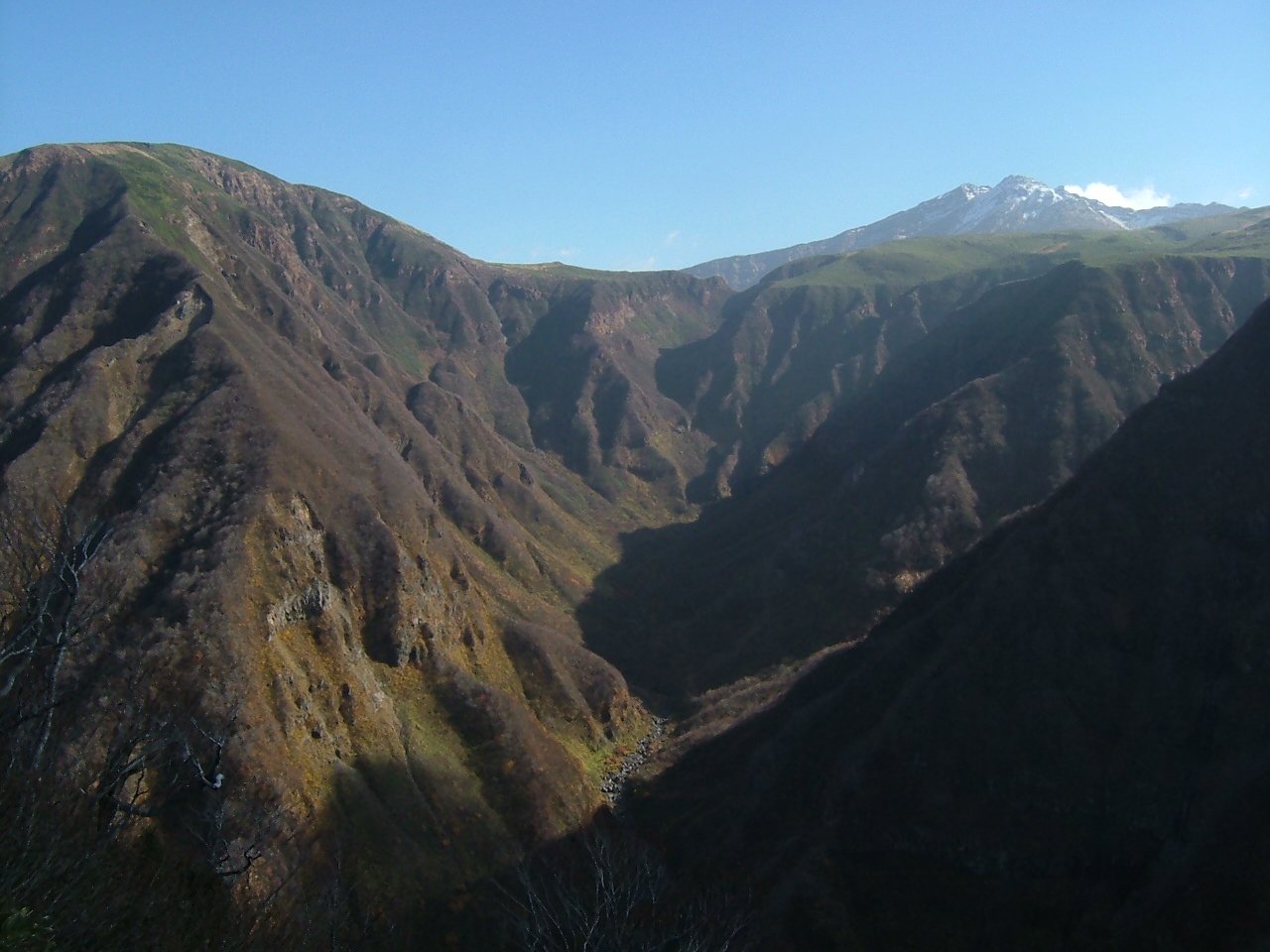
3. Mount Chokai — Hokodate Route
Snapshot
Itinerary
The Hokodate Route climbs from the fifth-station access area toward the upper volcano, passing high wetlands, snowfield-influenced terrain, and shrine/summit areas before reaching the high point of Mount Chokai. The route returns by the same line. The mountain’s position near the Sea of Japan gives unusually broad views for Tohoku when weather is clear.
Why it is essential
Mount Chokai is one of northern Honshu’s great standalone volcanoes, rising from near sea level to a 2,236 m summit. The Hokodate Route is the standard Akita-side day ascent.
Equipment
- Boots
- Warm and waterproof layers
- Headtorch
- Water and food
- Navigation backup
- Trekking poles
- Snow traction may be needed for lingering snowfields; check local conditions before departure
Hazards and notes
- Snowfields, fog, wind, thunderstorms, and long descent time are the main hazards.
- The route crosses high volcanic terrain and should be started early.
- Road access can be affected by season and weather.
GPX / KML links
| Source | URL | Format / access | Reuse status |
|---|---|---|---|
| AllTrails: Mount Chokai — Kisakata/Hokodate Route | alltrails.com | Source route page / app track | AllTrails terms apply; source route found, route-file reuse not confirmed |
| Yamagata tourism: Mount Chokai | yamagatakanko.com | Official tourism/access page | Website terms not fully checked; route context checked, GPX not found |
| NAVITIME/Japan travel guide: Mt. Chokai Hokodate context | japantravel.navitime.com | Guide/source page | Website terms not fully checked; access and route context checked, no GPX |
External links
- Yamagata tourism — Mount Chokai
- AllTrails — Mount Chokai Kisakata/Hokodate Route
- NAVITIME — Mt. Chokai route/access context
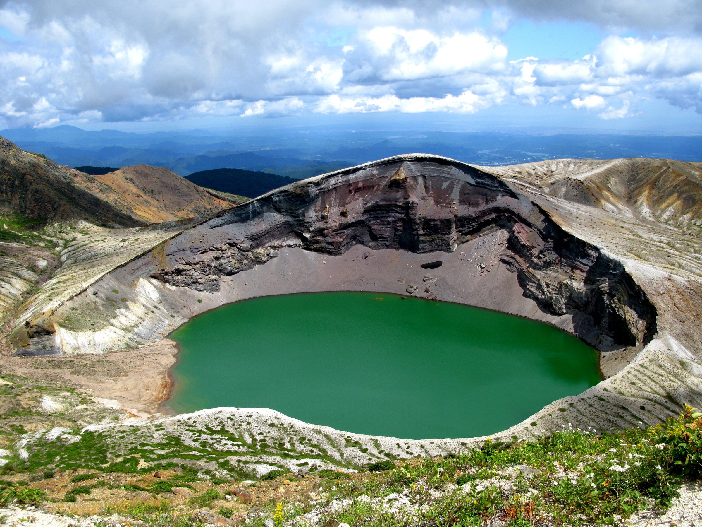
4. Mount Zao — Okama and Kumanodake
Snapshot
Itinerary
The compact route links the Okama crater viewpoint area with Kumanodake, the highest peak in the central Zao group. Depending access, it can be approached from the Zao Ropeway upper station, from Kattadake / Okama parking, or as a longer loop from Sainokawara. The walk crosses open volcanic ground with views of the crater lake, Kattadake, Kumanodake, and the surrounding Zao highlands.
Why it is essential
Zao’s Okama crater lake is one of Tohoku’s most recognisable volcanic landscapes, and Kumanodake provides the summit component. The route is an essential combination of crater view, volcanic ridge, and highland access.
Equipment
- Boots or sturdy hiking shoes
- Windproof/waterproof layer
- Warm layer
- Sun protection
- Water and food
- Map/GPS
- Snow equipment is required outside normal summer hiking conditions
Hazards and notes
- Fog can remove visual references quickly around Okama.
- Volcanic advisories, road closures, ropeway status, snow, and high wind all affect safety.
- Stay outside restricted crater areas and follow local signs.
GPX / KML links
| Source | URL | Format / access | Reuse status |
|---|---|---|---|
| JNTO: Okama Crater | japan.travel | Official route/access context | Website terms not fully checked; route context checked, GPX not found |
| AllTrails: Mount Zao Loop | alltrails.com | Source route page / app track | AllTrails terms apply; source route found, route-file reuse not confirmed |
| Go! Go! Mountain: Mt. Zao Kumanodake | en.gogomt.com | Route-stat source page | Website terms not fully checked; secondary route stats checked, GPX not found |
External links
- JNTO — Okama Crater
- AllTrails — Mount Zao Loop
- Go! Go! Mountain — Mt. Zao Kumanodake
- Zao Liza World — Okama access/context
5. Mount Bandai from Happodai
Snapshot
Itinerary
From Happodai, the trail climbs through forest and volcanic terrain toward Mount Bandai’s summit. The route passes the remains of old hut and volcanic landscape features before gaining open views over Lake Inawashiro, Urabandai, and the Bandai-Asahi region. The descent returns to Happodai by the same route.
Why it is essential
Mount Bandai is Fukushima’s defining volcano, shaped by the 1888 eruption and central to Bandai-Asahi National Park. The Happodai route is the common compact summit day hike.
Equipment
- Boots
- Waterproof and warm layers
- Water and food
- Sun protection
- Map/GPS
- Trekking poles
- Headtorch if starting late or in short daylight
Hazards and notes
- Mount Bandai is an active volcanic mountain. Check eruption/volcanic advisories and trail conditions.
- Wet rock, mud, fog, and lingering snow can affect the upper route.
GPX / KML links
| Source | URL | Format / access | Reuse status |
|---|---|---|---|
| AllTrails: Happodai Parking Lot — Mount Bandai | alltrails.com | Source route page / app track | AllTrails terms apply; source route found, route-file reuse not confirmed |
| Fukushima Prefecture Mount Bandai PDF | pref.fukushima.lg.jp | Official PDF map/context | Government PDF terms not fully checked; trailhead/context checked, GPX not found |
External links
- Fukushima Prefecture — Mount Bandai PDF
- AllTrails — Happodai Parking Lot / Mount Bandai
- National Parks of Japan — Bandai-Asahi overview
Missing data and follow-up
- Official downloadable GPX/KML files were not found in this pass; route-file entries are source-route pages or official maps/PDFs.
- Hakkoda has two plausible catalogue variants: the official ropeway-to-Sukayu O-dake course and the Sukayu O-dake loop. Final geometry should be selected before GPX production.
- Mount Zao statistics vary widely between short Okama/Kumanodake walks and longer AllTrails loop variants; final start/finish must be fixed for production.
- Mount Chokai and Mount Bandai route conditions, snowfields, volcanic advisories, and road access require date-specific checking.
External links
| Source | URL |
|---|---|
| National Parks of Japan — Towada-Hachimantai | japan.travel |
| National Parks of Japan — Hakkoda Ropeway and Kenashitai Marshlands Trail | japan.travel |
| National Parks of Japan — Mount Iwate Yanagisawa Trail | japan.travel |
| National Parks of Japan — Bandai-Asahi overview | japan.travel |
| JNTO — Okama Crater | japan.travel |
| MLIT/Japan Tourism Agency — O-dake Hiking Course PDF | mlit.go.jp |
| Yamagata tourism — Mount Chokai | yamagatakanko.com |
| Tohoku official tourism — Mt. Iwate / Umagaeshi Trailhead | tohokukanko.jp |
| NAVITIME — Mt. Chokai route/access context | japantravel.navitime.com |
| Go! Go! Mountain — Mt. Zao Kumanodake | en.gogomt.com |
| Zao Liza World — Okama access/context | zaoliza.co.jp |
| Fukushima Prefecture — Mount Bandai PDF | pref.fukushima.lg.jp |
| AllTrails — Hakkoda Mt. O-dake Loop | alltrails.com |
| AllTrails — Mount Chokai Kisakata/Hokodate Route | alltrails.com |
| AllTrails — Mount Zao Loop | alltrails.com |
| AllTrails — Happodai Parking Lot / Mount Bandai | alltrails.com |