Regional overview
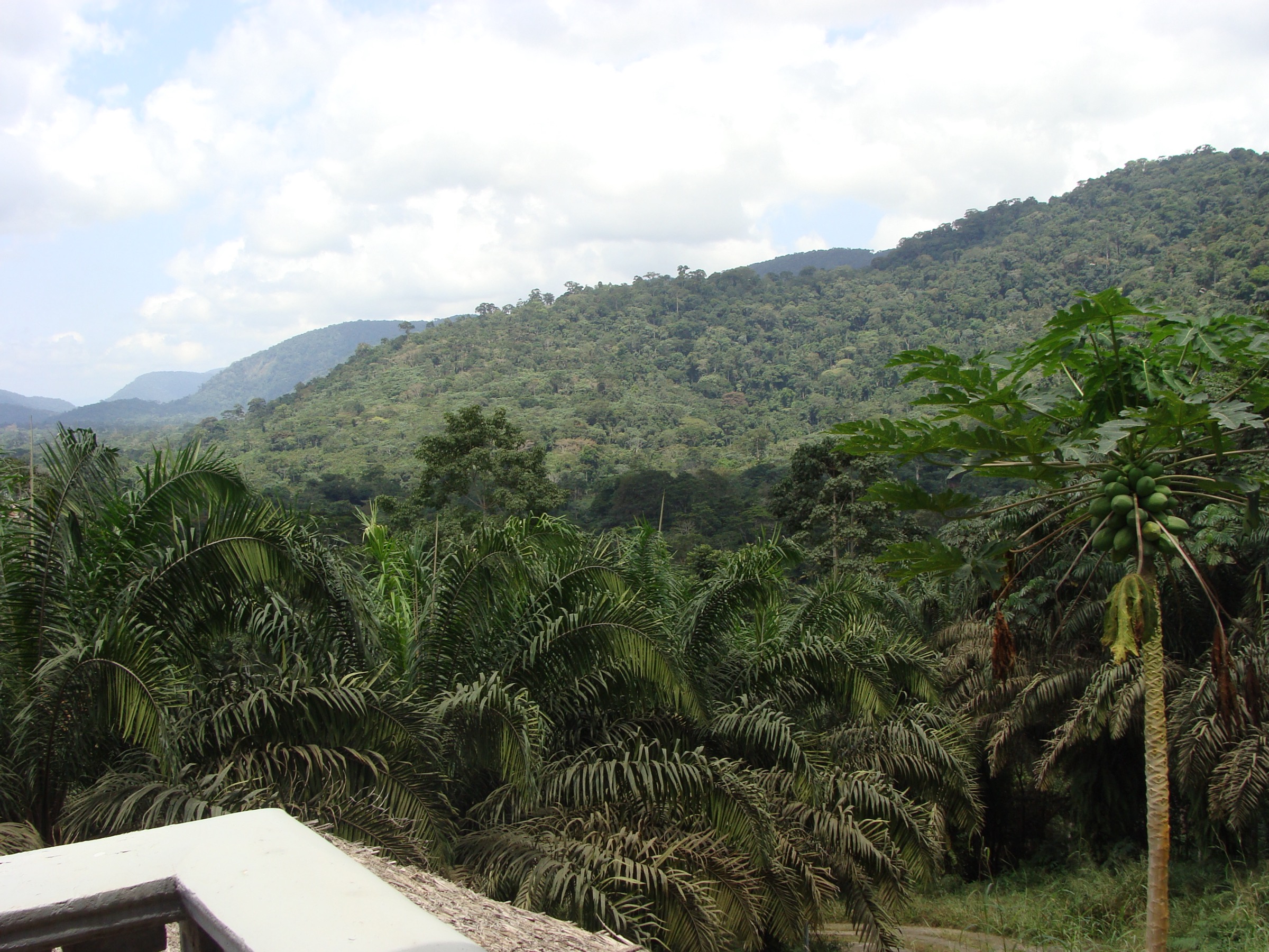
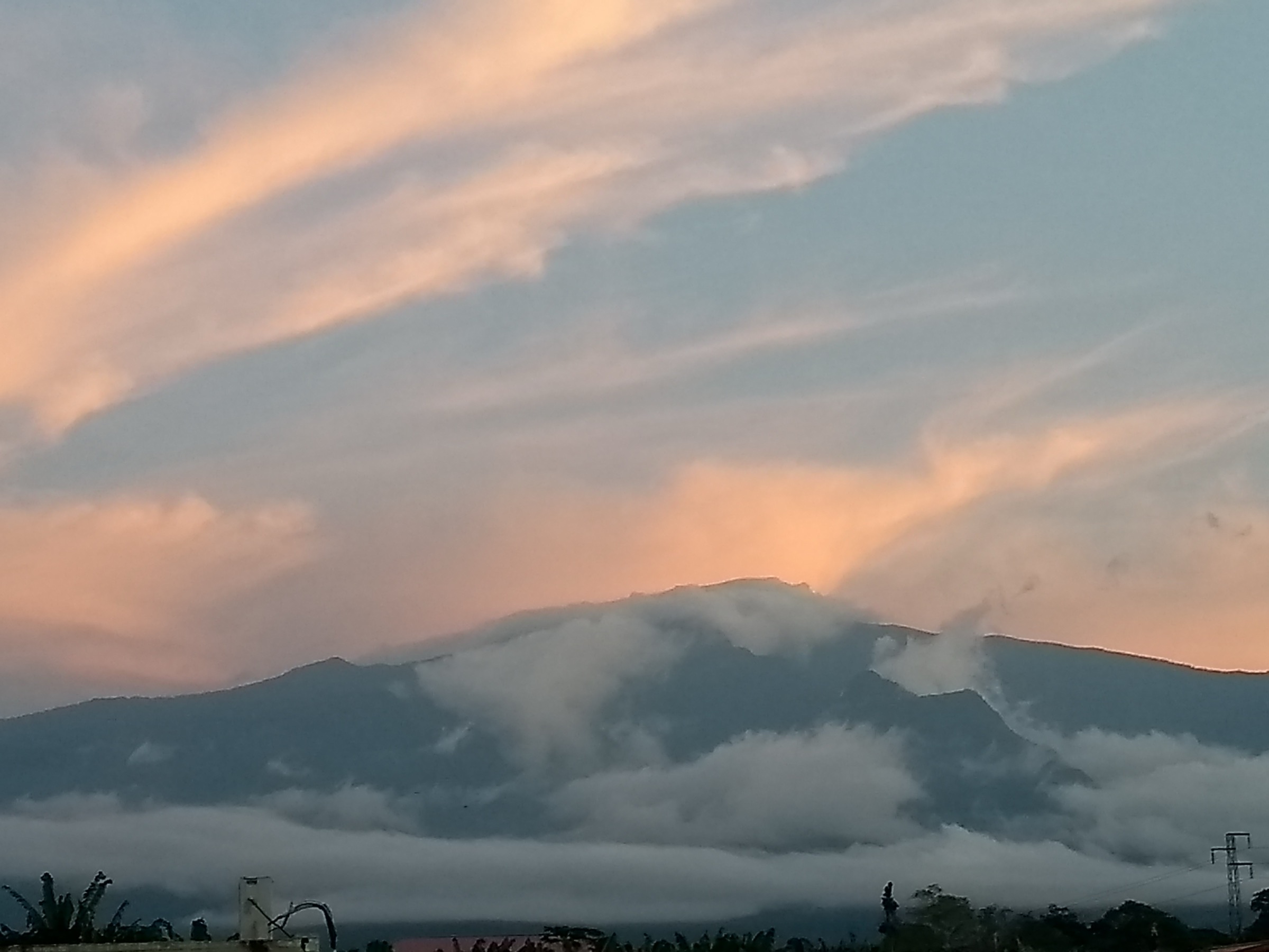
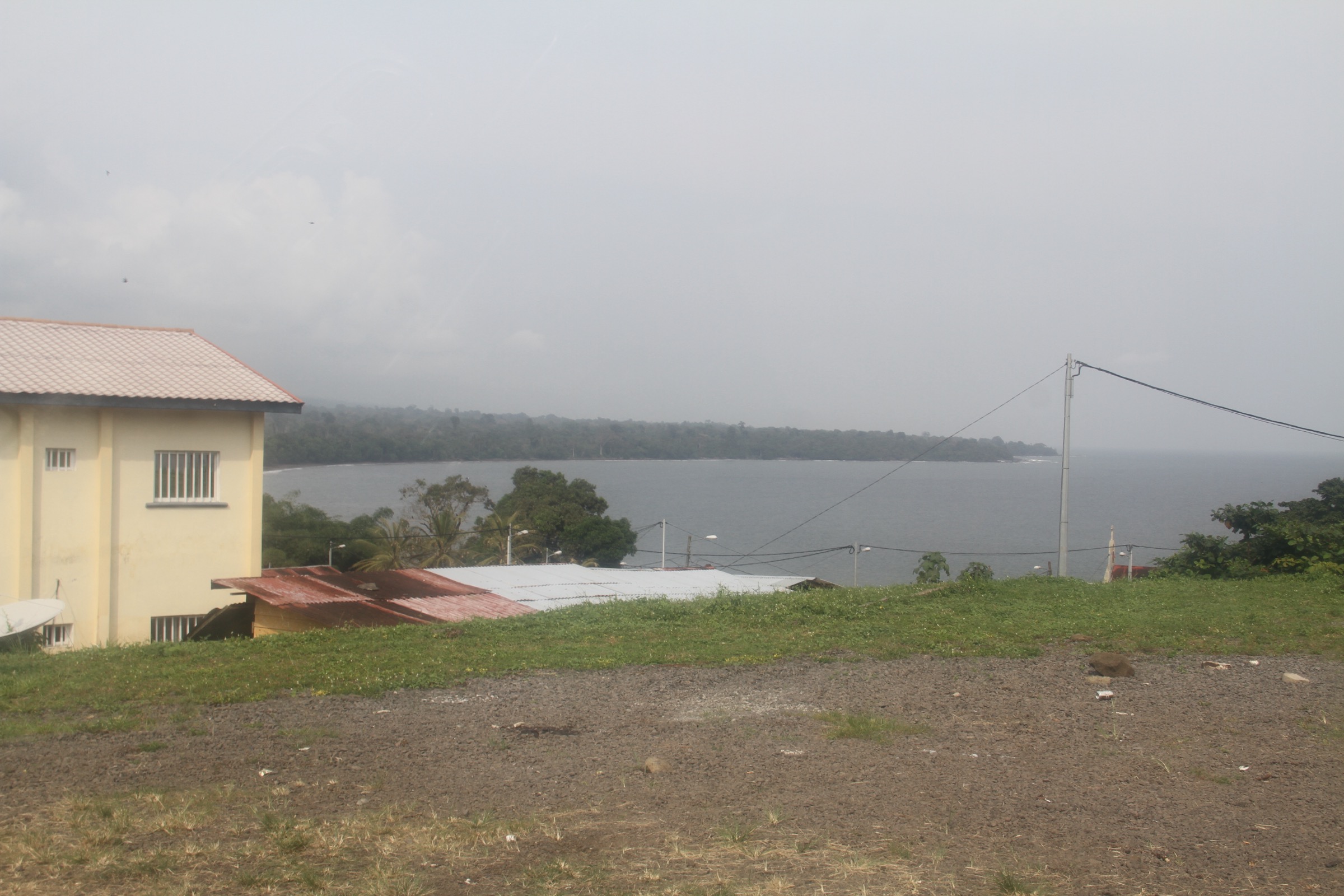
Bioko Island sits in the Gulf of Guinea about 32 km off the Cameroon coast and forms the northern end of the Cameroon Volcanic Line, the same chain that carries Mount Cameroon on the mainland and runs south-west into the oceanic volcanoes of Principe, Sao Tome, and Annobon. The island is the most populated and most mountainous part of Equatorial Guinea, with three overlapping basaltic shield volcanoes — Pico Basile in the north at 3,011 m, the Gran Caldera de Luba in the south-west at around 2,260 m, and the Pico Biao / Moka group in the south-east at around 2,000 m — together making up the Bioko Highlands.
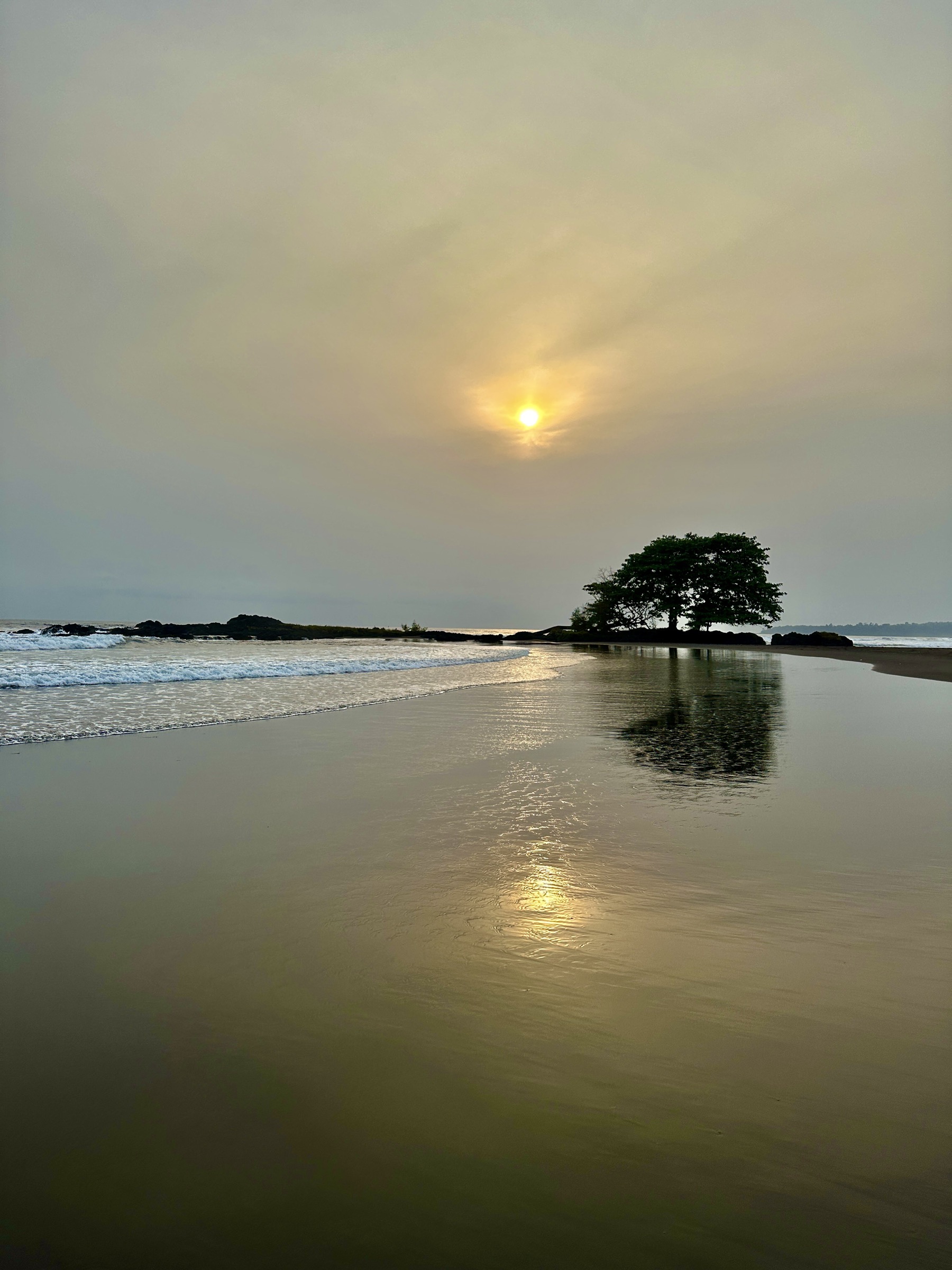
The walking centres cluster in three areas. Malabo and Pico Basile National Park sit on the northern shield, with the main road climbing through plantations and rainforest toward the 3,000 m radio and telecom site near the summit. The Moka highlands at around 1,300-1,500 m carry the most accessible village base on the island, with the Moka caldera and Lake Biao on its southern rim and Pico Biao on its eastern. The southern coast is anchored by Ureca village above one of the wettest measured climates in Africa, with the long Gran Caldera de Luba Scientific Reserve immediately to the west and the leatherback-turtle beaches running 15 km along the black-sand southern shore. Riaba on the east coast is the third walking node, with rainforest and waterfall routes in its hinterland.
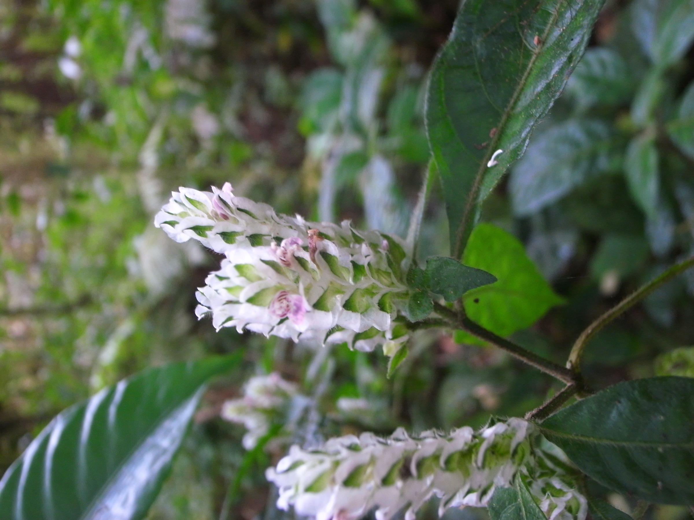
The landscape is rainforest top to bottom. Lowland tropical forest gives way to montane cloud forest from around 800 m, with mossy laurel and Schefflera woodland on the upper slopes and Afromontane grassland near the Pico Basile summit cone. Rainfall is heavy across the year and very heavy on the southern coast; Ureca is widely cited among the wettest inhabited places in Africa, with annual totals reported above 10,000 mm in some sources. The short drier window runs December to February with a secondary easing in July-August. Even in the drier months, cloud, mist, and abrupt heavy showers are routine on the upper mountain.
Access requires careful planning. Equatorial Guinea has historically restricted independent travel and entry usually requires a visa, with limited exemptions for certain passports; the US State Department travel advisory was last updated in October 2025 at Level 2 “Exercise increased caution,” and movement near military and government installations is restricted. Pico Basile carries a major communications and military telecom site near its summit and access to the top has been variable in the past, normally requiring permission from the relevant ministries. The Gran Caldera de Luba Scientific Reserve has been closed to non-research visitors in recent years; only the rim viewpoints around Moka can be treated as straightforward day options. All five routes here are best arranged with a registered guide through a Malabo-based operator and current entry rules, fees, and military-zone access should be confirmed with the Equatorial Guinea tourism authorities and the relevant foreign-office travel advice immediately before travel.
Selection rationale
The five hikes cover the principal volcanic landforms of the island while staying inside what is genuinely day-feasible in current access conditions. The Pico Basile summit walk represents the island’s high northern shield and the only 3,000 m mountain on the Cameroon Volcanic Line south of Mount Cameroon. The Moka caldera rim to Lake Biao captures the south-central highland landscape and is the most reliable walking objective from the main highland village. The Pico Biao crater-lake climb is the cloud-forest summit option from Moka and a quieter counterpart to Pico Basile. The Ureca coastal walk represents the leatherback-turtle beaches and the wet southern fringe, anchored by the long-running Bioko Biodiversity Protection Program (BBPP) monitoring work in partnership between Drexel University and the Universidad Nacional de Guinea Ecuatorial. The Puente Cope forest walk near Riaba represents the eastern lowland rainforest and is the most accessible non-summit objective from Malabo. The Gran Caldera de Luba interior is deliberately excluded because it is a multi-day expedition trek through a scientific reserve and not currently a day-hike target.
Summary table
| # | Hike | Country | Route type | Distance | Gain | Max elevation | Difficulty |
|---|---|---|---|---|---|---|---|
| 1 | Pico Basile summit walk | Equatorial Guinea | Out-and-back from the upper road | ~12-20 km depending on start | ~1,200 m | 3,011 m | Hard |
| 2 | Moka caldera rim to Mirador del Lago Biao | Equatorial Guinea | Out-and-back | ~8 km | ~560 m | ~1,750 m | Moderate |
| 3 | Pico Biao crater-lake climb from Moka | Equatorial Guinea | Out-and-back | ~7-8 km | ~600-700 m | ~2,000 m | Hard |
| 4 | Ureca black-sand coast and turtle-nesting beaches | Equatorial Guinea | Out-and-back coastal walk | ~8-10 km | Minimal | Sea level | Moderate |
| 5 | Puente Cope forest walk from Riaba | Equatorial Guinea | Out-and-back | ~5-8 km | ~150 m | ~250 m | Easy to moderate |
1. Pico Basile summit walk
Snapshot
Itinerary
The walking line on Pico Basile follows the access road that climbs the northern flank of the shield from Malabo. The road runs up through plantations and lowland rainforest, then enters montane cloud forest as it gains height; the foot section that visitors normally treat as a day-hike begins where the surfaced road ends and a steeper rough track and footpath continue toward the radio and telecom installations near the summit. The published route from the upper drop-off covers roughly 12 km return with around 1,200 m of ascent, although some accounts describe a longer 20 km round trip when the vehicle stop is lower on the road. The upper section climbs through mossy cloud forest into an open Afromontane vegetation belt, with views opening south and west across the island and north toward Mount Cameroon in clear weather. The summit area carries military and civil telecom infrastructure and is the high point of Equatorial Guinea at 3,011 m. The descent retraces the same line back to the vehicle drop-off.
Why it is essential
Pico Basile is the highest point of Equatorial Guinea, the highest mountain on the Cameroon Volcanic Line south of Mount Cameroon, and the headline volcanic objective of the Bioko Highlands. The summit gives the only 3,000 m viewpoint in the country and a clear sight of the volcanic chain that runs from the mainland down into the Gulf of Guinea oceanic islands.
Equipment
- Sturdy boots with good grip for wet, slippery forest tread
- Full rain shell and warm layer for the summit zone
- Sun protection and hat for the lower forest and grassland
- 2-3 L water carry; resupply on the climb is unreliable
- Headlamp for early starts
- Local guide and operator transfer arranged in Malabo
- Written permission for park entry and any military-zone passage normally arranged in advance
Hazards and notes
- Pico Basile National Park entry and any approach to the summit installations require permission; the upper area has historically been a controlled military and communications zone and access has been variable.
- Cloud and rain are routine on the upper mountain; cold and visibility loss can develop quickly.
- Steep, slippery sections on the upper road and on the foot path above it; falls are the principal risk.
- Limited communications and no formal rescue service; treat any incident above the road as remote.
- Current Equatorial Guinea tourism information, the US State Department travel advisory, and the UK FCDO travel advice should be consulted immediately before travel.
GPX / KML links
| Source | URL | Format / access | Reuse status |
|---|---|---|---|
| OpenStreetMap — Pico Basile search | openstreetmap.org | Source map / search | OSM data is ODbL; geometry cross-check only |
| Wikiloc search — Pico Basile | wikiloc.com | Search page; user tracks | Wikiloc terms apply on selection; reuse unresolved |
| PeakVisor — Pico Basile | peakvisor.com | Mountain reference page | No GPX download confirmed in this pass |
External links
- Wikipedia — Pico Basile
- Wikipedia — Pico Basile National Park
- US Department of State — Equatorial Guinea travel advisory
2. Moka caldera rim to Mirador del Lago Biao
Snapshot
Itinerary
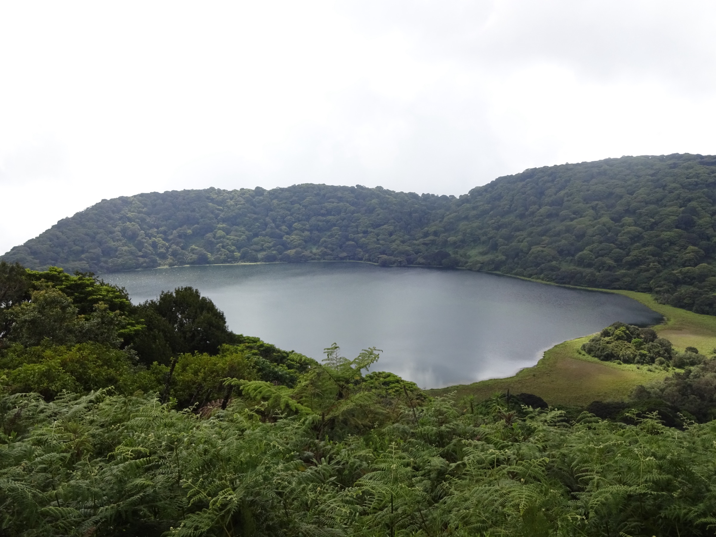
The route leaves Moka village at around 1,300 m and follows a forest path south toward the rim of the Moka caldera, the older of the southern volcanic centres on Bioko. The tread climbs steadily through cloud forest and giant tree-fern stands on a wet, root-laced surface, with the line largely unmarked outside the busier sections. Lake Biao, also written Lago Biao or Lago Loreto, sits inside the caldera at around 1,400 m, roughly 1 km across and rimmed by steep forested walls; the standard day objective is the Mirador del Lago Biao viewpoint at around 1,750 m on the rim, which gives the only clear sight of the lake. Reaching the lakeshore itself is rare; the rim viewpoint is the normal turnaround. Return is by the same path back to Moka.
Why it is essential
The Moka caldera is the most accessible volcanic-crater landscape in the Bioko Highlands and one of the few highland features that can be reached as a single day from a non-summit village base. Lake Biao is the headline cloud-forest crater lake of the island.
Equipment
- Boots with aggressive tread for slippery clay and mossy roots
- Light rain shell and warm layer
- Sun protection for any clearings
- 2 L water carry
- Insect repellent
- Local guide arranged in Moka or via a Malabo operator
Hazards and notes
- Slippery cloud-forest tread is the main hazard; falls on greasy roots are common.
- Path is unmarked above the village; weather changes fast and visibility can drop to a few metres in mist.
- Steep drops on the inner caldera rim near the viewpoint.
- Snakes reported in the forest understorey.
- Local guide normally required; community fees and access arrangements should be confirmed in Moka on the day.
GPX / KML links
| Source | URL | Format / access | Reuse status |
|---|---|---|---|
| Wikiloc — Lago Biao crater lake at Pico Biao | wikiloc.com | User-uploaded GPX | Wikiloc terms apply; reuse unresolved |
| OpenStreetMap — Moka and Lago Biao search | openstreetmap.org | Source map / search | OSM data is ODbL; geometry cross-check only |
External links
- Wikipedia — Moka, Equatorial Guinea
- Bioko Biodiversity Protection Program
- Rumbo Malabo — Visit Lake Biao
3. Pico Biao crater-lake climb from Moka
Snapshot
Itinerary
The Pico Biao route starts at the southern edge of Moka village, where the line passes through a short residential and sugar-cane section and then enters dense cloud forest on a steep, root-tangled path. The climb gains roughly 600-700 m through layered montane forest with moss-draped Schefflera and tree fern. The summit is the eastern centre of the southern Bioko volcanic group at around 2,000 m; the crater of the dormant volcano carries a small lake — separate from the Lake Biao on the Moka caldera rim further west, although both are sometimes confused in older sources. The objective is normally the crater-rim viewpoint above the small summit lake. Return is on the same line back to Moka.
Why it is essential
Pico Biao is the cloud-forest summit option of the southern highlands and a quieter, more biologically intact counterpart to the larger Pico Basile climb. It is the main non-Basile summit objective on the island and gives a true crater-lake view inside Bioko’s southern volcanic centre.
Equipment
- Boots with aggressive tread for greasy roots
- Trekking poles useful on the descent
- Light rain shell and warm layer
- 2-3 L water carry
- Headlamp for early starts
- Insect repellent
- Local guide essential; the upper path is unmarked
Hazards and notes
- Trail is unmarked and the cloud-forest understorey changes quickly; a local guide is required.
- Slippery roots and clay are the principal hazard; falls are the main risk.
- Cloud and rain develop rapidly; visibility loss is routine.
- Snakes reported by operators on the climb.
- No mobile coverage in the upper forest; rescue would be a guided carry-out only.
GPX / KML links
| Source | URL | Format / access | Reuse status |
|---|---|---|---|
| Wikiloc — hike to Lago Biao crater lake at Pico Biao | wikiloc.com | User-uploaded GPX | Wikiloc terms apply; reuse unresolved |
| OpenStreetMap — Pico Biao search | openstreetmap.org | Source map / search | OSM data is ODbL; geometry cross-check only |
External links
4. Ureca black-sand coast and turtle-nesting beaches
Snapshot
Itinerary
The route reaches Ureca by a long road transfer through Luba on the south-west coast; a road completed in recent years now runs from Luba over the highlands to the village above the southern shore, replacing the older multi-day forest approach. From the road end above the village a steep path drops to the black-sand beach, which runs roughly 15 km along the southern coast with several river mouths and offshore stack rocks. The standard walking line follows the beach east from the Ureca river mouth, with short detours to waterfalls that drop directly into the surf and to the lower forest fringe where the Bioko Biodiversity Protection Program operates its long-running monitoring stations. Four marine turtle species — leatherback, green, olive ridley, and hawksbill — use the black sand for nesting, with monitoring data collected by community teams from Ureca village in partnership with the BBPP since 2000. Return is back along the same beach line and up to the road end.
Why it is essential
Ureca represents one of the wettest measured climates in Africa, the longest stretch of black-sand turtle-nesting coast on the Cameroon Volcanic Line, and a working community-conservation site under the Bioko Biodiversity Protection Program. It is the southern coastal counterpart to the highland summits in this catalogue.
Equipment
- Trail shoes with good drainage; the route is wet most of the year
- Rain shell — heavy showers are routine
- Sun protection for any clearings
- 2-3 L water carry; supply at Ureca village is limited
- Insect repellent and head-net for sandflies in the evening
- Headlamp if a turtle-nesting evening monitoring walk is arranged
- Local guide and BBPP / community arrangement for any turtle-beach access; turtle interaction must follow monitoring rules
Hazards and notes
- Heavy surf on the southern coast; in-water swimming is not safe at most of the beach.
- River mouths swell quickly after rain; turn back if a crossing is doubtful.
- Turtle nesting and hatching sites are protected; any approach requires the community monitoring guide and follows BBPP protocol.
- Long, isolated transfer from Malabo; communications drop out on the highland section of the road.
- Heavy rainfall and slippery river crossings are routine; even the drier months see frequent showers.
GPX / KML links
| Source | URL | Format / access | Reuse status |
|---|---|---|---|
| OpenStreetMap — Ureca search | openstreetmap.org | Source map / search | OSM data is ODbL; geometry cross-check only |
| Wikiloc search — Ureca | wikiloc.com | Search page; user tracks | Wikiloc terms apply on selection; reuse unresolved |
External links
- Bioko Biodiversity Protection Program
- Drexel University — Protecting Bioko’s Biodiversity
- Rainforest Trust — Bioko Biodiversity Protection Program
5. Puente Cope forest walk from Riaba
Snapshot
Itinerary
The route leaves Riaba on the eastern coast of Bioko and follows the Cope river inland through lowland tropical rainforest. The Puente Cope bridge crosses the river inland of the village and gives the main walking objective on this side of the island; the path passes through a mix of secondary forest and cocoa plantation before reaching the bridge area. The walk can be extended further inland on logging and forest tracks to higher viewpoints over the eastern flank of the Pico Biao group, with overall ascent staying modest. Return is back along the river to Riaba and the eastern coast, where the bay gives a clear view across to the mainland in clear weather.
Why it is essential
Riaba and the eastern coast represent the lowland rainforest fringe of the Bioko Highlands and the closest non-summit walking option to Malabo. Puente Cope is the most accessible inland walking objective on this side of the island.
Equipment
- Trail shoes with good grip
- Sun protection
- Light rain shell
- 1-2 L water carry
- Insect repellent
- Local guide arranged in Riaba or via a Malabo operator
Hazards and notes
- Path is unmarked outside the village; a local guide is recommended.
- Cope river crossings swell quickly after rain.
- Snakes reported in the forest understorey.
- The route does not enter the Pico Basile or Pico Biao national park zones, but any extension toward the upper Pico Biao slopes requires the relevant park permissions.
- Communications drop out away from the village; this is a remote-rescue area.
GPX / KML links
| Source | URL | Format / access | Reuse status |
|---|---|---|---|
| OpenStreetMap — Riaba search | openstreetmap.org | Source map / search | OSM data is ODbL; geometry cross-check only |
| Wikiloc search — Riaba Bioko | wikiloc.com | Search page; user tracks | Wikiloc terms apply on selection; reuse unresolved |
External links
Missing data / follow-up work
- No official GPX/KML downloads were located for any of the five routes; OpenStreetMap and Wikiloc are used as geometry references only and a Wikiloc user track exists for Pico Biao / Lago Biao without confirmed reuse terms.
- Pico Basile summit access depends on permission for entry to the upper communications and military zone; current rules with the Equatorial Guinea Ministry of Tourism, Pico Basile National Park, and the relevant security authorities must be confirmed locally before travel. Distance and ascent figures vary between 12 km / 1,200 m and 20 km depending on where the vehicle drop-off is on the upper road.
- Pico Biao and Moka caldera distances and elevations vary noticeably between operator pages and Wikiloc user tracks; figures above are best-available approximations. The relationship between the small summit lake on Pico Biao and the larger Lake Biao in the Moka caldera is conflated in several sources.
- The Gran Caldera de Luba Scientific Reserve interior is not currently a viable day option; the rim viewpoints above Moka are the substitute and reserve access for the full crater requires a multi-day research-grade expedition.
- Ureca turtle-monitoring evening walks require pre-arrangement with the Bioko Biodiversity Protection Program or the community monitoring team; current rates, dates, and rules need direct confirmation with BBPP.
- The Puente Cope route is published from a small number of secondary sources and is marked Candidate only; route, distance, and elevation figures need on-the-ground confirmation.
- Wikipedia gives 614 m elevation as the cross monument on Mount Gemi in a separate range; Bioko-specific elevation data on Pico Biao varies between sources and is best confirmed against PeakVisor and operator GPX tracks.
- A direct, high-resolution open-licence photo of the Pico Basile summit installations could not be located in this pass; the cover image is the closest available wide view of the volcano.
- Current US State Department and UK FCDO travel advice and Equatorial Guinea tourism information should be re-checked immediately before travel; entry rules, fees, and movement near military installations change frequently.