Regional overview
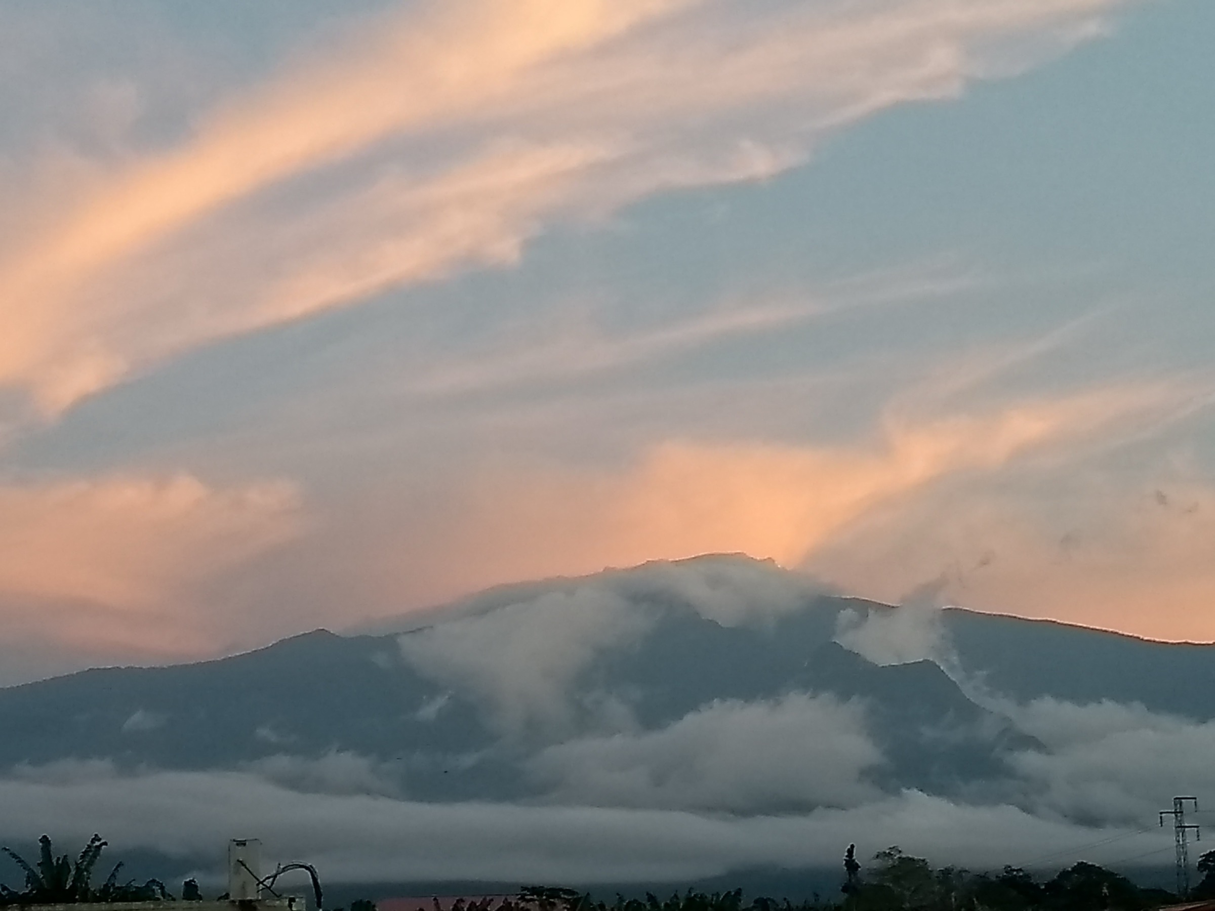
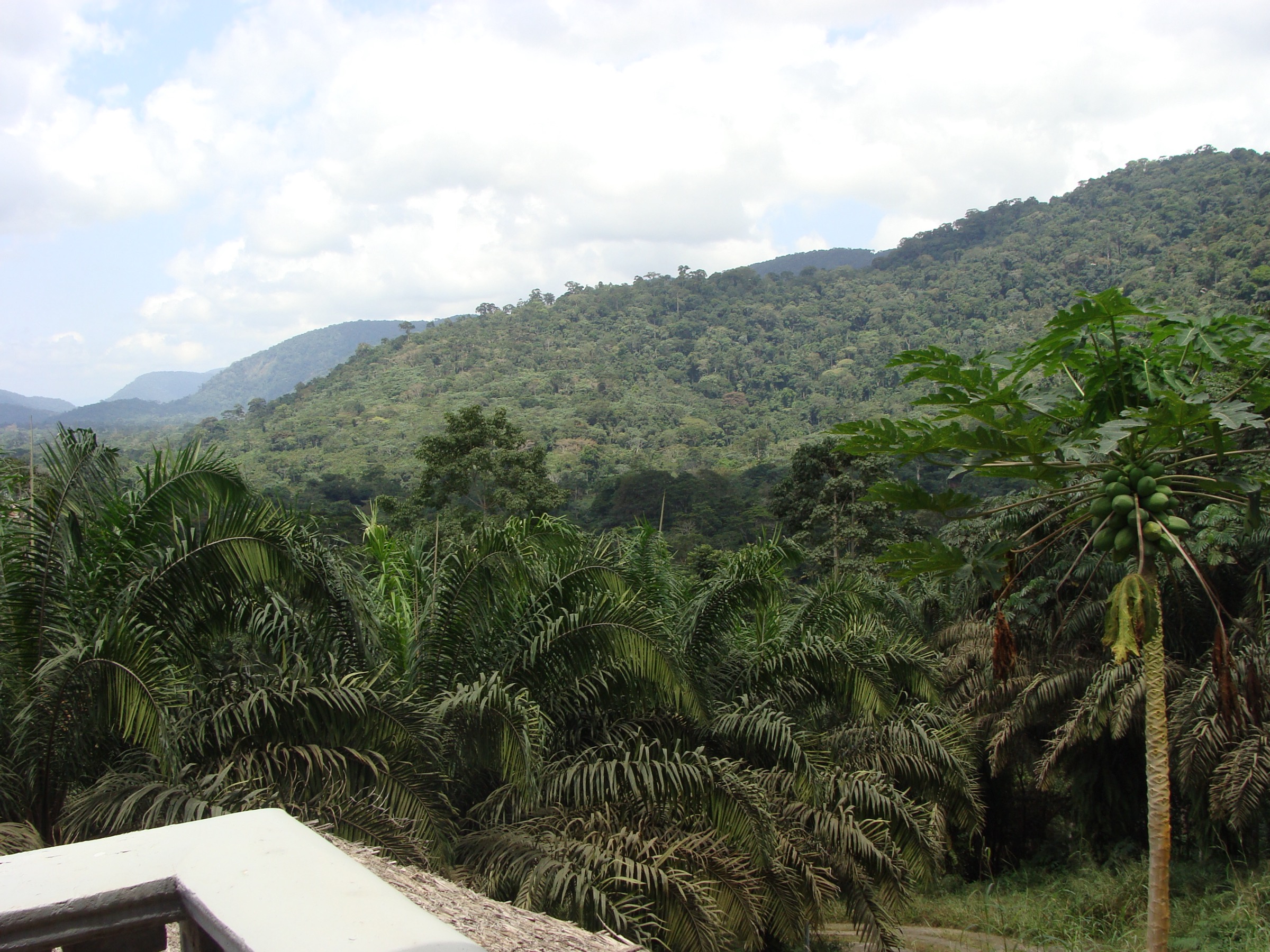
The Cristal Mountains, written Monts de Cristal in French and Crystal Mountains in older English sources, form a low but exceptionally wet Precambrian range running north-east to south-west across north-western Gabon and the eastern side of Equatorial Guinea’s Río Muni mainland. The range sits between the Atlantic coast and the Ogooué basin, with most named summits between 600 and 1,000 m and only a handful — Monte Mitra and Monte Alén in Equatorial Guinea — pushing above the 1,000 m mark. Permanent cloud, mist-belt rainforest, and one of the highest annual rainfall totals in Equatorial Africa give the range a microclimate that botanists rate among the most biodiverse on the continent.
Two protected areas anchor the walking interest. The Monts de Cristal National Park in Gabon is divided into a southern Mbé sector, accessible as a long day from Libreville along the Kinguélé and Tchimbélé hydroelectric roads, and a northern Mont Seni sector, reached only by boat from Cocobeach and effectively a research and expedition destination. The Monte Alén National Park in Equatorial Guinea sits on the Equatoguinean half of the same landscape, with a marked Los Palacios trail near the visitor centre and longer guided routes to Monte Mitra, Cascada Mosumo and the central crater lake of Lago Atok. Both parks are covered by the wider Monte Alén–Monts de Cristal Conservation Landscape recognised by the Central African Forest Commission.
Visitor infrastructure is thin on both sides of the border. Marked, waymarked, or signposted day-hike trails in the European sense are largely absent; access depends on a local guide, a 4×4, and in several cases on advance arrangement with the park authority. Distance and ascent figures published online are rarely sourced. Verification labels in this entry reflect that: most routes here are partially verified at best, with Mont Seni and the central Monte Alén objectives flagged as candidate only.
Selection rationale
The selection covers the two iconic Gabonese day objectives that any visitor based in Libreville can realistically attempt — the Kinguélé waterfalls and the Tchimbélé reservoir — paired with the strongest documented Equatoguinean route, the Los Palacios trail in Monte Alén. Mont Seni is retained as the highest named summit in the Gabonese park, even though there is no waymarked tourist line; the Lago Atok approach from Esamalan camp is included as the signature deep-forest objective on the Equatoguinean side. Together the five capture the rainforest, waterfall, reservoir, summit and crater-lake character of the range without leaving the Monte Alén–Monts de Cristal landscape.
Summary table
| # | Hike | Country | Route type | Distance | Gain | Max elevation | Difficulty |
|---|---|---|---|---|---|---|---|
| 1 | Kinguélé Falls and Makabane gorges | Gabon | Out-and-back / short loop | Unresolved; about 3–5 km on foot | Minimal | About 250 m | Easy |
| 2 | Tchimbélé reservoir loop | Gabon | Loop / lakeshore | Unresolved | Unresolved | About 450 m | Easy–moderate |
| 3 | Mont Seni summit | Gabon | Out-and-back, unverified | Unresolved | Up to about 500 m | 611 m | Candidate only |
| 4 | Los Palacios Trail | Equatorial Guinea | Loop | About 10 km | Unresolved | Around 700 m | Moderate |
| 5 | Lago Atok approach from Esamalan | Equatorial Guinea | Out-and-back, long day or staged | Unresolved | Unresolved | Around 600–700 m | Hard |
Before you go
Required equipment
- Sturdy hiking boots with aggressive tread for wet mud; trail-runners are inadequate.
- Lightweight long sleeves and trousers against insects, leeches, and stinging plants.
- Waterproof shell and a dry bag for camera and electronics — sudden rain is the norm.
- Three or more litres of water carry per day; treat any in-park water before drinking.
- Malaria chemoprophylaxis (year-round risk on both sides of the border), high-DEET repellent, and yellow-fever certificate for entry.
- Local guide for any inside-park objective; English is rare in Equatorial Guinea and outside Libreville in Gabon.
- Cash in local currency for park fees, fixers, and fuel; ATMs are absent in the park approaches.
Current access and safety notes
- Both parks require advance arrangement: ANPN (Agence Nationale des Parcs Nationaux) for the Gabonese Monts de Cristal and INDEFOR-AP / the Ministry of Forestry for Monte Alén. Walk-up entry is not the norm.
- Visas to Equatorial Guinea remain difficult to obtain for many nationalities; check current rules well before travel.
- Forest trails are slippery year-round; even the dry season retains heavy dew and mist-belt drainage.
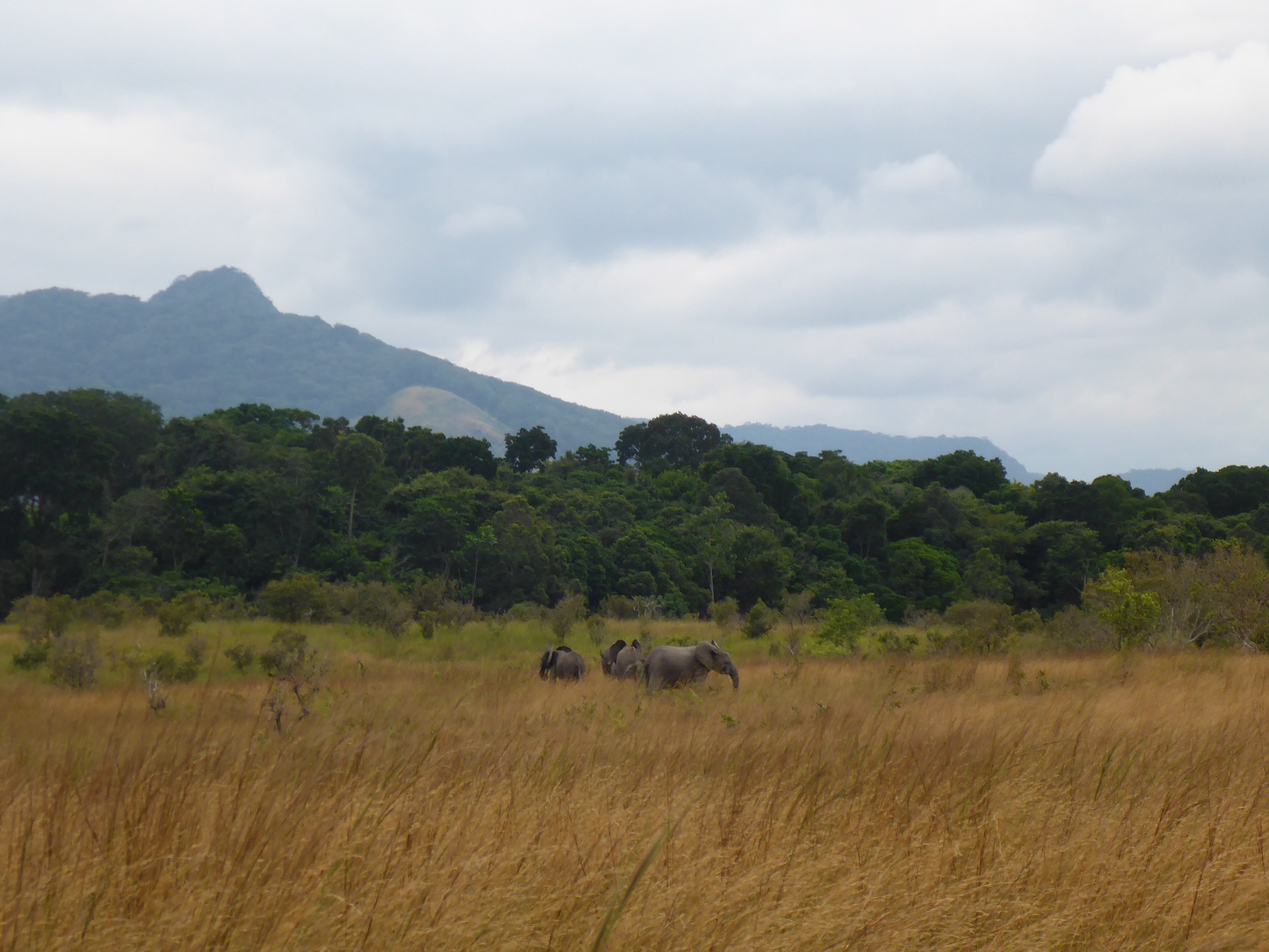
- Wildlife encounters with forest elephant and gorilla are possible inside Monte Alén; follow guide instructions.
- Phone coverage is absent for most of the in-park walking; expect a remote-rescue context.
- Long dry season (June to September) is the most reliable window; the short dry season (December to February) is workable but less consistent.
1. Kinguélé Falls and Makabane gorges

Snapshot
Itinerary
The walking line begins at the Kinguélé hydroelectric station on the Mbei river, the first of Gabon’s hydro plants and the gateway to the southern Mbé sector of Monts de Cristal National Park. The road approach from Libreville passes Kango on the N1 and then follows a forest track signposted for the dam; total distance is around 100 to 150 km depending on the chosen route. On foot, a short path leads to viewpoints over the lower Kinguélé fall, which drops around 45 m in a single curtain, and to the upper fall, which descends about 35 m in three consecutive steps.
A walking extension follows the Mbei river roughly 2 km north into the Makabane cascades and the Mbivane gorges, an area noted in regional botanical surveys for orchids, begonias and tree-fern stands. The route is unmarked and benefits from a local guide. The full day is normally combined with a continuation to Tchimbélé.
Why it is essential
Kinguélé is the most accessible feature of the southern Cristal Mountains and the only Cristal-system objective that can be reached on a long day from Libreville. The falls, the gorges and the surrounding mist-belt rainforest are representative of the wider Monts de Cristal landscape without requiring overnight commitment.
Equipment
Sturdy boots, lightweight rain shell, insect repellent, sun protection, two to three litres of water carry, a dry bag for camera kit, and a 4×4 or arranged driver from Libreville.
Hazards and notes
- Wet rock at the viewpoints and around the dam infrastructure; do not approach unprotected edges.
- The road can deteriorate quickly after heavy rain; plan around weather forecasts.
- Park entry permissions and any photography rules around the dam should be confirmed with ANPN before travel.
- Malaria exposure throughout; standard prophylaxis applies.
GPX / KML links
| Source | URL | Format / access | Reuse status |
|---|---|---|---|
| OpenStreetMap — Kinguélé | openstreetmap.org | Map data / search | OSM data is ODbL; candidate geometry check only |
| Wikiloc search — Kinguélé | wikiloc.com | Search | No reusable GPX identified |
External links
- Britannica — Kinguélé
- Wikipedia — Crystal Mountains (Africa)
- ANPN — Agence Nationale des Parcs Nationaux
2. Tchimbélé reservoir loop

Snapshot
Itinerary
The route uses the Tchimbélé hydroelectric reservoir on the upper Komo river as a base. The station is reached on a continuation of the Kinguélé track, with an underground turbine hall described in regional sources as the more impressive of the two Mbé-sector hydro installations. From the dam area, forest paths lead along the lakeshore through tall canopy with ridge views back across the reservoir; one informal branch climbs to a saddle north of the dam.
There is no waymarked tourist line. The walking is usually structured by a local guide or by the SEEG personnel managing dam access. Birdwatching from the lakeshore is the main visitor draw; large mammals are present but rarely seen during a casual day visit.
Why it is essential
Tchimbélé is the deep-forest counterpart to Kinguélé and the only Cristal landscape where a substantial freshwater body is set inside mist-belt rainforest at a viewable scale. The combination of reservoir, gallery forest and remnant primary rainforest makes it the most photogenic central feature of the Gabonese Cristal.
Equipment
Sturdy waterproof boots, gaiters for mud, insect cover, dry bag, two to three litres of water carry, basic first-aid kit, sun and rain layers. A local guide and advance ANPN / SEEG permission are essential.
Hazards and notes
- Slippery descents to the lakeshore after rain.
- Unsignposted paths; do not separate from the guide.
- Photography around the dam infrastructure may be restricted; ask before shooting.
- Some sections cross informal forestry tracks; vehicles are infrequent but possible.
GPX / KML links
| Source | URL | Format / access | Reuse status |
|---|---|---|---|
| OpenStreetMap — Tchimbélé | openstreetmap.org | Map data / search | OSM data is ODbL; candidate geometry check only |
| Wikiloc search — Tchimbélé | wikiloc.com | Search | No reusable GPX identified |
External links
3. Mont Seni summit

Snapshot
Itinerary
No publication-ready route line was found. Mont Seni sits in the northern, water-access-only sector of the park between the Komo and Noya rivers, with an outflow that drains into the Muni estuary near the Equatoguinean frontier. The walking objective is the rounded summit at 611 m, which receives the highest recorded annual rainfall in Gabon at around 3,500 mm. Visitor itineraries are limited to expedition-style projects organised by research teams and a small number of operators in Libreville.
Why it is essential
Mont Seni anchors the northern half of the Gabonese Cristal landscape and is the documented hydrological extreme of the country — the wettest named peak in Gabon. It is the only Cristal Mountains summit objective with an established geographic name and altitude figure.
Equipment
Full expedition kit: waterproof footwear, leech socks, biting-insect cover, hammock or tent suited to constant rain, water purification, machete-handling guide, redundant navigation, and a satellite communicator. River-transport bookings need confirmation.
Hazards and notes
- No marked trail; navigation is entirely guide-led.
- Constant rain and saturated ground; hypothermia is possible despite the equatorial location.
- Wildlife encounters with forest elephant are documented in the sector.
- Park permission via ANPN is required.
- River access depends on tide and weather windows.
GPX / KML links
| Source | URL | Format / access | Reuse status |
|---|---|---|---|
| OpenStreetMap — Mont Seni | openstreetmap.org | Map data / search | OSM data is ODbL; candidate geometry check only |
External links
4. Los Palacios Trail

Snapshot
Itinerary
The Los Palacios Trail is the most consistently named day-hike in Monte Alén National Park and is the only Equatoguinean route in the catalogue with a published distance figure. Regional tourism descriptions place the loop at around 10 km, with 4 to 5 hours of walking time and a moderate grade through dense lowland-to-mist-belt rainforest. The trail passes a series of cascading streams in its central section, with several short side-paths to viewpoints over the canopy.
The walk is normally organised from the Monte Alén visitor area near Engong, with a park guide assigned at registration. Wildlife is heard more often than seen — chimpanzee calls, mandrill troops in the canopy, and hornbills — but the headline attractions are botanical: massive okoumé and moabi specimens, climbing aroids, and orchids in the wetter sections.
Why it is essential
The Los Palacios Trail is the only Cristal-system day-walk in Equatorial Guinea with a published distance, time and grade. It captures the deep-forest character of Monte Alén on a feasible loop and provides the realistic baseline for any visitor planning to hike the park.
Equipment
Waterproof boots with gaiters, lightweight long sleeves and trousers, insect repellent with strong DEET, two to three litres of water carry, sun protection, basic first-aid kit, headlamp for unexpected late finishes, and a dry bag. The park requires a registered guide.
Hazards and notes
- The trail is rooted, muddy and slippery; falls are the main injury risk.
- Wildlife — including forest elephant — is present; follow guide instructions without exception.
- Mobile coverage is absent; carry an offline map and a whistle.
- Park-fee and guide arrangements are made at the visitor area; no walk-up entry.
- Visa and entry to Equatorial Guinea require planning weeks ahead for most nationalities.
GPX / KML links
| Source | URL | Format / access | Reuse status |
|---|---|---|---|
| OpenStreetMap — Monte Alén National Park | openstreetmap.org | Map data / search | OSM data is ODbL; candidate geometry check only |
| Wikiloc search — Monte Alén | wikiloc.com | Search | No reusable GPX identified |
External links
5. Lago Atok approach from Esamalan

Snapshot
Itinerary
The route is the signature interior expedition of Monte Alén National Park. From the Esamalan forest camp, a guide-led path follows rolling rainforest ridges into the heart of the park to Lago Atok, a small crater lake set entirely within tall canopy. Regional sources describe the walk as a 6 to 8 hour one-way effort with overgrown and slippery sections. Wildlife on the approach reportedly includes forest elephant, sitatunga, buffalo and mandrill.
Treating the round trip as a day-hike is feasible only for very fast walkers in dry conditions. Most parties either camp at the lake or use a second forest camp on the approach, with the lake itself as the half-way objective. The lake is described as appearing suddenly in the canopy, ringed by palms and visited by kingfishers.
Why it is essential
Lago Atok is the central feature of Monte Alén National Park and the most iconic interior objective in the Equatoguinean Cristal landscape. It is the only crater lake in the range with a documented visitor approach.
Equipment
Expedition-grade kit: waterproof boots, gaiters and leech socks, long sleeves and trousers, hammock or lightweight tent, sleeping mat and rainfly, head torch with spare batteries, water purification, malaria prophylaxis, satellite communicator, and full first-aid kit. A park guide is mandatory.
Hazards and notes
- Path is overgrown and slippery; published descriptions warn against walking it without a guide.
- Forest elephant encounters are reported in the central park.
- No reliable communications between Esamalan and the lake.
- Park permission, guide assignment and porter logistics require advance arrangement.
- Treat the route as candidate only until on-the-ground verification is available.
GPX / KML links
| Source | URL | Format / access | Reuse status |
|---|---|---|---|
| OpenStreetMap — Lago Atok | openstreetmap.org | Map data / search | OSM data is ODbL; candidate geometry check only |
| Wikiloc search — Monte Alén Atok | wikiloc.com | Search | No reusable GPX identified |
External links
Missing data and follow-up work
- Route geometry across the range — no public, reusable GPX track was identified for any of the five hikes; OpenStreetMap and Wikiloc references are search-level only.
- Tchimbélé walking lines — no specific marked distance or time was published; the entry is structured around the lake-margin walking custom described in regional tourism material.
- Mont Seni route — no waymarked summit line; the entry should be read as an expedition placeholder rather than a confirmed day-hike.
- Monte Mitra and Cascada Mosumo — both objectives are referenced in Monte Alén literature but lack published trail metrics; they remain candidate research subjects.
- Photography — only the cover image is licence-confirmed; per-hike photos remain unresolved and are flagged in each figcaption.
- Permits and access — both park authorities require advance contact; permit fees and guide rates should be confirmed close to the trip.
External links
| Source | URL |
|---|---|
| Wikipedia — Crystal Mountains (Africa) | en.wikipedia.org |
| Wikipedia — Crystal Mountains National Park | en.wikipedia.org |
| Wikipedia — Monte Alén National Park | en.wikipedia.org |
| Wikipedia — Tchimbélé | en.wikipedia.org |
| Britannica — Kinguélé | britannica.com |
| Britannica — Mbei River | britannica.com |
| Key Biodiversity Areas — Monte Alén | keybiodiversityareas.org |
| ANPN — Agence Nationale des Parcs Nationaux (Gabon) | parcsgabon.ga |
| Wikivoyage — Parc national des Monts de Cristal | fr.wikivoyage.org |
| Lonely Planet — Monts de Cristal | lonelyplanet.com |
| Lonely Planet — Monte Alén | lonelyplanet.com |
| Rainforest Parks and People — Mont Seni description | rainforestparksandpeople.org |
| CARPE — Monts de Cristal vegetation assessment | carpe.umd.edu |
| Wikiloc — Gabon search | wikiloc.com |
| Wikiloc — Equatorial Guinea search | wikiloc.com |