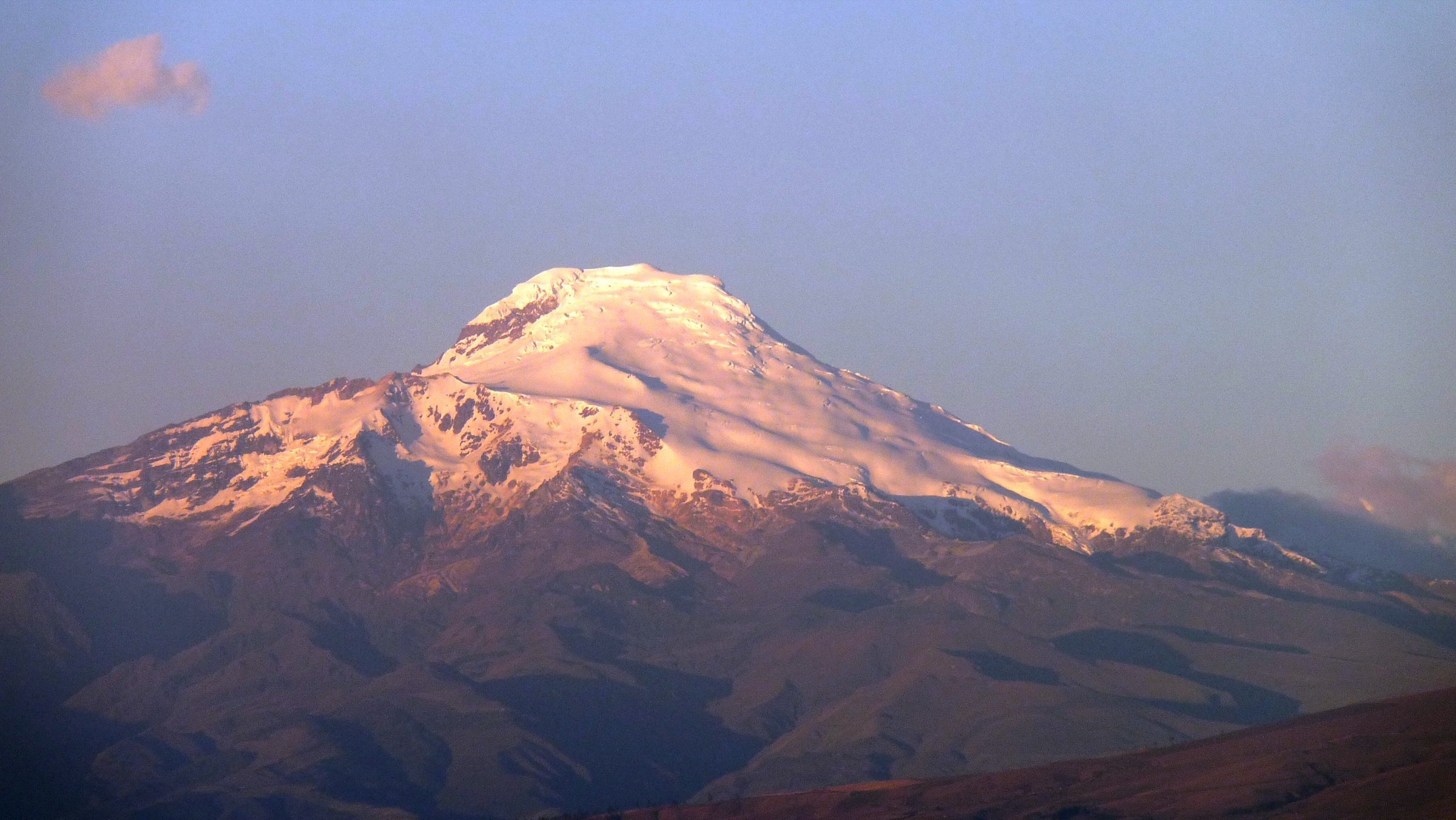
Regional overview
The Quito / Pichincha region has immediate high-altitude hiking from the city edge: cable-car volcano ridges, crater reserves, valley volcanoes, native forest remnants and river/waterfall routes. Weather can be urban-clear in the morning and mountain-obscured by midday.
Selection rationale
The selection covers the region’s defining day-hike experiences: Rucu Pichincha from the TelefériQo, Pasochoa’s summit and upper refuge trails, the Pululahua crater descent / Cerro Chivo variant, Ilaló volcano from the eastern valleys, and the Cóndor Machay waterfall on the Río Pita. Guagua Pichincha was not selected in this pass because current crater-floor access restrictions and volcanic monitoring make it less clean as a non-technical catalogue hike.
Summary table
| # | Hike | Country | Route type | Distance | Gain | Max elevation | Difficulty |
|---|---|---|---|---|---|---|---|
| 1 | Rucu Pichincha from TelefériQo | Ecuador | Out-and-back | Approx. 10-11 km | 750-900 m | 4,696 m | Hard |
| 2 | Pasochoa Summit / Upper Refuge Trails | Ecuador | Out-and-back | 9.5-12.5 km | 760-820 m | Approx. 4,210 m | Hard |
| 3 | Pululahua Crater Descent / Cerro Chivo Variant | Ecuador | Out-and-back or short loop | Approx. 5 km basic | 300-600 m | Moderate to hard | |
| 4 | Ilaló Volcano | Ecuador | Out-and-back or loop | 4.7-9.3 km | 300-684 m | 3,169-3,183 m | Moderate to hard |
| 5 | Cóndor Machay Waterfall / Río Pita | Ecuador | Out-and-back | 7.4-7.7 km | Approx. 406 m | Approx. 3,174 m | Moderate |
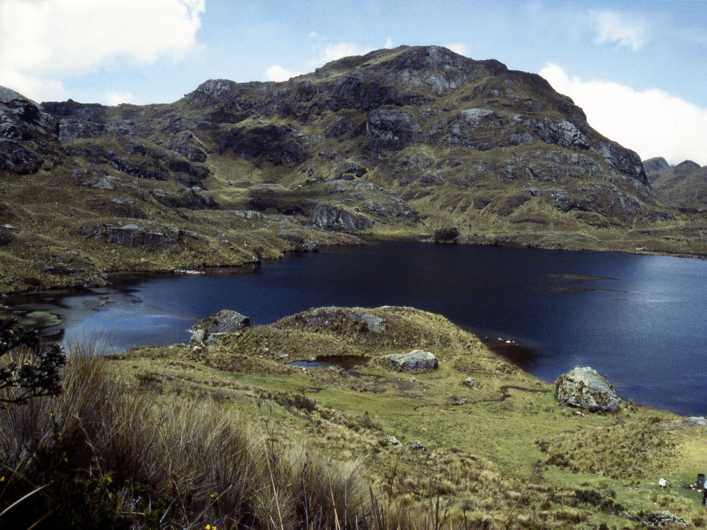
1. Rucu Pichincha from TelefériQo
Snapshot
Itinerary
High ridge walk from the cable-car station to the rocky summit of Rucu Pichincha, with a sandy upper track and short easy scrambling near the top.
Why it is essential
Quito’s signature high-altitude day hike and the most accessible major summit above the capital.
Equipment
- Warm layers
- Waterproof/windproof shell
- Grippy footwear
- Poles
- Sun protection
- Navigation
Hazards and notes
- Altitude, fog, exposure to weather, loose sandy rock, short final scramble.
GPX / KML links
| Source | URL | Format / access | Reuse status |
|---|---|---|---|
| Topo GPS: Rucu Pichincha route | topo-gps.com | Source route page; Topo GPS terms apply | Route-file reuse not verified |
| Outdooractive: Rucu Pichincha 4,696 m from mountain station TelefériQo | outdooractive.com | Secondary source map; Outdooractive terms apply | Route-file reuse not verified |
External links
2. Pasochoa Summit / Upper Refuge Trails
Snapshot
Itinerary
Forest and páramo ascent toward Pasochoa’s crater rim / summit zone, depending on the selected official or local trail.
Why it is essential
Accessible extinct volcano, native Andean forest refuge and major 4,000 m acclimatisation hike near Quito.
Equipment
- Waterproof boots
- Rain shell
- Warm layer
- Navigation
- Poles
Hazards and notes
- Fog / navigation, muddy forest tracks, steep grass near upper slopes, altitude.
GPX / KML links
| Source | URL | Format / access | Reuse status |
|---|---|---|---|
| AllTrails: Volcán Pasochoa | alltrails.com | Source map; AllTrails terms apply | Route-file reuse not verified |
| AllTrails: Entrada Refugio Pasochoa — Campamento del Pasochoa | alltrails.com | Alternate source map; AllTrails terms apply | Route-file reuse not verified |
External links
3. Pululahua Crater Descent / Cerro Chivo Variant
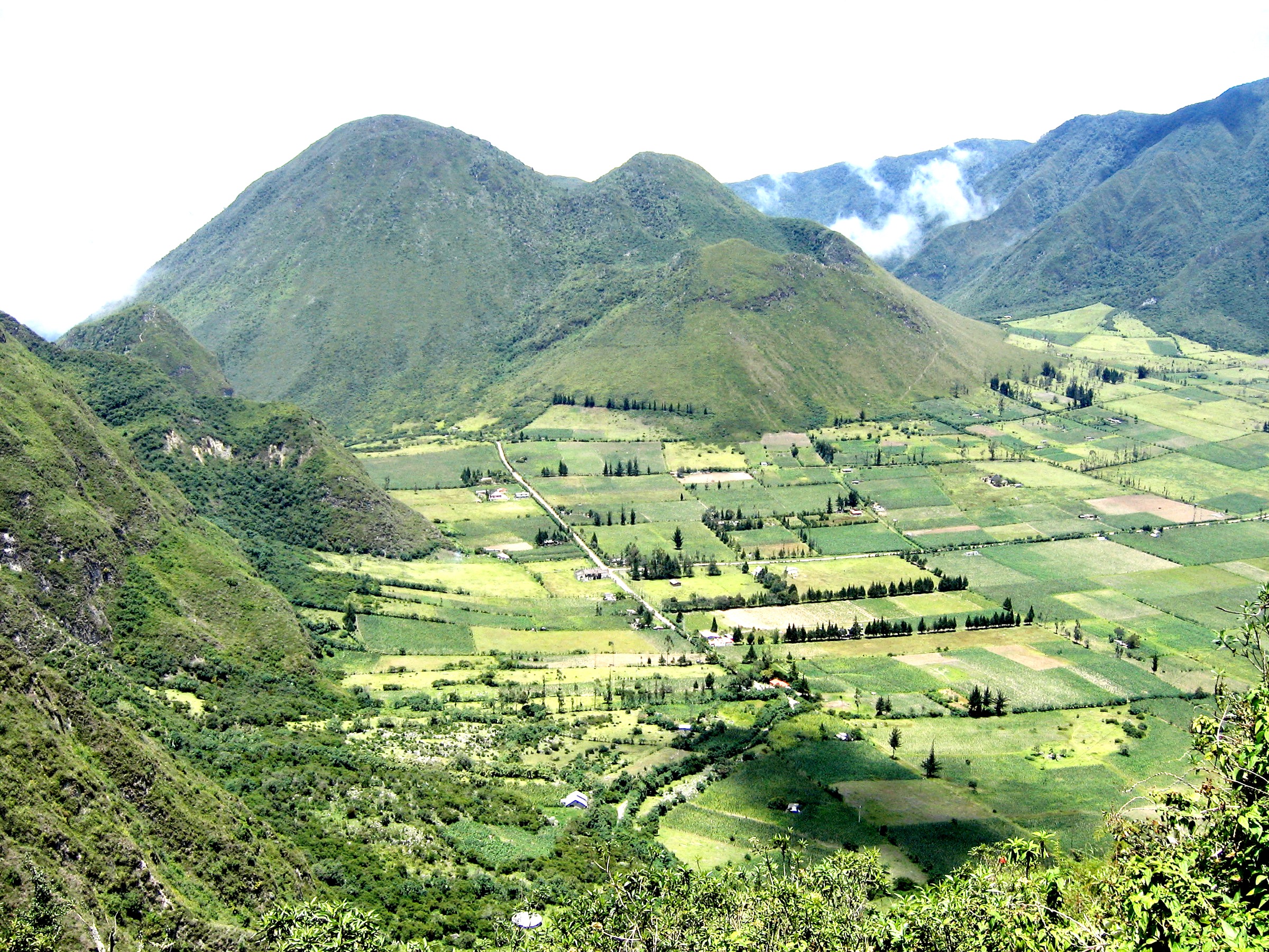
Snapshot
Itinerary
Descent from the crater rim into the inhabited Pululahua caldera, with possible Cerro Chivo or crater-floor extensions.
Why it is essential
Rare inhabited volcanic crater, close to Quito and Mitad del Mundo.
Equipment
- Hiking shoes
- Water
- Sun / rain protection
- Poles useful
Hazards and notes
- Steep descent / ascent, mud, fog, route-choice ambiguity.
GPX / KML links
| Source | URL | Format / access | Reuse status |
|---|---|---|---|
| AllTrails: Crater Pululahua | alltrails.com | Source map; AllTrails terms apply | The AllTrails line appears longer than the selected day-hike variant; route-file reuse not verified |
External links
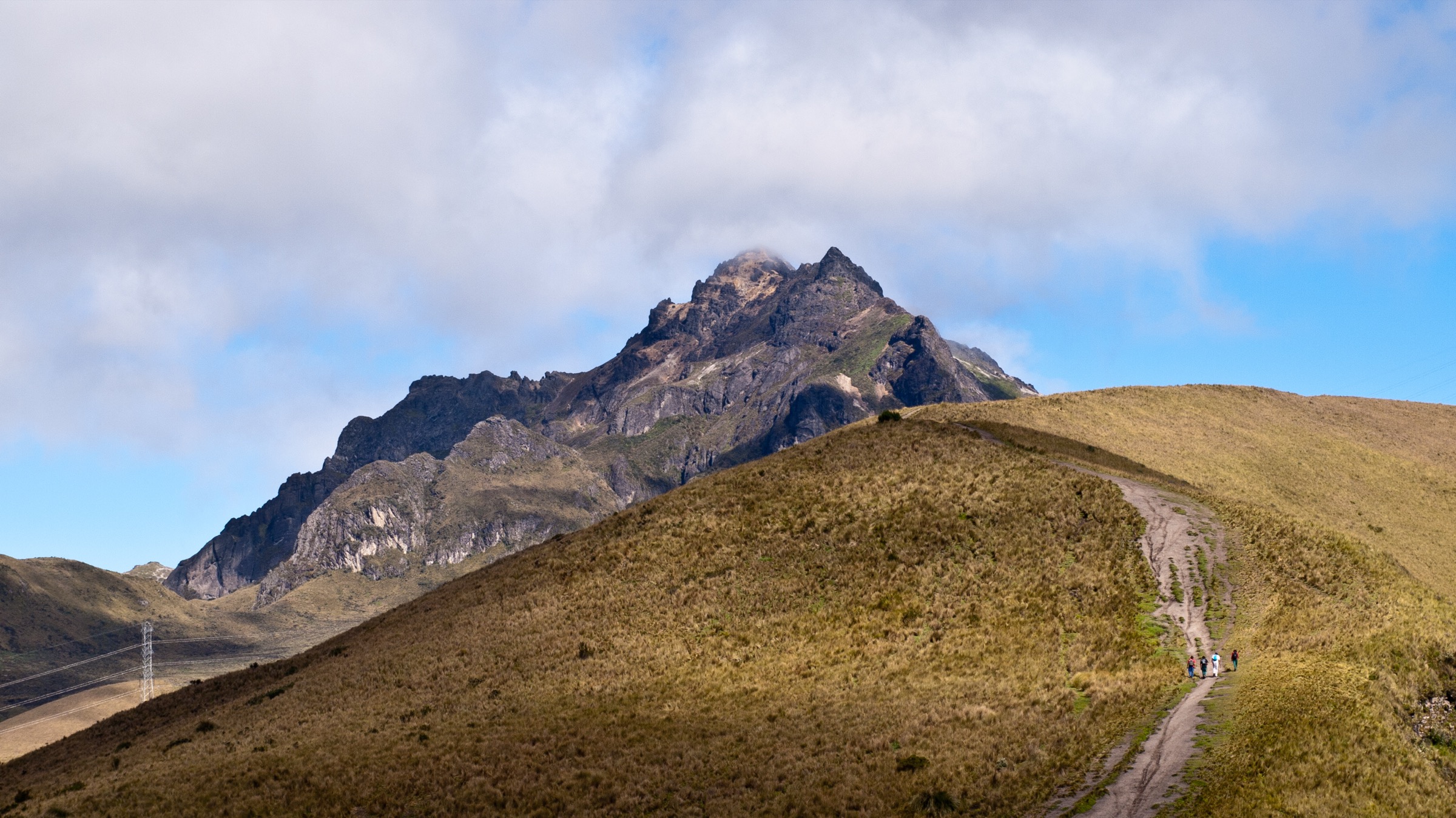
4. Ilaló Volcano
Snapshot
Itinerary
Dry Andean slopes and local tracks to Ilaló’s summit / cross viewpoints above Quito’s eastern valleys.
Why it is essential
Quito’s local valley volcano and a lower-altitude acclimatisation hike with city and valley views.
Equipment
- Sun protection
- Water
- Hiking shoes
- Navigation
Hazards and notes
- Eroded tracks, heat, mountain-bike / shared-use trails, route ambiguity.
GPX / KML links
| Source | URL | Format / access | Reuse status |
|---|---|---|---|
| AllTrails: Volcán Ilaló | alltrails.com | Source map; AllTrails terms apply | Route-file reuse not verified |
| Outdooractive: Cumbre del Volcán Ilaló desde Tumbaco | outdooractive.com | Secondary source; Outdooractive terms apply | Route-file reuse not verified |
External links
5. Cóndor Machay Waterfall / Río Pita
Snapshot
Itinerary
Maintained river trail with bridges through Andean vegetation to the Cóndor Machay waterfall.
Why it is essential
The Quito-Pichincha region’s classic waterfall day hike, with river scenery and volcano foothill setting.
Equipment
- Grippy shoes
- Rain shell
- Water
- Poles useful
Hazards and notes
- Wet bridges, slippery trail, river crossings / edges.
GPX / KML links
| Source | URL | Format / access | Reuse status |
|---|---|---|---|
| AllTrails: Cascada Cóndor Machay | alltrails.com | Source map; AllTrails terms apply | Route-file reuse not verified |
| Wikiloc: Cascada Cóndor Machay | wikiloc.com | Secondary source map; Wikiloc terms apply | Route-file reuse not verified |
External links
External links
| Source | URL |
|---|---|
| Topo GPS — Rucu Pichincha route | topo-gps.com |
| Outdooractive — Rucu Pichincha from TelefériQo | outdooractive.com |
| AllTrails — Volcán Pasochoa | alltrails.com |
| AllTrails — Entrada Refugio Pasochoa / Campamento del Pasochoa | alltrails.com |
| AllTrails — Crater Pululahua | alltrails.com |
| AllTrails — Volcán Ilaló | alltrails.com |
| Outdooractive — Cumbre del Volcán Ilaló desde Tumbaco | outdooractive.com |
| AllTrails — Cascada Cóndor Machay | alltrails.com |
| Wikiloc — Cascada Cóndor Machay | wikiloc.com |