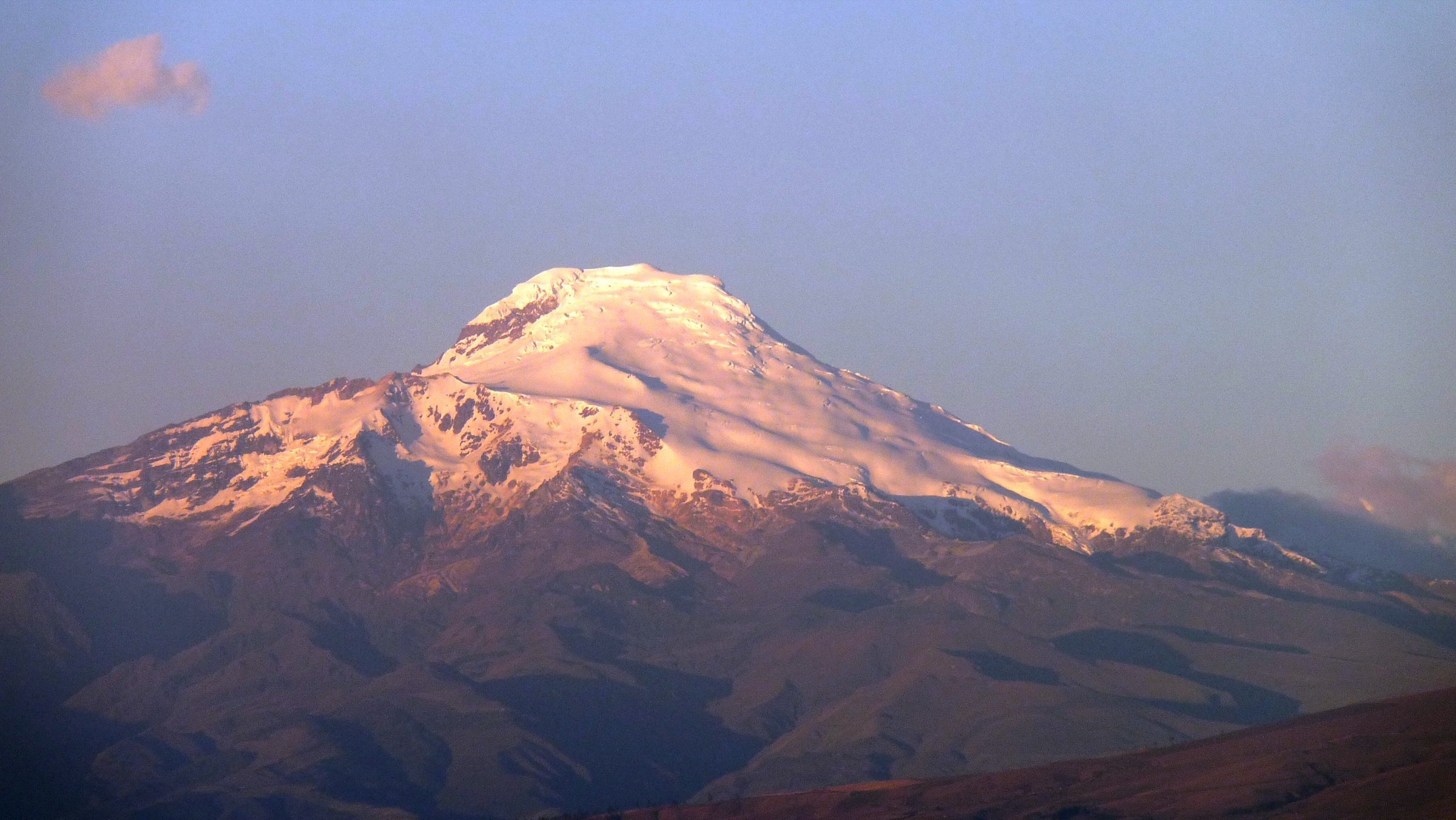
Regional overview
The Cajas-Loja region shows the southern Ecuadorian Andes at their most water-rich and biodiverse: high Cordillera Occidental paramo around Parque Nacional Cajas, cloud forest and elfin forest in Parque Nacional Podocarpus, and the remote lake-and-paramo landscapes of Parque Nacional Yacuri near the Peruvian border. Cuenca and Loja are the main hiking bases; Zamora and Amaluza / Jimbura serve lower Podocarpus and Yacuri access.
Cajas is comparatively well organised for day walking, with signed routes, visitor capacity controls and public-bus access from Cuenca to La Toreadora. Loja-side routes are more dispersed and often require private transport, local guidance and current access checks. Terrain ranges from easy lake circuits to long historic traverses and steep paramo viewpoints.
The main hazards are altitude, cold rain, fog, boggy ground, route-finding difficulty and long travel times to trailheads. Cajas routes sit mostly around 3,100-4,200 m; Podocarpus and Yacuri mix cloud forest, paramo and lake basins with frequent wet weather.
Selection rationale
The selection covers two Cajas lake classics, the historic Inca-road traverse across Cajas, a Loja-side Podocarpus cloud-forest/paramo viewpoint route and a Yacuri lake-and-rock viewpoint route. Longer Podocarpus Lagunas del Compadre trips are excluded because official and tourism sources treat them as at least two days with guide support.
Summary table
| # | Hike | Country | Route type | Distance | Gain | Max elevation | Difficulty |
|---|---|---|---|---|---|---|---|
| 1 | Cajas Route 1: Naturaleza e Historia Humana / Lagunas Unidas | Ecuador | Loop / short circuit | 4.46 km | approx. 190-240 m | approx. 4,000 m | Moderate |
| 2 | Sendero Uku / Laguna Llaviucu | Ecuador | Loop | 2.10 km | Low / not stated | 3,167 m avg | Easy |
| 3 | Camino del Inca: Laguna Luspa - Zorrocucho | Ecuador | Point-to-point | 18.49 km | 725 m on AllTrails variant | approx. 4,000 m | Hard |
| 4 | Podocarpus Cajanuma: Los Miradores | Ecuador | Loop / out-and-back variant | 3.5-5.0 km | approx. 3,400 m | Moderate-hard | |
| 5 | Yacuri: Laguna Negra and Picachos de Jimbura | Ecuador | Out-and-back / viewpoint ascent | 5-6 km return depending variant | 606 m on Wikiloc one-way source | 3,804 m | Hard |
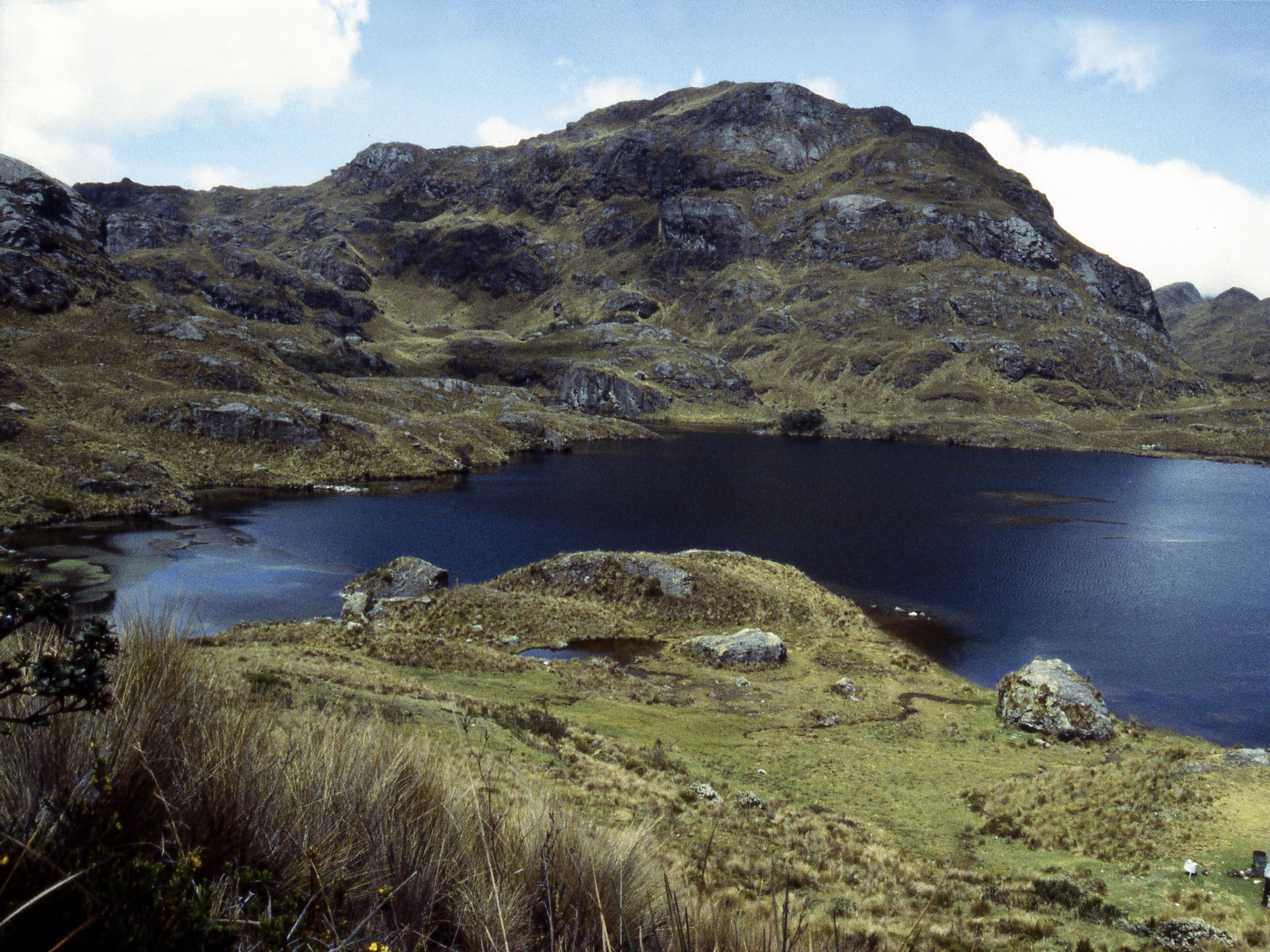
1. Cajas Route 1: Naturaleza e Historia Humana / Lagunas Unidas
Snapshot
Itinerary
From the La Toreadora visitor area, the route crosses classic Cajas paramo, small lakes, quenoa woodland and the Lagunas Unidas / Garcia Moreno historical-route sector. ETAPA lists Route 1, “Naturaleza e Historia Humana”, as 4.46 km, moderate, average altitude 3,900 m and 5:05 h. AllTrails/Komoot variants around Toreadora and Lagunas Unidas are slightly longer and faster, reflecting different loop choices.
The route is compact but should not be treated as lowland walking: boggy ground, thin air, fog and cold rain can slow progress.
Why it is essential
This is the best single short Cajas route for combining the park’s lake basin, paramo ecology, quenoa woodland and human-history interpretation near the main visitor hub.
Equipment
- Waterproof footwear
- Warm layer
- Rain shell
- Sun protection
- Water and snacks
- Offline map
- Trekking poles for wet ground
Hazards and notes
- Fog can make wayfinding difficult.
- Stay on signed paths to protect wetland vegetation.
- Visitor capacity controls apply in Cajas; check ETAPA/park guidance before visiting with a group.
GPX / KML links
| Source | URL | Format / access | Reuse status |
|---|---|---|---|
| ETAPA EP, Cajas routes table | etapa.net.ec | Official route-stat table; terms not stated | Official route reference; no GPX |
| AllTrails: Toreadora Lagoon — Patoquinoas Lagoon | alltrails.com | Source map; AllTrails terms apply | Nearby source-map variant |
External links
- ETAPA EP — Rutas y Senderos del Parque Nacional Cajas
- VisitCuenca — Cajas access by bus/car
- AllTrails — Toreadora Lagoon - Patoquinoas Lagoon
2. Sendero Uku / Laguna Llaviucu
Snapshot
Itinerary
Sendero Uku circles Laguna Llaviucu in the lower, greener eastern part of Parque Nacional Cajas. ETAPA lists the trail as 2.10 km, low difficulty, average altitude 3,167 m and 1 hour. The route gives an easier Cajas experience than the high La Toreadora routes, with lake-edge walking, bird habitat and forest/paramo transition.
Why it is essential
Llaviucu is the accessible low-elevation counterpoint to the high Cajas paramo. It represents the park’s lake and bird habitat for walkers who need a shorter route or a gentler acclimatisation day.
Equipment
- Hiking shoes; waterproof footwear after rain
- Rain layer
- Warm layer
- Water
- Sun protection
- Binoculars if birding
Hazards and notes
- Paths may be muddy and slippery.
- Respect wetland edges and any fishing, wildlife or visitor-capacity rules posted by the park.
- Dogs and off-trail walking should be checked against current protected-area rules.
GPX / KML links
| Source | URL | Format / access | Reuse status |
|---|---|---|---|
| ETAPA EP, Cajas routes table | etapa.net.ec | Official route-stat table; terms not stated | Official route reference; no GPX |
| OpenStreetMap search: Laguna Llaviucu | openstreetmap.org | Map geometry cross-check; OSM data is ODbL | Geometry cross-check only |
External links
- ETAPA EP — Rutas y Senderos del Parque Nacional Cajas
- VisitCuenca — Parque Nacional Cajas overview and access
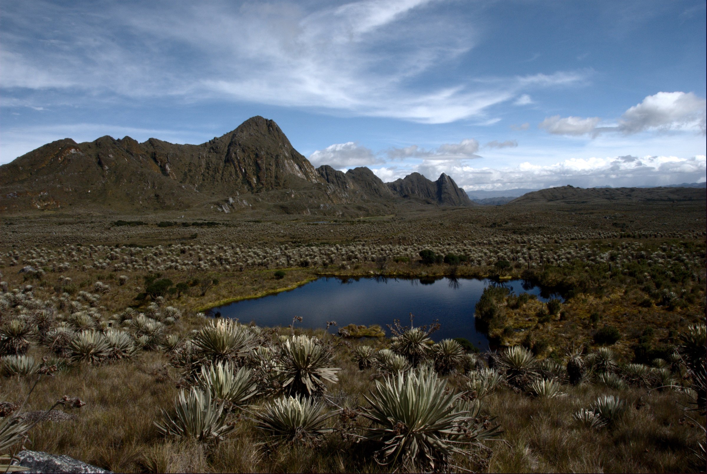
3. Camino del Inca: Laguna Luspa - Zorrocucho
Snapshot
Itinerary
This point-to-point route follows the historic Cajas highlands across lake basins, paramo and sections associated with the old Inca / pre-Hispanic route between the Andes and the coast. ETAPA lists “Camino del Inca y Lagunas Mayores” as Route 7, 18.49 km, high difficulty and 14:10 h. AllTrails records the Laguna Luspa - Zorrocucho line as 18.5 km with 725 m of ascent.
The long official time suggests a serious full-day traverse rather than a casual walk. It should be attempted only with reliable navigation, transport arranged at both ends and stable weather.
Why it is essential
The route is the historical backbone of Cajas hiking: it links the park’s lake landscape with the old Andean crossing that connected Tomebamba/Cuenca to the Pacific slope.
Equipment
- Sturdy waterproof boots
- Rain shell
- Warm layer
- Hat and gloves
- Food
- 2 litres of water or treatment method
- GPS/offline map
- Compass backup
- Headtorch
Hazards and notes
- Fog, bogs, cold rain, stream crossings and long distance are the main hazards.
- Because the route is point-to-point, missed transport can turn the day into a serious problem.
- Confirm whether a guide is required or recommended by the park for the chosen route.
GPX / KML links
| Source | URL | Format / access | Reuse status |
|---|---|---|---|
| ETAPA EP, Route 7 table entry | etapa.net.ec | Official route-stat table; terms not stated | Official route reference; no GPX |
| AllTrails: Inca Trail, Laguna Luspa — Zorrocucho | alltrails.com | Source map; AllTrails terms apply | Source-map reference only |
External links
- ETAPA EP — Rutas y Senderos del Parque Nacional Cajas
- AllTrails — Camino del Inca Laguna Luspa - Zorrocucho
- VisitCuenca — Cajas overview/access
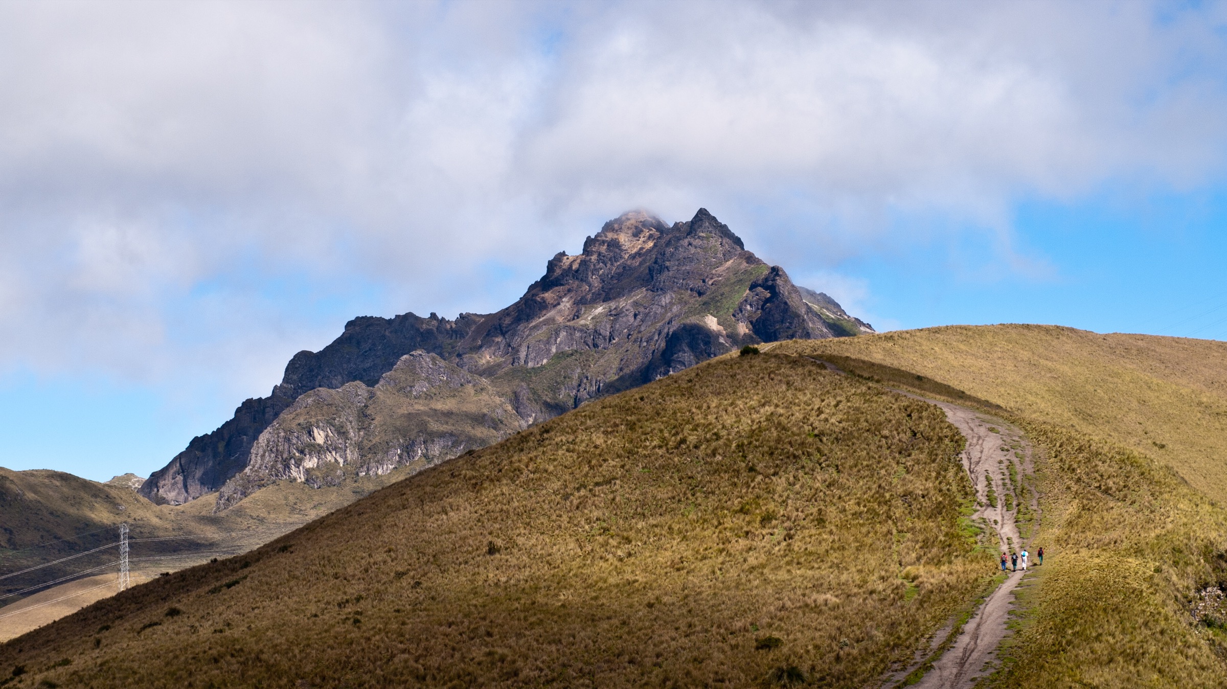
4. Podocarpus Cajanuma: Los Miradores
Snapshot
Itinerary
The Los Miradores / El Mirador route starts in the Cajanuma highland sector of Parque Nacional Podocarpus and climbs through cloud forest, elfin woodland and paramo-edge vegetation to viewpoints over the Loja, Vilcabamba and Malacatos valleys. Viajandox lists Los Miradores as a 5 km advanced circuit, while other summaries describe shorter El Mirador variants of about 3.5 km.
The exact line should be confirmed with the Cajanuma visitor staff, because Podocarpus has several short interpretive trails and longer routes that should not be confused with the multi-day Lagunas del Compadre trail.
Why it is essential
Cajanuma is the representative high-Andean entrance to Podocarpus. This route gives the region’s cloud-forest and paramo transition in a compact day walk close to Loja.
Equipment
- Waterproof boots
- Rain shell
- Warm layer
- Water and snacks
- Insect protection in warmer sections
- Offline map/GPS
Hazards and notes
- Expect mud, wet roots, cloud and limited visibility.
- Do not continue toward Lagunas del Compadre without the required time, guide support and permissions.
- Check current park hours and registration at Cajanuma.
GPX / KML links
| Source | URL | Format / access | Reuse status |
|---|---|---|---|
| Viajandox: Parque Nacional Podocarpus | viajandox.com | Route descriptions / no file; terms not stated | Descriptive source only |
| OpenStreetMap search: Cajanuma Podocarpus | openstreetmap.org | Map geometry cross-check; OSM data is ODbL | Geometry cross-check only |
External links
- Viajandox — Parque Nacional Podocarpus trail descriptions
- MAATE / Ambiente — Areas Protegidas Sierra 3, Podocarpus visitor sites (PDF)
5. Yacuri: Laguna Negra and Picachos de Jimbura
Snapshot
Itinerary
From the Lagunas Negras / Jimbura access area, the route visits Laguna Negra and climbs toward the Picachos de Jimbura rock viewpoints. The Municipio de Espíndola describes the Sistema Lacustre de Jimbura as a restricted-access lake system including Lagunas Negras, Laguna Bermeja, Laguna Los Patos and Laguna Natosa, with a downloadable route file notice. Wikiloc records a Picachos Jimbura source route of 2.91 km one way, 606 m ascent and maximum elevation 3,804 m.
The route should be planned with local access rules, as the municipality page describes restricted access and seasonal visiting windows.
Why it is essential
Yacuri adds the far-southern Ecuadorian paramo and border-region lake landscape to the Cajas-Loja entry. Laguna Negra and the Picachos are among the most recognisable day objectives in the Jimbura sector.
Equipment
- Sturdy boots
- Waterproof layer
- Warm clothing
- Gloves and hat
- Water and food
- Sun protection
- Map/GPS
- Trekking poles
- Extra insulation for wind on the Picachos
Hazards and notes
- Access restrictions, wind, fog, cold rain, steep ground and limited rescue access are the main concerns.
- The municipality notes strong winds in July-August.
- Confirm current permission, opening hours and whether a local guide is required before departure.
GPX / KML links
| Source | URL | Format / access | Reuse status |
|---|---|---|---|
| Municipio de Espíndola: Sistema Lacustre de Jimbura | espindola.gob.ec | Municipal source page with route-download prompt; terms not stated | Official local route reference; file not retrieved |
| Wikiloc: Picachos Jimbura | wikiloc.com | Source map / GPX availability via Wikiloc | Source-map reference only |
External links
- Municipio de Espíndola — Sistema Lacustre de Jimbura
- LojaEcuador — Parque Nacional Yacuri access overview
- Wikiloc — Picachos Jimbura
External links
| Source | URL |
|---|---|
| ETAPA EP — Rutas y Senderos del Parque Nacional Cajas | etapa.net.ec |
| VisitCuenca — Parque Nacional Cajas | visitcuencaecuador.com.ec |
| Viajandox — Parque Nacional Podocarpus | viajandox.com |
| MAATE / Ambiente — Areas Protegidas Sierra 3 (PDF) | ambiente.gob.ec |
| Municipio de Espíndola — Sistema Lacustre de Jimbura | espindola.gob.ec |
| LojaEcuador — Parque Nacional Yacuri | lojaecuador.com.ec |
| AllTrails — Camino del Inca Laguna Luspa - Zorrocucho | alltrails.com |
| AllTrails — Toreadora Lagoon - Patoquinoas Lagoon | alltrails.com |
| Wikiloc — Picachos Jimbura | wikiloc.com |