Regional overview
The central-Hunan upland connector is the lower, greener hill country that sits between the better-defined mountain blocks of the Xuefeng range (雪峰山) to the west, the Luoxiao range (罗霄山) on the Jiangxi border, the Wugong Shan (武功山) alpine grasslands further east, the Jinggangshan (井冈山) revolutionary forest park to the south-east, and the Nanyue Hengshan (南岳衡山) sacred mountain to the south. Walking character here is mostly managed forest-park and scenic-area hiking — short summit routes, reservoir-and-temple paths, waterfall valleys, bamboo and subtropical forest, rice-terrace view paths, and road-linked scenic stops — rather than the long alpine traverses that define the higher Xuefeng or the Luoxiao watershed. The defining high points are Seven Star Peak (七星峰, 1,607.9 m) on Dawei Mountain (大围山) in Liuyang, which is reported as the highest summit in eastern Hunan, and the Ziquejie rice-terrace amphitheatre (紫鹊界梯田) in Xinhua county, a 2,000-year-old terrace cultural landscape inscribed as a Globally Important Agricultural Heritage System.
Public route statistics are honestly thin. Unlike Wugong Shan or the Zhangjiajie / Wulingyuan area, many central-Hunan upland sites publish scenic-area descriptions but no downloadable GPX or KML tracks and no audited walking distances. For that reason, this catalogue keeps exact figures unresolved unless a source provides them and treats several routes as selected day-walk objectives for later GPS verification. The verification status field on each route distinguishes confirmed scenic-area features and verified summit elevations from unverified distance and ascent statistics.
The walking season runs March to May and September to November. April–May gives the cleanest spring flowers on Dawei and the azalea bloom on the upper Seven Star Peak; September–November gives the autumn-harvest gold on the Ziquejie terraces and the lowest crowd density of the year. June–August is hot (28-35 °C), humid and storm-prone, with afternoon thunderstorms developing quickly over the forest-park ridges and the stone-step routes becoming slippery. December–February is cool (3-12 °C) and damp, with occasional ice on the higher forest-park stone steps and the Heimi Peak summit road. Avoid the Qingming (early April) and National Day (early October) holiday weeks on Dawei, Heimi Peak and Ziquejie, when scenic-area ticket queues and Changsha-side day-trip traffic both spike.
Access is straightforward from Changsha (长沙) — the provincial capital sits on the Beijing–Guangzhou HSR mainline and the Shanghai–Kunming HSR line and is the natural hub for all five routes in this catalogue. Dawei Mountain and Heimi Peak are day-trip distance by self-drive or car-and-driver hire; Ziquejie requires a longer trip via Loudi (娄底) or Xinhua (新化); Ningxiang Fragrant Hills sits in the western suburbs of Changsha. Internal scenic-area shuttles and forest-park access roads carry the last-mile transport at each site.
For the higher Xuefeng range proper, see also the dedicated Xuefeng Mountains roundup where available, and the dedicated Wugong Shan, Jinggangshan and Nanyue Hengshan entries for the surrounding ranges. The present page is the connector catalogue for the central-Hunan upland country between those blocks.
Selection rationale
Five day-hikes are presented, spanning the essential walking set across the central-Hunan upland connector: the Dawei Mountain Seven Star Peak summit as the canonical eastern-Hunan high-forest walk, the Dawei Mountain Limu Bridge to Maweicao waterfall valley as the contrasting water-and-forest route on the same massif, the Ziquejie rice-terrace amphitheatre as the canonical cultural-landscape walk, the Heimi Peak reservoir, temple and summit loop as the most accessible Changsha-side summit walk, and the Ningxiang Fragrant Hills bamboo-and-gorge loop as the canonical lower-elevation forest-park entry.
The selection deliberately avoids duplicating the dedicated Wugong Shan, Jinggangshan, Nanyue and high-Xuefeng entries elsewhere on the site. Dawei Mountain appears twice because it is the strongest eastern-Hunan mountain park in this connector region and its summit and waterfall routes are genuinely different day-walk types. Several routes carry unresolved distance and ascent figures — the scenic-area authorities do not publish standardised route data and downloadable GPX/KML coverage is limited; this page distinguishes verified site features (park status, summit elevation, scenic-area sectors) from unverified route statistics. The dedicated Wugong Shan grassland traverse, the Jinggangshan revolutionary-park summits, the Nanyue Hengshan sacred-mountain stair and the high-Xuefeng watershed routes are out of scope here and covered in their own catalogues.
Summary
| # | Hike | Section | Route type | Distance | Gain | Max elevation | Difficulty |
|---|---|---|---|---|---|---|---|
| 1 | Dawei Mountain Seven Star Peak | Liuyang | Out-and-back summit candidate | ~5–10 km (est.) | Unresolved | 1,607.9 m | Moderate to hard |
| 2 | Dawei Mountain Limu Bridge to Maweicao | Liuyang | Out-and-back gorge-and-waterfall | ~4–8 km (est.) | Unresolved | Unresolved | Moderate |
| 3 | Ziquejie rice-terrace amphitheatre | Xinhua / Loudi | Linked viewpoint terrace walk | ~4–8 km (est.) | Unresolved | Unresolved | Easy to moderate |
| 4 | Heimi Peak reservoir, temple and summit | Wangcheng / Changsha | Loop or out-and-back | ~5–10 km (est.) | Unresolved | 590.5 m | Moderate |
| 5 | Ningxiang Fragrant Hills bamboo and gorge | Ningxiang / Changsha | Loop or out-and-back candidate | ~4–8 km (est.) | Unresolved | Unresolved | Moderate |
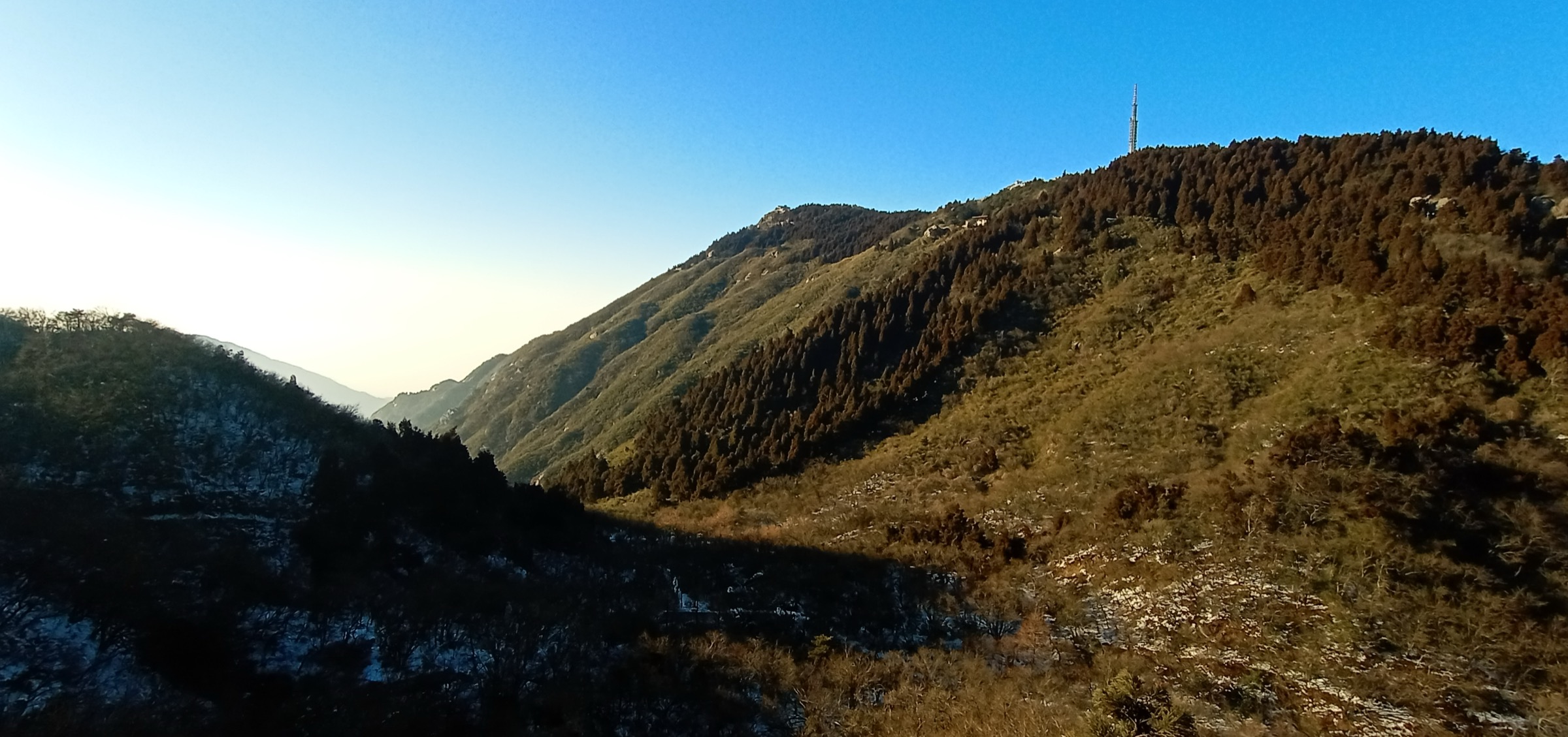
1. Dawei Mountain Seven Star Peak
Snapshot
Itinerary
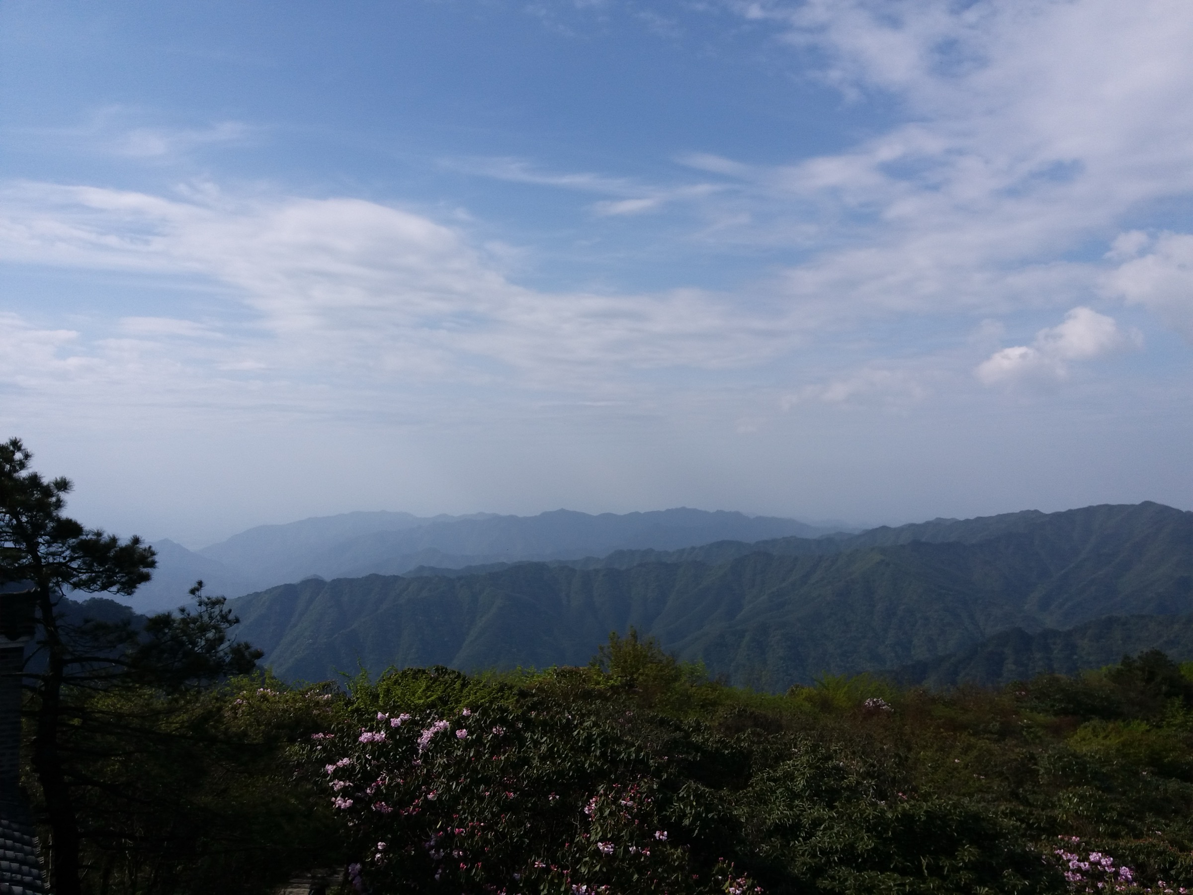
From the Dawei Mountain National Forest Park upper scenic access, follow the signed public stair-and-road network up the south flank of the Seven Star Peak (七星峰) ridge. The route passes through engineered stair sections in mid-elevation subtropical forest, then opens onto the upper azalea slopes — the canonical Dawei spring-flower zone, with mass colour in April–May — before topping out at the Seven Star Peak summit (1,607.9 m), the highest summit in eastern Hunan. Return by the same line; the back-side traverses are not formally signed for day-hikers and require local confirmation before committing.
Why it is essential
Seven Star Peak is the highest summit in eastern Hunan and the most important high-forest objective on the Hunan side of the northern Luoxiao uplands. The peak gives clean long-distance views over the Liuyang basin and east into the Jiangxi watershed country, and the upper azalea slopes are the canonical eastern-Hunan spring-flower set. As a single day this is the strongest natural-history walk in the central-Hunan upland catalogue.
Equipment
- Grippy walking shoes for the stair sections
- Trekking poles for the descent
- 2 L water and a snack
- Sun protection (the upper ridge is partly exposed)
- Rain shell and warm layer (summit is 8–10 °C cooler than the park base)
- Offline OSM map (back-side trail network is poorly documented)
- Cash or mobile payment for park entry and shuttle
Hazards and notes
- Fog rolls in quickly on the upper ridge; the engineered stair is wet and slippery in mist.
- Summer afternoon thunderstorms develop within an hour; descend immediately at first thunder.
- Stone steps freeze on the upper section December–February; light traction helps.
- Side paths off the main signed stair are unverified and may not connect.
- Park gate closes mid-afternoon in low season; confirm at the lower entrance before committing.
2. Dawei Mountain Limu Bridge to Maweicao waterfalls
Snapshot
Itinerary
From the Limu Bridge (栗木桥) access point on the lower west side of Dawei Mountain, follow the signed valley path upstream through stream, boulder and waterfall scenery. The route works through a sequence of small cascades, polished granite plunge pools and subtropical mixed forest on the engineered streamside stair. If the current park map links Limu Bridge to the Maweicao (马尾槽) waterfall group by signed public footpath, extend the walk to take in the additional cascades — Maweicao is the most concentrated waterfall section in the lower park; otherwise keep the route as a shorter out-and-back on the Limu Bridge corridor itself.
Why it is essential
This route represents the water-and-forest side of Dawei Mountain — a strong day-hike counterpoint to the high summit route on Seven Star Peak. The lower valleys hold the densest waterfall scenery in the park, and the engineered streamside stair gives sustained close contact with running water and subtropical forest — landscape character that no other route on the central-Hunan connector matches. As a half-day or paired-day combination with Seven Star Peak, this is the canonical Dawei “water day” entry.
Equipment
- Grippy walking shoes (stair gets greasy with spray and algae)
- Rain shell and quick-dry layer
- 1.5 L water and a snack
- Insect repellent in warm months (the streamside path attracts mosquitoes)
- Trekking poles for the wet-step descent
- Cash or mobile payment for park entry
Hazards and notes
- Wet stone, algae and high water after storms are the main hazards — do not enter streambeds or waterfall edges outside marked areas.
- Flash-flood risk in the lower gorge after upstream rain; leave the path and move uphill at first sign of rising water.
- Some side paths are closed seasonally; confirm at the gate before planning a full out-and-back to Maweicao.
- The lower park is at low elevation and uncomfortably hot midday in summer; aim for morning or late afternoon.
- Park gate hours vary; confirm at the Limu Bridge access before committing.
3. Ziquejie rice-terrace amphitheatre

Snapshot
Itinerary
From the Ziquejie scenic-area visitor centre at the lower edge of the amphitheatre, use the current scenic-area map to link public terrace viewpoints, village-edge paths and signed ridge viewpoints around the Ziquejie rice-terrace amphitheatre (紫鹊界梯田). The canonical loop links the main viewpoint platform with the Cattle Stone Rear (牛石后) ridge viewpoint above the central amphitheatre, drops onto the village-edge lanes between Yangchuan and Banzhuwan villages, and returns by the eastern ridge path past the Eight Diagrams Field (八卦田) pattern viewpoint. Keep to signed visitor routes and avoid entering planted terraces without permission.
Why it is essential
Ziquejie gives the central-Hunan upland catalogue a cultural-landscape walk rather than a summit objective — 2,000+ years of terrace cultivation across an amphitheatre that runs from roughly 500 m to 1,200 m on the eastern flank of the Xuefeng range, inscribed in 2018 as a Globally Important Agricultural Heritage System (GIAHS) by the FAO. The terrace system has no external irrigation source other than the cloud-saturated forest watershed above the terraces themselves, which makes the engineered hydrology a globally rare example of self-sustaining mountain agriculture. Walking value here is built on ridge views, field patterns and village-edge paths rather than a single summit, and the route gives the catalogue a contrast to the forest-park stair walking that dominates the rest of the connector region.
Equipment
- Comfortable walking shoes (terrace lanes can be muddy after rain)
- Rain shell
- Sun protection (the upper ridges are fully exposed)
- 1.5 L water and a snack
- Respectful clothing and behaviour around village and agricultural areas
- Camera (a polariser helps with the reflection-season terraces)
Hazards and notes
- Terrace edges are muddy and structurally fragile; do not walk on paddy walls or planted fields unless explicitly permitted.
- Some road sections carry scenic-area shuttle and local farm traffic with limited shoulder; walk on the inside.
- Respect village privacy — many houses are working family homes, not guesthouses.
- The reflection-season effect requires standing water on the terraces (April–May); the dry autumn walk is photogenic in a different register.
- Scenic-area entry fee applies; confirm at the visitor centre.
4. Heimi Peak reservoir, temple and summit

Snapshot
Itinerary
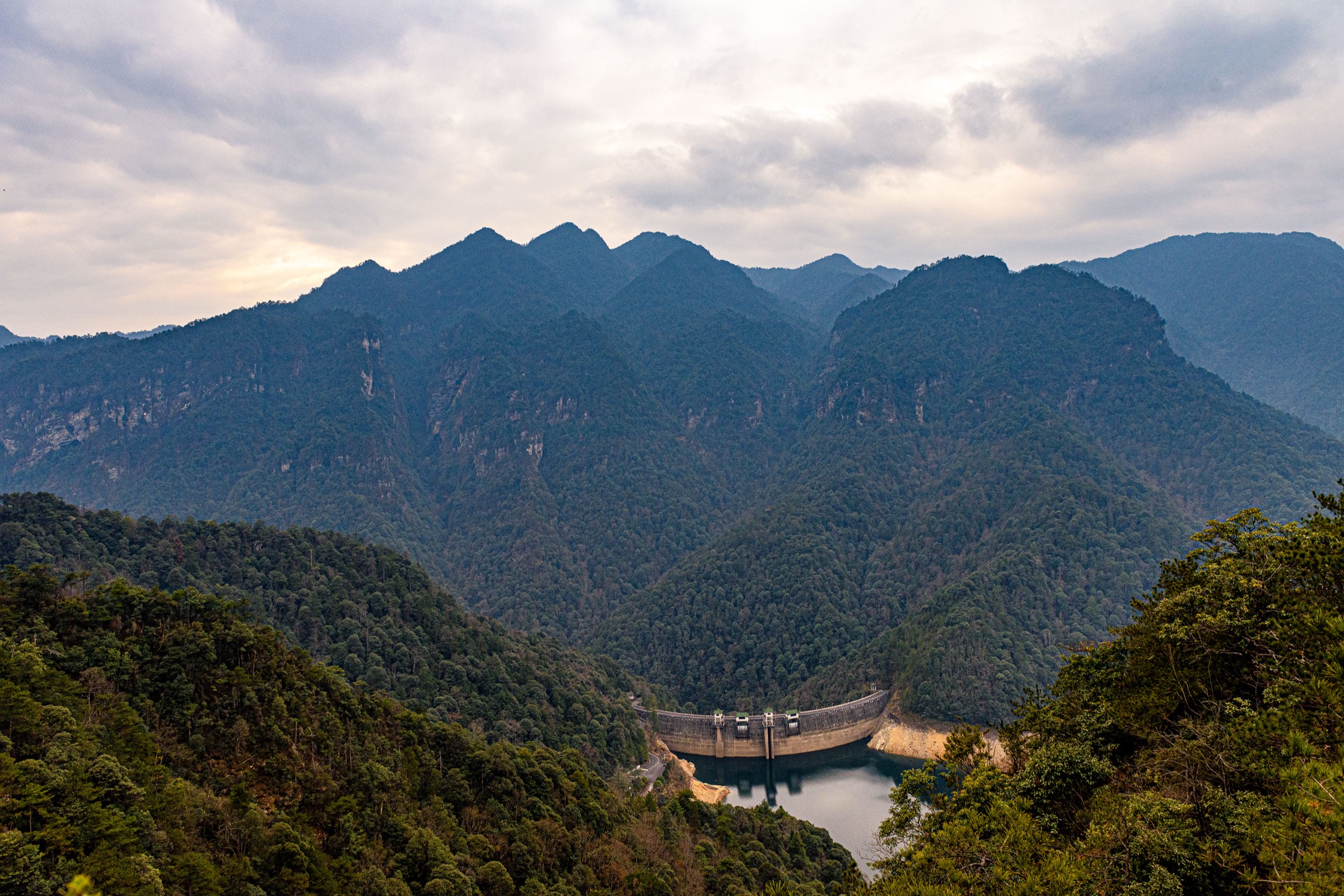
From the Heimi Peak National Forest Park entrance at the lower access road, follow the engineered park road and the linked summit stair up the south flank of the peak, passing the Heimi Peak Reservoir (黑麋峰水库) on the way up. The route continues to the Heimifeng Temple (黑麋峰寺) complex near the summit — a working Buddhist temple with morning ceremonies if you arrive at first light — and then the short final stair to the Heimi Peak summit (590.5 m) for the canonical sunrise viewpoint over the Wangcheng suburban basin. Return by the same route, or by a signed park loop if it is currently open.
Why it is essential
Heimi Peak is the most accessible true hill-summit walk on the Changsha side of the central Hunan uplands — close enough to the city for a sunrise day trip, high enough to clear the suburban haze, with a reservoir, temple and viewpoint sequence that gives the route a varied half-day character. The sunrise viewpoint is the canonical Changsha-side photo, and the working Heimifeng Temple anchors the walk culturally. As a low-commitment introduction to central-Hunan upland walking, this is the strongest single-day entry on the catalogue.

Equipment
- Walking shoes with grippy soles (stone steps are wet at dawn)
- 1.5 L water and a snack
- Rain shell
- Sun protection (the summit and reservoir are partly exposed)
- Headlamp if doing a legal pre-dawn start for the sunrise viewpoint
- Cash or mobile payment for park entry
Hazards and notes
- Road walking on the lower park road has light vehicle traffic; walk on the inside.
- Wet stone steps are slippery year-round, particularly at dawn after dew.
- Summer heat is uncomfortable on the engineered road and stair; aim for morning or evening.
- Park opening hours vary seasonally; for sunrise walks confirm the gate is open the night before.
- The summit temple is a working religious site; behave respectfully and do not enter restricted areas.
5. Ningxiang Fragrant Hills bamboo and gorge
Snapshot
Itinerary
From the Xiangshanchong Reservoir or Dragon Phoenix Gorge access points inside the Ningxiang Fragrant Hills (沩山) National Forest Park, use the current park map to link the reservoir shoreline path, the Dragon Phoenix Gorge (龙凤峡) streamside stair, the bamboo-forest corridors and the small waterfall features where the paths are open. If no full loop is currently signed, keep the walk as an out-and-back from the chosen scenic access. The route gives a mix of standing-water (reservoir), running-water (gorge stair) and dry forest-floor (bamboo) walking — landscape character that the higher-elevation Dawei routes do not offer.
Why it is essential
This route represents the lower, greener central-Hunan hill country — bamboo, reservoir, gorge, waterfall and old-road landscape rather than a high mountain summit. The Ningxiang Fragrant Hills is the closest substantial bamboo-forest walking on the western side of Changsha and gives the catalogue an easy half-day alternative to the steeper Dawei and Heimi Peak routes. The cultural anchor is Mishan Temple (密印寺) below the park’s eastern access — a Tang-dynasty Buddhist temple founded in 807 that is one of the oldest active religious sites in Hunan, and a natural before- or after-walk stop.
Equipment
- Grippy walking shoes (gorge stair is wet year-round)
- Rain shell and quick-dry layer
- 1.5 L water and a snack
- Insect repellent in warm months
- Offline OSM map (park signing is patchy)
- Cash or mobile payment for park entry
Hazards and notes
- Wet stone, algae and unclear side-path continuity are the main hazards.
- Bamboo-floor sections can hide drop-offs; stay on the engineered path.
- Seasonal closures of the gorge stair are common after typhoon-season rain; confirm at the gate.
- The forest park is well-trafficked on summer weekends; for a quieter walk choose a weekday or early morning.
- Route statistics and exact path continuity need local map or field-GPS confirmation before travel.
Routes excluded as out of scope
The following sit inside or adjacent to the central-Hunan upland connector but fall outside a day-hike entry in this catalogue, or duplicate routes covered in dedicated sister entries.
- Wugong Shan (武功山) grassland traverse. A multi-day alpine-grassland tramp on the Hunan–Jiangxi border, covered in its own dedicated entry; out of scope here as a tramp rather than a day-hike.
- Jinggangshan (井冈山) revolutionary forest park summits. The Luoxiao block on the Jiangxi border, covered in its own dedicated entry.
- Nanyue Hengshan (南岳衡山) sacred-mountain stair. The sacred-mountain stair walk south of Changsha, covered in its own dedicated entry.
- High Xuefeng range watershed routes. Long ridge traverses on the western Xuefeng range proper, covered in dedicated Xuefeng catalogues; out of scope here as multi-day tramps.
- Zhangjiajie / Wulingyuan sandstone-pillar circuits. The quartz-sandstone pillar landscape of northwestern Hunan, covered in dedicated entries; geographically separate from the central-Hunan connector.
Further reading
| Source | URL |
|---|---|
| FAO — Globally Important Agricultural Heritage Systems (Ziquejie listing) | fao.org |
| Hunan Provincial Department of Culture and Tourism | whhly.hunan.gov.cn |
| Changsha municipal tourism portal | visitchangsha.cn |
| Wikipedia — Dawei Mountain National Forest Park | en.wikipedia.org |
| Wikipedia — Heimi Peak | en.wikipedia.org |
| Wikipedia — Ningxiang Fragrant Hills National Forest Park | en.wikipedia.org |
| Chinese Wikipedia — Ziquejie rice terraces (紫鹊界梯田) | zh.wikipedia.org |
| Chinese Wikipedia — Seven Star Peak (七星峰, Dawei Mountain) | zh.wikipedia.org |
| Chinese Wikipedia — Mishan Temple (密印寺) | zh.wikipedia.org |
| OpenStreetMap — Dawei Mountain area | openstreetmap.org |
| OpenStreetMap — Ziquejie rice terraces | openstreetmap.org |
| OpenStreetMap — Heimi Peak | openstreetmap.org |
| OpenStreetMap (ODbL 1.0) | openstreetmap.org |