Regional overview
Mount Heng (衡山 / Héngshān), known almost universally in Chinese as Nanyue (南岳 / Nányuè, “Southern Sacred Mountain”), is the southernmost of the Five Great Mountains of China. It rises from the subtropical lowlands of central Hunan, straddling Nanyue District of Hengyang prefecture together with Hengshan and Hengdong counties, and is conventionally described as a chain of 72 peaks stretching about 150 km between Huiyan Peak in Hengyang and Yuelu Mountain in Changsha. The modern ticketed Nanyue Hengshan Scenic Area covers only the central cluster around Zhurong Peak (祝融峰, 1,300 m), the principal summit, named after the Chinese fire deity Zhurong. The bedrock is predominantly granite; the range belongs to the transition zone between the western Luoxiao and eastern Xuefeng systems. Despite occasional claims to the contrary on travel sites, Hengshan is not a UNESCO World Heritage Site — it appears on China’s UNESCO tentative list (submission 5353, 2008) as part of “The Four Sacred Mountains as an Extension of Mt. Taishan” and remains tentative as of 2026.
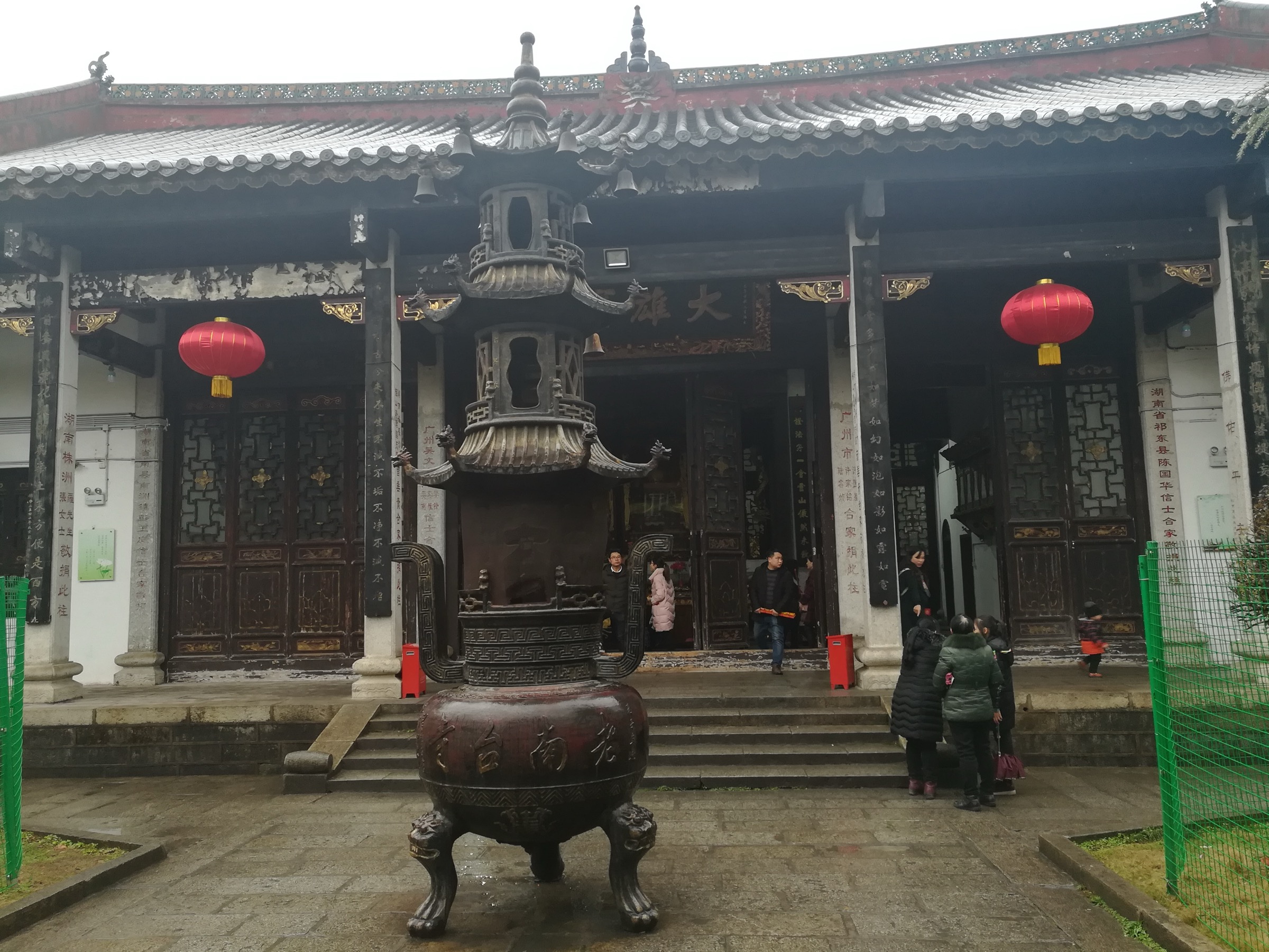
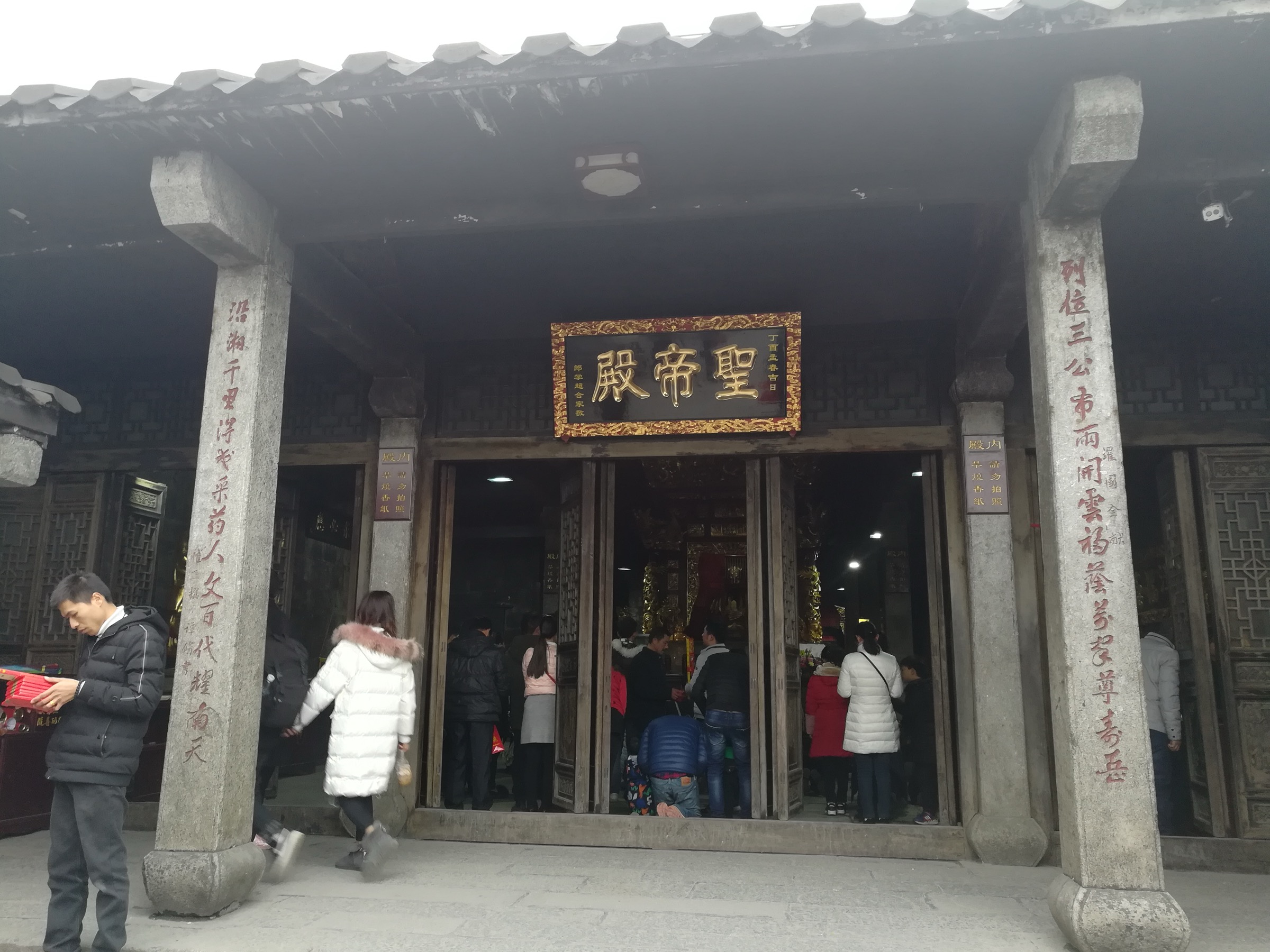
Hengshan’s significance is overwhelmingly cultural and spiritual rather than wilderness. The mountain has been a Daoist sacrificial site since at least the Han dynasty — imperial sacrifices to Nanyue are recorded by 110 BCE — and the present Grand Temple of Nanyue (南岳大庙) at the southern foot, first documented in 725 CE and rebuilt in 1882 in a layout modelled on the Forbidden City, is the largest classical temple complex in southern China. Above the temple, the wooded slopes hold four of China’s National Key Buddhist Temples in the Han Chinese Area: Zhusheng Temple, Fuyan Temple, Nantai Temple and Shangfeng Temple. Nantai Temple in particular is the 8th-century residence of Shitou Xiqian (石头希迁, 700–790), whose lineage gave rise to the Caodong (Sōtō), Yunmen and Fayan schools of Chan / Zen Buddhism, making Nanyue a genuine ancestral site for much of present-day East Asian Zen practice. Fuyan Temple holds a ginkgo (Ginkgo biloba) estimated at around 1,400 years old and traditionally attributed to the temple’s 6th-century founder Huisi.
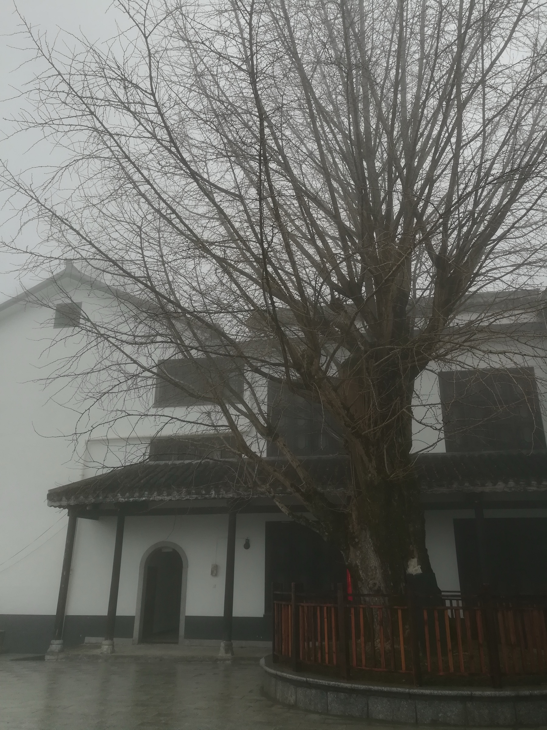
Botanically, Hengshan sits in the central Chinese subtropical evergreen broad-leaf forest belt. Vegetation grades from camphor, Schima, Cyclobalanopsis and Castanopsis stands at the base, through mixed broad-leaf and Pinus massoniana forest, to summit shrub, bamboo (including extensive Phyllostachys edulis groves) and grassland. Large old ginkgos are unusually common — Hunan is a documented hotspot for ancient Ginkgo biloba — and the upper ridge holds relict yews (Taxus chinensis) more than a millennium old. Climate is humid subtropical: mean annual temperature near the base is around 17–18 °C, the summit averages roughly 11 °C, summers are hot and very wet (May to August is the monsoon period), and winters are cool with occasional snow and rime ice on the upper ridge — heavily marketed as “Nanyue snow scenery” (南岳雪景).
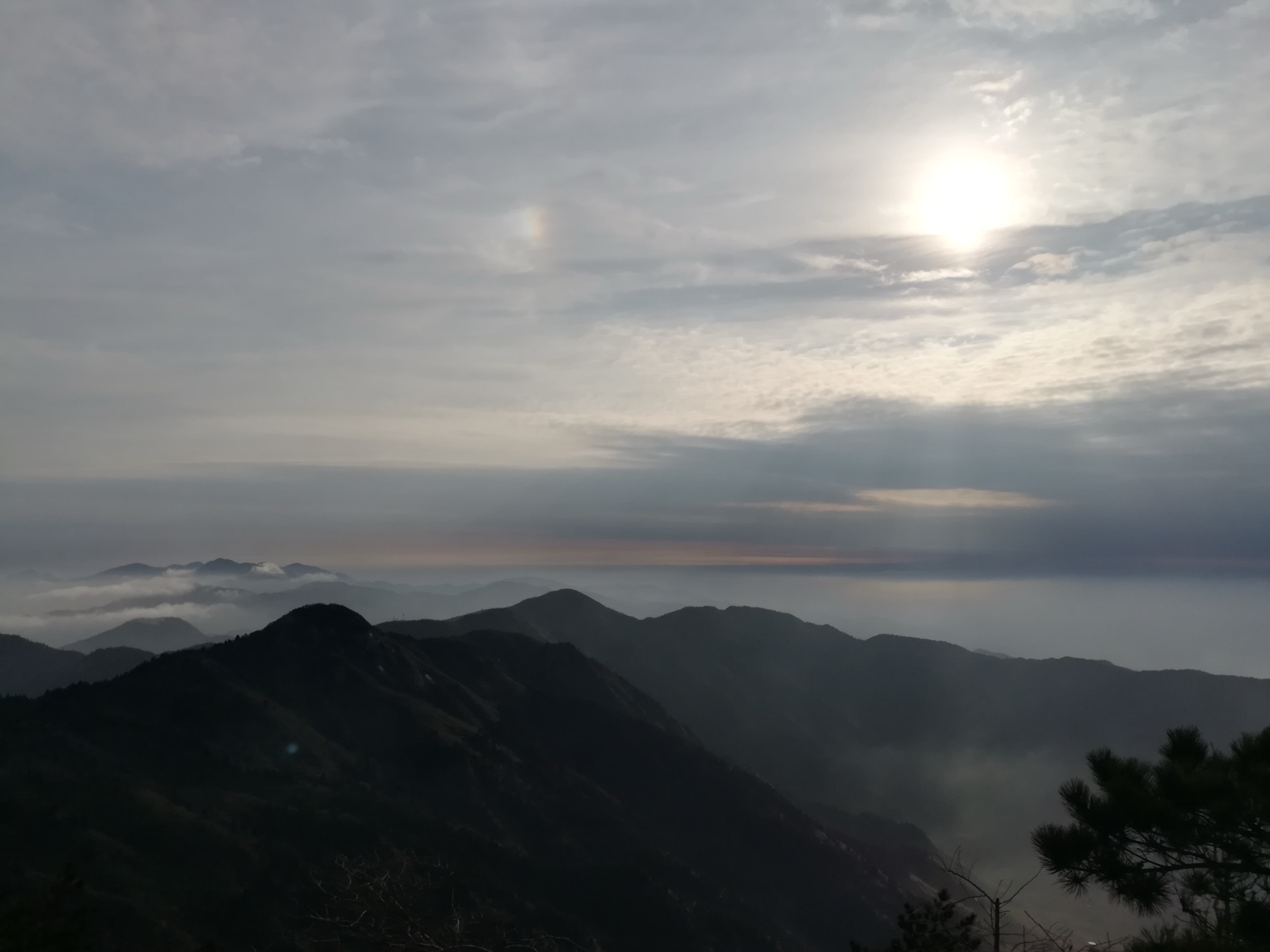
Hiking practicalities are unusual by Western standards and must be stated honestly. Nanyue is a fully developed, ticketed Class 5A scenic area: a single entrance ticket (around ¥100–120, with seasonal variation) is required for any access above the base zone, and the central pilgrim route from Nanyue Damiao to Zhurong Peak is paved or stone-paved staircase shared with electric shuttle buses, sedan-chair porters, vendors, and on festival days thousands of pilgrims. A cable car (Nanyue Suodao 南岳索道) connects a mid-mountain station near Banshanting with Nantianmen high on the ridge, and is used by most visitors at least one way; operating status has fluctuated in 2025–2026 and should be confirmed close to a visit. Wilderness in the Western sense is essentially absent. The appeal is cultural-spiritual, scenic — especially the famed sea-of-clouds sunrise from Zhurong — and ecological: a sustained tour through two thousand years of layered Daoist, Buddhist and Confucian architecture in a subtropical forest setting.
Selection rationale
The five hikes below were chosen to represent the genuine pedestrian character of Hengshan while avoiding overlap with sibling articles on Wugongshan, Jinggangshan and the wider central Hunan uplands. The set includes the classic full-foot pilgrim ascent from the Grand Temple to the summit; a lift-assisted summit ridge loop that is the experience most pilgrims and tourists actually have; a high-mountain temple circuit linking the three Chan Buddhist temples of the upper ridge; a quieter stone-paved walk through Fanyin Valley with the 1,400-year ginkgo and Huayan Lake; and the historical Zeng Guofan / North Mountain Pilgrim Ancient Path on the back-mountain side, the only Hengshan route that retains a recognisably pre-modern atmosphere. A Tianzhu Peak (天柱峰) route was investigated and rejected — public sources do not document a clearly defined and currently maintained day-hike trail, and including it would have required inventing route data.
Summary table
| # | Hike | Country | Route type | Distance | Gain | Max elevation | Difficulty |
|---|---|---|---|---|---|---|---|
| 1 | Nanyue Damiao to Zhurong Peak (classic pilgrim ascent) | China | Point-to-point | 10–13 km | 1,180–1,260 m | 1,300 m | Moderate |
| 2 | Nantianmen to Zhurong Peak summit ridge (lift-assisted) | China | Out-and-back | 3–4 km | ~250 m | 1,300 m | Easy |
| 3 | Fuyan – Nantai – Shangfeng Chan Buddhist circuit | China | Point-to-point | 6–8 km | 350–500 m | ~1,260 m | Easy–moderate |
| 4 | Fanyin Valley: Kangjialong – Huayan Lake – Yinzhou Academy | China | Point-to-point | ~9 km | 300–400 m | ~900 m | Easy |
| 5 | Zeng Guofan / North Mountain Pilgrim Ancient Path | China | Point-to-point | ~17 km | ~1,100 m | 1,300 m | Moderate–strenuous |
1. Nanyue Damiao to Zhurong Peak — classic pilgrim ascent
Snapshot
Itinerary
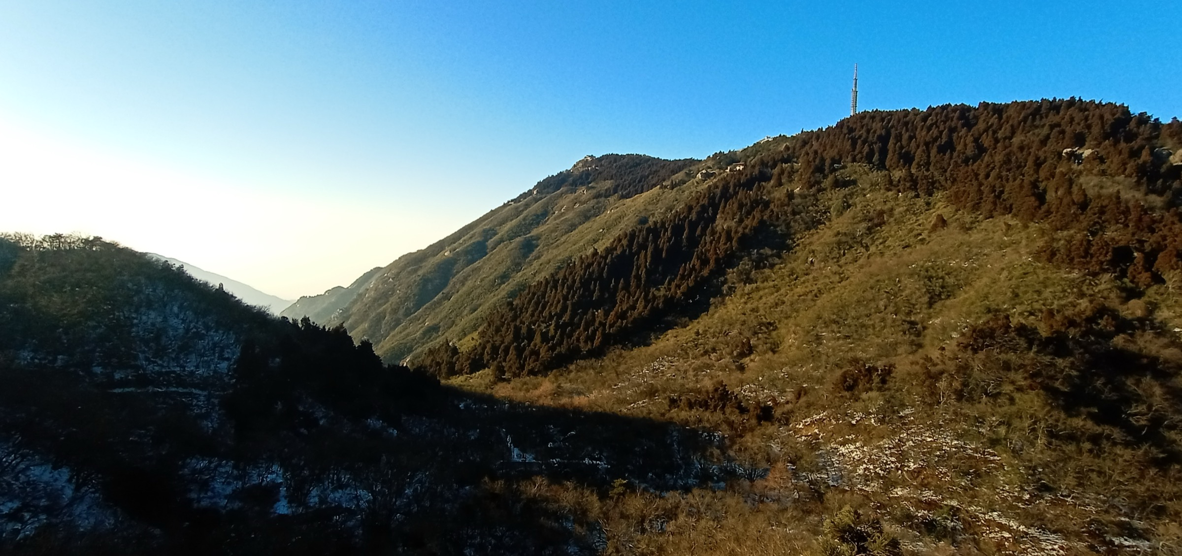
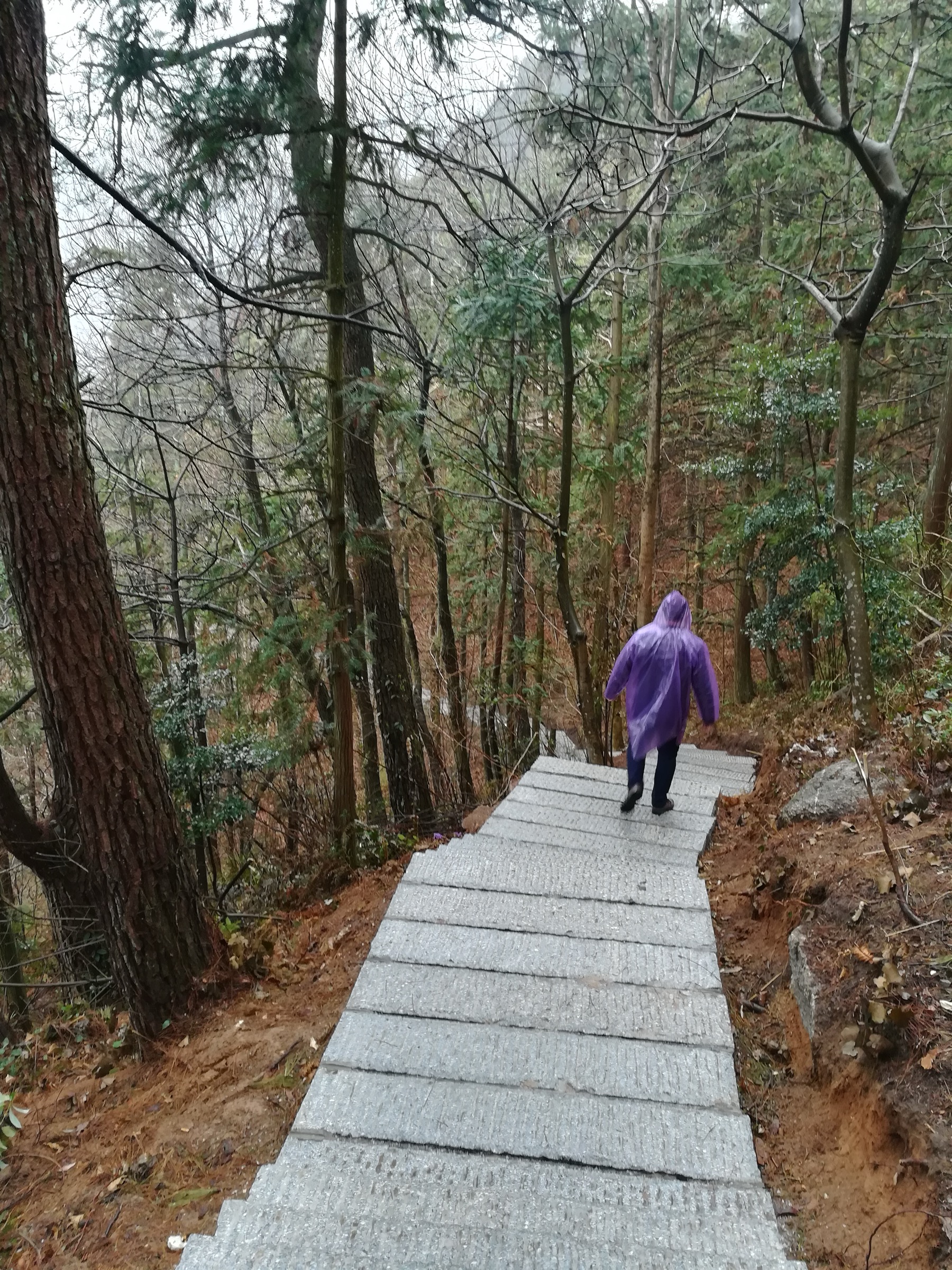
The route begins at the Shengli Archway, immediately behind the north exit of Nanyue Damiao in Nanyue town. From the archway a paved pilgrim avenue leads north into the lower forest, passing the Kangjialong ticket booth where the scenic-area ticket is checked. Above Kangjialong the formal Fanyin Valley gorge route diverges to the right, while the main pilgrim line continues directly upward via Huayan Lake and a series of small Buddhist halls and tea-houses, climbing through camphor, Cyclobalanopsis and Castanopsis broad-leaf forest.
The path reaches Banshanting (半山亭, “Half-Mountain Pavilion”) at roughly 650–700 m, the traditional rest point and the upper terminus of the modern electric shuttle road. From Banshanting the line passes Zizhulin Daoist Hall, Yehou Academy (associated with the Tang minister Li Bi), the Iron Buddha Temple, and Wuyue Hall before joining the Xiangnan Temple and Zushidian cluster. The gradient steepens to Nantianmen (南天门, “South Heavenly Gate”) on the upper ridge at around 1,100 m, where the cable car from Banshanting arrives.
From Nantianmen the path turns north along the summit ridge past Shizi Yan (“Lion Cliff”) and rises through bamboo and rime-frosted forest to Shangfeng Temple, the highest classical Buddhist temple on the mountain. Beyond Shangfeng a short stair climbs to the small granite summit platform crowned by Zhurong Hall — a Ming-period stone structure with an iron-tiled roof. The summit is famous for sea-of-clouds (云海) sunrises; pilgrims often overnight at Shangfeng Temple or take the first pre-dawn cable car to be on the summit at first light. Descent is normally by the same line on foot, by cable car from Nantianmen to Banshanting, or — most commonly — by a combination of cable car and the scenic-area shuttle bus.
Why it is essential
This is the historically definitive Nanyue ascent and the route walked by emperors, Daoist priests and Buddhist pilgrims for more than fifteen centuries. It connects the largest classical temple complex in southern China with the iconic stone summit hall of Zhurong, passing through the cultural core of the Five Great Mountains tradition and a continuous gradient of subtropical evergreen forest. No other walk on Hengshan combines the architectural, ritual and biogeographic story of the mountain in a single line.
Equipment
- Trail shoes (boots not essential — the path is paved stone throughout)
- Light rain shell
- Sun protection
- Water (refillable at temple stalls)
- Warm layer and gloves October–April
- Microspikes in January–February if rime or ice is reported
- Headtorch for a pre-dawn sunrise ascent
- Pre-purchased scenic-area ticket and, if intended, cable car ticket
- Cash or WeChat / Alipay for incense, water and shuttle bus
Hazards and notes
The path is paved throughout, low-exposure and well signed, but is shared with shuttle vehicles, sedan-chair porters and crowds. The principal hazards are slippery wet stone in the May–August monsoon, rime ice on the upper ridge in winter, and severe congestion at major festivals and on national holidays. Sea-of-clouds sunrise conditions are unpredictable. Wild camping is not permitted; the upper ridge is fully managed. Drone and pet rules inside the scenic area change periodically — check current notices on nanyuequ.com before travel.
GPX / KML links
| Source | URL | Format | Notes |
|---|---|---|---|
| OpenStreetMap | openstreetmap.org | OSM data (export GPX) | ODbL 1.0; reusable with attribution; main pilgrim line is well mapped |
| AllTrails community track | alltrails.com | GPX (account) | AllTrails ToS — personal use only |
| Nanyue Hengshan Scenic Area | nanyuequ.com | Maps only | No public GPX confirmed |
No official GPX is published. OpenStreetMap coverage of the main pilgrim line is good and can be used to construct a clean track manually.
Sources
- Wikipedia — Mount Heng (Hunan)
- Zhihu — 南岳衡山徒步攻略,路线和雷区一次全讲清
- zhiqiang.org — 南岳衡山祝融峰小路往返
- AllTrails — Mount Zhurong via Nanyue
- Wikivoyage — Mount Heng (Hunan)
- China Mountain Travel — Nanyue Hengshan Travel Guide
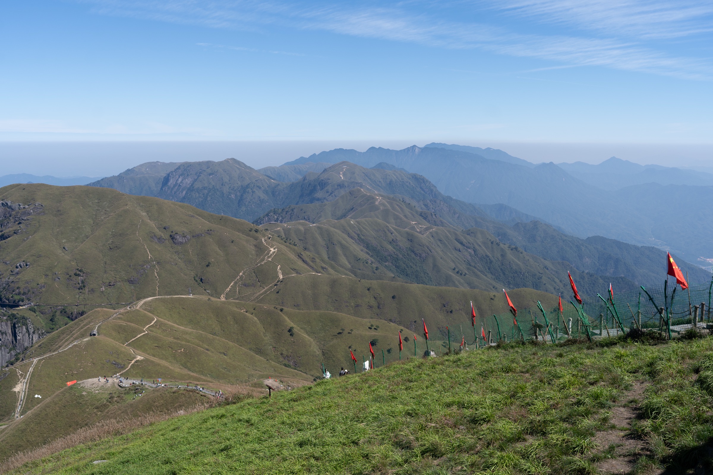
2. Nantianmen to Zhurong Peak — lift-assisted summit ridge
Snapshot
Itinerary
From the Nantianmen cable-car station the summit walkway leads north along the granite ridge. The first significant landmark is Shizi Yan (狮子岩, “Lion Cliff”), a viewpoint over the western valleys often used for sea-of-clouds photography. The path continues to Shangfeng Temple, originally established in the Sui dynasty (605–618 CE) on the site of an Eastern Han Daoist temple and later expanded under the Ming and Qing dynasties; the present buildings include the Hall of Four Heavenly Kings, the Mahavira Hall and bell and drum towers, all rebuilt after Second World War damage and the temple’s 1983 designation as a National Key Buddhist Temple in the Han Chinese Area.
Above Shangfeng the path climbs a final stone staircase to the summit platform of Zhurong Peak at 1,300 m, crowned by the small Ming-era Zhurong Hall — a stone structure with an iron-tiled roof dedicated to the fire deity Zhurong and to the southern direction in Wuyue cosmology. From the summit the views extend east across the Xiang River valley and west toward the Xuefeng range. The descent retraces the ridge back to Nantianmen and the cable car.
Why it is essential
For visitors who cannot or do not wish to commit to a full vertical ascent — including older pilgrims, families and most international visitors — this is the standard Hengshan summit experience and the one that delivers the iconic Zhurong sunrise on a manageable schedule. It is the only realistic way to combine first light at the summit with same-day travel from Hengyang or Changsha.
Equipment
- Standard hiking footwear
- Warm layer year-round (summit roughly 9 °C colder than the base)
- Wind shell, gloves and hat October–April
- Microspikes during rime / ice events
- Headtorch for pre-dawn sunrise walks
- Pre-purchased cable car tickets (first cable car in sunrise season may sell out — book via the scenic area’s WeChat mini-programme or at the lower station)
Hazards and notes
Crowding is the main hazard; the summit platform is small and at peak times is shoulder-to-shoulder. Stone stairs become slippery in rain or rime. Cable car operations can be suspended in high wind or thunderstorms — typhoon-tail systems in July–September are the most common cause, and the 2025–2026 service has reportedly been intermittent or extended-shuttle-replaced at points, so confirm operations close to a visit. No camping or drone use without prior scenic-area permission.
GPX / KML links
| Source | URL | Format | Notes |
|---|---|---|---|
| OpenStreetMap | openstreetmap.org | OSM data (export GPX) | ODbL 1.0; reusable with attribution |
| AllTrails community track | alltrails.com | GPX (account) | ToS — personal use only |
No official GPX; OSM is sufficient to construct the short summit-ridge line.
Sources
- Wikipedia — Shangfeng Temple
- Wikipedia — Mount Heng (Hunan)
- China Mountain Travel — Nanyue Hengshan Travel Guide
- Trip.com Moments — Zhurong Peak Travel Guide
3. Fuyan – Nantai – Shangfeng Chan Buddhist circuit
Snapshot
Itinerary
From Banshanting a short paved path leads east-northeast to Fuyan Temple (福严寺), founded in 567 CE by the Tiantai patriarch Huisi under the original name Bore Temple. The Song emperor Taizong personally inscribed the temple’s present name. Today the compound holds a Shanmen, Mahavira Hall, meditation halls and the Hall of the Holy Emperor of Mount Heng, alongside four ancient ginkgo trees — one estimated at roughly 1,400 years old and traditionally attributed to Huisi’s own planting.
A short connecting path drops west to Nantai Temple (南台寺), founded in 502–557 CE during the Liang dynasty by Master Haiyin. Nantai is considered the ancestral temple of the Caodong, Yunmen and Fayan schools of Chan Buddhism: the Tang-dynasty master Shitou Xiqian (700–790) resided here from the mid-8th century, and the lineage he transmitted through his disciples and grand-disciples seeded the present-day Sōtō Zen, Yunmen and Fayan houses. The temple was designated a National Key Buddhist Temple in 1983.
From Nantai the route rejoins the main pilgrim line and ascends gradually through bamboo forest past the Iron Buddha Temple, Yehou Academy and Wuyue Hall toward Nantianmen at ~1,100 m, then continues another 1.5 km along the ridge to Shangfeng Temple at roughly 1,260 m. Hikers with time and energy normally tag Zhurong Peak before descending by cable car or shuttle bus.
Why it is essential
This is the most religiously consequential walk on Nanyue. Within a half-day on foot it links three temples that together hold founder status for major branches of Chinese and Japanese Buddhism, plus one of China’s most-cited ancient ginkgo trees. Hengshan’s identity as a centre of southern Chan Buddhism — separate from its better-known Daoist Wuyue role — is most clearly experienced on this circuit.
Equipment
- Standard hiking footwear
- Modest temple-appropriate dress (covered shoulders, no shorts in the halls)
- Cash or WeChat / Alipay for incense and donations
- Warm layer above Nantianmen at any season
- Microspikes in winter rime events
Hazards and notes
Low-hazard walking. The temples are active religious sites — photography inside halls is restricted at all three. Some inner courts close to the public for retreats; check signs at each temple gate. The scenic-area ticket is required.
GPX / KML links
| Source | URL | Format | Notes |
|---|---|---|---|
| OpenStreetMap | openstreetmap.org | OSM ways and POIs | ODbL 1.0; reusable with attribution |
| FYSK Daoist Culture Centre Database | en.daoinfo.org | Reference only | Temple coordinates and history |
No official GPX; OSM is sufficient to assemble a clean circuit line.
Sources
- Wikipedia — Fuyan Temple
- Wikipedia — Nantai Temple
- Wikipedia — Shangfeng Temple
- Wikipedia — Shitou Xiqian
- China’s Key Temples blog — Nantai Temple
4. Fanyin Valley — Kangjialong to Yinzhou Academy
Snapshot
Itinerary
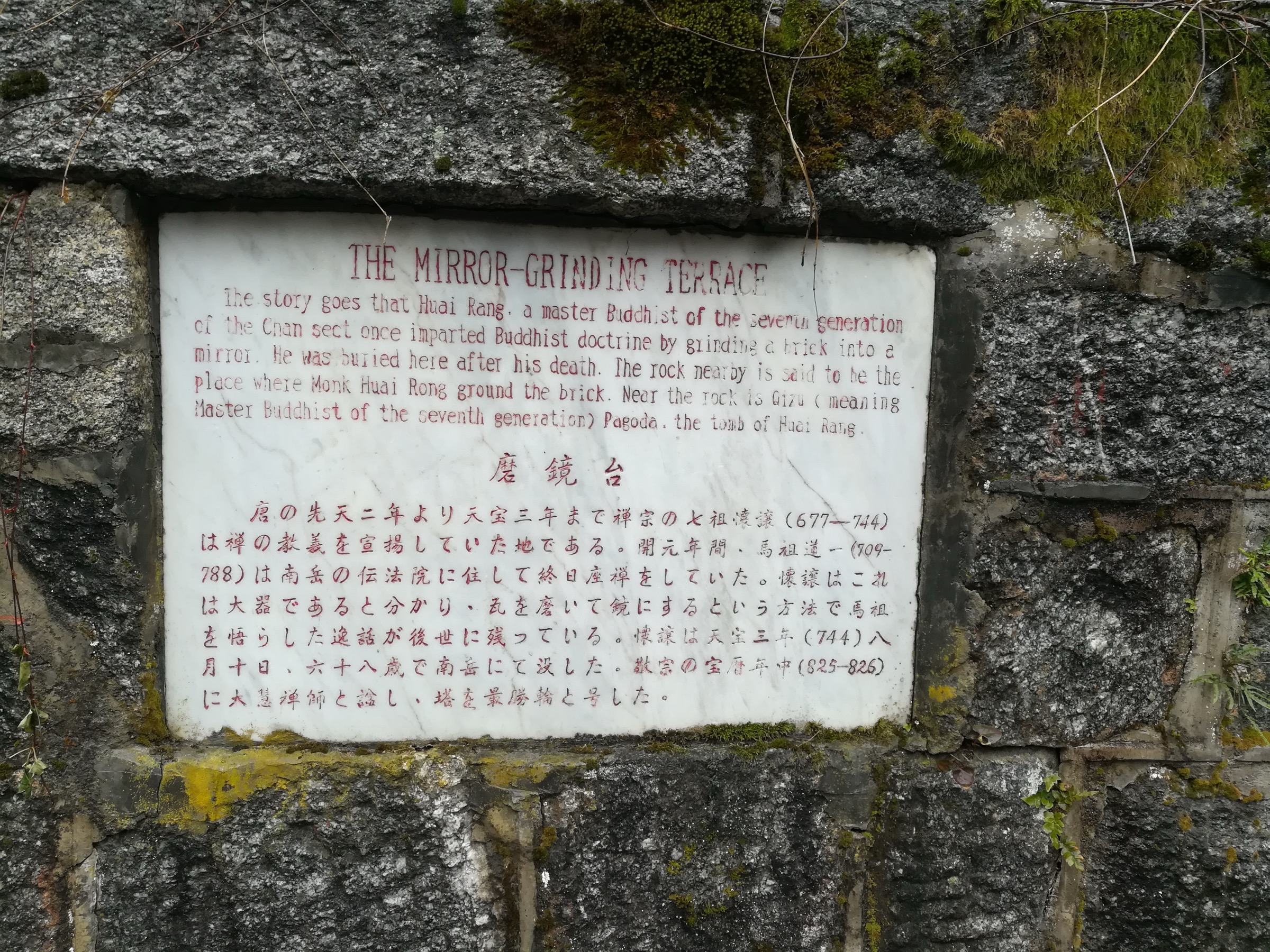
From the Kangjialong ticket booth above Nanyue Damiao, the Fanyin Gu (梵音谷, “Sanskrit Sound Valley”) path diverges right from the main pilgrim line into a wooded gorge. The route — described in Chinese-language hiking guides as the Fanyin Ancient Path (梵音古道, approximately 9 km) — climbs gently through subtropical evergreen broad-leaf forest along a perennial stream, passing Huayan Lake (华严湖), Yuban Bridge (玉板桥), Ledao Pavilion (乐道亭), Fanyin Pavilion (梵音亭) and the Zhonglie Shrine (忠烈祠), built in 1943 to commemorate Nationalist soldiers killed in the Second Sino-Japanese War. Higher up the path reaches Mojing Terrace (磨镜台, “Mirror-Grinding Terrace”), Lingzhi Spring (灵芝泉) and the Maguo (麻姑) and Yanhui (烟霞) immortal-realm pavilions before rejoining the main ridge near Yinzhou Academy.
This is the quietest of the four formal stone-paved trails in the central ticketed area: most visitors take the shuttle bus straight to Banshanting and so bypass the valley entirely. It threads three traditions — Buddhist (Fanyin / Huayan toponyms), Daoist (the immortal-realm pavilions) and modern Republican-era commemoration (Zhonglie Shrine) — alongside the best small-stream and lower-forest ecology in the scenic area.
Why it is essential
It is the only walk inside the main scenic area that delivers a quiet forest-and-stream experience, and it carries the most diverse single concentration of cultural landmarks at low elevation. As a complement to the high-ridge temple circuit, it gives a complete picture of the cultural and ecological zone below Banshanting that lift-assisted visitors otherwise skip entirely.
Equipment
- Standard hiking footwear with good grip — the stone path is slippery when wet
- Insect repellent May–September
- Scenic-area ticket
- Carry water; the stream is not consistently safe to drink
Hazards and notes
Low hazard. Paths can be very slippery in monsoon rain. Some pavilions and shrines have restricted hours.
GPX / KML links
| Source | URL | Format | Notes |
|---|---|---|---|
| OpenStreetMap | openstreetmap.org | OSM data (export GPX) | ODbL 1.0; lower-valley coverage is partial — on-the-ground field check recommended |
No official GPX. Coverage of the Fanyin Valley path on OpenStreetMap is partial and would benefit from a field-collected track.
Sources
- qi18.com — 朝圣古道-衡阳市南岳区朝圣古道旅游指南
- m.hy.bendibao.com — 南岳衡山游玩攻略
- Zhihu — 五岳之南岳衡山——最全攻略(避雷指南)
- Ctrip — 南岳衡山:还你清净的徒步古道
5. Zeng Guofan / North Mountain Pilgrim Ancient Path
Snapshot
Itinerary
The “North Mountain Pilgrim Ancient Path” (北山朝圣古道) was the historical route used by pilgrims from the Xiangxiang and Xiangtan plains, north and west of Hengshan proper, to reach the Wuyue summit. It is documented from at least the mid- and late Tang dynasty, with Southern Song Jingding-era stone inscriptions still in place along the ridge, and was rebuilt and re-paved in the Qing Tongzhi period under the patronage of the Zeng brothers (Zeng Guofan 曾国藩 and Zeng Guoquan 曾国荃) — for which reason it is commonly known today as the Zeng Guofan Ancient Path.
From Hongqi Primary School in Longfeng Township the path crosses agricultural ground and enters the forest, climbing roughly 7 km along a ridge spine that links a series of named landmarks: Baoxin Ling (宝信岭), Wuyue Hall (the back-mountain instance), Ganlu Pavilion (甘露亭) and the small temple complex at Huixian Bridge (会仙桥). At Huixian Bridge the route joins the upper portion of the central scenic area, and most through-hikers continue past Shangfeng Temple to Zhurong Peak — an additional ~3 km and several hundred metres of climb. The full Longfeng-to-Zhurong line is given by Chinese hiking-club sources as approximately 17 km with about 1,124 m cumulative gain, taking a fit walker 6–8 hours.
The lower and middle sections retain genuine traditional character: hand-cut stone steps, Song- and Qing-era inscriptions on boulders, traditional rest pavilions, and very few or no commercial stalls. The path crosses into the ticketed scenic-area zone only in the upper part; visitors should expect to buy a ticket at the upper checkpoint if continuing past Huixian Bridge.
Why it is essential
This is the surviving pedestrian counterpart to the heavily developed front-mountain pilgrim line, and the only Hengshan walk that retains a recognisably pre-modern atmosphere along most of its length. It is also the route most directly associated with named historical patrons — the Zeng brothers and the network of late-Qing Hunanese statecraft — making it the strongest single hike on the mountain for visitors with an interest in late-imperial Chinese history rather than only Daoist or Buddhist heritage.
Equipment
- Sturdy boots (uneven traditional stonework and bare earth)
- Trekking poles useful on the unimproved sections
- Full water for the day (1.5–2 L); no resupply between Longfeng and the upper temples
- Food
- Full waterproofs
- Offline map plus GPS navigation backup
- Headtorch for late finishes
- Basic first aid including snake-bite awareness
- Microspikes in winter ice conditions
Hazards and notes
Markedly less developed than the front-mountain trails. Trail signage is intermittent. Leeches occur in summer; vipers (notably Trimeresurus stejnegeri) are present in lowland forest. Mobile reception is patchy along the ridge. The ticket boundary inside the upper zone is enforced; walkers planning a through-hike to Zhurong must carry a scenic-area ticket or buy one at the upper checkpoint. In winter the upper ridge holds ice well into late February.
No licence-compatible image specifically of this route was located in this pass — most extant photos sit on Chinese travel blogs without explicit reuse licences.
GPX / KML links
| Source | URL | Format | Notes |
|---|---|---|---|
| OpenStreetMap | openstreetmap.org | OSM ways | ODbL 1.0; partial coverage; reusable with attribution |
| Hengyang municipal government feature | hengyang.gov.cn | Government feature article | Reference only |
| Hengyang Culture & Tourism Bureau notice | hengyang.gov.cn | Government announcement | Reference only |
No official GPX. OSM coverage of this back-mountain line is partial, and the lower and middle sections in particular would benefit from a field-collected track.
Sources
- qi18.com — 朝圣古道-衡阳市南岳区朝圣古道旅游指南
- Hengyang municipal government — 徒步曾国藩古道,一路风景独好
- Hengyang Culture & Tourism Bureau — 南岳区发布古道旅游线路
- 天涯户外 — 2024年南岳衡山跨年迎新登高祈福徒步节3日
- Zhihu — 南岳衡山徒步攻略
External links
| Source | URL |
|---|---|
| UNESCO World Heritage Centre — Four Sacred Mountains as an Extension of Mt. Taishan (tentative list, 2008) | whc.unesco.org |
| Hunan Provincial Department of Culture and Tourism — Mount Heng 5A page | whhlyt.hunan.gov.cn |
| Nanyue Hengshan Scenic Area (official, Chinese) | nanyuequ.com |
| Wikipedia — Mount Heng (Hunan) | en.wikipedia.org |
| Wikipedia — Grand Temple of Mount Heng | en.wikipedia.org |
| Wikipedia — Fuyan Temple | en.wikipedia.org |
| Wikipedia — Nantai Temple | en.wikipedia.org |
| Wikipedia — Shangfeng Temple | en.wikipedia.org |
| Wikipedia — Shitou Xiqian | en.wikipedia.org |
| Wikipedia — Sacred Mountains of China | en.wikipedia.org |
| Wikipedia — National Key Buddhist Temples in Han Chinese Area | en.wikipedia.org |
| Wikivoyage — Mount Heng (Hunan) | en.wikivoyage.org |
| FYSK Daoist Culture Centre Database — Great Hengshan Temple | en.daoinfo.org |
| China Mountain Travel — Nanyue Hengshan Travel Guide | chinamountaintravel.com |
| Lonely Planet — Heng Shan attraction page | lonelyplanet.com |
| AllTrails — Mount Zhurong via Nanyue | alltrails.com |
| Xie et al. (2024) — Distribution pattern of large old Ginkgo biloba in China | onlinelibrary.wiley.com |
| Wikimedia Commons — Mount Heng (Hunan) category | commons.wikimedia.org |
| OpenStreetMap — Nanyue Hengshan area (ODbL 1.0) | openstreetmap.org |