Regional overview
The “central Hunan uplands” do not correspond to any single named range. They occupy the inter-range hill country squeezed between the Xuefeng Shan (雪峰山) escarpment to the west, the Luoxiao Shan (罗霄山) – Wugong – Jinggang barrier on the Jiangxi border to the east, the Wuling Shan and the Yuanjiang basin to the northwest, and the sacred Heng Shan (Nanyue, 衡山) massif to the south. Administratively the region overlaps parts of Loudi, Yiyang, Hengyang, Xiangtan, Zhuzhou, Changsha and Yongzhou prefectures. Elevations are mostly modest — peaks generally between about 500 m and 1,700 m, with only Yongzhou’s Jiuyi Shan reaching beyond 1,800 m — but local relief from rice-paddy valley floors at 80–200 m to forested summits can be substantial.
Lithology is unusually varied. The eastern margin around Liuyang and Pingjiang is dominated by Mesozoic granite intrusions that have weathered into rounded domes and tor-like outcrops (Daweishan, Lianyunshan). The Anhua–Xinhua corridor along the upper Zijiang exposes a long band of Cambrian–Ordovician slate, shale and metamorphosed sandstone — the geological cradle of the historic Meishan (梅山) cultural area. South-central Hunan around Lianyuan, Shaoyang and Hengyang contains extensive Carboniferous–Permian limestone and karst plateaus dissected by the Lian, Zi and Xiang river systems. Around Yongzhou and Ningyuan the bedrock is again largely granite and gneiss, with Jiuyi Shan forming a distinct ridge belt rising sharply above the karst lowlands of the southern Xiang basin.
Culturally the region is denser than its modest topography suggests. The Anhua–Xinhua Meishan zone is the homeland of Meishan Daoism and Meishan martial arts (recognised as national-grade intangible cultural heritage in 2014). Yongzhou and Ningyuan hold the Mausoleum of Emperor Shun (舜帝陵) at Jiuyi Shan — one of the oldest recorded ancestral tombs of Han civilisation. Xiangtan has Shaoshan (韶山), Mao Zedong’s birthplace and one of the highest-visiting “red tourism” sites in China. Liuyang and the Changsha periphery hold Tang- and Song-foundation Daoist cave-mountains such as Heimi Feng (黑麋峰, the 24th of the 三十六小洞天). The hiking on these mountains is rarely internationally celebrated, but each summit anchors a substantial local pilgrim or domestic-tourist tradition.
The climate is humid subtropical. Hiking season runs roughly March to November, but May–June brings the East Asian “meiyu” monsoon rains and July–August deliver heavy humidity, frequent thunderstorms and heat indices above 35 °C. Best windows are late March to early May (azalea, rapeseed and rhododendron bloom), late September to mid-November (ginkgo and maple colour, stable air), and dry days in early winter. Winter snowfall is light and patchy but freezing rain can glaze upper paths above 1,200 m on Daweishan, Yangming Shan and Jiuyi Shan from December to February. Access is overwhelmingly by long-distance bus or a combination of high-speed rail (Beijing–Guangzhou and Changsha–Kunming HSR corridors) followed by a county-level taxi or shuttle. Trails are mostly stepped-stone pilgrim paths or service roads with cable-car or shuttle-bus options near the summits; way-marking is in Chinese only, English-language route information is sparse, and offline mapping (OSM or AMap) is essential.
Selection rationale
This entry deliberately picks hikes that do not belong to the four sibling regions already covered: Xuefeng Mountains proper (which absorbs Daxiongshan 大熊山, explicitly described in Chinese sources as the “腹地 hinterland of Xuefeng”), Wugong Shan, Jinggang Shan, and Hengshan (Nanyue). What remains is a genuinely transitional hill country, less internationally documented than any of those four. The five hikes were chosen to span the eastern granite belt (Daweishan, Liuyang), the Daoist cave-mountain ring around Changsha (Heimi Feng), the central red-tourism core (Shaoshan, Xiangtan), the southern sacred range (Jiuyi Shan, Ningyuan) and the southern central nature reserve (Yangming Shan, Shuangpai). Each hike anchors a recognised national-grade designation — National Forest Park, National Nature Reserve, National Scenic Area, or AAAAA/AAAA cultural site — and all five are completable within a single day by fit walkers under normal conditions.
No licence-compatible GPX files were located for any of the five hikes during research; OSM nodes for named summits and trailheads are the only open-data positional reference. Photo coverage on Wikimedia Commons is uneven — strong for Yangmingshan, Heimi Feng and Shaoshan, essentially absent for Jiuyi Shan and Daweishan summit — and is honestly reflected in the image selection below.
Summary table
| # | Hike | Country | Route type | Distance | Gain | Max elevation | Difficulty |
|---|---|---|---|---|---|---|---|
| 1 | Daweishan — Qixing Peak from Limu Bridge | China | Out-and-back (shuttle-assisted) | 8–14 km | 400–900 m | 1,608 m | Moderate |
| 2 | Yangming Shan — Wanshou Temple to Wangfotai | China | Out-and-back | 6–10 km | 300–500 m | 1,624.6 m | Easy–moderate |
| 3 | Jiuyi Shan — Shun Mausoleum to Sanfen Rock | China | Out-and-back | ~12 km | ~1,000 m | 1,822 m | Strenuous |
| 4 | Heimi Feng — Heimi Temple ancient path loop | China | Loop / out-and-back | 5–8 km | 350–450 m | 590.5 m | Easy |
| 5 | Shaoshan — Shaofeng Peak Stele Forest loop | China | Loop / out-and-back | 4–6 km | 250–350 m | 518.9 m | Easy |
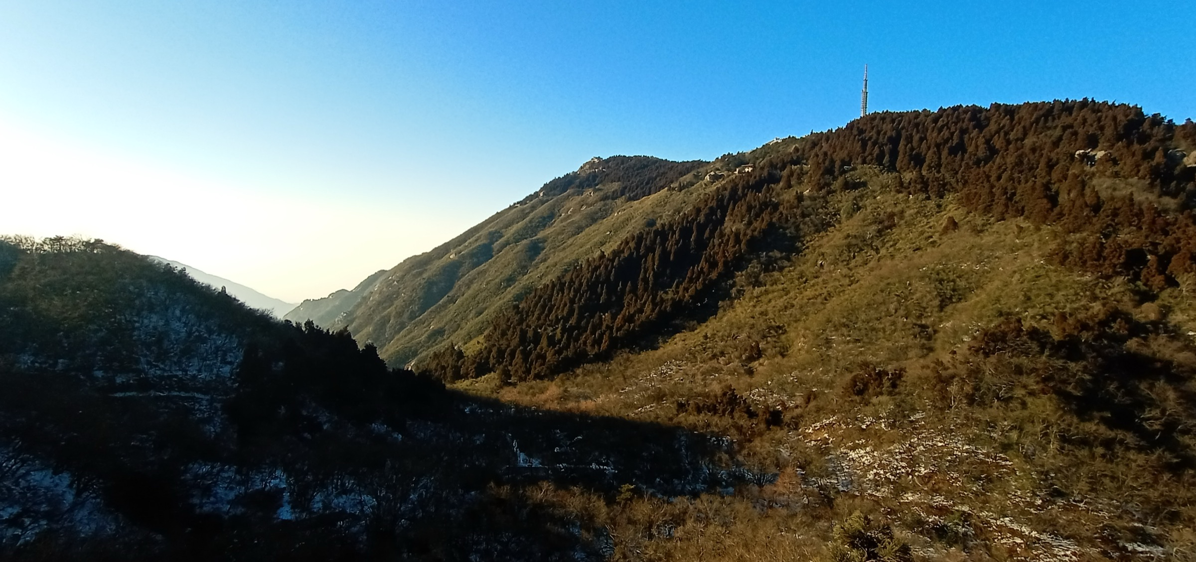
1. Daweishan — Qixing Peak from Limu Bridge
Snapshot
Note: no open-licence summit photograph of Daweishan was located during research; Wikimedia Commons coverage of the mountain is limited to a single unverified shrine image.
Itinerary
The standard one-day circuit enters from the West Gate. The first section walks the Limu Bridge Scenic Area (栗木桥), a 1–1.5 hour stream-side loop past Fenglin Waterfall, the source springs of the Liuyang River, and a series of granite plunge pools that the park markets as the “essence of Dawei Mountain”. Walkers then return briefly to the road junction and catch the internal shuttle bus to the Honglian Temple Service Area (红莲寺服务区) at roughly 1,200 m. The temple itself, a small Tang–Song foundation, sits in a clearing surrounded by Chinese fir.
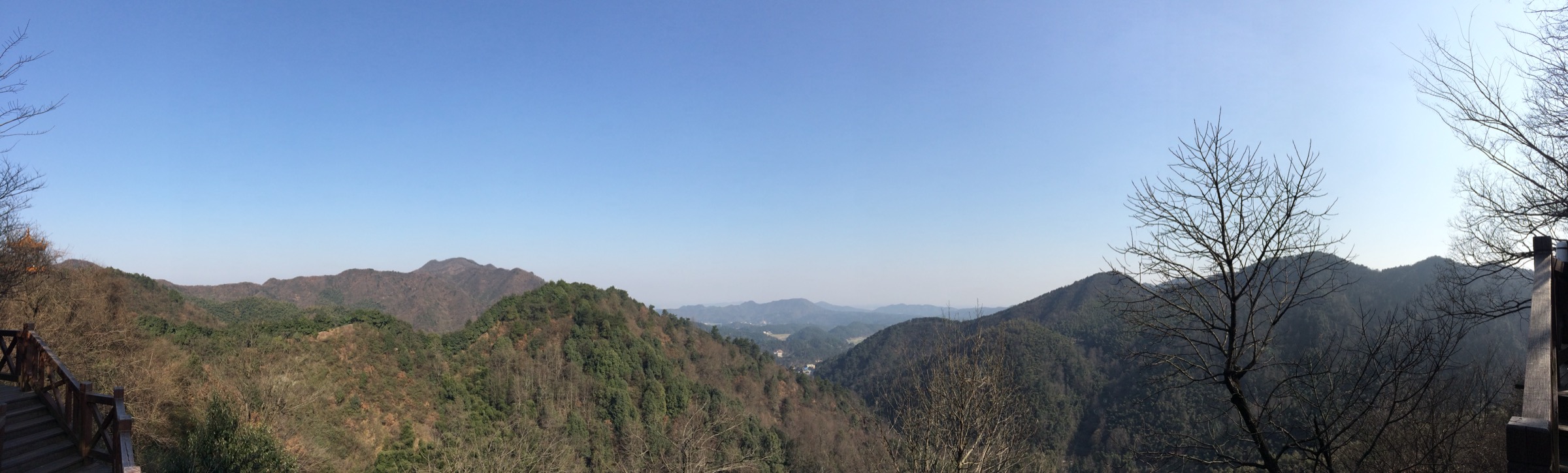
From Honglian Temple the route ascends a paved stone-step path through bamboo and broadleaf forest, joining the alpine-meadow zone above approximately 1,500 m. The final 1.5–2 km open onto the Qixing Ling alpine meadow, an unusual high-elevation grassland for this latitude of Hunan, with summit views over the rolling hill country towards Jiangxi to the east, Pingjiang to the north and the upper Liuyang River catchment to the south. The named summit Qixing Feng is reached by a short final stair; the park signs cite 1,607.9 m. Walkers descend by the same path, or take the cable car back down to Honglian Temple and then to the West Gate.
Why it is essential
Daweishan is the most accessible high-relief summit in the eastern central-Hunan uplands and the only one in this entry that exceeds 1,600 m. Its position on the Hunan–Jiangxi border places it geologically between the Luoxiao and Mufu ranges; the alpine meadow at 1,500 m is botanically distinctive and the late-April rhododendron bloom along the upper ridge is documented in Chinese provincial-tourism media as one of the largest in central Hunan. The park is also Hunan’s most active mountain-cycling and skiing venue, with the only sustained winter snow on a summit east of Xuefeng.
Equipment
- Sturdy boots, weatherproof shell, warm midlayer (the summit is 5–8 °C cooler than Liuyang town year-round)
- Trekking poles helpful on the long stone-step descent
- 2 L water minimum; refill at Honglian Temple service area only
- Sun protection for the open upper meadow
- Cash in CNY for park entry, internal shuttle and cable car; foreign payment cards are not reliably accepted
- Microspikes or chained boots from late December through February when the upper steps may be glazed
Hazards and notes
The mountain receives substantial summer thunderstorm activity; afternoon storms are common June–August and the meadow ridge offers little shelter. Freezing rain and “wu song” rime-ice frequently coats the upper section in winter — the park may close above Honglian Temple during these episodes. The path is well-marked in Chinese characters only. Park gate ticket and internal shuttle are separate fees. Drone flying is restricted near the temple complex.
GPX / KML links
| Source | URL | Format | Notes |
|---|---|---|---|
| OpenStreetMap | openstreetmap.org | OSM data (export GPX) | ODbL 1.0; reusable with attribution. Search “七星峰 大围山” |
| Liuyang Daweishan official site | dwstravel.com | HTML route description only | No published GPX |
| GPX file | None located | — | — |
Sources
- Liuyang Daweishan National Forest Park (English mirror)
- Wikipedia — Dawei Mountain National Forest Park
- Hunan Provincial Department of Culture & Tourism — National Forest Parks listing
2. Yangming Shan — Wanshou Temple to Wangfotai
Snapshot
Itinerary
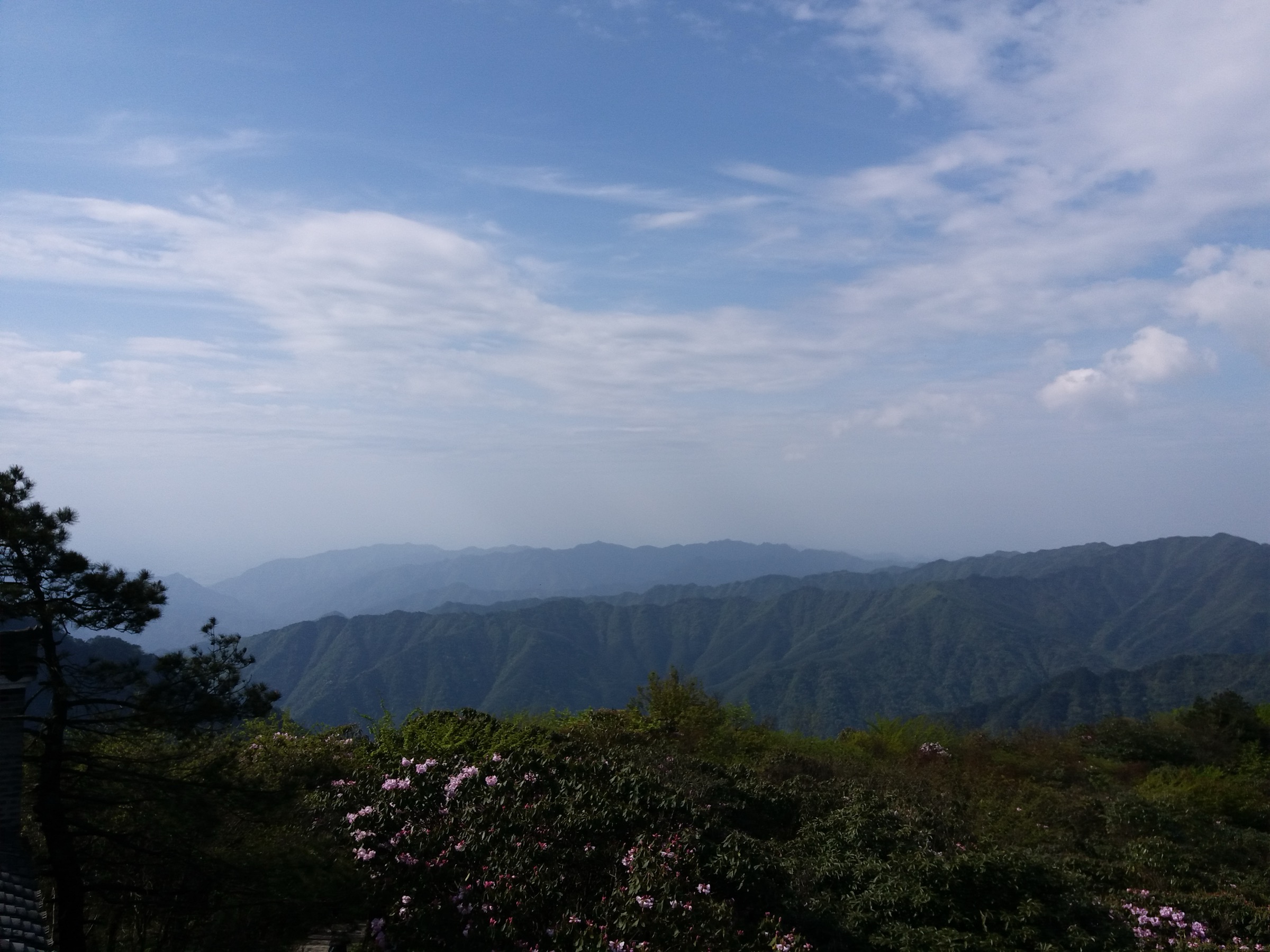
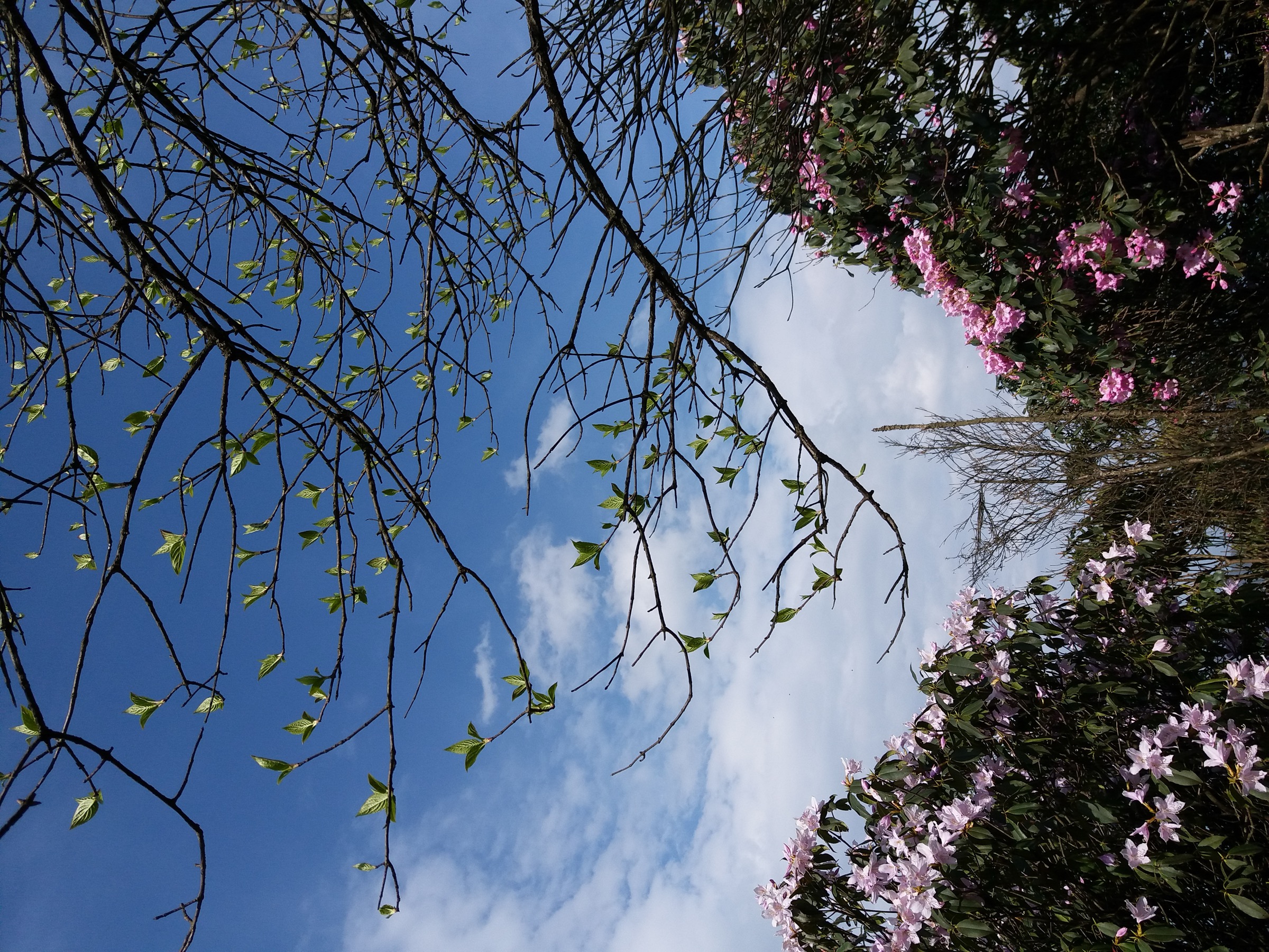
The walk begins at the park gate near the Wanshou Temple parking area. Wanshou Si (万寿寺) is a Song-dynasty foundation rebuilt in the Ming, set on a granite slope at 1,357 m in a basin of subtropical broadleaf forest. The temple-to-summit path leaves the complex on a well-paved stone staircase climbing east-southeast through dense rhododendron understory. In late April and the first week of May this section is the principal display of the “best wild azalea in China” claimed by Hunan provincial tourism literature. The grade is steady but never sustained at more than about 25 percent; intermediate platforms include the Wangfo viewpoint and the Yunhai (cloud-sea) platform.
The summit at Wangfotai (望佛台, 1,624.6 m) is a granite plateau marked by a small stone pavilion and an open viewpoint over the Xiaohuangjiang headwater basin. On clear autumn days the view extends west towards the eastern Xuefeng outliers and south across the upper Xiang basin. Walkers either return by the ascent path or extend the route by descending the western side to the Xiaohuangjiangyuan (小黄江源) headwater stream, picking up a forest trail that re-joins the Wanshou Temple road through a narrow gorge — this variant adds approximately 3–4 km and about 200 m of additional descent and reascent.
Why it is essential
Yangming Shan is the only confirmed National Nature Reserve (国家级自然保护区, 2009) in the southern central-Hunan uplands and contains genuinely intact subtropical evergreen broadleaf forest above 1,000 m, with more than 70 percent of its area above that elevation. The late-spring wild-azalea display is the most-cited single botanical attraction of the central-southern Xiang basin. Combining a high-elevation summit, an old Buddhist temple, and a national-reserve forest in a single moderate day-walk makes this hike a representative cultural-natural example of the region in a way no other single mountain in the entry achieves.
Equipment
- Trail shoes or light boots, weatherproof shell, warm layer for the summit
- 1.5–2 L water; refill at temple kiosks only
- Sun protection — summit is exposed
- Lightweight insect repellent in late spring and summer
- Cash in CNY for park entry (full price 65 CNY per Chinese tourism listings; verify locally)
Hazards and notes
Summer thunderstorm risk is significant from June through August; the summit pavilion offers limited shelter. Trail signage is in Chinese only. The Xiaohuangjiangyuan extension passes a few short sections of unstabilised forest path that become slick after rain. The reserve restricts off-trail entry and overnight camping. Drone use requires reserve administration approval. Dogs are generally prohibited inside National Nature Reserves.
GPX / KML links
| Source | URL | Format | Notes |
|---|---|---|---|
| OpenStreetMap | openstreetmap.org | OSM data (export GPX) | ODbL 1.0; reusable with attribution. Search “万寿寺” and “望佛台” |
| GPX file | None located | — | — |
Sources
- Wikipedia — Yangmingshan National Forest Park
- Wikipedia — Shuangpai Yangming National Forestry Park
- Wikipedia — Yangming Mountains
- Wikidata Q28153295 — Yangmingshan National Forest Park
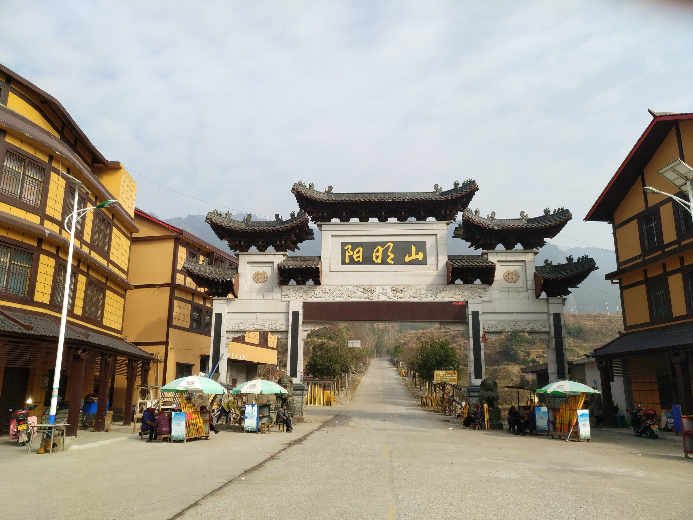
3. Jiuyi Shan — Shun Mausoleum to Sanfen Rock (Candidate only)
Snapshot
Note: no open-licence photograph of Jiuyi Shan or the Sanfen Rock summit was located during research. Targeted Chinese-language searches for 九嶷山, 三分石 and 舜帝陵 on Wikimedia Commons returned no usable imagery.
Itinerary
The walk begins at the Shun Emperor Mausoleum complex (舜帝陵), the recognised ancestral tomb of the legendary Emperor Shun and a national key cultural relic. From the mausoleum forecourt the trail climbs north-east into the Jiuyi Shan ridge through bamboo — including the endemic spotted bamboo, “Jiuyi banzhu” 九嶷斑竹 — and subtropical broadleaf forest. Chinese-language route accounts describe a sustained ascent past the Yuguan Rock (玉琯岩) area, a steepening through a climbing zone where short fixed-rope or chain assistance is reportedly used at the steepest slabs, and a final ridge approach to Sanfen Rock (三分石) — three close-set granite tors that are visible from much of southern Hunan and that mark the watershed between the Xiang and Pearl River drainages.
The summit area at 1,822 m gives one of the most extensive ridge views in southern Hunan, looking south across the Mengzhu Shan (萌渚岭) towards Guangdong and Guangxi. Return is normally by the same route; some hikers continue south on a longer ridge traverse off the mountain but those routes exceed day-hike scope. Total distance and time are reported as approximately 12 km and 7 hours by Trip.com travel-account contributors; this entry treats those figures as approximate.
Why it is essential
Jiuyi Shan is the principal sacred-mountain pilgrimage of southern Hunan, the recognised tomb site of Emperor Shun (referenced in the Shujing and Shiji), and the highest peak in any of the five hikes in this entry. The combination of a foundational Han-civilisation cultural site at the trailhead with a genuinely high, genuinely strenuous ridge walk on the watershed between the Yangtze and Pearl drainages has no equivalent elsewhere in the central Hunan uplands. The distinctive triple-tor “Sanfen” summit is one of the most recognisable landforms in the southern Xiang basin.
Equipment
- Sturdy boots, weatherproof shell, warm layer, full sun protection
- Gloves recommended for the slab section
- 3 L water; no reliable refill above the mausoleum
- Headtorch (early start and possible late return)
- Snake gaiters worth considering in summer — the area has documented venomous-snake habitat
- Cash in CNY for scenic-area entry
Hazards and notes
This is the most serious hike in the entry. Chinese-language sources reference rope-assisted sections that, while not technical climbing, demand basic scrambling competence and should not be attempted in rain or on glazed rock. Summer thunderstorms can be intense and the ridge offers no shelter. Local guide assistance is strongly advisable for the upper section. The scenic area enforces opening hours and may close the upper ridge in adverse weather. ID registration at the scenic-area entrance is standard. The hike is flagged here as Candidate only because the route statistics and rope-assisted-slab descriptions are sourced from a single Trip.com user account and need cross-checking against a second independent source; if the rope sections are confirmed as technical, the route may belong in a scrambling rather than hiking catalogue.
GPX / KML links
| Source | URL | Format | Notes |
|---|---|---|---|
| OpenStreetMap | openstreetmap.org | OSM data (export GPX) | ODbL 1.0; reusable with attribution. Search “三分石” and “舜帝陵” |
| Trip.com — Sanfen Rock user account | hk.trip.com | HTML narrative only | Not reusable as GPX; useful for cross-checking distance and time |
| GPX file | None located | — | — |
Sources
- Wikipedia — Jiuyi Mountains
- Hunan Provincial Department of Culture & Tourism — Jiuyi Mountain Emperor Shun’s Mausoleum Scenic Area
- Hunan provincial government English mirror — Jiuyi Mountain Scenic Area
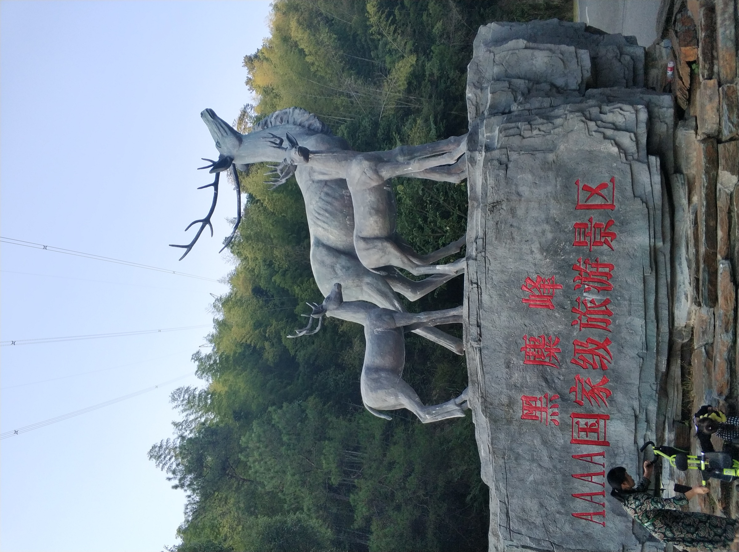
4. Heimi Feng — Heimi Temple Ancient Path Loop
Snapshot
Itinerary
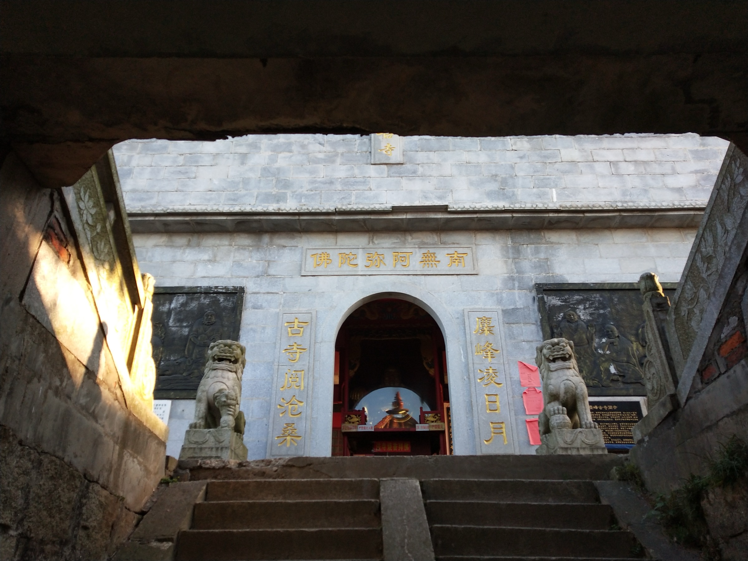
The walk begins at the Heimi Peak Forest Park main gate. The classic “ancient path” (古道) climbs in concrete steps through bamboo and Chinese fir directly to the saddle below the summit, gaining roughly 350 m in 1.5–2 km. Heimi Temple, also known as Dongyang Guan (洞阳观), occupies the summit clearing — a Tang-dynasty foundation traditionally identified as the 24th of the “Thirty-six Minor Cave Heavens” (三十六小洞天) of Daoist sacred geography, later converted to a Buddhist site, with a documented heritage stretching to roughly 1,300 years.
From the temple a short staircase leads to the summit viewpoint at 590.5 m. On clear days the view sweeps south over the Xiang River bend and the central Changsha skyline, and north across the Wangcheng farmland to the Miluo River. The recommended loop returns by the forest service road on the south-east flank past the Starry Sky Reservoir (星空水库) and rejoins the main gate. The full loop is comfortably done in a half day and pairs naturally with a morning or evening visit to Wangcheng or central Changsha.
Why it is essential
Heimi Feng is the highest natural summit inside Changsha municipality and the cultural anchor of the Daoist cave-mountain tradition on the north side of the city. As a small but recognised piece of the Thirty-six Cave Heavens system, it is the only entry in this catalogue that connects directly to the formal Daoist sacred-mountain geography of China. Its accessibility from the provincial capital — the only sub-region site that can be done as a half-day trip from a Changsha hotel without a three-hour drive — makes it the obvious “city-edge” inclusion. The thick forest, the temple complex, and the views over Changsha provide a contrast of scale to the Yongzhou high-mountain entries.
Equipment
- Trail shoes, light shell, water (1 L), sun protection
- Cash in CNY for park entry
- No technical equipment required
Hazards and notes
The principal hazard is summer heat and humidity: the stepped ascent is unshaded in several sections and heat exhaustion is the most common rescue-call cause in summer. Steps may be slick after rain. Vehicle traffic on the service-road descent requires basic caution. Drone use near the temple is restricted. The site sees heavy weekend domestic-tourist traffic; weekday visits give a much quieter experience.
GPX / KML links
| Source | URL | Format | Notes |
|---|---|---|---|
| OpenStreetMap | openstreetmap.org | OSM data (export GPX) | ODbL 1.0; reusable with attribution. Search “黑麋峰” |
| GPX file | None located | — | — |
Sources
5. Shaoshan — Shaofeng Peak Stele Forest Loop
Snapshot
Itinerary
The standard walk begins at the Mao Zedong Former Residence parking area, the cultural and physical centre of the Shaoshan scenic complex. A signed stone-stair pilgrim path leaves the western edge of the residence complex and climbs steadily through bamboo and mixed forest. Approximately halfway up, the route reaches the Mao Zedong Poems Stele Forest (毛泽东诗词碑林) — an open hillside garden of inscribed stone tablets covering roughly 20,000 m², opened to the public in 1993 and now a fixed item on the standard Shaoshan domestic tour. From the stele forest the path continues to the Shaofeng summit at 518.9 m (also known as Fairy Peak, 仙女峰), where a small pavilion gives views over Shaoshanchong and the rolling Xiangtan hill country.
Descent is either by the same path or by the cable car back to the stele forest level. Walkers commonly combine the summit walk with a level-ground visit to the Former Residence and the adjacent Shaoshan museum, easily filling a full day from a Changsha base.
Why it is essential
Shaoshan is one of the most-visited domestic tourist sites in China and the cultural focal point of central Hunan; an essential-hikes catalogue of the region that omitted it would mis-represent the area. The Shaofeng walk itself is the only on-foot summit experience at the site and is the route by which Mao’s relationship to the local landscape has been formally commemorated in the stele forest. Although the elevation is modest by comparison with the other entries, the combination of a recognised AAAAA cultural site with a discrete signed hill walk gives the entry a unique cultural register.
Equipment
- Trail shoes, water (1 L), sun protection
- Cash in CNY for cable car (optional) and any combined scenic-area tickets
- No technical equipment required
Hazards and notes
The principal hazard is crowding: weekends, summer school holidays, and Chinese-government anniversaries can produce queue waits at the cable car and the stele forest entrance. Heat and humidity in July–August are the next biggest concern; the path is partly shaded but not consistently so. Photography of certain commemorative installations is restricted; follow posted notices. The scenic area enforces ID registration at gates. Drones are restricted across the site.
GPX / KML links
| Source | URL | Format | Notes |
|---|---|---|---|
| OpenStreetMap | openstreetmap.org | OSM data (export GPX) | ODbL 1.0; reusable with attribution. Search “韶峰” |
| GPX file | None located | — | — |
Sources
- China Discovery — Shaoshan Travel
- Travel China Guide — Mt. Shaoshan Scenic Area
- China.org.cn — Shaoshan, Mao Zedong’s Birthplace
External links
| Source | URL |
|---|---|
| Hunan Provincial Department of Culture & Tourism (English) | whhlyt.hunan.gov.cn |
| Hunan Provincial Government English portal | enghunan.gov.cn |
| Liuyang Daweishan National Forest Park (official) | dwstravel.com |
| Hunan provincial tourism — Jiuyi Mountain Scenic Area | enghunan.gov.cn |
| Wikipedia — Dawei Mountain National Forest Park | en.wikipedia.org |
| Wikipedia — Yangmingshan National Forest Park | en.wikipedia.org |
| Wikipedia — Jiuyi Mountains | en.wikipedia.org |
| Wikipedia — Heimi Peak | en.wikipedia.org |
| Wikimedia Commons — Heimi Peak category | commons.wikimedia.org |
| Wikimedia Commons — Shaoshan category | commons.wikimedia.org |
| OpenStreetMap (ODbL 1.0) | openstreetmap.org |