Regional overview
Wugong Shan (武功山) rises out of the western Jiangxi hills as a long Mesozoic granite dome, weathered at the summit into a sub-flat plateau of tussock grass and bedrock outcrops above 1,600 m. The range forms the northern section of the Luoxiao Mountains (罗霄山脉), a NNE–SSW orogenic belt that follows the Jiangxi–Hunan provincial line; its high point, Jīndǐng (金顶, “Golden Summit”) or Báihè Fēng (白鹤峰, “White Crane Peak”), reaches 1,918.3 m and is the highest summit in Jiangxi. The massif extends about 120 km along the boundary between the Jiangxi prefectures of Pingxiang, Yichun and Ji’an, with low forested ridges continuing westward into eastern Hunan. By convention the range belongs to the Luoxiao chain rather than the Xuefeng (雪峰) range further west.
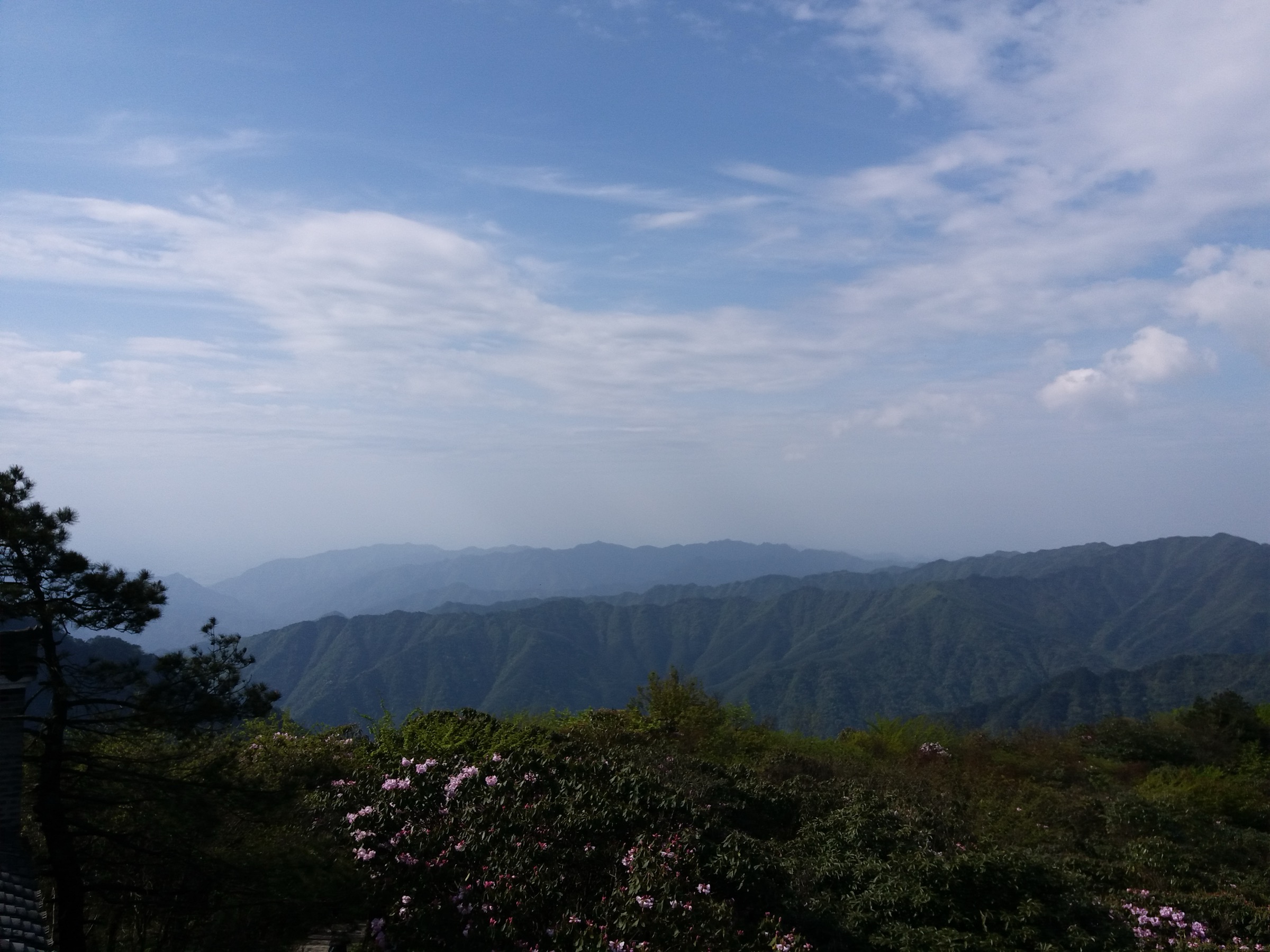
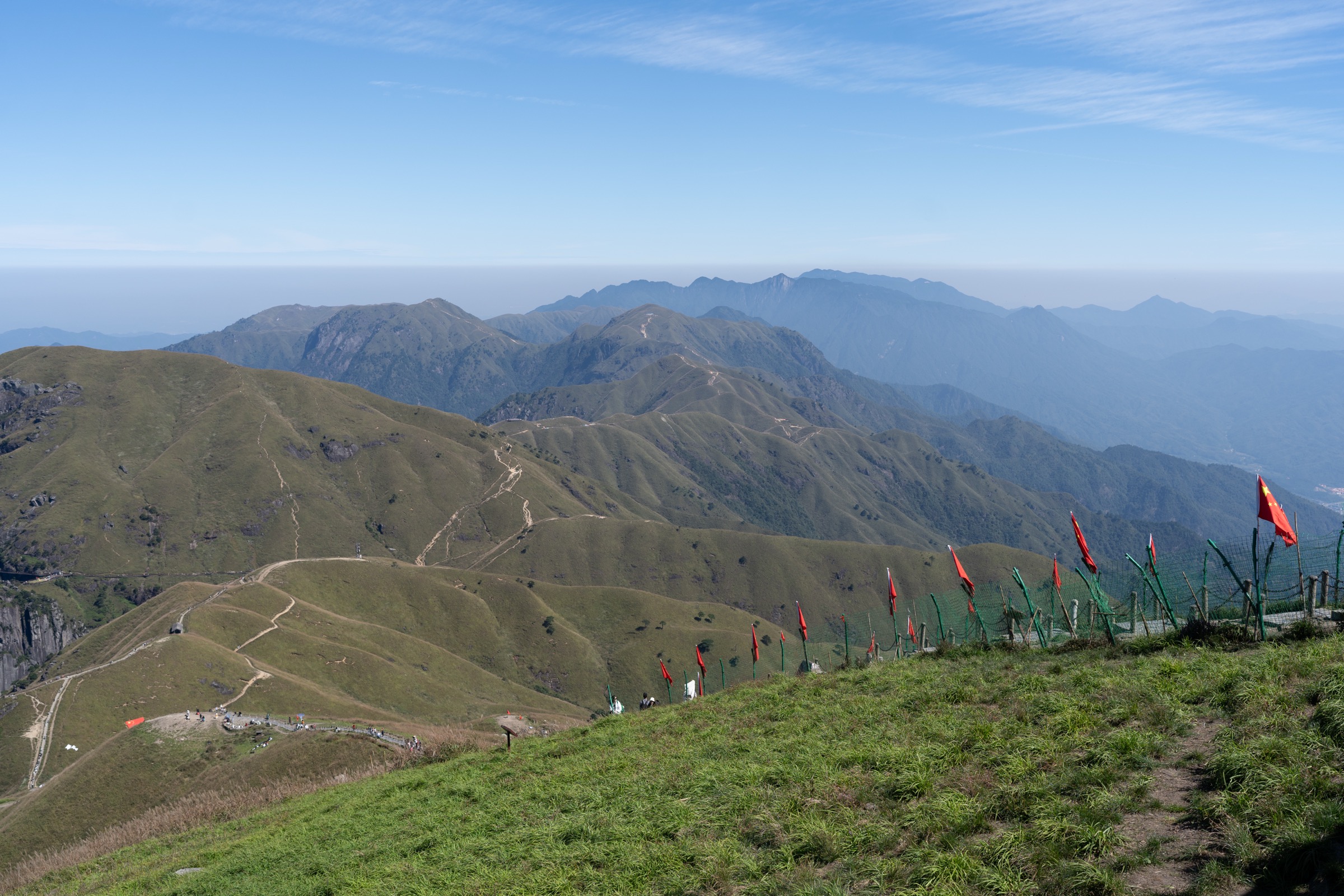
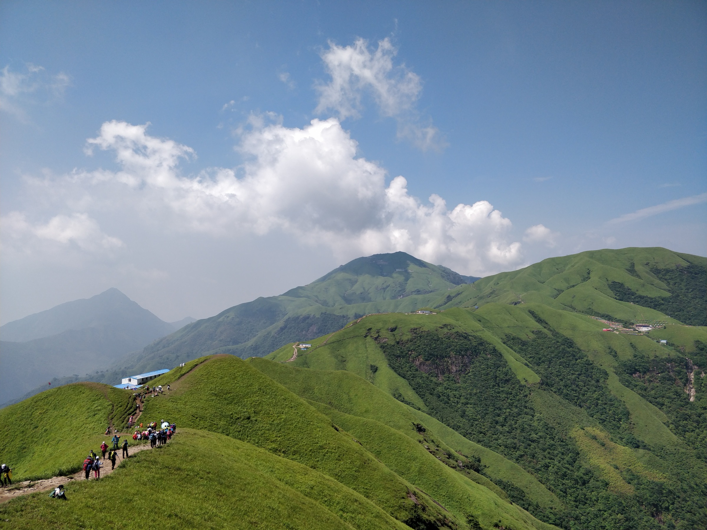
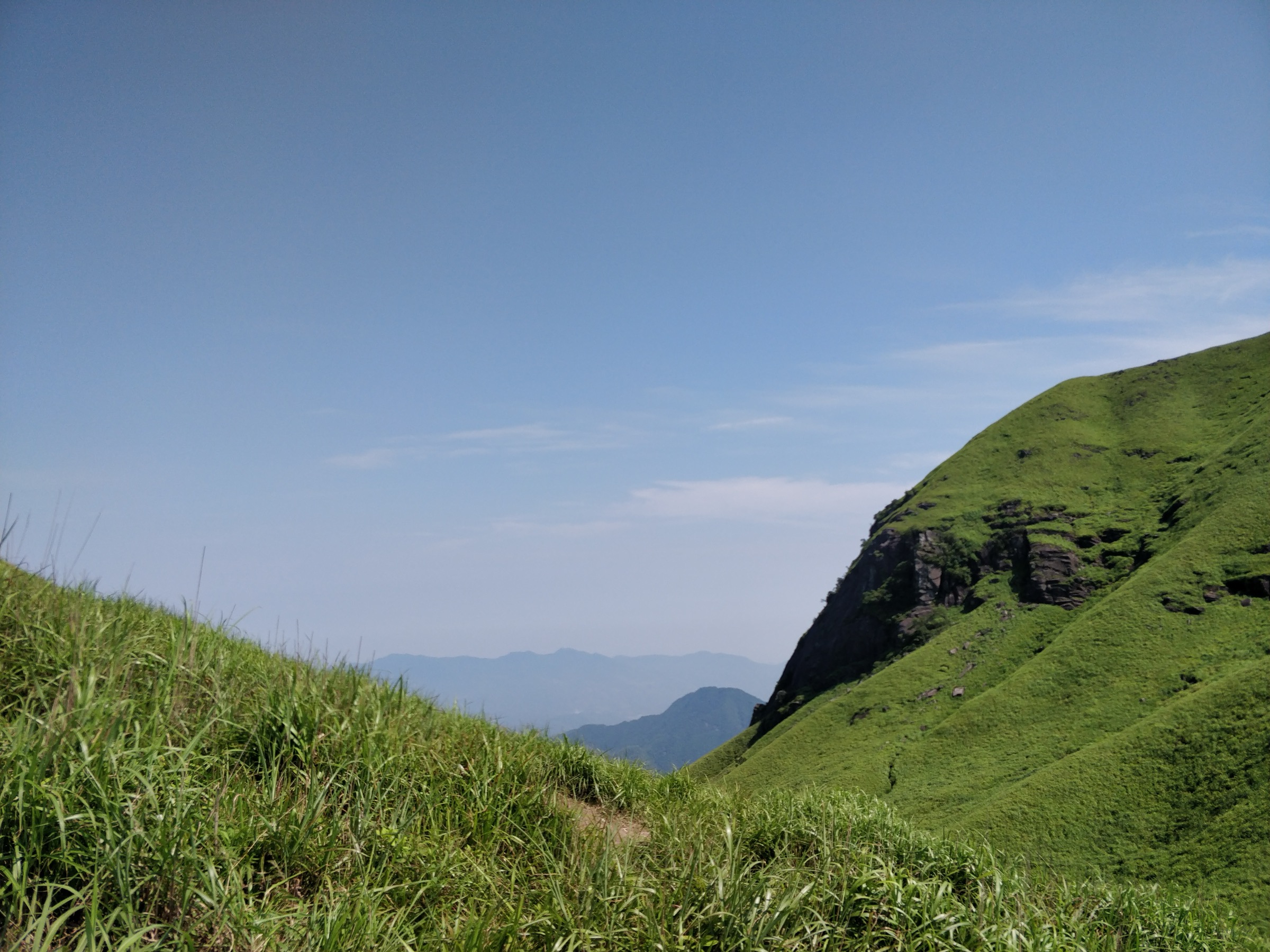
The defining feature is roughly 6,600 hectares of contiguous alpine meadow (高山草甸) spread across the upper plateau — an unusual vegetation cover at this subtropical latitude (about 27° 29′ N), sustained by freely-draining weathered granitic gneiss and 200-plus fog days per year. The meadow’s photogenic combination with the sea of clouds (云海) that frequently fills the surrounding valleys has made the Jīndǐng-to-Fāyúnjiè ridge one of the most photographed hiking landscapes in eastern China, and the Wugongshan International Camping Festival has anchored a youth-oriented outdoor scene since 2008. In March 2024 the range was inscribed as Wugongshan UNESCO Global Geopark, the only geopark in the world whose central body is a granite dome structure: Jurassic granite stone forests and weathered Silurian granitic gneiss above, carbonate karst on the lower flanks, ring-shaped hot springs around the dome margin.
The climate is humid subtropical mountain (Cfa transitioning to Cfb at the summit) with hot wet summers, persistent fog, and frequent thunderstorms from April to August. Peak hiking windows are mid-September to mid-November (golden grass, red maple, stable highs) and mid-March to mid-May (azalea / Rhododendron bloom). The October National Day Golden Week brings extreme crowding on the Jīndǐng plateau and at both cable cars — entrance tickets, cable cars and summit-area tent platforms should be booked in advance for that week. Above the treeline the hazards are lightning, slippery wooden plankways in wet weather, hypothermia in fog (the meadow can drop below 5 °C even in summer at night), and disorientation on the open meadow plateau in low visibility. The mountain is fully ticketed and ticketing checkpoints extend onto the upper ridge — through-hikers from non-ticketed village trailheads still encounter inspections at the meadow gates.
Access is from three sides. The Pingxiang (Luxi County) side on the west is the headline tourist core, served by a sequence of two cable cars from the Shǐgǔ Sì base. The Yichun (Yuanzhou) side on the north reaches the Yángshīmù granite scenic area on a separate cable-car line. The Anfu (Ji’an) side on the east gives access both to the Lóngshān backpacker trailhead and to the Wild Bull Waterfall canyon. Pingxiang Railway Station (regular and high-speed) is the standard arrival point, with scenic-area shuttle services at roughly RMB 22–27. There is no significant Hunan-side hiking infrastructure — Wugong Shan tourism and trail development sits almost entirely on the Jiangxi side.
Selection rationale
The five hikes triangulate the geographic and experiential breadth of the Wugong Shan tourist core while remaining feasible as single-day outings for fit walkers. The set is weighted toward the iconic alpine-meadow ridge — the feature that defines the range — but includes one granite peak-forest counterpoint and one canyon route to capture the geological diversity that earned the UNESCO geopark designation. Jīndǐng Summit & Alpine Meadow Circuit is the headline cable-car-assisted day. The Fāyúnjiè → Jīndǐng Ridge Day Traverse extracts the most scenic meadow stretch from the classic 2–3 day east-to-west backpacking route. Yángshīmù Granite Ridge is the Jurassic peak-forest counterpoint on the Yichun side, with the famous Lingyun cliff plankway. Wild Bull Waterfall Grand Canyon is the low-altitude wet-forest complement, displaying the granite–carbonate contact geology. The Lóngshān Cūn → Fāyúnjiè Ascent is the standard backpacker entry walked as a hard one-day out-and-back — the only route that delivers the meadow on foot from the bottom of the mountain without lift assistance.
All five are non-technical in dry summer or autumn conditions. None require glacier or via ferrata equipment. The Yángshīmù plankway sections and the Wild Bull canyon include exposed wooden walkways and one cantilevered glass-floor platform; these are walked, not climbed, and require no specialist kit.
Summary table
| # | Hike | Country | Route type | Distance | Gain | Max elevation | Difficulty |
|---|---|---|---|---|---|---|---|
| 1 | Jīndǐng Summit & Alpine Meadow Circuit (Pingxiang) | China | Lift-assisted loop | 6–8 km | 300–450 m | 1,918 m | Easy–moderate |
| 2 | Fāyúnjiè → Jīndǐng Ridge Day Traverse | China | Point-to-point | 12–15 km | 700–900 m | 1,918 m | Moderate–hard |
| 3 | Yángshīmù Granite Ridge — Lingyun Plank Road | China | Lift-assisted loop | 6–9 km | 400–500 m | ~1,760 m | Moderate |
| 4 | Wild Bull Waterfall Grand Canyon (Anfu) | China | Out-and-back | 10–13 km | 400–600 m | ~1,100 m | Moderate |
| 5 | Lóngshān Cūn → Fāyúnjiè Ascent | China | Point-to-point or out-and-back | 12–14 km one-way | 900–1,100 m | ~1,650 m | Hard |
Distance and elevation values are approximate, drawn from a combination of trail databases, Chinese hiking-community itineraries and official scenic-area route descriptions; sources differ and ranges are deliberately conservative.
1. Jīndǐng Summit & Alpine Meadow Circuit (Pingxiang side)
Snapshot
Itinerary
The route starts at the Wugong Mountain Tourist Centre on the Pingxiang side. From the centre a short walk or shuttle reaches Shǐgǔ Sì (石鼓寺, “Drum-Stone Temple”), the base of the Zhōng’ān (中庵) cable car — the Level 1 lift — which climbs in roughly ten minutes to the Zǐjí Gōng (紫极宫, Ziji Palace) area on the mid-mountain shelf. From Ziji Palace the marked path traverses gently north-east via the Xǔyuàn Qiáo (许愿桥, Wishing Bridge), a steel suspension bridge over a forested gully, and the Fùxīng Gǔ (复兴谷, Fuxing Valley), where the Jīndǐng (Level 2) cable car lower station sits. Walkers can either continue on foot up the marked plank-and-step path (about 300 m of climb in 1.5–2 km) or take the second cable car to the platform near the summit.
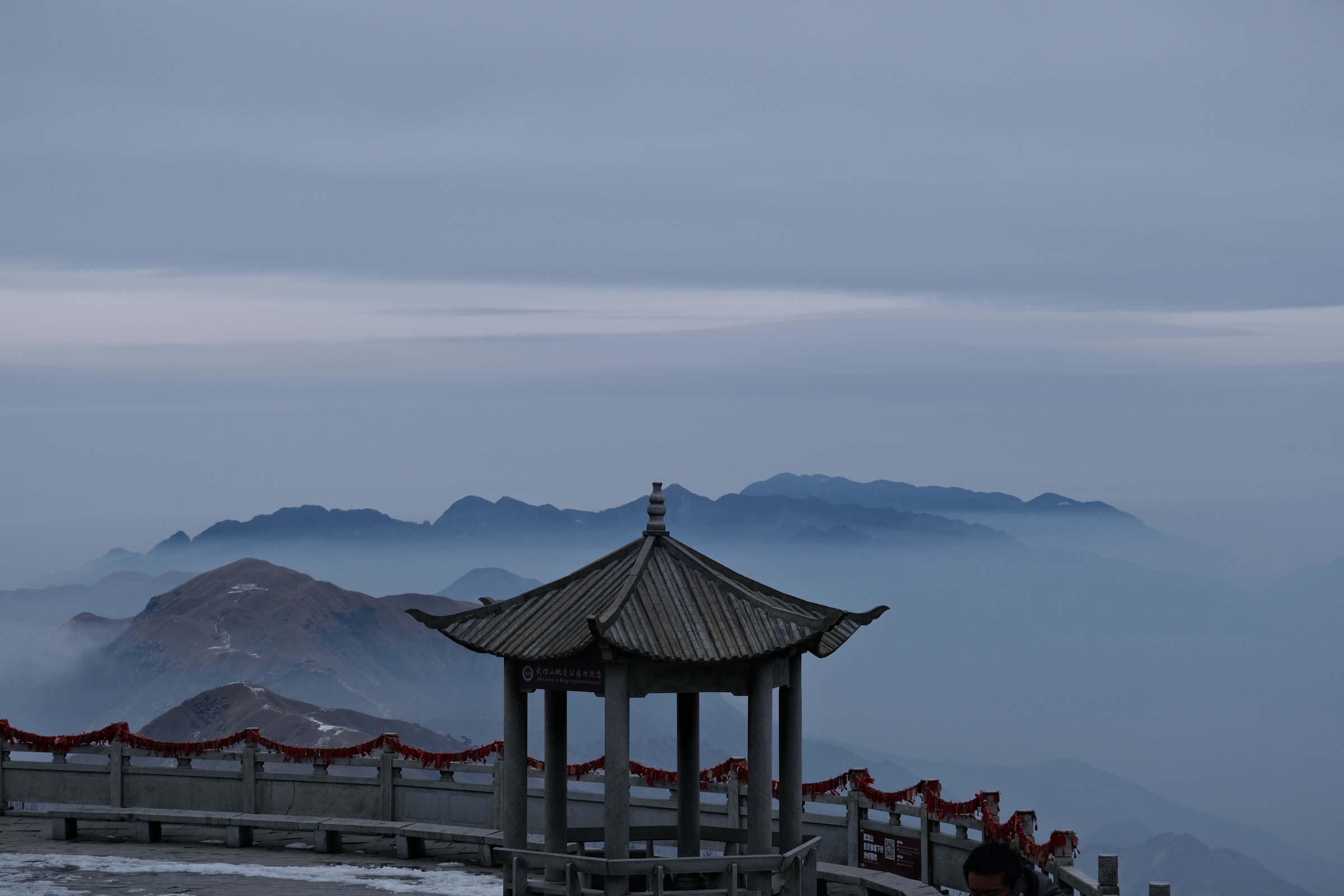
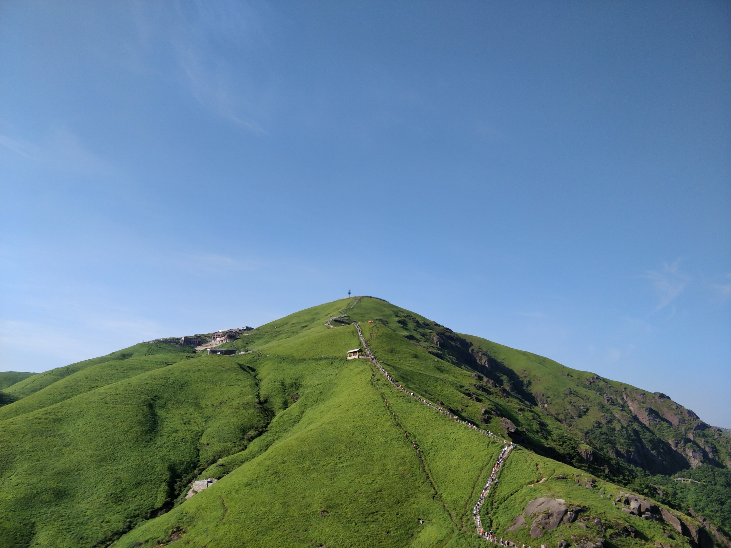
The summit zone is a sub-flat alpine plateau of tussock grass and bedrock outcrops. The ancient altar group (古祭坛群) — comprising Gěxiān Tán (葛仙坛), Wángxiān Tán (汪仙坛), Chóngyíng Tán (冲应坛) and Qiūshí Tán (求嗣坛), with a documented Taoist sacrificial history said to span more than 1,700 years — sits a short walk south of the cable-car top station. The marked plank circuit links the altars with the summit marker plaque, Jīndǐng Temple (金顶寺) and the Báihè Guān (白鹤观) viewing pavilion. A clockwise loop of the upper plateau covers roughly 2–3 km on plank and stone path with frequent viewpoints over the eastern meadow extending toward Fāyúnjiè.
Return is by the same cable-car sequence, or by walking down via Fuxing Valley → Wishing Bridge → Ziji Palace (~3–4 km of mostly stepped descent) to the Zhōng’ān cable car for the final drop to Shǐgǔ Sì. A fully walked variant in both directions runs approximately 16–18 km with 1,200–1,400 m of cumulative ascent and is a long, hard day in summer humidity.
Why it is essential
This is the single most representative outing in the Wugong Shan tourist core: the historic altar complex, the highest point in Jiangxi, the iconic plank-and-meadow plateau, and the sea-of-clouds viewpoint that defines the range in Chinese popular imagination. It is the only itinerary that combines all four of the range’s headline assets — summit, meadow, Taoist heritage and cloud sea — in a single day, and it is the only Wugong itinerary realistically completable by visitors who are not equipped for multi-day backpacking.
Equipment
- Hiking shoes or light boots (plank surfaces become slick in fog and rain)
- Weatherproof shell
- Warm layer — the summit can be 10–15 °C colder than Pingxiang city
- 1.5–2 L water and food
- Sun protection
- Headtorch for a sunrise visit
- Pre-booked cable-car tickets and entrance ticket (RMB ~60 online / ~70 at gate, subject to seasonal change)
Hazards and notes
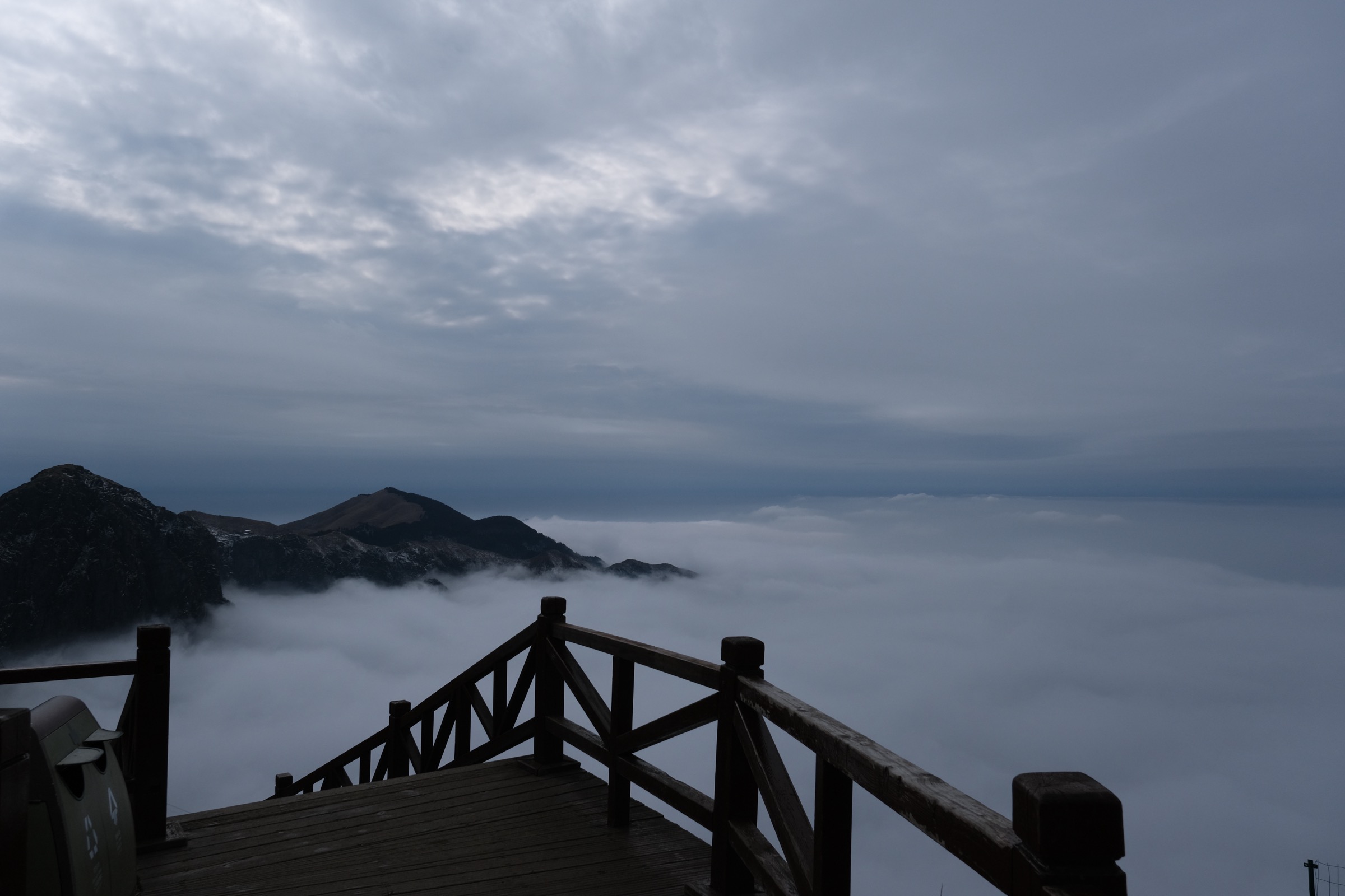
Fog on the plateau routinely drops visibility to a few metres; the marked plank circuit is normally easy to follow but excursions onto the open meadow can become disorienting. Lightning above the treeline is a serious warm-season hazard — afternoon thunderstorms are routine April–August. The summit plateau is fully ticketed and identity-document inspection at gates should be expected. Camping is permitted only at designated tent platforms (notably Baihefeng tent station near Jīndǐng); wild camping outside designated zones is restricted under the 2021 Jiangxi Wugongshan Scenic Area regulations. Dogs are generally not permitted in the ticketed scenic core.
GPX / KML links
| Source | URL | Format | Notes |
|---|---|---|---|
| OpenStreetMap | openstreetmap.org | OSM data (export GPX) | ODbL 1.0; partial summit-zone coverage |
| AllTrails — Wugongshan: Longshan Village to Dongjiang Village | alltrails.com | GPX (account) | AllTrails ToS — personal use only |
| Wugongshan National Forest Park (official routes) | wugongshan.cn | Source page | No official GPX published |
No official GPX or KML is published by the Wugongshan National Forest Park; route geometry must be reconstructed from OSM, AllTrails community tracks or Wikiloc.
Sources
- Wugongshan UNESCO Global Geopark (IGGP)
- Wugongshan National Forest Park — official site
- Travel China Guide — Wugong Mountain
- China Discovery — Wugong Mountain hiking
- Wikipedia — Wugong Mountains
2. Fāyúnjiè → Jīndǐng Ridge Day Traverse
Snapshot
Itinerary
This is a one-day extraction of the central scenic meadow stretch of the classic Wugongshan east-to-west traverse. The standard 2- or 3-day backpacking version walks Longshan Village (龙山村) → Fāyúnjiè (发云界) → Jīnyínghú or Diàomǎzhuāng (吊马庄) → Juéwàngpō (绝望坡, “Despair Slope”) → Hǎohàn Pō (好汉坡, “Hero’s Slope”) → Guānyīnyán (观音岩) → Tiěbǐ Fēng (铁壁峰) → Jīndǐng. The day-hike variant assumes an early start with a pre-arranged drop at the Fāyúnjiè meadow plateau (1,628 m) — reached by jeep or scenic-area minibus from the Longshan or Anfu side after a short approach climb — and uses the Jīndǐng cable car for the descent.
From the Fāyúnjiè meadow huts the route heads west-south-west on the marked main ridge path. The first kilometres roll across open meadow with widely-spaced rock outcrops; in clear weather the panorama extends north to the granite peaks of Yángshīmù. The path climbs and descends Diàomǎzhuāng and then approaches Juéwàngpō, a steep grass-and-rock pull whose nickname reflects its position late in the traditional first day’s walk for backpackers — for day-hikers starting fresh from Fāyúnjiè it is shorter than its reputation.
Beyond Juéwàngpō the path crosses Hǎohàn Pō and enters the granite-rich middle ridge. Guānyīnyán (观音岩) is a prominent rock outcrop with a small shrine and one of the standard cloud-sea viewpoints. From there the path climbs gradually past secondary high points to Tiěbǐ Fēng (“Iron Wall Peak”) and onto the broad approach to Jīndǐng. The final 1–2 km onto the summit plateau is on engineered plank and stone steps shared with day-trippers from the cable car. The standard descent is via the Jīndǐng cable car to Fuxing Valley (saving 300 m of knee-loading descent), then on foot to Ziji Palace, then the Zhōng’ān cable car to Shǐgǔ Sì and the tourist centre. A fully on-foot descent via the eastern plank-and-step path adds two to three hours.
Why it is essential
The cable-car-only summit loop cannot deliver what this day does: hours of continuous walking across open high-altitude meadow, with the long sightlines, rolling terrain and shifting cloud-sea light that have made the range a Chinese hiking icon. It also samples the named rite-of-passage features (Juéwàngpō, Guānyīnyán, Tiěbǐ Fēng) of the classic traverse without committing to the multi-day camp.
Equipment
- Sturdy hiking boots
- Trekking poles for the long descent
- Extra warm layer, hat and gloves outside high summer — the ridge holds wind even in October
- Weatherproof shell
- Offline map or downloaded GPX — way-finding on the open meadow is non-trivial in poor visibility despite the path being well-trodden
- Headtorch
- 2–3 L water (no reliable water on the ridge)
- Food for the day, sun protection
- Pre-booked cable-car and entrance tickets in peak season
Hazards and notes
Exposure is the dominant hazard: the ridge is entirely above the treeline and offers no shelter between meadow huts. Thunderstorms April–August routinely close the upper ridge for safety, and managers occasionally close the cable cars in high wind. Hypothermia in fog is the most reported emergency on the mountain. The path is well-trodden but unsigned at several minor junctions; in fog a downloaded track materially reduces risk. Camping is permitted only at managed sites along the ridge (Fāyúnjiè, Diàomǎzhuāng, Jīndǐng tent stations) under the post-2021 scenic-area regulations. Tickets are inspected on the ridge itself.
GPX / KML links
| Source | URL | Format | Notes |
|---|---|---|---|
| OpenStreetMap | openstreetmap.org | OSM data (export GPX) | ODbL 1.0; partial main-ridge coverage |
| Wikiloc — 武功山穿越 (Day 3) | wikiloc.com | GPX (account) | Wikiloc author terms — registration required |
| AllTrails — Wugongshan: Longshan to Dongjiang | alltrails.com | GPX (account) | AllTrails ToS — personal use only |
No official GPX is published. Third-party tracks on Wikiloc and AllTrails should be treated as geometry references and redrawn before publication.
Sources
- Wikiloc — Wugong Shan traverse Day 3
- AllTrails — Wugongshan: Longshan to Dongjiang
- China Discovery — 2-day Wugong Mountain hiking tour
- The Outbound — Backpack the Wugong Mountains
- The China Boss — Hike Wugong Mountain
3. Yángshīmù Granite Ridge — Lingyun Plank Road and Shisun Peak Loop
Snapshot
Itinerary
Yángshīmù (“Sheep and Lion Curtain”) sits on the north side of the Wugong massif, separated from Jīndǐng by a deep intervening valley. The scenic area covers roughly 37.5 km² and is dominated by Jurassic granite peak-forest landforms — sharp-edged blocks, tower peaks and sheer cliff faces — rather than the meadow that defines the Pingxiang side. The marked walking circuit is built around a sightseeing bus and a cable car that does the bulk of the ascent.
From the visitor entrance a sightseeing shuttle delivers walkers to the lower cable-car station. The Yángshīmù cable car (publicly reported at about 3,500 m line length) ascends in roughly 15–20 minutes to a ridge station near the start of the plank circuit. The marked main route follows the Língyún Zhànlùdào (凌云栈道, “Lingyun Plank Road”) along the granite ridgecrest. The walkway is partly cantilevered over the cliff edge and includes several glass-floor sections and the Chuānyún Shí (穿云石, “Cloud-Piercing Stone”) suspended plankway.
The plankway traverses past the named pictographic granite formations — Shisun Feng (石笋峰, “Stone Bamboo-Shoot Peak”), Riyue Feng (日月峰, “Sun and Moon Peak”) and Guanggong Mian (关公面) — with multiple platforms designed as cloud-sea viewpoints. Shisun Peak, the high point of the scenic area at about 1,764 m, is reached via a short side spur. The full plank circuit returns to the upper cable-car station after roughly 5–6 km depending on the variant taken (the network includes a Yáotián Lǐng / 瑶天岭 connector with further viewing platforms). Descent is most efficient by cable car; a walked-down variant via the main maintenance and visitor path adds 2–3 km and around 400 m of descent through subtropical evergreen broadleaf forest.
Why it is essential
Yángshīmù is the granite peak-forest counterpoint to Jīndǐng’s meadow. Together they capture the essential dichotomy of the Wugongshan UNESCO Geopark — Jurassic granite tower-and-cliff exposure on one side, weathered-gneiss alpine meadow on the other — within a single range. Yángshīmù also offers materially smaller crowds than the Pingxiang core and a completely different visual register (cliffs, towers, glass viewing platforms) for visitors who want a non-meadow Wugong day.
Equipment
- Hiking shoes (the plankway is non-slip in dry conditions but treacherous when wet)
- Weatherproof shell
- Warm layer
- Sun protection
- Water and food (limited refreshments at the upper station)
- Pre-booked cable-car ticket in peak periods
Visitors with a fear of heights should be aware that several plankway sections are cantilevered over open drops and incorporate glass-floor segments.
Hazards and notes
Granite plankways become slippery in rain, and lightning is a risk in summer thunderstorms. Several plankway sections are exposed to long vertical drops; all are railed and engineered to a similar standard as comparable Chinese cliff plankways. The cable car closes in high wind. The scenic area enforces standard ticketing and ID checks.
GPX / KML links
| Source | URL | Format | Notes |
|---|---|---|---|
| OpenStreetMap | openstreetmap.org | OSM data (export GPX) | ODbL 1.0; partial plankway coverage |
| AllTrails — Jiangxi search | alltrails.com | Search page | No verified Yángshīmù track surfaced |
| Wikiloc — Yangshimu search | wikiloc.com | Search page | Re-verify before relying on any track |
No official GPX is published, and no high-quality third-party track for Yángshīmù has been independently verified. Route geometry should be confirmed on the ground or against OSM before publication of any downloadable file.
Sources
- Baidu Baike (EN) — Wugong Mountain Scenic Area
- LoongWander — Wugong Mountain Scenic Area
- ChinaXianTour — Wugong Mountain
- Wugongshan UNESCO Global Geopark
4. Wild Bull Waterfall Grand Canyon (Anfu side)
Snapshot
Itinerary
The Wild Bull Waterfall Grand Canyon (Yěniú Gōu Dà Xiágǔ) cuts the eastern flank of the Yángshīmù massif, draining the granite ridge into the Anfu lowlands. It was designated a National AAAA Tourist Attraction on 17 June 2022 and sits administratively as the canyon-floor counterpart of the Yángshīmù ridge above.
From the lower scenic-area gate, the trail follows the canyon floor north-westward on a built stone-and-plank path. Chinese tourism descriptions cite a walking-path length of about 13 km through the full canyon system; the standard day-walk follows the path as far as comfortable and returns, with most visitors turning around at the upper waterfall sequence rather than continuing to the ridge junction. The path passes a continuous series of pools, cascades and named waterfalls, with subtropical broadleaf forest on both sides. The canyon walls expose the granite-carbonate contact that forms part of the geopark’s geological narrative — rockfall remnants, hanging pines and large erratic blocks are frequent.
There is little elevation gain on the lower half of the canyon walk; the upper half climbs more steeply on stone steps to reach the upper waterfall belt. Strong walkers can connect from the canyon head onto the Yángshīmù ridge plankways for an extended traverse, but that doubles the day and is best treated as a separate itinerary.
Why it is essential
This is the only one of the five routes that stays at low elevation and showcases the wet, forested, waterfall-rich canyon environment that complements the open ridges higher up. It is also the best single hike to display the granite–carbonate contact geology that underpins the geopark designation. It is markedly less crowded than the cable-car-served scenic areas and is well-suited to mid-summer when the ridges are storm-prone.
Equipment
- Hiking shoes (canyon path is wet and slippery near waterfalls)
- Weatherproof shell
- Warm layer (canyon shade keeps temperatures cool)
- 2 L water and food
- Sun protection (useful near the upper sections)
- Trekking poles for the upper stepped sections
- Tick precaution in the subtropical forest months
Hazards and notes
Flash floods following heavy upstream rain are the principal canyon hazard — the route should not be walked immediately after heavy summer storms. Slippery stone, wet plankway and exposed sections near waterfalls require attention. The canyon is fully ticketed under Yángshīmù / Anfu Wugong Mountain Scenic Area administration. Camping in the canyon is not permitted.
GPX / KML links
| Source | URL | Format | Notes |
|---|---|---|---|
| OpenStreetMap | openstreetmap.org | OSM data (export GPX) | ODbL 1.0; canyon-floor trail may be incompletely mapped |
| AllTrails — Pingxiang search | alltrails.com | Search page | No verified canyon track surfaced |
No official GPX is published, and no verified third-party track for Wild Bull Waterfall Grand Canyon was located during research. Route geometry should be confirmed against OSM or Chinese hiking forums (8264, 绿野) before relying on any downloadable file.
Sources
- ChinaXianTour — Wugong Mountain
- LoongWander — Wugong Mountain Scenic Area
- Baidu Baike (EN) — Wugong Mountain Scenic Area
- Trip.com — Anfu Wugong Mountain
5. Lóngshān Cūn → Fāyúnjiè Ascent
Snapshot
Itinerary
Longshan Village sits at a road end on the eastern flank of the range on the Pingxiang (Luxi County) side. It is the standard backpacker entry point for the classic east-to-west Wugong traverse, and many ridge-camp hikers begin here on Day 1 with packs.
As a day-hike, the route ascends from the Longshan road end on a forested track through subtropical evergreen broadleaf forest, climbing steadily on stone steps and dirt path. The lower half traverses bamboo and broadleaf forest with limited views; the upper half emerges onto progressively more open hillside. The path crosses several small streams (treat or carry water) and passes one or two seasonal vendor huts in peak season. The final approach reaches the Fāyúnjiè meadow plateau where the path opens onto rolling alpine meadow at about 1,628 m. Fāyúnjiè is one of the four named major meadow basins of Wugongshan (alongside Jīndǐng, Guānyīndāng and Jiǔlóngshān).
The day-hike turnaround is the cluster of tent platforms and viewpoint cairns on the meadow plateau, which give the full sea-of-clouds panorama on a clear morning. Return is by reverse of the ascent track. The same ascent forms Day 1 of the classic 2-day traverse, which continues westward to Jīndǐng overnight at the Fāyúnjiè camps or further along the ridge.
Why it is essential
This is the standard hiker entry point to Wugong Shan and the only one of the five hikes that delivers the meadow on foot from the bottom of the mountain without lift assistance. It is the natural choice for visitors who want the full vertical experience — closed forest at the road end, open meadow at the ridge — in a single day. It also avoids cable-car queues entirely, which makes it a viable alternative during peak-week scenic-area congestion.
Equipment
- Sturdy boots
- Trekking poles (long sustained climb and descent)
- 2.5–3 L water
- Food for the day, sun protection
- Weatherproof shell
- Warm layer for the meadow top (typically 10–12 °C cooler than the valley)
- Headtorch
- Downloaded GPX track — signage on the forest section is in Chinese only
- Cash for the entry-point gate (some unofficial collection points on the village access road have been reported in the past; verify locally)
Hazards and notes
Heat exhaustion in summer on the closed forest ascent is the dominant warm-season risk; a pre-dawn start is sensible June–August. Lightning at the meadow top is a risk in convective weather. The final meadow approach is exposed, and fog can reduce visibility sharply at the ridge transition. The route is well-trodden but signage on the forest sections is in Chinese only. Camping is permitted only at managed sites at Fāyúnjiè; through-hikers continuing west should book tent platforms in advance during peak season.
GPX / KML links
| Source | URL | Format | Notes |
|---|---|---|---|
| OpenStreetMap | openstreetmap.org | OSM data (export GPX) | ODbL 1.0; eastern approach trail may not be fully traced |
| AllTrails — Wugongshan: Longshan to Dongjiang | alltrails.com | GPX (account) | AllTrails ToS — personal use only |
| Wikiloc — Wugong Shan traverse | wikiloc.com | GPX (account) | Wikiloc author terms — registration required |
No official GPX is published. Third-party tracks should be redrawn before publication, particularly for the lower forest section where OSM coverage is incomplete.
Sources
- AllTrails — Wugongshan: Longshan to Dongjiang
- The Outbound — Backpack the Wugong Mountains
- The China Boss — Hike Wugong Mountain
- Wikiloc trail listing
External links
| Source | URL |
|---|---|
| Wugongshan UNESCO Global Geopark (IGGP) | unesco.org |
| Wugongshan National Forest Park (official, English routes) | wugongshan.cn |
| Wugongshan official — Alpine Meadow page | wugongshan.cn |
| Baidu Baike (EN) — Wugong Mountain Scenic Area | baike.baidu.com |
| Wikipedia — Wugong Mountains | en.wikipedia.org |
| Geodiversity of Wugongshan UGGp (Geoheritage, 2025) | link.springer.com |
| Granite landform evolution at Mount Wugongshan (J. Mountain Science) | link.springer.com |
| Wugong Mountain meadow ecosystem (IntechOpen) | intechopen.com |
| Travel China Guide — Wugong Mountain | travelchinaguide.com |
| China Discovery — Wugong Mountain | chinadiscovery.com |
| ChinaXianTour — Wugong Mountain | chinaxiantour.com |
| LoongWander — Wugong Mountain Scenic Area | loongwander.com |
| The China Boss — Hike Wugong Mountain | thechinaboss.com |
| The Outbound — Backpack the Wugong Mountains | theoutbound.com |
| AllTrails — Wugongshan: Longshan to Dongjiang | alltrails.com |
| Wikiloc — Wugong Shan traverse Day 3 | wikiloc.com |
| OpenStreetMap (Wugong Shan area) | openstreetmap.org |
| Wikimedia Commons — Category: Wugong Mountain | commons.wikimedia.org |