Regional overview
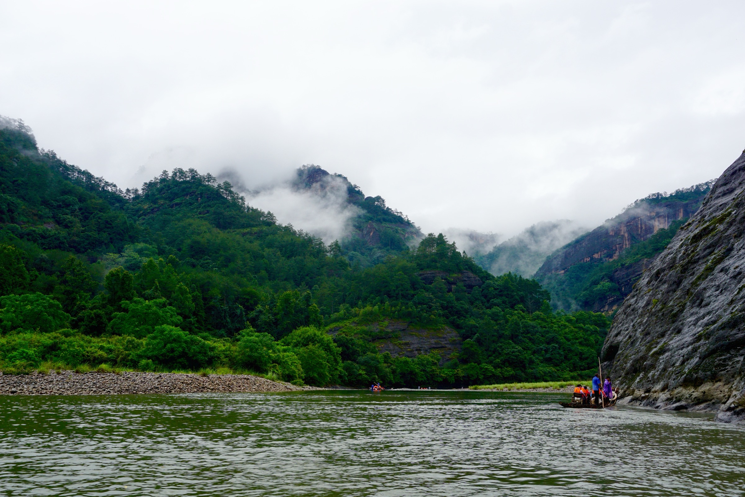
The Wuyi Shan Scenic and Historic Interest Area (武夷山风景名胜区) is the classic public face of the Wuyi Mountains — a UNESCO mixed World Heritage landscape inscribed in 1999 for both natural and cultural value, set in the upper basin of the Jiuqu Xi (九曲溪, Nine Bend Stream) in north-west Fujian. The scenic area is a tight cluster of red-bed Danxia (丹霞) sandstone cliffs, rock-tea valleys, river gorges, slot-caves, Taoist hermitages, Neo-Confucian academies and short but steep stone-stair mountain paths. The signature Tianyou Peak (天游峰, 408 m) rises straight from the third bend of Nine Bend Stream as the canonical Wuyi viewpoint; the highest summit inside the scenic area is the less-visited Sanyang Peak (三仰峰, 718 m) above the Taoyuan Cave back-country.
Walking here is managed scenic-area hiking rather than remote backcountry travel. Routes are reached by scenic-area shuttle bus, use built paths or stone stairs, and are gated by ticketing, opening hours and crowd-control measures. Distances are short — most marked walks run 2-8 km — but cumulative ascent on the steep cliff-stair sections is significant, and the cumulative effect of multiple stairway summits in a single day adds up. The scenic area is also the cultural heartland of Wuyi rock tea (武夷岩茶, Wuyi Yancha) — the dark-roasted oolung tea grown in the cliff-base valleys between Da Hong Pao and Niulanken — and several walking routes link the canonical tea-bush sites with the cave-and-cliff geology that defines the rock-tea terroir.
The walking season runs March to May and September to November. April–May is the rock-tea harvest, the most atmospheric time to walk the Niulanken corridor; September–November is the autumn-colour peak with the lowest crowd density of the year. July–August is hot (28-35 °C), humid and unsafe for the steep stair routes after midday; afternoon thunderstorms develop quickly over the cliff country. December–February is cool (5-12 °C) and dry but the north-facing stone stairs can be icy at dawn. Avoid the Qingming (early April) and National Day (early October) holiday weeks, when the central scenic-area shuttle queues exceed two hours and the Tianyou stair becomes a single-file traffic jam.
Access is straightforward. Wuyishan East (武夷山东) on the Hefei–Fuzhou (Hefu) HSR line and Wuyishan (武夷山) station on the Nanping–Fuzhou conventional line both sit within 12 km of the scenic-area south gate; intercity buses, scenic-area shuttles and taxis cover the remaining distance in 20-30 minutes. The scenic area runs an integrated internal shuttle network from the South Gate (南入口) and North Gate (北入口) to every major trailhead — Tianyou, Da Hong Pao, Water Curtain Cave, Tiger Roaring Rock, A Thread of Sky, Wuyi Palace, Sanyang Peak — at 15-30 minute intervals during opening hours.
For the wider south China context, see also the higher-level South China Ranges: Wuyi / Nanling roundup, which covers Wuyi alongside the Nanling, Luoxiao and Danxia ranges at a regional scale. The present page is the deep dive into the Wuyi scenic area itself.
Selection rationale
Five day-hikes are presented, spanning the essential walking set inside the Wuyi Shan scenic area: the iconic Tianyou Peak viewpoint over Nine Bend Stream, the Da Hong Pao to Water Curtain Cave rock-tea valley traverse, the Tiger Roaring Rock to A Thread of Sky cliff-and-cave southern circuit, the historic Wuyi Palace to Great King Peak palace-and-summit walk, and the harder back-country branch from Taoyuan Cave to Sanyang Peak, the highest summit inside the scenic area.
The selection balances the canonical view (Tianyou), the canonical tea valley (Da Hong Pao), the canonical cave traverse (Yixiantian), the canonical cultural site (Wuyi Palace) and the canonical hill challenge (Sanyang). Several routes carry estimated or unresolved distance and ascent figures — the scenic-area authority does not publish standardised route data and public GPX/KML coverage is limited; this page distinguishes between verified route character (peak coordinates, OSM named ways, photographic confirmation) and unverified statistics. The wider river-cruise on Nine Bend Stream itself is a bamboo-raft trip rather than a hike and is out of scope. Multi-day expeditions into the deeper Wuyi National Nature Reserve north of the scenic area are also out of scope as tramps rather than day-hikes.
Summary
| # | Hike | Section | Route type | Distance | Gain | Max elevation | Difficulty |
|---|---|---|---|---|---|---|---|
| 1 | Cloud Nest and Tianyou Peak | Central scenic area | Loop / out-and-back | ~3–5 km | ~200–300 m | 408 m | Moderate |
| 2 | Da Hong Pao to Water Curtain Cave | Rock-tea valley | Point-to-point / loop | 2.4 km short / 11.6 km loop | ~150 m short / ~646 m loop | 362 m | Easy to moderate |
| 3 | Tiger Roaring Rock to A Thread of Sky | Southern scenic area | Point-to-point with cave traverse | ~2.9 km + side paths | ~150–250 m (est.) | ~250 m (est.) | Moderate |
| 4 | Wuyi Palace to Great King Peak | Palace and Da Wang Feng | Loop / out-and-back | ~4–6 km (est.) | ~250–400 m (est.) | ~530 m (est.) | Moderate to hard |
| 5 | Taoyuan Cave to Sanyang Peak | Back-country / scenic-area high point | Out-and-back | ~8–10 km (est.) | ~500–700 m (est.) | 718 m | Hard for the scenic area |
1. Cloud Nest and Tianyou Peak
Snapshot
Itinerary
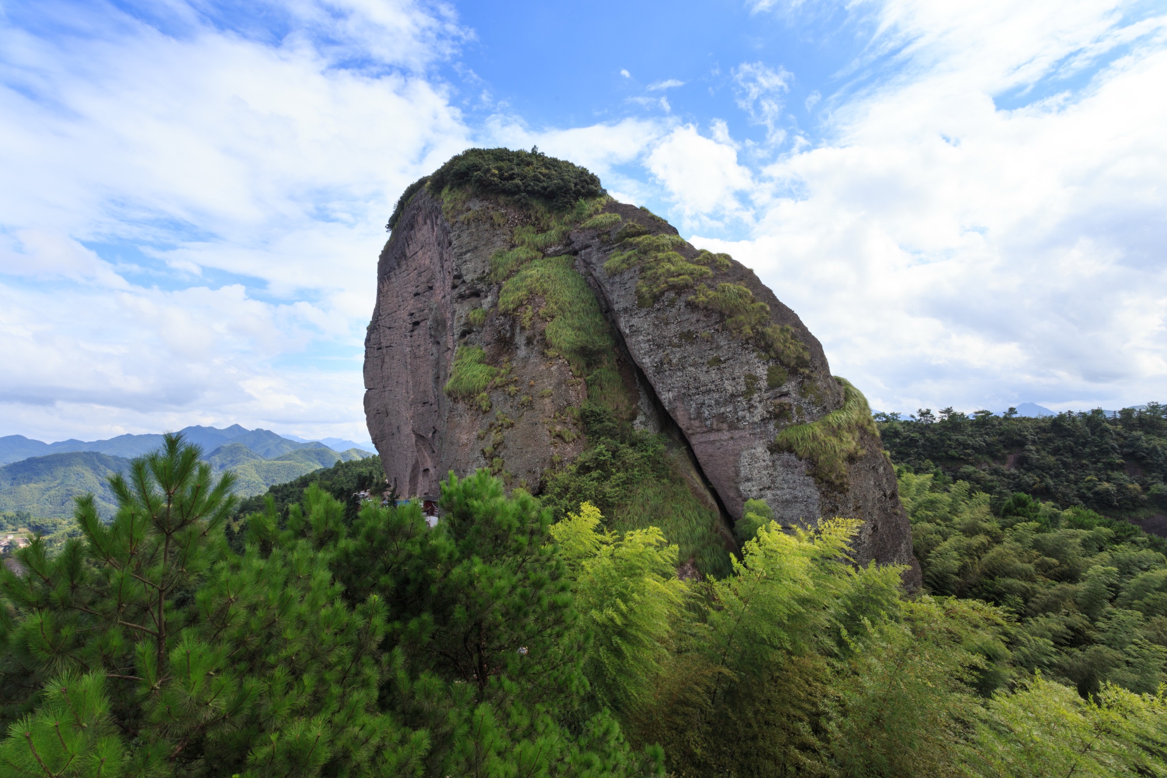
From the Yunwo (云窝, “Cloud Nest”) scenic-area shuttle stop, follow the built scenic path through the Cloud Nest cliff terrace — a flat shelf of polished red sandstone at the base of the Tianyou cliff line — and on past the Wuyi Jingshe (武夷精舍), the Neo-Confucian academy founded by Zhu Xi in 1183. From the academy the route turns up the Tianyou Peak stairway, a long engineered cliff-side staircase that climbs straight up the south face of the peak. The summit platform at Tianyou Peak (天游峰, 408 m) gives the canonical Wuyi panorama — the third bend of Nine Bend Stream curving 200 m directly below, with the Danxia cliff line stretching south to Da Wang Peak. Descend by the same stairway or, when the back-side path is open, continue north toward the Taoyuan Cave (桃源洞) and the back of the central scenic-area network.
Why it is essential
Tianyou Peak is the signature Wuyi viewpoint and the most direct day-hike expression of the region’s cliff-and-river landscape. Xu Xiake — the late-Ming travel writer who walked the Wuyi cliffs in 1616 — singled out Tianyou as the finest mountain prospect in south China, and the assessment has held: no other Wuyi summit gives the river-loop view as completely. The route is short, intense, and absolutely central to a first Wuyi day.
Equipment
- Light hiking shoes with grippy soles (stone stairs)
- Trekking poles for the descent
- 1.5 L water and a snack
- Sun protection (the upper stair is fully exposed)
- Waterproof layer (afternoon thunderstorms develop quickly)
- Offline scenic-area map
- Cash or mobile-payment for scenic-area entry and shuttle
Hazards and notes
- Stone stairs are slippery after rain; the descent is the main injury vector.
- The summit stairway becomes a single-file bottleneck on national-holiday weekends — start at gate opening or expect 30–60 min waits.
- Cliff-edge viewpoints have low railings; do not lean.
- Scenic-area opening hours typically 06:30–17:30 in peak season, 07:00–17:00 in low season.
- The back-side descent to Taoyuan Cave is occasionally closed for one-way visitor flow; confirm at the upper platform before committing.
2. Da Hong Pao to Water Curtain Cave
Snapshot
Itinerary
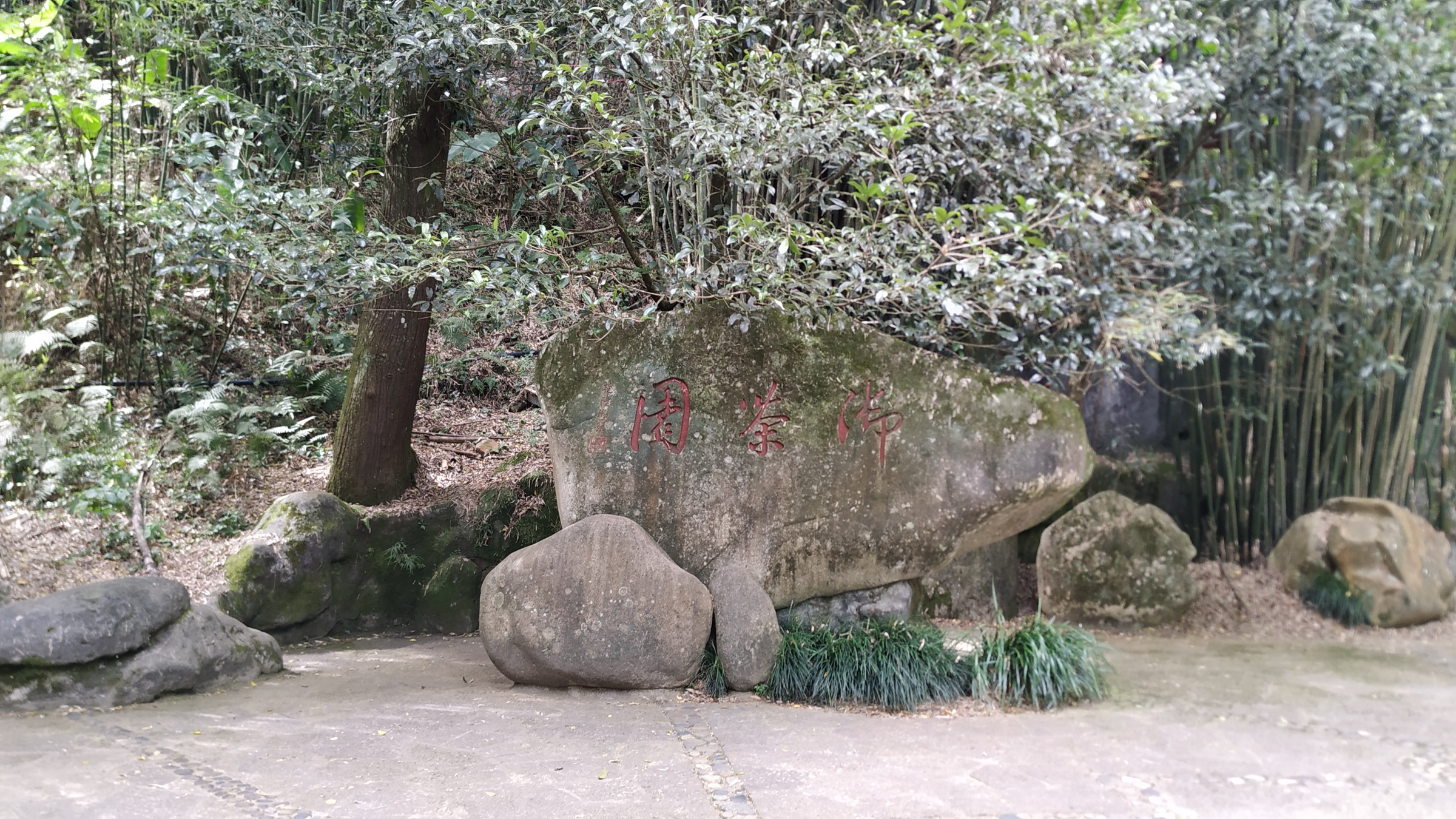
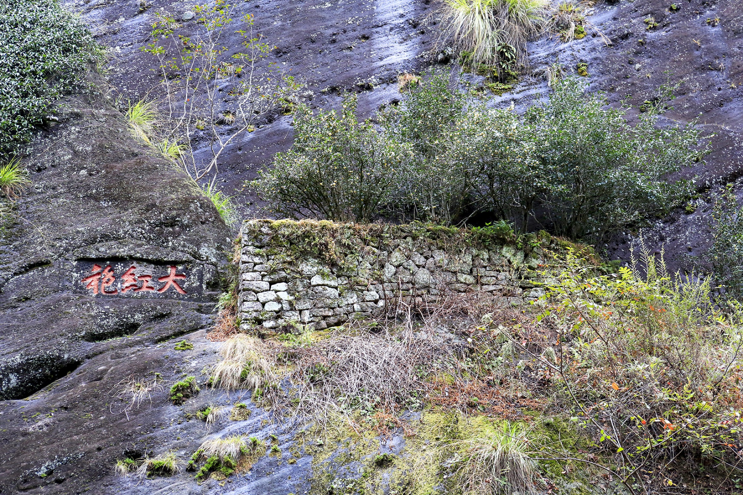
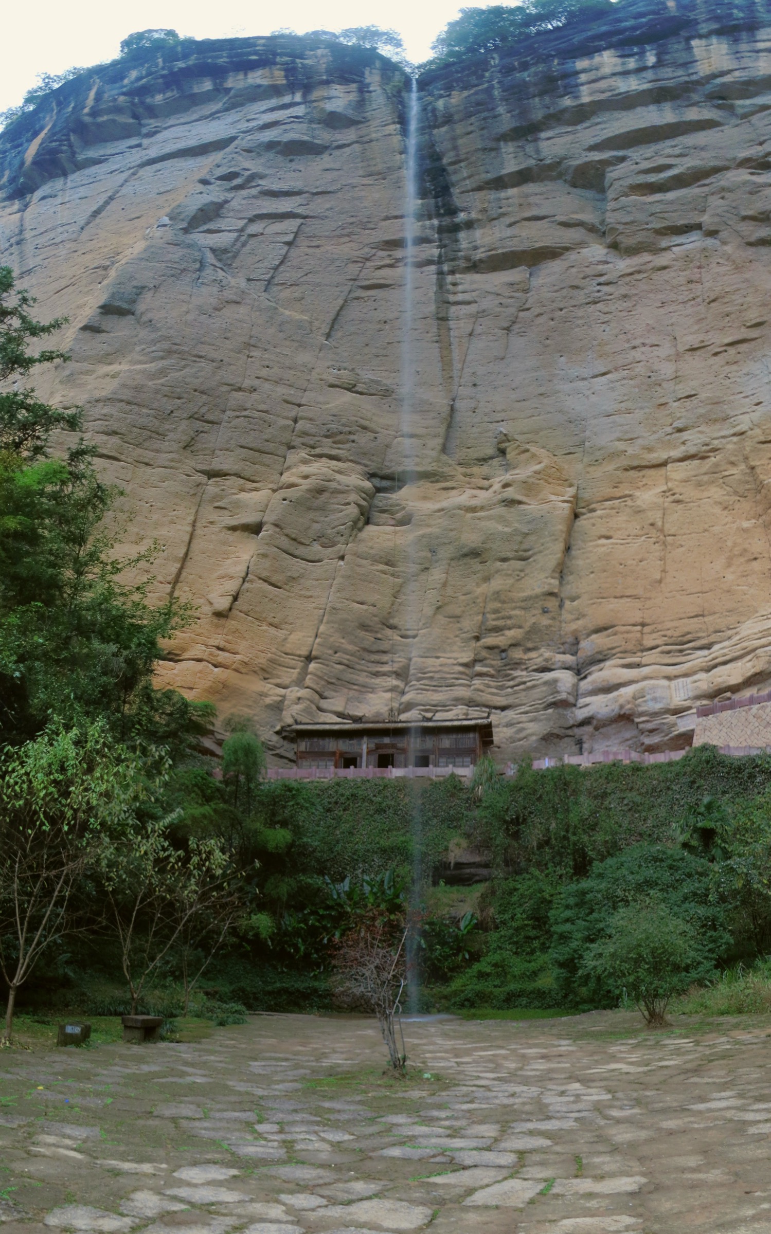
From the Da Hong Pao shuttle stop at Jiulongke (九龙窠), walk into the narrow rock-tea valley to the original Da Hong Pao tea bushes (母树大红袍) — six ancient tea trees growing from a crevice in the cliff base, the founding plants of Wuyi rock tea and the source of the “Big Red Robe” cultivar that now dominates the regional tea economy. From Jiulongke, the named slow-travel path Yangu Huaxiang Manyou Dao (岩骨花香慢游道, “Rock-Bone Floral-Fragrance Slow-Travel Path”) runs north-west along the Niulanken (牛栏坑) stream corridor, past working tea plantations, named cliff bases (each linked to a named tea cultivar) and the small Liu Xiang Jian (流香涧, “Flowing Fragrance Stream”) gorge, emerging at the Water Curtain Cave (水帘洞) — a large arched rock overhang on the back side of the Zhanghongyan cliff line, with a seasonal waterfall that pours across the cave mouth. Return by scenic-area shuttle, or extend the day into the 11.6 km loop that connects Water Curtain Cave with the upper Niulanken paths and back to Da Hong Pao via the cliff-top track.
Why it is essential
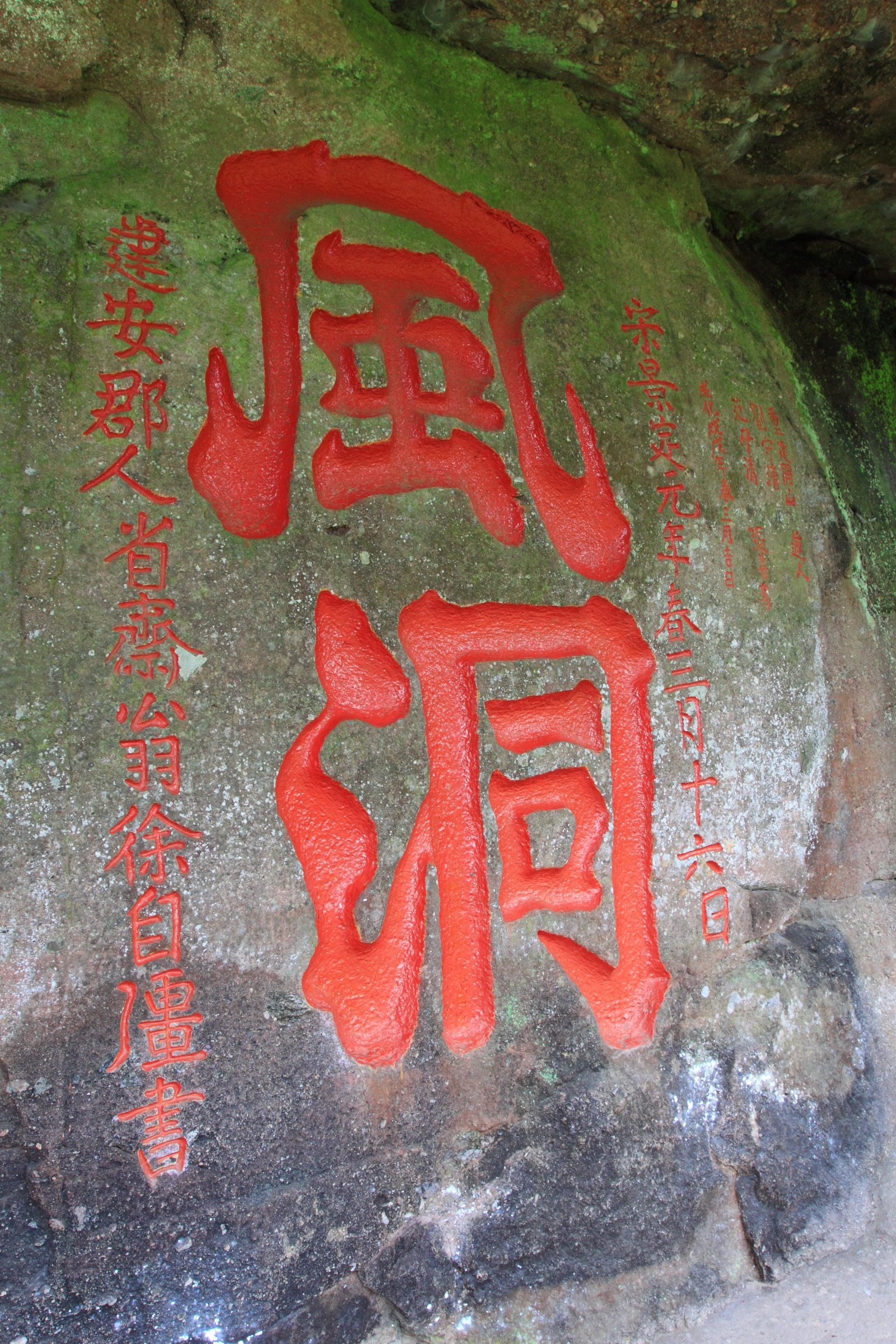
This is the single best Wuyi walk for rock-tea culture, linking the founding plants of Da Hong Pao with one of the scenic area’s major cave-and-cliff features. The Niulanken valley is the geographic heart of the rock-tea terroir — the steep red-bed sandstone walls, the limited solar exposure and the constant mist combine to produce the mineralised “rock rhyme” (岩韵) that defines Wuyi tea — and walking the corridor in tea-harvest season is the canonical Wuyi cultural-walking experience. The Water Curtain Cave end-point gives a geological set-piece to balance the cultural focus of the start.
Equipment
- Light walking shoes
- 1.5 L water; a refill is available at the Water Curtain Cave kiosk
- Sun and rain protection
- Insect repellent in summer
- Time buffer for the shuttle return if walking one-way
Hazards and notes
- Stone paving and the cave-base path are slick after rain.
- The Water Curtain Cave waterfall is seasonal; flow is heaviest May–July, often dry October–March.
- Do not step inside the rope barriers around the original Da Hong Pao bushes; the plants are heritage-protected.
- Tea-production yards are private; respect signage.
- Mid-day in summer is uncomfortably hot in the rock-walled valley; aim for morning or late afternoon.
3. Tiger Roaring Rock to A Thread of Sky
Snapshot
Itinerary
From the Tiger Roaring Rock (虎啸岩, Huxiao Yan) shuttle stop, climb the Huxiao Yan stairway through the cliff-and-stair landscape of the lower Tiger Roaring Rock — a series of named small caves and inscription rocks set against a sheer Danxia cliff. From the top of the Huxiao loop, follow the named connector trail Luye Xianzong Manyou Dao (绿野仙踪慢游道, “Green-Wilderness Magic-Trace Slow-Travel Path”) west-south-west through a quiet wooded corridor to the entrance of A Thread of Sky (一线天, Yixiantian) — the canonical Wuyi slot-cave, a narrow body-width passage cut through a sandstone fin where the cave roof closes to leave only a thin sliver of sky visible above. Exit the cave on the south side, walk down to the Yixiantian shuttle stop and return by scenic-area shuttle.
Why it is essential
This route combines Wuyi’s compact cliff walking with the region’s most famous narrow-cave experience. The Yixiantian slot is one of the canonical sights of the Wuyi scenic area — the “thread of sky” visible from the cave floor is a small but unforgettable geological set-piece — and the Huxiao Yan cliff-stair section gives an exposed-rock contrast to the river-and-tea routes elsewhere in the scenic area. As a half-day combination, the traverse is a strong complement to a Tianyou Peak morning.
Equipment
- Grippy walking shoes (the cave floor is uneven and wet underfoot in places)
- Small daypack (large packs catch in the cave slot)
- Water and a snack
- Light layer (cave temperature drops 6–8 °C below outside)
- Headlamp (the deepest cave section is dim)
- Mobile or printed scenic-area map
Hazards and notes
- The cave slot narrows to body width in places — uncomfortable for tall walkers, claustrophobics and large packs.
- After heavy rain the cave floor floods at the lowest point; the scenic-area authority closes the cave when flow makes the floor unsafe.
- Stone steps and cave floors are slippery year-round.
- Single-file traffic in the cave means the start may queue on holiday weekends.
- Scenic-area opening hours typically 06:30–17:30 in peak season.
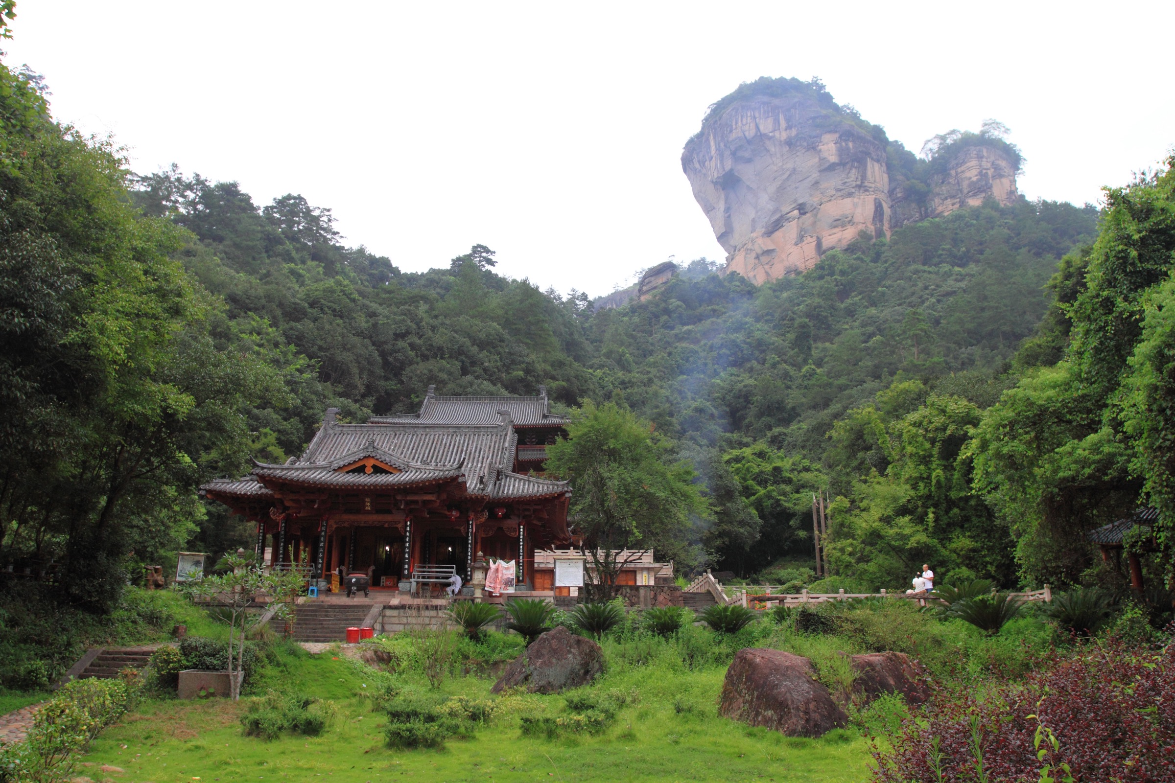
4. Wuyi Palace and Great King Peak
Snapshot
Itinerary
Begin at Wuyi Palace (武夷宫) — the historic ceremonial complex at the south end of the central scenic area, founded in the Tang dynasty and rebuilt repeatedly through the Song, Yuan, Ming and Qing as the official Taoist temple of the Wuyi range. From the palace courtyard, the route walks north on the cobbled lane to Zhizhi’an (止止庵) — the Song-era Taoist hermitage at the foot of Da Wang Feng — and then turns onto the cliff-side stairway that climbs the south face of Great King Peak (大王峰, Da Wang Feng). The upper stairway is sustained and exposed; the summit platform gives clean views over Nine Bend Stream and across to Tianyou Peak. Descend by the same stair (the alternative back-side traverse is occasionally closed) and return to Wuyi Palace, or continue on the cliff-base lane to link with the central scenic-area path network.
Why it is essential
Great King Peak (大王峰) is traditionally counted first among Wuyi’s named peaks — the 36 canonical summits of the range are listed beginning with Da Wang, before Tianyou and the rest. Wuyi Palace anchors the scenic area’s cultural history and is the literal gateway through which Qing-era visitors entered the range. The route gives the catalogue a palace-and-summit walk rather than another gorge or tea path, and the south-face stairway is one of the most direct cliff ascents in the scenic area. The combination of Tang-era temple architecture at the base and the Song-era Taoist hermitage on the climb is unmatched at any other trailhead in the scenic area.
Equipment
- Sturdy walking shoes for the cliff stair
- Trekking poles for the descent
- 1.5 L water and a snack
- Sun protection (the upper stair is fully exposed)
- Light wind shell at the summit
- Cash for scenic-area entry and any side-temple donation
Hazards and notes
- The summit stairway is steep and exposed; do not attempt in wet weather or after dark.
- Access to the upper stair is occasionally closed for maintenance or weather; confirm at the Wuyi Palace shuttle stop or the Zhizhi’an noticeboard.
- The south-face cliff has low railings at viewpoints; supervise children.
- Do not use closed shortcuts along the cliff line.
- Scenic-area opening hours typically 06:30–17:30 in peak season.
5. Taoyuan Cave to Sanyang Peak
Snapshot
Itinerary
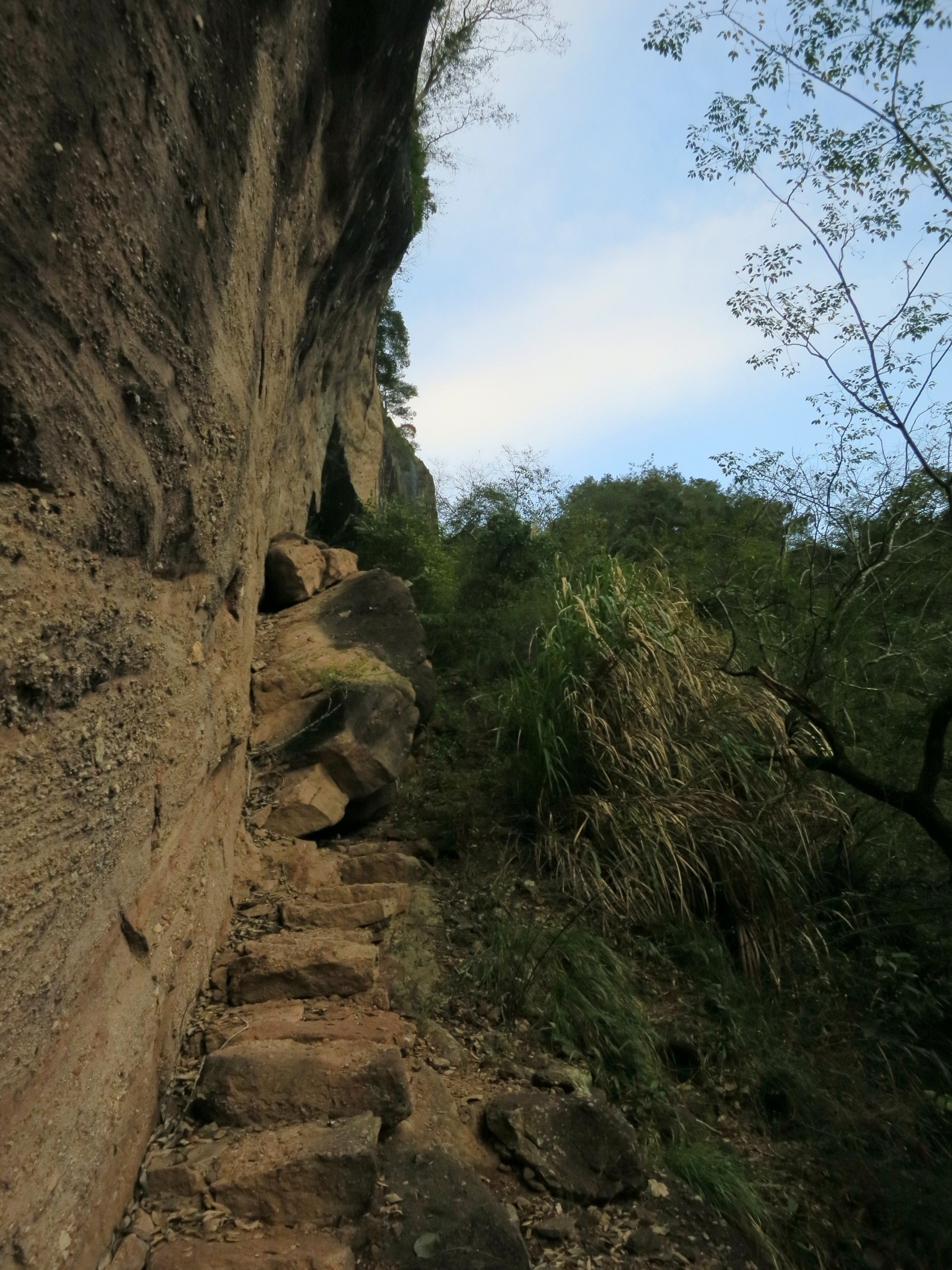
From the Taoyuan Cave (桃源洞) — a small enclosed valley behind Tianyou Peak, reached from the Yunwo–Tianyou shuttle stop by walking the back-side trail past Wuyi Jingshe and over the Phoenix Mound (凤凰岭) — the route leaves the main scenic-area path network and climbs the lesser-trafficked back trail through dense subtropical forest. The path follows the watershed ridge north-west, gaining altitude steadily on a rougher engineered stone-step trail with longer stretches of natural forest path, until it tops out at Sanyang Peak (三仰峰, 718 m) — the highest summit inside the Wuyi Shan scenic area and the source of the Sanyang ridge complex that bounds the back of the rock-tea valleys. The summit gives a clear view back over the central scenic area and north into the deeper Wuyi country. Return by the same line; alternative descents are not formally maintained.
Why it is essential
Sanyang Peak gives the Wuyi entry a harder, higher objective and balances the shorter managed scenic walks with a more committing hill route. At 718 m it is the scenic-area high point — higher than Tianyou (408 m), Great King Peak (~530 m) and any of the rock-tea valley summits — and the only walking objective inside the scenic area that requires a full day rather than a half-day. The back-country path is honestly rougher than the engineered cliff stairs elsewhere, and the route gives a contrasting “wild forest” character to a Wuyi visit otherwise dominated by stone-step terraces and ticketed sightseeing platforms.
Equipment
- Hiking shoes or light boots (rougher path than elsewhere)
- Offline OSM map and GPS (the back-country trail is less signed)
- 2.5 L water and food for the day
- Sun protection
- Waterproof layer
- Headlamp (the descent may run late)
- Cash or mobile-payment for scenic-area entry; full-day ticket recommended
Hazards and notes
- The Taoyuan Cave back trail is less well documented than the major scenic circuits; confirm with scenic-area staff that the path is open before committing.
- Do not attempt in heavy rain, dense fog, or if the upper trail is closed for typhoon-recovery work.
- Forest cover above ~400 m is dense; mobile coverage is patchy.
- The summit is on the watershed; thunderstorms develop quickly on hot afternoons — descend immediately at first thunder.
- Scenic-area gate closure is the binding constraint; aim to be back at a shuttle stop by 17:00.
Routes excluded as out of scope
The following sit inside or adjacent to the Wuyi Shan scenic area but fall outside a day-hike entry, or duplicate routes covered elsewhere.
- Nine Bend Stream bamboo-raft cruise (九曲溪竹筏漂流). A 90-minute downstream raft trip rather than a hike; the canonical Wuyi water experience but not a walking route.
- Wuyi National Nature Reserve, Jiangxi side. The deeper protected forest north and west of the scenic area, across the provincial border in Jiangxi; multi-day expeditions only and outside the Fujian scenic-area scope.
- Huanggang Shan (黄岗山, 2,160 m). The highest summit in the Wuyi range proper, on the Jiangxi border in the national nature reserve; restricted access and beyond a single day from the scenic area.
- Xiamei Ancient Village tea-merchant circuit. A flat lane walk through a Ming-Qing tea-merchant village, not a mountain route; an excellent half-day cultural add-on rather than a hike.
- Bamboo-raft and water-village half-day combinations. Marketed as “hiking + raft” packages but predominantly water-borne; not a walking entry.
Further reading
| Source | URL |
|---|---|
| UNESCO World Heritage Centre — Mount Wuyi (No. 911) | whc.unesco.org |
| Wuyi Shan Scenic and Historic Interest Area — official | wys.cn |
| Fujian Provincial Department of Culture and Tourism | whhly.fujian.gov.cn |
| Wuyishan city government | wuyishan.gov.cn |
| Wikipedia — Mount Wuyi | en.wikipedia.org |
| Wikipedia — Da Hong Pao tea | en.wikipedia.org |
| Chinese Wikipedia — Wuyishan Scenic Area (武夷山风景名胜区) | zh.wikipedia.org |
| Baidu Baike — Tianyou Peak (天游峰) | baike.baidu.com |
| Baidu Baike — Da Hong Pao tea cliff site (大红袍) | baike.baidu.com |
| Baidu Baike — Sanyang Peak (三仰峰) | baike.baidu.com |
| OpenStreetMap — Tianyou Peak node (1864142189) | openstreetmap.org |
| OpenStreetMap — Sanyang Peak node (3838425347) | openstreetmap.org |
| OpenStreetMap — Niulanken slow-travel path (363556868) | openstreetmap.org |
| OpenStreetMap — Tiger Roaring Rock connector (175855137) | openstreetmap.org |
| AllTrails — Water Curtain Cave Loop | alltrails.com |
| OpenStreetMap (ODbL 1.0) | openstreetmap.org |