Regional overview
The South China Ranges are a humid subtropical mountain belt of forested ridges, red sandstone cliffs, tea mountains, sacred peaks, old temple routes, waterfalls, and karst-edge highlands. This entry focuses on the Wuyi Mountains of Fujian/Jiangxi, the Nanling and Luoxiao uplands of Guangdong/Hunan/Jiangxi, and nearby south China red-bed mountain landscapes that are normally visited as managed scenic areas.
Walking here is often a mixture of stone stairways, forest roads, scenic-area shuttles, boardwalks, monastery paths, and rougher outdoor hiking routes. Summer heat, humidity, thunderstorms, slippery stone, typhoon rain, leeches or ticks in forest, and crowd management are more important planning issues than altitude on most routes. The exception is the Nanling high forest and Wugongshan meadows, where weather, cold wind, fog, and long ridge distances can become serious.
Access is usually through ticketed scenic areas with fixed opening times and internal transport. Independent GPX files are less common than in Europe or North America, and official route geometry is often not published. The routes below therefore distinguish between verified route character and unresolved GPS-grade data.
Selection rationale
The five hikes represent the region’s core walking characters: Wuyi’s UNESCO Danxia river cliffs, Guangdong’s highest Nanling summit, the pilgrimage ascent of the Southern Sacred Mountain, the type locality of Danxia landform at Danxiashan, and Wugongshan’s high meadow ridge. They are selected for landscape importance, cultural status, scenic value, and day-hike feasibility for fit walkers under normal conditions.
Summary table
| # | Hike | Country | Route type | Distance | Gain | Max elevation | Difficulty |
|---|---|---|---|---|---|---|---|
| 1 | Wuyi Mountains: Tianyou Peak and Nine-Bend Stream | China | Loop / point-to-point scenic-area walk | 4.0-7.8 km depending variant | 215-347 m | 408.8 m | Moderate |
| 2 | Shikengkong / Guangdong First Peak | China | Out-and-back / shuttle-assisted summit walk | 5 km direct route; 15-18 km traverse variant | Approx. 600 m direct route | 1,902 m | Moderate-hard |
| 3 | Nanyue Hengshan: Victory Arch to Zhurong Peak | China | Out-and-back / loop; shuttle-assisted variants possible | 11 km ascent; 22-25 km full walking day depending descent | Approx. 1,100-1,250 m | 1,300.2 m | Hard if walked from town |
| 4 | Danxia Mountain: Zhanglao / Jade Screen Peak and Xianglong Lake | China | Loop / scenic-area traverse | 9.5 km for Jade Screen Peak route; longer park circuits possible | 347 m on Wikiloc route | Approx. 408 m on Zhanglao Peak; 619 m highest geopark peak not on this route | Moderate |
| 5 | Wugongshan: Longshan Village to Dongjiang Village via high meadow ridge | China | Point-to-point | 14.8 km | 1,529 m | AllTrails track max 1,700 m; Golden Peak 1,918.3 m if summit spur included | Hard |
1. Wuyi Mountains: Tianyou Peak and Nine-Bend Stream
Snapshot
Itinerary
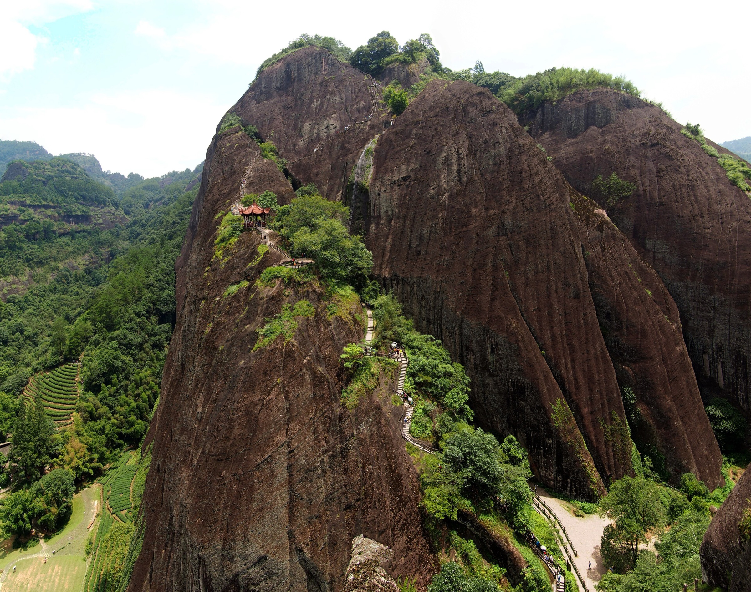
From the Tianyou Peak or Yunwo access point, the path follows the scenic-area approach below red sandstone cliffs and then climbs the famous Tianyou Peak stairway. Travel and park sources consistently describe the ascent as 848 stone steps. The summit viewpoint overlooks the fifth and sixth bends of the Nine-Bend Stream, with Wuyi’s cliff-and-river Danxia landscape below.
The descent can return by the same route or continue by the back side of the peak towards Taoyuan Cave and the Wuyi Palace / Nine-Bend Stream area if the path is open. The route is short, but the stairway is steep, narrow in places, and busy in peak periods.
Why it is essential
Tianyou Peak is the signature walking viewpoint of Mount Wuyi, a UNESCO mixed World Heritage landscape known for Danxia cliffs, the Nine-Bend Stream, tea culture, and Neo-Confucian sites. It gives the South China Ranges entry its clearest Wuyi cliff-and-river hike.
Equipment
Standard hiking equipment: grippy walking shoes, waterproof layer, water, sun protection, and a map or offline route. In hot months, carry extra water and start early.
Hazards and notes
Stone steps become slippery after rain. Thunderstorms, summer heat, crowding, and temporary scenic-area closures can affect the route. Stay on open paths; cliff-edge shortcuts and closed stairs should not be used.
GPX / KML links
| Source | URL | Format / access | Reuse status |
|---|---|---|---|
| Wikiloc: Mount Wuyi Tianyou Peak-Peach Blossom Spring Cave | wikiloc.com | Route page / GPS track | Wikiloc terms apply; source geometry found; file reuse terms not confirmed |
| Wikiloc: Wuyi Mountain-Tianyou Peak | wikiloc.com | Route page / GPS track | Wikiloc terms apply; source geometry found; file reuse terms not confirmed |
| OpenStreetMap search: Tianyou Peak Wuyi | openstreetmap.org | Map/search | OSM data is ODbL; geometry cross-check only |
External links
- UNESCO World Heritage Centre — Mount Wuyi
- Wuyi Mountain official site — Tianyou Peak
- Top China Travel — Mount Wuyi hiking tips
- Wikiloc — Mount Wuyi Tianyou Peak to Peach Blossom Spring Cave
2. Shikengkong / Guangdong First Peak
Snapshot
Itinerary
The direct summit route uses current scenic-area or forest-road access to gain the high ridge below Shikengkong, the highest point in Guangdong. From the Fourth Forest Road / high access area, the route climbs through montane forest and broken stair or path sections to the summit area. Wider traverse variants combine Water-Contact Valley / Qingshuigu-style walking, forest tracks, and the summit zone, but those variants are longer and less cleanly verified.
Because Nanling National Forest Park access has changed and some travel sources report temporary closure or rectification periods, the route should be treated as conditionally available. Confirm current opening, legal trailheads, and whether the summit path is accessible before departure.
Why it is essential
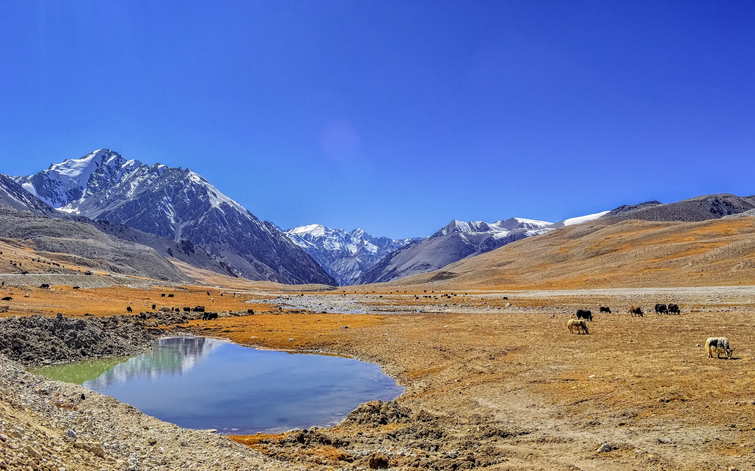
Shikengkong is the “Roof of Guangdong” and the defining high summit of the Nanling core. It represents the subtropical montane forest and high-ridge character of the South China Ranges better than lower urban or temple walks.
Equipment
Mountain hiking equipment: sturdy boots, trekking poles, waterproof layer, warm layer for the summit, water, food, offline map/GPS, headtorch, and tick/leech protection in warm wet periods. Microspikes may be needed if winter ice is reported.
Hazards and notes
Fog, rain, muddy forest tracks, poor mobile signal, winter ice, and unclear access rules are the main issues. Avoid unapproved shortcuts through protected forest. Start early enough to descend before afternoon thunderstorms.
GPX / KML links
| Source | URL | Format / access | Reuse status |
|---|---|---|---|
| OpenStreetMap search: Shikengkong | openstreetmap.org | Map/search | OSM data is ODbL; geometry cross-check only |
| PeakWiki: Shikengkong | peakwiki.org | Peak page with track-source pointers | Site terms apply; links out to track services; source page only; route-file reuse unresolved |
| Go20s Chinese hiking summary for Shikengkong | go20s.com | Route-stat summary page | Site terms apply; statistics cross-check only; GPX not found |
External links
- China Daily Guangdong — The first peak in Guangdong
- Key Biodiversity Areas — Nanling mountains factsheet
- Top China Travel — Nanling National Forest Park and Shikengkong
- Go20s — Shikengkong route-time summary
3. Nanyue Hengshan: Victory Arch to Zhurong Peak
Snapshot
Itinerary
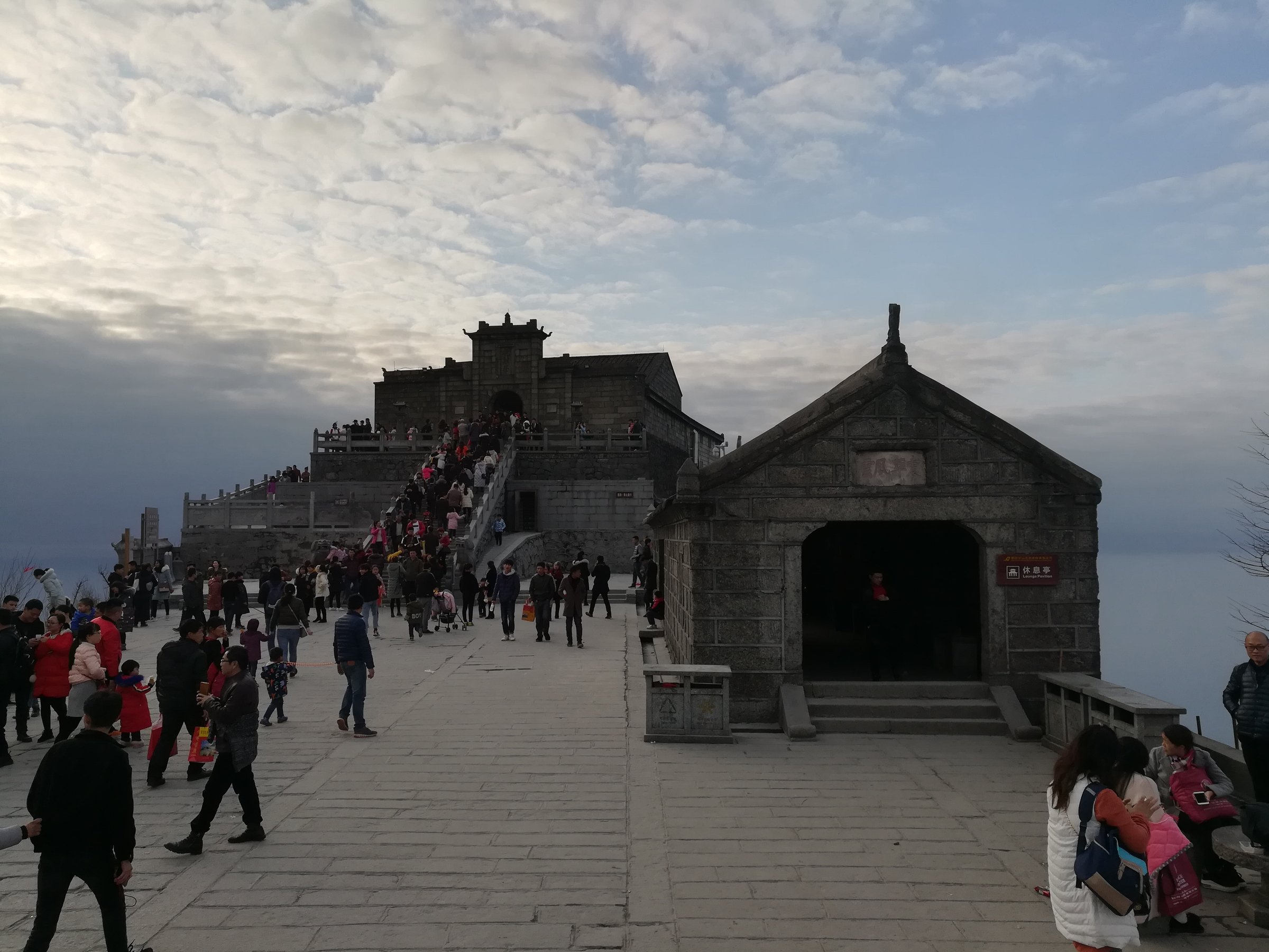
From Nanyue town, the traditional walking ascent begins near Victory Arch and climbs through the central scenic area. The route passes temple and memorial landscapes, including Nanyue religious sites, forested stairways, road crossings, mid-mountain facilities, Nantianmen, and the final summit approach to Zhurong Peak.
Scenic buses and cableway arrangements change over time, but current travel sources consistently note that even bus-assisted visitors must still walk uphill to reach Zhurong Peak. A full foot ascent is a long stair-and-road walking day, while a bus-assisted ascent is a shorter pilgrimage walk.
Why it is essential
Nanyue Hengshan is the Southern Sacred Mountain among China’s Five Great Mountains. The Zhurong Peak ascent combines cultural pilgrimage, temple history, and a classic south-central China mountain stair route.
Equipment
Standard to mountain hiking equipment depending whether walking from town: grippy shoes, water, food, waterproof layer, warm layer, sun protection, offline map/GPS, and headtorch for an early or late finish.
Hazards and notes
The main hazards are long stone stairs, slippery surfaces, mist, bus-road crossings, winter ice, and crowding during pilgrimage and holiday periods. Use official paths and check shuttle/cableway status before relying on a motor-assisted descent.
GPX / KML links
| Source | URL | Format / access | Reuse status |
|---|---|---|---|
| Wikiloc: Hengshan - Victory Arch to Zhurong Peak | wikiloc.com | Route page / GPS track | Wikiloc terms apply; source geometry found; file reuse terms not confirmed |
| Wikiloc: Climbing the Heng Mountain, Hunan | wikiloc.com | Route page / GPS track | Wikiloc terms apply; source geometry found; file reuse terms not confirmed |
| OpenStreetMap search: Nanyue Hengshan Zhurong Peak | openstreetmap.org | Map/search | OSM data is ODbL; geometry cross-check only |
External links
- China Mountain Travel — Nanyue Hengshan guide
- East China Trip — Mount Heng walking route
- Wikiloc — Hengshan Victory Arch to Zhurong Peak
4. Danxia Mountain: Zhanglao / Jade Screen Peak and Xianglong Lake
Snapshot
Itinerary
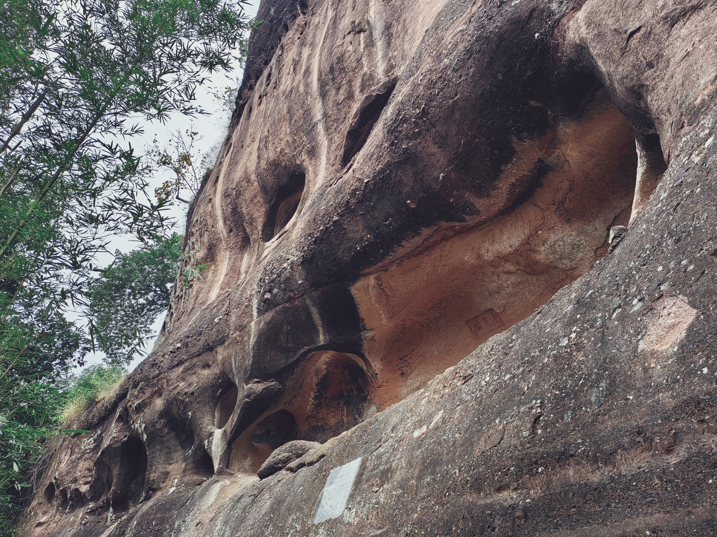
The route climbs the Zhanglao Peak / Jade Screen Peak area on constructed paths through red sandstone cliff scenery, temple sites, inscriptions, and viewpoints. It can be linked with Xianglong Lake paths and, if time allows, a transfer to Yangyuan Mountain. The selected day-hike statistics are based on the shorter Jade Screen Peak walking route rather than the much longer all-scenic-area wanderings sometimes recorded by GPS users.
Why it is essential
Danxia Mountain is the naming locality of Danxia landform and a UNESCO Global Geopark. A Zhanglao / Jade Screen Peak walk gives close contact with the red cliffs, towers, temples, and lake-valley scenery that define the landform.
Equipment
Standard hiking equipment: grippy shoes, water, rain layer, sun protection, and an offline map. In summer, carry more water than the short distance suggests.
Hazards and notes
Steep stone steps, cliff-edge viewpoints, heat, thunderstorms, and slippery red sandstone are the main hazards. Some routes use internal shuttles or cableways; check current access before planning a one-way walk.
GPX / KML links
| Source | URL | Format / access | Reuse status |
|---|---|---|---|
| Wikiloc: Danxia Mountain Jade Screen Peak Hike | wikiloc.com | Wikiloc listing / GPS track source | Wikiloc terms apply; source track identified in Shaoguan walking listings; direct file reuse not confirmed |
| OpenStreetMap search: Danxia Mountain Zhanglao Peak | openstreetmap.org | Map/search | OSM data is ODbL; geometry cross-check only |
External links
- UNESCO Global Geoparks — Danxiashan UNESCO Global Geopark
- UNESCO World Heritage Centre — China Danxia
- Global Geoparks Network — Danxiashan profile
- Wikiloc — Shaoguan walking listings (Danxia Mountain Jade Screen Peak)
5. Wugongshan: Longshan Village to Dongjiang Village via High Meadow Ridge
Snapshot
Itinerary
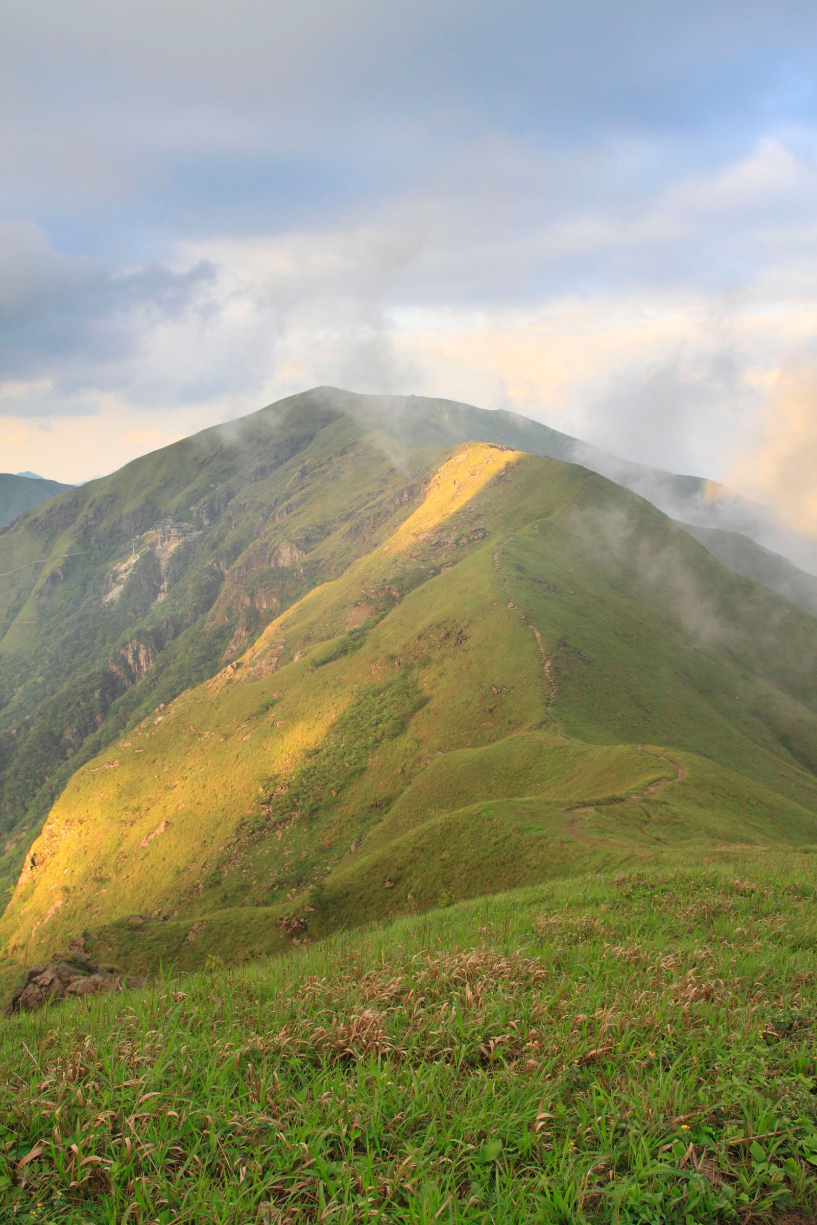
The route climbs from Longshan Village into the Wugongshan high country, passing forest, streams, waterfall areas, and open ridges before traversing the famous alpine meadow landscape. Depending on the exact line, hikers may pass Fayunjie, exposed meadow slopes, Diao Ma Stake, and the Golden Peak / Baihe Peak area before descending towards Dongjiang Village or a scenic-area exit.
This is a strenuous day hike rather than a casual scenic-area stroll. Many hikers split Wugongshan ridge routes over two days to see sunrise or camp; the catalogue route is included as a hard one-day traverse for fit walkers in stable weather.
Why it is essential
Wugongshan is one of south China’s most famous high meadow landscapes, with ridge walking, sea-of-cloud views, waterfalls, and a summit cultural landscape around Golden Peak.
Equipment
Mountain hiking equipment: boots, trekking poles, waterproof layer, warm layer, food, at least 2 litres of water, headtorch, offline route, power bank, and emergency insulation. In winter or after freezing rain, traction may be required.
Hazards and notes
Fog can make meadow navigation difficult. Thunderstorms, wind exposure, muddy slopes, long descent fatigue, and crowding around Golden Peak are common issues. Check whether the intended descent is legal and open; do not rely on informal camping unless current rules allow it.
GPX / KML links
| Source | URL | Format / access | Reuse status |
|---|---|---|---|
| AllTrails: Wugongshan - Longshan Village to Dongjiang Village | alltrails.com | Route page / app map | AllTrails terms apply; GPX export terms not verified; source-map and statistics used |
| Wikiloc: Wugong Mountain.gpx | wikiloc.com | Route page / GPS track | Wikiloc terms apply; track source found; file reuse not confirmed |
| OpenStreetMap search: Wugongshan Golden Peak | openstreetmap.org | Map/search | OSM data is ODbL; geometry cross-check only |
External links
- Wugongshan official site
- AllTrails — Wugongshan Longshan Village to Dongjiang Village
- LoongWander — Wugong Mountain Scenic Area
- China Daily — Wugong Mountain Scenic Area
External links
| Source | URL |
|---|---|
| UNESCO World Heritage Centre — Mount Wuyi | whc.unesco.org |
| Wuyi Mountain official site | wyschina.com |
| Top China Travel — Mount Wuyi hiking tips | topchinatravel.com |
| China Daily Guangdong — The first peak in Guangdong | guangdong.chinadaily.com.cn |
| Key Biodiversity Areas — Nanling mountains | keybiodiversityareas.org |
| Top China Travel — Nanling National Forest Park | topchinatravel.com |
| China Mountain Travel — Nanyue Hengshan guide | chinamountaintravel.com |
| East China Trip — Mount Heng walking route | eastchinatrip.com |
| UNESCO Global Geoparks — Danxiashan | unesco.org |
| UNESCO World Heritage Centre — China Danxia | whc.unesco.org |
| Global Geoparks Network — Danxiashan profile | globalgeopark.org |
| Wugongshan official site | wugongshan.cn |
| AllTrails — Wugongshan Longshan to Dongjiang | alltrails.com |
| LoongWander — Wugong Mountain Scenic Area | loongwander.com |
| Wikiloc — Mount Wuyi Tianyou Peak to Peach Blossom Spring Cave | wikiloc.com |
| Wikiloc — Hengshan Victory Arch to Zhurong Peak | wikiloc.com |
| Wikiloc — Wugong Mountain GPX | wikiloc.com |