Regional overview
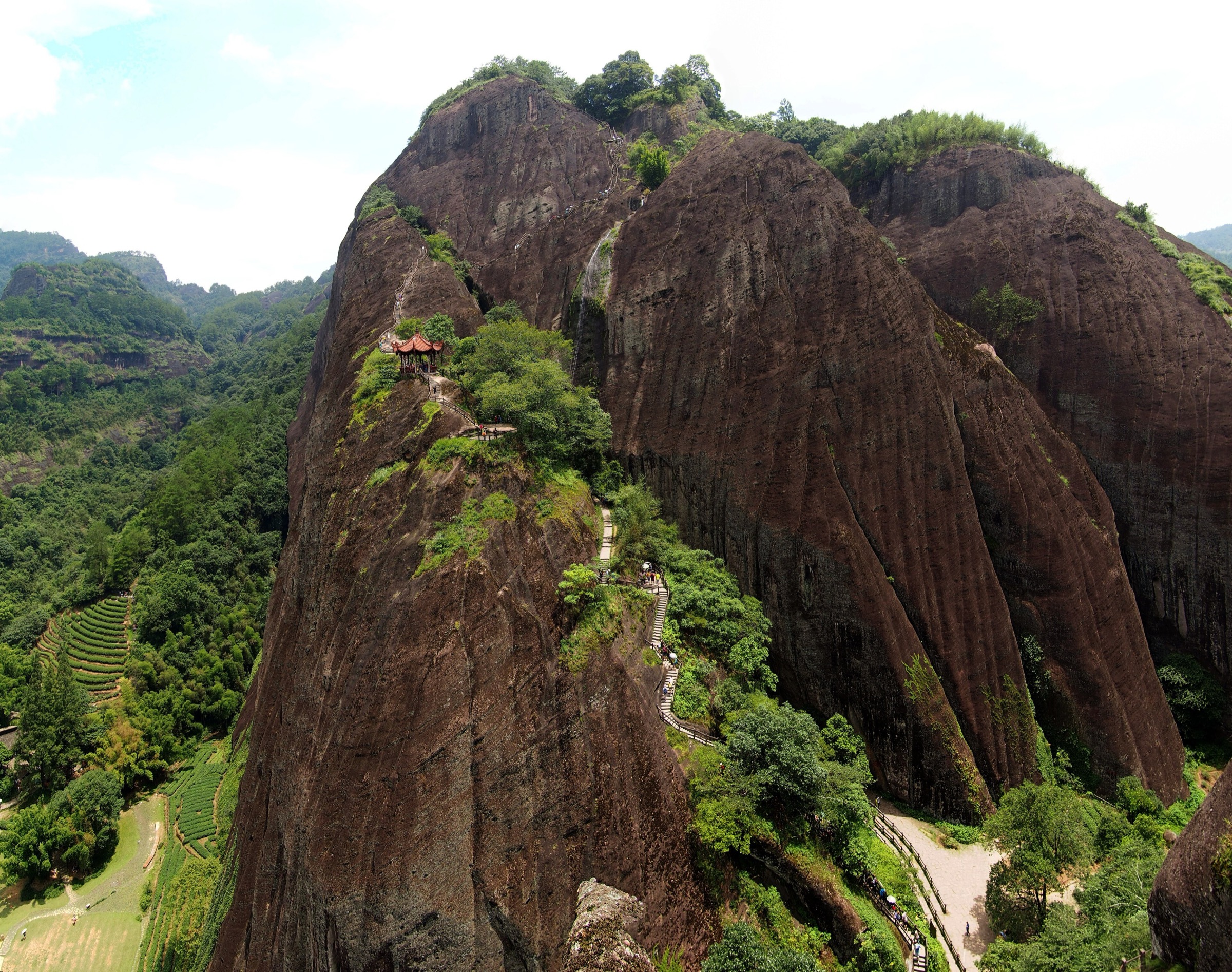
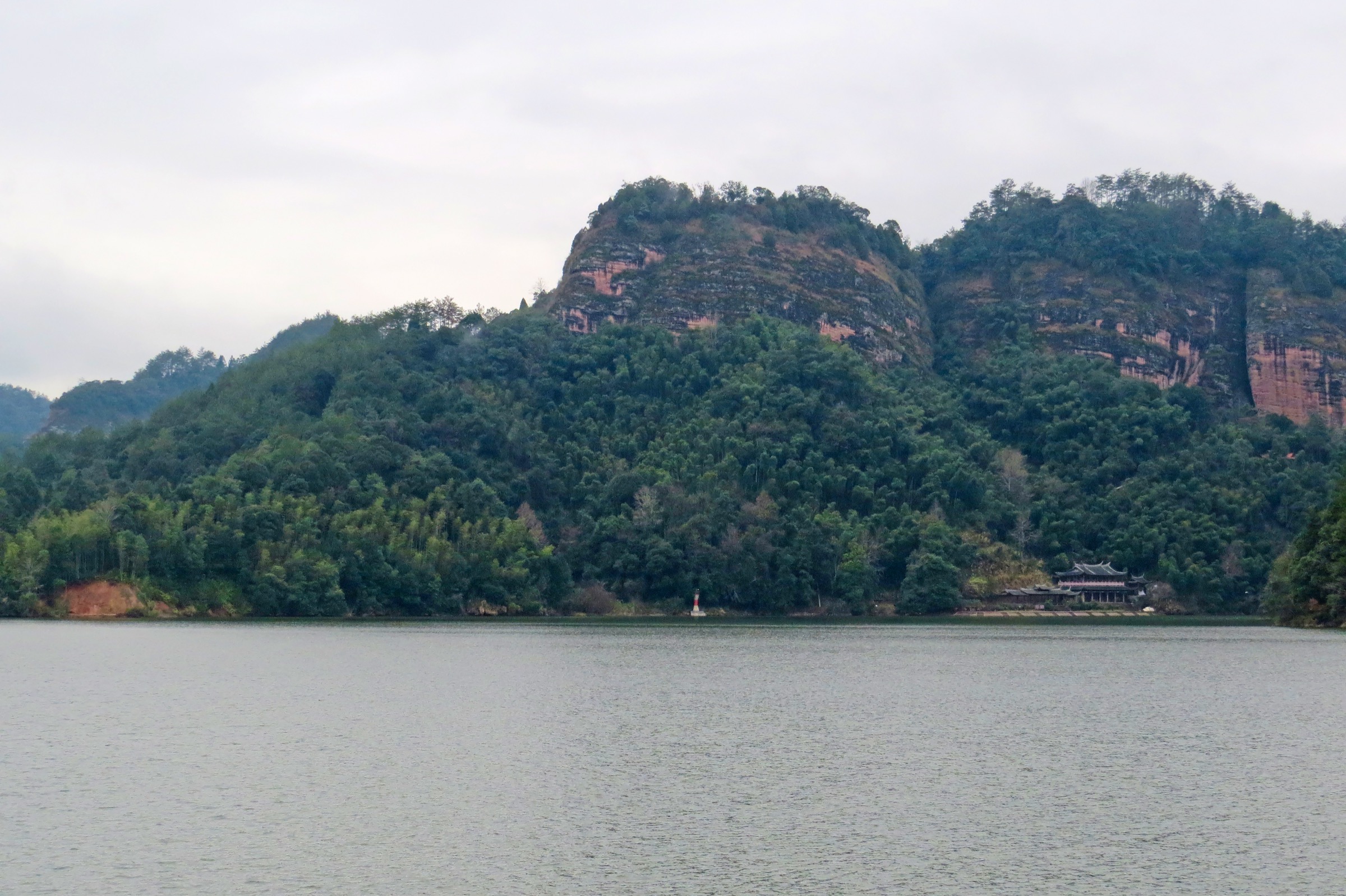
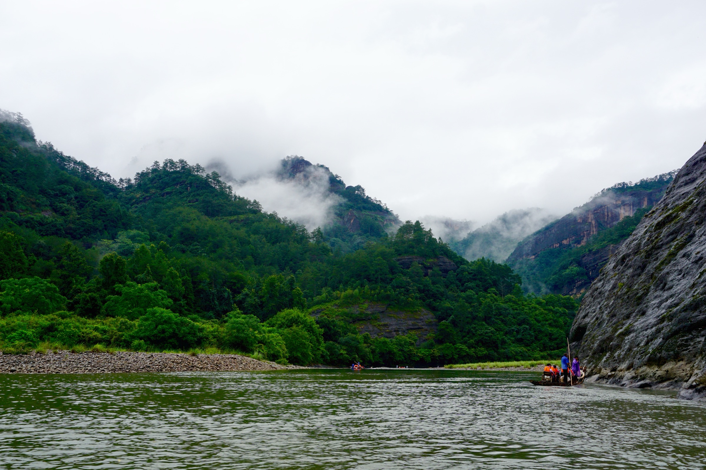
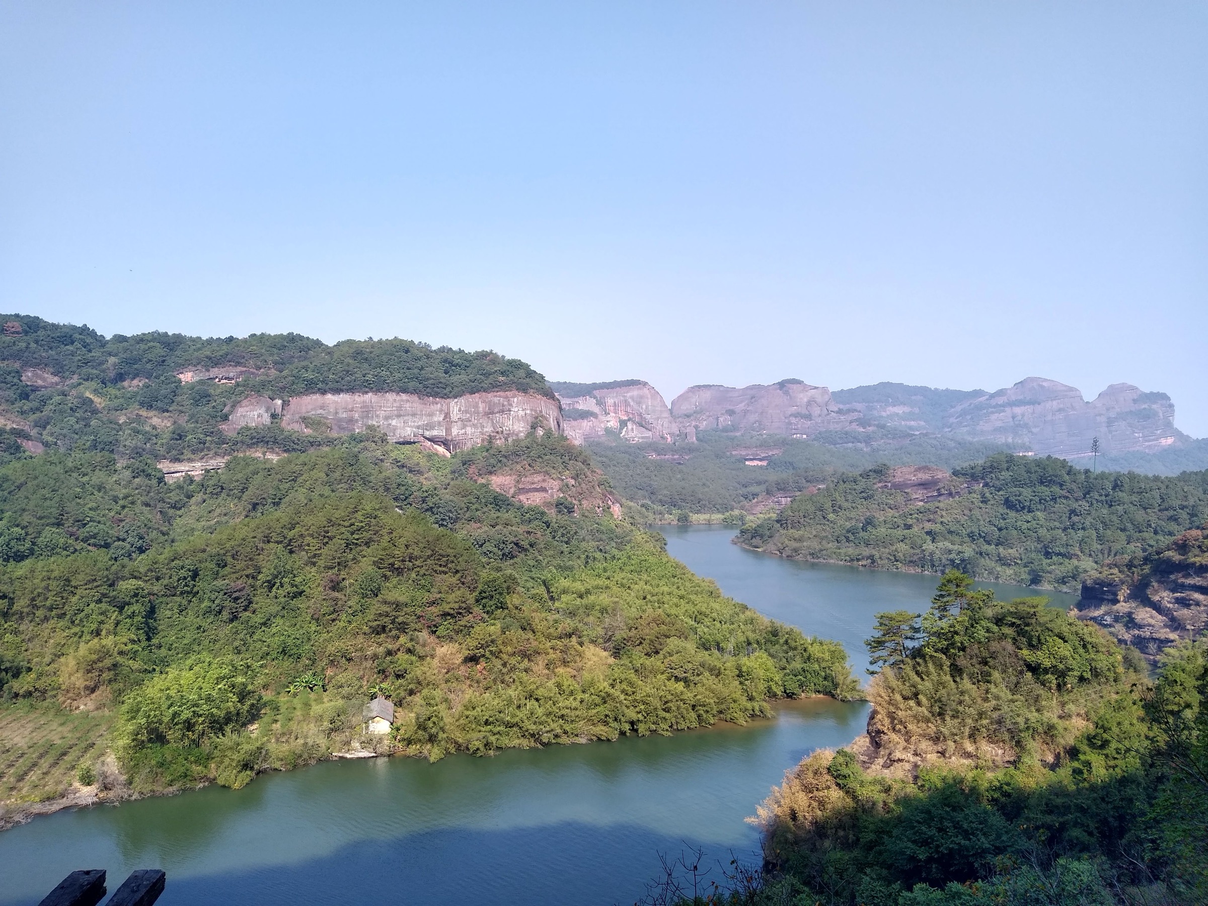
Danxia Shan (丹霞山) is the type locality of the Danxia landform and the southern Nanling Mountains’ best-known walking destination, in Renhua County, Shaoguan, northern Guangdong. The 292 km² scenic-area complex carries an unusually thick stack of designations — National Park, National Nature Reserve, AAAAA scenic area, UNESCO Global Geopark, and one of six components of the UNESCO China Danxia World Heritage serial property — and protects a landscape of red sandstone cliffs, towers, narrow ravines, lake corridors, temples and cliff plank roads. Baozhu Peak sits at roughly 408 m above the Jin River basin, so this is low-altitude walking, but the relief is concentrated and the engineered staircases are steep.
The walking character is managed scenic-area hiking: stone steps, cliff stairways, plank roads, temple courtyards, short summit loops, lake paths and shuttle-linked sectors. Routes cluster in four scenic zones — Changlaofeng around Baozhu Peak (the headline cultural and viewpoint area), the Yangyuan Mountain sector (Yangyuan Stone, the Yunya plank road and the Ximei Fortress challenge loop), Xianglong Lake (a low water-and-cliff corridor) and the Shaoshi sector to the east. Internal shuttles connect the gates and major paths, the official Danxiashan site publishes opening hours, ticket policy and recommended itineraries, and a January 2024 protected-area notice prohibits unauthorised entry into the reserve’s core and buffer zones, so the practical walking universe is the public scenic-area network.
Best walking seasons are October to April for cool dry weather. Spring brings scenic mist that softens the red rock but also slick stairs. Summer is hot, humid and stormy, with flash-flood risk on the lower corridors and slippery sandstone on the cliff routes. Winter is mild, but the early starts needed for sunrise from Baozhu Peak can be cold. Danxia Shan sits at the southern end of the Nanling hiking arc that continues east into the Wuyi and central Nanling ranges.
Selection rationale
The five hikes cover the practical Danxia Shan walking spectrum: the classic Changlaofeng cultural ridge with its temples, cliff inscriptions and Shaoyin Pavilion summit; the short Rudder Stone viewpoint that works as an add-on or a compact route in itself; the Yangyuan Mountain challenge loop combining the Yunya plank road with Ximei Fortress and the Jiujiu Heavenly Ladder; the Xianglong Lake loop for a lower water-focused day; and the less fully verified Shaoshi / Jinguiyan historic walk. Statistics for the first four come from a combination of the official Danxiashan route guide and AllTrails source maps. The Shaoshi entry remains candidate-level because exact route geometry has not been resolved in this pass.
Summary table
| # | Hike | Country | Route type | Distance | Gain | Max elevation | Difficulty |
|---|---|---|---|---|---|---|---|
| 1 | Changlaofeng cultural ridge | China | Out-and-back / traverse variant | 5.95 km | 395 m | Unresolved | Hard |
| 2 | Rudder Stone viewpoint | China | Short out-and-back | 1.45 km | 122 m | Unresolved | Moderate |
| 3 | Yangyuan Mountain — Ximei Fortress loop | China | Loop | 3.86 km | 180 m | Unresolved | Moderate |
| 4 | Xianglong Lake loop | China | Lake loop | 3.86 km | 280 m | Unresolved | Moderate |
| 5 | Shaoshi / Jinguiyan historic walk | China | Scenic-area walk (candidate) | Unresolved | Unresolved | Unresolved | Moderate |
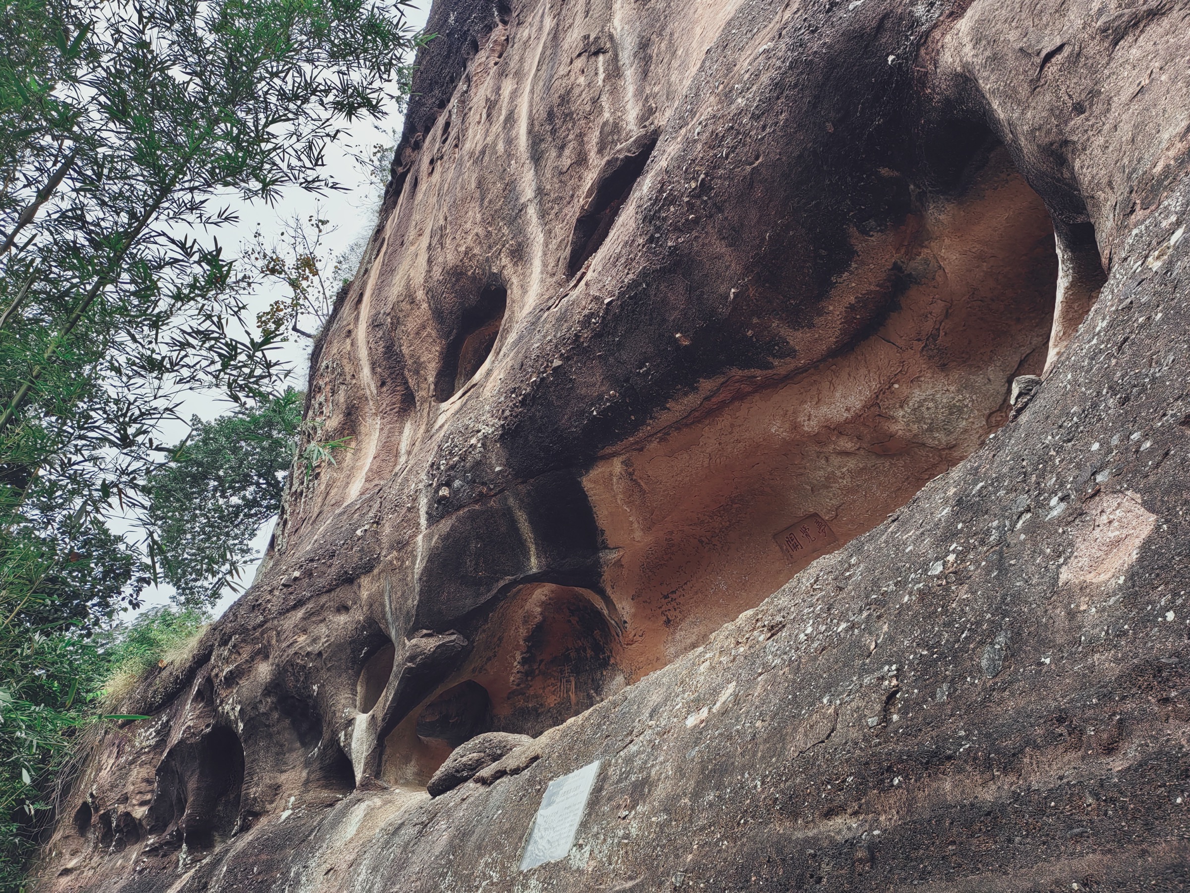
1. Changlaofeng cultural ridge — Jinshiyan, Biechuan Temple, Shaoyin Pavilion
Snapshot
Itinerary
The official experiential Changlaofeng route starts at the Changlaofeng checkpoint and threads together Jinshiyan Temple, Banshan Pavilion, cliff inscriptions, Biechuan Zen Temple, Danti Tiesuo, Luoding Futu, Shaoyin Pavilion and the Rudder Stone / cableway descent area, with red sandstone cliffs, temple courtyards and cliff staircases the entire way. The AllTrails core route covers a shorter Baozhu Peak — Biechuan Temple — Shaoyin Pavilion line as the headline source-statistic route, at 5.95 km out-and-back and 395 m of gain.
A common day plan is to ascend on foot through the Jinshiyan / Biechuan Temple line, take Shaoyin Pavilion at the top for the sunrise or panoramic view, and descend by cableway to save the knees. Allow extra time for the temple complexes — they are part of why the route is the headline Danxia walk, not a detour.
Why it is essential
This is the strongest single Danxia Shan walk — red sandstone cliffs, temple sites, cliff inscriptions, steep stairs and a high summit pavilion, all in the type locality of the Danxia landform. It is the route most directly responsible for the area’s UNESCO and AAAAA reputations.
Equipment
Grippy walking shoes, 1.5–2 L water, a rain shell, sun hat, sunscreen, snacks, and an offline map. Trekking poles help on long stair descents but can be awkward on the narrowest steps.
Hazards and notes
Steep stairs, cliff-edge viewpoints, wet sandstone, heat, thunderstorms and crowding are the main hazards. Stay on the open public paths and respect the January 2024 protected-area notice — the reserve’s core and buffer zones are off-limits to general visitors.
GPX / route file
| Source | URL | Format | Notes |
|---|---|---|---|
| AllTrails — Baozhu Peak / Biechuan Temple / Shaoyin Pavilion | alltrails.com | Source map / app route | AllTrails terms apply; direct GPX not retrieved; source-map reference only |
| Official Danxiashan route guide | dxs.sg.gov.cn | Official itinerary page | Route description verified; no downloadable GPX found |
| OpenStreetMap — Danxia Shan area | openstreetmap.org | Map / search | OSM data is ODbL; geometry cross-check only |
Further reading
2. Rudder Stone viewpoint
Snapshot
Itinerary
Use the Changlaofeng / Baozhu Peak side of the scenic area to reach the Rudder Stone spur, branching off the main Changlaofeng route at the Shaoyin Pavilion area. The walk is short but steep enough to stand on its own as a compact viewpoint hike or to attach as an add-on to the cultural ridge route in section 1.
Why it is essential
Rudder Stone is one of the clearest short high-viewpoint options in the Danxia Shan core — useful for visitors who want a sharply focused red-rock viewpoint without committing to the full Changlaofeng traverse, or for adding a sunset spur after the main day’s walk.
Equipment
Walking shoes with good grip, water, rain shell, sun protection, and a camera. Carry extra water in hot weather even though the route is short.
Hazards and notes
Short routes here still mean steep stairs, cliff viewpoints, slippery rock, heat and thunderstorm exposure. Treat it as a mountain stair route, not a stroll. Do not bypass closure notices.
GPX / route file
| Source | URL | Format | Notes |
|---|---|---|---|
| AllTrails — Rudder Stone Viewpoint | alltrails.com | Source map / app route | AllTrails terms apply; direct GPX not retrieved |
| Official Danxiashan route guide | dxs.sg.gov.cn | Official itinerary context | Confirms Rudder Stone within the Changlaofeng route |
| OpenStreetMap — Danxia Shan area | openstreetmap.org | Map / search | OSM data is ODbL; geometry cross-check only |
Further reading
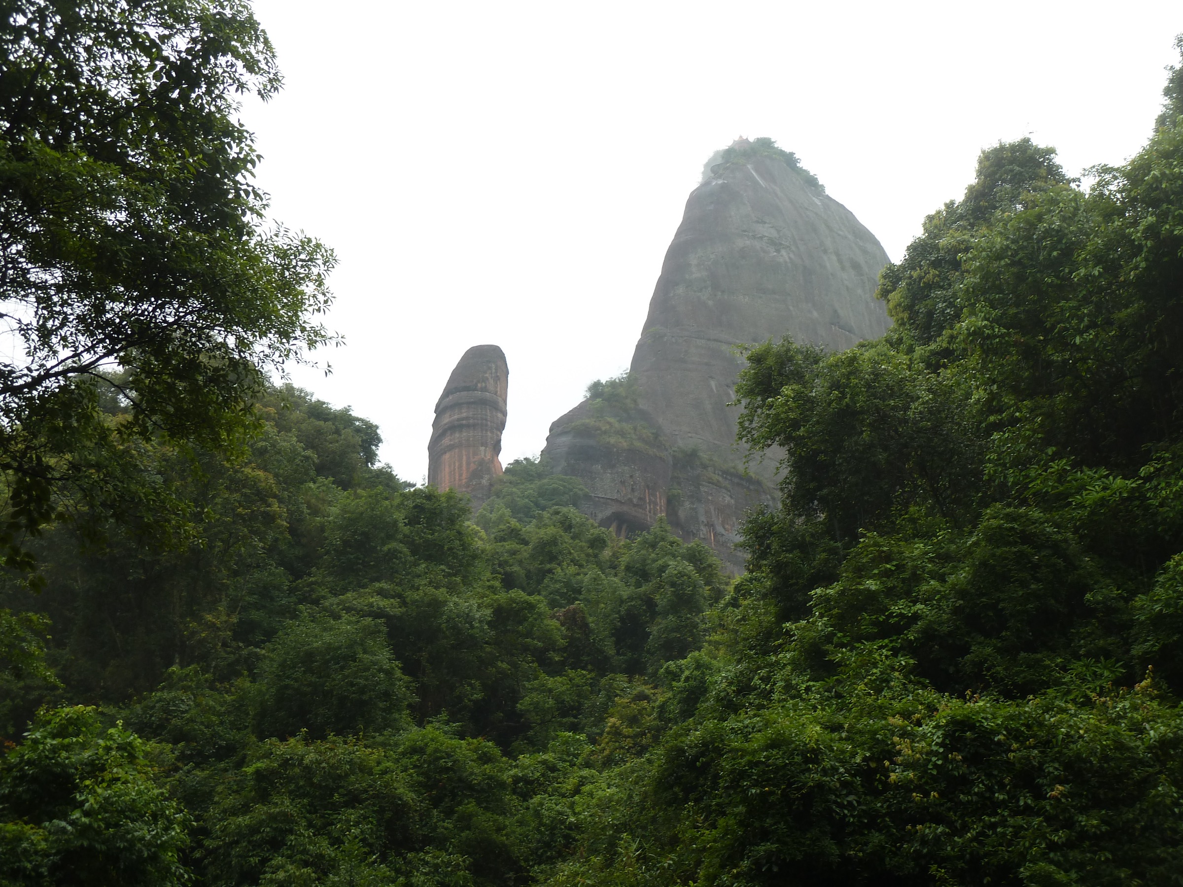
3. Yangyuan Mountain — Yunya plank road, Ximei Fortress and Jiujiu Heavenly Ladder
Snapshot
Itinerary
The official challenge route starts at the Yangyuan checkpoint and links the Yangyuan Stone viewpoint, Baiyangtai, the Yunya plank road, Jiadun Pavilion, Ximei Fortress and the Jiujiu Heavenly Ladder before closing the loop back at the checkpoint. The AllTrails Qianyun Pavilion / Ximei Fortress loop provides distance and elevation figures for a closely related line in the same sector, at 3.86 km and 180 m of gain.
This is the most concentrated Danxia route on this list: a short circuit through engineered cliff plank roads, a fortress site and one of the most recognisable rock pillars in southern China.
Why it is essential
Yangyuan is Danxia Shan’s compact challenge loop — red-rock stairs, exposed plank-road sections, fortress history and the famous Yangyuan Stone in one short but memorable day hike. It pairs well with the Changlaofeng cultural ridge as a two-day Danxia plan.
Equipment
Grippy shoes, water, rain shell, sun protection, and a light pack. Avoid bulky loads on ladders or narrow stair sections.
Hazards and notes
Steep ladders and stairs, exposed sandstone, slippery wet surfaces, crowds at Yangyuan Stone, heat and thunderstorms are the main issues. Do not use closed cliff routes; the cliff plank-road sections are sometimes shut for repairs or in high wind.
GPX / route file
| Source | URL | Format | Notes |
|---|---|---|---|
| AllTrails — Qianyun Pavilion / Ximei Fortress | alltrails.com | Source map / app route | AllTrails terms apply; direct GPX not retrieved |
| Official Danxiashan route guide | dxs.sg.gov.cn | Official itinerary page | Route sequence verified; no downloadable GPX found |
| OpenStreetMap — Danxia Shan area | openstreetmap.org | Map / search | OSM data is ODbL; geometry cross-check only |
Further reading
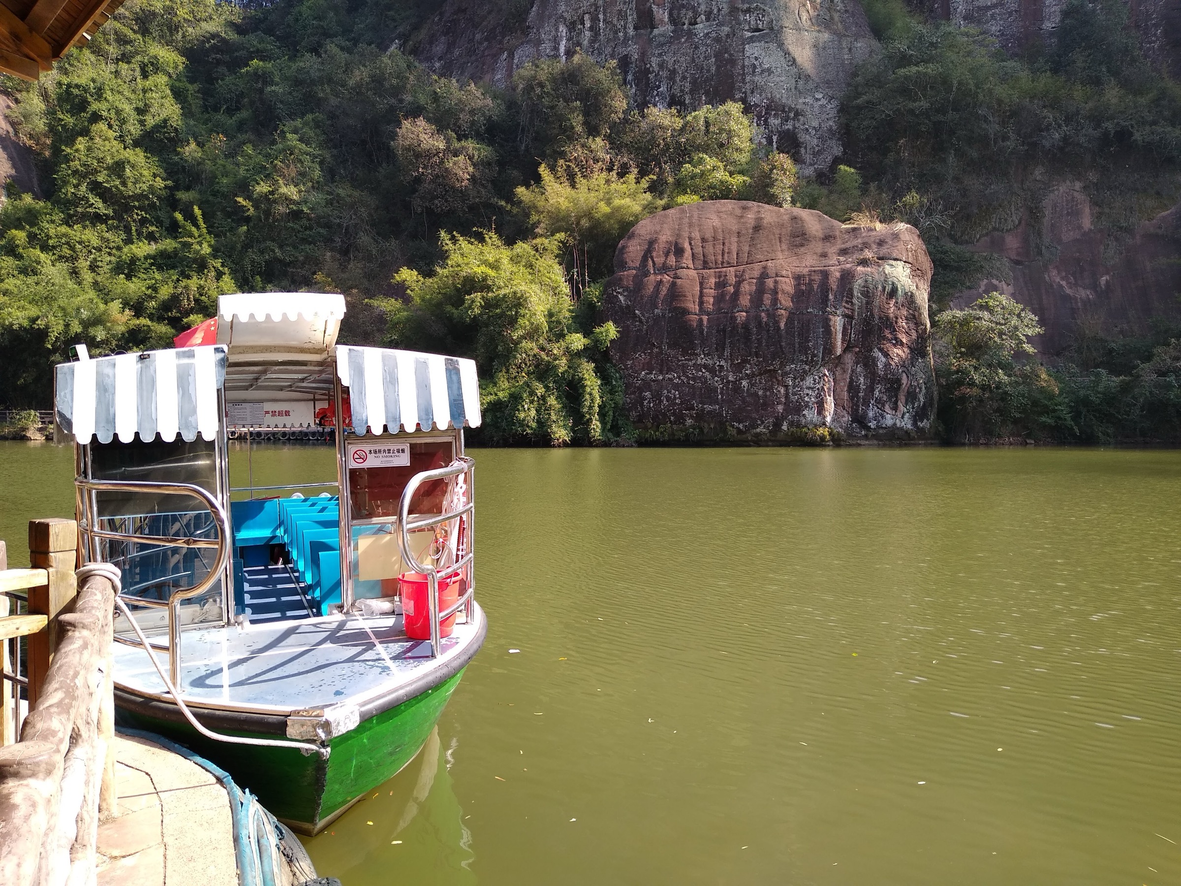
4. Xianglong Lake loop
Snapshot
Itinerary
From the Xianglong Lake access area, follow the public lake path around water, cliff and pavilion viewpoints. Depending on current operations, the walking loop can be combined with boat services to add an on-water section, or linked into nearby scenic paths — keep to open signed routes only. The walking line should match the published AllTrails loop at roughly 3.86 km and 280 m of cumulative climb across the bench paths above the lake.
Why it is essential
Xianglong Lake adds a lower, water-focused Danxia route to the catalogue. It is the natural counterpoint to the steeper Changlaofeng and Yangyuan walks and shows how red cliffs, vegetation and lake corridors define the geopark together rather than separately.
Equipment
Comfortable hiking shoes, rain shell, water, sun protection, and insect protection in warm months.
Hazards and notes
Wet steps, lake-edge paths, heat, thunderstorms and slippery boardwalk or stone surfaces are the main issues. If planning a combined walk-and-boat itinerary, check boat and path operations on arrival.
GPX / route file
| Source | URL | Format | Notes |
|---|---|---|---|
| AllTrails — Xianglong Lake Loop | alltrails.com | Source map / app route | AllTrails terms apply; direct GPX not retrieved |
| Official Danxiashan homepage | dxs.sg.gov.cn | Official scenic-area overview | Confirms Xianglong Lake tourist area; no downloadable route file |
| OpenStreetMap — Danxia Shan area | openstreetmap.org | Map / search | OSM data is ODbL; geometry cross-check only |
Further reading
5. Shaoshi Mountain / Jinguiyan historic scenic walk
Snapshot
Itinerary
Use only the official public Shaoshi / Jinguiyan scenic paths open on the day of travel. The intended walk is a historic and geological scenic route through the Shaoshi sector, with red-rock landforms, cultural sites and viewpoint paths. Exact trail geometry, distance, ascent and current opening status need follow-up verification before this entry can be published as anything other than a candidate.
Why it is essential
Shaoshi broadens the Danxia Shan catalogue beyond the better-known Changlaofeng, Yangyuan and Xianglong Lake sectors. It is named by the official scenic-area site as a developed sightseeing and science-tourism area, which makes it a plausible fifth essential route once route data is confirmed on the ground.
Equipment
Standard hiking kit: grippy shoes, rain shell, water, sun protection, snacks, and an offline map. Carry extra water in hot weather.
Hazards and notes
Because route geometry is not verified, do not publish a precise line yet. Stay out of the reserve’s core and buffer zones and avoid unofficial outdoor routes. Cliff steps, wet sandstone, heat and thunderstorms remain the headline hazards.
GPX / route file
| Source | URL | Format | Notes |
|---|---|---|---|
| Official Danxiashan homepage | dxs.sg.gov.cn | Official scenic-area overview | Confirms Shaoshi as a developed sightseeing area; no route file |
| Danxiashan protected-area notice | dxs.sg.gov.cn | Official access restriction notice | Access constraint only; no route file |
| OpenStreetMap — Danxia Shan area | openstreetmap.org | Map / search | OSM data is ODbL; no verified Shaoshi route |
Further reading
Further reading
| Source | URL |
|---|---|
| Official Danxiashan homepage | dxs.sg.gov.cn |
| Official Danxiashan route guide | dxs.sg.gov.cn |
| Danxiashan 2026 ticket policy | dxs.sg.gov.cn |
| Danxiashan protected-area notice | dxs.sg.gov.cn |
| UNESCO — China Danxia World Heritage | whc.unesco.org |
| Wikipedia — Mount Danxia | en.wikipedia.org |
| Wikipedia — Danxia landform | en.wikipedia.org |
| Wikipedia — China Danxia | en.wikipedia.org |
| AllTrails — Baozhu Peak / Biechuan Temple / Shaoyin Pavilion | alltrails.com |
| AllTrails — Rudder Stone Viewpoint | alltrails.com |
| AllTrails — Qianyun Pavilion / Ximei Fortress | alltrails.com |
| AllTrails — Xianglong Lake Loop | alltrails.com |
| Wikimedia Commons — Category: Mount Danxia | commons.wikimedia.org |