Regional overview
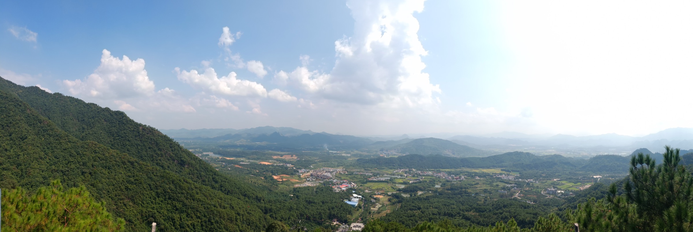
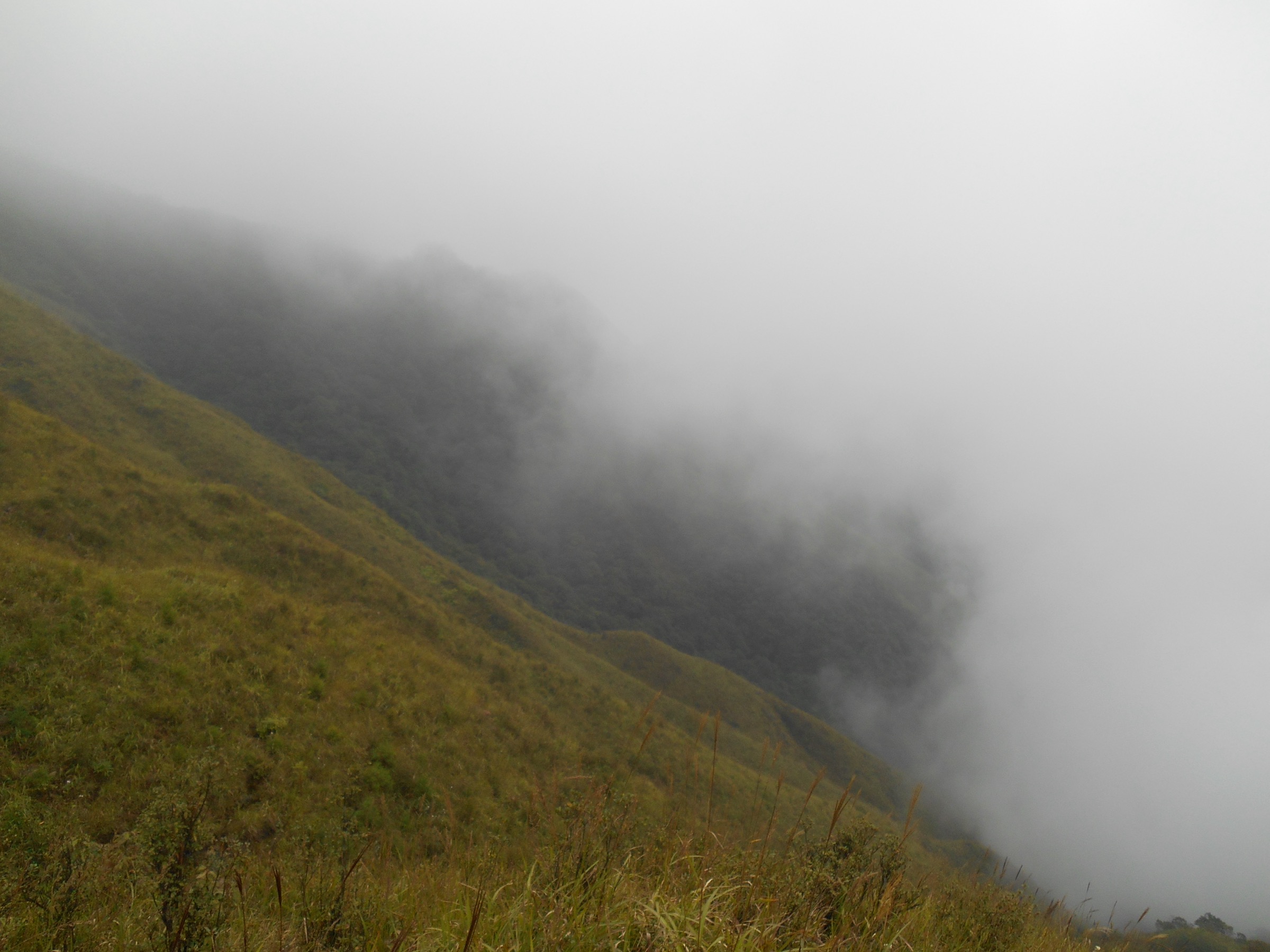
The Guangxi side of the Nanling Mountains is dominated by the Yuechengling (越城岭) range and its high point Mao’er Mountain (猫儿山, 2,141 m) — the highest peak in the Nanling proper and one of the highest points in southern China. The range straddles Ziyuan, Xing’an and Longsheng counties in Guilin prefecture, and forms both a major watershed between the Xiang and Li river systems and a subtropical-forest refugium of national ecological importance. Alongside the summit country sit two adjacent walking landscapes: the Ziyuan Danxia hills at the northern edge of Guilin karst country, and the Longji (龙脊) terraces at Longsheng, where centuries of hand-cut paddy rice climb the southern flank of the same range.
The walking character across the region is a mixture of managed scenic-area routes, cultural-village paths, and — around Mao’er Mountain itself — genuinely wild forest ridge and summit terrain inside a national nature reserve. Public route geometry is weak for the summit country: reserve rules, unclear last-mile access, and thin licence-compatible GPX or KML files mean that most Mao’er and Yuechengling walking objectives should be treated as candidate routes only until local guiding, current reserve status and route lengths have been checked on the ground. The Longji terraces at Longsheng and the Bajiaozhai Danxia geopark at Ziyuan are much better documented and are where the region’s more predictable day-hikes sit.
Best walking seasons run October to April for cool, dry weather and better chances of clear views. The summer monsoon brings heavy rain, low cloud, thunderstorms and flash-flood risk in the gorge and terrace country, and temporary scenic-area closures are common after heavy rain. Winter can be cold and misty on the ridge, and snow and hoar frost are recorded on Mao’er’s summit plateau. Standard equipment is walking boots with grip for wet stone steps and boardwalks, waterproof shell and warm mid-layer, sun protection, water and food, and a way of navigating that does not rely on scenic-area waymarks — several of the sub-regions in this article are still short on well-audited public route files.
Selection rationale
Five day-scale routes are presented across the Guangxi side of the Nanling. Only one of them — the Longji “Thousand Layers to the Heaven” terrace walk — is drawn from a well-documented cultural landscape with reliable public route information. The four range and geopark objectives — Mao’er Mountain summit approach, Yuechengling ridge and cloud-sea viewpoints, Ziyuan Bajiaozhai Danxia geopark walk and the Ziyuan Danxia foothill circuit — are presented as research-grade candidates: geographically real objectives inside published protected areas, but with route geometry, current access, and media rights that a walking party should re-verify locally before committing. Longer through-trips across the Nanling boundary, unaudited backcountry variants and any route requiring off-track travel inside the Mao’er reserve sit outside this catalogue. For the Hunan-side Nanling boundary summit at Shikengkong, see the Mangshan guide; for the Nanling’s northern Guangdong sandstone, karst and canyon country, see the Northern Guangdong Nanling uplands guide.
Summary
| # | Hike | Sub-region | Route type | Distance | Gain | Max elevation | Difficulty |
|---|---|---|---|---|---|---|---|
| 1 | Mao’er Mountain summit approach | Xing’an / Mao’er reserve | Summit out-and-back candidate | Unresolved | Unresolved | 2,141 m | Hard |
| 2 | Yuechengling ridge and cloud-sea viewpoints | Ziyuan / Yuechengling | Ridge out-and-back candidate | Unresolved | Unresolved | Unresolved | Hard |
| 3 | Bajiaozhai Danxia geopark walk | Ziyuan / Bajiaozhai | Scenic-area loop candidate | Unresolved | Unresolved | Unresolved | Moderate |
| 4 | Ziyuan Danxia foothill circuit | Ziyuan / Ziyuan town | Foothill walk candidate | Unresolved | Unresolved | Unresolved | Easy–moderate |
| 5 | Longji “Thousand Layers to the Heaven” terrace walk | Longsheng / Longji | Cultural-landscape loop | About 6–9 km | About 400–600 m | About 1,100 m | Moderate |
1. Mao’er Mountain summit approach
Snapshot
Itinerary
Treat this as a candidate route rather than a signed public walk. Recent open-source descriptions place a walking approach to Mao’er’s summit on the Xing’an side of the reserve, with local guiding, current access and route length all to be re-verified locally before travel. The summit itself is a broad forested plateau with cloud-sea and Nanling ridge views on clear days, and can be very cold and windy even in summer.
Why it is essential
Mao’er Mountain is the highest peak in the Nanling range at 2,141 m, and the walking objective at the heart of Guangxi’s contribution to the Nanling catalogue. It sits inside a national nature reserve of major ecological importance and gives the region its one true high-mountain summit — the counterpart to Guangdong’s Shikengkong and Hunan’s Mangshan boundary summits.
Equipment
- Boots with grip for wet forest paths and stone steps
- Waterproof shell and warm mid-layer for the summit plateau
- Full water and food for a long, remote day
- Headtorch and back-up navigation independent of scenic-area waymarks
- Local contact / guiding arrangements before travel
Hazards and notes
- Draft-status route — do not treat this as a publication-ready itinerary; verify local access, route length and reserve permission
- Rapid weather change on the summit plateau — cloud, cold and thunderstorm risk even in shoulder seasons
- Nature-reserve rules — off-track walking is likely restricted; keep to signed public routes and heed reserve staff
- Summer monsoon rain brings flash-flood risk on the lower valleys and can close approach roads
2. Yuechengling ridge and cloud-sea viewpoints
Snapshot
Itinerary
Treat this as a candidate route rather than an audited public itinerary. Yuechengling ridge access from the Ziyuan side threads high subtropical forest with named cloud-sea and cliff viewpoints on clear days. Route length, waymarking status and current access should be re-verified on the ground; parties without local knowledge should engage a Ziyuan-side guide.
Why it is essential
The Yuechengling ridge is the skyline of the Guangxi Nanling, and gives the region its classic cloud-sea walking experience — the atmospheric high-forest counterpart to the geopark and terrace walks lower down. It links the Mao’er summit country to the Ziyuan Danxia foothills and completes the vertical picture of the range.
Equipment
- Boots with grip for wet forest paths
- Waterproof shell and warm mid-layer for the ridge
- Full water and food for a long day
- Headtorch and back-up navigation independent of scenic-area waymarks
Hazards and notes
- Draft-status route — verify local access and route length before travel
- Cloud and thunderstorm risk on the ridge; cloud-sea days can flip to whiteout quickly
- Reserve rules — parts of the ridge lie inside protected areas; keep to signed routes
- Summer monsoon rain raises approach-road flooding and landslide risk
3. Bajiaozhai Danxia geopark walk
Snapshot
Itinerary
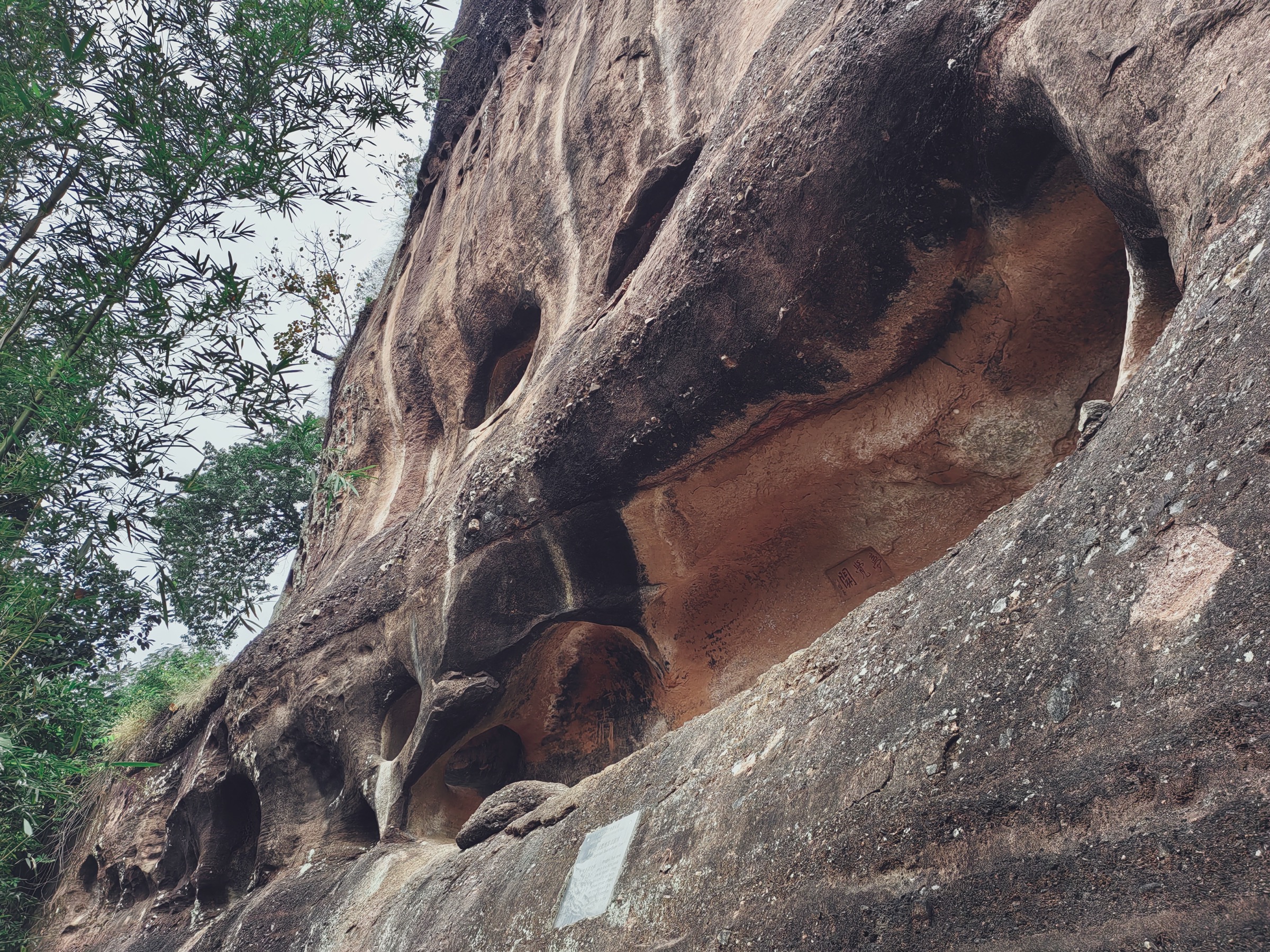
Treat this as a candidate route at survey level. The Bajiaozhai geopark preserves a Danxia sandstone landscape at the northern edge of Guangxi and is walked on the scenic area’s stone-step and boardwalk network. Route length, waymarking status and cableway operation should be re-verified before travel.
Why it is essential
Bajiaozhai is the Danxia counterpart to Guangdong’s Danxia Shan and Hunan’s Wanfoshan on the Guangxi side of the Nanling. It gives the region its red-rock walking landscape — the sandstone contrast to the karst, terrace and high-forest country in the rest of this article.
Equipment
- Grippy walking shoes for wet stone steps and boardwalks
- Waterproof shell and sun protection
- Water and food for a full-day plan
- Small daypack and headlamp
Hazards and notes
- Draft-status route — verify current scenic-area access and route length before travel
- Slippery stone steps in wet weather
- Cliff-edge sections on the upper loops
- Scenic-area opening hours and ticketing shape the day; check before travel
4. Ziyuan Danxia foothill circuit
Snapshot
Itinerary
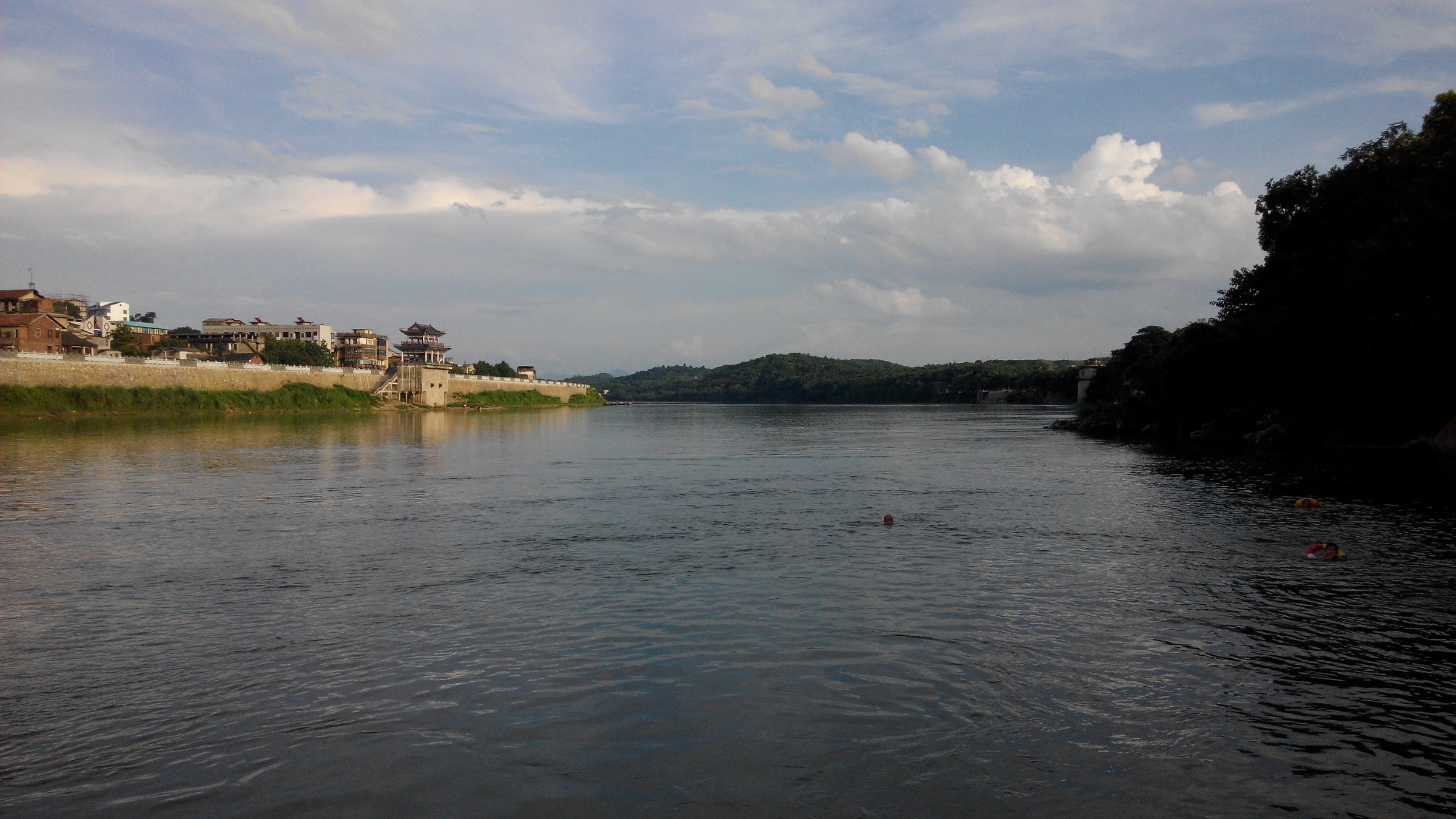
Treat this as a candidate route rather than an audited itinerary. The Ziyuan foothill walking country sits at the northern edge of Guilin’s karst zone, at the foot of the Yuechengling ridge. Local farm tracks and short signed circuits give an accessible low-relief walking day with views up to the Nanling ridge on clear days.
Why it is essential
The Ziyuan foothills are the approach country to Mao’er Mountain and the Yuechengling ridge, and give a low-relief walking day with wide open views up to the range’s skyline. They are also the region’s most likely bad-weather fallback when the high country is closed by cloud or rain.
Equipment
- Walking shoes or light boots
- Waterproof shell and sun protection
- Water and food for a half-day plan
Hazards and notes
- Draft-status route — verify signage and access before travel
- Summer heat and humidity on the exposed foothill country
- Occasional dogs and farm-track navigation in the settled foothill landscape
- Path conditions can change quickly after monsoon rain
5. Longji “Thousand Layers to the Heaven” terrace walk
Snapshot
Itinerary
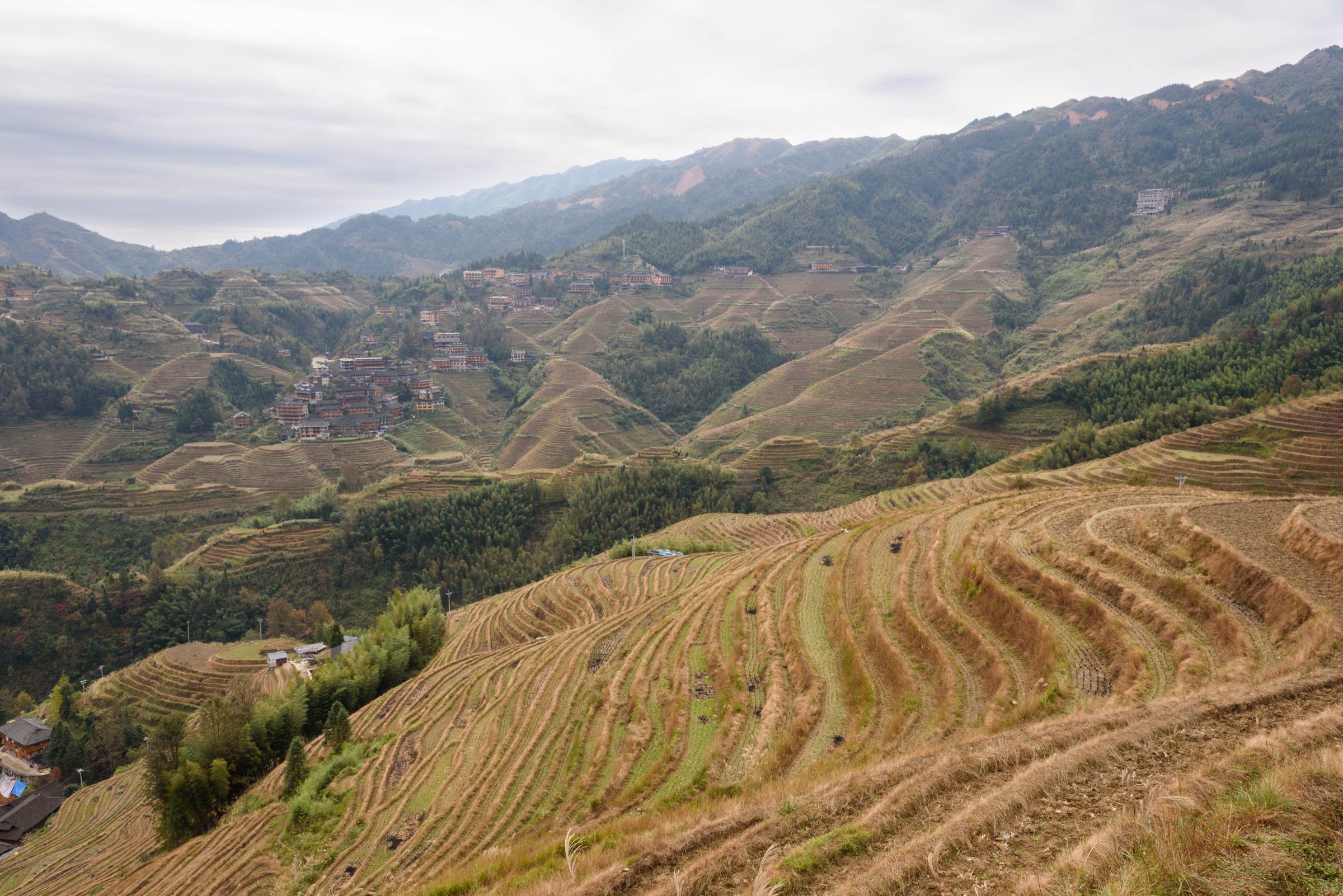
From the Ping’an or Dazhai scenic-area gate, follow the stone-step path network through the terrace tiers to the named viewpoints — commonly the “Seven Stars with Moon”, “Nine Dragons and Five Tigers” and the “Thousand Layers to the Heaven” upper terraces. The walk can be run as a village-based loop or as a Ping’an-to-Dazhai traverse using the paired scenic-area path between the Zhuang and Yao villages, with a scenic-area shuttle back to the start.
Why it is essential
The Longji terraces are the region’s cultural-landscape signature and the one Guangxi Nanling walk with reliable route information. Cut into the southern flank of the Yuechengling by generations of Zhuang and Yao farmers, they carry the same range as the summit country higher up, but framed by paddy terraces, wooden villages and terrace-side viewpoints rather than forest ridge. The walk gives the article a well-audited, high-value objective that complements the four candidate-only high-country routes.
Equipment
- Walking shoes or light boots with grip for wet stone steps
- Waterproof shell and sun protection
- Water and food; village tea houses are common but not guaranteed
- Small daypack; camera for the terrace light
Hazards and notes
- Slippery stone steps in wet weather and after rain
- Summer thunderstorm and flood risk on the lower terrace paths
- Scenic-area ticketing and shuttle operation shape the day
- Village etiquette — respect resident privacy and terrace-farming activity; keep to the signed paths
Further reading
- Mangshan, southern Hunan — five essential day-hikes — Hunan-side Nanling ridge country and the Shikengkong boundary summit
- Northern Guangdong Nanling uplands — five essential day-hikes — Guangdong-side Danxia, canyon, karst and Shikengkong approach
- Danxia Shan, Guangdong — five essential day-hikes — the Nanling’s signature red-rock walking landscape
Missing data / follow-up work
- Mao’er Mountain summit approach: current public trailhead, exact route length, elevation gain, reserve permission process and typical guiding arrangements all to be verified locally.
- Yuechengling ridge and cloud-sea viewpoints: current public ridge access from Ziyuan, route length, waymarking status and viewpoint identifications all to be verified locally.
- Bajiaozhai Danxia geopark walk: scenic-area route lengths, cableway status, current opening hours and any January-2024-style protected-area notices to be verified before travel.
- Ziyuan Danxia foothill circuit: exact signed foothill walking loop, distance and access to be verified locally.
- Longji “Thousand Layers to the Heaven” terrace walk: confirm current scenic-area ticket and shuttle status; verify the specific viewpoint circuit distances against on-the-ground signage.
- Media rights: additional per-hike figures for Mao’er Mountain, Yuechengling ridge and Bajiaozhai are still to be sourced under commercially reusable licences; the current article ships with a Ziyuan foothill cover and a Longji terrace figure only.