Regional overview
The Pearl River Delta (珠江三角洲) is better known for its skylines than its summits, yet a discontinuous belt of low and moderately elevated hills rings the entire estuary in central Guangdong, and the walking on those hills is some of the most rewarding day-hiking in southern China. Geologically the belt is a mosaic of Mesozoic granite, the eroded plug of an ancient extinct volcano at Xiqiao Shan (西樵山), parts of the Dinghu Shan (鼎湖山) massif and uplifted metamorphic blocks, all weathered hard under a humid subtropical climate. Elevations are modest by Chinese standards — Baiyun Shan (白云山) in Guangzhou tops out at only 427 m, Xiqiao Shan at 346 m, Wugui Shan (五桂山) at 531 m and Dinghu Shan at around 1,000 m — but the eastern margin rises sharply at Luofu Shan (罗浮山) in Huizhou to 1,296 m, the highest summit in the broader Delta belt and the headline cultural mountain of eastern Guangdong.
Vegetation across the belt is dominated by subtropical evergreen broadleaf forest, with camphor, Castanopsis, Schima, Chinese fir, masson pine and large stands of dawn-redwood (Metasequoia) plantation. Dinghu Shan in particular protects the largest surviving tract of lowland Chinese subtropical primary forest, was the country’s first national nature reserve (1956), and was inscribed as the country’s first UNESCO Man and the Biosphere reserve in 1979. Most of the hiking is on paved or stone-stepped walkways within formally ticketed scenic areas — these mountains are National 4A or 5A tourist sites rather than wilderness areas, and routes are well-graded, well-marked and busy at weekends.
Main hiking centres are Guangzhou (Baiyun Shan), Zhaoqing (Dinghu Shan), Foshan (Xiqiao Shan), Zhongshan (Wugui Shan) and Huizhou (Luofu Shan). The Guangzhou-Shenzhen high-speed rail corridor, the Pearl River Delta intercity rail network and the Hong Kong-Zhuhai-Macau Bridge put almost every trailhead within day-trip reach of Guangzhou, Shenzhen, Macau or Hong Kong. The best walking season runs from late October to March, when the cool, dry north-east monsoon brings clearer skies and lower humidity; the wet summer monsoon from May to September is hot, humid and exposed to typhoons, and the visibility cost of urban smog and Pearl River Delta air pollution can be significant even in winter. None of the hikes in this catalogue is technical, but several have ticketed entry, opening-hour restrictions, and cable cars or shuttles that must be planned around.
Selection rationale
The five entries span the geographic and elevation spectrum of the Pearl River Delta coastal uplands. Baiyun Shan represents the urban-park hill at the centre of Guangzhou itself; Dinghu Shan captures the UNESCO-listed forest reserve and the cultural-religious heart of the western Delta at Zhaoqing; Xiqiao Shan represents the central-Delta volcanic mountain at Foshan with its world-record Guanyin statue and crater lake; Wugui Shan covers the southern Delta uplands at Zhongshan, on the western shore of the estuary opposite Hong Kong; and Luofu Shan adds the highest summit on the eastern margin at Huizhou, the only entry requiring a sustained mountain-day effort. Together they cover all five of the principal Delta-margin cities, the full elevation band from 346 m to 1,296 m, and the full cultural spectrum from Taoist temple (Luofu, Xiqiao) to UNESCO biosphere reserve (Dinghu) to urban green lung (Baiyun) to working communications summit (Wugui).
Summary table
| # | Hike | Country | Route type | Distance | Gain | Max elevation | Difficulty |
|---|---|---|---|---|---|---|---|
| 1 | Baiyun Shan (Guangzhou) — Yuntai Garden to Moxing Ridge summit | China | Loop | 8-9 km | ~400 m | 427 m | Moderate |
| 2 | Dinghu Shan (Zhaoqing) — Qingyun Si and Feishuitan circuit | China | Loop | 6-8 km | ~400-500 m | ~700 m | Moderate |
| 3 | Xiqiao Shan (Foshan) — Tianhu, Baiyun Cave and Guanyin summit circuit | China | Loop | 7-9 km | ~350-450 m | 346 m | Easy-moderate |
| 4 | Wugui Shan (Zhongshan) — Main Peak ascent | China | Out-and-back | 8-11 km | ~500-600 m | 531 m | Moderate |
| 5 | Luofu Shan (Huizhou) — Chongxu Guan to Feiyun Ding summit | China | Out-and-back / lift-assisted | 7-14 km | 700-1,200 m | 1,296 m | Hard |
1. Baiyun Shan (白云山), Guangzhou — Yuntai Garden to Moxing Ridge summit
Snapshot
Itinerary
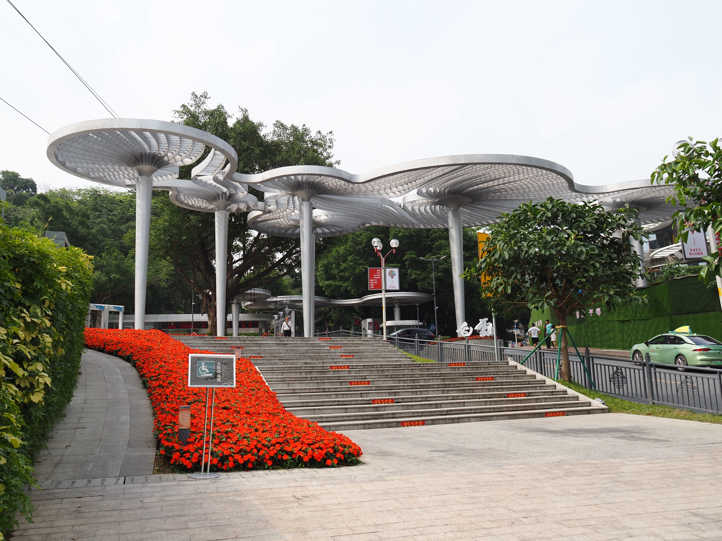
The standard route enters at the South Gate beside Yuntai Garden (云台花园) on Guangyuan Middle Road, follows the paved Mingchun Valley (鸣春谷) avenue past the aviary and Cheng Precipice (蒲谷), and climbs steadily on broad stone-paved walkways through camphor and pine forest toward Sanjie Si Temple (三界庙) and the Songtao Bie Yuan (“Pine-Wind”) pavilion. From here a series of switchback paths and stairways rise through the central plateau past Bai Yun Wan Wang Tai (“Baiyun’s Ten-Thousand-View Terrace”, roughly 380 m) and the Tian Nan First Peak Memorial Archway to the open summit knoll of Moxing Ridge at 427 m. The summit terrace gives an extensive panorama over central Guangzhou — the Pearl River, Canton Tower, Tianhe CBD, the airport approach to the north — although the view is regularly muted by haze. Descent is usually via the broad Yunxi Ecological Park (云溪生态公园) trail to the West Gate, or by retracing the ascent to Yuntai Garden. Walkers wanting to shorten the day can ride the Suodao chairlift between the lower stations and the central plateau.
Why it is essential
Baiyun Shan is the headline urban hill of Guangzhou — a National 5A scenic area, the city’s largest green space and its highest natural viewpoint. The Moxing Ridge ascent is the only walking route in this catalogue that climbs directly out of a major Chinese megacity skyline, and the well-graded paved paths make it the most accessible representative hike of the Pearl River Delta uplands. Long-listed in the historic “Eight Sights of Yangcheng” since the Song dynasty, the mountain is considered the spiritual centrepiece of the city’s natural backdrop.
Equipment
Standard hiking equipment: trail shoes or comfortable walking shoes (paths are paved throughout), light layer, sun protection, plentiful water (kiosks operate on the plateau but spacing is uneven), small daypack. No technical kit required. Bring small change or mobile pay for the entrance fee and any cable-car use.
Hazards and notes
The scenic area is ticketed. Paths are crowded on weekends and public holidays — start early. Summer afternoons bring intense humidity, thunderstorms and reduced air quality; viewing conditions are best after a cold front in winter. Off-trail walking is discouraged within the scenic area. Dogs are generally not permitted in the formal scenic area.
GPX / KML links
| Source | URL |
|---|---|
| AllTrails — Baiyunshan Moxing Summit to Huangpodong Reservoir | alltrails.com |
| AllTrails — Guangzhou Forest of Stone Tablets to Moxing Summit | alltrails.com |
| OpenStreetMap — Baiyun Shan Scenic Area trails | openstreetmap.org |
2. Dinghu Shan (鼎湖山), Zhaoqing — Qingyun Si and Feishuitan circuit
Snapshot
Itinerary
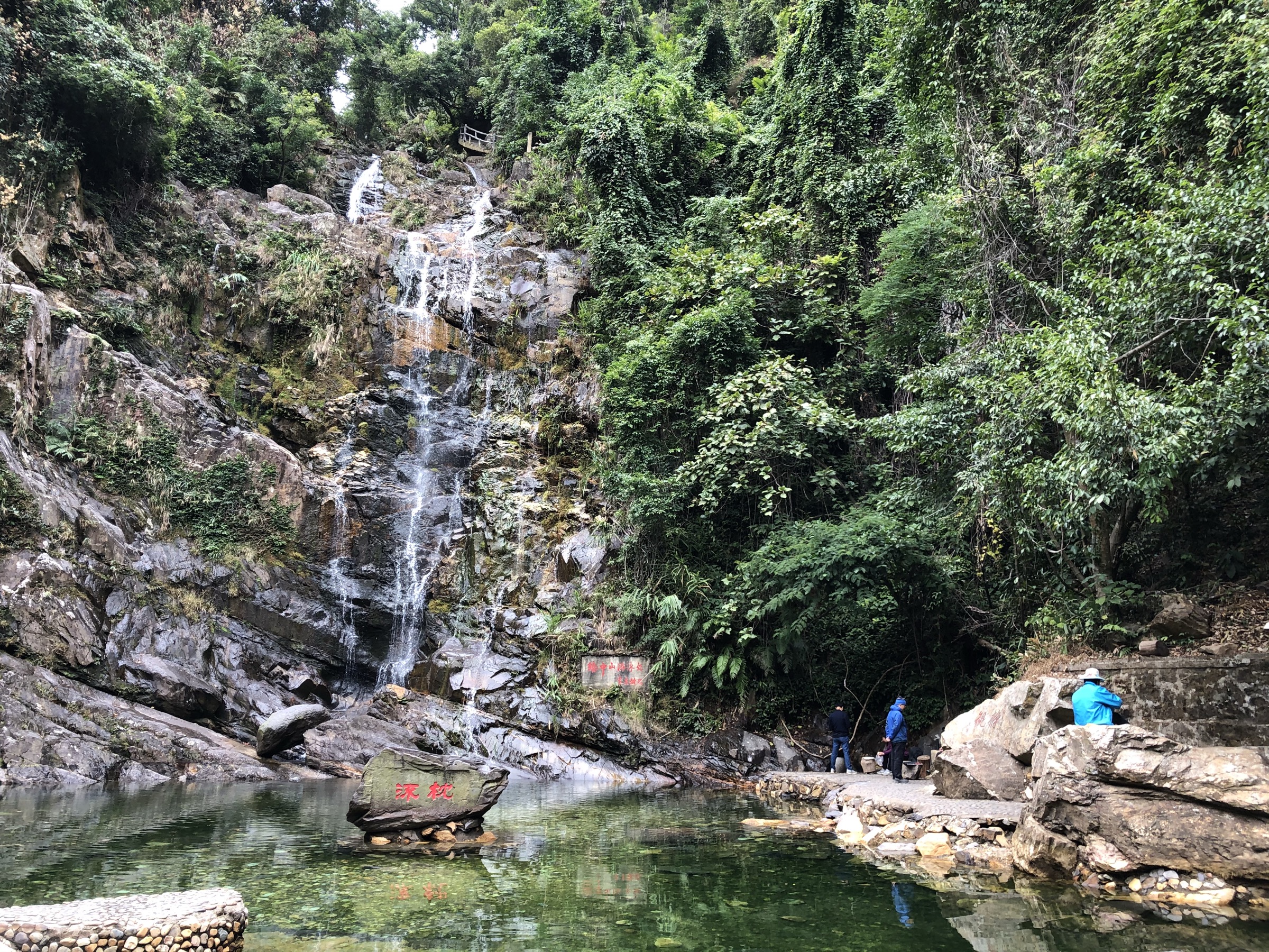
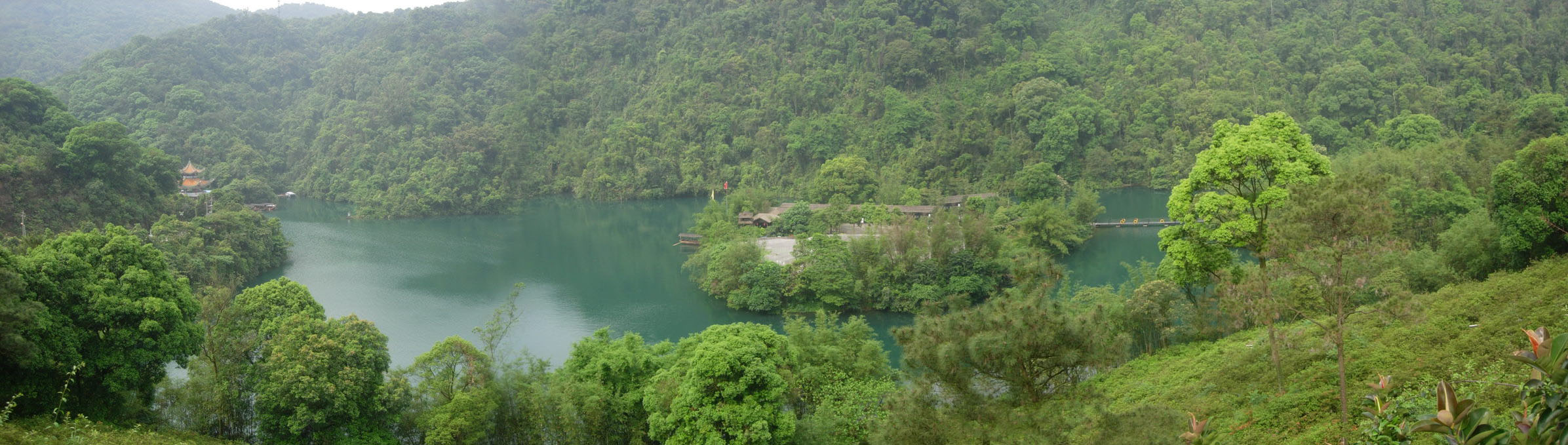
From the main gate, the standard circuit follows the Tianxi (Heavenly Stream) valley on broad paved walkway past the Visitor Centre, climbs gently through dense subtropical broadleaf forest to the Baoding Yuan (宝鼎园) garden — site of the world-record nine-dragon ceremonial ding cauldron — and continues up the stone-stepped path to Qingyun Si (庆云寺), a Ming-dynasty temple founded in 1633 and one of the “four great temples of Lingnan”. From the temple, a steeper paved trail drops south-east through hillside forest for roughly 1.5 km to Feishuitan (飞水潭, “Flying Water Pool”), a thirty-metre cascade with a deep emerald plunge pool inscribed with Song Qingling’s calligraphy commemorating Sun Yat-sen’s swim in 1923. The walk returns along the lower stream path past Bodhi Pond and the swimming pavilion to the main gate. The 6 km basic loop can be extended on the upper Tianhu (Heavenly Lake) trail toward the Cloud Stream (Yunxi) sector for an additional 2 km.
Why it is essential
Dinghu Shan was the first national nature reserve established in China (1956) and is the country’s first UNESCO Man and the Biosphere reserve (1979). The Tianxi-Qingyun-Feishuitan circuit is the only one of the three scenic zones fully open to general visitors and is the canonical day walk through south China’s last remaining tract of lowland subtropical evergreen broadleaf primary forest, with more than 2,500 documented plant species. The combination of Buddhist temple, primary forest and well-known waterfall makes it the headline natural-and-cultural day-hike of the western Pearl River Delta.
Equipment
Standard hiking equipment: comfortable trail or walking shoes with grip on damp stone, light shell (the forest canopy and stream valleys hold humidity), sun protection, at least 1.5 litres of water (kiosks operate at intervals), insect repellent in summer. No technical equipment required.
Hazards and notes
The Yunxi-Laoding scenic area and the Jilong Ding summit lie within the strict-protection core zone and are closed to general visitors — do not attempt off-trail or unauthorised access. Stone steps become slippery after rain. The on-site eco-shuttle (separately ticketed) runs between major zones and is useful in heat. Photography is permitted along marked trails; tripods may be restricted in some areas.
GPX / KML links
| Source | URL |
|---|---|
| Pacer — Dinghu Mountain Scenic Area walk trail, Zhaoqing | mypacer.com |
| OpenStreetMap — Dinghushan reserve area | openstreetmap.org |
| 两步路 (Liangbulu) community tracks for 鼎湖山 | 2bulu.com |
3. Xiqiao Shan (西樵山), Foshan — Tianhu, Baiyun Cave and Guanyin summit circuit
Snapshot
Itinerary
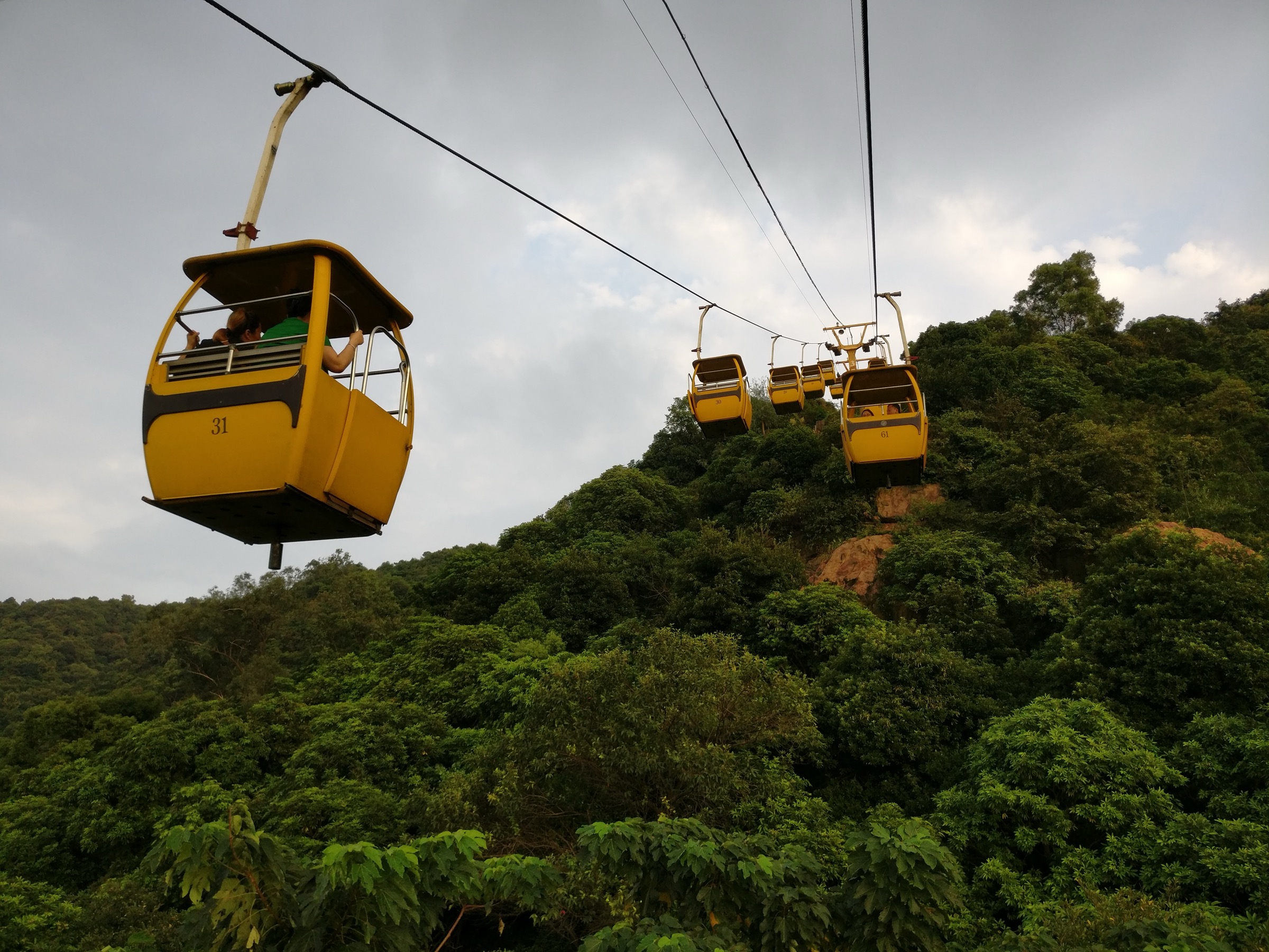
From the main gate, the standard circuit climbs the broad paved path past the visitor centre to Tianhu Lake (天湖), a crater lake of roughly 8 hectares set in the caldera floor and ringed by lakeside walking promenade. Trails continue west and north past Baiyun Cave (白云洞) — the most famous Taoist grotto on the mountain, with stone-cut shrines, the Yingri Peak viewpoint and several small temples — then climb stone steps through forest to the broad summit shoulder of Daxian Peak. The Nanhai Guanyin Cultural Park (南海观音文化苑) occupies the summit plateau with a 61.9 m seated bronze Guanyin statue cast on a pedestal of 11.12 m; the platform gives panoramas across the Pearl River Delta to Foshan and Guangzhou on clear days. Descent loops east via the Bishu Tan and Sili Tower path through camphor and pine forest back to the main gate. Adventurous variants add the Shiyan and Cui Yan rocky pinnacles, which require a short detour on rougher paths.
Why it is essential
Xiqiao Shan is a National 5A-level scenic area, national forest park and national geological park, founded on a 40-50-million-year-old extinct volcano. The combination of crater lake, Taoist cave temples, ancient stone-tool quarries (the mountain is the type-site for the Neolithic “Xiqiao Shan culture” of stone-tool manufacture) and the world’s tallest seated bronze Guanyin makes it the canonical cultural-volcanic day-hike of the central Pearl River Delta. It anchors the Foshan side of the catalogue and balances the higher-elevation entries.
Equipment
Standard hiking equipment: comfortable walking shoes, sun protection, water, light layer; the mountain has many cafes and kiosks. Modest dress is appropriate within the Guanyin Cultural Park and Baiyun Cave temple grounds.
Hazards and notes
Trails can be very busy on weekends, public holidays and around Guanyin’s birthday (lunar 2/19, 6/19 and 9/19). Some rock-pinnacle paths (Cui Yan, Shiyan) are rougher and slippery when wet. The Baiyun Cave precinct is an active Taoist site — observe posted etiquette.
GPX / KML links
| Source | URL |
|---|---|
| Trip.com — Xiqiao Mountain hiking moments (community routes) | sg.trip.com |
| OpenStreetMap — Xiqiao Mountain Scenic Area | openstreetmap.org |
| 两步路 (Liangbulu) — community tracks for 西樵山 | 2bulu.com |
4. Wugui Shan (五桂山), Zhongshan — Main Peak (主峰) ascent
No licence-compatible photo of the Wugui Shan main peak is currently available on Wikimedia Commons; this section is illustrated by text only pending a future Flickr Creative Commons sweep or direct outreach to the Zhongshan 42 Peaks community.
Snapshot
Itinerary
The simplest line follows the broad cement service road that rises from the Wuguishan subdistrict (off Boai Road / National G94 Shenhai Expressway) up the south-western flank of the main peak. The road climbs steadily through dense secondary subtropical forest of pine, camphor and Chinese fir, passing a small reservoir basin and several abandoned rest pavilions, and arrives at the broad summit shoulder, which is occupied by the Zhongshan Radio and Television transmission station and a fenced compound. The trig point and viewpoint at 531 m sit on the shoulder above the compound and provide an extensive panorama: the Pearl River estuary and the Shenzhen-Zhongshan Link to the east, Macau and Zhuhai’s Doumen district to the south-west, and on a clear day the higher Hong Kong skyline beyond. Variants extend the day across the “Zhongshan 42 Peaks” traverse (中山四十二峰), a community-popular long ridgeline route that links Wugui Shan main peak with the secondary summits east and west.
Why it is essential
Wugui Shan is the only true mountain in Zhongshan municipality, its highest point at 531 m and the headline natural landmark of the city. It is by reputation the highest summit in the western Pearl River estuary, anchors the Zhongshan side of the catalogue and complements the Foshan and Guangzhou entries with a coastal-influenced upland walk close to the Macau and Zhuhai border. The Changjiang Reservoir dawn-redwood grove on the lower flanks is a regionally famous winter photography destination.
Equipment
Standard hiking equipment: trail shoes (paths are paved but long and sun-exposed), sun hat, plentiful water (no reliable refill on route), light shell, snacks. No technical gear required. Insect repellent in warmer months.
Hazards and notes
The summit compound housing the broadcast station is fenced and off-limits — stay on the public trig-point shoulder. The mountain is large and ridge variants are confusing; carry an offline map (OsmAnd, Maps.me or the 两步路 app) and download a GPX track in advance. The paved service road has no shade for long sections; mid-summer attempts risk heat exhaustion. Air quality and haze regularly reduce summit visibility, especially after still winter days.
GPX / KML links
| Source | URL |
|---|---|
| 两步路 (Liangbulu) community trace — “穿越五桂山主峰” | 2bulu.com |
| 两步路 — Zhongshan 42 Peaks community guide | 2bulu.com |
| OpenStreetMap — Wugui Shan main peak area | openstreetmap.org |
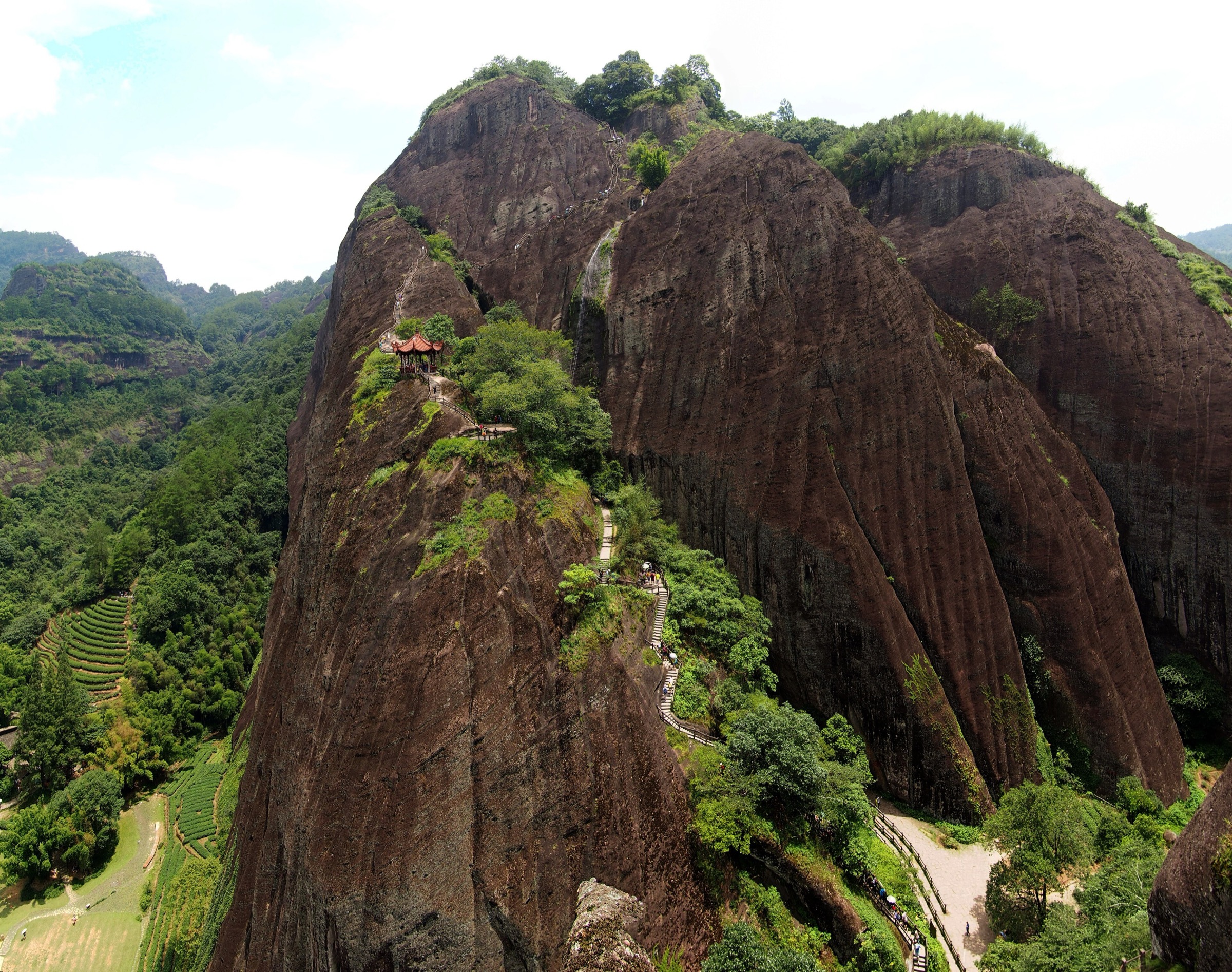
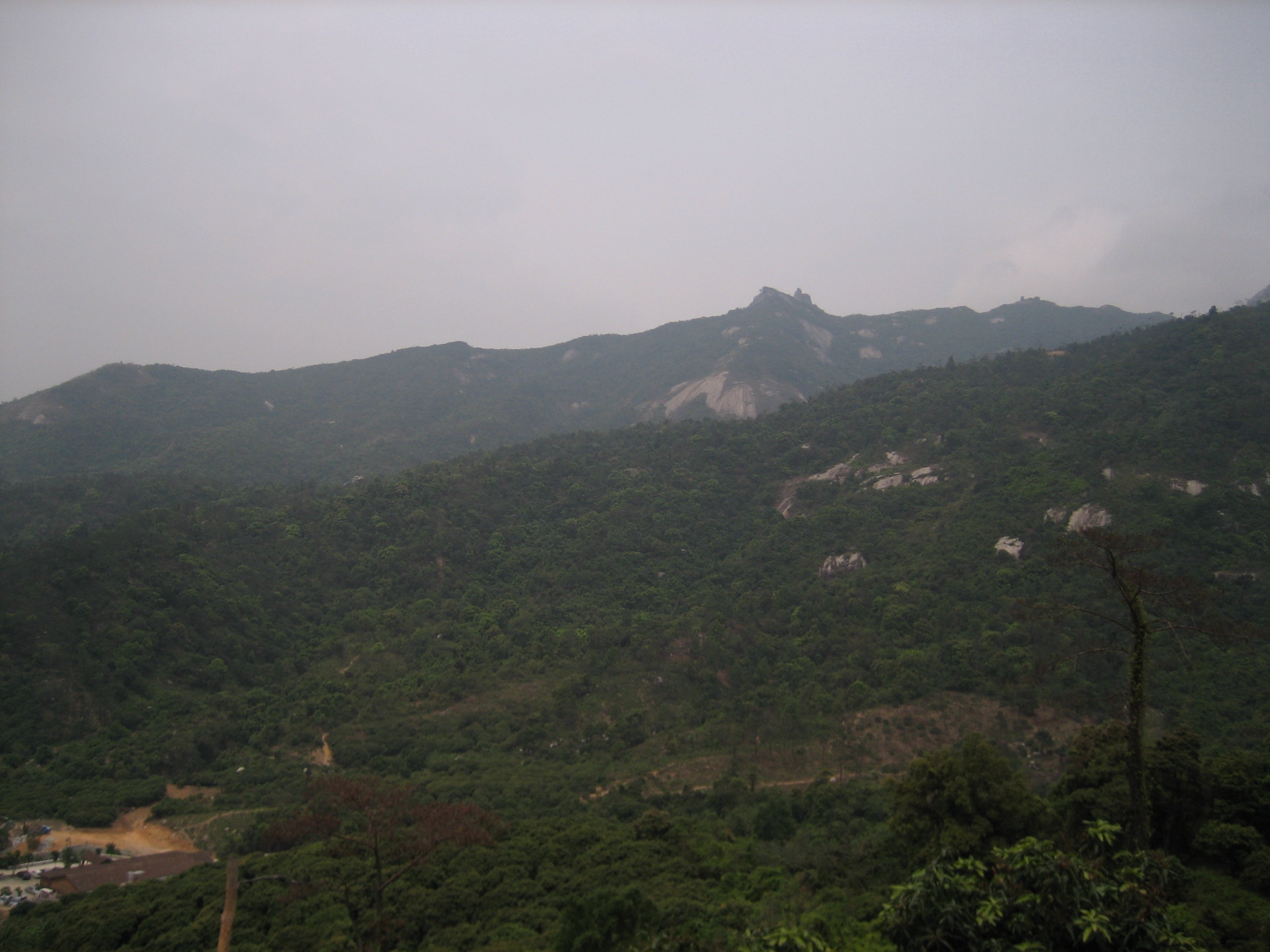
5. Luofu Shan (罗浮山), Huizhou — Chongxu Guan to Feiyun Ding summit
Snapshot
Itinerary
The classic line begins at Chongxu Guan, the 1,600-year-old Taoist temple in the Zhuming Cave (朱明洞) precinct said to have been founded by the alchemist Ge Hong in the Eastern Jin dynasty. The path passes the Xianren Pavilion and Baihegang (White Crane Mound) ridge before rising on long sequences of stone steps through subtropical evergreen forest, with viewpoints over the cascading Baishuimen (白水门) waterfalls. The trail joins the cable-car corridor at the middle station (around 600 m), where many walkers take the gondola for the final pitch. From the upper cable-car station, a steep stepped path climbs to the rocky summit ridge and onward to the Feiyun Ding triangulation pillar at 1,296 m. The summit offers a panoramic sweep across the Dongjiang plain, the Pearl River Delta cities to the south-west, and the Lianhua Shan range to the south-east. Many parties watch sunrise from the small summit shelters and descend via the same route, taking the cable car down to save knees.
Why it is essential
Luofu Shan is the highest peak of the broader Pearl River Delta upland belt, one of the ten greater dongtian (“grotto-heavens”) of Taoism, and the headline cultural mountain of eastern Guangdong. Its scale (one source cites 432 named peaks across the massif) places it firmly within the regional uplands while elevating the catalogue’s strenuous-day option. The combination of an active 1,600-year-old Taoist temple precinct, alchemical heritage, the highest viewpoint in the Pearl River Delta region and a famous sunrise summit makes it the obvious final entry — a high-effort, high-reward counterpart to the gentler urban hills earlier in the list.
Equipment
Mountain hiking equipment: stiff trail shoes or boots with good grip (long stone-step descents), warm windproof layer (the summit is significantly cooler and windier than the gate), head torch (essential for the popular dawn ascent), trekking poles strongly recommended, at least 2 litres of water, food. A light shelter or extra layer is sensible if waiting for sunrise on the summit.
Hazards and notes
Summit weather is changeable; cloud frequently fills the col below the summit and obscures the sunrise view. The stone-step path is slippery when wet and surprisingly hard on the knees over the long descent. Camping is restricted; overnight visitors typically stay in the small guesthouses at the upper cable-car station or in temple-affiliated accommodation. Respect Taoist temple etiquette at Chongxu Guan and the smaller summit shrines.
GPX / KML links
| Source | URL |
|---|---|
| Outdooractive — Luofu Mountain Feiyunding Circuit Hike | outdooractive.com |
| AllTrails — Mount Luofu Trail | alltrails.com |
| 两步路 (Liangbulu) community — 罗浮山飞云顶 tracks | 2bulu.com |
| OpenStreetMap — Luofu Shan Scenic Area | openstreetmap.org |
Notes and outstanding follow-up
Ticket and opening-hour information for all five scenic areas changes seasonally and during national holidays; reconfirm pricing and WeChat reservation requirements via the official scenic-area mini-programs before travel — Xiqiao Shan in particular has shifted to free main-gate entry with online booking, and the Luofu Shan and Dinghu Shan headline figures cited here should be cross-checked at the gate. Cable-car operations on Baiyun Shan, Dinghu Shan and Luofu Shan are weather- and maintenance-dependent and should be reconfirmed within the same week as any planned descent. Air-quality and visibility cautions apply to the Moxing Ridge and Feiyun Ding viewpoints in particular and a same-day AQI check is recommended in winter.
A licence-compatible photograph of the Wugui Shan main peak landscape was not located on Wikimedia Commons during research; a future Flickr Creative Commons sweep filtered by Zhongshan, or direct outreach to the local Zhongshan 42 Peaks community, is the next step toward a cover-resolution image for that hike. The grouping of Luofu Shan with the Pearl River Delta coastal uplands rather than the adjoining Lianhua Shan range or the broader Nanling foothills is a scope choice for this catalogue — alternative regional groupings exist in the literature and should be cross-checked against any future revision of the project’s authoritative range list.
External links
| Source | URL |
|---|---|
| Wikipedia — Baiyun Mountain (Guangdong) | en.wikipedia.org |
| Wikipedia — Dinghu Mountain | en.wikipedia.org |
| Wikipedia — Mount Xiqiao | en.wikipedia.org |
| Wikipedia — Mount Luofu | en.wikipedia.org |
| Wikipedia — Wuguishan Subdistrict | en.wikipedia.org |
| Wikipedia (Chinese) — 五桂山主峰 | zh.wikipedia.org |
| Baidu Baike — 五桂山 | baike.baidu.com |
| UNESCO Silk Roads — Dinghushan biosphere reserve | en.unesco.org |
| topchinaguide.com — Dinghushan National Nature Reserve | topchinaguide.com |
| topchinatravel.com — Xiqiao Mountain in Nanhai of Foshan | topchinatravel.com |
| travelchinaguide.com — Foshan Xiqiao Mountain | travelchinaguide.com |
| travelchinaguide.com — Luofu Mountain, Huizhou | travelchinaguide.com |
| intotravelchina.com — Luofu Mountain Scenic Area | intotravelchina.com |
| chinaexplorertour.com — Baiyun Mountain Guangzhou Visitor’s Guide | chinaexplorertour.com |
| chinaexplorertour.com — Luofu Mountain Full-Day Itinerary 2025 | chinaexplorertour.com |
| chinajourneyguide.com — Baiyun Mountain Guangzhou | chinajourneyguide.com |
| daoinfo.org — The Temple of Emptiness (Chongxuguan) | en.daoinfo.org |
| AllTrails — Baiyunshan Scenic Area | alltrails.com |
| AllTrails — Mount Luofu Trail | alltrails.com |
| Outdooractive — Luofu Mountain Feiyunding Circuit Hike | outdooractive.com |
| 两步路 (Liangbulu) community — Zhongshan and Pearl River Delta tracks | 2bulu.com |
| OpenStreetMap — base trail and road data | openstreetmap.org |
| Wikimedia Commons — Baiyun Mountain category | commons.wikimedia.org |
| Wikimedia Commons — Mount Dinghu category | commons.wikimedia.org |
| Wikimedia Commons — Mount Xiqiao category | commons.wikimedia.org |
| Wikimedia Commons — Mount Luofu category | commons.wikimedia.org |