Regional overview
Shenzhen is best known as a megacity of more than 17 million people, but roughly 40 per cent of its land area is protected as forest park, country park or ecological reserve, and the city is built around a chain of low but steep granite and metavolcanic hills that rise abruptly from the Pearl River estuary. The headline summit, Wutong Shan (梧桐山, 943.7 m), sits on the eastern edge of the urban area in Luohu and Yantian districts and is the highest peak inside any first-tier Chinese city. To the east, the Dapeng Peninsula (大鹏半岛) carries the second-highest summit, Qiniang Shan (七娘山, 869 m), inside the Shenzhen Dapeng Peninsula National Geopark. North-west of the centre, Yangtai Shan (羊台山, 587 m) and Tanglang Shan (塘朗山, 430.8 m) forest parks form a green corridor between Bao’an, Nanshan and Longhua districts, while the Maluan Shan (马峦山, ~590 m) country park in Pingshan and the cross-border ridges between Shatoujiao and Sha Tau Kok complete the network.
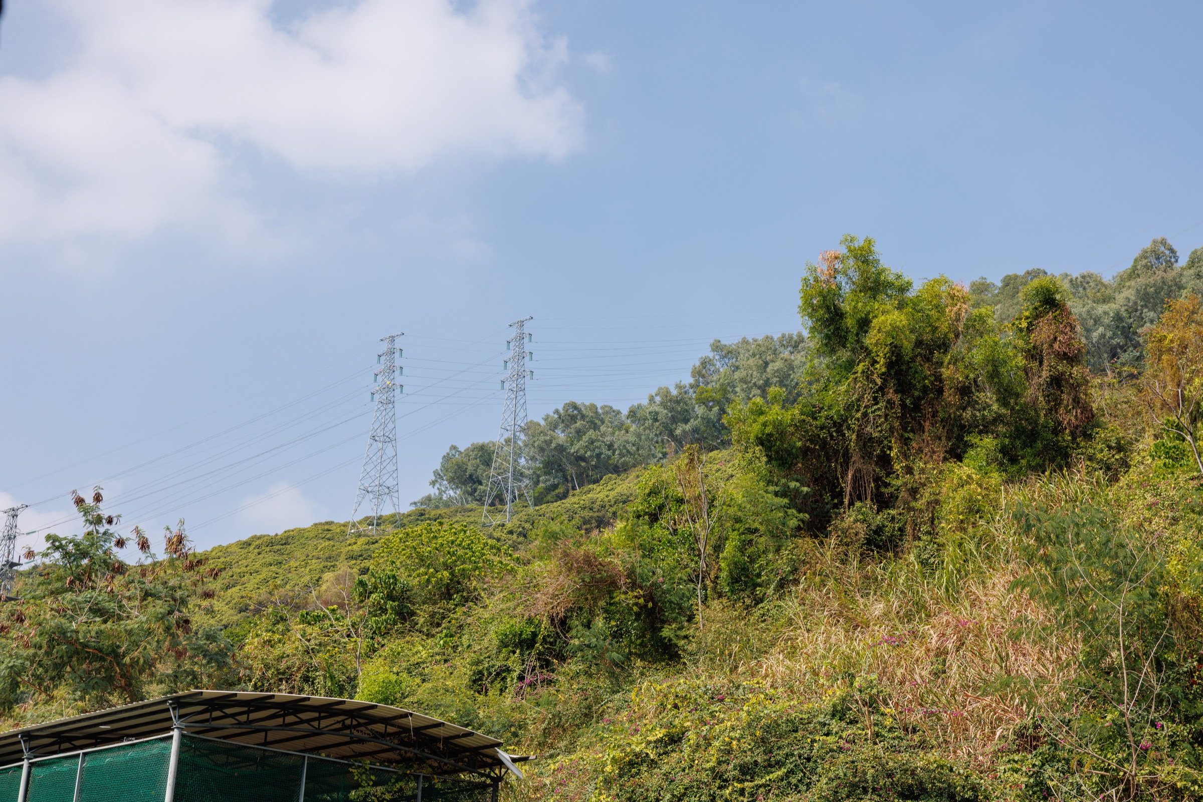
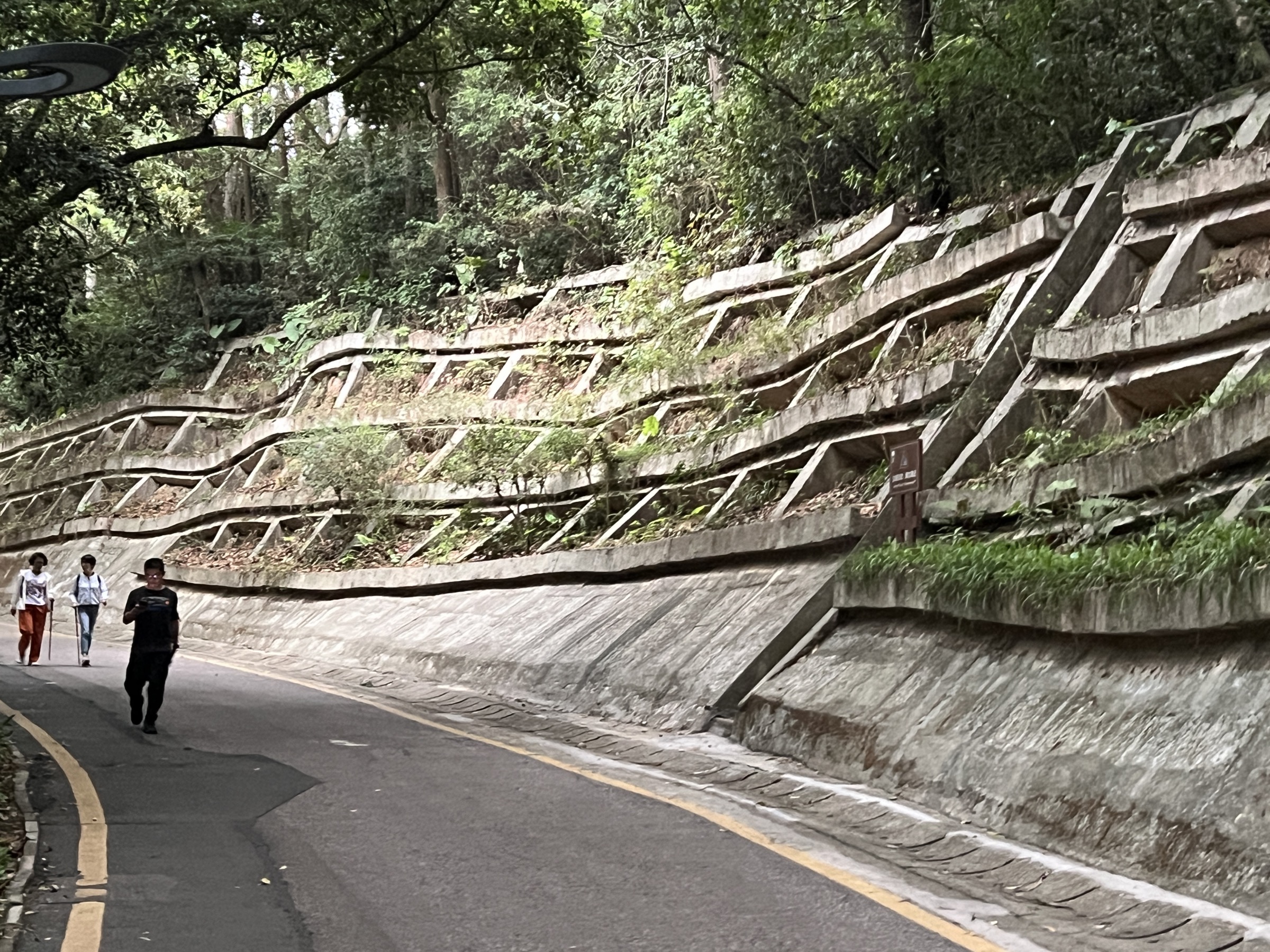
The region’s hiking character is short, sharp coastal hills with humid subtropical broadleaf forest, granite tors, sweeping views over the Pearl River estuary or the South China Sea, and well-engineered stone-step trails maintained by the Shenzhen Municipal Bureau of Urban Administration and Comprehensive Law Enforcement (深圳市城市管理和综合执法局). Most main trails are paved with granite slabs or concrete and are signposted in Chinese and English, with elevation profiles, water points and emergency post numbers. The walking is typically 5–15 km with 400–900 m of gain and can be completed in three to six hours, but the combination of heat, humidity and continuous staircases makes Shenzhen hill days more demanding than the modest elevations suggest.
The best walking season runs from late October to early March, when north-east monsoon conditions bring cool, dry, clear air and visibility from the summits often reaches Hong Kong’s Tai Mo Shan, Lantau Peak and the Wanshan Archipelago. April to early June is the plum-rain season with heavy thunderstorms, while June to September is hot, oppressively humid and frequently disrupted by typhoons that close forest parks entirely. Wutong Shan National Forest Park operates a timed-entry reservation system (real-name booking via the 梧桐山预约 WeChat mini-programme) on weekends, public holidays and during the spring azalea bloom; daily quotas apply and entry is generally permitted between 06:00 and 18:00, with the upper Hao Jiang Bei (好汉坡) section closing earlier. Several trailheads in Yantian and on the Dapeng Peninsula sit close to military or border-management zones, and a small number of ridge paths along the Shenzhen–Hong Kong frontier are closed to the public. Drone flying is prohibited inside Wutong Shan National Forest Park and restricted in most other Shenzhen country parks.
Selection rationale
The five entries cover the city’s signature high summit (Wutong Shan main ridge from the Dengyun Dao path), the wildest coastal summit on the Dapeng Peninsula (Qiniang Shan from Xichong), the classic urban forest peak (Yangtai Shan from Shiyan), the central greenway summit closest to Futian and Nanshan (Tanglang Shan from the west gate), and the waterfall-and-loquat country park east of the city (Maluan Shan and the Biling Waterfall loop in Pingshan). Together they cross every signature element of Shenzhen’s hill country: granite ridge with TV-mast summit, coastal geopark peak, lowland subtropical forest park, urban park summit with skyline views, and stream-and-waterfall valley loop. Trailheads are deliberately spread across Luohu/Yantian, Dapeng, Bao’an/Longhua, Nanshan and Pingshan rather than clustered in one park, and each route is independently described on the official Shenzhen city parks portal or its district equivalent.
Summary table
| # | Hike | Country | Route type | Distance | Gain | Max elevation | Difficulty |
|---|---|---|---|---|---|---|---|
| 1 | Wutong Shan (梧桐山) main ridge — Dengyun Dao to Hao Jiang Bei | China | Point-to-point or out-and-back | 10–12 km | 850–900 m | 943.7 m | Hard |
| 2 | Qiniang Shan (七娘山) main summit from Xichong / Geopark south gate | China | Out-and-back | 9–11 km | 800–900 m | 869 m | Hard |
| 3 | Yangtai Shan (羊台山) from Yangtaishan Forest Park (Shiyan main gate) | China | Loop or out-and-back | 9–11 km | 500–600 m | 587 m | Moderate |
| 4 | Tanglang Shan (塘朗山) summit loop from the west gate | China | Loop | 7–9 km | 400–500 m | 430.8 m | Moderate |
| 5 | Maluan Shan (马峦山) and Biling Waterfall loop, Pingshan | China | Loop | 10–12 km | 550–650 m | ~590 m | Moderate to hard |
1. Wutong Shan (梧桐山) main ridge — Dengyun Dao to Hao Jiang Bei
Snapshot
Itinerary
The classic ascent follows the Dengyun Dao (登云道, “Cloud-Climbing Path”), a paved concrete-and-granite-step route that begins from the main entrance on Luosha Road near Wutongshan Metro Station. The first 2 km rise gently through subtropical broadleaf forest, passing the Taishan Stream (泰山涧) and a series of stone arch bridges. The path then turns south and steepens through camphor and Schima superba woodland, reaching the Xiao Wutong (小梧桐, ~692 m) shoulder at around 4 km. From Xiao Wutong, a short concrete spur descends slightly before climbing the final 1.5 km along the Wantong Daodao (万通道) ridge to the Fenghuang Terrace (凤凰台) panorama and the trig point at Da Wutong (大梧桐, 943.7 m), marked by a microwave relay tower and a stone summit pillar. On a clear winter day the view takes in the Shenzhen CBD, the Pearl River estuary, the Wanshan Archipelago, Lantau Peak and Tai Mo Shan in Hong Kong, and the entire Dapeng Peninsula. The standard descent uses the Hao Jiang Bei (好汉坡, “Brave Man’s Slope”) — a much steeper, almost stair-only route on the south side — to drop to the Pengcheng (鹏城) trailhead near Fairy Lake Botanical Garden (仙湖植物园), from where bus M207 returns to the metro. Out-and-back via Dengyun Dao is equally popular and avoids the steep, knee-jarring descent of Hao Jiang Bei.
Why it is essential
Wutong Shan is the single highest peak inside any first-tier Chinese city and the natural high point of Shenzhen. The summit ridge offers a uniquely complete view of the Greater Bay Area — Shenzhen’s skyline to the west, Hong Kong’s northern New Territories and Tai Mo Shan to the south-east, and the South China Sea — and the upper slopes carry one of the most-visited azalea (映山红) blooms in southern China each February–March, with the Mao Du Juan (毛杜鹃) and Yun Jin Du Juan (云锦杜鹃) flowering tracts protected as part of the National Forest Park.
Equipment
Standard hiking equipment plus trail shoes or light boots with good grip on wet stone, head torch for pre-dawn or late descents, 2 L of water per person (refill points exist near the main entrance and Xiao Wutong but not on the upper ridge), sun protection, a light wind layer for the summit, and trekking poles for the Hao Jiang Bei descent. Real-name advance booking via the official 梧桐山预约 WeChat mini-programme is required on weekends, public holidays and during peak azalea season.
Hazards and notes
Heat and humidity are the principal hazards from April to October, with summer heat-stroke incidents reported regularly; the park may suspend entry during typhoon warnings, heavy-rain alerts and red fire-risk days. The Hao Jiang Bei descent is exposed to the sun and very steep, and slippery in rain. Avoid the summit during thunderstorms — the TV mast attracts strikes. Daily quotas apply on peak days; entry without booking can be refused at the gate. Drone flying is prohibited inside the National Forest Park.
GPX / route file
| Source | URL |
|---|---|
| OpenStreetMap — Wutong Shan summit and trails | openstreetmap.org |
| Hikentrail community guide — Mt. Wutong | hikentrail.org |
| AllTrails — Mount Wutong area | alltrails.com |
| Pacer — Wutong Mountain hiking trail | mypacer.com |
| 两步路 (Liangbulu) — search “梧桐山” | 2bulu.com |
2. Qiniang Shan (七娘山) main summit from Xichong / Geopark south gate
Snapshot
Itinerary
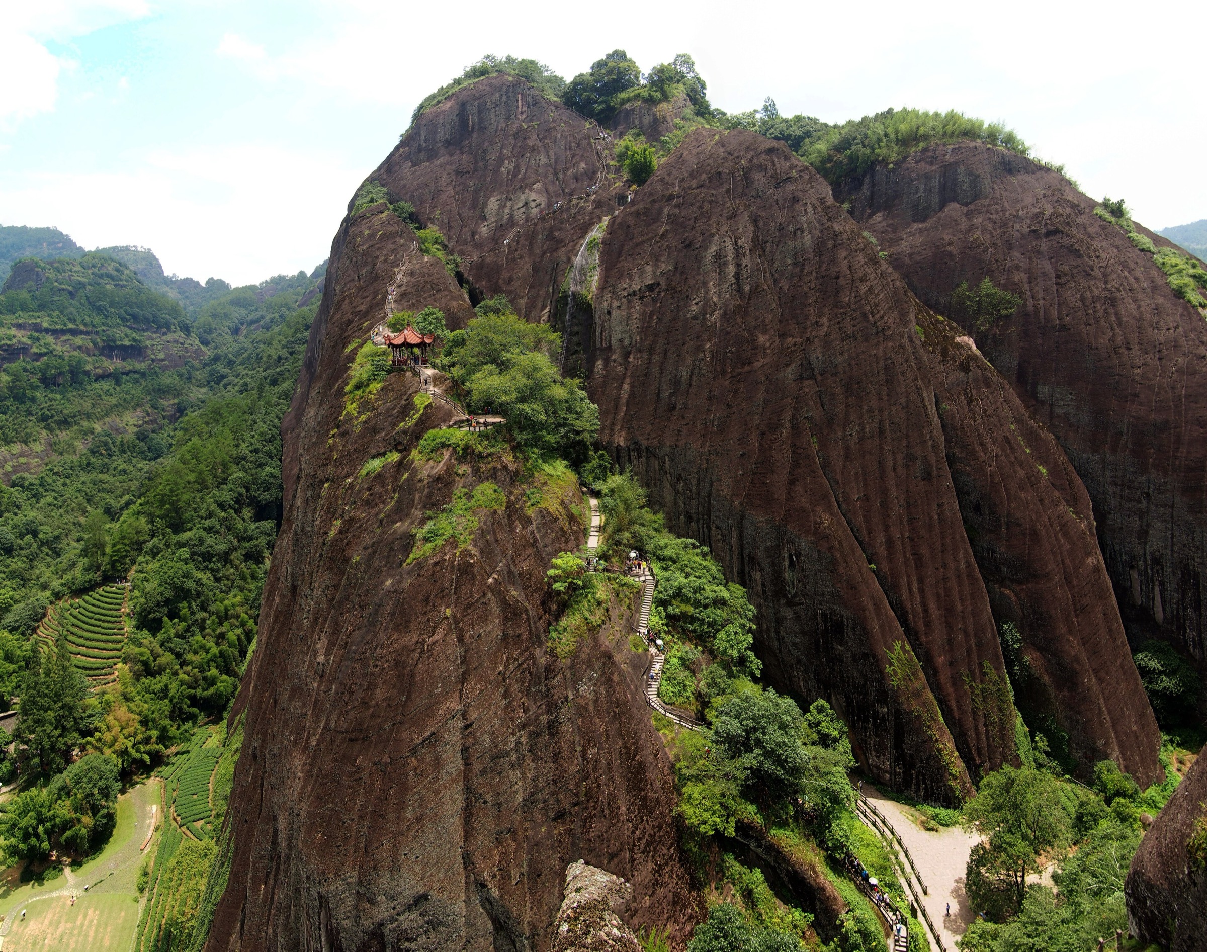
The traditional route begins near the Qiniangshan Mineral Water Plant on the road between Nan’ao and Xichong, on the south side of the Dapeng Peninsula. A signed concrete-step path climbs steeply north-east through subtropical forest into a granite tor landscape, gaining height fast on stone staircases interspersed with short natural-surface scrambles over weathered boulders. The trail traces the south flank of the seven-peak ridge that gives the mountain its name (七娘 = “Seven Maidens”) and arrives at the main summit (主峰, 869 m) after roughly 4.5 km. The summit pillar sits in low coastal shrubland with sweeping views over Xichong and Dongchong bays, Daya Bay (大亚湾) to the north-east, the South China Sea to the south, and on a clear day Hong Kong’s Plover Cove and Pat Sin Leng ridges to the south-west. Some fit walkers continue eastwards along the connecting ridge to the secondary peaks before turning back; the round trip to all seven knolls adds 2–3 km and another 200 m of gain. Most parties descend the same way to avoid the rougher, less-maintained north-side paths.
Why it is essential
Qiniang Shan is Shenzhen’s second-highest peak and the wildest of the city’s official summits. It is the only mainland mountain in the city that sits inside a national geopark (Dapeng Peninsula National Geopark, established 2009 for its Mesozoic volcanic geology and dinosaur-era fossil exposures) and the only one with a true coastal-summit panorama over open South China Sea waters. It complements Wutong Shan by representing the marine, rather than urban, edge of Shenzhen’s hill country.
Equipment
Mountain hiking equipment: sturdy trail shoes or boots, plenty of water (3 L recommended — no refill on route), high-factor sun protection (much of the upper trail is exposed), a light wind layer for the summit, and trekking poles for the steep descent. A head torch is advisable for any late finish given the remote trailhead and limited evening transport.
Hazards and notes
The trail is exposed to sun and wind on the upper ridge; sunstroke is the main hazard in warm months. Sections of stair are slick after rain; some natural-surface boulder steps require care. Mobile-phone coverage is patchy. Avoid in typhoon season (June to September); the Geopark closes during red weather warnings. Snakes — including the occasional Chinese cobra and bamboo viper — are present in the lower forest, so stay on the path. Some neighbouring ridges and coves are within military or border-management areas; do not stray from the marked Qiniang Shan trail.
GPX / route file
| Source | URL |
|---|---|
| OpenStreetMap — Qiniangshan summit and ridge | openstreetmap.org |
| AllTrails — Qiniangshan | alltrails.com |
| Shenzhen hikes blog — Qiniang Mountain 七娘山 | szhike.wordpress.com |
| 两步路 (Liangbulu) — search “七娘山” | 2bulu.com |
3. Yangtai Shan (羊台山) from Yangtaishan Forest Park (Shiyan main square)
Snapshot
Itinerary
From the Shiyan Yangtai Mountain Square — the most popular trailhead because of its short approach — a wide stone-paved path passes under the Yangtai Mountain Archway (羊台山牌坊) and climbs continuously through evergreen Schima and Castanopsis forest. The early part of the trail passes the Lover’s Stepping Stones (情人步石) feature on the Laiwu Reservoir spillway, then steepens into a series of switchbacks with rest pavilions at roughly 200 m intervals. Above 400 m the forest opens to fern and grassland, and the path joins the main ridge connecting the secondary summit (460.7 m) and the main peak (587.3 m), where a stone summit plate and three-tier pavilion mark the high point. Views run west to the Pearl River estuary and Houhai, north to Dongguan, and on a clear day south-east to Wutong Shan. The Shiyan return is the standard option; fitter walkers can traverse east to the Dalang gate (大浪入口) via the long ridge for an extra 3–4 km of descent. The Shenzhen Municipal Trail (深圳市绿道) waymarks the entire ridge in green.
Why it is essential
Yangtai Shan is the highest summit in western Shenzhen and the centrepiece of the city’s largest single block of urban forest park (28.57 km²). Beyond the scenic ridge, it carries strong historical weight as the wartime base of the Dongjiang Column (东江纵队), which in 1942 conducted the “Great Rescue” (大营救) of more than 800 Chinese cultural figures from Japanese-occupied Hong Kong, escorting them across Mirs Bay and over Yangtai Shan to free China. A memorial monument near the summit commemorates the operation. The hike combines a major view summit with cultural and historical significance unmatched by other Shenzhen hill walks.
Equipment
Standard hiking equipment: light trail shoes, 2 L of water, sun and rain protection. Trekking poles are useful for the descent but not essential. The trail is engineered throughout and well signposted in Chinese; a Chinese-character map or GPS is helpful for the longer traverse to Dalang.
Hazards and notes
Heat and humidity are the main risk April to October; afternoon thunderstorms develop quickly in spring. The path is closed during typhoon alerts and on red fire-risk days. Picnic fires are prohibited everywhere in the park. Drone flying is restricted; check the park notice board. Camping is not permitted.
GPX / route file
| Source | URL |
|---|---|
| OpenStreetMap — Yangtaishan Forest Park trails | openstreetmap.org |
| AllTrails — Mount Yangtai | alltrails.com |
| AllTrails — Yangtaishan Forest Park (park page) | alltrails.com |
| 两步路 (Liangbulu) — search “羊台山” | 2bulu.com |
4. Tanglang Shan (塘朗山) summit loop from the west gate
Snapshot
Itinerary
From the west gate at Longzhu Sixth Road the trail enters dense subtropical broadleaf forest and climbs steadily on a paved switchbacking road that is closed to private traffic. After roughly 2 km the road reaches the ridge col and a junction with stone-step paths; the main left-hand fork climbs east along the ridge through Schima, Castanopsis and bamboo to the main summit (430.8 m), marked by a stone pillar, view pavilion and microwave transmitter. The summit panorama is the best low-elevation view of the Shenzhen CBD: Ping An Finance Centre, the Houhai skyline, the Shenzhen Bay Bridge to Hong Kong’s Yuen Long, and on a clear day the Lantau Peak ridge across the bay. The standard return descends the south ridge on a longer paved path past the Mei Lin Mountain (梅林山) connection trail and back to the west gate, completing a loop of about 7.5 km. Longer variants traverse the full ridge east to Meilin Country Park (Mei Lin Pa Sha Reservoir) for a 12–15 km point-to-point day.
Why it is essential
Tanglang Shan is the central urban-park summit of Shenzhen, sitting directly above the Nanshan high-tech corridor and the city’s start-up district. It is the most accessible of the city’s named summits — reachable on foot from a metro station — and delivers the most photographed skyline view in Shenzhen, with Ping An Finance Centre and the entire Houhai CBD framed against the bay. It complements the more remote hills (Wutong, Qiniang) by representing the urban-park face of the city’s hiking culture.
Equipment
Standard hiking equipment: light shoes (the path is paved throughout), water, sun protection, and a light wind layer for the summit. A head torch is useful in winter for short days. No specialist kit is required.
Hazards and notes
Heat exhaustion is the main hazard April to October; little shade on the upper ridge. The Country Park can close during typhoon warnings and on red fire-risk days; check the park notice. The summit pavilion attracts large weekend crowds — early-morning starts are quieter. Dogs are not permitted in the Country Park.
GPX / route file
| Source | URL |
|---|---|
| OpenStreetMap — Tanglang Shan trails | openstreetmap.org |
| AllTrails — Tang Lang Hill Country Park | alltrails.com |
| AllTrails — Tanglang Mountain to Meilin Mountain | alltrails.com |
| Dr Mark Nan Tu trail guide | drnantu.com |
5. Maluan Shan (马峦山) and Biling Waterfall loop, Pingshan
Snapshot
Itinerary
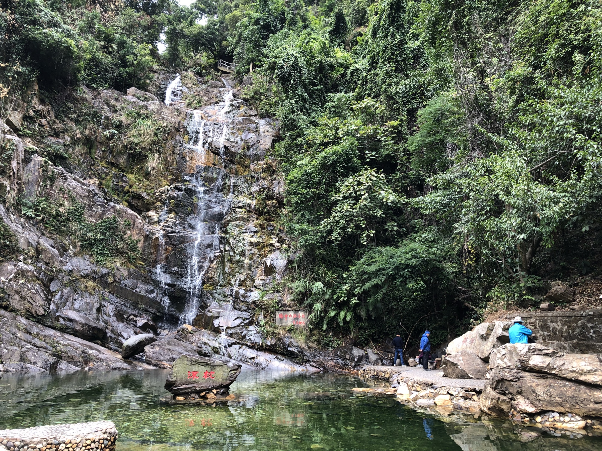
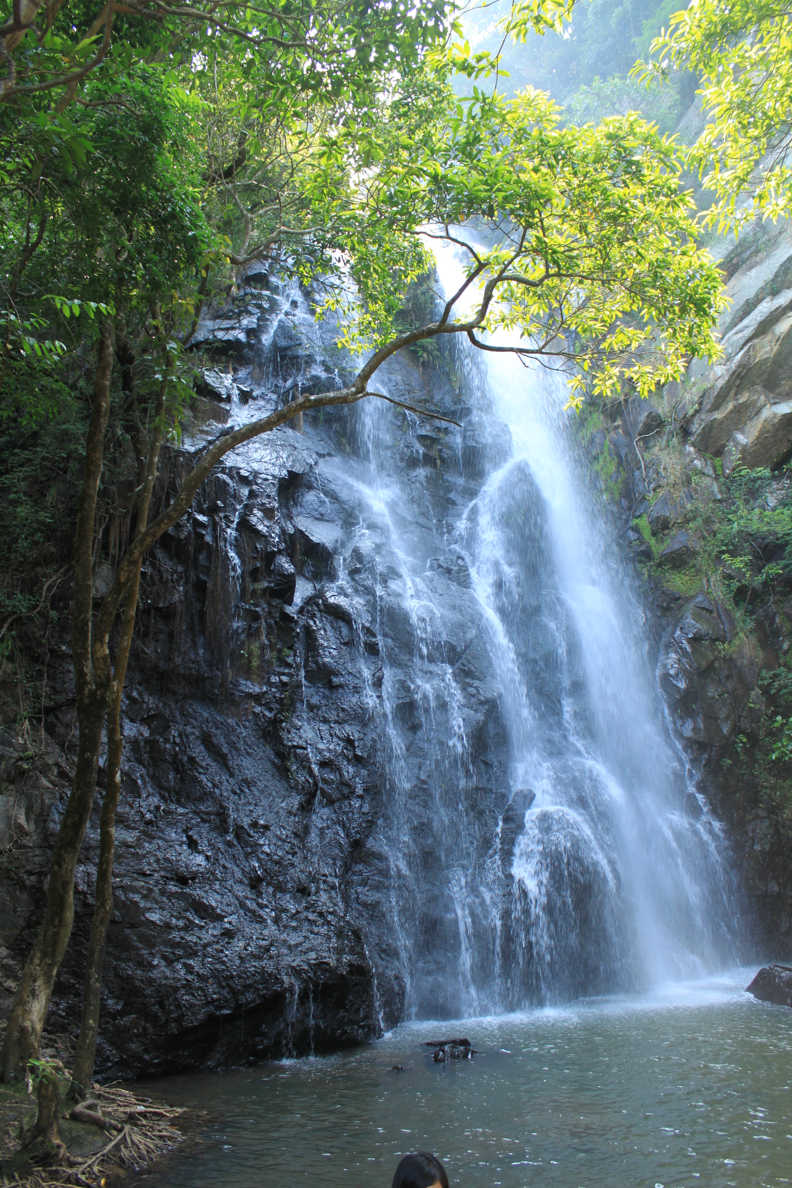
From the north-west gate near Huangzhukeng Village (黄竹坑村) the trail enters cool subtropical broadleaf forest along a stream valley and follows the Mucuna Trail (禾雀花径), a 6.5 km path named for the dense canopy of wild Mucuna birdwoodiana vines that flower in late March. The path passes Pingshan reservoir intakes and gains height gradually to the central ridge, where the Maluan Shan summit area sits at around 590 m and gives views east over Pingshan, the Daya Bay nuclear power station and the open South China Sea, and south-west over Yantian Port and Hong Kong’s North-East New Territories. The descent leg follows the Biling Waterfall Trail (碧岭瀑布径, 3.05 km) past the five-tier Biling Waterfalls (碧岭瀑布群) — billed locally as “Shenzhen’s First Waterfall” — and through the Thousand-Mu Plum Garden (千亩梅园) on the lower slopes back to the trailhead. Compared with most Shenzhen hill walks, Maluan Shan is unusually free of granite staircase: most of the route is flat path or natural-surface trail, making it a softer alternative for tired knees.
Why it is essential
Maluan Shan is the largest country park in Shenzhen and the city’s principal waterfall and stream-valley walk. The five-tier Biling Waterfalls are the only major waterfall feature inside the municipal boundary, and the park’s first-country-park status (the first protected as such in Shenzhen) together with the Gengzi First Uprising historical site (庚子首义旧址) give it cultural and political weight that the more recreational urban parks lack. It complements the four summit-focused entries by offering a stream-and-waterfall day rather than a ridge day.
Equipment
Standard hiking equipment: trail shoes (some sections become muddy after rain), 2 L of water, sun and rain protection. Insect repellent is recommended in the lower stream valleys. Swimming in the waterfall pools is technically prohibited and water levels can change suddenly during storms.
Hazards and notes
Flash-flood risk in the stream valleys during heavy rain; the park may close the waterfall trail in red rain warnings. Snakes (including bamboo viper) are present in the lower forest. Mosquitoes are heavy April to October. Picnic fires are prohibited park-wide and enforcement is strict in fire-risk season. Some perimeter paths approach reservoir catchment zones marked off-limits — stay on the official waymarked routes.
GPX / route file
| Source | URL |
|---|---|
| OpenStreetMap — Maluan Shan Country Park | openstreetmap.org |
| EyeShenzhen — Maluan Mountain Country Park | eyeshenzhen.com |
| Pingshan District government — Hiking on Mt. Maluan | szpsq.gov.cn |
| TimHiking — Maluan Mountain · Maluan Waterfalls | timhiking.com |
| 两步路 (Liangbulu) — search “马峦山” | 2bulu.com |
Practical notes and follow-up
No single official downloadable GPX exists for any of the five routes; all rely on OpenStreetMap geometry plus secondary trail-database traces (AllTrails, 两步路, Pacer). The OSM relations should be reviewed for completeness before any serious planning, particularly on the Hao Jiang Bei descent of Wutong Shan and the seven-peaks ridge of Qiniang Shan. Wutong Shan timed-entry rules and daily quotas are controlled by the 梧桐山预约 WeChat mini-programme and change with the season — confirm peak-period booking windows close to your visit. On the Dapeng Peninsula, border and military exclusion zones around Qiniang Shan have shifted historically and some ridge variants north and east of the main summit may be off-limits; stay on the marked trail. The Yangtai Shan summit memorial monument can be temporarily closed during national commemorations. The Tanglang Shan to Meilin traverse extends well beyond a single day-hike when continued all the way to Mei Lin Pa Sha Reservoir; the entry above covers only the standard 7.5 km Tanglang loop. Sources on the Maluan Shan main peak elevation differ — official Shenzhen city park material states “most peaks below 500 m,” while secondary sources give the main peak as ~590 m; treat the upper figure as approximate.
External links
| Source | URL |
|---|---|
| Wutong Shan National Forest Park (深圳市梧桐山国家森林公园) — official park information and the 梧桐山预约 WeChat mini-programme | search the official park portal |
| Shenzhen Municipal Bureau of Urban Administration and Comprehensive Law Enforcement (深圳市城市管理和综合执法局) | szcgj.sz.gov.cn |
| EyeShenzhen — official English-language portal of Shenzhen Municipal Government | eyeshenzhen.com |
| Pingshan District government — Hiking on picture-perfect Mt. Maluan | szpsq.gov.cn |
| Dapeng Peninsula National Geopark (大鹏半岛国家地质公园) | search the official Geopark portal |
| Wikipedia — Wutong Mountain | en.wikipedia.org |
| Wikipedia — Qiniangshan | en.wikipedia.org |
| Wikipedia — Mount Yangtai | en.wikipedia.org |
| PeakVisor — Qī Niáng Shān | peakvisor.com |
| AllTrails — Mount Wutong area | alltrails.com |
| AllTrails — Qiniangshan | alltrails.com |
| AllTrails — Mount Yangtai | alltrails.com |
| AllTrails — Tang Lang Hill Country Park | alltrails.com |
| Pacer — Wutong Mountain hiking trail | mypacer.com |
| Hikentrail — Mt. Wutong community guide | hikentrail.org |
| Dr Mark Nan Tu — Tang Lang Hill Country Park trail guide | drnantu.com |
| TimHiking — Maluan Mountain and Maluan Waterfalls | timhiking.com |
| Shenzhen hikes blog — Qiniang Mountain 七娘山 | szhike.wordpress.com |
| OpenStreetMap — Shenzhen mountain search | openstreetmap.org |
| 两步路 (Liangbulu) — Chinese hiking-trace platform | 2bulu.com |
| Wikimedia Commons — Wutong Mountain category | commons.wikimedia.org |
| Wikimedia Commons — Yangtai Mountain Forest Park category | commons.wikimedia.org |
| Wikimedia Commons — Tanglang Mountain category | commons.wikimedia.org |
| Wikimedia Commons — Dapeng Peninsula category | commons.wikimedia.org |
| Wikimedia Commons — Maluan Mountain category | commons.wikimedia.org |