Regional overview
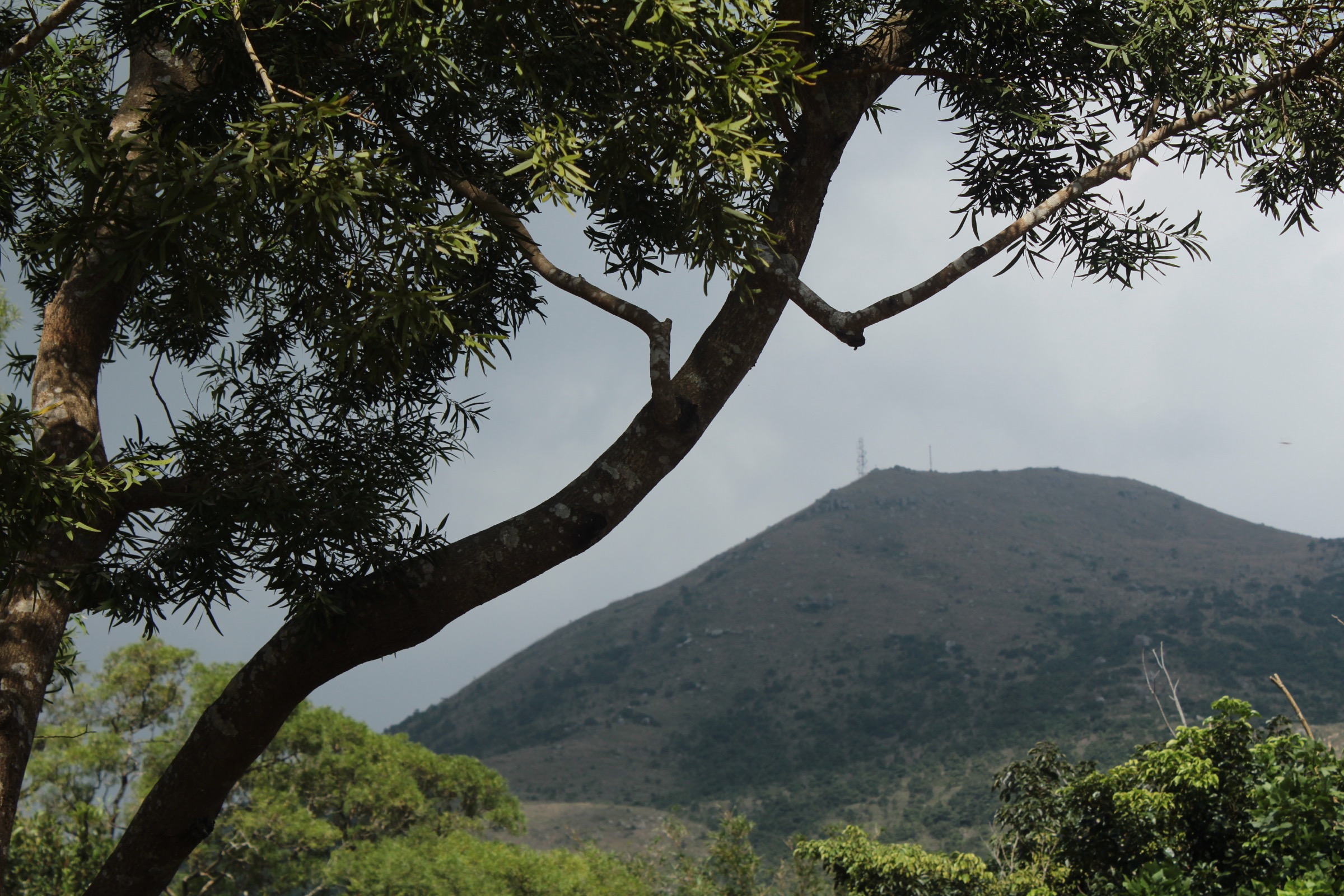
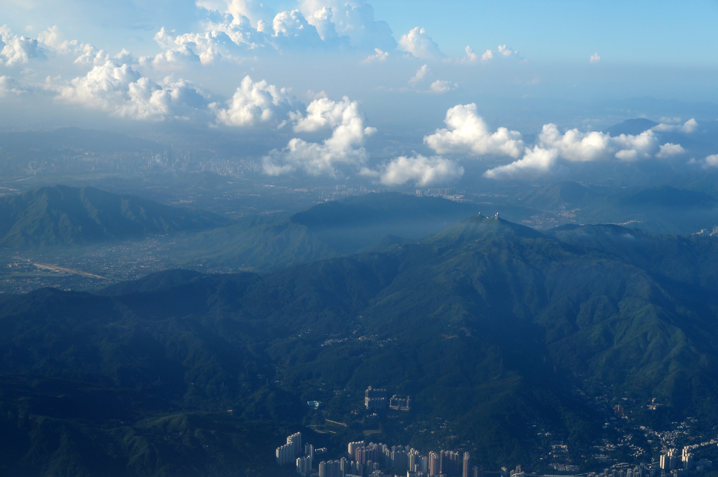
The Kowloon and New Territories ranges occupy roughly three-quarters of the Hong Kong Special Administrative Region, rising abruptly from a coastline of bays, inlets and offshore islands. The terrain is a series of compact granite and volcanic ridges separated by deep, often roadless valleys: the Tai Mo Shan massif in the centre, the Kowloon ridges (Lion Rock, Beacon Hill, Tate’s Cairn, Kowloon Peak / Fei Ngo Shan) immediately above the urban harbour, the Ma On Shan – Pyramid Hill chain east of Sha Tin, and the Sai Kung peninsula in the east, where Sharp Peak (Nam She Tsim), Sai Wan Shan and the Tai Long Wan bays form one of the wildest stretches of coast in southern China. Tai Mo Shan, at 957 m, is the highest summit in the territory.
Most of this upland is protected within the country park system, gazetted from 1977 onwards and managed by the Agriculture, Fisheries and Conservation Department (AFCD). Tai Mo Shan Country Park, Lion Rock Country Park, Ma On Shan Country Park and Sai Kung East / West Country Parks together host four long-distance trails — the 100 km MacLehose Trail, the 78 km Wilson Trail, the 50 km Hong Kong Trail (largely on Hong Kong Island) and the 70 km Lantau Trail — plus a dense network of country-park trails, family walks and ridge approaches. The trail network is signposted in English and Chinese, with distance markers every 500 m on the MacLehose, Wilson and other named trails, and access points generally lie within 10-30 minutes’ walk of an MTR station or a country-park bus.
The optimum walking season runs from October to April, when humidity drops, skies are typically clearest and daytime temperatures sit between 15 °C and 25 °C. Summer (June to September) is hot, very humid and exposed to tropical cyclones; hill fires, heat exhaustion and flash thunderstorms are real hazards. The AFCD issues fire-danger warnings between October and April, and several routes — most notably Sharp Peak — are not recommended in wet or windy weather because of slippery rock and steep, unprotected drops. Public transport across the New Territories is extensive: trailheads at Tai Mo Shan, Lion Rock, Ma On Shan and Pak Tam Chung are all reachable by MTR plus a short bus or taxi ride.
Selection rationale
The five entries cover Hong Kong’s highest summit (Tai Mo Shan), the city’s most iconic urban-edge peak (Lion Rock above Kowloon), the steep granite ridgeline of Ma On Shan via the conical Pyramid Hill, the territory’s classic technical day summit (Sharp Peak on Sai Kung), and the canonical coastal traverse (MacLehose Trail Section 2 along Tai Long Wan). They spread across the four major hill systems of mainland Hong Kong — Tai Mo Shan, Kowloon ridges, Ma On Shan and Sai Kung — and balance an urban-edge classic, a high-point traverse, two demanding peak days and a beach-and-headland traverse of UNESCO Global Geopark coast.
Summary table
| # | Hike | Country | Route type | Distance | Gain | Max elevation | Difficulty |
|---|---|---|---|---|---|---|---|
| 1 | Tai Mo Shan via Rotary Park (MacLehose Section 8 summit) | Hong Kong | Out-and-back | 9.5 km | 490 m | 957 m | Moderate |
| 2 | Lion Rock from Wong Tai Sin | Hong Kong | Loop | 6.7 km | 520 m | 495 m | Moderate |
| 3 | Ma On Shan via Pyramid Hill (Ngong Ping) | Hong Kong | Point-to-point | 12 km | 740 m | 702 m | Hard |
| 4 | Sharp Peak (Nam She Tsim) from Pak Tam Au | Hong Kong | Out-and-back | 11.7 km | 760 m | 468 m | Hard |
| 5 | MacLehose Trail Section 2 — Long Ke to Pak Tam Au | Hong Kong | Point-to-point | 14 km | 900 m | 314 m | Hard |
1. Tai Mo Shan via Rotary Park (MacLehose Section 8 summit)
Snapshot
Itinerary
The route leaves the Rotary Club Park gate at roughly 465 m on Route Twisk and follows the closed, paved Tai Mo Shan Road eastwards. After about 1.5 km it joins MacLehose Trail Section 8, which climbs steadily through grassland and Taiwan cherry plantings, with widening views southwards over Tsuen Wan and the Tsing Ma Bridge. The road bends north below the upper slopes, traverses the silver-grass plateau that gives the mountain its summer-cloud character, and reaches the locked radar station compound at 957 m. The true summit lies inside the Hong Kong Observatory’s restricted area; the public high point is the viewpoint just outside the gate, with a 360-degree panorama from Lantau and Hong Kong Island in the south to the Shenzhen ranges across the border. Descent is by the same line.
Why it is essential
Tai Mo Shan is the highest summit in Hong Kong and the obvious anchor of any mainland walking list. The wide, paved approach is suitable for almost all fit walkers and is a recognised MacLehose section finish, while the silver-grass plateau, cherry groves at lower altitude and harbour panorama from the top combine the three signature landscapes of the central New Territories in a single day.
Equipment
Standard hiking shoes, sun protection (the upper slopes are almost completely shadeless), windproof layer for the exposed summit ridge, 2 litres of water minimum in warm weather, and a headtorch for any winter descent in fading light. Trekking poles are not necessary on the paved surface.
Hazards and notes
The summit is regularly above the cloud base — visibility can drop to a few metres within minutes — and is the coldest place in Hong Kong, with occasional winter ground frost. Heat and humidity are the dominant summer hazards. Tai Mo Shan Road is open to authorised vehicles only but is also used by official cyclists, so keep to the edge on the bends. The radar station compound is permanently off-limits.
GPX / KML links
| Source | URL |
|---|---|
| AllTrails: Rotary Park - Tai Mo Shan | alltrails.com |
| AFCD: MacLehose Trail Section 8 | hiking.gov.hk |
| Wikiloc: Tai Mo Shan summit | wikiloc.com |
2. Lion Rock from Wong Tai Sin
Snapshot
Itinerary
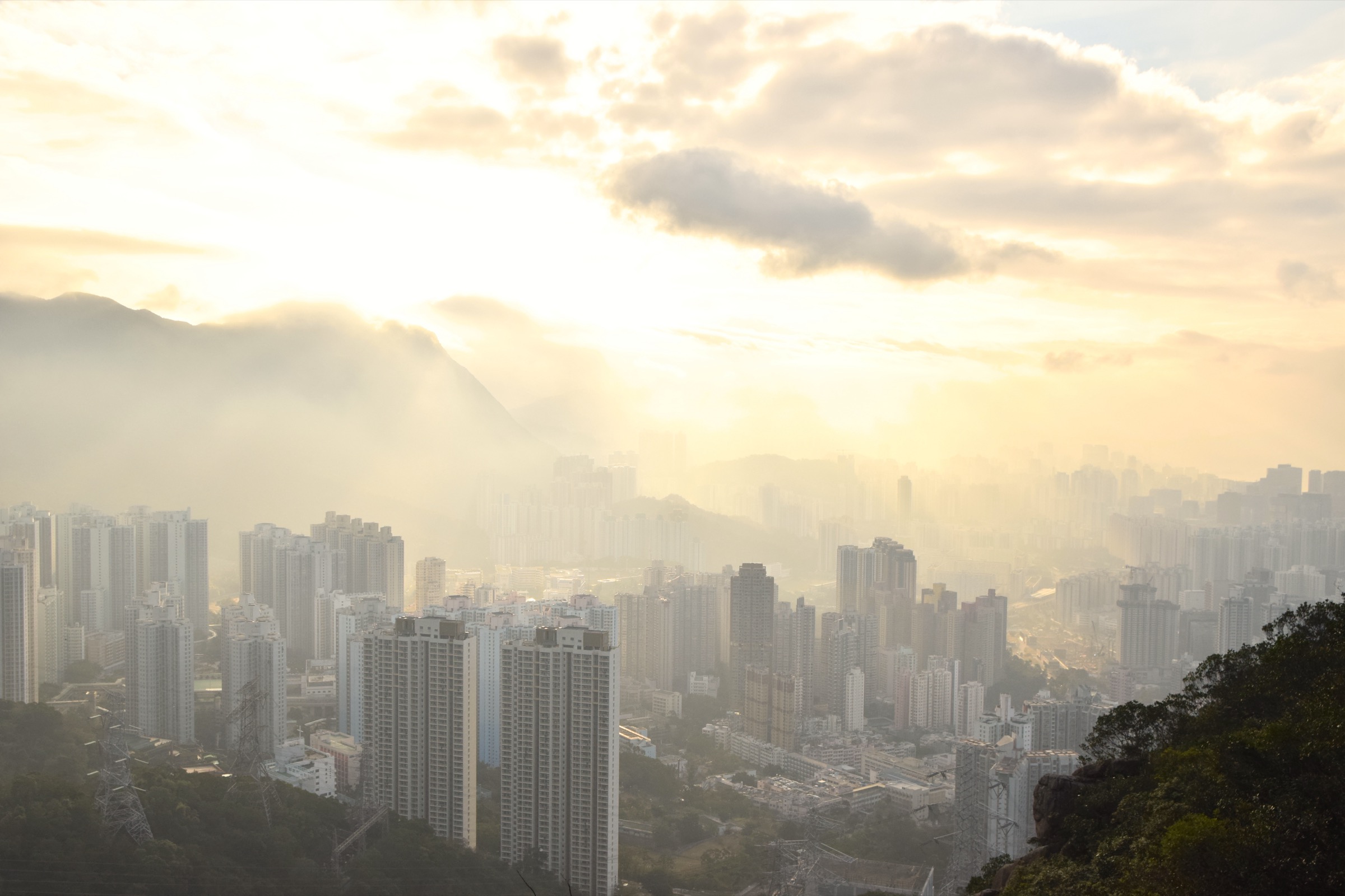
From Wong Tai Sin MTR the route climbs Sha Tin Pass Road past the Wong Tai Sin Temple complex and enters Lion Rock Country Park at the upper pavilion. A signposted side path leaves the Maclehose-Wilson connector and ascends the southern flank of the lion’s body through pine and bamboo to a short ridge crest, with a brief rocky step up the back of the lion’s head onto the airy 495 m summit. The view runs unbroken from Tsim Sha Tsui and Victoria Harbour across all of Kowloon to Hong Kong Island. The loop continues westwards along the Wilson Trail Section 5 ridgeline to Beacon Hill, then drops back down to the Sha Tin Pass road and the Wong Tai Sin trailhead.
Why it is essential
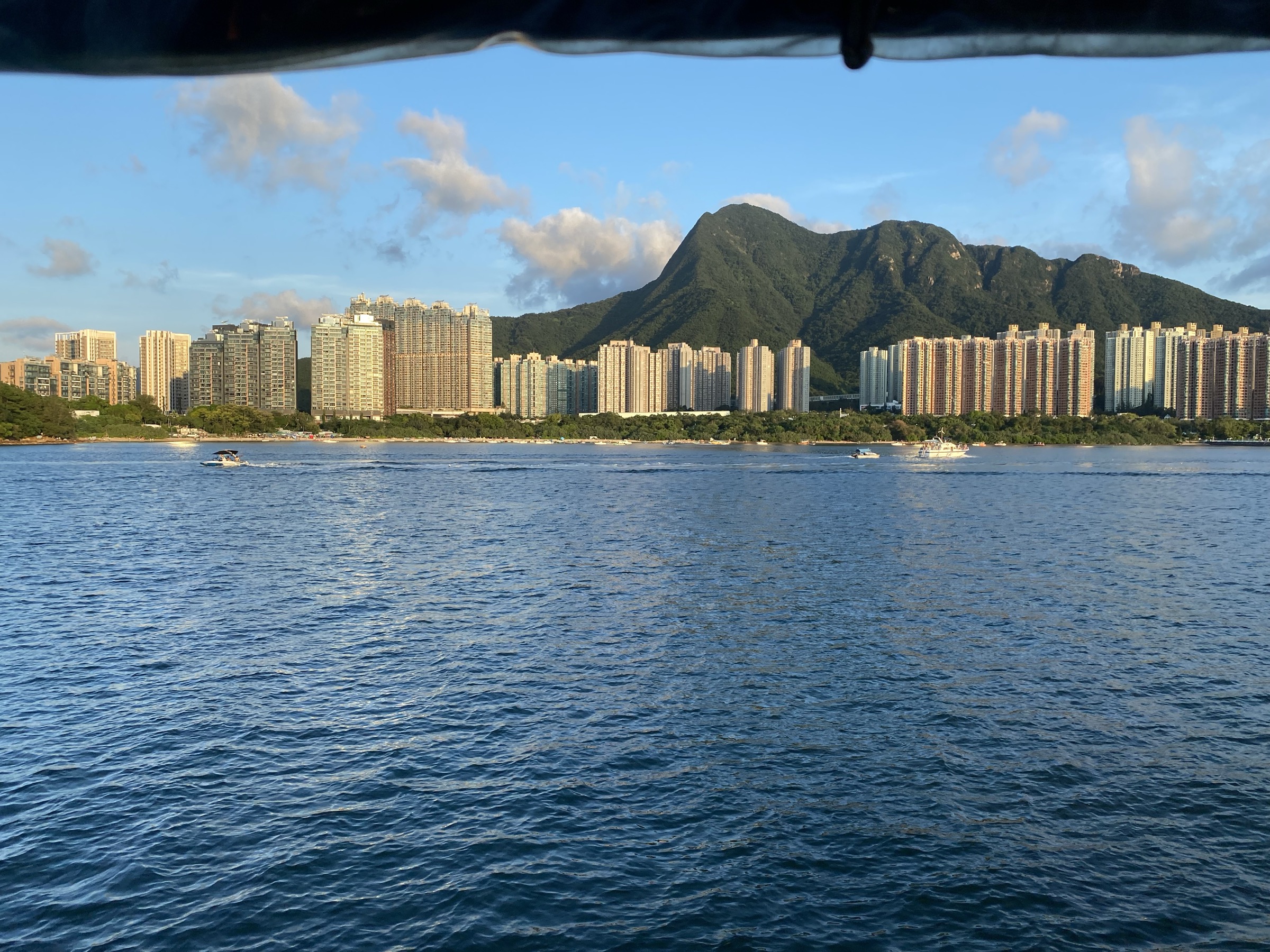
Lion Rock is the single most recognisable mountain in Hong Kong and a powerful local cultural symbol — the “Lion Rock spirit” of post-war Kowloon. It is the only summit in this selection that overlooks the city skyline directly, and the only one reachable on foot from an MTR station in under an hour. No other peak in southern China combines an iconic granite head, a harbour panorama and a 30-minute commute to the trailhead.
Equipment
Standard hiking shoes with good rubber for the short rock scramble, sun protection, 1.5-2 litres of water, and a headtorch if descending near sunset. The summit is exposed; a windproof layer is sensible in winter.
Hazards and notes
The final scramble to the lion’s head involves an unprotected step with significant exposure on either side; a fall would be serious. The trail can be very busy at weekends and on holiday afternoons, and the rock polishes quickly in damp weather. Hill fires are a winter risk on the surrounding grassland — observe AFCD warnings. Beacon Hill carries Civil Aviation Department radar; stay outside fenced compounds.
GPX / KML links
| Source | URL |
|---|---|
| AllTrails: Lion Rock Trail | alltrails.com |
| AFCD: Wilson Trail Section 5 (Lion Rock) | hiking.gov.hk |
| Wikiloc: Lion Rock from Wong Tai Sin | wikiloc.com |
3. Ma On Shan via Pyramid Hill (Ngong Ping)
Snapshot
Itinerary
From Heng On MTR a steady tarmac climb on Ma On Shan Country Trail leads to the Ngong Ping grassland plateau at around 400 m, a popular paragliding launch with sweeping views of the Tolo Channel. Pyramid Hill (Tai Kam Chung, 536 m) rises as a conical horn directly behind the plateau and is climbed by an obvious eroded path with a few rocky steps near the top. The main ridge then drops to a saddle and climbs steeply up the northern shoulder of Ma On Shan to the 702 m main summit. The view spans Sai Kung’s offshore islands, Tolo Harbour and the inland reservoirs. Descent follows the south ridge over Ngau Ngak Shan (The Hunchbacks) and Mau Ping, then drops on graded steps to Pak Kong and Sai Kung town.
Why it is essential
Ma On Shan is the most dramatic ridgeline accessible as a day-hike on mainland Hong Kong, combining the territory’s most photographed conical peak (Pyramid Hill) with a substantial granite summit and a balcony traverse high above the Sai Kung coast. It also makes a logical MTR-to-town traverse, giving the truest feeling of crossing the New Territories on foot.
Equipment
Mountain hiking kit: sturdy boots with sticky rubber, weatherproof shell, warm layer for the ridge in winter, sun protection, 2.5-3 litres of water (no reliable refill once on the ridge), trekking poles for the steep descents off Pyramid Hill and Ma On Shan, and a headtorch for the long finish.
Hazards and notes
The summit ridge between Pyramid Hill and Ma On Shan is steep, eroded and exposed on both sides; a slip would be serious. Heat exhaustion is the dominant hazard in spring and autumn. The route should not be attempted in wet weather, when the rocky steps and grassed slopes become genuinely treacherous. Mobile coverage is patchy in the upper ravines.
GPX / KML links
| Source | URL |
|---|---|
| AllTrails: Pyramid Hill - Ma On Shan | alltrails.com |
| AFCD: Ma On Shan Country Trail | hiking.gov.hk |
| Wikiloc: Ma On Shan via Pyramid Hill | wikiloc.com |
4. Sharp Peak (Nam She Tsim) from Pak Tam Au
Snapshot
Itinerary
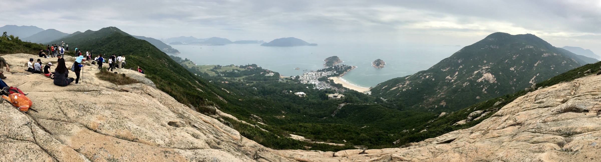
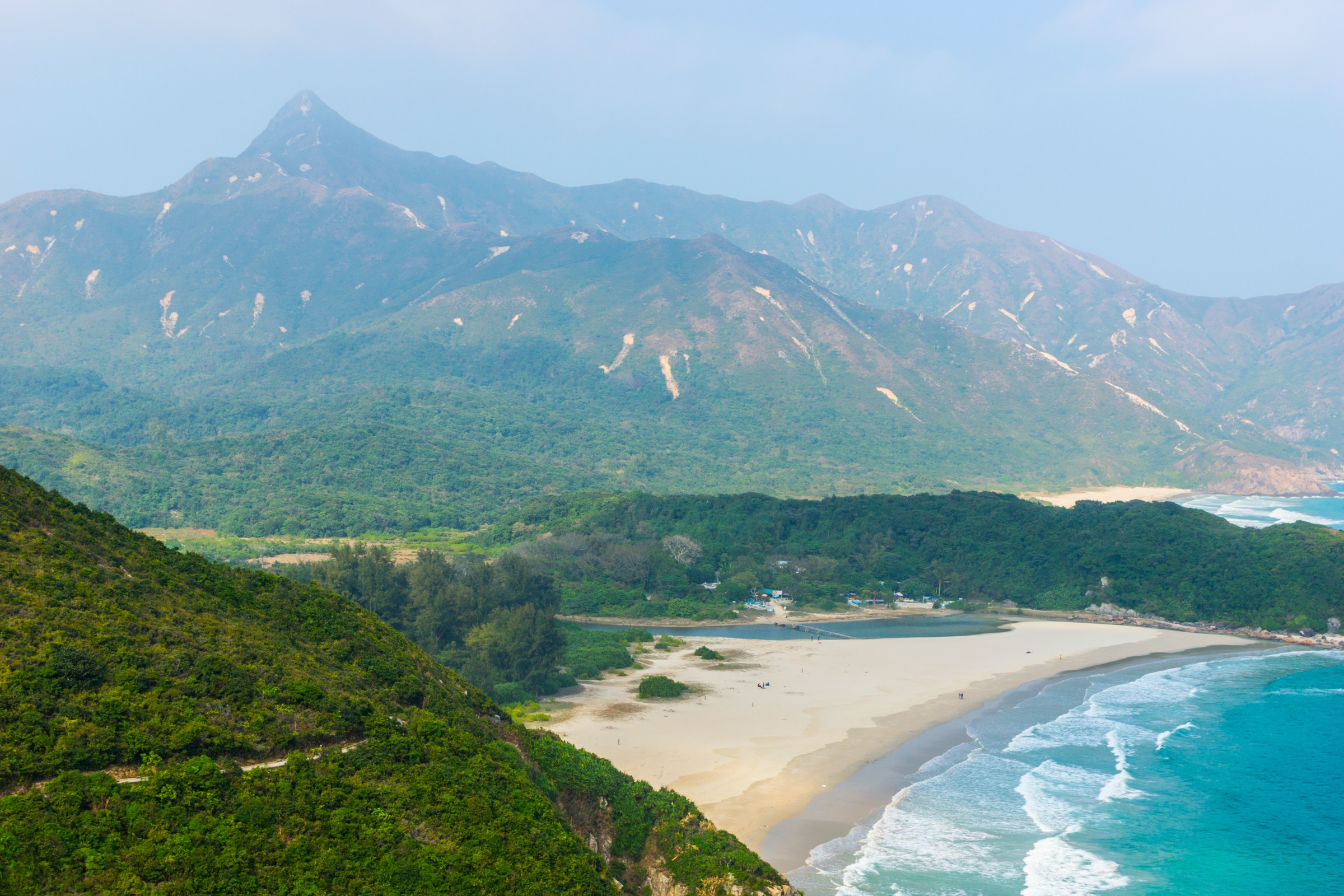
The route leaves Pak Tam Au on the MacLehose Trail heading north-east, drops through low forest to the Chek Keng inlet, then climbs onto open hill above Tai Long Wan with widening views of Sharp Peak’s distinctive arrowhead silhouette. The signposted side path turns north off the MacLehose just before the Tai Long campground and climbs straight up the steep, exposed south-west ridge of Sharp Peak on loose decomposed granite and short rocky steps. The summit at 468 m is a tight crest with one of the finest coastal panoramas in southern China: the Tai Long Wan beaches and Tap Mun (Grass Island) to the north, the Ninepin Group to the south, and Ma On Shan inland. Descent is by the same line; some walkers extend the day by descending to Ham Tin Wan beach before retracing to Pak Tam Au.
Why it is essential
Sharp Peak is the technical day-summit of mainland Hong Kong and the one outing that makes a fit hill walker feel they have done something serious. It is the steepest, sharpest and most photographed of the Sai Kung peaks, and its position directly above the Tai Long Wan beach gives a coastal context that no other summit in the territory can match.
Equipment
Mountain hiking boots with sticky rubber are essential. Carry a windproof and waterproof shell, sun protection, 2.5-3 litres of water (no refill on the route), gloves for the loose-granite ridge, a headtorch for any chance of a late finish, and trekking poles for the descent (some hikers prefer to stow them for the hand-on-rock sections).
Hazards and notes
The summit cone is genuinely steep and loose, with unprotected drops on both sides of the final ridge. Multiple injuries and rescues occur on Sharp Peak each year. The route should not be attempted in wet weather, in cloud or in winter monsoon winds. The AFCD posts a permanent warning sign at the foot of the cone. Mobile coverage is intermittent. Begin early and turn back if the cone is wet.
GPX / KML links
| Source | URL |
|---|---|
| AllTrails: Sharp Peak | alltrails.com |
| AllTrails: Sharp Peak Loop | alltrails.com |
| Wikiloc: Sharp Peak Nam She Tsim | wikiloc.com |
5. MacLehose Trail Section 2 — Long Ke to Pak Tam Au
Snapshot
Itinerary
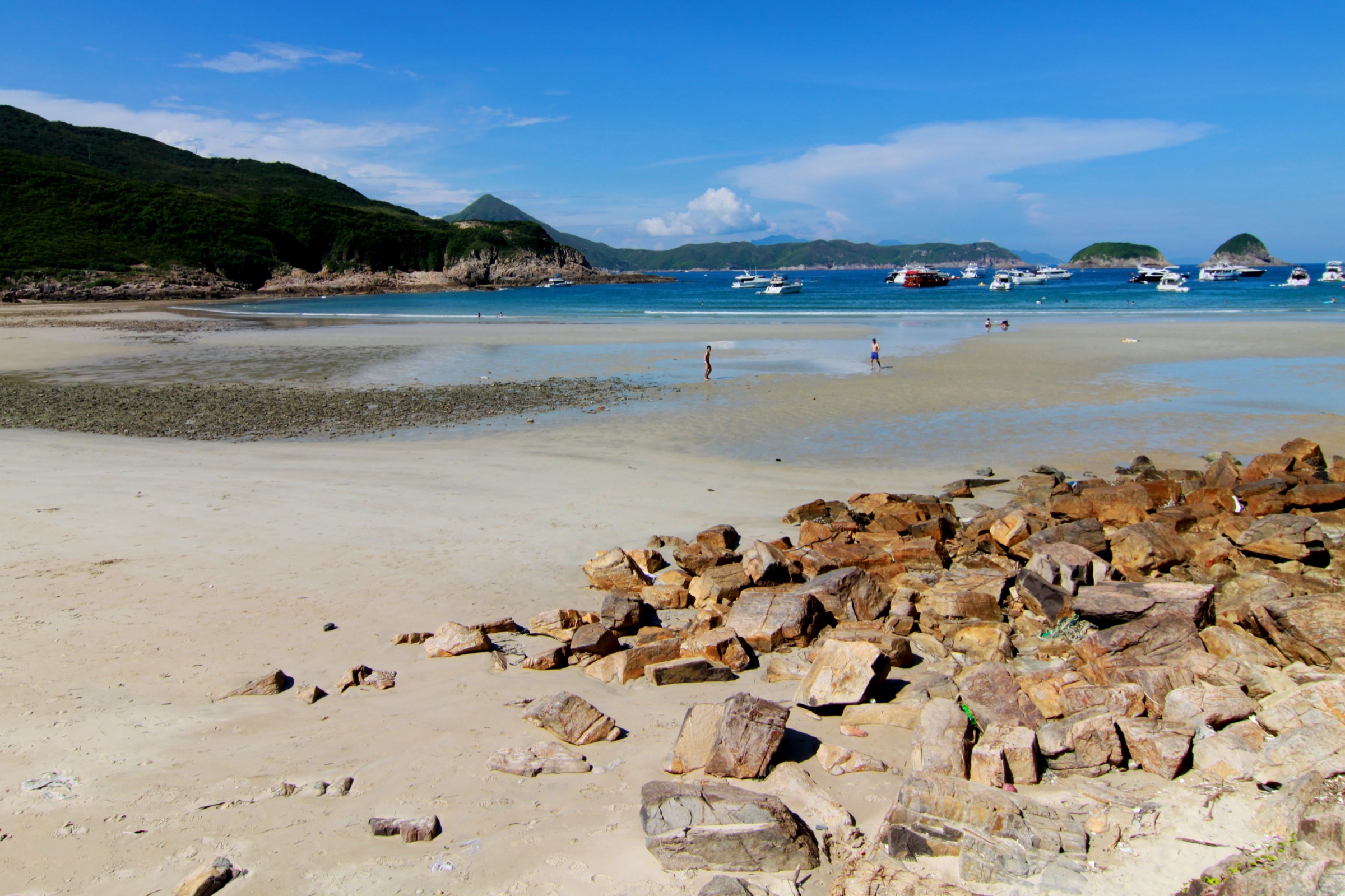
Section 2 of the MacLehose is the canonical coastal stage of the trail and one of the most celebrated day-walks in southern China. From Long Ke the path drops to the perfect arc of Long Ke Wan beach, climbs the south-east ridge of Sai Wan Shan to the 314 m grassy summit, then drops to the village of Sai Wan above the open sweep of Tai Long Sai Wan. A signed contour traverse leads round to Ham Tin Wan, with its iconic wooden footbridge across the lagoon, and onwards through the abandoned hamlet of Chek Keng. The final climb crosses the low pass below Tai Tun and descends through young forest to the Pak Tam Au bus stop. Distance markers M030 to M058 punctuate the stage.
Why it is essential
Section 2 is the essential MacLehose day. It combines the cleanest beaches in Hong Kong, the geological backbone of the UNESCO Global Geopark, a 360-degree summit ridge over the Sai Kung peninsula, and one of the most famous footbridges on the East Asian coast. It is the only entry in this selection that gives both serious ridge walking and a swimmable beach lunch.
Equipment
Standard hiking shoes with grip, broad-brimmed sun hat (the ridges are completely exposed), 3 litres of water minimum (refill at Sai Wan village cafés in season — these are not guaranteed open midweek in winter), light waterproof, swimwear and a towel if planning a beach stop, and a headtorch for the late return bus. Trekking poles help on the descents off Sai Wan Shan and the long Pak Tam Au climb.
Hazards and notes
The ridges are completely shadeless; heat stress is the dominant hazard outside winter. Distances at Sai Kung are deceptive — most walkers take longer than they expect. Strong onshore winds can make the Sai Wan Shan ridge unpleasant in cold-front conditions. The Ham Tin lagoon and Sai Wan rocks are subject to powerful waves and rip currents; check sea state before swimming. Last buses from Pak Tam Au and Sai Kung run early in the evening — plan timing accordingly.
GPX / KML links
| Source | URL |
|---|---|
| AllTrails: MacLehose Trail Section 2 | alltrails.com |
| AFCD: MacLehose Trail Section 2 | hiking.gov.hk |
| Gaia GPS: Pak Tam Au Campsite via MacLehose Section 2 | gaiagps.com |
External links
| Source | URL |
|---|---|
| AFCD Hong Kong — Hiking and Country Parks portal | hiking.gov.hk |
| AFCD — MacLehose Trail overview | hiking.gov.hk |
| AFCD — Wilson Trail overview | hiking.gov.hk |
| Hong Kong Tourism Board — Tai Mo Shan hike | discoverhongkong.com |
| Wikipedia — Tai Mo Shan | en.wikipedia.org |
| Wikipedia — Lion Rock | en.wikipedia.org |
| Wikipedia — Ma On Shan (peak) | en.wikipedia.org |
| Wikipedia — Pyramid Hill (Hong Kong) | en.wikipedia.org |
| Wikipedia — Sharp Peak | en.wikipedia.org |
| Wikipedia — MacLehose Trail | en.wikipedia.org |
| Wikipedia — Tai Long Wan, Sai Kung | en.wikipedia.org |
| Wikipedia — Sai Wan Shan (Sai Kung) | en.wikipedia.org |
| AllTrails — Rotary Park - Tai Mo Shan | alltrails.com |
| AllTrails — Lion Rock Trail | alltrails.com |
| AllTrails — Pyramid Hill - Ma On Shan | alltrails.com |
| AllTrails — Sharp Peak | alltrails.com |
| AllTrails — MacLehose Trail Section 2 | alltrails.com |
| Hiking the World — Sharp Peak (Nam She Tsim) | hikingtheworld.blog |
| Localiiz — Hike to Lion Rock | localiiz.com |
| Wikimedia Commons — Tai Mo Shan category | commons.wikimedia.org |
| Wikimedia Commons — Lion Rock category | commons.wikimedia.org |
| Wikimedia Commons — Sharp Peak category | commons.wikimedia.org |