Regional overview
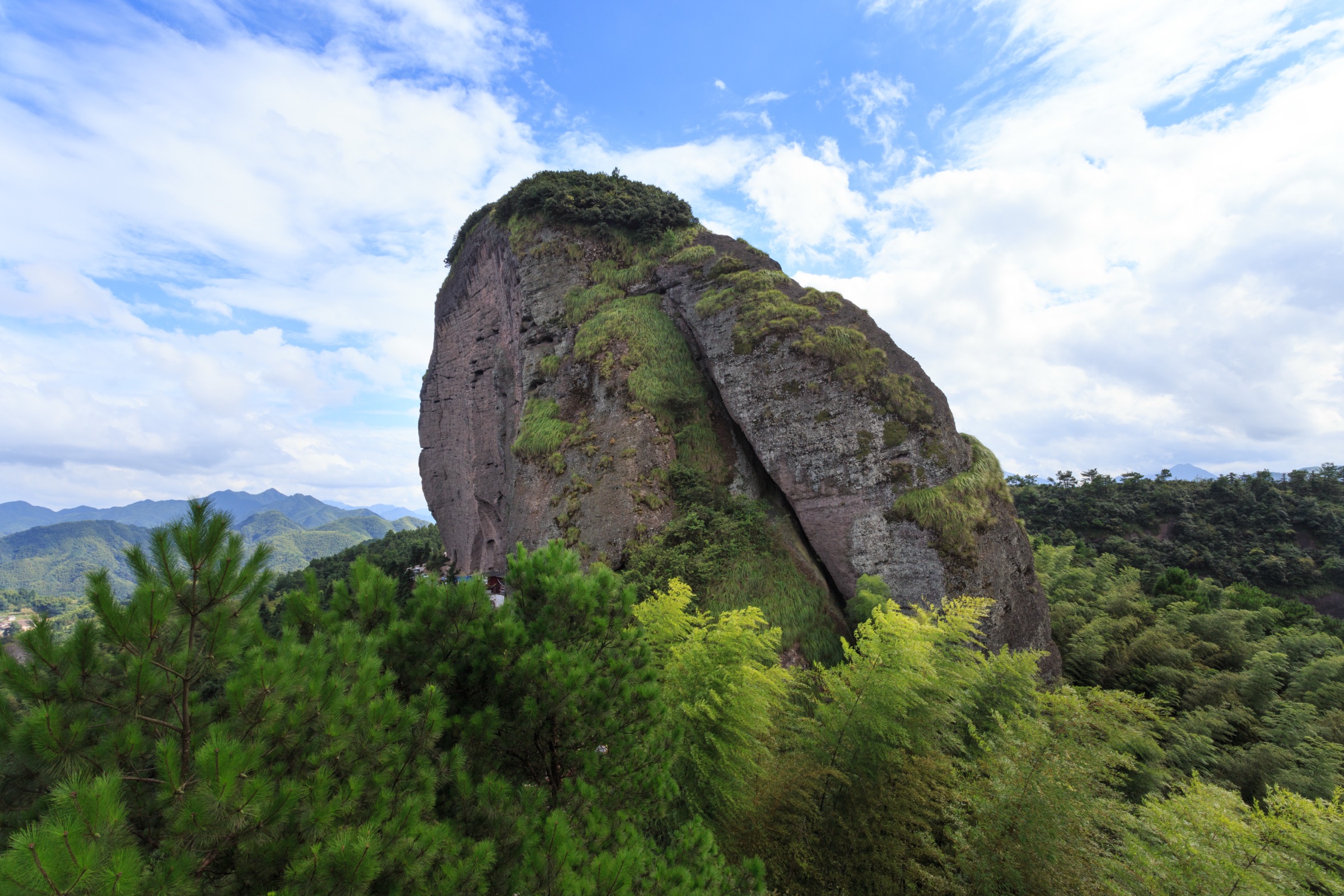
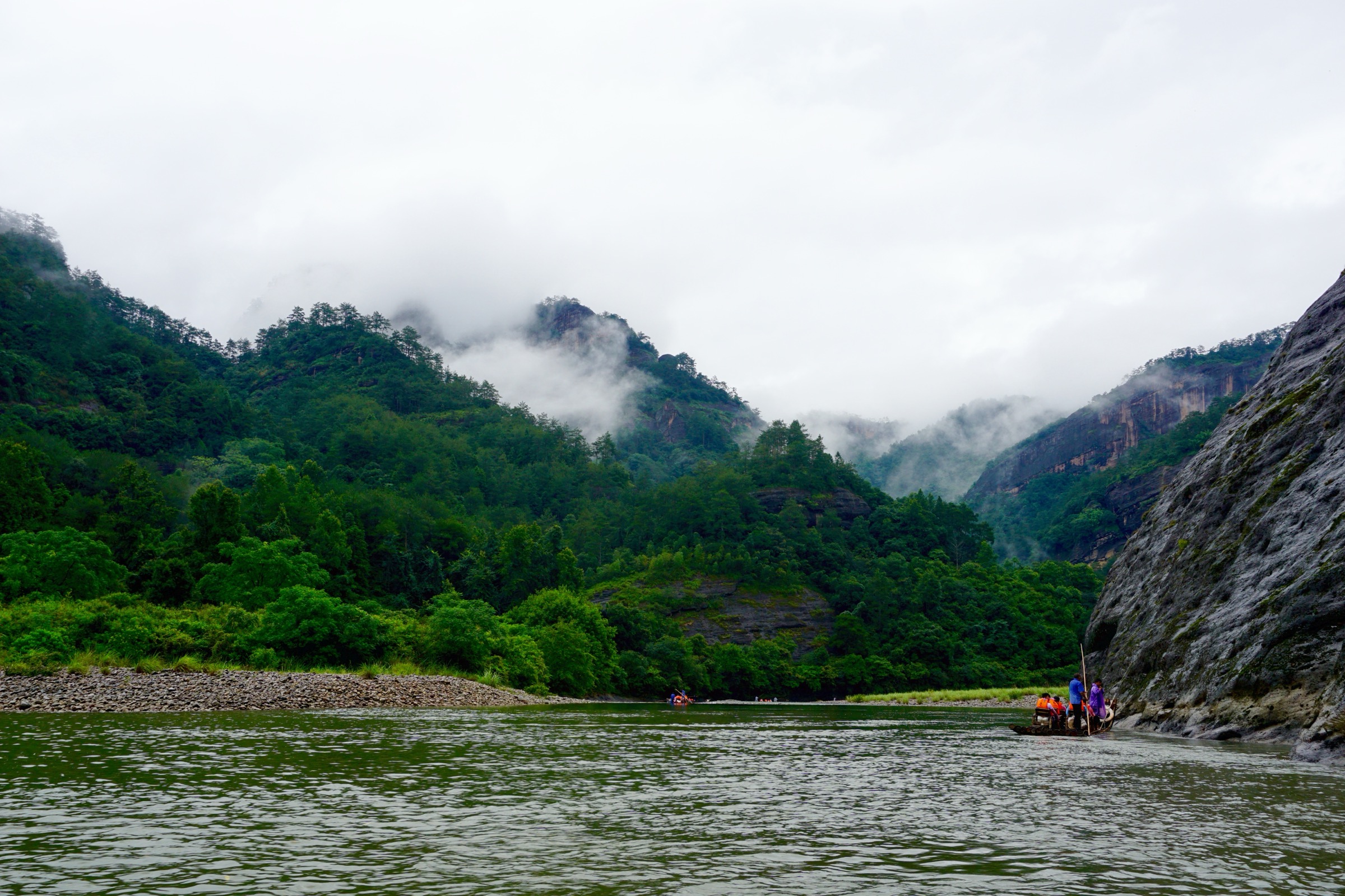
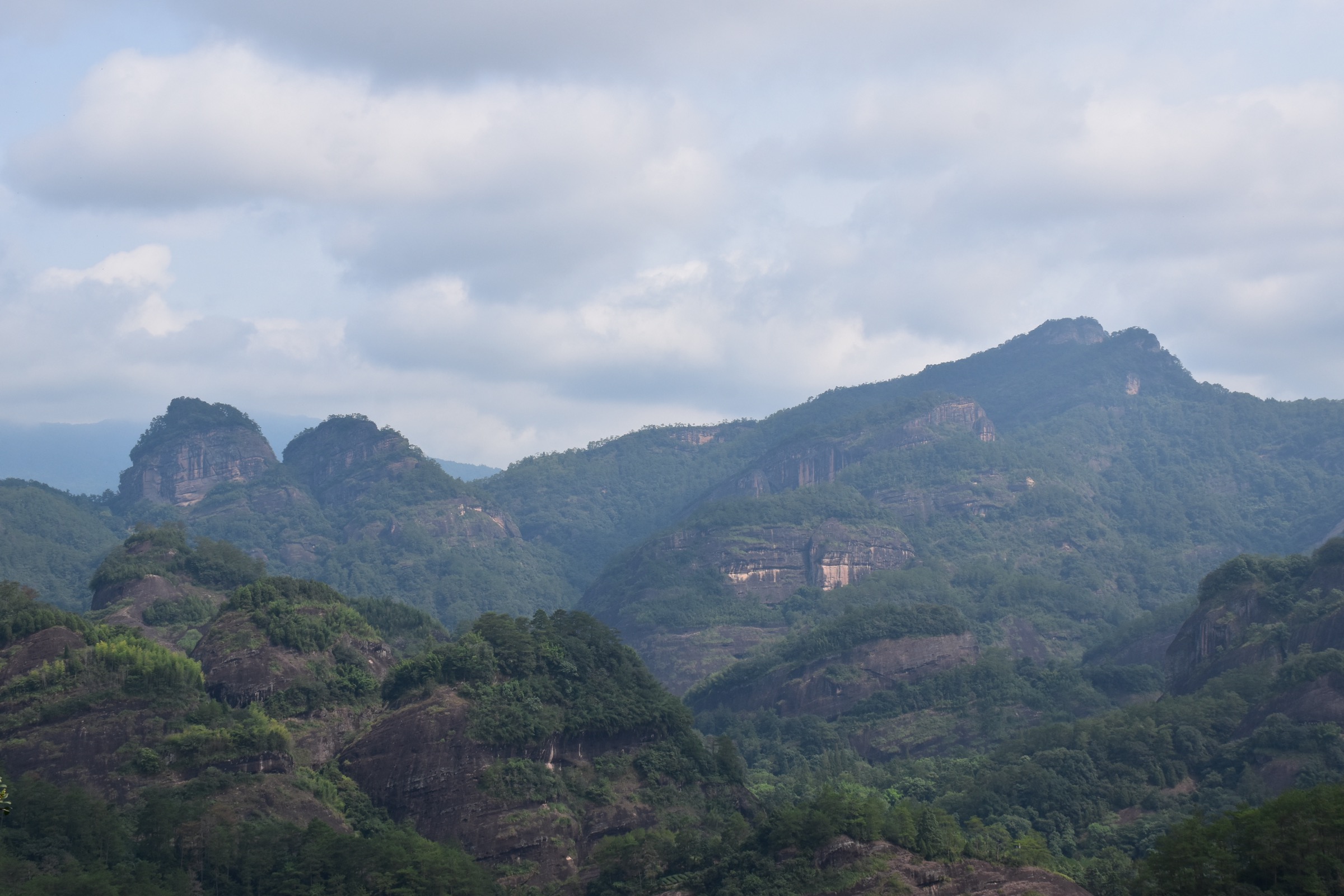
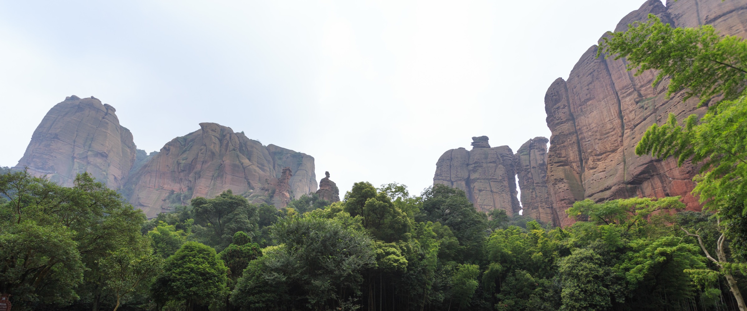
The Wuyi Mountains (武夷山) form the principal watershed between the Yangtze drainage of Jiangxi and the Min River drainage of Fujian, a 550 km arc of Cretaceous red-bed Danxia sandstone, granitic intrusions and dissected subtropical broadleaf forest running along the inland edge of south-east China. The hiking core sits on the Fujian side in the Wuyishan Scenic Area (武夷山风景名胜区), where the Jiuqu Brook (九曲溪, “Nine-Bend Stream”) cuts a sinuous gorge through a ~70 km² maze of vertical red-rock peaks no higher than about 700 m; the protected reserve behind it climbs into the South Sea-facing escarpment up to Huanggangshan (黄岗山) at 2,160.8 m, the highest summit in south-east China outside Taiwan. Across the divide in Jiangxi, the same Late Cretaceous red beds re-emerge as the old-stage Danxia landscapes of Guifeng (龟峰, Yiyang) and Longhushan (龙虎山, Yingtan), both inscribed alongside Mount Wuyi’s natural property in the China Danxia serial World Heritage listing.
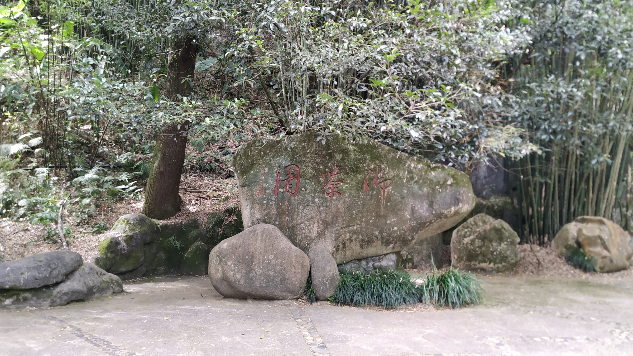
Mount Wuyi is one of just four UNESCO mixed (natural + cultural) World Heritage sites in China, inscribed in 1999 for the combination of its Danxia geomorphology, its subtropical evergreen broadleaf forest — one of the largest continuous blocks of its kind in southeast Asia — and an unbroken cultural record running from Bronze Age cliff-burial boat-coffins through Han Yuyue royal city ruins at Chengcun to the 11th- and 12th-century Neo-Confucian academies of Zhu Xi (朱熹), whose 50-year residence at Wuyi reshaped the entire East Asian Confucian tradition. The reserve holds roughly 2,900 vascular plant species and around 5,000 recorded insect species (the type locality for an unusual number of subtropical Chinese taxa), and supports the resident populations of clouded leopard, Chinese muntjac and several endemic salamanders that justified the natural-property inscription. Outside the protected core, the steep red-rock river valleys host the world’s principal oolong rock-tea (岩茶) industry: the Da Hong Pao mother trees on Jiulongke cliff, six gnarled bushes propagated in the 16th century and still producing leaf, gave rise to the most expensive single tea in commercial history (a 20 g lot sold at auction for 208,000 RMB in 2005).
The Jiangxi side complements Wuyi with two of the type-locality landscapes of China Danxia. Guifeng (Yiyang County, Shangrao) is the textbook old-stage Danxia of compact peak clusters, isolated stone walls, natural arches and through-caves on a basin floor; the scenic area’s namesake “tortoise peak” sits among more than 30 separately named rock forms within an area of around 136 km². Longhushan (“Dragon-Tiger Mountain,” Guixi/Yingtan) is both a Class 5A scenic area and the cradle of the Zhengyi school of Taoism, founded here by Zhang Daoling in the 1st century CE and continuously practised through 63 generations of the Celestial Master lineage at the Shangqing palace complex; the Lu River (泸溪) cliffs above the same valley hold roughly 200 wooden coffins suspended in caves at heights of 20–60 m, the largest concentration of pre-Qin Bo people boat-burials in China and a key cultural site within the Danxia inscription.
Walking here is essentially a managed-scenic-area exercise. The Wuyishan inner zone runs a paid ticket (currently around 130–170 RMB depending on combination) with a separate scenic-area shuttle bus (~70 RMB) that is effectively mandatory — private vehicles cannot enter the core trail-heads; cable cars assist at the Da Hong Pao to Water Curtain Cave traverse and at the Tianyou descent. Guifeng and Longhushan run their own combined tickets and internal road/raft shuttles. Subtropical weather, not altitude, is the operational constraint: relative humidity sits around 80 % in summer, the rainy season runs late April to mid-June, July–August convective storms are intense and frequent, and the typhoon tail can reach the inland mountains in August and September. Late March to early June and mid-September to mid-November are the practical hiking windows, with the spring tea harvest peak in early May and the autumn colour window in early to mid-November. Avoid the 1 May and 1 October Golden Weeks; the Tianyou stair, the Da Hong Pao corridor and Longhushan can run at full capacity with one-way controls and multi-hour queues at the cable cars.
Access is straightforward by rail. Wuyishan-East station on the Hefei–Fuzhou high-speed line connects to Beijing, Shanghai, Fuzhou and Hangzhou in roughly 4–7 hours; the older Wuyishan-North station serves regional trains. Yingtan and Yingtan-North handle Longhushan. Shangrao and Yiyang are the rail hubs for Guifeng. Internal connections between the three nodes are best done by high-speed rail rather than road — they form a rough triangle of around 200–300 km on either side of the Wuyi divide.
Selection rationale
The five hikes below cover the watershed’s defining landscapes without duplicating trail-heads or overlapping with the broader South China Ranges catalogue more than necessary. Tianyou Peak is the iconic Nine-Bend Stream balcony — the single most reproduced Wuyi composition and the cleanest expression of Jiuqu’s river-and-cliff geomorphology. The Da Hong Pao to Water Curtain Cave corridor walks the heart of the rock-tea production zone, threading the protected mother trees, the inscribed cliff, the Liuxiangjian river path and the temple-rear cave at the back of the Jiulongke gorge. Roaring Tiger Rock and One-Line-Sky pair the steepest Wuyi rock-stairway with the most-cited fault-cleft passage in south China. Guifeng anchors the catalogue to old-stage Jiangxi Danxia, and Longhushan adds the cultural component — Taoist heritage, river cliffs and the Bronze Age hanging-coffin landscape — that the natural-property selection alone would miss.
The high-altitude reserve behind the Fujian scenic area — Huanggangshan and the Wuyishan National Nature Reserve forest interior — is deliberately not selected. Public hiking access to the reserve summit and its trails is restricted, the most recent on-the-ground confirmations of route legality are inconsistent across Chinese-language sources, and an unauthorised attempt would risk both a fine and the protected forest itself.
No packaged official GPX exists for any of the five routes; OpenStreetMap coverage of the formal stepped paths is partial inside the Wuyi scenic area and uneven across the Jiangxi side. Wikiloc and AllTrails carry user-traced approximations of the Tianyou and Da Hong Pao corridors but should be treated as references rather than reusable route files.
Summary table
| # | Hike | Country | Route type | Distance | Gain | Max elevation | Difficulty |
|---|---|---|---|---|---|---|---|
| 1 | Tianyou Peak and the Nine-Bend Stream balcony | China | Lift-assisted short loop | 3–4 km | 215–250 m | 408.8 m | Moderate |
| 2 | Da Hong Pao mother trees to Water Curtain Cave | China | Point-to-point corridor | ~4.5 km | ~150 m | ~450 m | Easy–moderate |
| 3 | Roaring Tiger Rock and One-Line-Sky | China | Point-to-point scenic walk | ~3 km | ~250 m | ~430 m | Moderate |
| 4 | Guifeng Danxia scenic loop | China | Loop | 4–6 km | 250–400 m | ~520 m | Moderate |
| 5 | Longhushan Xianshuiyan river-cliff walk | China | Lift- and raft-assisted loop | 4–7 km | 100–200 m | ~247 m | Easy–moderate |
1. Tianyou Peak and the Nine-Bend Stream balcony

Snapshot
Itinerary
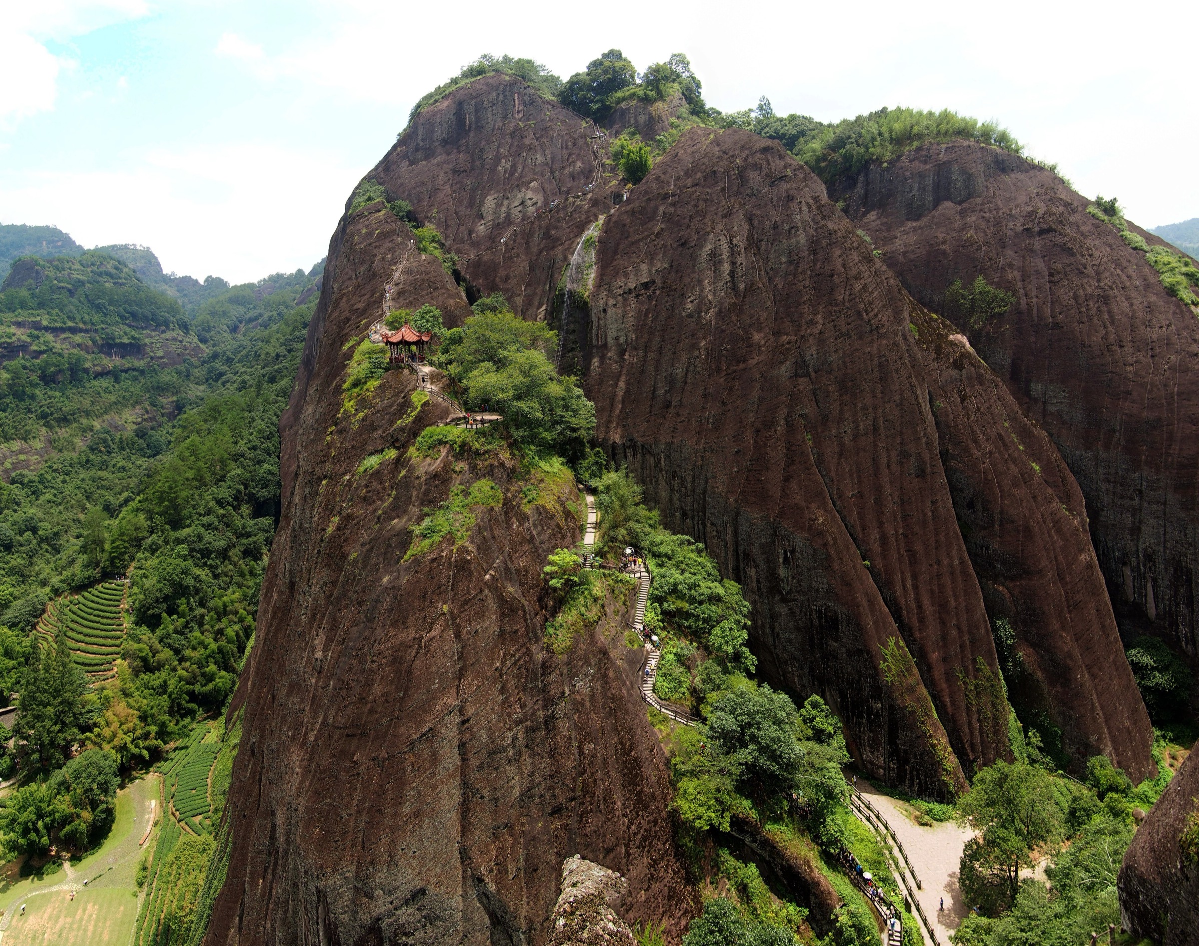
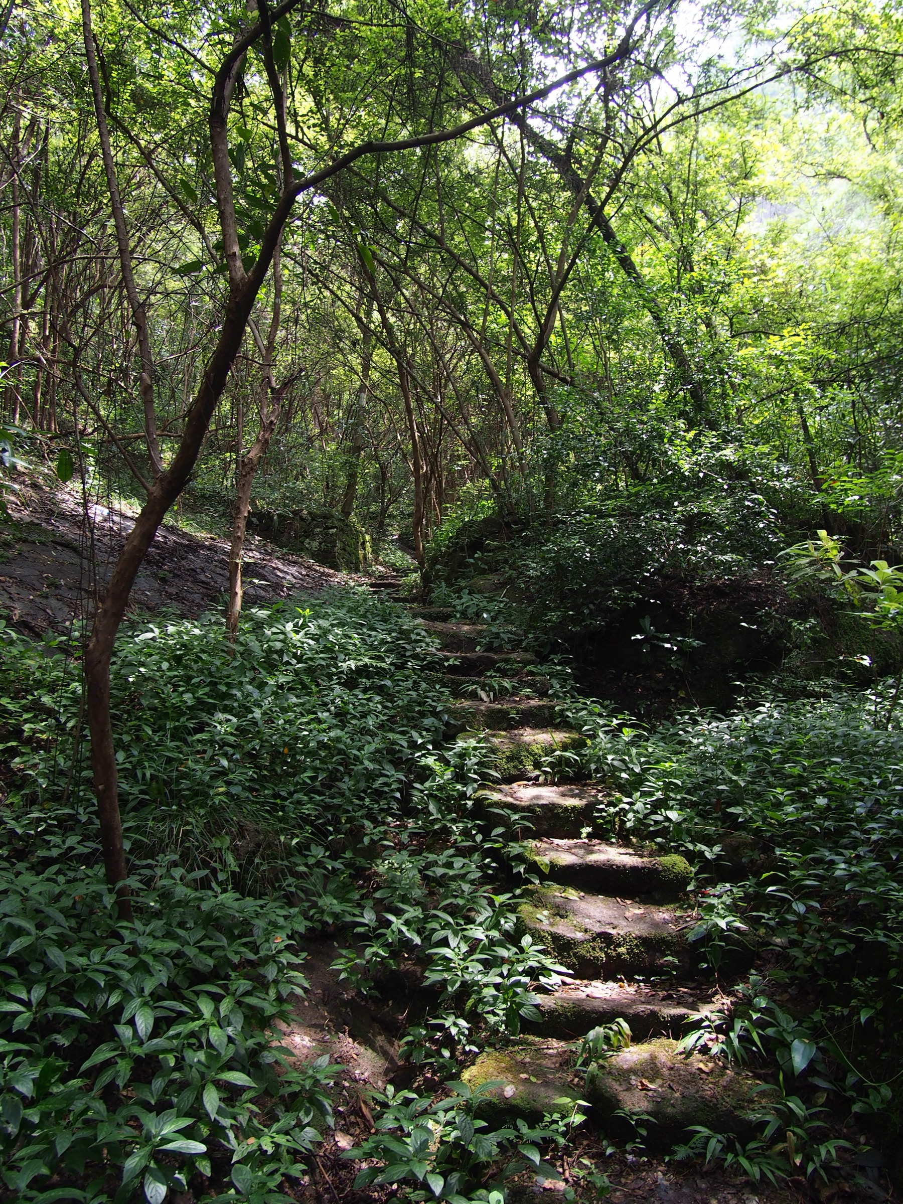
The walk starts at the Yunwo shuttle stop, where the scenic-area bus drops at the foot of the Tianyou stairway on the north bank of the Jiuqu Brook. From the riverside, a paved stepped path climbs the sandstone scarp through hanging-cliff sections decorated with carved imperial inscriptions and the 17th-century Yunwo cliff-side cluster — six small inscribed grottoes that mark the lower path. Above them the stair steepens into the Yi Lan Tai (一览台, “View-in-one-glance Platform”) and then the so-called “Heavenly Ladder” — 848 stone risers laid against the south face of the peak, with iron-chain rails on the exposed sections. The summit platform at 408.8 m looks down on the fifth and sixth bends of the Jiuqu Brook, with the great red wall of Yunu (玉女) Peak directly opposite and the rock-tea valleys spreading inland.
The descent route swings north-west off the summit through a wooded back-stair that emerges either at the Taoyuan Cave (桃源洞) Taoist grotto — adding about 2–4 km of forest path and a small Daoist temple complex — or returns directly to the Yunwo stop. The Wikiloc traces show both variants; the Wuyi scenic-area official site gives the standard relative relief as 215 m and the peak elevation as 408.8 m. Most visitors complete the loop in about 2.5 hours; longer if the Jiuqu raft trip is added at the base.
Why it is essential
Tianyou Peak is the single most reproduced Wuyi image, named “the best in Wuyi” by the Ming traveller-geographer Xu Xiake in 1616 and the unmissable balcony view over the Jiuqu Brook. The walk compresses the entire UNESCO mixed inscription — Danxia cliffs, river meanders, Neo-Confucian cliff inscriptions, rock-tea slopes — into a single short loop, and the steepness keeps the experience an actual climb rather than a level promenade.
Equipment
- Grippy footwear — the granite-block steps are smooth and slick when wet
- Light rain shell and small pack cover; spring and summer thunderstorms are sudden
- Sun hat and sunscreen — the upper stairs are exposed and the south face reflects strongly
- Water (1–1.5 L) and snacks; no reliable refill on the loop
- Trekking pole optional but useful on the descent
Hazards and notes
The “Heavenly Ladder” is the busiest single section in the Fujian-side scenic area and may run as one-way uphill during peak hours; check the day’s signed direction. Wet stone and high foot traffic are the dominant hazard combination. Lightning risk on the exposed summit during summer convection is real; the scenic-area authority will sometimes close the peak path during storms. The Jiuqu raft trip is a separate ticketed activity and not counted as hiking. Drones are not permitted inside the inscribed core without prior authorisation; Phyllostachys bamboo and protected understorey species along the path are not to be cut or collected.
GPX / KML links
| Source | URL | Format | Notes |
|---|---|---|---|
| Wikiloc — Mount Wuyi Tianyou Peak / Taoyuan Cave variant | wikiloc.com | GPS track | Wikiloc terms; reference only |
| Wikiloc — Wuyi Mountain Tianyou Peak | wikiloc.com | GPS track | Wikiloc terms; reference only |
| OpenStreetMap — Tianyou Peak node | openstreetmap.org | OSM | ODbL 1.0 |
| No official park GPX | — | — | Not located; trace from OSM and field GPS |
Sources
- UNESCO World Heritage Centre — Mount Wuyi
- Wuyi Mountain official site
- TopChinaTravel — Mount Wuyi hiking tips
2. Da Hong Pao mother trees to Water Curtain Cave
Snapshot
Itinerary
From the Da Hong Pao stop the path enters the Jiulongke (九龙窠) gorge, a narrow red-rock corridor walled in by tea-bush terraces clinging to the lower cliffs. About 400 m in, signed steps lead up to the Da Hong Pao mother trees — six ancient Camellia sinensis var. sinensis bushes growing on the south-facing cliff at roughly 90 m above the path, marked by a 1927 Republican-era inscription that gives the cultivar its modern name. The mother trees were last commercially harvested in 2006; their stock is now preserved as a national agricultural heritage. The path then continues north past the Tianxin (天心) monastery turn-off (a worthwhile 1 km return diversion to the late-Ming Yongle Temple, the cradle of Lapsang Souchong black tea), and drops into the Huiyuan (慧苑) valley with its Song-dynasty Huiyuan’an rock-tea garden and Ying’zui (鹰嘴, “Eagle’s Beak”) rock above.
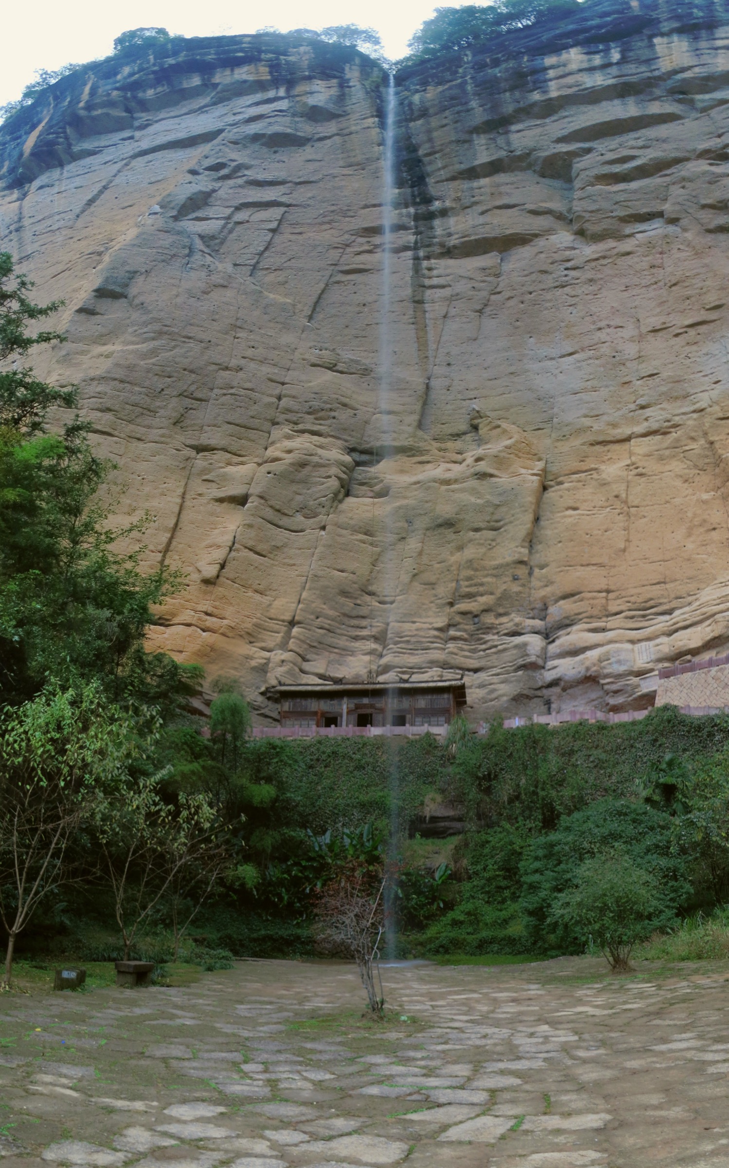
From Huiyuan the corridor runs north along Liuxiangjian (流香涧, the “Fragrance Stream”) — a narrow water-cut slot at the base of vertical red-rock walls, lined with wild osmanthus that gives the canyon its name — and then climbs a short stepped ramp to a saddle overlooking the Zhanglong (章堂) valley. The descent ends at the Water Curtain Cave: a deep undercut beneath an overhanging cliff that, in flood season, hangs a continuous 80 m sheet of water across the cave mouth; in dry winter months it shows the bare carved inscriptions and a small Buddhist hermitage at the back. The Water Curtain Cave shuttle stop is around 400 m beyond, on the scenic-area road. TopChinaTravel gives the canonical corridor as 4.5 km / 2.5–3 h; the longer AllTrails-mapped loop returns south via the Liuxiangjian–Huiyuan ridge and adds another ~7 km and 500 m of climb.
Why it is essential
This is the heart of the Wuyi rock-tea production zone and the single best ground-level expression of why UNESCO inscribed the mountain as a mixed property. The corridor links three distinct cultural-landscape components — the Da Hong Pao mother trees and tea cultivars, the Tianxin and Huiyuan monastic complexes, and the Liuxiangjian water-cut canyon — with the Water Curtain Cave undercut at the end. The gradient is gentle enough that the walk works as a contemplative half-day rather than a stair workout, and the rock-tea slopes at full leaf in late April / early May are one of the great working agricultural landscapes of subtropical China.
Equipment
- Comfortable trail shoes; the corridor is paved or pavé throughout
- Light rain layer; valley sections funnel sudden showers
- Sun protection — exposed sections between gorges
- Water and snacks; small tea kiosks at Tianxin and Huiyuan but no reliable refill points
- Cash (small notes) if buying tea from the gardens en route
Hazards and notes
Tea-picking and bush-trimming is prohibited along the entire corridor; the gardens are private commercial concessions inside the World Heritage core and watched by garden staff. Slippery moss on Liuxiangjian after rain is the recurrent slip hazard. Avoid the rock-tea harvest crush in the first ten days of May, when production transport and pickers occupy the corridor — a Sunday in mid-October is the cleanest equivalent for walkers. The Water Curtain Cave shuttle stop closes by approximately 17:30 in low season; do not start the corridor late.
GPX / KML links
| Source | URL | Format | Notes |
|---|---|---|---|
| AllTrails — Water Curtain Cave Loop | alltrails.com | Route page | AllTrails terms; reference only |
| OpenStreetMap — Jiulongke / Huiyuan paths | openstreetmap.org | OSM | ODbL 1.0 |
| No official park GPX | — | — | Not located |
Sources
- UNESCO World Heritage Centre — Mount Wuyi
- AllTrails — Water Curtain Cave Loop
- TopChinaTravel — Mount Wuyi hiking tips
3. Roaring Tiger Rock and One-Line-Sky
Snapshot
Itinerary
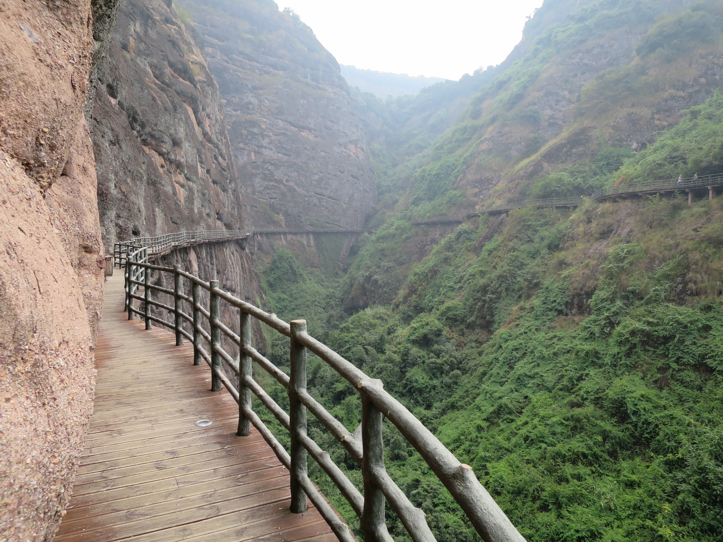
The walk starts at the Huxiao Yan stop on the southern scenic-area loop, where a paved path runs across tea terraces to the base of the great south-facing buttress that gives the area its name — the “roaring tiger” effect comes from the wind funnelling through a vertical cleft on the upper rock and producing a low growl audible from the path. From the base, a chain-railed cliff stair — the Hao Han Po (好汉坡, “Hero’s Slope”) — climbs roughly 100 m up the exposed south face to a saddle, with carved imperial inscriptions on the rock at chain height. A short side spur leads to the Tianyou viewing platform that gives the published photographs of the peak across the Jiuqu basin; the main path then drops down a back stair into a small Phyllostachys bamboo basin.
From the basin the route swings east along a tea-bush-margin path to the Yingzui Yan (鹰嘴岩, “Eagle’s Beak Rock”) and on to the One-Line-Sky entrance. One-Line-Sky is a single near-vertical fault-controlled cleft cutting through a Danxia ridge: the Wuyi scenic-area survey gives the cleft as 178 m long, 49 m high at its tallest point, and a narrowest passage of just 0.3 m at shoulder height. A line of timber duckboards and iron chains carries walkers through three chambers — the Linglong (玲珑), Fengkou (风口) and Caishen (财神) — and emerges on the north side close to the Yi Xian Tian shuttle stop. TopChinaTravel rates the combined Huxiao–One-Line-Sky walk at about 3 km and 2 hours under uncrowded conditions.
Why it is essential
This is the most compact Wuyi rock-route: chain-stair, ridge view, tea fields and a once-in-a-lifetime slot cleft inside three kilometres. The Hero’s Slope is the steepest stretch of Wuyi stairway open to the public, and One-Line-Sky is among the narrowest signed scenic-area passages in China — neither feature is replicated on the Tianyou side, and the combination provides a different and more physical Wuyi experience than the Jiuqu balcony.
Equipment
- Trail shoes with strong grip; the Hero’s Slope is smooth granite under wear and chains
- Slim daypack — a bulky bag does not fit through the One-Line-Sky pinch
- Headtorch optional — the deepest chamber is dim even at midday
- Sun protection and a light layer
- Water; no refill points on the route
Hazards and notes
The Hero’s Slope is slippery in rain and may be closed on safety grounds during thunderstorms; check at the lower entry. One-Line-Sky has a real claustrophobia and bulk constraint — the 0.3 m pinch is at chest height for an average adult and is not navigable for larger frames, wide packs, or anyone with significant mobility issues. Photography in the cleft is forbidden during peak flow to keep the queue moving; do not stop in the narrowest section. The cleft can flood after heavy rain; the south entrance is sometimes closed in summer. Drone use over the rock cluster is restricted as it is in the World Heritage core.
GPX / KML links
| Source | URL | Format | Notes |
|---|---|---|---|
| OpenStreetMap — Huxiao Yan / Yi Xian Tian footpath | openstreetmap.org | OSM | ODbL 1.0; partial coverage |
| No official park GPX | — | — | Not located |
Sources
- Wuyi Mountain official site
- TopChinaTravel — Mount Wuyi hiking tips
- Wikipedia (Chinese) — Wuyishan Scenic Area
4. Guifeng Danxia scenic loop
Snapshot
Itinerary
The walk uses the developed inner trail of the Guifeng Scenic Area (龟峰风景名胜区), a 136 km² Class 5A protected zone declared a national-grade scenic area in 1988 and inscribed as a component locality of the China Danxia World Heritage property in 2010. From the south entrance, a stepped path climbs the basin floor through dense subtropical broadleaf forest and onto the lower ridge plank-walks, which thread between detached red-rock pinnacles, natural arches and the namesake tortoise-back rock that gave Guifeng its name. The main inner loop traces a circuit of about 4 km, with cable-car assistance available on the Sanqing ridge section for those who prefer to skip the steepest stair sequence.
From the upper ridge the trail visits a series of named viewpoint platforms — the most photographed include the “Lao Shou Xing” (老寿星) standing rock, the Tian Sheng arch, and the pagoda-topped ridge above the basin. The descent route drops past the Tianxiang (天香) cave-temple and rejoins the basin path back to the entrance. The cliff-top pagoda visible above the central peak cluster is a 21st-century reconstruction of a Ming-era observation tower destroyed during the 1850s Taiping wars. Most Chinese-language walking guides give the full loop at about 4 hours; the longer cliff-spur extension adds the Xiang Lu (香炉) peak ridge and another 1.5–2 hours.
Why it is essential
Guifeng is among the half-dozen “old-stage” Danxia localities used by Chinese geomorphologists to define the late-erosional cycle of the landform — isolated towers, walls and through-caves on a soft basin floor — and it is the most accessible of the inscribed Danxia properties from a high-speed rail line. The compact peak cluster delivers the visual essentials of the Danxia inscription (vertical red rock, isolated towers, basin-floor caves) in a single half-day, and pairs naturally with Longhushan to the west for a two-day Jiangxi Danxia loop.
Equipment
- Trail shoes with good grip; the stepped sections become slick after autumn dew
- Light waterproof shell; the ridge is exposed
- Sun protection and a wide-brimmed hat — the red sandstone reflects strongly
- Water and snacks; one mid-loop tea kiosk only
- Trekking pole optional on the descent
Hazards and notes
The most concrete operational hazards are wet stairs after rain, lightning on the exposed ridge platforms in summer convection, and temporary closures of cliff sections after storms. Cable-car timing is not always aligned with first or last shuttle — confirm closing times at the entrance. The Sanqing ridge and the cliff-spur extensions are not recommended in winds above ~30 km/h. The route distance, gain and maximum elevation given here are estimates; the scenic-area authority does not publish authoritative trail statistics, and Chinese walking guides quote a wide range.
GPX / KML links
| Source | URL | Format | Notes |
|---|---|---|---|
| OpenStreetMap — Guifeng Scenic Area | openstreetmap.org | OSM | ODbL 1.0; partial coverage |
| UNESCO World Heritage Centre — China Danxia | whc.unesco.org | World Heritage source | Property context, not a route file |
| No official park GPX | — | — | Not located |
Sources
5. Longhushan Xianshuiyan and river-cliff walk
Snapshot
Itinerary
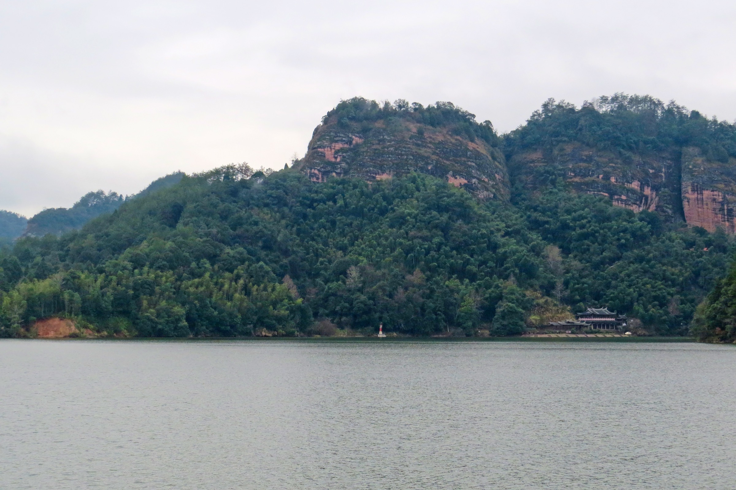
The walking day focuses on the Xianshuiyan (仙水岩) sector of Longhushan, on the south bank of the Lu River about 8 km downstream of the main Shangqing Taoist palace complex. From the Xianshuiyan entrance, a stone-paved path follows the foot of a 1.5 km vertical Danxia cliff that rises directly out of the river, with stepped spurs branching up to a sequence of cliff-edge viewing platforms (the Wenshe Yan, Yu Bi and Daoist Master platforms) overlooking the river bend below. Above the cliff, the path climbs a short ridge stair through pine forest to the main Longhu summit area at around 247 m, with the panorama opening across the meandering Lu River and the carp-back ridges of the inner scenic area.
The route then descends to the Lu River bank, where the so-called Xianshuiyan hanging coffins are visible in undercut caves at 20–60 m above the water — approximately 200 wooden boat-shaped coffins of the pre-Qin Bo people, the largest such concentration in China and a defining cultural component of the China Danxia inscription. A working reconstruction of the historical coffin-hoist (using ropes and counterweights from the cliff edge) is performed daily by the scenic-area authority and is the only reliable demonstration of the technique still in operation. From the riverbank, walkers may either return via the same path or pick up a bamboo raft for the downstream return to the entrance — the raft is a sightseeing add-on and is not part of the walking statistics.
Why it is essential
Longhushan is the principal cultural-and-natural complement to Mount Wuyi on the watershed: a Class 5A Danxia scenic area, a constituent of the China Danxia World Heritage inscription, the seat of 63 generations of Zhengyi Celestial Masters since the 1st century CE, and the largest single cliff-burial site in China. None of the other four hikes pass through Taoist heritage on this scale, and the river-cliff geometry — vertical red rock plunging into a navigable river meander — is not replicated anywhere on the Fujian side of the watershed.
Equipment
- Walking shoes; the cliff-edge platform stairs are paved but smooth
- Light rain layer; cliff-base sections are sheltered, ridge sections are not
- Sun protection; the cliff-foot path is open and the rock is reflective
- Water and snacks; cluster of kiosks at the entrance only
- Cash for the optional bamboo-raft ticket
Hazards and notes
The Lu River can flood seasonally; the cliff-foot path closes when river levels rise above the lower platforms. The Bo cliff-burial site itself is not accessible and should not be approached from the cliff edge — viewing is from designated platforms and from the river. The daily coffin-hoist demonstration is a contracted performance with set times (typically late morning and mid-afternoon) and is the only sanctioned interaction with the burial site. Drone use over the river cliffs is restricted as a World Heritage core; the scenic-area authority enforces this consistently. Walking-only distance is given for the foot route — bamboo-raft sightseeing is counted separately.
GPX / KML links
| Source | URL | Format | Notes |
|---|---|---|---|
| OpenStreetMap — Longhushan / Xianshuiyan | openstreetmap.org | OSM | ODbL 1.0; partial coverage |
| UNESCO World Heritage Centre — China Danxia | whc.unesco.org | World Heritage source | Property context, not a route file |
| No official park GPX | — | — | Not located |
Sources
- UNESCO World Heritage Centre — China Danxia
- Wikipedia (Chinese) — Longhushan
- Wikipedia (Chinese) — Xianshuiyan cliff tombs
Missing data / follow-up work
- Tianyou Peak loop is one-way under peak-season crowd management; confirm the current published direction with the scenic-area authority before relying on the descent path described above.
- Da Hong Pao to Water Curtain Cave has two viable variants; the canonical 4.5 km corridor is the catalogue route, but the 11.6 km AllTrails loop is the better option for fit walkers on a longer day. Decide which to store as the headline distance in the next refresh.
- The Roaring Tiger Rock / One-Line-Sky route lacks an authoritative published distance, gain and maximum elevation; the figures here are estimates and should be replaced with surveyed values when available.
- Guifeng distance, gain and max-elevation figures are estimates synthesised from Chinese walking-guide ranges. The scenic-area authority does not publish authoritative trail statistics; confirm in person.
- Longhushan needs a clean walking-only GPX that separates the bamboo-raft sightseeing leg from the foot route, and a confirmation of the current coffin-hoist demonstration schedule.
- The Mount Wuyi ticket and shuttle pricing, dog restrictions and post-typhoon closures change frequently — re-check at the scenic-area gate or on the official site within a month of travel.
Further reading
| Source | URL |
|---|---|
| UNESCO World Heritage Centre — Mount Wuyi | whc.unesco.org |
| UNESCO World Heritage Centre — China Danxia | whc.unesco.org |
| Wuyi Mountain official site | wyschina.com |
| TopChinaTravel — Mount Wuyi hiking tips | topchinatravel.com |
| AllTrails — Water Curtain Cave Loop | alltrails.com |
| Wikipedia (Chinese) — Wuyishan Scenic Area | zh.wikipedia.org |
| Wikipedia (Chinese) — Guifeng Scenic Area | zh.wikipedia.org |
| Wikipedia (Chinese) — Longhushan | zh.wikipedia.org |
| Wikipedia (Chinese) — Xianshuiyan cliff tombs | zh.wikipedia.org |
| Wikimedia Commons — Category:Wuyi Mountains | commons.wikimedia.org |
| OpenStreetMap — Wuyishan area | openstreetmap.org |