Regional overview
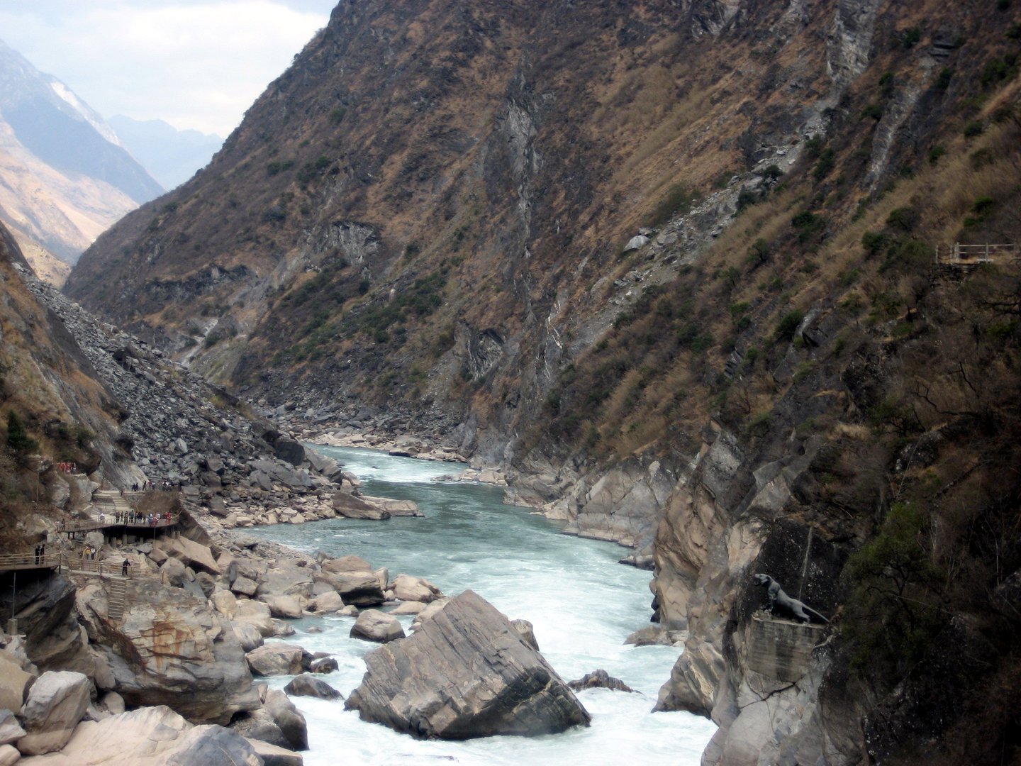
The Gongga Shan region is the high Daxue Mountains core of the eastern Hengduan: a huge relief wall rising from the Dadu and Yalong river systems to Mount Gongga / Minya Konka, Sichuan’s highest mountain at 7,556 m. The day-hiking character is split between managed scenic-area walks on the eastern Hailuogou side, high-lake and forest walks around Kangding and Mugecuo, and harder western viewpoint routes that are much less consistently documented.
Hailuogou is the strongest sourceable day-hiking base because the official scenic-area site publishes route descriptions, ticket and opening notes, and safety guidance. The Hailuogou official service page currently lists Hailuogou as open with ticket and sightseeing-bus pricing, while Yanzigou and Yajiageng Sea are marked temporarily closed; this catalogue therefore avoids those closed neighbouring valleys. The higher west-side Gongga viewpoint walks remain important to the region’s identity but route geometry, legal access and current road conditions need field confirmation. Companion catalogues already on this site cover the Qionglai / Siguniangshan and Shaluli / Litang-Daocheng-Yading sectors of western Sichuan’s Hengduan.
Walking here is high-altitude, humid and weather-sensitive. Hailuogou routes start around Moxi or scenic-area shuttle access and reach approximately 2,900 m on the rainforest walks and roughly 3,600 m at the Camp 4 viewpoint platforms. The west-side lake and pass walks reach higher still. The best seasons are generally late spring to autumn, with winter glacier views possible only when scenic-area access and ice conditions are safe. Altitude symptoms, cold rain, snow, landslides, forest closures, macaques, slippery boardwalks and strict protected-area rules all matter.
Selection rationale
The selection prioritises officially documented Hailuogou day walks, then adds one Kangding / Mugecuo scenic-area lake walk and one candidate west-side Gongga reflection viewpoint to represent the wider Daxue / Gongga region. No official reusable GPX or KML files were found in this pass; Hailuogou route statistics come mainly from official scenic-area articles, while Mugecuo and Lenggacuo require stronger route-file follow-up.
Summary table
| # | Hike | Country | Route type | Distance | Gain | Max elevation | Difficulty |
|---|---|---|---|---|---|---|---|
| 1 | Hailuogou Yueya Lake to Chengmendong / Bingjiaokou glacier-science route | China | Guided out-and-back | Approx. 2 km access plus 1.5 km one way along the glacier route | Not verified | Around 2,900-3,000 m; high point not verified | Moderate, altitude |
| 2 | Hailuogou Camp 3 ice-rainforest, Dongga Temple and Caohaizi walk | China | Out-and-back / linear scenic walk | Not published; 2-3 hr full walk | Not verified | Around 2,900 m at Camp 3 | Easy-moderate, altitude |
| 3 | Hailuogou Ganheba and Camp 4 glacier-view walkway | China | Ropeway-assisted out-and-back | Approx. 1.2 km access plus short viewpoint walks | Mostly by ropeway | Camp 4 approx. 3,600 m | Easy-moderate, altitude |
| 4 | Mugecuo Lake / Seven-Colour Sea scenic walk | China | Scenic-area out-and-back / loop variants | Approx. 3-8 km; route unresolved | Not verified | Mugecuo Lake cited around 3,777 m | Moderate, altitude |
| 5 | Lenggacuo Gongga west-face viewpoint lake walk | China | Out-and-back candidate | Not verified | Not verified | Around 4,500 m commonly reported, not publication-verified | Hard, altitude |
1. Hailuogou Yueya Lake to Chengmendong / Bingjiaokou glacier-science route
Snapshot
Itinerary
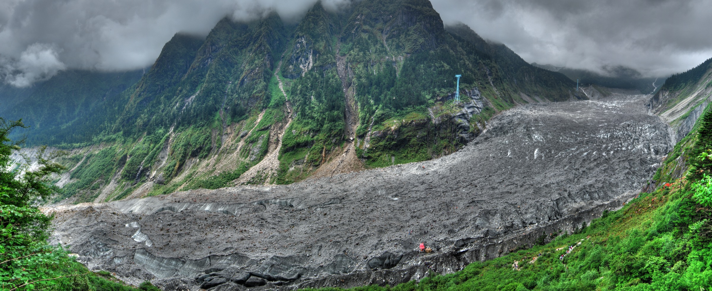
From the Camp 3 / Jinshan Hotel area, reach Yueya Lake / Chengmendong via the scenic-area walking or electric-cart access described by the official Hailuogou hotel guide. The glacier-science route then follows the moraine-side line toward the glacier terminus and Bingjiaokou. The official article states that the 1.5 km one-way glacier route must be accompanied by a professional leader; entering the glacier zone independently is not permitted.
Why it is essential
This is the most sourceable non-technical way to walk close to Hailuogou’s low-altitude modern glacier and icefall landscape without entering technical glacier terrain. It represents the eastern Gongga glacier environment better than any viewpoint-only stop.
Equipment
Mountain hiking equipment: sturdy shoes or boots, warm layer, waterproof and windproof shell, sun protection, sunglasses, water, snacks and trekking poles. Follow the leader’s instructions; personal technical-glacier kit is not a substitute for authorised guided access.
Hazards and notes
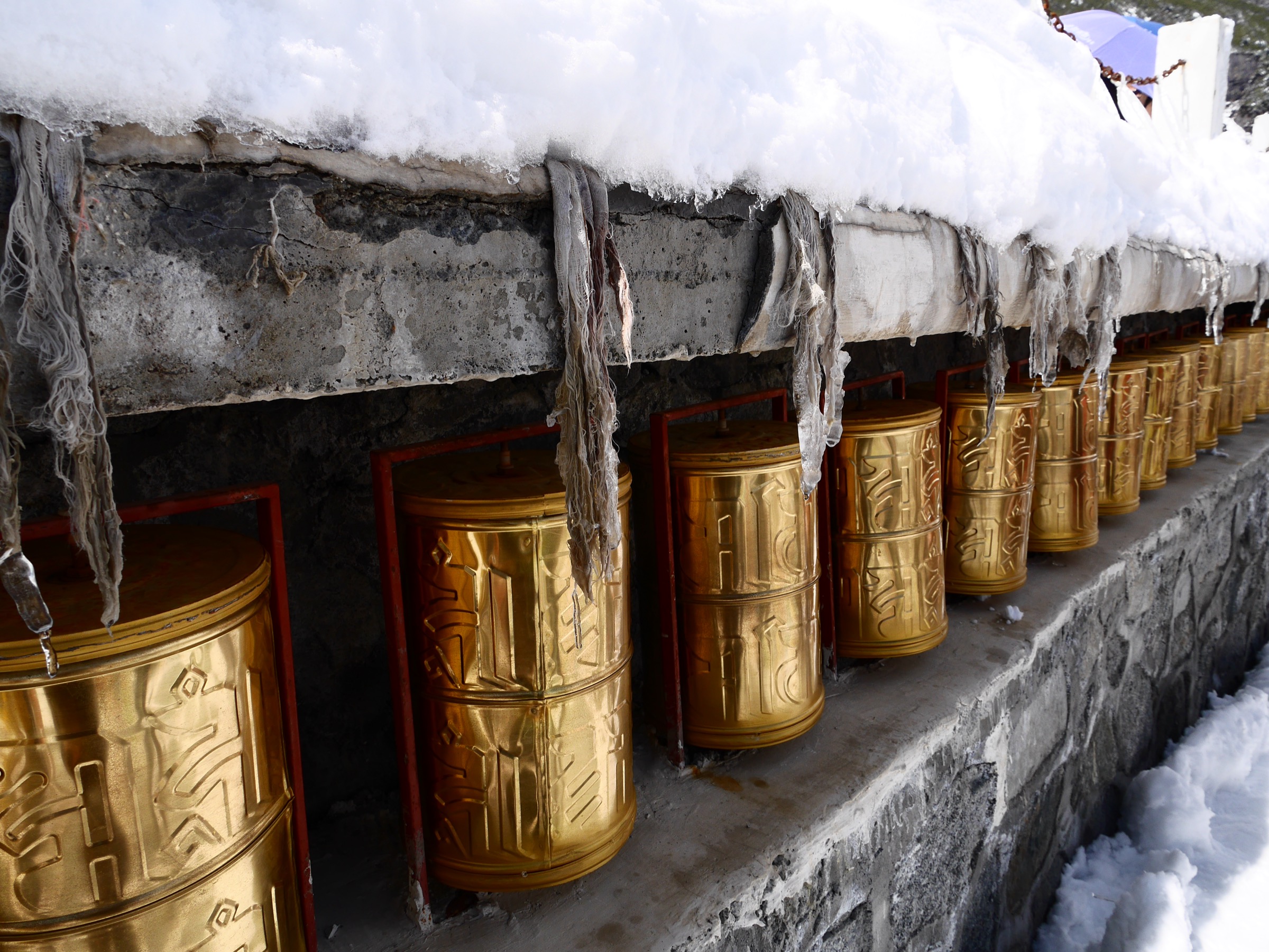
The official Hailuogou safety guidance advises checking opening status, tickets, weather and road conditions, bringing cold and rain gear, following signs and staff, not entering undeveloped or unopened areas, taking altitude precautions, avoiding rivers and railings, and not feeding macaques. Moraine and glacier-edge ground can be unstable and cold even in good weather. Yanzigou and Yajiageng Sea were marked temporarily closed on the official service page at the time of writing — do not substitute closed neighbouring valleys for this route.
GPX / route file
| Source | URL | Format / access | Reuse status |
|---|---|---|---|
| Hailuogou official glacier-science route article | hailuogou.com | Official route description | Website copyright retained; verifies route name and guide requirement; no reusable geometry |
| Hailuogou official Jinshan Hotel guide | hailuogou.com | Official route / access article | Website copyright retained; verifies Camp 3 / Yueya Lake distances and walking time |
| Hailuogou official map page | hailuogou.com/hlg-map | Official map viewer | Website terms apply; source map only, no downloadable GPX / KML found |
Further reading
- Hailuogou — official glacier / outdoor route article
- Hailuogou — official Jinshan Hotel guide
- Hailuogou — official service / ticket page
- Hailuogou — official safety guidance
2. Hailuogou Camp 3 ice-rainforest, Dongga Temple and Caohaizi walk
Snapshot
Itinerary
The official Hailuogou hotel guide describes a walking line starting from the walkway beside the Camp 3 hotel area, crossing the glacier rainforest, passing Dongga Temple and ending at Caohaizi. It is presented as a comfortable forest-and-wetland walk and is the main non-glacier low-impact walking option in Hailuogou.
Why it is essential
The route shows the eastern Gongga vertical ecosystem at a human scale: glacier-side rainforest, temple culture and wetland scenery below the icefall viewpoints. It balances the more exposed glacier-science and ropeway routes that dominate Hailuogou’s day-hiking inventory.
Equipment
Standard hiking equipment: grippy walking shoes, waterproof layer, warm layer, water, snacks, sun protection and trekking poles if paths are wet.
Hazards and notes
Boardwalks and forest paths can be slippery after rain or in winter. Follow official signs, avoid unopened areas and do not feed macaques. Hailuogou safety guidance also warns against smoking and fires and against playing in river channels.
GPX / route file
| Source | URL | Format / access | Reuse status |
|---|---|---|---|
| Hailuogou official Jinshan Hotel guide | hailuogou.com | Official route / access article | Website copyright retained; verifies route sequence and 2-3 hr time estimate |
| Hailuogou official map page | hailuogou.com/hlg-map | Official map viewer | Source map only |
| OpenStreetMap search — Hailuogou Camp 3 | openstreetmap.org | Map / search | OSM data is ODbL; geometry cross-check only |
Further reading
3. Hailuogou Ganheba and Camp 4 glacier-view walkway
Snapshot
Itinerary
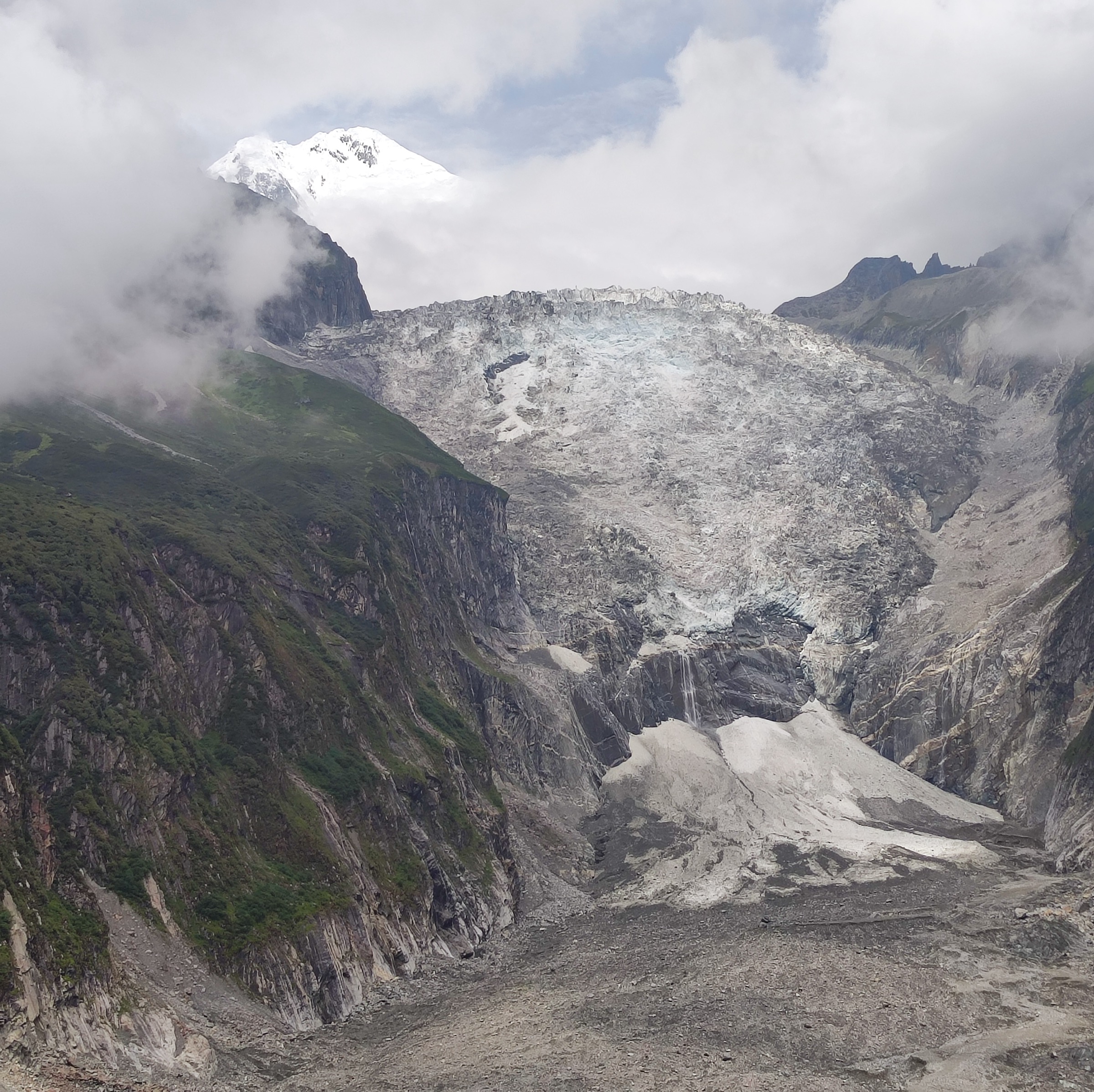
Walk or transfer from the Camp 3 / Jinshan Hotel area to Ganheba, then take the ropeway to Camp 4. From Camp 4, use the authorised viewpoint walks for the Hailuogou glacier panorama, the big icefall and the Gongga main-peak view when weather allows. Return by ropeway and use the high-altitude walkway back toward Camp 3 where it is open.
Why it is essential
This is the classic Hailuogou glacier-view day: the easiest way for walkers to reach the high public viewpoints of the icefall and Gongga without technical glacier travel.
Equipment
Standard hiking equipment with serious cold protection: warm layer, waterproof and windproof shell, hat and gloves outside warm weather, sunglasses, sunscreen, water and snacks.
Hazards and notes
Altitude and cold wind at Camp 4 are the main hazards. Ropeway operating hours, last transport times and visibility can change quickly. Check the official service page for current ticket, route and closure status before travel.
GPX / route file
| Source | URL | Format / access | Reuse status |
|---|---|---|---|
| Hailuogou official Jinshan Hotel guide | hailuogou.com | Official route / access article | Website copyright retained; verifies Ganheba distance, Camp 4 altitude and ropeway context |
| Hailuogou official map page | hailuogou.com/hlg-map | Official map viewer | Source map only |
| OpenStreetMap search — Hailuogou Camp 4 | openstreetmap.org | Map / search | OSM data is ODbL; geometry cross-check only |
Further reading
4. Mugecuo Lake / Seven-Colour Sea scenic walk
Snapshot
Itinerary
Use the Mugecuo scenic-area access system to walk authorised lake-side and forest / boardwalk sections around Mugecuo Lake and, if open, the Seven-Colour Sea area. The route should stay within the managed scenic-area paths and use shuttles where required.
Why it is essential
Mugecuo adds the Kangding-side high-lake landscape to the Gongga region: alpine lake, forest, hot-spring and scenic-area context, and Daxue Mountains weather at nearly 3,800 m.
Equipment
Standard hiking equipment for altitude: grippy shoes, warm layer, waterproof and windproof shell, sun protection, water, food and navigation backup.
Hazards and notes
Altitude, cold wind, sudden rain or snow, icy boardwalks and shuttle operating hours are the main concerns. Exact public walking distance and gain need official confirmation before this entry can be promoted from candidate to verified status.
GPX / route file
| Source | URL | Format / access | Reuse status |
|---|---|---|---|
| OpenStreetMap search — Mugecuo Kangding | openstreetmap.org | Map / search | OSM data is ODbL; location and manual-GPX planning only |
| Wikipedia — Kangding | en.wikipedia.org | Source context | Wikipedia CC BY-SA for text; not a route file; regional access and climate context only |
Further reading
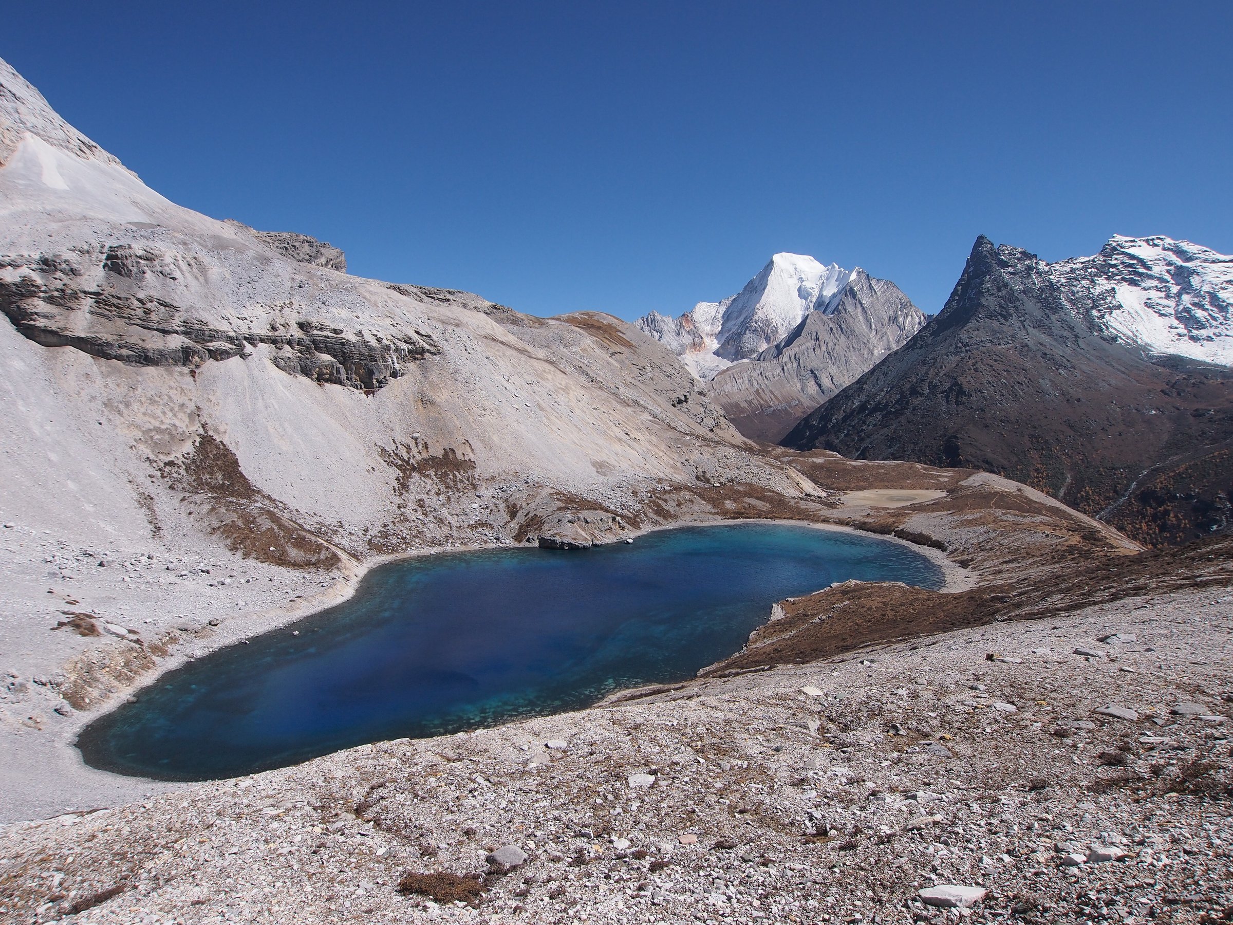
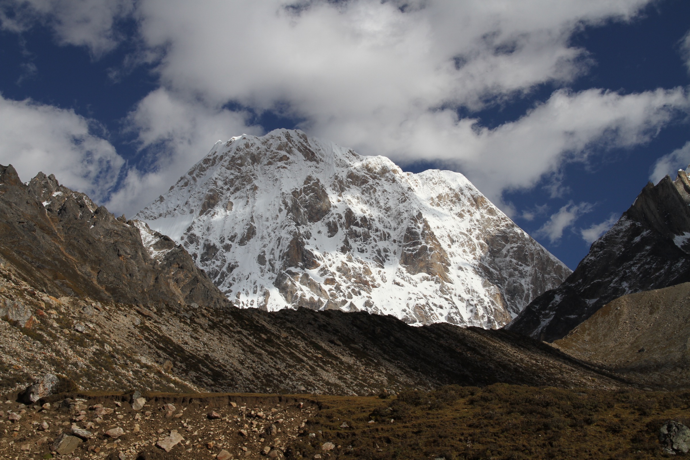
5. Lenggacuo Gongga west-face viewpoint lake walk
Snapshot
Itinerary
The candidate route is the west-side day walk to Lenggacuo, a high lake and reflection viewpoint for the Gongga massif. The route should be published only after confirming a legal trailhead, current access permissions, exact distance and gain, and whether vehicle or motorcycle access affects the walking line.
Why it is essential
Lenggacuo represents the high west-side Gongga viewpoint tradition: lake foreground, close snow-peak panorama and the dry plateau edge of the Daxue Mountains. It is included as a candidate because the west side is essential to the region’s identity, but the route evidence remains incomplete.
Equipment
Mountain hiking equipment: sturdy boots, trekking poles, warm and waterproof layers, hat and gloves, sunglasses, sunscreen, headtorch, food, water, navigation backup and emergency insulation. Acclimatisation matters.
Hazards and notes
High altitude, snow, road access, weather exposure, remote rescue, local access rules and possible route changes are the main hazards. Do not treat informal traveller GPS tracks or vehicle tracks as permission to enter restricted land.
GPX / route file
| Source | URL | Format / access | Reuse status |
|---|---|---|---|
| OpenStreetMap search — Lenggacuo Gongga | openstreetmap.org | Map / search | OSM data is ODbL; location search only; no route relation verified |
| Wikipedia — Mount Gongga | en.wikipedia.org | Source context | Wikipedia CC BY-SA for text; not a route file; regional geography and hazard context only |
Further reading
Routes excluded
Yanzigou and Yajiageng Sea were not selected because the Hailuogou official service page marked them temporarily closed at the time of writing. Independent unguided travel on the Hailuogou glacier itself is not permitted under the official safety guidance and is therefore not included as a separate hike. Multi-day Konka Gompa pilgrim circuits and high traverses around the Gongga massif are outside the day-hike scope of this catalogue.
Missing data / follow-up work
- No official reusable GPX or KML files were found for any route in this pass.
- Hailuogou publishes official route descriptions but not downloadable route geometry; later manual GPX creation should use the official maps, OSM cross-checks and field verification.
- Mugecuo needs an official scenic-area route map with exact walking distance and elevation gain before it can be promoted from candidate to verified.
- Lenggacuo remains candidate-only until legal access, route statistics and current road / trail conditions are verified.
- No licence-compatible images of Mugecuo Lake or Lenggacuo were found on Wikimedia Commons in this pass; figures for hikes 4 and 5 are regional context only.
Further reading
| Resource | Link |
|---|---|
| Hailuogou — official site | hailuogou.com |
| Hailuogou — official service / ticket and closure page | hailuogou.com/service |
| Hailuogou — official safety guidance | hailuogou.com/zxyd |
| Hailuogou — official glacier / outdoor route article | hailuogou.com |
| Hailuogou — official Jinshan Hotel route guide | hailuogou.com |
| Hailuogou — official map page | hailuogou.com/hlg-map |
| Wikipedia — Mount Gongga | en.wikipedia.org |
| Wikipedia — Daxue Mountains | en.wikipedia.org |
| Wikipedia — Hailuogou | en.wikipedia.org |
| Wikipedia — Kangding | en.wikipedia.org |
| Wikimedia Commons — Category: Hailuogou Glacier | commons.wikimedia.org |
| Wikimedia Commons — Category: Mount Gongga | commons.wikimedia.org |