Regional overview
The Greater Khingan range (Da Hinggan Ling / 大兴安岭 / Mongolian: Их Хянган) forms the eastern wall of the Mongolian Plateau, running roughly 1,200 km north–south from the Amur (Heilong Jiang) basin south to the upper Liao river. On the Inner Mongolian side it presents an asymmetric profile: a gentle western slope sliding down into the Hulunbuir grasslands and a steeper eastern flank dropping into the Heilongjiang lowlands. Relief inside the range is moderate — most summits sit between 1,100 m and 1,700 m, with the highest points near 2,000 m — but the biogeographic stakes are large. This is the southernmost continuous fragment of the Eurasian boreal forest, and the meeting line between larch–birch taiga and open Mongolian steppe is the landscape that defines hiking here.
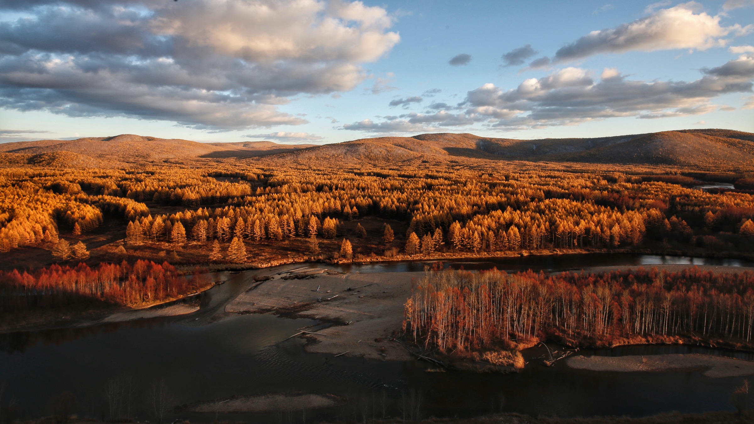
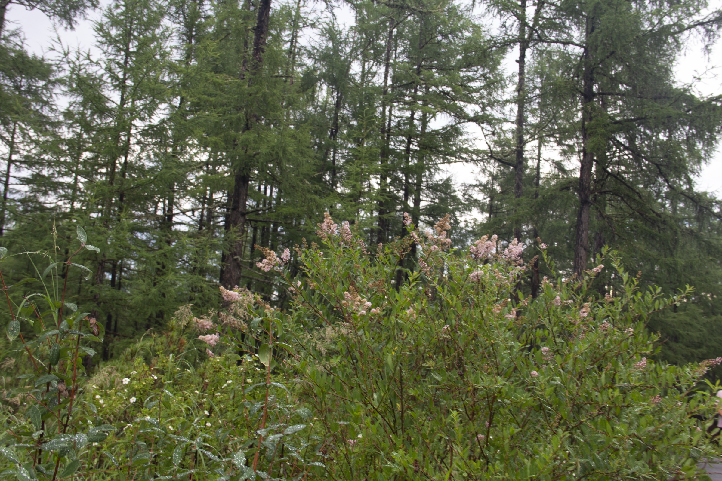
The taiga is dominated by Dahurian larch (Larix gmelinii / 兴安落叶松), with Mongolian Scots pine (Pinus sylvestris var. mongolica / 樟子松), white birch (Betula platyphylla / 白桦) and aspen (Populus davidiana / 山杨) as common associates; understorey rhododendrons (Rhododendron dauricum / 兴安杜鹃, locally 达紫香) carpet the floor in late spring. South of roughly 47°N the closed taiga fragments into mosaics of forest stands and open meadow steppe — the forest-steppe ecotone — and along the Ergun (额尔古纳河 / Erguna) and Halaha (哈拉哈河) river valleys the larch fingers reach down to floodplain wetlands and Mongol pasture in unbroken sweeps. Holocene basaltic volcanism around Arxan (阿尔山 / Aěrshān, from Mongolian Arxan, “holy hot spring”) has overlaid this matrix with crater lakes (Tianchi / 天池), lava flows, scoria cones and geothermal springs; the Arxan-Chaihe volcanic field is one of the youngest in eastern China and the centrepiece of the Arxan UNESCO Global Geopark inscribed in 2017.
Culturally the region is the historic homeland of Mongol, Daur (Daghur / 达斡尔), Ewenki (Evenki / 鄂温克) and Oroqen (Orochen / 鄂伦春) peoples. The Reindeer Ewenki at Aoluguya (敖鲁古雅, “dense birch forest” in Ewenki) near Genhe (根河 / Gēnhé) remain the only reindeer-herding community in China. UNESCO has Hulun Buir on its World Heritage Tentative List as the “Hulun Buir Landscape and Birthplace of Ancient Minority”, citing the Greater Khingan as the only extension of the Siberian taiga inside China and the Ergun basin as the cradle of the Xianbei (early Mongolic and Tungusic peoples; cf. the Gaxian Cave inscription).
Climate is the operating constraint. Genhe is regularly listed as the “Cold Pole of China” (中国冷极), with recorded winter lows below −50 °C; Arxan averages around −30 °C in January. Useful hiking conditions are restricted to roughly mid-May through early October. Wildflowers and Rhododendron dauricum peak late May to mid-June; mid-July to mid-August is the warmest period but also brings dense mosquito and biting-fly populations and the highest visitor numbers; mid-September to early October delivers larch and birch autumn colour and the most settled weather. Deep snow blankets all higher ground from late November through April.
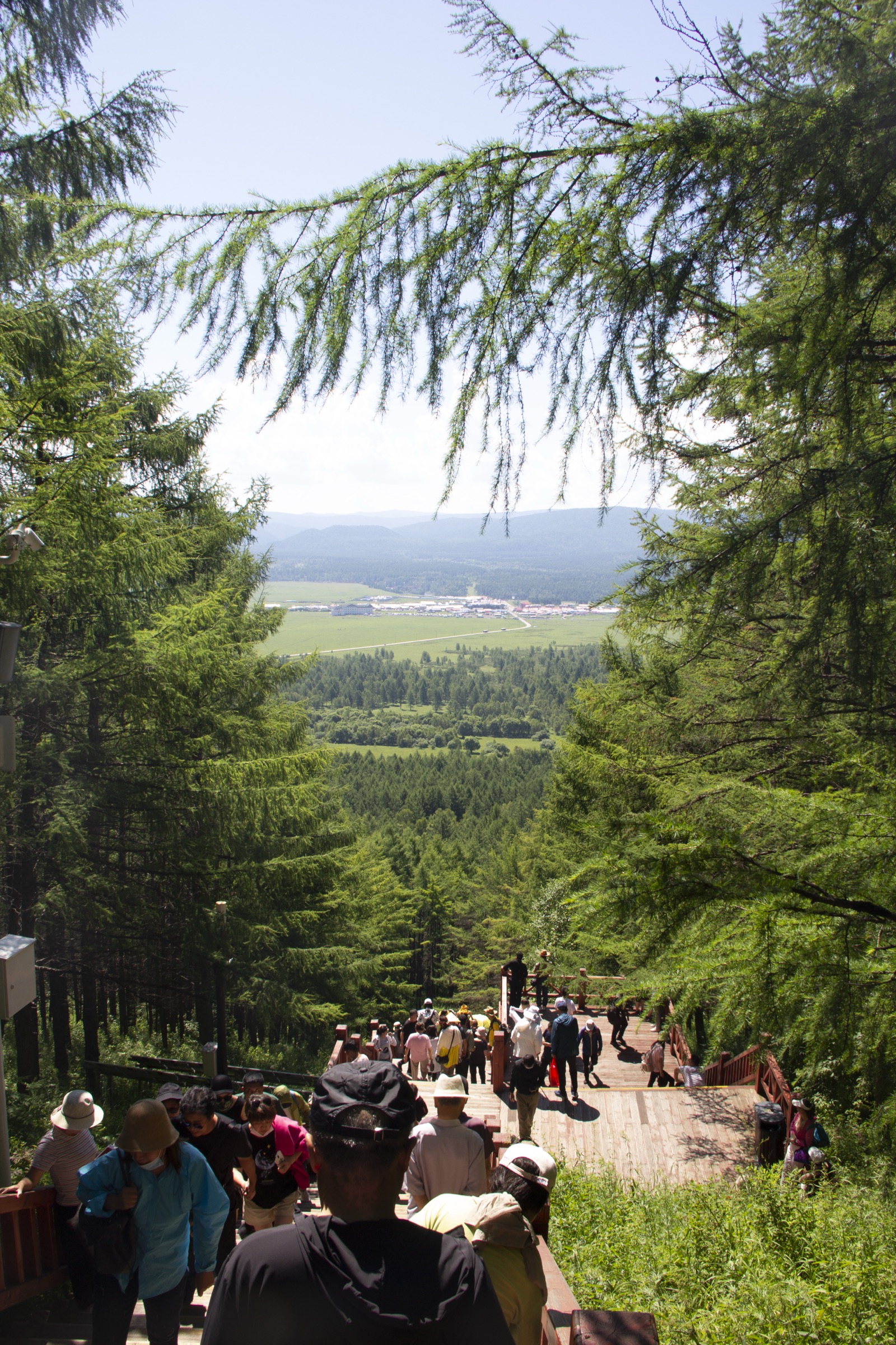
Most hiking in the Inner Mongolian Greater Khingan is done on graded boardwalk and stair systems inside fee-paying scenic areas — Arxan National Forest Park, Erguna National Wetland Park, Aoluguya Reindeer Village, Hailar Xishan National Forest Park — with shuttle buses between stops. Genuinely off-piste walking is restricted: Hanma National Nature Reserve (寒马) and other primary-forest core zones are closed to the general public, and the Russian and Mongolian border belts along the Ergun and Halaha rivers require permits. The five hikes below stay within sanctioned trails inside scenic areas, which is the practical reality of day-hiking this region.
Selection rationale
Day-hiking in the Inner Mongolian Greater Khingan is concentrated in two destinations: Arxan National Forest Park (which delivers the volcanic and taiga-interior landscapes) and the Ergun / Hulunbuir wetland-edge parks (which deliver the forest-steppe transition). The five selected hikes spread across both poles. Arxan Tianchi is the headline crater-lake walk and the iconic feature of the entire region; Tuofengling Tianchi (Camel Peak Heavenly Lake) is its quieter sister 37 km deeper into the park; Shitanglin (Stone Pond Forest) is the boardwalk loop across a young basaltic lava field — the most complete young-volcanic terrain in China; Santan Gorge along the Halaha River is the riverine boardwalk through volcanic-rock cataracts; and Erguna National Wetland Park is the only selection that sits squarely on the taiga / Hulunbuir steppe boundary. The combination covers iconic, landscape, ecotone and cultural-geographic dimensions without stacking five trails inside one trailhead.
All five sit inside the Inner Mongolia Autonomous Region — Arxan City in Hinggan League (Xing’an Meng / 兴安盟) and Ergun City in Hulunbuir City. None falls inside the Heilongjiang-administered Greater Khingan Prefecture (Da Hinggan Ling Prefecture / 大兴安岭地区, seat at Jiagedaqi), which is the subject of a sibling Lesser Khingan / Heilongjiang file.
Summary table
| # | Hike | Country | Route type | Distance | Gain | Max elevation | Difficulty |
|---|---|---|---|---|---|---|---|
| 1 | Arxan Tianchi (阿尔山天池) | China | Out-and-back stair | ~1.5–2 km | ~150 m | ~1,332 m | Easy–moderate |
| 2 | Tuofengling Tianchi (驼峰岭天池) | China | Out-and-back stair | ~1.5–2 km | ~100–130 m | ~1,284 m | Easy–moderate |
| 3 | Shitanglin lava boardwalk (石塘林) | China | Loop boardwalk | ~3 km | ~30–50 m | ~1,100 m | Easy |
| 4 | Santan Gorge / Halaha (三潭峡) | China | Linear boardwalk | ~3 km one way | ~50 m | ~1,000 m | Easy |
| 5 | Erguna National Wetland Park (额尔古纳国家湿地公园) | China | Loop boardwalk + viewpoint | ~4–5 km | ~100–150 m | ~720 m | Easy |
1. Arxan Tianchi (阿尔山天池)
Snapshot
Itinerary
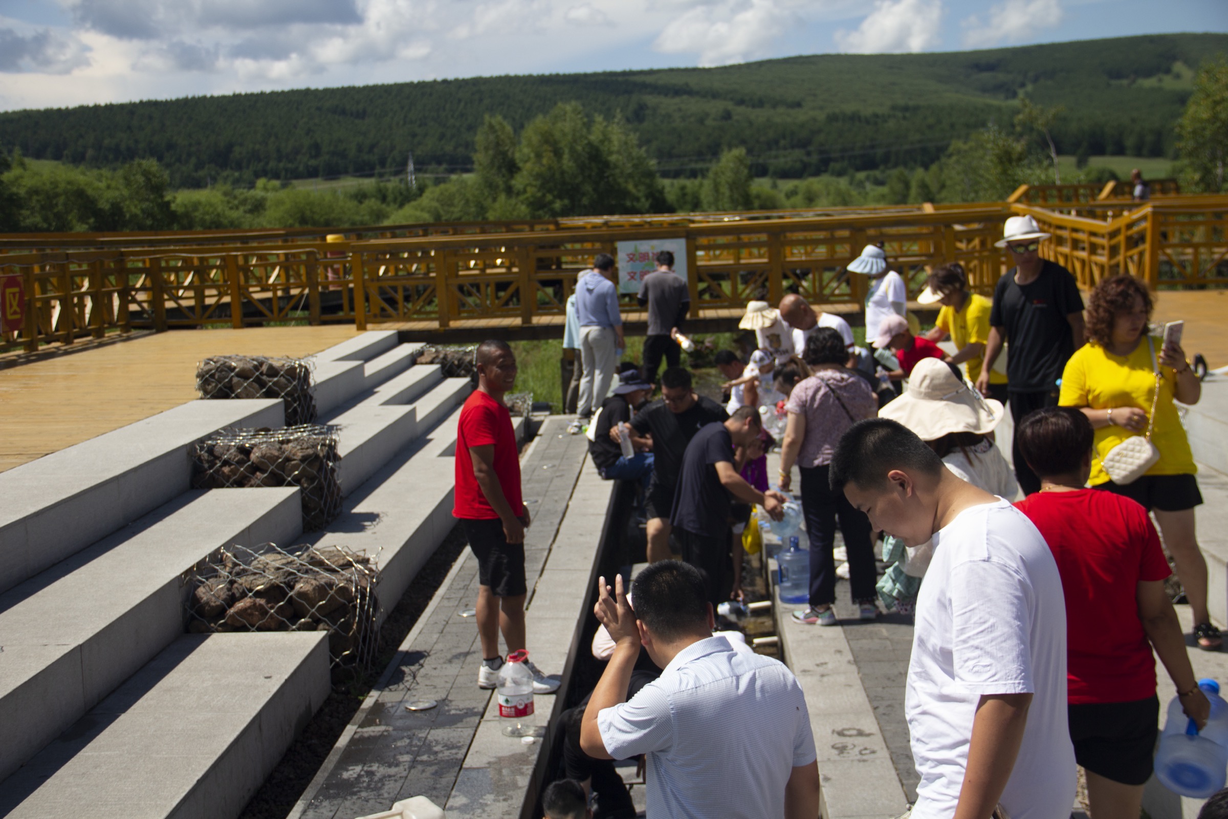
The shuttle drops walkers at the Arxan Tianchi stop among Dahurian larch and white birch at roughly 1,200 m. From the trailhead the route follows a graded wooden-step staircase — widely advertised as “998 steps” (阿尔山天池 998 级台阶) on Chinese-language guides and on the park’s own signage. The stair climbs the constructional flank of the volcanic cone steadily through closed taiga; benches and small landings break the ascent every 100–200 steps. The forest opens at the rim where a fenced platform overlooks an elliptical crater lake of roughly 13.5 hectares, given in geological surveys as up to 373 m deep at maximum and 204 m on average. The lake has no surface inlet or outlet — a defining feature of the Arxan-Chaihe crater group. After circling the rim platforms, the route descends the same staircase. Sources differ on the exact step count, with both 998 and 989 reported; 998 is the more frequently cited figure and matches park signage.
Why it is essential
Arxan Tianchi is the landmark feature of the Arxan UNESCO Global Geopark and one of the three lakes most commonly referred to as “Tianchi” in China alongside Changbaishan Tianchi on the Korean border and Tianshan Tianchi in Xinjiang. Perched at roughly 1,332 m on the crest of a basaltic cone with no in- or outflow, it is the most accessible Holocene crater lake in the Greater Khingan and the trailhead the entire Arxan park is built around. The 998-step ascent is the canonical way to experience the volcanic landform: it crosses the larch–birch taiga in compressed elevation and ends at one of the most photographed views in Inner Mongolia.
Equipment
- Trail shoes or light boots (stairs can be wet and slippery)
- Weatherproof shell (afternoon thunderstorms common July–August)
- Warm mid-layer (sub-10 °C mornings even in summer at this elevation)
- Sun protection, water, snacks
- Mosquito repellent (essential mid-July to mid-August)
Hazards and notes
The stair surface can be icy from mid-October through May, and the park does not actively clear it in winter. The open rim platform carries lightning exposure during summer thunderstorms. All access is via the mandatory park shuttle system; the ticket covers shuttle and is valid for two days. The lake itself is fenced — do not attempt to descend to the water, as the crater rim is steep and unstable in places and entering the water is prohibited. Drone use is generally restricted inside the geopark.
GPX / KML links
| Source | URL | Format | Notes |
|---|---|---|---|
| OpenStreetMap (Arxan National Forest Park area) | openstreetmap.org | OSM data (export GPX) | ODbL 1.0; verify mapping completeness |
| Arxan National Forest Park official site | aesly.com | Source page | No published GPX |
No official park GPX has been located in this pass. The trail is short and entirely on built stair and boardwalk infrastructure; coordinates can be derived from OSM or by on-site GPS recording.
Sources
- UNESCO IGGP — Arxan UNESCO Global Geopark
- Arxan National Forest Park (official)
- Smithsonian Global Volcanism Program — Arxan-Chaihe
- IntechOpen — Basic Volcanic Elements of the Arxan-Chaihe Volcanic Field
- China Discovery — Arxan UNESCO Global Geopark
2. Tuofengling Tianchi — Camel Peak Heavenly Lake (驼峰岭天池)
Snapshot
Itinerary
From the shuttle stop the boardwalk-staircase climbs through Larix gmelinii and birch forest up the rim of an older crater. The lake is shaped, in Chinese descriptive tradition, like a human left foot — about 800 m north–south, 450 m east–west, with a surface area near 26 hectares. The rim viewing platform looks down onto pale blue water set within a forested basin and out across the wider Arxan-Chaihe volcanic field to the south. Walking and photography time is best spent on the rim circuit, where short flat sections connect three platforms; floating pumice clasts can be seen on the lake shore from selected viewpoints. Descent is by the same staircase.
Why it is essential
Tuofengling is the second of the major crater lakes inside Arxan and a quieter counterpart to its more famous sister. The distinctive shape, larger surface area, and broader panorama across the volcanic field make this the strongest single-viewpoint vantage on Quaternary basaltic crater landforms in the Greater Khingan; multiple guides single it out as the more off-the-beaten-path stop inside the park.
Equipment
- Trail shoes or light boots
- Weatherproof shell
- Warm mid-layer
- Sun protection, water, food
- Mosquito repellent in summer
Hazards and notes
Stair-related hazards mirror Arxan Tianchi — wet timber and lightning exposure on the rim. The Tuofengling spur is the furthest shuttle stop in the park (~37 km from the gate); plan for the full shuttle schedule and the last bus back. Combining Tuofengling Tianchi with Arxan Tianchi in a single day is feasible inside the two-day shuttle ticket.
GPX / KML links
| Source | URL | Format | Notes |
|---|---|---|---|
| OpenStreetMap (Arxan NFP area) | openstreetmap.org | OSM data (export GPX) | ODbL 1.0; check mapping completeness |
| Arxan National Forest Park official site | aesly.com | Source page | No published GPX |
No official park GPX has been located. The route is short and stair-bound; consider on-site GPS capture or OSM-based derivation.
Sources
- UNESCO IGGP — Arxan UNESCO Global Geopark
- China Discovery — Arxan UNESCO Global Geopark
- IntechOpen — Basic Volcanic Elements of the Arxan-Chaihe Volcanic Field
3. Shitanglin lava boardwalk (石塘林)
Snapshot
Itinerary
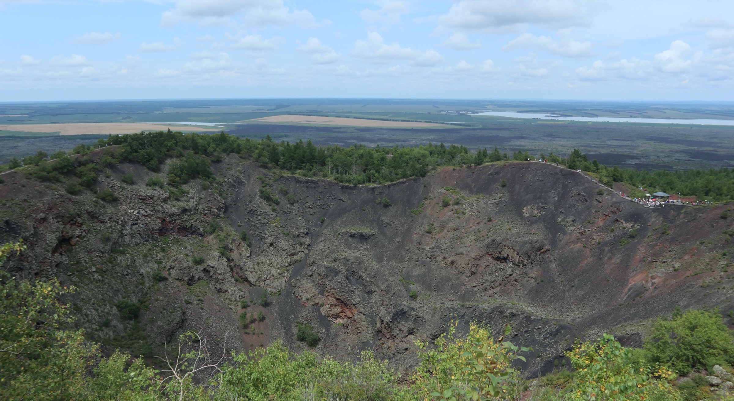
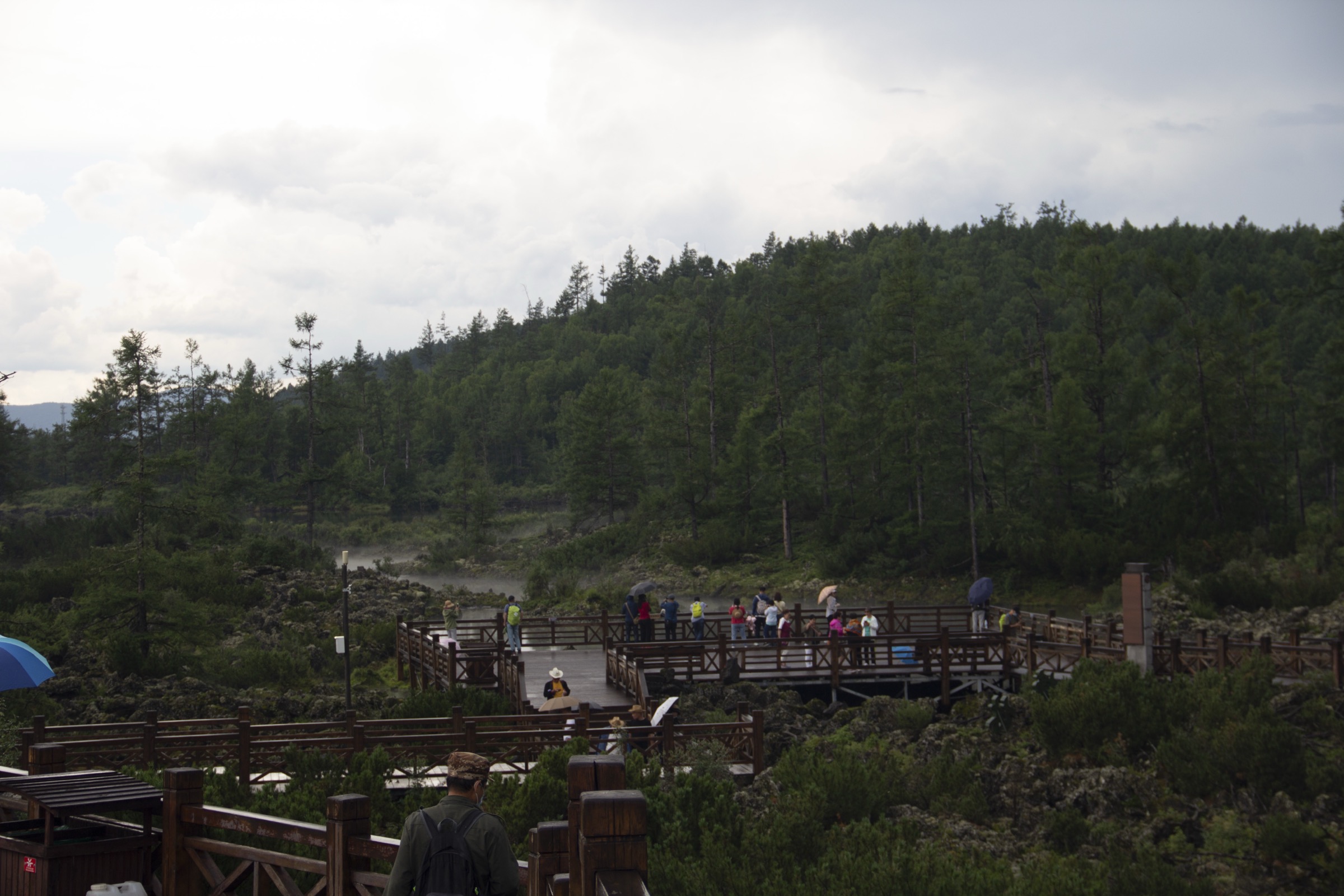
Shitanglin — literally “Stone Pond Forest” — is a young basaltic lava flow described in the Arxan UNESCO Global Geopark dossier and Chinese-language park materials as covering roughly 28.5 km² and extending about 20 km long by 10 km wide. The boardwalk loop, built specifically to protect the surface lavas from foot traffic, threads between fumarolic cones, lava ridges, ropy (pahoehoe-style) lava sheets, lava tumuli, lava plates, lava caves, lava hills and lava depressions. Mature larches grow directly out of the cooled flow — the “stones and forests coexisting” landscape that is the visual signature of the park. Interpretive signage in Chinese and English describes the volcanic morphology at intervals, and small barrier lakes formed where lava dams blocked drainage lines punctuate the route.
Why it is essential
Shitanglin is identified by Chinese geological surveys as the most complete and most diverse young volcanic-lava landform terrain in China. The boardwalk loop is the only walk in the entire region that crosses an active-looking pahoehoe flow at close range, and the contrast between black lava and Dahurian larch is the most visually distinctive landscape inside the Arxan geopark.
Equipment
- Trail shoes (boardwalk timber can be slick when wet)
- Light layers
- Sun protection — most of the flow is exposed
- Mosquito repellent in mid-summer (the small barrier lakes breed insects)
- Water (no on-route sources)
Hazards and notes
Stay on the boardwalk. Off-path lava is razor-sharp and ankle-twisting, and the surface vegetation is fragile. There are no water sources on the boardwalk itself; carry enough. The site is open through the snow season but the boardwalk is not actively cleared. Geopark rules prohibit collecting lava samples.
GPX / KML links
| Source | URL | Format | Notes |
|---|---|---|---|
| OpenStreetMap (search 石塘林 / Shitanglin) | openstreetmap.org | OSM data (export GPX) | ODbL 1.0; check mapping completeness |
| Arxan National Forest Park — Shitang Lin | aesly.com | Source page | No published GPX |
No official route file located in this pass.
Sources
- Arxan National Forest Park — Shitang Lin Forest
- UNESCO IGGP — Arxan UNESCO Global Geopark
- China Discovery — Arxan UNESCO Global Geopark
- IntechOpen — Basic Volcanic Elements of the Arxan-Chaihe Volcanic Field
4. Santan Gorge along the Halaha River (三潭峡 / 哈拉哈河)
Snapshot
Itinerary
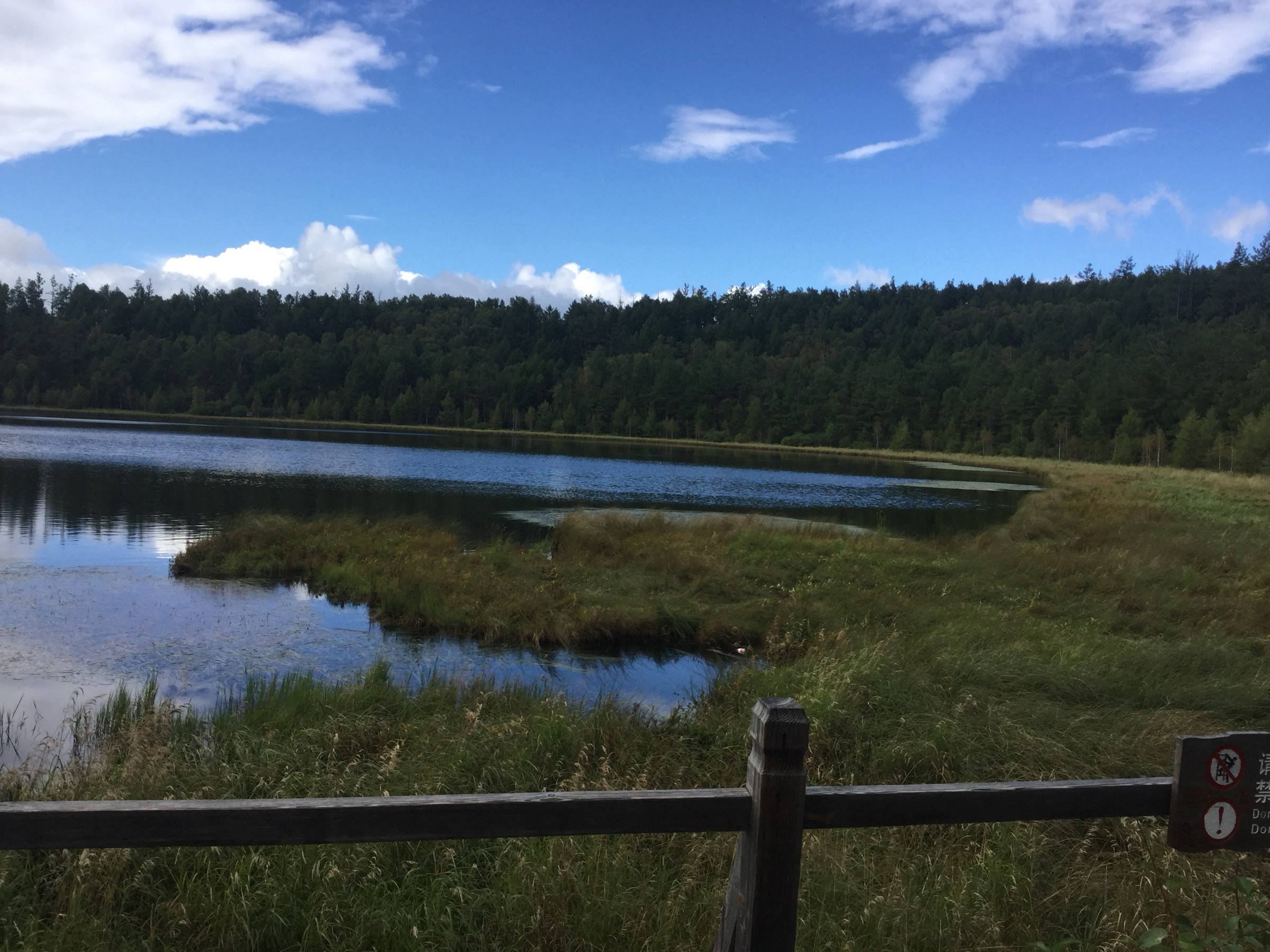
The Halaha River (Mongolian: Halh / Khalkh Gol / 哈拉哈河) rises on the western flanks of the Greater Khingan and flows southwest, eventually forming part of the China–Mongolia border. Inside Arxan National Forest Park the upper river has cut a 3 km basalt gorge known as Santan Gorge or “Three Pool Gorge”, named for three pools strung along the canyon: Woniu Pond (Reclining Cow Pond / 卧牛潭), Hushi Pond (Tiger Stone Pond / 虎石潭) and Yuexin Pond (Crescent-Heart Pond / 月亮潭, sometimes 悦心潭). The south wall is steep and precipitous; the north bank is a pile of huge volcanic blocks. The boardwalk runs along the north bank, climbing over basalt ledges and dropping back to river level on timber stairs. Spray from rapids wets the timber across the year. Rhododendron dauricum and white birch are the dominant bank species. The route ends at the lower shuttle stop near the confluence area; some visitors walk the gorge as an out-and-back instead of taking the shuttle.
Why it is essential
The Halaha is the defining hydrological feature of the southern Greater Khingan and the river that, downstream, gives its name (Khalkhin Gol) to the 1939 battles. Santan Gorge is the only point in the Arxan park where the river–lava interaction is exposed at walking range, with a built boardwalk that allows the basaltic gorge geology to be inspected close up. The walk is the canonical “river” companion to the crater (Arxan and Tuofengling) and the lava-field (Shitanglin) walks, and rounds out the geological story of the geopark.
Equipment
- Trail shoes with grippy sole (wet timber and stone are constant)
- Weatherproof layer (riverine micro-climate; cooler than the surrounding forest)
- Warm layer
- Mosquito repellent in mid-summer; midge / black-fly activity is heaviest on still days
- Sun protection where the boardwalk leaves the gorge canopy
Hazards and notes
Wet timber and slick basalt make falls the main hazard. The path is fenced; do not attempt to descend into the river — currents are stronger than they look and water temperature stays low. The lower section of the gorge can be closed for boardwalk repair after spring snowmelt floods; check at the park gate. The Halaha downstream forms the Mongolia border; the boardwalk does not approach the border, and the walk should not be extended downstream off the sanctioned path.
GPX / KML links
| Source | URL | Format | Notes |
|---|---|---|---|
| OpenStreetMap (search 三潭峡 / Santanxia) | openstreetmap.org | OSM data (export GPX) | ODbL 1.0; verify completeness |
| Arxan National Forest Park official site | aesly.com | Source page | No published GPX |
No official route file located in this pass.
Sources
- China Discovery — Arxan UNESCO Global Geopark
- UNESCO IGGP — Arxan UNESCO Global Geopark
- Wikipedia — Khalkhin Gol (river system background)
5. Erguna National Wetland Park — boardwalk and viewpoint hill (额尔古纳国家湿地公园)
Snapshot
Itinerary
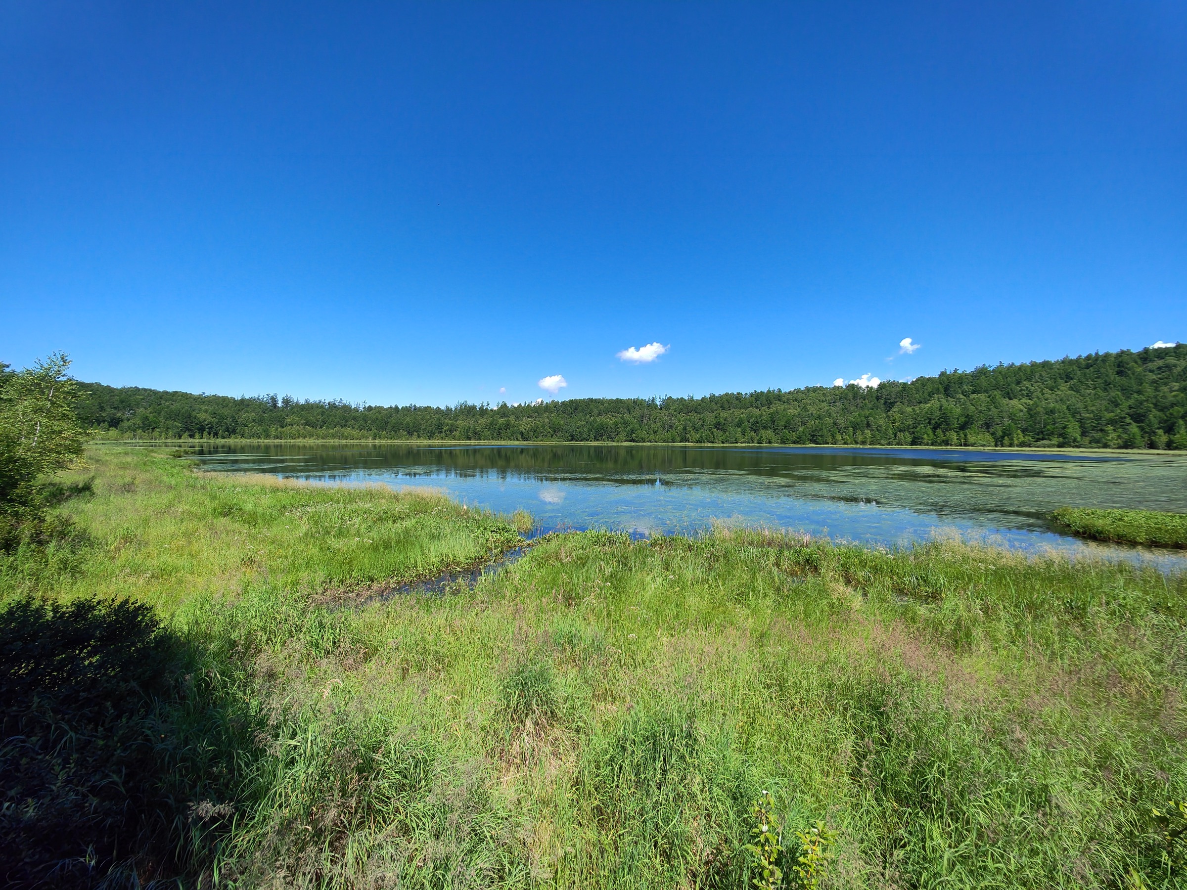
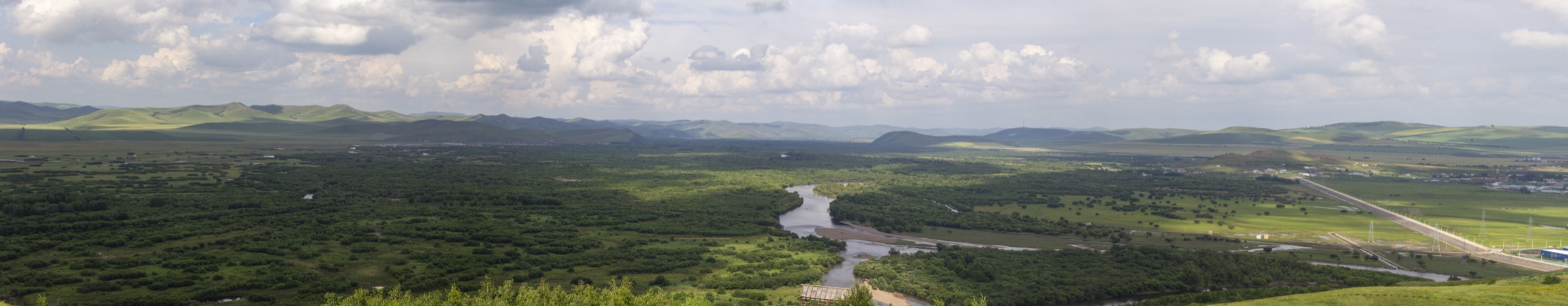
Erguna National Wetland Park (额尔古纳国家湿地公园, formerly known as Genhe Wetland / 根河湿地, renamed after 2009) sits where the Genhe river meets the Ergun river floodplain on the western flank of the Greater Khingan. From the main gate the marked route climbs a series of timber stairs and gravel zigzags to the principal viewing platform on the small ridge inside the park — locally referred to as the “main peak”, at approximately 720 m. From the platform the panorama opens out across the meandering floodplain: the famous Horseshoe Island (Mahuandao / 马蹄岛), a near-circular oxbow loop named for its shape; the “S-bend” of the Ergun, a sinuous double meander often likened in Chinese tourism materials to a taijitu (Tai Chi) diagram; and the wider forest–grassland mosaic where the Greater Khingan larch finger meets the Hulunbuir steppe. After descending, the boardwalk circuit (3.2 km of wooden walkway) leads down through riparian willow scrub and reed beds at floodplain level, with three principal observation platforms set out over the river.
The route can be walked in either order; most guides recommend the viewpoint-hill first (cooler in the morning) and the floodplain boardwalk second.
Why it is essential
This is the cleanest single-walk expression of the forest-steppe ecotone in Inner Mongolia. From the viewing platform the larch–birch taiga of the Greater Khingan stands on one side and the Hulunbuir grassland on the other, separated by the Ergun floodplain itself. The site appears on UNESCO’s tentative World Heritage list as part of the “Hulun Buir Landscape and Birthplace of Ancient Minority” inscription rationale, and multiple Chinese sources describe it as the largest wetland in China at over 200,000 hectares. For visitors who are not trekking into the closed primary forests of Hanma, this is the most accessible representative landscape of the entire region.
Equipment
- Trail shoes (the viewing-platform stair can be wet)
- Weatherproof layer (open landscape; wind exposure on the ridge)
- Warm layer (cool mornings and evenings)
- Sun protection — the ridge platforms are exposed
- Mosquito repellent and long-sleeved clothing in mid-summer; tick protection sensible in the grassland-edge brush
- Binoculars for birdwatching — the wetland sits on the East Asian–Australasian Flyway and supports red-crowned cranes, white storks and many waterfowl species in season
Hazards and notes
The viewing-platform stair is exposed; descend in lightning conditions. The boardwalk is not lit; finish before dusk. Cycling and drone use are restricted inside the park; check on-site signage. Although the Russian border runs along the lower Ergun, the park itself is well inside Chinese territory and does not require a border permit. The Shiwei (室韦) and Heishantou (黑山头) border-town visits further downstream do involve checkpoint stops. Dogs are generally not allowed on scenic-area boardwalks; verify at the gate.
GPX / KML links
| Source | URL | Format | Notes |
|---|---|---|---|
| OpenStreetMap (search 额尔古纳国家湿地公园) | openstreetmap.org | OSM data (export GPX) | ODbL 1.0; verify completeness |
| China Discovery — Ergun Travel Guide | chinadiscovery.com | Source page | No published GPX |
No official park GPX has been located in this pass. The route is short and contained inside scenic-area infrastructure; consider on-site GPS capture or OSM-based derivation.
Sources
- China Discovery — Ergun (Hulunbuir) Travel Guide
- UNESCO World Heritage Centre — Hulun Buir Landscape (Tentative List)
- Ramsar Sites — Inner Mongolia Grand Khingan Hanma Wetlands
External links
| Source | URL |
|---|---|
| UNESCO IGGP — Arxan UNESCO Global Geopark | unesco.org |
| Arxan National Forest Park (official) | aesly.com |
| Smithsonian Global Volcanism Program — Arxan-Chaihe | volcano.si.edu |
| UNESCO World Heritage — Hulun Buir Landscape (Tentative List) | whc.unesco.org |
| Ramsar — Inner Mongolia Grand Khingan Hanma Wetlands | rsis.ramsar.org |
| IUCN Green List — Hanma National Nature Reserve | iucngreenlist.org |
| China Discovery — Arxan UNESCO Global Geopark | chinadiscovery.com |
| China Discovery — Ergun Travel Guide | chinadiscovery.com |
| IntechOpen — Arxan-Chaihe Volcanic Field | intechopen.com |
| OpenStreetMap (ODbL 1.0) | openstreetmap.org |