Regional overview
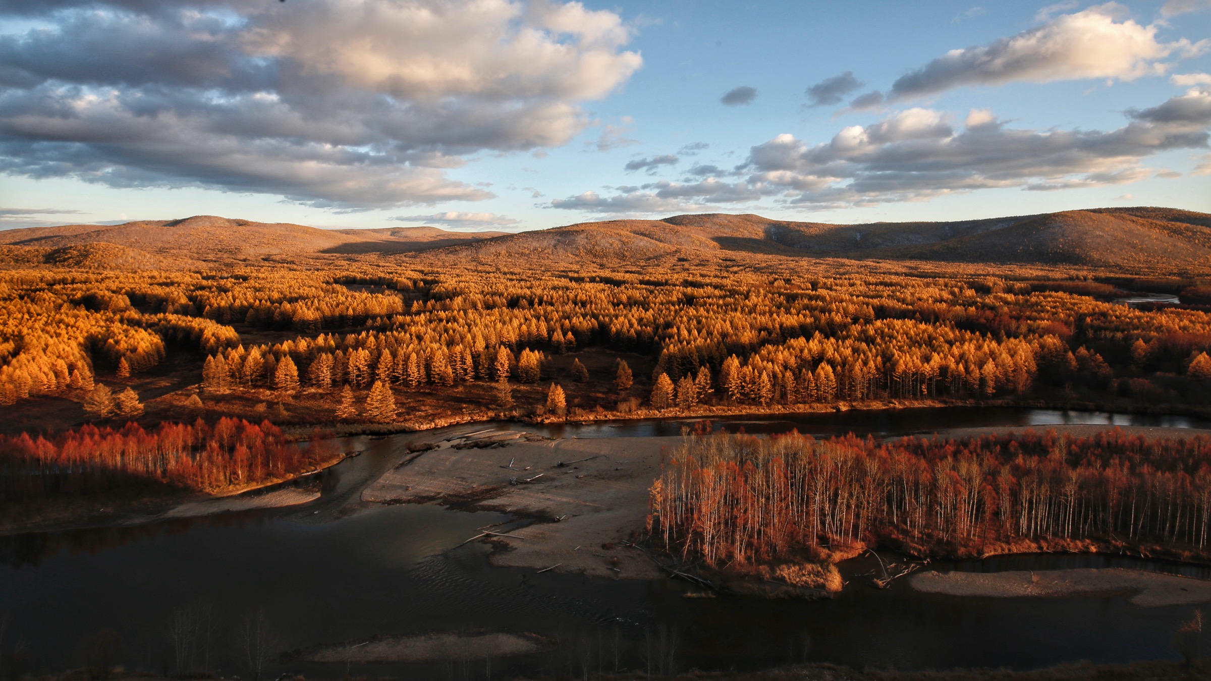
The Wudalianchi (五大连池 / Wǔdàliánchí, “Five Connected Lakes”) volcanic field lies on the southern flank of the Lesser Khingan range (小兴安岭 / Xiǎo Xīng’ānlǐng) in north-central Heilongjiang Province, about 380 km north of Harbin and 230 km south of the Russian border city of Blagoveshchensk. Fourteen monogenetic cinder cones and shield volcanoes are arranged in three sub-parallel north-east trending zones across a basaltic plateau of roughly 500–1,060 km² (the figure depends on whether the inner volcanic field or the full geopark perimeter is meant). The two youngest cones, Laoheishan (老黑山 / Lǎohēishān, “Old Black Mountain”) and Huoshaoshan (火烧山 / Huǒshāoshān, “Fire-Burnt Mountain”), erupted between January 1720 and April–May 1721 — the peer-reviewed window now cited by the Smithsonian Global Volcanism Program, although popular sources still occasionally give the slightly broader 1719–1721 form from contemporary Qing-dynasty reports. Those eruptions produced about one billion cubic metres of lava and 150 million cubic metres of tephra, dammed the Bei’an–Shilonghe drainage, and impounded the chain of five barrier lakes — Lianhuachi (Lotus, first), Yanshanchi (Wild-Goose Mountain, second), Bailongchi (White Dragon, third, the largest), Hemingchi (Cranes-Crying, fourth) and Ruyichi (Ruyi-Sceptre, fifth) — from which the area takes its name. Geochemically the lavas are unusual: ultrabasic to intermediate alkaline–peralkaline potassic rocks (olivine leucitite, leucite basanite and trachybasalt) with potassium contents averaging around 5.1 %, and the field is widely studied as a type locality of intra-plate potassic volcanism.
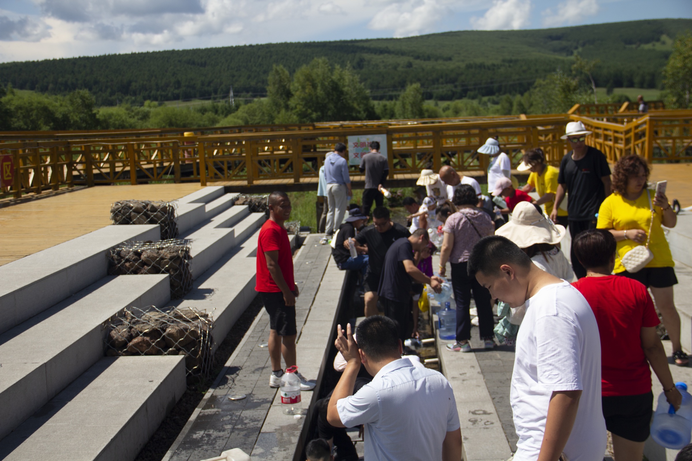
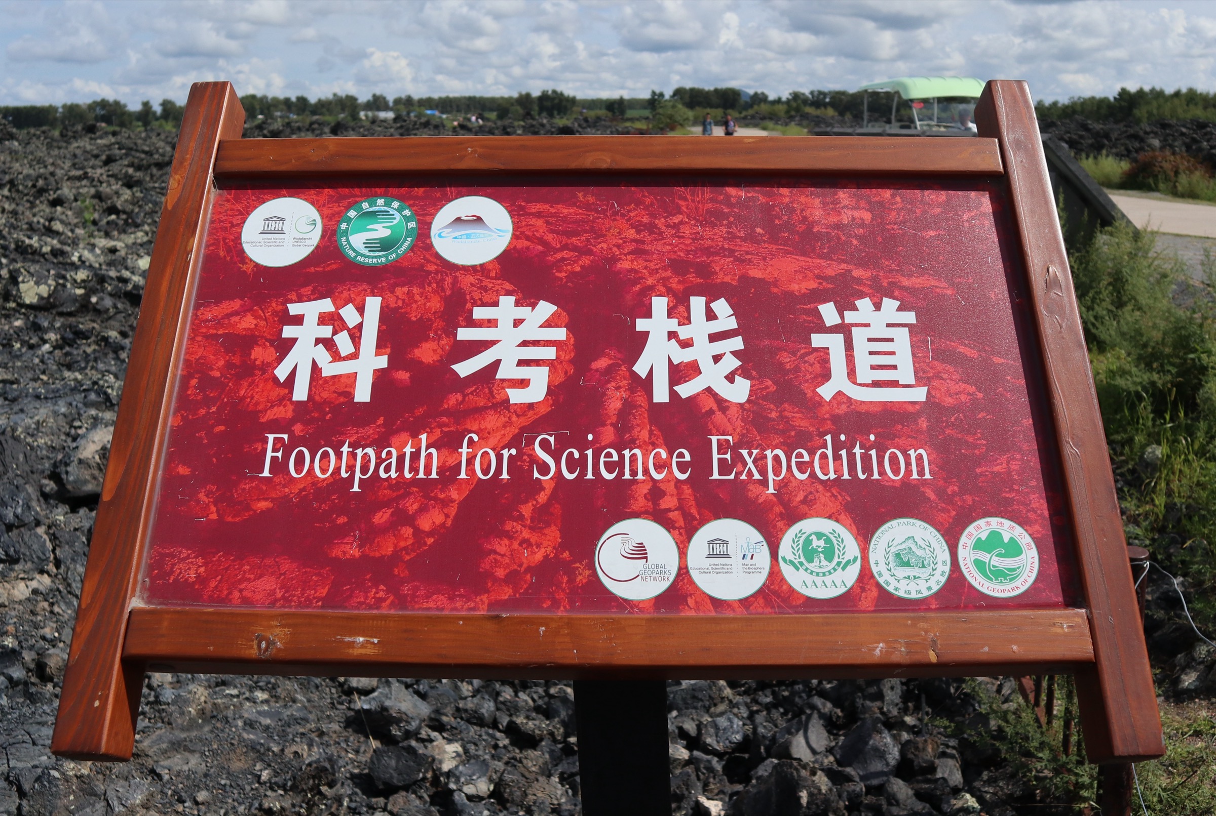
Wudalianchi was inscribed as a UNESCO Global Geopark in 2004 — one of China’s earliest, designated under the original Global Geoparks Network and integrated into the UNESCO Global Geoparks programme from 2015 — and joined UNESCO’s World Network of Biosphere Reserves under the Man and the Biosphere Programme in 2003. The reserve covers about 1,060 km² of cones, lava plateaux, lakes and the boreal–deciduous transition forest typical of the southern Lesser Khingan. The federal scenic-area status (国家重点风景名胜区) and 5A tourist rating mean access is firmly gated: tickets are required, and most hiking takes the form of well-built timber boardwalks (栈道 / zhàndào) laid over the friable lava and porous tephra. Off-boardwalk walking is officially discouraged because the spatter cones, lava-tube roofs and aa surfaces are genuinely collapse-prone, and rangers actively enforce the rule.
The walking culture here is therefore unlike a typical mountain region. Most published “trails” are short geological-interpretation circuits of 1–4 km, served by a network of internal park shuttle buses (环保车 / huánbǎochē) that link the south-line (南线 / nánxiàn) cluster of Longmen Stone Village, Wenpo and Bailong Cave with the north-line (北线 / běixiàn) cluster of Laoheishan, Huoshaoshan and the Yaoquan / spring complex. To reach a full day-hike footprint of 5–25 km, visitors typically chain two or three boardwalk circuits in one direction and add the lake-edge paths or the inter-attraction service roads. Two of the routes catalogued below are honest single-attraction loops that stretch into the day-hike range (the Laoheishan crater-and-lava combination and the Longmen Shizhai stone-sea boardwalk pair); the other three are explicitly multi-stop linked walks that mirror the south-line, north-line and lakeside itineraries published by the geopark itself. None of these routes involves technical terrain, but the surface — porous cinder, jagged aa, slippery wood — punishes light footwear.
The hiking season runs from late April to mid-October, with peak conditions from late May through early September. July averages around 21.6 °C; January around −23.3 °C, with extreme record lows below −43 °C. Mosquitoes and biting flies are intense in mid-summer near the lakes and forested cones (Wohushan, Yaoquanshan), and tick-borne encephalitis is endemic in the Lesser Khingan, so tick precautions are sensible from May to September. The mineral-spring drinking tradition — the cold, carbon-dioxide-charged 南泉 / 北泉 (south spring / north spring) waters, comparable in chemistry to Vichy or the Caucasian Narzan — is an integral cultural part of any visit and is open year-round; the annual Shèngshuǐ Jié (圣水节, “Holy Water Festival”, also called Yàoquán Huì 药泉会) in early summer is the busiest single date in the calendar. Winter ice-tube and snow-lava tours are advertised but are not hiking in the day-walk sense and are excluded here. Access is by road or rail from Harbin (about 4½–5 hours by car; train to Bei’an then bus, or direct long-distance coach), or by air via the small Wudalianchi Dedu (DTU) and Heihe Aihui (HEK) airports.
Selection rationale
The five routes catalogued below were chosen to be (a) accessible to ordinary day visitors on the published boardwalks and shuttle network; (b) representative of the geopark’s principal geological themes — fresh-eruption cones, blocky lava, hornitos and gas-vent cones, mineral water and older eroded shields; and (c) long enough to qualify as day hikes under the 5–25 km project guideline once the connecting paths and lake fronts are included. Because of the boardwalk-and-shuttle character of the park, each route is described as a linked walk rather than a single named “trail”; the linked-walk concept follows the geopark’s own published south-line and north-line itineraries. The two younger cones, Laoheishan and Huoshaoshan, anchor the new-eruption story; the Longmen Shizhai (Dragon-Gate Stone Village) blocky-lava boardwalks represent older Pleistocene flow surfaces and the most extensive forested aa landscape; Wenpo and Bailongdong on the south line cover the spring-and-lava-tube combination; and the Yaoquanshan / mineral-springs / Bailongchi lakeside walk represents the cultural-religious and hydrological themes. Wohushan and Geleqiushan, while interesting older cones, are either lightly developed or have very short boardwalks and are noted under follow-up work rather than catalogued.
Summary table
| # | Hike | Country | Route type | Distance | Gain | Max elevation | Difficulty |
|---|---|---|---|---|---|---|---|
| 1 | Laoheishan crater ascent and Stone-Dragon lava boardwalk | China | Out-and-back with summit loop | 5.5–7 km | 180–230 m | 515.9 m | Moderate |
| 2 | Longmen Shizhai and Wenpo south-line linked walk | China | Linked boardwalk traverse | 7–9 km | 100–150 m | ~360 m | Easy–moderate |
| 3 | Yaoquanshan, mineral springs and Bailongchi lakeshore loop | China | Loop with cultural stops | 6–8 km | ~100 m | ~356 m | Easy |
| 4 | Huoshaoshan, gas-vent cone field and Laoheishan link | China | Linked walk (north-line) | 8–10 km | ~200 m | ~515 m | Moderate |
| 5 | Bailongdong lava tube to Wenpo and Sanchi lakeshore | China | Linked walk with cave segment | 7–9 km | ~80 m | ~320 m | Easy |
1. Laoheishan crater ascent and Stone-Dragon lava boardwalk
Snapshot
Itinerary
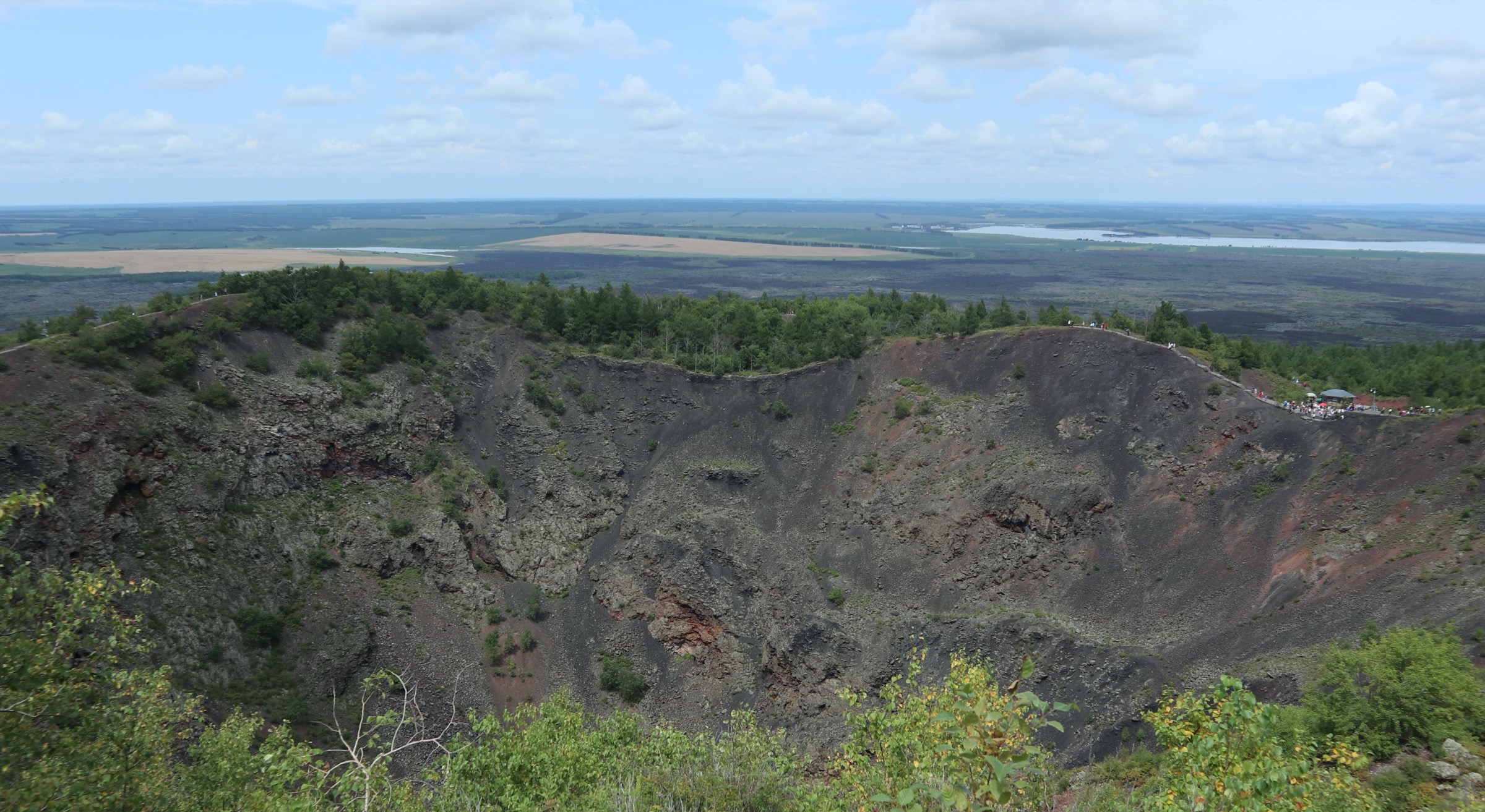
The standard ascent starts at the Laoheishan car-park on the north-line shuttle route, where a long flight of timber-and-concrete steps climbs the north flank of the cone through a young birch–poplar forest growing on 1721 cinder. The steps gain about 150 m to the crater rim over roughly 1.6–1.8 km. Where the trees fall away, the path emerges on the rim of an almost perfectly preserved funnel-shaped crater 350 m across and 136–145 m deep, with reddened oxidised scoria stratified down its inner walls. A boardwalk circumnavigates the rim — perimeter approximately 1,200 m — giving views over the Stone-Dragon (Shilonghe / 石龙河) aa lava field to the north-east, Huoshaoshan 2 km away, and the chain of barrier lakes to the south. From the rim a continuing flight of steps drops to the crater floor for visitors who wish to descend; this option adds about 250 m one-way of stepped descent and the same in return. The conventional descent follows a separate eastern-flank stair down to the foot of the cone, where the route rejoins the lava-plateau boardwalk back to the car park. Most visitors who want a fuller day extend by following the signed Stone-Dragon (石龙) boardwalk across the surrounding 65 km² pahoehoe-aa lava field, including the Fanhuá Shíhǎi (翻花石海, “buckled stone sea”) and the named hornitos clearly visible from the trail. A park figure quoted in Chinese-language guides puts the full “car-park → ascent → crater rim → descent” loop at “under 4.3 km, with under 150 m of climb”; adding the inner crater-floor visit and the Stone-Dragon boardwalk pushes the day’s walking to around 6–7 km.
Why it is essential
Laoheishan is the defining sight of Wudalianchi: the youngest large historically active volcano in north-eastern China, the source of the 1720–21 eruption that created the five lakes, and the only cone in the field with a fully developed summit-and-crater walking infrastructure. Its summit gives the only comprehensive view of all the major elements of the geopark — the chain of lakes, the Stone-Dragon lava field, Huoshaoshan, the older Wohushan and Yaoquanshan shields, and the Lesser Khingan forests beyond. The combination of stair ascent, narrow rim circuit and lava-field boardwalk extension provides the only day-hike-scale walking option within a single attraction zone.
Equipment
- Sturdy hiking shoes (cinder gravel is hard on light trainers)
- Weatherproof shell layer
- Warm layer for the rim where wind funnels
- Sun protection and 1.5 L water (none on the cone)
- Insect repellent in summer
- Trekking poles useful on the long stair flights for descent
Hazards and notes
The inner crater wall is loose oxidised scoria and the rim path is narrow; railings are present on the main observation platforms but not continuously. Stepping off the boardwalk onto the surrounding lava is officially prohibited because the surface — particularly the hornito-bearing zones — is friable and prone to collapse. Mosquitoes and ticks are intense in the forest skirt of the cone in mid-summer. The scenic area enforces the ticketed shuttle / boardwalk system strictly; access outside operating hours (broadly 07:30–17:30 in peak season, 08:00–16:30 in low season) is not possible. The cone is fully closed during heavy thunderstorms and may be closed in early winter snow.
GPX / KML links
| Source | URL | Format | Notes |
|---|---|---|---|
| OpenStreetMap (Laoheishan crater and access steps) | openstreetmap.org | OSM data (export GPX) | ODbL 1.0; manual GPX construction required |
| Wudalianchi UNESCO Global Geopark | wdlcggp.org.cn | Source page | No published GPX |
No official park GPX is published; OSM maps the boardwalk and stairway as highway=footway / highway=steps. Trailhead coordinates (approximate): car-park 48.717° N, 126.156° E; summit 48.7196° N, 126.156° E.
Sources
- UNESCO Global Geoparks — Wudalianchi
- Smithsonian Global Volcanism Program — Wudalianchi (VN 305030)
- Wikipedia — Wudalianchi volcanic field
- Baidu Baike — 老黑山
2. Longmen Shizhai and Wenpo south-line linked walk
Snapshot
Itinerary
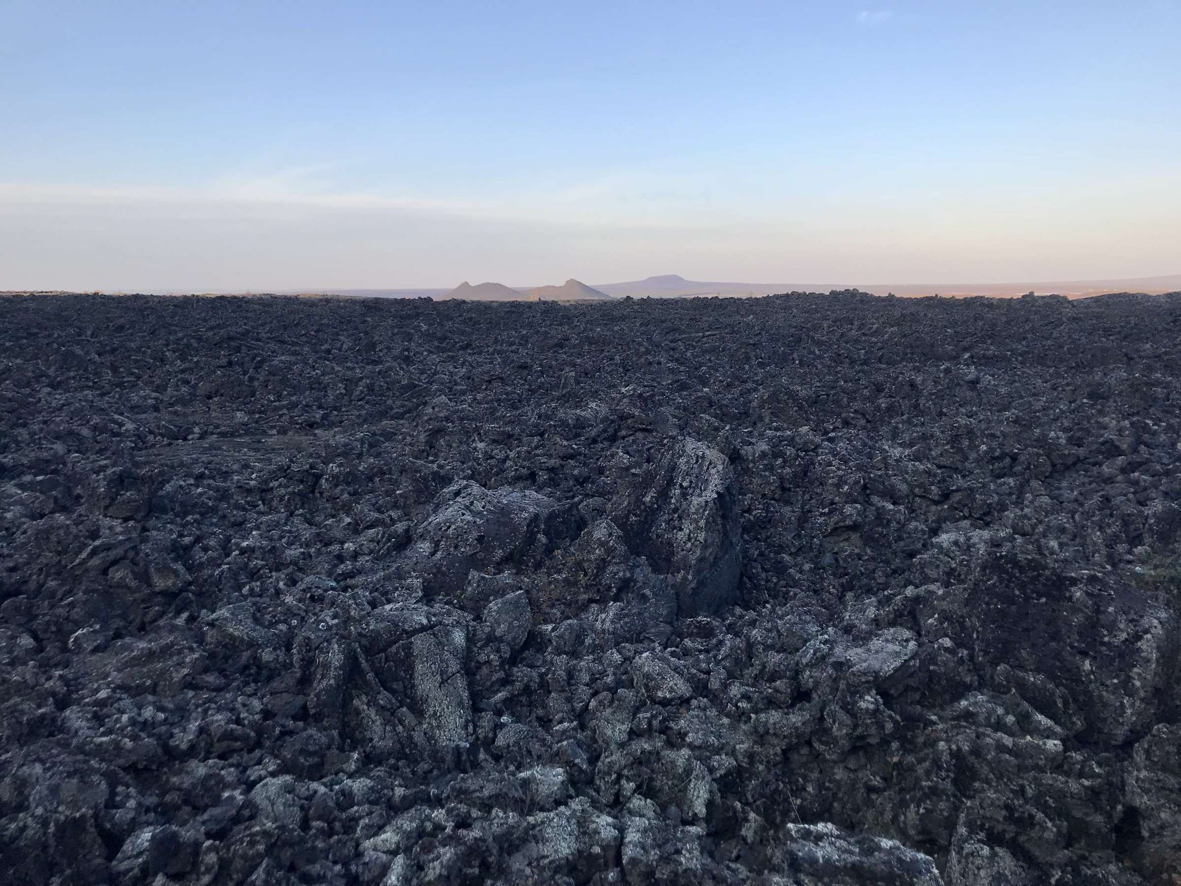
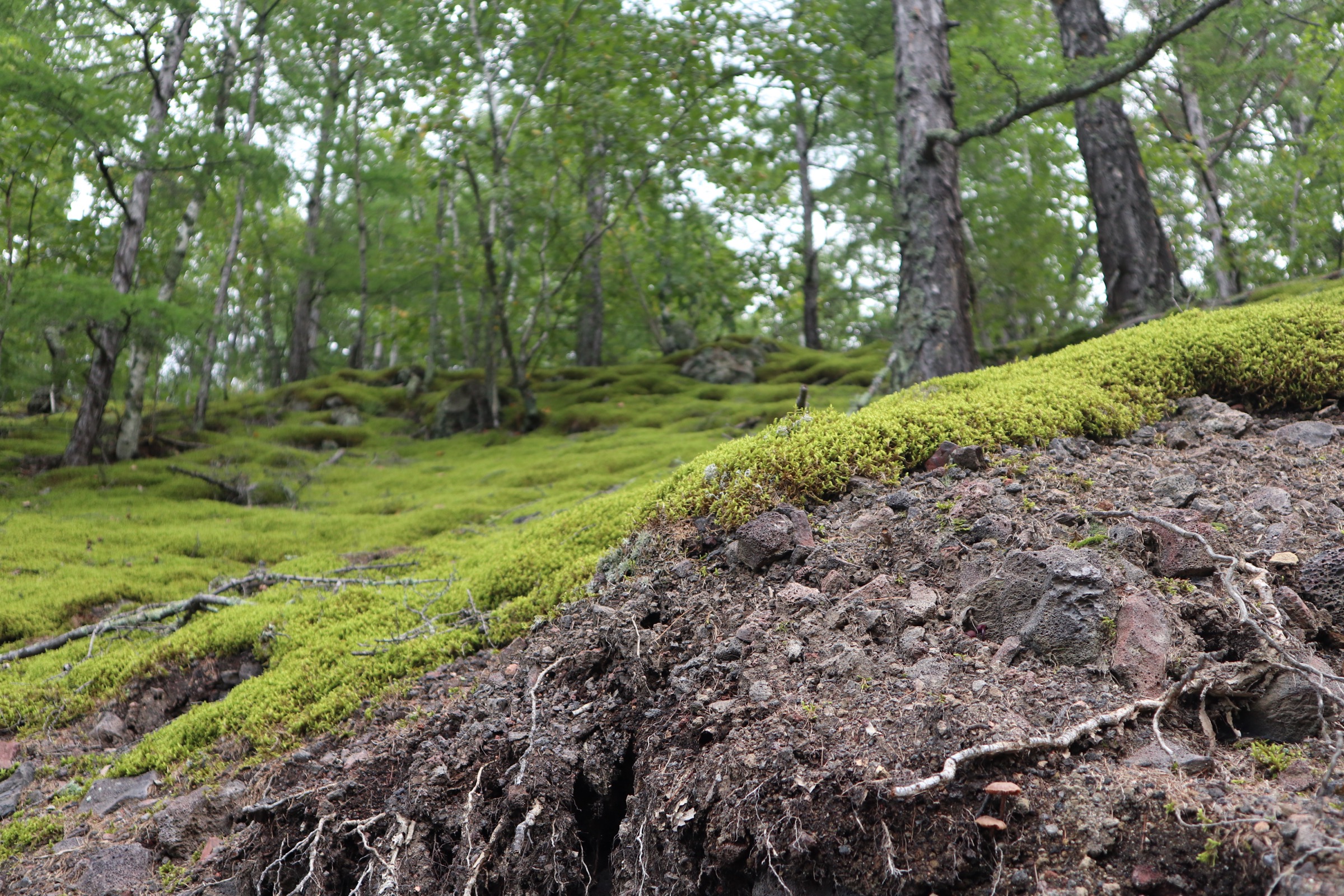
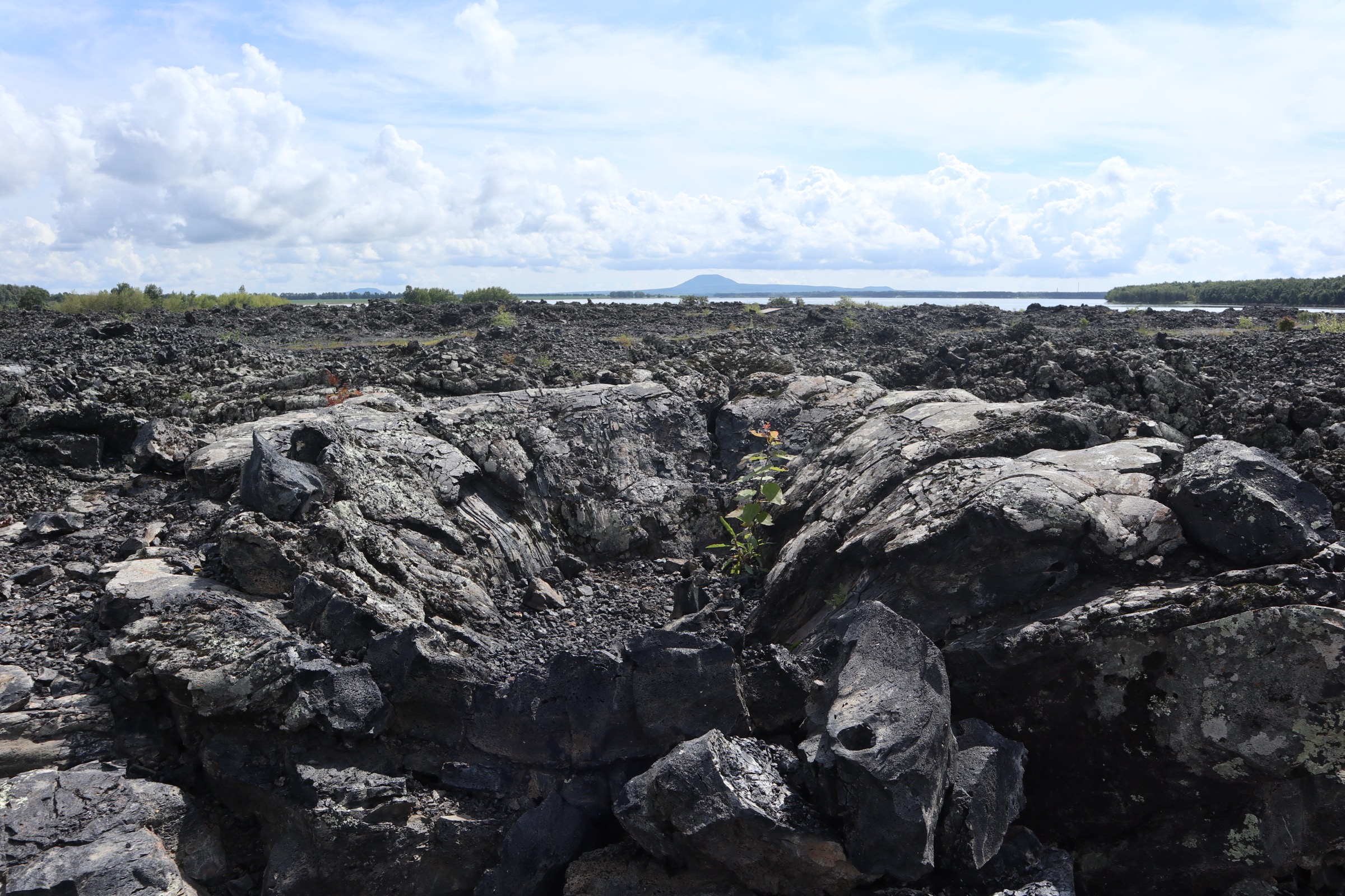
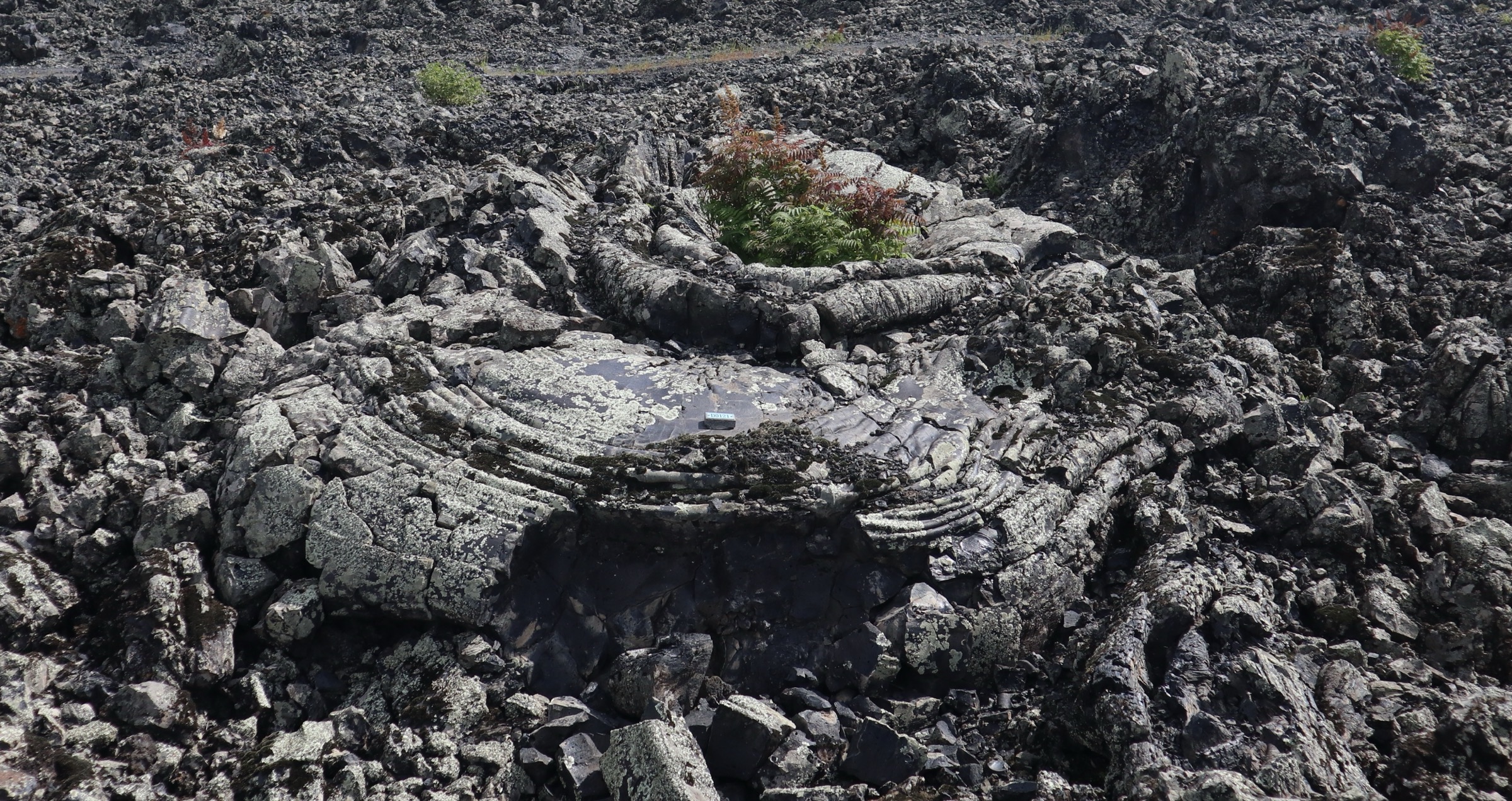
Longmen Shizhai (龙门石寨, “Dragon-Gate Stone Village”) sits on the south-eastern edge of the geopark and preserves the largest exposure of blocky aa lava in the field — a flow plateau covering some 20–50 km² (sources vary), erupted from the East and West Longmen cones approximately 280,000–340,000 years ago. The main boardwalk is signed at 2.8 km and runs as a linked figure-of-eight through a sequence of named sections: Lóngmén Yúndǐng (龙门云顶, “Dragon-Gate Cloud Summit”), the central stone-sea, the Dázixiāng (达子香 / Rhododendron dauricum) garden, Gǔdào Xúnzōng (“Ancient Path Search”), Shíxiào Shānbēng (“Stone-Roar Mountain-Collapse”), the upended-block “Old Stockade”, and the Fēnghuǒ Léitái viewing platform. Secondary spur boardwalks reach further into the plateau, taking the walking distance inside Shizhai to about 4 km if all named loops are included. The substrate is genuine blocky aa, weathered to dark grey-brown, with white-and-black birch (Betula platyphylla) and Pinus koraiensis (Korean red pine) rooted in the cracks; lichen and moss are dense across the boulder tops in summer, and the autumn colours of the rhododendron understorey against the birch canopy are widely photographed in October.
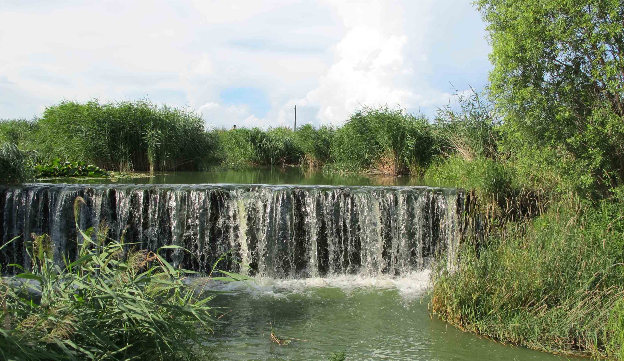
From the Shizhai north exit, the south-line internal road leads about 3 km north-west to Wenpo (温泊, “Warm Pool”), passing the access for Bailongdong (see Hike 5). Wenpo is a low-lying lava-water complex where springs upwell through the lava floor of an old channel to form clear, shallow turquoise pools at a constant 14 °C, with the lava banks above. The signed Wenpo boardwalk is given variously as 1,200 m and 1,800 m and traces a single elongated loop above and beside the water. The combined Longmen Shizhai (about 2.8–4 km) plus Wenpo (about 1.2–1.8 km) plus the connecting service-road footpath if walked rather than shuttled (about 3 km) totals 7–9 km, with very modest cumulative gain.
Why it is essential
This linked walk represents the older, vegetated, and most geomorphologically diverse part of the geopark. Longmen Shizhai is the largest accessible blocky-aa surface in the country and the only one with a fully developed boardwalk allowing walking inside the flow; Wenpo offers the rare combination of clear cold spring water threading through historic lava in a single short circuit. Together they cover the geopark’s “older volcanism + water” themes and provide the most boardwalk distance on the south side without requiring a separate cave or summit excursion.
Equipment
- Closed trail shoes with grip (timbers slick after rain; aa is sharp)
- Sun protection — the open Shizhai plateau gives little shade
- Strong insect repellent (mosquitoes and biting flies, late May to early September)
- 1.5 L drinking water — there is none on-route apart from the ticket pavilions
Hazards and notes
The aa surface is genuinely sharp; minor falls cut hands. Officially marked routes only — stepping off the boardwalks is prohibited and the surface is locally unstable. Snake encounters are uncommon but possible in summer. Shoulder-season visits should account for shortened shuttle hours; if the last shuttle is missed, the connecting road walk to the south gate is feasible but unlit. Storms can close the boardwalk system. Dog access is not permitted in scenic-area attractions.
GPX / KML links
| Source | URL | Format | Notes |
|---|---|---|---|
| OpenStreetMap (Longmen Shizhai boardwalks and Wenpo loop) | openstreetmap.org | OSM data (export GPX) | ODbL 1.0; manual GPX assembly required |
| Wudalianchi UNESCO Global Geopark | wdlcggp.org.cn | Source page | No published GPX |
Trailhead coordinates (approximate, from OSM): Longmen Shizhai 48.620° N, 126.222° E; Wenpo 48.636° N, 126.196° E.
Sources
- Lonely Planet — Longmen Stone Village
- Heihe Municipal Government — Wudalianchi tourism portal
- Ctrip — Longmen Shizhai south-line guide
- China Today — Wudalianchi: A Volcanic Kingdom
3. Yaoquanshan, mineral springs and Bailongchi lakeshore loop
Snapshot
Itinerary
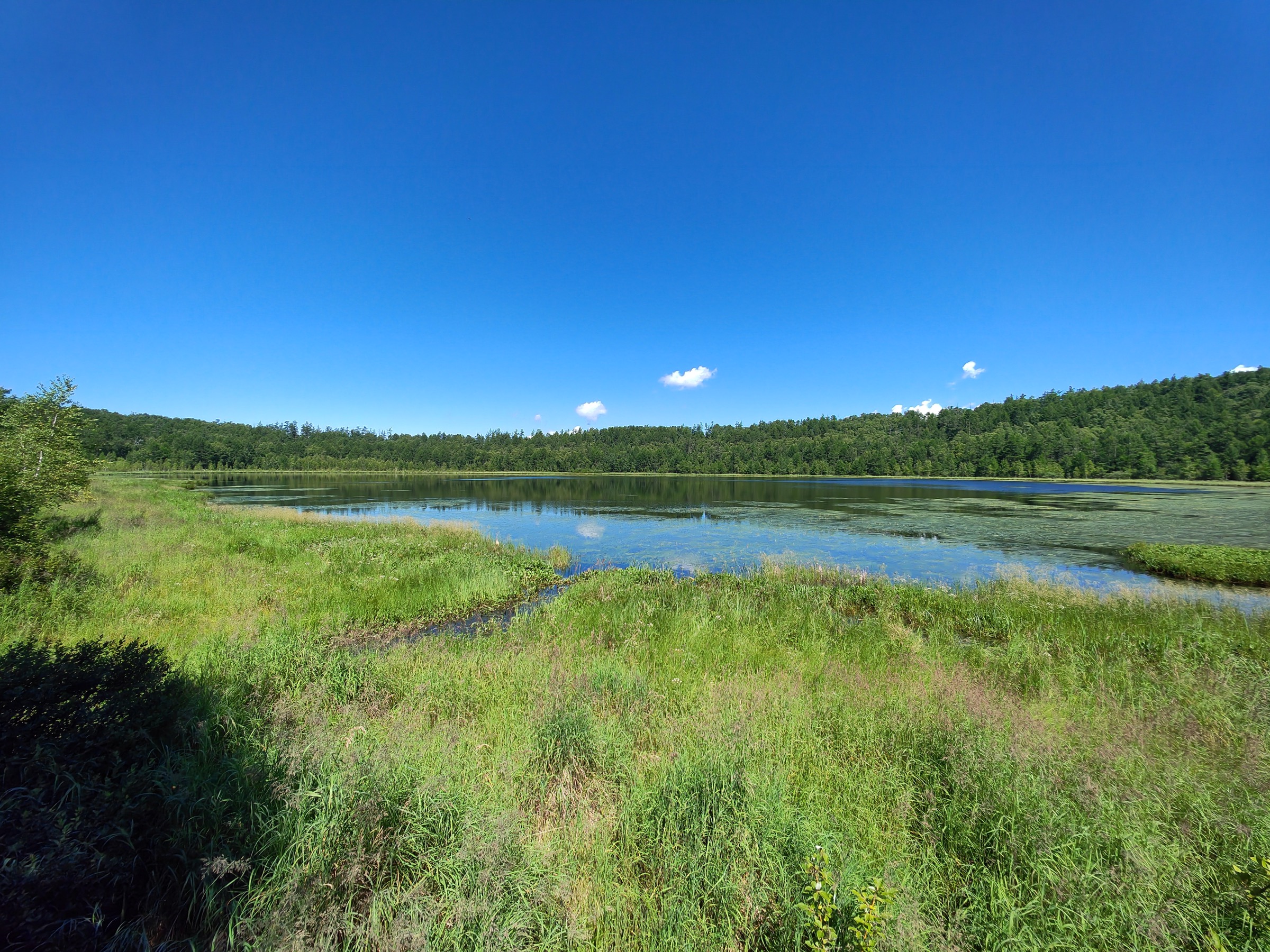
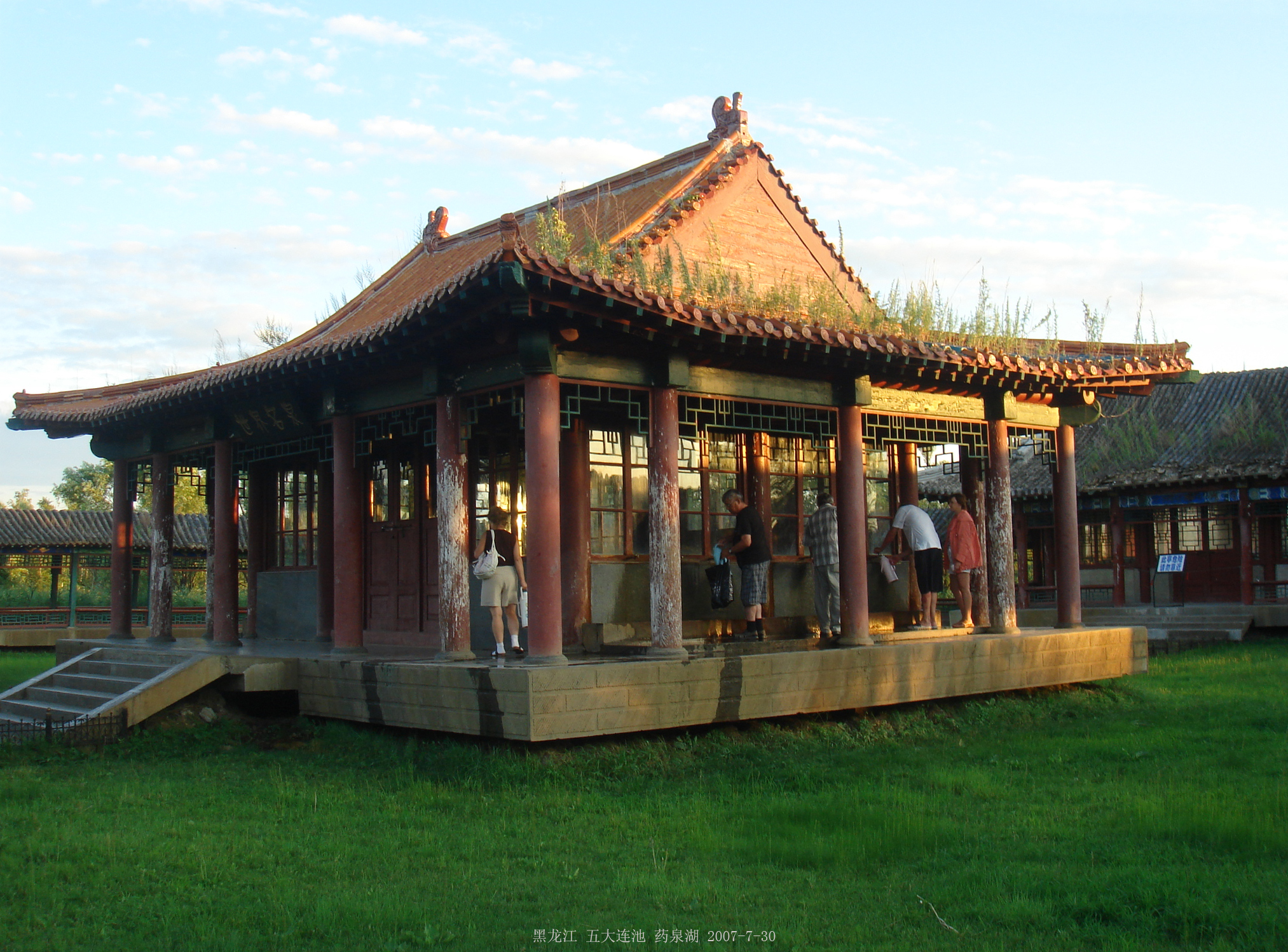
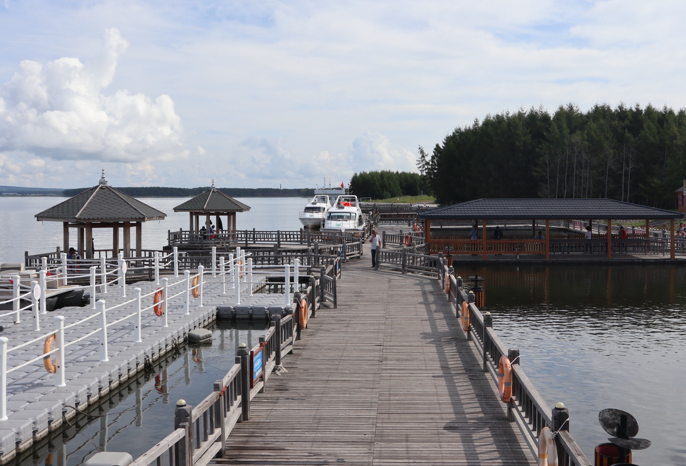
Yaoquanshan (药泉山 / Yàoquánshān, “Medicinal-Spring Mountain”) is the smallest and lowest of the 14 cones, an old eroded shield with a roughly armchair-shaped crater hollow whose floor sits at the level of the surrounding plain. The route begins in the Beiyinquan park, where a 2 km lakeside boardwalk circles the spring pavilion, the Chángshòu Yuán (Longevity Garden), a basalt-arch ceremonial gate, the reed-fringed Yàoquán Hú (药泉湖) wetland, and the Yaoquan Waterfall. The carbonated, iron-rich spring is sampled freely by Chinese visitors filling plastic bottles at the pavilion. A short stair-and-ramp link about 600 m south climbs the gentle east flank of Yaoquanshan to the Zhōnglíng Chán Sì (钟灵禅寺), founded in 1917, destroyed in 1931 and 1943, and rebuilt to its current 1.87 ha footprint; the Moon-Body Hall in the north-west corner enshrines the mummified Bodhisattva Jiǔyè. Temple entry is free. From the temple, the path follows the rim of the shallow crater hollow before descending the south side back toward Yaoquan town and continuing about 2–3 km south-east to the Sānchí Nán-Mǎtóu (三池南码头, South Dock of the Third Lake, Bailongchi) on lakeside paths and short forest stretches. The dock provides views of Bailongchi — the largest of the five barrier lakes — and from here the loop returns by the lakeside walk to the Nányǐnquán (南饮泉, South Drinking Spring) park and back to the Beiyinquan starting point.
Why it is essential
This is the cultural and hydrological circuit of the geopark: the only walk that combines a Buddhist pilgrimage site, the field’s defining cold mineral springs, and lakeshore on Bailongchi without entering a separately ticketed cone attraction. Yaoquanshan is also the only cone with a temple-bearing summit and the only one openly walkable on its old-shield slopes year-round. For visitors with limited time, this is the single best low-strain walk that still conveys the cultural identity of Wudalianchi and the lake-and-spring core that gave the place its UNESCO biosphere-reserve status.
Equipment
- Comfortable walking shoes
- Layered clothing
- 1.5 L water and a small empty bottle for tasting spring water (encouraged at both pavilions)
- Sun protection
- Insect repellent — reed lakeshore is heavily mosquito-bitten in summer
Hazards and notes
The cold mineral water at the spring pavilions is genuinely highly mineralised; drinking very large quantities in one visit is locally discouraged. The temple is an active religious site and visitors are expected to behave respectfully. Pilgrim crowds are very dense around the Holy Water Festival and the route should be reversed or shortened then. Dog access in the spring parks is restricted. Mosquitoes near the lake and reed beds are aggressive; tick precaution is sensible in the forest stretches between Yaoquanshan and Bailongchi.
GPX / KML links
| Source | URL | Format | Notes |
|---|---|---|---|
| OpenStreetMap (Yaoquan town, Beiyinquan park, Yaoquanshan and Sanchi south dock) | openstreetmap.org | OSM data (export GPX) | ODbL 1.0; manual GPX assembly required |
| Wudalianchi UNESCO Global Geopark | wdlcggp.org.cn | Source page | No published GPX |
Trailhead coordinates (approximate): Beiyinquan 48.6526° N, 126.1476° E.
Sources
- UNESCO MAB — Wudalianchi biosphere reserve
- Baidu Baike — 北饮泉 (Beiyinquan)
- Baidu Baike — 五大连池火山
- Ctrip — Yaoquanshan
4. Huoshaoshan, gas-vent cone field and Laoheishan link
Snapshot
Itinerary
Huoshaoshan, 2 km north-east of Laoheishan, is the smaller sibling of the 1721 eruption — a cone rising 73 m above the plateau, with a summit of about 391–392.6 m and a crater 414 m wide and 63 m deep. Unlike Laoheishan, Huoshaoshan has no developed summit trail; the cone is steep, sparsely vegetated, and officially viewed only from the surrounding lava-field boardwalks. The walk starts at the Huoshaoshan north-line shuttle stop and follows the elevated boardwalks that thread the surrounding pahoehoe-to-aa transition flows, routed past the famed gas-vent cone field (喷气锥群 / pēnqì zhuī qún) — clusters of small spatter cones formed where lava-derived gas blew small chimneys out of the cooling crust. These structures are world-significant volcanological features and are heavily signed for interpretation in Chinese and English. The route then crosses south-west along the Stone-Dragon (Shilonghe) boardwalk system into the central plateau between the two new cones, then south to the eastern foot of Laoheishan. Walkers may finish at the Laoheishan car-park and shuttle back, or — for a true day-hike footprint — continue up Laoheishan’s east-flank stair to the crater rim and back, taking the day’s distance to about 9–10 km and the high point to 515.9 m. The whole walk crosses landscapes barely 300 years old, and it is the longest entirely on lava-plateau boardwalk in the geopark.
Why it is essential
This is the only route that walks the full breadth of the 1720–21 eruption product: from the smaller, untouched Huoshaoshan cone through the spatter-cone and gas-vent zone — one of the most geologically significant features of the geopark — across the still-young Stone-Dragon plateau, and up the larger Laoheishan cone. It also resolves the day-hike-length problem: Huoshaoshan on its own offers only a short viewing loop, but linked to Laoheishan it becomes a credible full-day walk that covers most of the geopark’s youngest landscape. Bear in mind that the link itself is informal: the route exists as a stitched-together sequence of officially signed boardwalks rather than as a single named trail, and the shuttle-led visitor flow means most other walkers will leapfrog the connection on the bus.
Equipment
- Closed shoes with stiff soles for long boardwalk-and-stair sections
- Sun hat and high-factor sunscreen — almost no shade
- Weatherproof layer (the plateau is very exposed)
- 2 L water minimum (none on the plateau)
- Insect repellent
- Trekking poles useful for the Laoheishan east-flank stair finish
Hazards and notes
The greatest hazard is the boardwalk-only access rule: the gas-vent cone field has a number of structures with thin lava roofs over voids, and rangers strictly enforce the rule that walkers do not leave the boardwalks. Some of the lava plateau is also home to nesting birds in summer and is closed periodically; check current closures at the gate. Sun and wind exposure on the open plateau is significant. Lightning storms are not uncommon in July–August and the boardwalk is the highest local point; if a storm is building, return to a shuttle stop. The linked walk depends on shuttle timings; the last shuttle of the day on the north-line is typically around 17:30 in peak season.
GPX / KML links
| Source | URL | Format | Notes |
|---|---|---|---|
| OpenStreetMap (Huoshaoshan boardwalk and Stone-Dragon lava paths) | openstreetmap.org | OSM data (export GPX) | ODbL 1.0; manual GPX assembly required |
| Wudalianchi UNESCO Global Geopark | wdlcggp.org.cn | Source page | No published GPX; visitor flow is shuttle-led and not GPX-tracked |
Sources
- Smithsonian Global Volcanism Program — Wudalianchi
- Wikipedia — Wudalianchi volcanic field
- Ctrip — Huoshaoshan attraction page
- Tourism XP — Wudalianchi Geopark guide
5. Bailongdong lava tube to Wenpo and Sanchi lakeshore traverse
Snapshot
Itinerary
The walk starts at the Bailongdong entrance on the south-line. Bailongdong is the longest volcanic lava tube currently developed for visitors in China, with a total cavern length of about 515 m of which 365 m is open as a walking route and a further 150 m is reserved for adventure-tour access only. The cave is an old lava tube formed in a Pleistocene flow; because part of its floor sits in permafrost-cold rock, the inside maintains an average temperature around −12 °C year-round, and freshly-formed ice crystals, lava-rope flow surfaces and arch-roof drip features are interpreted along the developed walk. The nearby Shuǐjīnggōng (水晶宫, “Crystal Palace”) ice cave is shorter — about 150 m — and stays around −5 °C; some itineraries combine the two. Allow about 60–90 minutes inside the caves with photography stops. From Bailongdong the route follows the south-line service road and short forest boardwalks roughly 2 km east to Wenpo, where a 1.2–1.8 km signed loop traces the lava-channel pools and the upper lava banks (see also Hike 2). From Wenpo, signed paths and the lakeshore service track lead about 3 km north-east to the Sanchi (Bailongchi) south dock, with views across the lake to the southern flanks of Laoheishan. The route ends at the dock, where shuttle service returns visitors to the south gate.
Why it is essential
This is the only walk in Wudalianchi that combines a lava-tube interior, a lava-water boardwalk and an open lakeshore in a single linked day. It covers two of the most distinctive geological products in the park — the permafrost-cooled lava tube and the spring-fed Wenpo channels — and ends with the only walkable shore segment on the largest of the five lakes. For visitors who have already done Laoheishan and want a contrasting day, this is the natural choice. No licence-compatible photograph of the Bailongdong cave interior was located in this pass, so the cave itself is illustrated only by the external boardwalk imagery here.
Equipment
- Standard hiking equipment plus an extra warm layer and gloves for the cave
- Head torch — railings and lighting are installed in the developed section but supplementary light helps for photography
- Closed shoes with grip — the cave floor has ice patches even in summer
- Outside the cave: sun protection, 1.5 L water, insect repellent
Hazards and notes
The cave develops slippery ice underfoot even in midsummer; railings and lighting are installed in the developed section but the surface is uneven. Visitors with claustrophobia or limited mobility should reconsider the cave segment. The cave is closed after heavy rain because of localised drip and refreeze hazards; check at the gate before paying the joint-ticket cave supplement. Outside, mosquitoes and ticks are intense on the lakeshore between Wenpo and the Sanchi dock in summer. The signed route is the only legal route — there is no swimming or off-trail access permitted on the lake or its margins, which are part of the strictly managed biosphere reserve.
GPX / KML links
| Source | URL | Format | Notes |
|---|---|---|---|
| OpenStreetMap (Bailongdong, Wenpo, Sanchi south dock) | openstreetmap.org | OSM data (export GPX) | ODbL 1.0; manual GPX assembly required |
| Wudalianchi UNESCO Global Geopark | wdlcggp.org.cn | Source page | No published GPX |
Sources
- Travel China Guide — Wudalianchi Global Geopark
- IntechOpen — A Review of Chinese Ice Caves
- Tourism XP — Wudalianchi guide (Bailongdong, Shuijinggong)
- Trip.com — Wenpo entry
External links
| Source | URL |
|---|---|
| UNESCO Global Geoparks — Wudalianchi | unesco.org |
| UNESCO Man and the Biosphere — Wudalianchi | unesco.org |
| UNESCO Tentative List — Wudalianchi Scenic Spots | whc.unesco.org |
| Smithsonian Global Volcanism Program — Wudalianchi (VN 305030) | volcano.si.edu |
| Wudalianchi UNESCO Global Geopark (official, English) | wdlcggp.org.cn |
| Wudalianchi Scenic Area (official, Chinese) | chinawdlc.org.cn |
| Heihe Municipal Government — Wudalianchi tourism portal | heihe.gov.cn |
| Wikipedia — Wudalianchi volcanic field | en.wikipedia.org |
| John Seach — Wudalianchi Volcanic Field | volcanolive.com |
| VolcanoDiscovery — Wudalianchi | volcanodiscovery.com |
| Oregon State Volcano World — Wudalianchi | volcano.oregonstate.edu |
| Travel China Guide — Wudalianchi | travelchinaguide.com |
| Tourism XP — Wudalianchi Geopark guide | tourismxp.com |
| OpenStreetMap area view of Wudalianchi | openstreetmap.org |
| Wikimedia Commons — Category:Wudalianchi | commons.wikimedia.org |