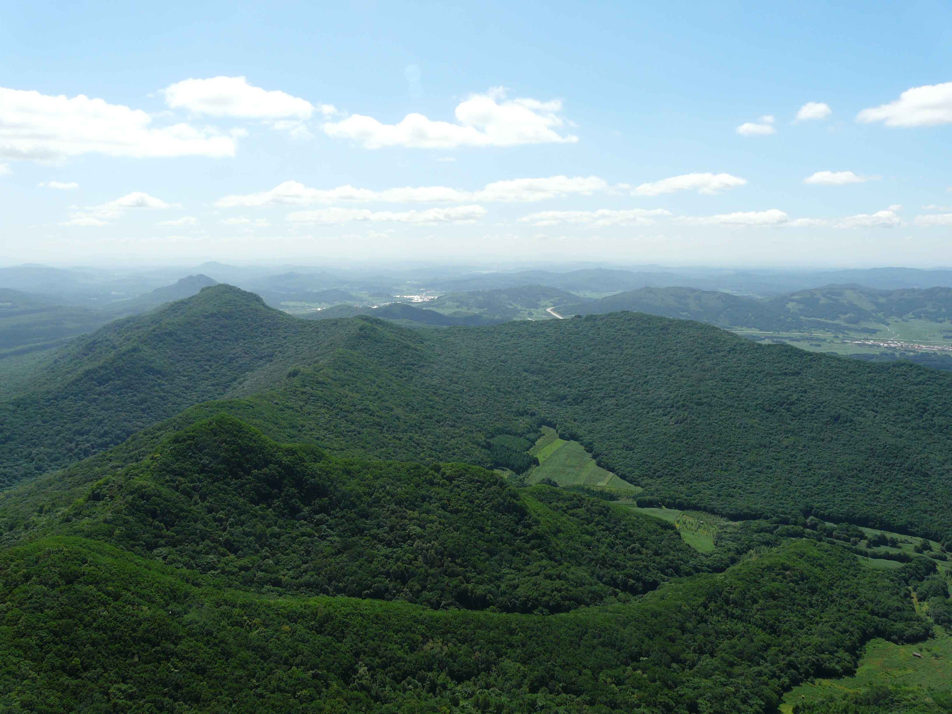
Regional overview
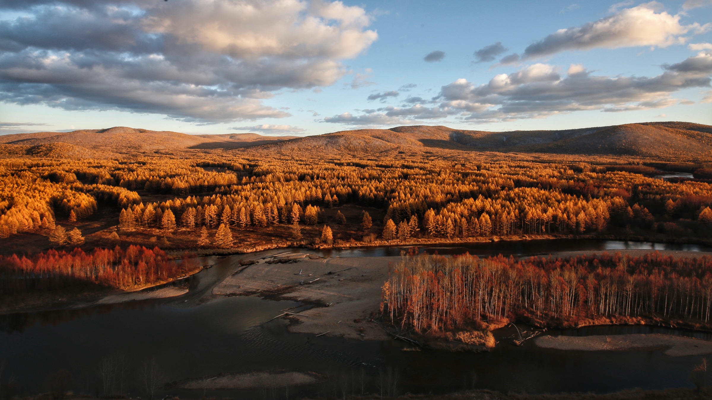
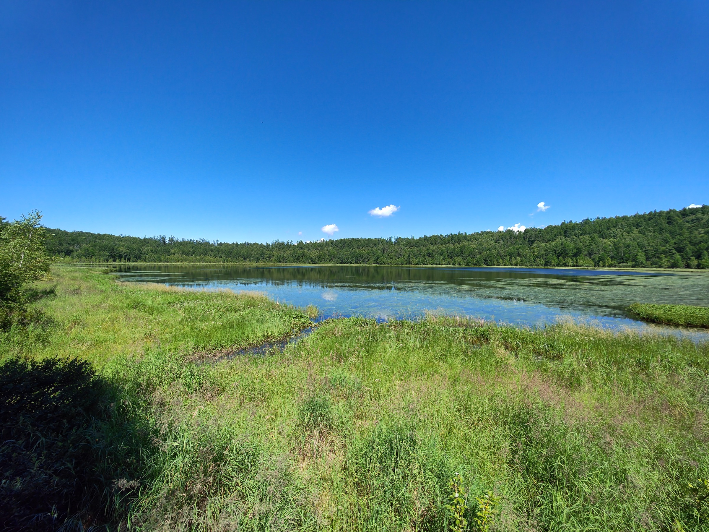
The Lesser Khingan — Xiaoxing’anling (小兴安岭 / Xiǎoxīng’ānlǐng) — is a low, heavily forested mountain belt that runs roughly northwest to southeast across northern Heilongjiang, from the Amur (Heilongjiang) River near Heihe down to the Songhua basin north of Harbin. The range is generally given a length of around 400–500 km and a maximum elevation of 1,429 m at Pingdingshan (平顶山), although the bulk of the topography sits between 400 m and 1,000 m. Geologically it mixes Mesozoic granite tors, Jurassic acid volcanics and Cenozoic basalt flows, all heavily mantled with conifer–broadleaf forest. Together with the Greater Khingan (Daxing’anling) to the northwest and the Sikhote-Alin and Russian Lesser Khingan across the Amur, it forms the southern edge of the Eurasian boreal-temperate transition belt — the South Manchurian taiga ecoregion. Off the boardwalks the forest interior is genuinely close to Russian Far East taiga in structure: tall Korean pine over Manchurian fir, Yeddo spruce, Mongolian oak, Manchurian ash and Amur linden, with a dense shrub layer of hazel, Maximowicz honeysuckle and dwarf bamboo.
The ecological signature species of the range is the Korean pine (红松 hóngsōng, Pinus koraiensis), and the Lesser Khingan holds what is generally described as the most extensive and best-preserved natural broad-leaved/Korean pine mixed forest left in Asia. Two national-level reserves protect the core stands — Fenglin (凤林国家级自然保护区 / Fènglín) and Liangshui (凉水国家级自然保护区 / Liángshuǐ) — and Fenglin was admitted to the UNESCO Man and the Biosphere (MAB) network in 1997. The same forest supports brown bear (Ursus arctos), Asiatic black bear, wild boar, sika and red deer, sable, lynx, and an attempted re-colonisation corridor for the Amur tiger out of Russia. Yichun (伊春市 / Yīchūn) — branded “China’s Forest Capital” — administers most of the productive Chinese side of the range and is the natural base for nearly every hike below. The city has commercial flights via Yichun Lindu Airport (LDS, opened 2009) with connections from Harbin, Beijing and a handful of other domestic hubs, plus overnight trains from Harbin (roughly 6–9 hours depending on service).
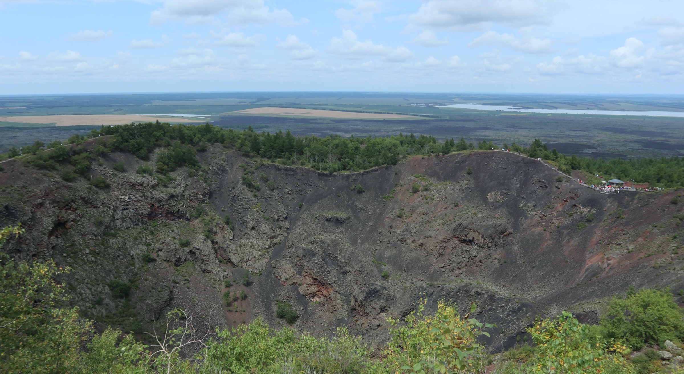
Tangwanghe National Park (汤旺河 / Tāngwànghé), gazetted in 2008, is the headline conservation achievement of the range: it was the first protected area in China to carry the “国家公园” (national park) label, predating by nearly a decade the Sanjiangyuan, Wuyishan and Giant Panda national-park pilots. The park combines a granite tor “stone forest” — closer in feel to the Bohemian Switzerland sandstone labyrinths or Korean Wolchulsan than to the Yunnan Stone Forest — with primary larch and Korean pine stands along the upper Tangwang River. The Russian Khingansky Zapovednik, across the Amur in Amur Oblast, protects a similar mosaic of taiga, Korean pine forest and Amur wetlands, but Russian access is dominated by zapovednik permits and field-station science rather than waymarked day-hikes, whereas the Yichun side has invested heavily in boardwalks, sightseeing trains, observation towers and 4A/5A scenic-area infrastructure that resemble Japanese kokuritsu-koen visitor zones more than wilderness trail systems.
The practical hiking season is May to early October. Snow is reliable on the ground from November through April; spring thaw and snowmelt typically clears the trail boardwalks by mid-May. The classic window for foliage colour is early to mid September, when the Mongolian oaks, maples and birches turn before the conifers darken; this is also the most popular and busiest week for domestic visitors. Two serious health hazards shape the kit list: tick-borne encephalitis (森林脑炎 / sēnlín nǎoyán) is endemic across the Lesser Khingan, with peak activity April–October and a confirmed history of clinical cases in forestry workers; and the mosquito and biting-fly densities in mid-summer (late June to early August) are notorious even by Russian taiga standards. Bears are present in every reserve discussed below but encounters on the developed trail networks are very rare. Solo wilderness travel off the boardwalks is generally not permitted inside the reserves.
Selection rationale
The five chosen hikes give a representative cross-section of the range rather than five repeats of the same forest stroll. Tangwanghe Stone Forest is the granite tor showpiece of China’s first national park and the single most-photographed walk in the range. The Wuying Korean Pine Garden boardwalk is the canonical walk through the largest contiguous primary Korean pine stand on the Chinese side, with a long suspended boardwalk through 500-year-old trees. The Wuyiling Tianchi loop is the standard touring circuit through the same operator complex, balancing forest density with open water and a high observation tower. Fenglin Biosphere Reserve is the scientifically essential entry: the only UNESCO MAB-listed site of the Lesser Khingan, included even though independent visits are constrained. Maoershan, at the southern tail of the range, is the most-climbed single peak near Harbin and the only entry with genuine top-out views above the canopy.
This mix covers granite/karst-like terrain, primary Korean pine forest, wetland-with-pine ecotone, strict-protection biosphere reserve, and an actual summit. Three of the five cluster around Yichun city; Maoershan sits at the southern tail of the range, two hours by road from Harbin.
Independent verification of route data for the Chinese Lesser Khingan is unusually thin. OpenStreetMap, Komoot, Wikiloc and AllTrails coverage of the internal boardwalk and trail networks is partial to nil; Chinese tourism sites typically present “play time” (游玩时间 / yóuwán shíjiān) rather than measured route length. All five entries below should be read as candidate routes — distances, gains and maximum elevations are interpolated from operator narratives, base mapping and topographic inference and are explicitly labelled as approximate. No GPX or KML files have been located for any of the five hikes.
Summary table
| # | Hike | Country | Route type | Distance | Gain | Max elevation | Difficulty |
|---|---|---|---|---|---|---|---|
| 1 | Tangwanghe Stone Forest grand circuit | China | Loop (shuttle-assisted option) | ~8–12 km | ~300–450 m | ~520 m | Easy–moderate |
| 2 | Wuying Korean Pine Garden boardwalk loop | China | Loop (forest train option) | ~5–8 km | ~80–150 m | ~400 m | Easy |
| 3 | Wuyiling Tianchi & Songxiang Bridge loop | China | Loop | ~6–7 km | ~150–200 m | ~430 m | Easy |
| 4 | Fenglin Biosphere Reserve visitor walk | China | Out-and-back (guided) | ~3–5 km | <100 m | ~480 m | Easy (permit-restricted) |
| 5 | Maoershan main summit | China | Out-and-back | ~7–9 km | ~450–550 m | 805–808 m | Moderate |
1. Tangwanghe Stone Forest grand circuit (汤旺河林海奇石景区)
Snapshot
Itinerary
The scenic area entrance sits on the north bank of the Tangwang River and is divided by the operators into six named zones: Yi Xian Tian (一线天, “One-Line Sky”), Linhai Guanyin (林海观音, “Forest-Sea Avalokitesvara”), Tranquil Valley (幽静谷 / Yōujìnggǔ), Adventure Valley (探险谷 / Tànxiǎngǔ), the Korean Pine Garden (红松园 / Hóngsōngyuán) and the Botanical Garden (植物园 / Zhíwùyuán). The grand circuit links all of them, mostly along graded boardwalk with occasional granite-step climbs onto the tor tops.
From the entrance the walking route follows the riverside boardwalk for around 1.5 km to the Yi Xian Tian gateway, where two ~20 m granite blocks stand 60 cm apart, forming the iconic “one line of sky” slot. The path threads the slot and climbs by stone staircase onto the Mile Feng (弥勒峰, “Maitreya Peak”) ridge, with platform views across the dark Korean pine canopy. From Maitreya the route descends counterclockwise into Adventure Valley, a steeper section with railings and short ladder-stepped passages between the tors, then drops to the Linhai Guanyin viewpoint, named for a large weathered tor that — from a marked angle — resembles a standing Avalokitesvara figure. A boardwalk known locally as the “oxygen-bar corridor” (氧吧长廊 / yǎngbā chángláng) traces the contour back through tall Korean pine, exiting near the One-Line Sky shuttle stop where visitors can either rejoin the river path back to the gate or take the internal shuttle to the Botanical Garden and Korean Pine Garden zones for an extension.
Why it is essential
Tangwanghe is the only granite tor “stone forest” of national-park rank in the Chinese northeast, and is the type-site for the geological landscape the China Geopark system labels “Xiaoxing’anling-style granite stone forest” (小兴安岭式花岗岩石林). The park’s 2008 designation as China’s first national park gives the walk historical-administrative weight beyond its scenery: this is where the Chinese protected-area system began experimenting with single-agency management, signage and visitor-flow control modelled loosely on US and Japanese national parks. The combination of granite tors, primary Korean pine stand and an accessible boardwalk grid makes it the single best half-day introduction to the range.
Equipment
- Trail shoes or light boots
- Weatherproof shell and warm layer
- 1.5–2 L water and food
- Sun protection
- Strong insect repellent (DEET or icaridin) June–August; head-net useful in July
- Long trousers tucked into socks; permethrin-treated clothing where possible (tick-borne encephalitis is endemic)
- Light traction (microspikes) only relevant before mid May or after mid October when the boardwalks may ice
Hazards and notes
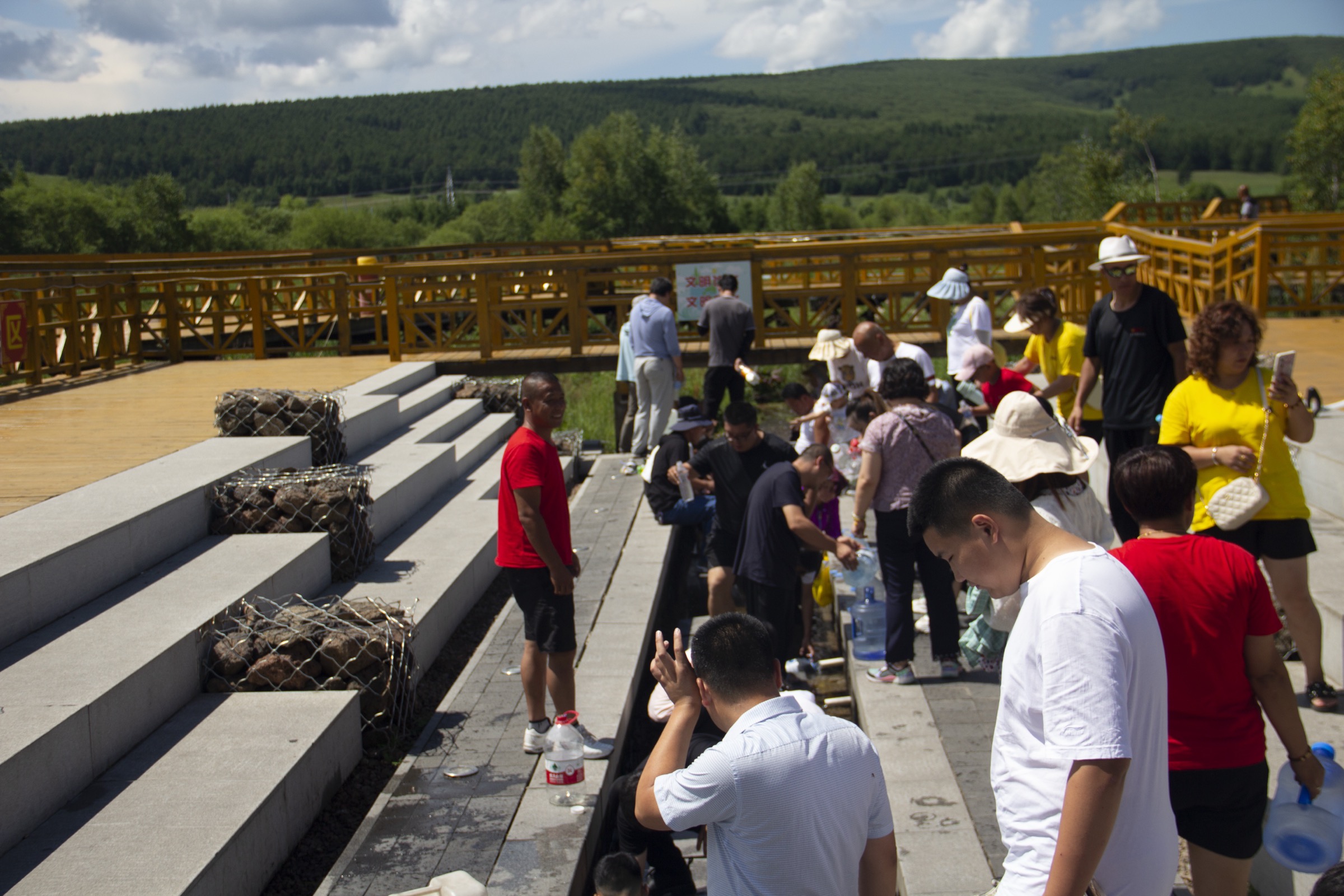
The granite tor staircases are exposed to drop-offs of up to ~20 m but are railed throughout. Afternoon thunderstorms are common in July and August. Tick-borne encephalitis vaccination is recommended for any extended forest-floor activity in this region; mosquitoes in July can be overwhelming. The scenic area is gated and ticketed; opening hours and last-entry times shift seasonally and should be confirmed with the Tangwanghe management office before travel. The area is bear range but boardwalk encounters are very rare. Dogs are not permitted. The internal shuttle timetable has not been independently verified for the current season — shuttle availability affects the practical walking distance significantly.
Trailhead coordinates (approximate): 48.45° N, 129.57° E (Tangwanghe Linhai Qishi scenic area entrance). No licence-compatible site-specific image was located in research; no GPX track has been published. OpenStreetMap coverage of the scenic area’s internal boardwalks is sparse.
Sources
- Heilongjiang Provincial People’s Government — 汤旺河林海奇石景区
- China.org.cn — Tangwanghe National Park: a river runs through it
- Travel China Guide — Tangwanghe National Park, Yichun, Heilongjiang
- LoongWander — Tangwang River Linhai Qishi Scenic Area
2. Wuying Korean Pine Garden boardwalk loop (乌马河红松林木栈道)
Snapshot
Itinerary
The operator’s standard tour route runs: park gate → Shaoqi No. 1 ancient pine (烧旗1号 / Shāoqí Yīhào) → Songxiang Bridge (松乡桥 / Sōngxiāngqiáo) → Guantao Tower (观涛塔 / Guāntāotǎ) → Lüxian Yuan (绿仙苑, “Green Fairy Residence”) → Tianci Lake (天赐湖 / Tiāncìhú) → garden-in-garden (园中园) → Xiangshui Stream (响水溪 / Xiǎngshuǐxī) → forest-bath loop → optional Heixialing (黑瞎岭, “Black-bear Ridge”) spur → exit. The walk runs almost entirely on raised wooden boardwalk through pure Korean pine stand, with single-stem trunks of 30–37 m and crown diameters of nearly a metre; the oldest documented tree in the park is over 500 years old.
Songxiang Bridge is a wooden suspended walkway raised several metres above the forest floor and is the route’s photogenic centrepiece. Guantao Tower is a steel-framed observation platform that gives the only over-canopy view of the day, oriented north toward the Wuyiling wetland basin. The Tianci Lake section opens the canopy briefly across a small pond before the trail re-enters the pines toward Xiangshui Stream. Heixialing is a short ridge extension whose name — literally “Black-bear Ridge” — reflects local Asiatic black bear sightings; it is closed periodically for wildlife reasons.
Why it is essential
This park is widely cited as containing the largest contiguous primary Korean pine stand still on the Chinese side of the range. The walk is the cleanest single experience of the broad-leaved/Korean pine forest community type that defines the Lesser Khingan ecoregion. From a scientific tourism perspective it is a sister site to Fenglin Biosphere Reserve, but with significantly more accessible visitor infrastructure: a network of boardwalks, an observation tower, a narrow-gauge forest train and well-developed signage.
Equipment
- Trail runners or light shoes (the boardwalk is forgiving outside spring thaw)
- Rain shell and warm layer
- 1.5–2 L water and food
- Insect repellent (essential June–August)
- Tick-bite precautions
- Lightweight binoculars — Wuying is a noted birding stop for hazel grouse, Siberian rubythroat and several woodpecker species
Hazards and notes
The park gate is ticketed. The internal forest train operates seasonally and on a fixed schedule; check before relying on it as a return option. Asiatic black bear and brown bear are both present in the wider district, although boardwalk encounters are very rare. The boardwalk surface becomes slick in rain. Tick-borne encephalitis exposure risk is the same as elsewhere in the range — assume year-round caution from April to October. Dogs are not permitted. The operator complex straddles district boundaries and is variably referred to as Wuying National Forest Park, Wuyiling National Forest Park, and the Wuying Red Pine Forest Scenic Area; ticketing arrangements between the boardwalk loop (this entry) and the Tianchi loop (Hike 3) should be confirmed at the gate.
Trailhead coordinates (approximate): 48.51° N, 129.27° E (Wuying National Forest Park gate). No licence-compatible site-specific image was located in research; no GPX track has been published. OSM coverage of internal boardwalk segments is partial; the perimeter forest road is mapped.
Sources
- Trip.com — Wuying National Forest Park
- Xinhua — Scenery of Wuying National Forest Park in China’s Heilongjiang
- Shanghai Birding — Birding the Lesser Khingan Mountains of Heilongjiang
3. Wuyiling Tianchi and Songxiang Bridge loop (五营天池–松乡桥)
Snapshot
Itinerary
This loop is the most commonly walked variant inside Wuying / Wuyiling National Forest Park — the same operator complex as Hike 2, but treated separately because the Tianchi pond circuit is regularly marketed and signed as its own day-circuit and because some visitors do the Tianchi loop without the longer Korean pine boardwalk.
From the main car park the route follows a graded forest road for the first 600 m before joining the wooden boardwalk system at Songxiang Bridge — a wooden suspended walkway over a stream gully, the most photographed structure in the park. The boardwalk climbs gently to Guantao Tower (观涛塔), a steel observation platform with views over an unbroken Korean pine canopy north toward the Wuyiling wetlands. From the tower the route drops back along a parallel boardwalk to Tianci Lake (天赐湖, “Heaven-bestowed Lake”), a small forest pond ringed by fir and pine. Continuing south, the loop passes through Xiangshui Stream (响水溪, “Echo Stream”) and exits via the Lüxian Yuan ornamental garden back to the park gate.
Why it is essential
The Tianchi/Guantao loop is the standard one-day visitor experience of the largest contiguous protected Korean pine forest in China and is widely treated by the Heilongjiang Forestry Administration’s promotional materials as the canonical introduction to the Lesser Khingan boreal landscape. The short ascent to Guantao Tower is the only over-canopy view in this list besides Maoershan, and is the easier of the two by a wide margin. The loop’s stream-pond-canopy sequence shows the wetland ecotone that distinguishes the Chinese Lesser Khingan from the drier Greater Khingan immediately to the west.
Equipment
- Trail shoes or light boots
- Rain shell and warm layer
- 1.5–2 L water
- Insect repellent and tick-prevention measures
- Trekking poles optional — most visitors do without them on this graded boardwalk
Hazards and notes
Same biological hazards as Hike 2 — bears in the wider district, mosquitoes in July, tick-borne encephalitis exposure across the warm season. Park entry is ticketed and gates close at dusk. The Guantao Tower is steel-framed with steep stairs and can be slippery in rain. No dogs permitted. Booking is not currently required for day entry but the operator may impose visitor caps during the September peak.
Trailhead coordinates (approximate): 48.11° N, 129.25° E (Wuying / Wuyiling forest park area). No licence-compatible site-specific image was located in research; no GPX track has been published.
Sources
- Trip.com — Wuying National Forest Park
- Travel China Guide — Yichun Heilongjiang
- Wanderlog — Wuying National Forest Park
4. Fenglin Biosphere Reserve visitor walk (凤林国家级自然保护区参观线路)
Snapshot
Itinerary
Fenglin is a strict-protection national-level nature reserve and a UNESCO MAB Biosphere Reserve (admitted 1997). The reserve area is 28,500 ha, of which around 64% is Korean pine forest, including stands more than 300 years old with trunks up to 1.4 m in diameter and 37 m tall. The reserve is closed to general independent visitors but operates a guided visitor route through a designated experimental/buffer zone for educational groups, including university field courses.
The visitor walk begins at the gated entrance and follows a marked path through what is described in reserve literature as “natural-state primary Korean pine forest,” with stops at named champion trees, an interpretive station, and a viewing platform onto an old-growth stand. Total walking distance is short — typically less than 5 km — and elevation change is minimal because the visitor route stays close to the reserve’s eastern edge. Independent off-trail exploration is not permitted.
Why it is essential
Fenglin is the only UNESCO MAB-listed site of the Lesser Khingan and the scientifically central reference site for the broad-leaved Korean pine forest ecosystem. For a balanced regional catalogue, omitting Fenglin would be a serious gap; for any reader interested in the ecological story of the range, even the short controlled visitor walk is the single most informative few hours in Yichun. The catch is that this is not a freely accessible day hike — entry is conditional on advance arrangement with reserve administration or via an established Chinese ecotourism operator. Independent walkers should treat this entry as a reference rather than a drop-in itinerary.
Equipment
- Trail shoes; quiet clothing and footwear (the reserve hosts research stations whose work may be ongoing)
- Rain shell and warm layer
- 1.5 L water
- Strong insect repellent (essential)
- Tick precautions (essential)
- Camera (permitted on the visitor route; tripods may require advance approval)
Hazards and notes
Access is the principal “hazard”: independent visits without prior arrangement may be refused at the gate. Brown bear, Asiatic black bear and Amur tiger (extremely rare, but documented from camera-trap surveys across the wider corridor) are present in the reserve interior; encounters on the visitor route are very rare but the route is guided in part for this reason. Tick-borne encephalitis exposure risk is the same as the rest of the range. Drones are not permitted. Dogs are not permitted.
Reserve area centroid (approximate): 48.10° N, 128.96° E. No licence-compatible site-specific image was located in research; no GPX track has been published, and the visitor-zone path is not on OSM at any meaningful resolution.
Sources
- UNESCO Man and the Biosphere Programme — Fenglin
- International Alliance of Protected Areas — Fenglin National Nature Reserve
- BirdLife International Data Zone — Fenglin Nature Reserve
- China Culture — Fenglin National Nature Reserve
5. Maoershan main summit (帽儿山主峰)
Snapshot
Itinerary
Maoershan (“Hat Mountain”) is the most-climbed accessible summit in the southern Lesser Khingan and the highest peak in the immediate Harbin region. The trailhead sits in the experimental forest of Northeast Forestry University — the university’s Mao’ershan Forest Ecosystem National Field Science Observation and Research Station, which has operated here for decades. The mountain is composed of Jurassic medium-acid volcanic rock, giving it a more rounded, less tor-dominated profile than Tangwanghe.
From the gate the route follows a forest road for the first ~1.5 km through second-growth oak and birch before entering the climbing trail proper. The ascent is steady, gaining altitude on switchbacks through Mongolian oak, Korean pine and Manchurian ash. Roughly two-thirds of the way up the path narrows and steepens onto the summit cone. The top is open, with a small platform; the official summit elevation is variously given as 805 m or 808 m and the precise figure remains unconfirmed against an authoritative topographic map. A spring on the upper slope is widely cited as the highest-elevation natural spring in Heilongjiang. Descent is by the same route. A separate winter ski operation uses the lower north flank between approximately 318 m and 626 m — irrelevant in the hiking season but useful for orientation when reading maps.
Why it is essential
Maoershan is the only entry in this list that delivers a genuine summit experience with above-canopy views and a clear topographic objective. It is the most-climbed peak in the range by a very wide margin, with serious local recognition: Northeast Forestry University students treat it as a rite of passage, and it is the only Lesser Khingan summit that appears reliably in Harbin-based weekend hiking guides. It also represents the southern, drier, more oak-dominated end of the range — a useful contrast to the Korean-pine-heavy parks further north.
Equipment
- Sturdy boots or stiff trail shoes (loose-step sections near the summit)
- Trekking poles recommended for the descent
- Warm layer and shell — the summit is exposed and weather can change quickly
- 2 L water, food, sun protection
- Headtorch for any late-season ascent
- Microspikes from late October through April for ice on the upper slope
- Insect repellent and tick precautions in summer
Hazards and notes
The summit cone is the steepest section and can be slippery when wet or icy. Lightning exposure is a real risk in July–August thunderstorms; descend below the summit at the first sign of build-up. Bear and wild boar are present in the wider experimental forest but encounters on the trail are uncommon. The scenic area is ticketed and gates close at dusk. The ski operation occupies the north flank in winter; off-piste descents from the summit into the ski area are not advisable. Dogs may be restricted at the gate; confirm at the ticket office.
Trailhead coordinates (approximate): 45.39° N, 127.65° E (Maoershan scenic area gate). No licence-compatible site-specific image was located in research — Commons coverage of the Heilongjiang Maoershan (as distinct from the Guangxi peak of the same name) appears very thin. No GPX track has been published; OSM has the summit point and a partial forest road but the summit trail itself is not currently mapped at usable detail.
Sources
- Trip.com — Maoer Mountain
- Mindat — Mao’er Shan, Heilongjiang Sheng, China
- TripAdvisor — Maoer Mountain (Shangzhi)
- Northeast Forestry University — About the University
External links
| Source | URL |
|---|---|
| UNESCO MAB — Fenglin biosphere reserve | unesco.org |
| Heilongjiang Provincial People’s Government — Tangwanghe Linhai Qishi | hlj.gov.cn |
| Northeast Forestry University | en.nefu.edu.cn |
| Travel China Guide — Yichun, Heilongjiang | travelchinaguide.com |
| Travel China Guide — Yichun Lindu Airport | travelchinaguide.com |
| Wikipedia — Lesser Khingan | wikipedia.org |
| Wikipedia — Pinus koraiensis | wikipedia.org |
| PeakVisor — Lesser Khingan | peakvisor.com |
| BirdLife International — Fenglin IBA factsheet | datazone.birdlife.org |
| Shanghai Birding — Birding the Lesser Khingan Mountains | shanghaibirding.com |
| Pang et al. (2023) — Is the Lesser Khingan Suitable for the Amur Tiger Restoration? | mdpi.com |
| OpenStreetMap (ODbL 1.0) | openstreetmap.org |