Regional overview
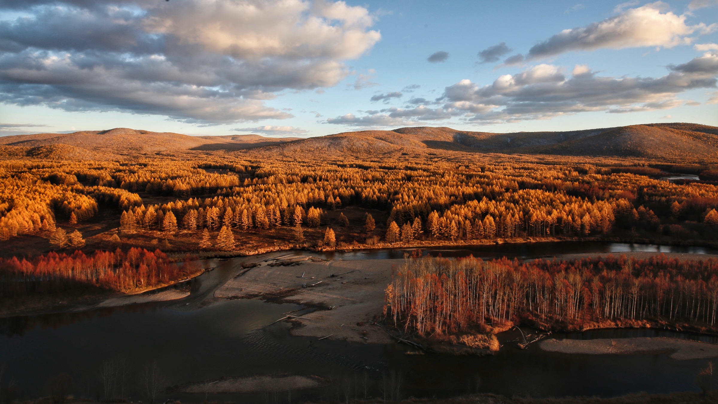
The Greater Khingan — Daxing’anling (大兴安岭, “Da Hinggan Ling”) in Mandarin, Yehe-yin Hinggan Daban in Mongolian, Joo-shilada in Oroqen — is the long, low, almost continuously forested range that defines the northeastern margin of the Mongolian Plateau. It runs roughly 1,200 km north–south, from the Mongolian border near Manzhouli up to the Heilongjiang (Amur) River, with most ridge crests between 700 m and 1,400 m and the highest peaks around 1,500–1,529 m. This article covers only the northern boreal-forest core: the high-latitude Larix gmelinii (Dahurian larch) taiga that occupies northeastern Inner Mongolia (Hulunbuir’s Genhe, Ergun and Ewenki banner uplands) and the slim Heilongjiang sliver — Daxing’anling Prefecture — that pokes north past 52° N. The southern volcanic edge at Arxan, the Hulunbuir grassland transition, and the Lesser Khingan (Xiaoxing’anling) sit in sibling articles.
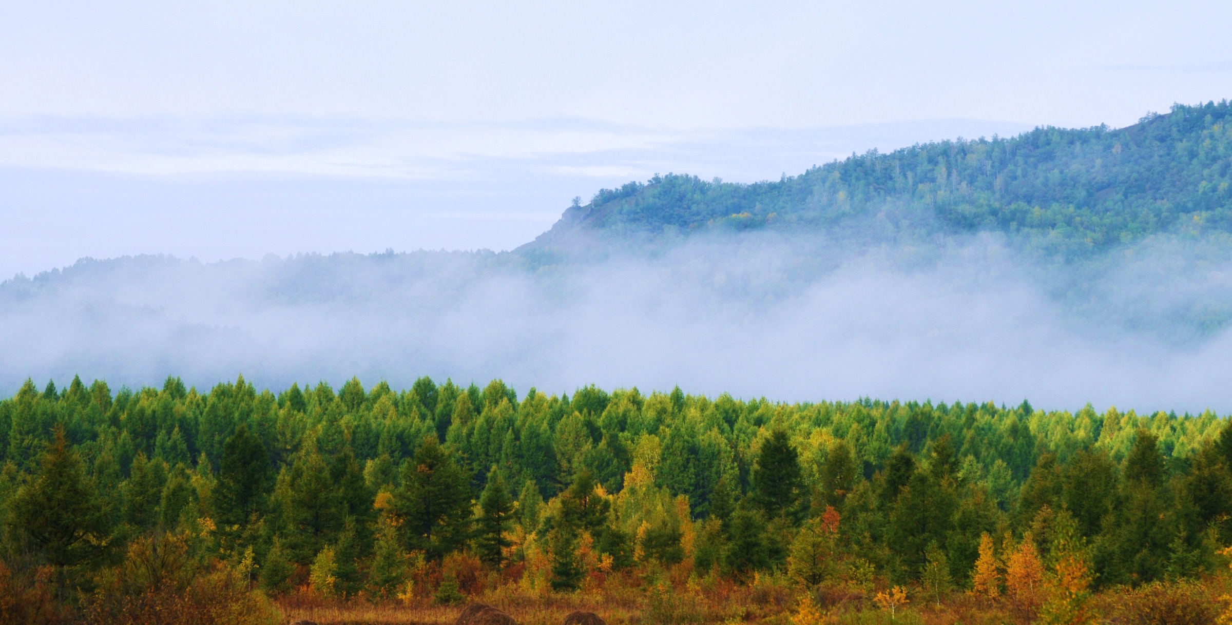
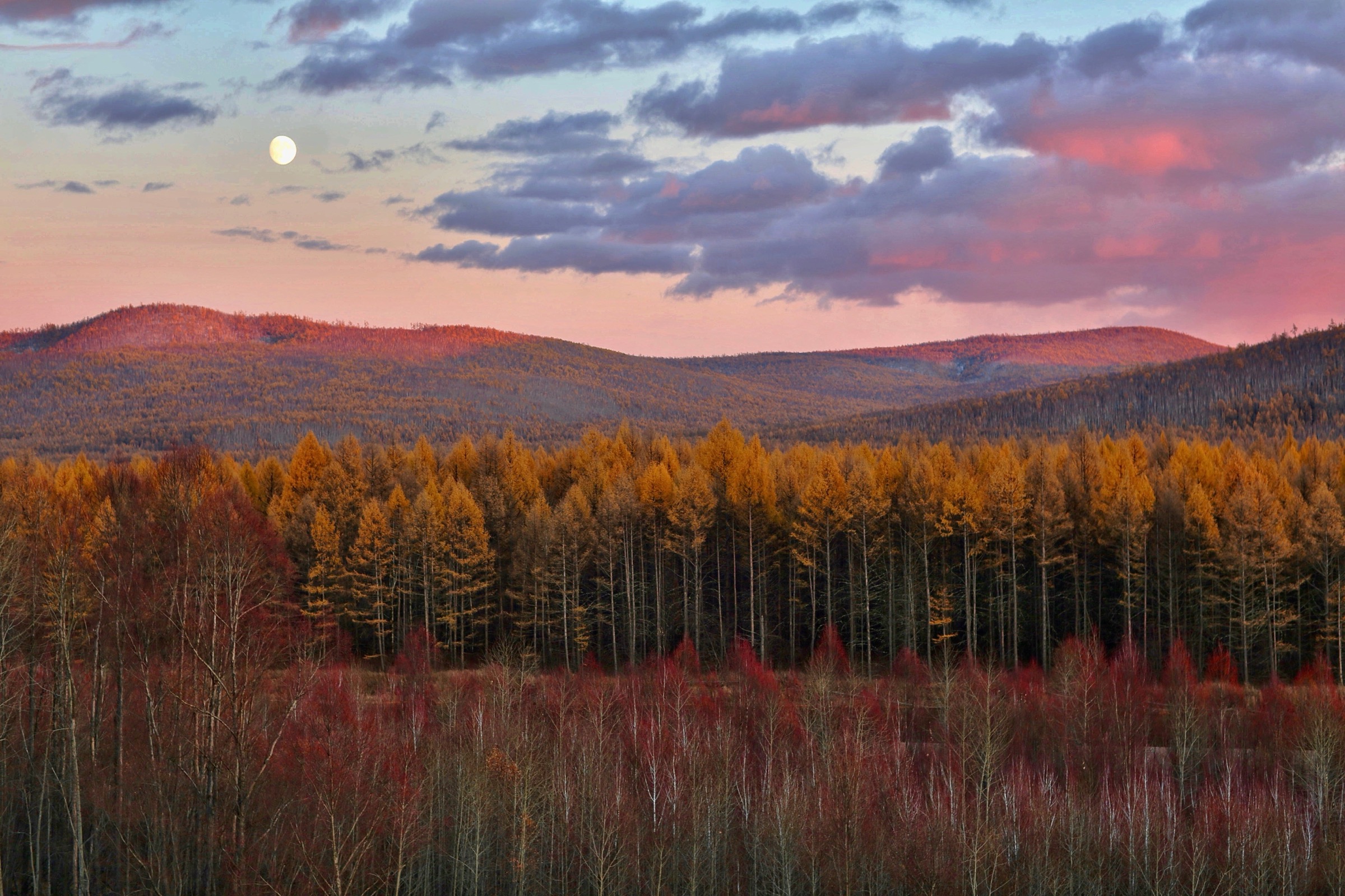
Ecologically this is China’s only true boreal forest. Larix gmelinii — the only larch hardy enough to dominate above 50° N on continuous permafrost — covers most of the range in single-species stands, with Mongolian Scots pine (Pinus sylvestris var. mongolica) on drier south-facing slopes, Erman’s birch (Betula ermanii) and Asian white birch (B. platyphylla) in recovery zones after fire or logging, and dwarf Siberian pine (Pinus pumila) at the upper-treeline mosaic. The flora belongs to the Da Hinggan–Dzhagdy Mountains conifer-forest ecoregion, which extends across the Amur into Russia’s Zeya basin. Wildlife of conservation interest includes brown bear, sable, lynx, Manchurian moose, musk deer and the northern edge of Amur tiger range; capercaillie, hazel grouse, Siberian crane on passage and Blakiston’s fish-owl on the rivers round out the bird list.
The human geography overlaps three distinct indigenous traditions. The Oroqen (鄂伦春族), a small Tungusic hunting people, historically ranged across the Heilongjiang side of the watershed; the closely related Ewenki (鄂温克族, Evenki) include the Aoluguya (敖鲁古雅 / Áolǔgǔyǎ) sub-group, China’s only reindeer-herding community and one of the last in the world; and the Daur (达斡尔族), Mongolic-speaking riverine farmers and traders, hold the southern banks of the Heilongjiang and Nen rivers. Mongol and Buryat communities sit on the western steppe edge, and Han in-migration has been overwhelmingly post-1950 state forestry. Daxing’anling Prefecture (大兴安岭地区), with its seat at Jiagedaqi, is an administrative artefact: a Heilongjiang prefecture geographically located inside Inner Mongolia, carved out in the 1960s to manage state-forestry units in the northern range.
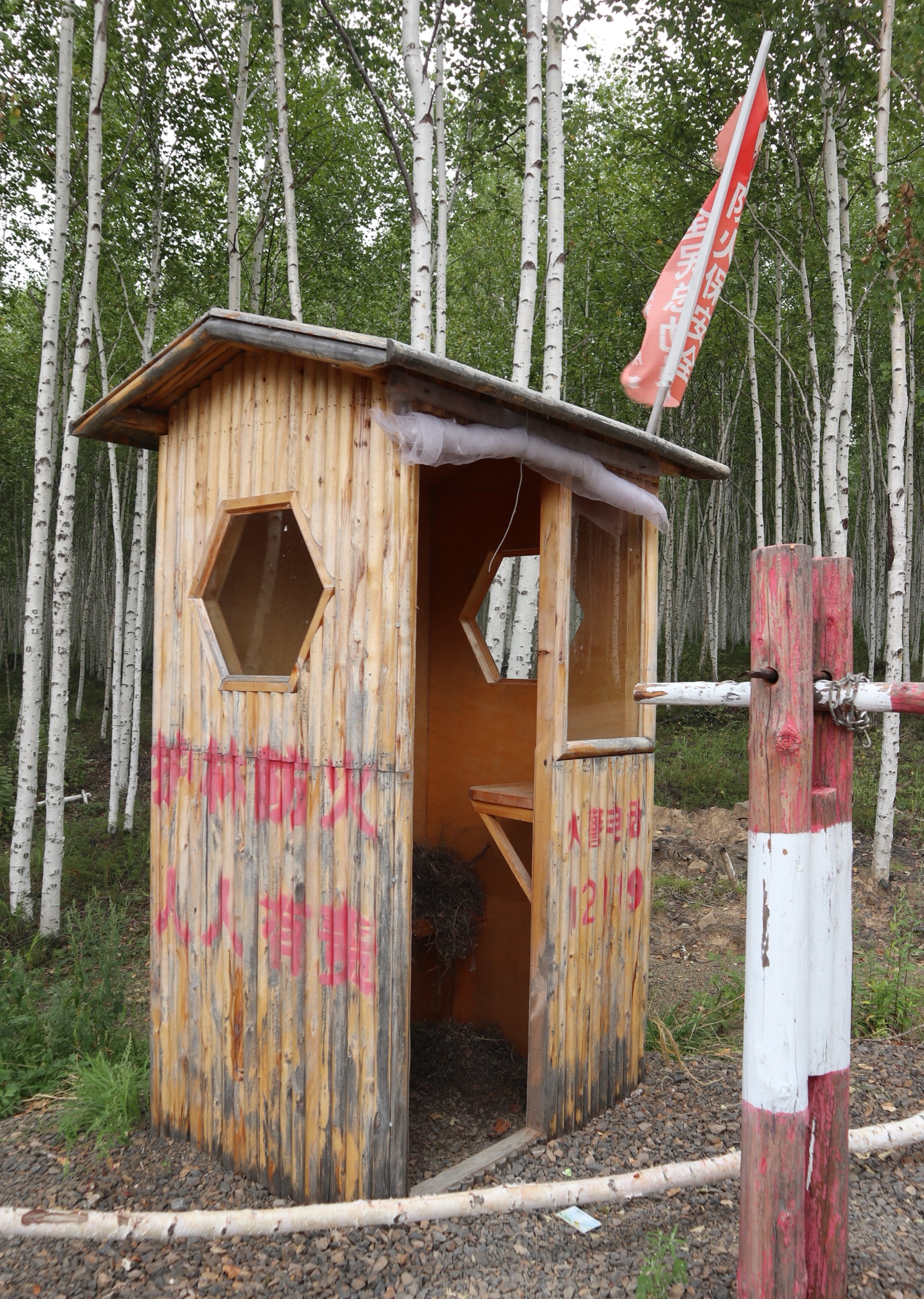
Climate is the regional headline. Mohe (漠河 / Mòhé), the northern county, holds China’s officially recognised cold record at −52.3 °C (Beijicun, 13 February 1969); colder unofficial readings have been logged at Huzhong (呼中 / Hūzhōng) and Genhe forestry stations. The 1987 Black Dragon Fire burned about 1.01 million hectares of forest inside China — 7.3 million hectares including the Russian side, the largest forest-fire complex on record — killed 211 people and reset the management of the entire range. Fire watchtowers, fuel-break grids and gated forestry roads still date from the post-1987 rebuild.
Hiking season runs early June to mid-September, with the foliage peak in mid- to late September when larch needles turn gold before falling. Mosquito and biting-fly densities are notorious between mid-June and mid-August, comparable to Russian Far East taiga. Ticks are active April through October and tick-borne encephalitis is regionally endemic. Brown bear are present everywhere; rare Amur tiger transit has been recorded in border zones near Mohe. The Heilongjiang River forms the Sino-Russian border throughout the prefecture: many of the northernmost walks (Beijicun, Wusuli Shoal) are inside the official border zone — Chinese citizens need no special permit but foreign nationals are routinely asked for passport details at the Mohe checkpoint and at the Wusuli Shoal entry, and riverbank access can close without notice.
A practical note on documentation: this is one of the thinnest English-language hiking regions in our catalogue. No GPX or KML files have been located for any of the five entries; OSM coverage of the prefecture’s internal boardwalks is partial; and Chinese tourism sources describe these as “tour time” (游玩时间) rather than measured route length. Distance and elevation figures here are cross-checked best estimates, not authoritative measurements, and verification labels — Route verified, media pending or Candidate only — are stated honestly in each section.
Selection rationale
Five hikes were chosen to represent the northern Greater Khingan forest belt — not the volcanic, steppe or southern grassland sub-regions covered by sibling articles. The set deliberately spreads across the prefecture so that no two walks rely on the same trailhead or scenic-area operator. Beijicun (北极村 / Běijícūn) is the canonical “find the north” riverside walk along the Heilongjiang at China’s northernmost village. Longjiang First Bay and Wusuli Shoal provide the major panoramic walk, with a stepped boardwalk climb to the omega-bend overlook and the country’s northernmost geodetic marker. Dabaishan (大白山 / Dàbáishān) in the Huzhong cold-pole zone is the only summit candidate that genuinely tops the larch canopy. Aoluguya is the cultural-essential entry through the Ewenki “dense birch forest” the camp is named for. Moerdaoga (莫尔道嘎 / Mòěrdàogǎ) National Forest Park is the standard introduction to primary Larix gmelinii–birch taiga on the Inner Mongolia side. A Jiagedaqi urban-hill walk and the Mangui / Tahe forestry villages were considered and rejected — their walking infrastructure is essentially identical to Mohe at lower visitor priority.
Summary table
| # | Hike | Country | Route type | Distance | Gain | Max elevation | Difficulty |
|---|---|---|---|---|---|---|---|
| 1 | Beijicun riverside & Arctic Sandbar loop | China | Loop | ~6–10 km | <50 m | ~300 m | Easy |
| 2 | Longjiang First Bay & Wusuli Shoal | China | Out-and-back + shuttle | ~3–5 km on foot | ~150–250 m | ~500 m | Moderate |
| 3 | Dabaishan summit walk (Huzhong) | China | Out-and-back | ~6–10 km | ~400–600 m | ~1,528 m | Moderate |
| 4 | Aoluguya Ewenki reindeer-camp walk | China | Loop | ~3–5 km | <100 m | ~750 m | Easy |
| 5 | Moerdaoga National Forest Park circuit | China | Multi-stop point-to-point | ~6–9 km on foot | ~250–400 m | ~1,100 m | Easy–moderate |
All five entries should be read as Candidate only to Route verified, media pending; specific labels appear in each section. Statistics are approximate where so labelled.
1. Beijicun riverside and Arctic Sandbar loop
Snapshot
Itinerary
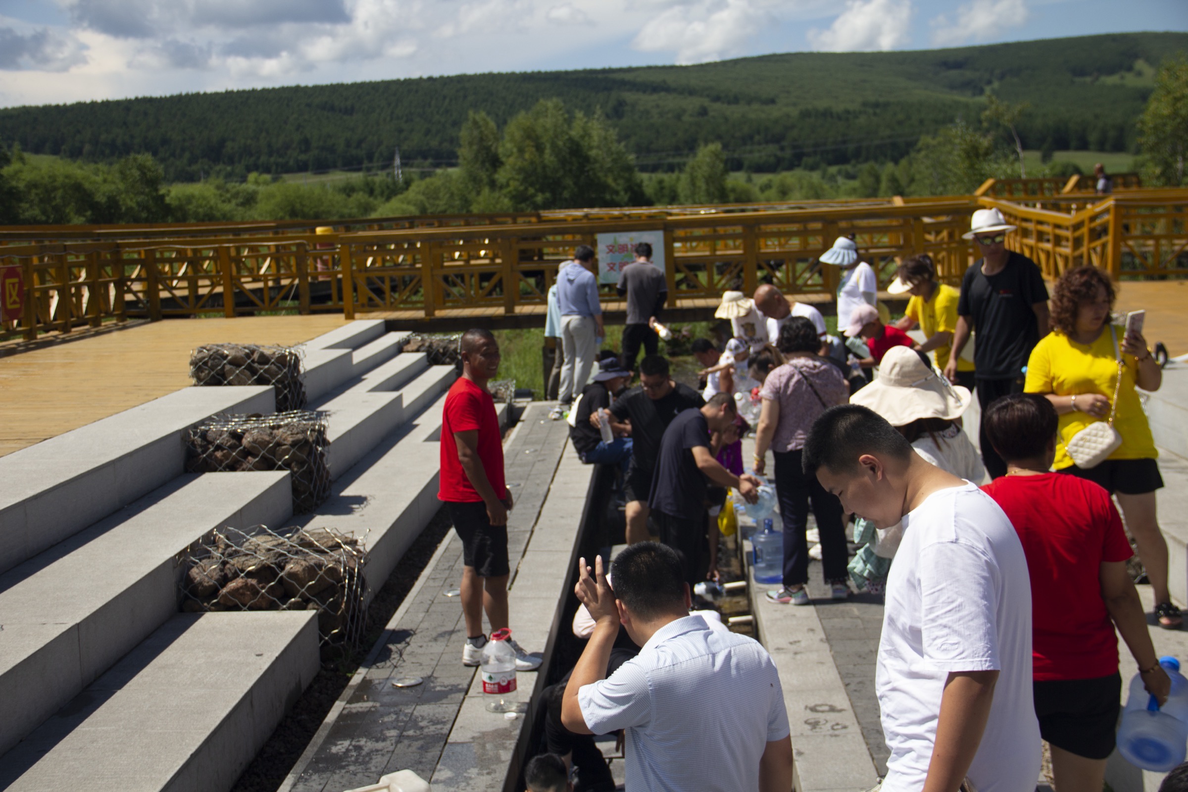
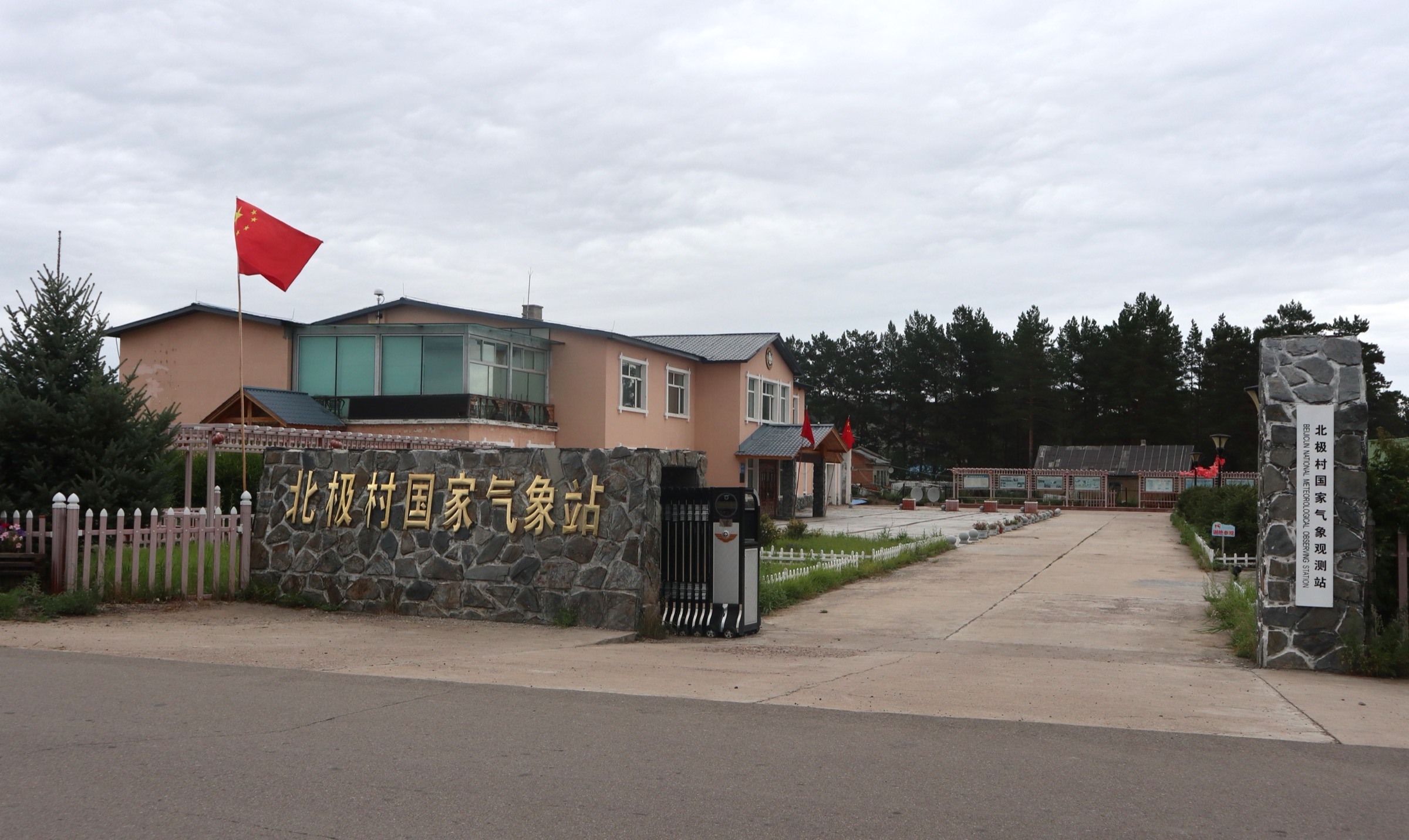
The Beijicun scenic area covers a roughly 16 km² triangular block bounded by the Heilongjiang River to the north — the Sino-Russian border — and Heilongjiang tributaries to the south and west. Walking entries usually begin at the south gate, where the scenic-area ticket is checked. From the gate, a tree-lined gravel street runs about 1.5 km north through old log-cabin guesthouses to the river embankment, passing the village’s reconstructed wooden Orthodox-style chapel, the Beijicun Post Office (“China’s northernmost post office”, a popular postmark stop) and the Beijixiang government compound.
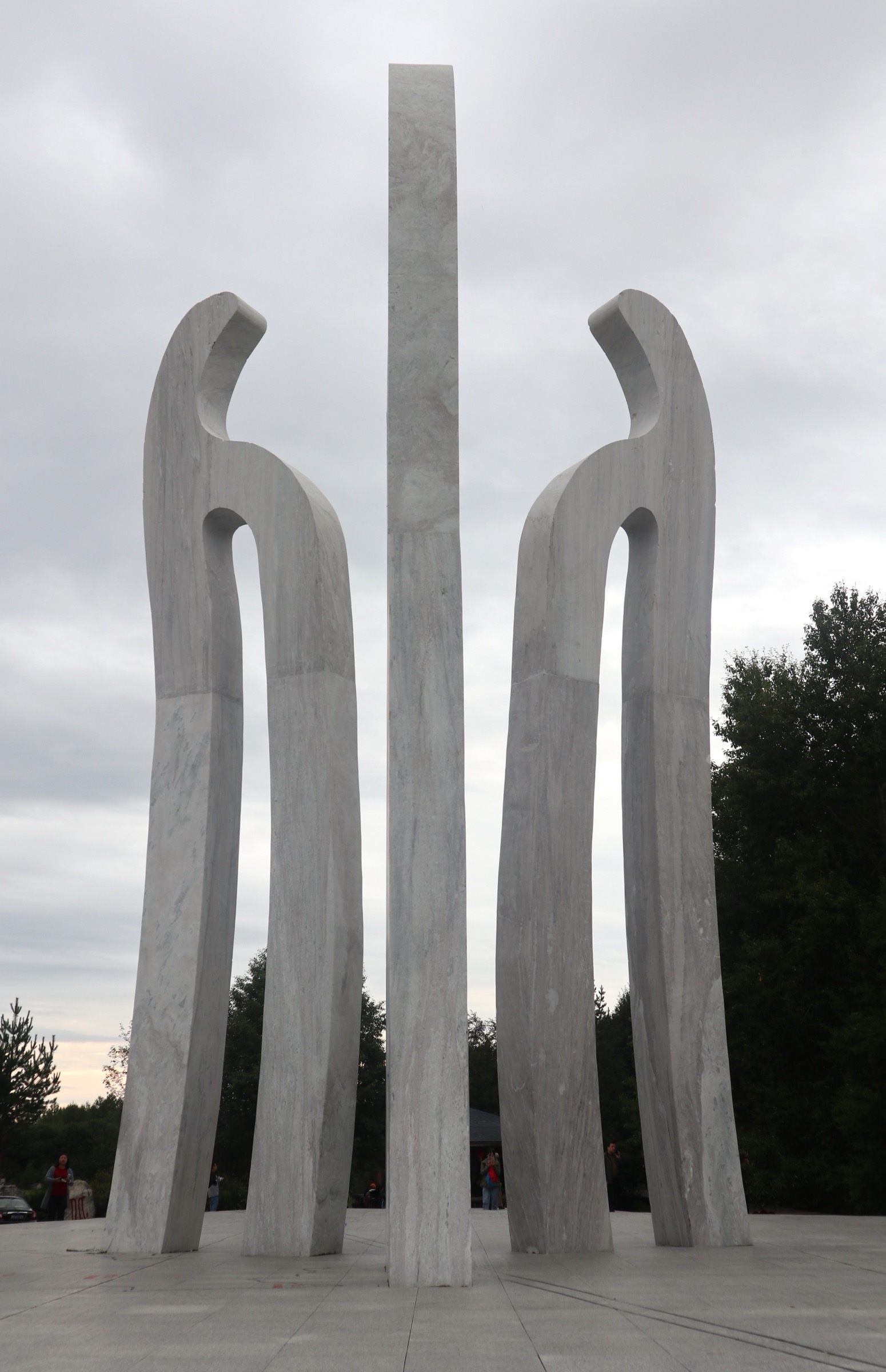
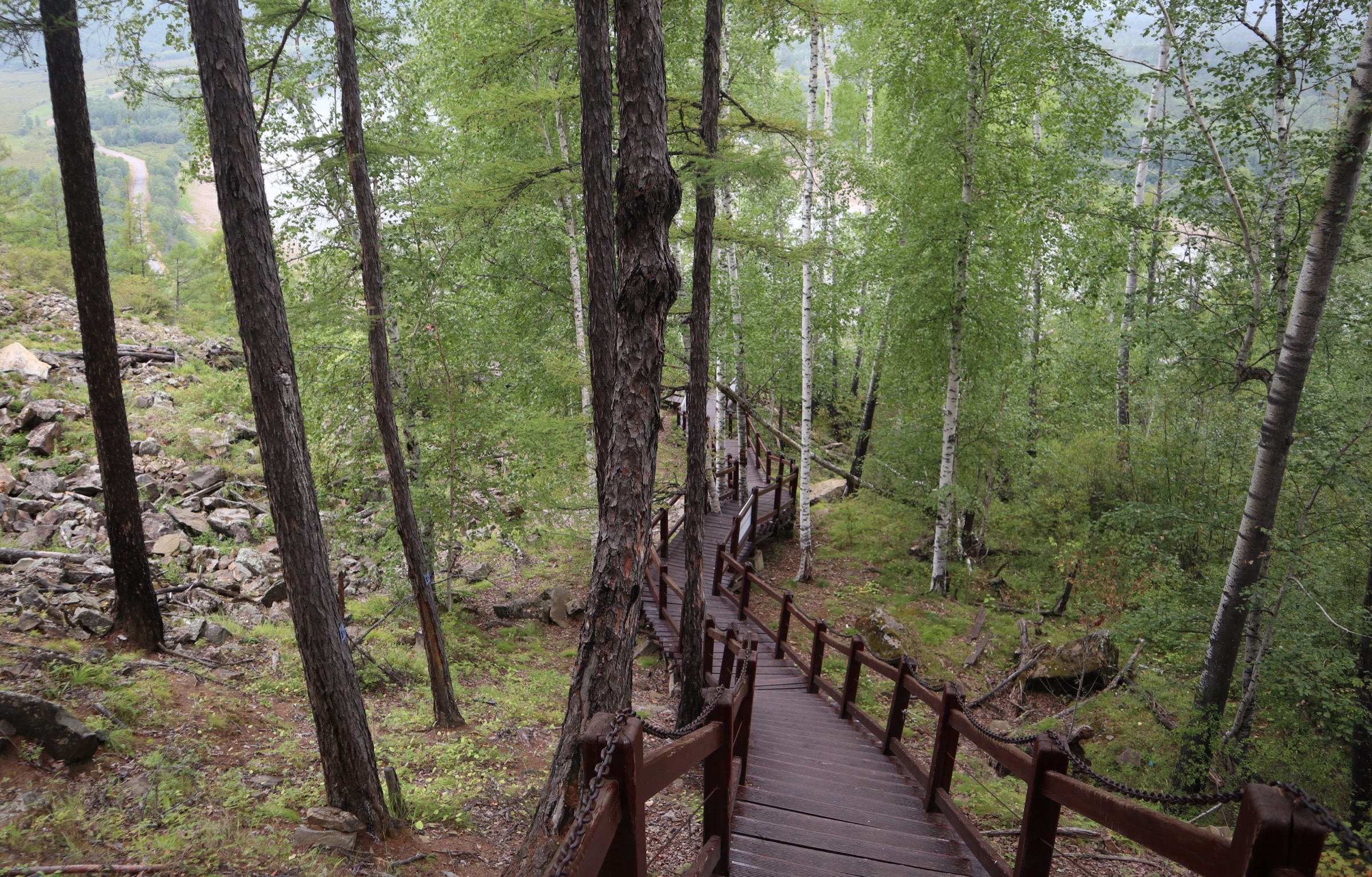
The route reaches the Heilongjiang at the riverbank promenade, where a paved walkway runs parallel to the water with cross-river views of the Russian village of Ignashino. Turning west along the embankment, the path passes the Shenzhou Beiji Stele (神州北极石碑) — the most-photographed marker in the village — then descends onto a timber boardwalk that leads onto the Arctic Sandbar (北极沙洲). The sandbar boardwalk, a mid-2020s addition, includes the “North Character Square” (北字广场) where more than thirty calligraphic forms of the character 北 are inset into the planking. It terminates at the 53°33′43″ N geodetic marker; this is the northernmost point reachable on foot inside the village (the absolute northernmost point of China is at Wusuli Shoal — see hike 2).
The return route loops south on the inland boardwalk, passing the Polar Light Plaza (北极光广场) and the Aurora Dome Theatre (a 360° projection facility opened in 2025) before threading the western edge of the village back to the south gate. Branch options include the Beijixiang Forest Park boardwalk (a flat 2 km add-on through riparian larch–birch behind the village) and a riverside extension east to the Sentinel Tower (北陲哨所), where access depends on border-zone signage and is sometimes closed.
Why it is essential
Beijicun is the single most-visited destination in the prefecture and the canonical “find the north” walk: nearly every Chinese visitor to Daxing’anling walks at least the river-stele section. The route is the only place in China where the Sino-Russian border can be walked along on foot without permits beyond the standard scenic-area ticket, and the only setting where larch–birch riparian taiga, the Heilongjiang River and a working ethnic-Han forestry-village morphology overlap inside one walkable circuit. It is the natural anchor of the catalogue.
Equipment
- Trail shoes; weatherproof shell; warm layer
- Water, food, sun protection — twilight extends past 22:00 in late June
- Strong insect repellent (DEET or icaridin) from mid-June to mid-August; head-net useful in early July
- Tick-bite prevention — long trousers tucked into socks, permethrin-treated clothing where possible
- Passport (foreign nationals); Mohe is inside the border zone and ID checks are routine
- Bicycle hire (15–30 CNY per hour) if shuttle access is preferred
Hazards and notes
The walk itself is low-hazard. The principal concerns are weather (afternoon thunderstorms in July), insects, and the riverbank: the Heilongjiang is a strong, deep international waterway, swimming is prohibited, and ice-margin walking in shoulder season is unstable. Aurora-season visits (March, November) are not walking trips — temperatures below −30 °C make any extended outdoor activity a cold-weather expedition. Scenic-area opening hours and last-entry times are seasonal and should be confirmed with the Beijixiang scenic-area management office before travel.
GPX / route file
No GPX located. OSM coverage of the Beijicun internal boardwalks is partial — the main village street and river embankment are mapped, the Arctic Sandbar boardwalk is not. Suggested approach: digitise from the official scenic-area map and confirm against satellite imagery. Trailhead coordinates (approximate, from OSM and Mapcarta): 53.4767° N, 122.3411° E (Beijicun south gate); 53.5619° N, 122.3583° E (53°33′43″ N stele on the sandbar).
Sources
- Wikipedia — Beiji, Heilongjiang
- Wikipedia — Mohe City
- Travel China Guide — Beiji Village, Mohe Heilongjiang
- Trip.com — Arctic Village tickets
- Top China Travel — Arctic Village in Mohe
- Wikimedia Commons — Category:Beiji
2. Longjiang First Bay and Wusuli Shoal
Snapshot
Itinerary
The Longjiang First Bay (龙江第一湾) is the prefecture’s most-photographed landscape: an approximately 11 km Ω-shaped meander of the Heilongjiang (Amur), with the Russian bank wrapping around a forested peninsula and the Chinese bank rising sharply to a ridge that carries the viewing platform. The walking element is a single stair-and-boardwalk climb from the lower gate up the ridge spine to the platform, then back down the same route. Sources consistently describe “over a thousand wooden steps”; the climb is exposed to the south, with no shade on the upper sections.
From the platform the route continues by sightseeing shuttle along the 9 km forestry road north to the Wusuli Shoal (乌苏里浅滩) entry, which sits at the absolute northernmost land point of China — 53°33′42″ N, 123°15′30″ E. The shoal is a 2 km-wide alluvial bench on the Chinese side of the river; a short timber boardwalk (about 1 km) runs out to the four corner markers (“East Longitude”, “North Latitude”, “China’s Northernmost Point”, “Heilongjiang River Waterway”) and the 8 m Taishan-stone marker erected by the local government in 2016. Visitors typically walk the boardwalk loop, return to the shuttle stop, and either reverse to Mohe or continue to Beihong Village on the same operator circuit.
Variations: a small percentage of visitors take the shuttle up to the platform and walk down, which is gentler on the knees. The Wusuli boardwalk is typically the only walking element at that sub-site.
Why it is essential
Longjiang First Bay is the prefecture’s single defining landscape image. Combined with Wusuli Shoal — the country’s geographic northernmost point — the two form the only walking circuit in China that physically reaches both a major panoramic landform and an extreme cardinal-point geographic marker. The walk is shorter and steeper than Beijicun’s, and complements it: Beijicun is the cultural and conceptual “north pole”, Longjiang First Bay and Wusuli Shoal are the geographic ones.
Equipment
- Trail shoes (the stair planks can be slippery after rain)
- Weatherproof shell; warm layer
- Water (no reliable refill point on the climb)
- Sun protection — the ridge is south-facing and exposed
- Strong insect repellent and a head-net in July; the lower stair sections are heavily mosquitoed
- Tick-bite prevention on the surrounding larch-leaf litter
- Passport for foreign nationals; ID checks at Wusuli Shoal entry are routine
- Cash for shuttle (typically 30–80 CNY each way; foreign cards may not be accepted)
Hazards and notes
The stair-and-boardwalk climb is the main physical hazard — long, steep, with little shade, and the platform railings can be slippery in wet weather. The Wusuli Shoal sits on an active river bank that floods seasonally; the boardwalk and markers may be partially submerged in late-spring high water. As at Beijicun, swimming in the Heilongjiang is prohibited and stepping off the boardwalks toward the river can trigger border-control attention. The last shuttle from Wusuli back to the gate is normally mid-afternoon and is strictly enforced. Bears are present in the surrounding forest but encounters on the stair and the boardwalk are very rare.
GPX / route file
No GPX located. OSM coverage of the platform stair and the Wusuli boardwalk is essentially absent. Suggested approach: digitise the stair line from satellite imagery (it appears as a treeless corridor on the south-facing ridge) and verify the Wusuli boardwalk against the official scenic-area map. Trailhead coordinates (approximate): 53.10° N, 123.16° E (Longjiang First Bay lower gate); 53.5617° N, 123.2583° E (Wusuli Shoal northernmost marker).
Sources
- Baidu Baike — Longjiang First Bay Scenic Area
- Baidu Baike — Wusuli Shoal
- Top China Guide — Heilongjiang First Bay
- Trip.com — The First Bay of Longjiang
- Trip.com — Wusuli Shoal
3. Dabaishan summit walk, Huzhong
Snapshot
Itinerary
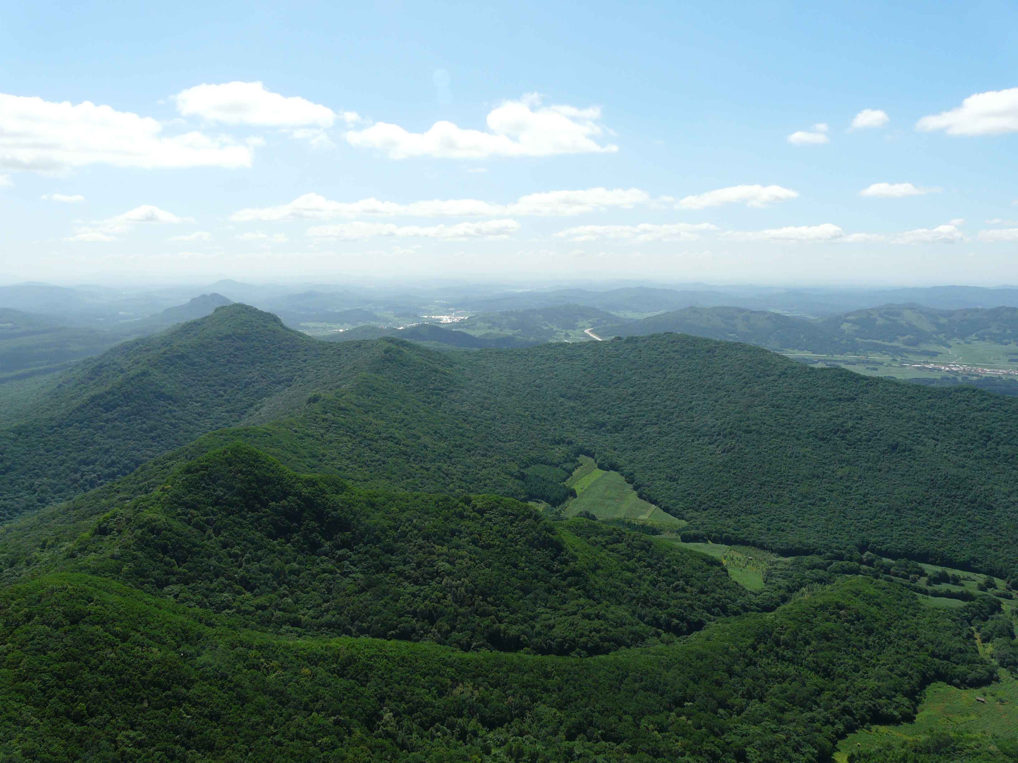
Dabaishan (“Great White Mountain”) is the highest peak in the northern Greater Khingan within Chinese territory and the headline summit of the Huzhong cold-pole region. The walk begins at the scenic-area gate on a forestry road about 12 km southwest of Huyuan Town and climbs through Larix gmelinii with white birch understorey for roughly the lower two thirds of the ascent. As elevation rises, the larch thins, dwarf Siberian pine (Pinus pumila) appears, and the upper section opens into a permafrost-pavement zone of frost-heaved boulders and ground willow that strongly resembles Russian Far East alpine tundra. A wooden boardwalk has been installed across the summit barrens to limit damage to the cushion-plant communities, and a small platform marks the high point. Views on a clear day extend across hundreds of kilometres of larch taiga in every direction; on the clearest days, the upper Heilongjiang valley is visible to the north.
The walk is normally done as an out-and-back. The exact gate-to-summit distance and the precise road-vs-boardwalk split are not consistently documented in English-language sources, and the route is best treated as a candidate rather than a fully verified day-hike. Several Chinese operator pages note that the scenic area is open in summer only, with a short June–September window; some pages list the area as 4A-class, others describe it as a scenic area “under development”.
Why it is essential
Three factors lift Dabaishan out of the “another larch ridge” category. First, it is the only walkable true summit in the northern Greater Khingan that pokes above the larch canopy — every other hike in this catalogue is a riverbank, forest-floor or low-relief walk. Second, the upper barrens are the only accessible high-latitude alpine-tundra environment in China outside the Tian Shan and Qinghai-Tibet. Third, the route sits inside the Huzhong cold-pole zone, where the regional climate signature (sub-Arctic continental, recorded unofficial extreme of −53 °C at the Huzhong meteorological station and lower at Genhe forestry stations) is most concentrated. The documentation is thinner than for the Mohe walks, but it is the only credible summit candidate for the region.
Equipment
- Sturdy boots and trekking poles (the summit boulder pavement is uneven)
- Extra warm layer — the upper section runs 5–10 °C colder than the gate
- Wind-resistant shell, hat and gloves even in midsummer
- Water (no refill on the route); food
- Navigation backup — offline map or downloaded satellite tile; phone signal at the summit is unreliable
- Strong insect repellent below the treeline (the boardwalk above the treeline is usually breezy enough)
- Tick-bite prevention on the lower forest section
- Headtorch if the round trip pushes into evening
- Confirm that the scenic area is open in the planned travel window — the gate is closed in shoulder season
Hazards and notes
The route has the most weather exposure of any hike in this catalogue. Summer thunderstorms roll across the barrens with little warning; the boardwalk is exposed and offers no shelter. Cold-pole climate means summer night temperatures can drop below freezing at the summit. Bears are present throughout the lower forest; sightings are uncommon but the Huzhong reserve sits in core Ursus arctos range. The exact opening dates, ticket policy and whether the upper forestry road is barriered (forcing a longer walk-in) should be confirmed with the Huzhong District tourism office or the Huzhong Forestry Bureau before travel — several sources state that the broader reserve is “under development and not yet open to the public” while others sell tickets to the Dabaishan scenic area inside the same district.
GPX / route file
No GPX located. OSM coverage of the Huzhong reserve is essentially absent. Suggested approach: digitise the forestry road from satellite imagery (visible as a clear line through the larch) and the summit boardwalk from the scenic-area map. Trailhead coordinates (approximate, from regional tourism descriptions): 51.78° N, 123.05° E (Huyuan Town centre); summit approximately 12 km southwest. These are placeholder coordinates and should be replaced with verified gate coordinates before publication.
Sources
- afunadventure.com — Huzhong National Nature Reserve
- BirdLife International — Huzhong Nature Reserve
- Key Biodiversity Areas — Huzhong Nature Reserve
- Trip.com — Huzhong Nature Reserve
- Baidu Baike — Cold Pole of China
- PeakVisor — Greater Khingan
4. Aoluguya Ewenki reindeer-camp birch-forest walk
Snapshot
Itinerary
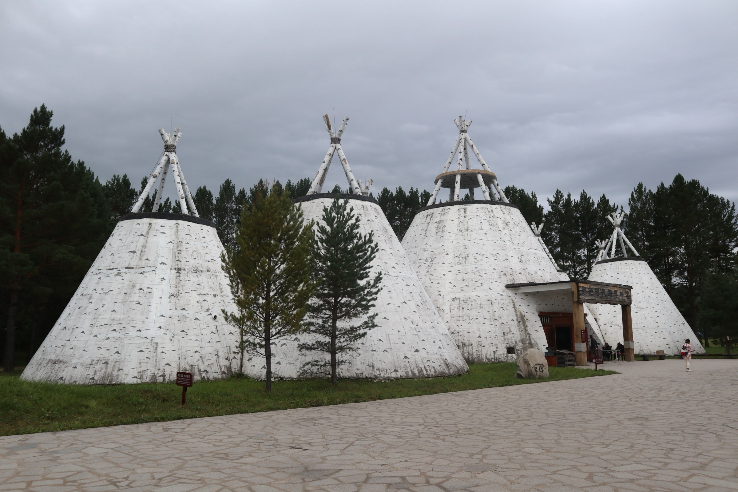
The Aoluguya Ewenki Ethnic Township is the resettled centre of China’s only reindeer-herding community: a Tungusic sub-group of the Evenki who relocated from forest hunting camps to a state-built village in 2003. The scenic area at the western edge of the township is the most accessible point on this catalogue at which to walk through the aoluguya — Ewenki for “dense, flourishing birch forest” — that gives the camp its name.
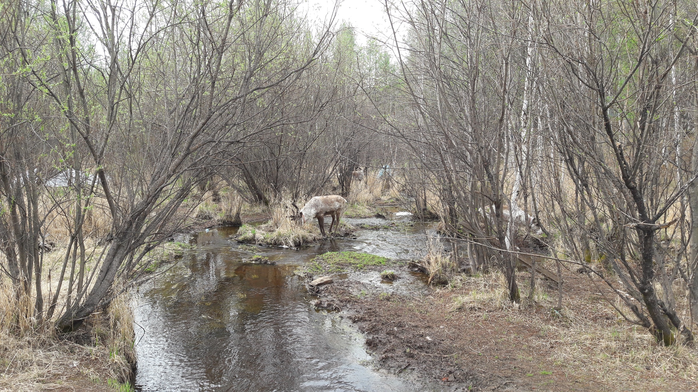
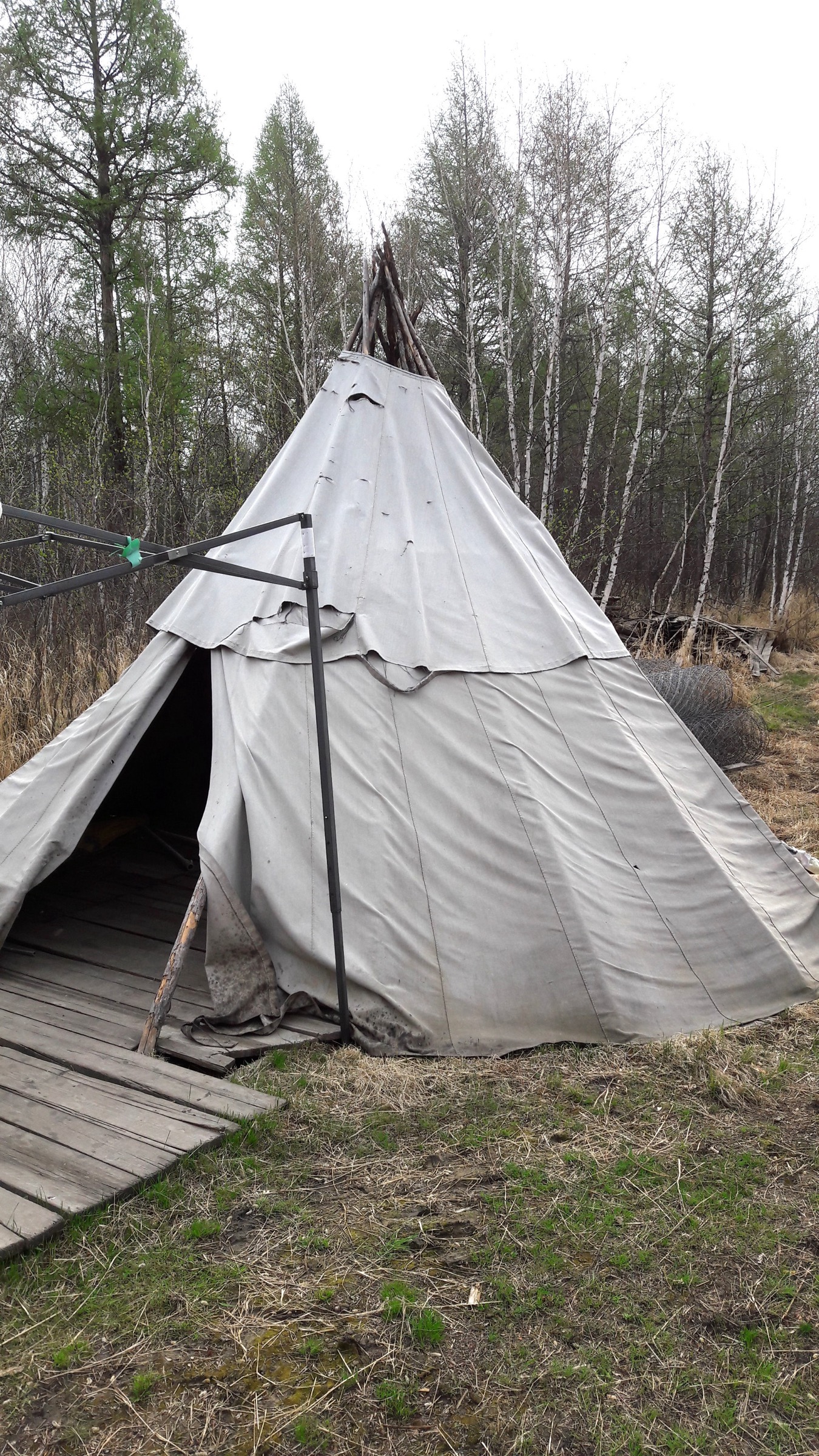
The visitor-zone walk begins at the main gate and follows a graded loop through white birch and larch, passing reconstructed cuoluozi (撮罗子) — the conical birch-bark and pole tents historically used by the Reindeer Ewenki — and a fenced demonstration paddock where a small reindeer herd is kept on the site. The loop links the Aoluguya Ewenki Museum, the traditional dwellings interpretation area, and a riverside boardwalk back to the gate. Working reindeer camps (where calving, antler-harvesting and seasonal migration are still practised) are typically 30 km from the township and are not casually accessible — visits are arranged through community contacts or operator tours rather than turning up.
Variations: the on-site walk is short and can be combined with the Genhe Wetlands (covered in the sibling Hulunbuir article — not duplicated here) for a longer day. Extended walks to a working camp normally require a guide, vehicle transfer and prior arrangement with the community.
Why it is essential
Aoluguya is the only place on this catalogue where a still-living indigenous reindeer-herding tradition can be encountered on a walk through forest the herding family actually uses. The Ewenki Reindeer Tribe is widely documented in academic and ethnographic literature (Smithsonian Center for Folklife and Cultural Heritage, Berghahn ethnographies by Kolås and Xie) as China’s last reindeer-using community, and the resettlement of 2003 makes the site one of the clearest case studies in the country of state ecological-relocation policy. It occupies the cultural niche that summit hikes cannot.
Equipment
- Trail shoes; weatherproof shell; warm layer
- Water; food; sun protection
- Strong insect repellent — biting flies in the birch understorey are intense
- Tick-bite prevention
- Small bills if a feeding interaction with the reindeer is planned (the on-site fee structure changes annually)
- Respectful clothing and behaviour — this is a living indigenous community, not a re-enactment park
Hazards and notes
Hazards are low. The reindeer are habituated to visitors but are wild-temperament animals; bulls during the rut (September–October) can be aggressive — keep a respectful distance and follow staff direction. Photography of community members should follow standard ethnographic etiquette and explicit consent. Scenic-area opening hours are seasonal; in winter the experience shifts almost entirely indoors. As elsewhere in the region, ticks are active April–October.
GPX / route file
No GPX located. OSM coverage of the Aoluguya scenic-area paths is essentially absent. Suggested approach: digitise the visitor loop from the official site map and the satellite-visible road structure. Trailhead coordinates (approximate): 50.7833° N, 121.4500° E (Aoluguya Ewenki Ethnic Township centre).
Sources
- China Xian Tour — Aoluguya Reindeer Village
- Trip.com — Aoluguya Reindeer Village
- Tour-Beijing — Aoluguya Ewenki Ethnic Township
- Smithsonian Folklife — China’s Last Reindeer Herders
- China Today — Reindeer Ewenki
- Kolås, Å. and Xie, Y. (eds), Reclaiming the Forest: The Ewenki Reindeer Herders of Aoluguya (Berghahn, 2015)
5. Moerdaoga National Forest Park central circuit
Snapshot
Itinerary
Moerdaoga (Mongolian: Mor daghah, “to mount up to battle”; the legend attributes the place name to a Genghis Khan hunting expedition) National Forest Park, gazetted in 2000 and covering 148,324 hectares, is the largest single national forest park in China. The park sits at the heart of the Inner Mongolian Greater Khingan and protects a mosaic of primary Larix gmelinii, white birch, dwarf Siberian pine and small patches of Erman’s birch alongside the upper Erguna and Genhe river systems. Forest cover inside the park is cited at 94.97 %, the highest of any national forest park in China.
The classic visitor route is not a single trail but a chain of short walks linked by the park’s internal road, traversed by sightseeing vehicle and broken at each named viewpoint for foot stops:
- Longyan Mountain (龙岩山) viewing platform — the high point of the day, a staircase climb to a panoramic platform over the larch sea.
- Linhai Qishi / Forest-Sea Stones (林海奇石) — a short tor-and-boardwalk loop through weathered granite outcrops.
- Hongdou Slope (红豆坡) — a flat boardwalk loop through a Dahurian larch stand named for the red lingonberry understorey.
- Yi Mu Jiu Ling / Nine Ridges in One Glance (一目九岭) — a stacked-ridge panorama platform, the classic “layered green ranges” image.
- Bingshui Bay / Ice-Cliff sub-area — riverside and permafrost-feature short walk (seasonal).
- Bailianhua Lake (白莲花湖) — short boardwalk loop around a small lake near the inner end of the park road.
The full chain, taken in one day, totals roughly 6–9 km of foot distance spread across these stops, plus the bulk of the day in the internal vehicle. Visitors typically buy a combined gate-and-shuttle ticket; the internal road is not generally walkable end-to-end and self-driving inside the park is restricted.
Why it is essential
Moerdaoga is the standard introduction to primary Larix gmelinii taiga on the Inner Mongolia side of the watershed, the largest national forest park in the country, and the only protected area in this catalogue that holds extensive virgin forest stands across multiple drainage basins. Its visitor model — short walks chained by a sightseeing road — is unusual by Western trail-database standards but is the dominant Chinese national-forest-park format and reflects the practical reality of the region. It covers the canonical “vast larch sea” experience that no single-trailhead walk in this catalogue can.
Equipment
- Trail shoes; weatherproof shell; warm layer (the park interior runs noticeably cooler than Hailar)
- Water; food; sun protection
- Strong insect repellent and a head-net through summer — the park is well inside taiga mosquito range
- Tick-bite prevention
- Cash for shuttle and combined-ticket purchase (foreign card acceptance is unreliable at the gate)
- Confirmation of internal-shuttle schedule, especially the last departure out of the inner sub-areas
Hazards and notes
The principal concerns are logistical rather than physical: the park is large, the internal road is one-way in places, and the last shuttle from the inner stops back to the gate is typically mid- to late afternoon. The walking itself is low-risk graded boardwalk. Forest-fire risk is taken seriously across the park; smoking is banned outside designated zones, and the gate may close on red-flag fire-danger days. Bear range; sightings on the developed boardwalks are very rare.
GPX / route file
No GPX located. OSM coverage of Moerdaoga’s internal park road and viewpoint loops is partial — the main spine road is mapped, the side-loop boardwalks are not. Suggested approach: digitise each viewpoint loop from the official park map and stitch with the OSM road geometry. Trailhead coordinates (approximate): 51.6720° N, 120.6750° E (Moerdaoga National Forest Park gate).
Sources
- China Xian Tour — Moerdaoga National Forest Park
- China Daily — Mo’erdaoga National Forest Park
- Tour-Beijing — Moerdaoga Travel Guide
- Top China Travel — Larch Forest in the Great Khingan
- Trip.com — Moerdaoga National Forest Park tickets
External links
| Source | URL |
|---|---|
| Daxing’anling Prefecture government portal | dxal.gov.cn |
| Hulunbuir Municipal Government portal | hlbe.gov.cn |
| One Earth — Da Hinggan–Dzhagdy Mountains conifer forests | oneearth.org |
| Britannica — Da Hinggan Range | britannica.com |
| Wikipedia — Greater Khingan | en.wikipedia.org |
| Wikipedia — Daxing’anling Prefecture | en.wikipedia.org |
| Wikipedia — 1987 Black Dragon fire | en.wikipedia.org |
| UNDP — Daxing’anling Sustainable Forest Management (PDF) | info.undp.org |
| BirdLife International — Huzhong Nature Reserve | datazone.birdlife.org |
| Smithsonian Folklife — Ewenki coverage | folklife.si.edu |
| PeakVisor — Greater Khingan | peakvisor.com |
| Wikimedia Commons — Category:Greater Khingan | commons.wikimedia.org |
| Wikimedia Commons — Category:Mohe | commons.wikimedia.org |
| Wikimedia Commons — Category:Beiji | commons.wikimedia.org |
| OpenStreetMap (ODbL 1.0) | openstreetmap.org |