Regional overview
The Arxan Volcanic Field (阿尔山火山群; geologically the Arxan–Chaihe Volcanic Field, 阿尔山–柴河火山区) drapes the southern Greater Khingan (Da Hinggan Ling / 大兴安岭) where the range steps down from its high crest in Hinggan League (Xing’an Meng / 兴安盟) toward the Mongolian Plateau. It covers roughly 2,000 km² with at least 47 vents — a NE–SW swarm of scoria cones, craters, maars and lava domes — together with seven crater lakes (“Tianchi” / 天池), about forty lava-dammed lakes, and the country’s largest exposed Quaternary basalt flow at Shitanglin (石塘林). The Smithsonian Global Volcanism Program lists the field under the entry “Arxan-Chaihe”; the youngest eruptions, in the Yanshan (焰山) and Gaoshan (高山) cones, are dated to roughly 2,000 years before present, making this the youngest mainland volcanic system in eastern China outside Heilongjiang’s Wudalianchi (五大连池). Both are UNESCO Global Geoparks on the same broad alkali-basalt province produced by intra-continental, asthenosphere-driven volcanism along the eastern margin of the Mongolian Plateau.
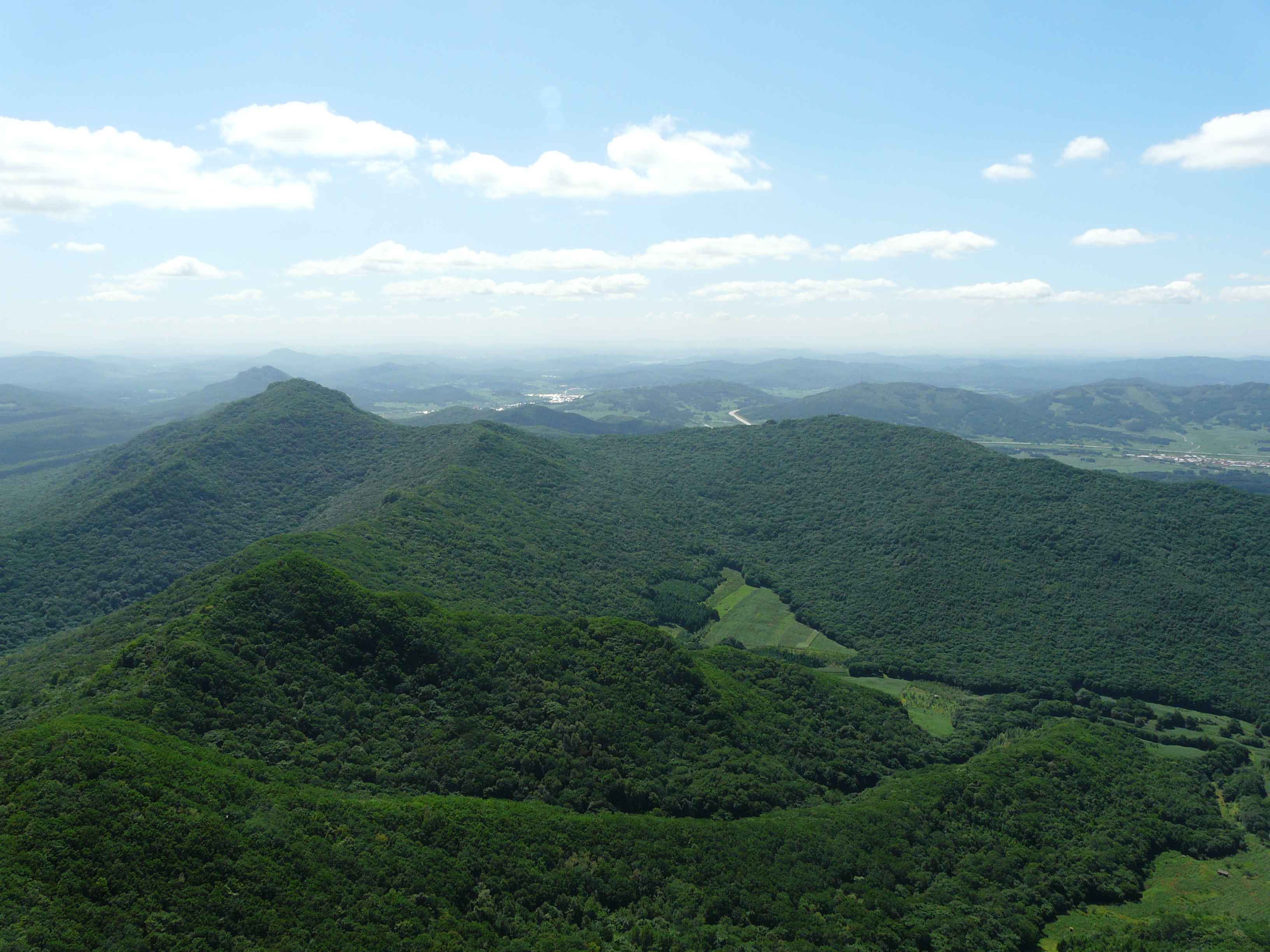
Topographically Arxan is moderate ground: the main lava plateaus sit between 1,000 m and 1,300 m, crater rims reach 1,300–1,400 m, and the surrounding Greater Khingan summits rarely break 2,000 m. The hydrological signature is the Halaha River (哈拉哈河; Mongolian Khalkh / Khalkhin Gol), which rises on the western flank of the range, runs through the centre of the geopark in a basalt-rimmed valley, and then turns southwest to form a stretch of the China–Mongolia border before draining into Lake Buir. Young lava shapes the local hydrology: flows dammed pre-existing drainages to create the long string of barrier lakes (Dujuanhu / Azalea Lake is the canonical example); fissures still vent enough geothermal heat to keep certain river stretches ice-free year-round (the “Unfrozen River” / 不冻河); and granite basement is exposed only on the northwestern edge, in the Meigui Feng (Rose Peak / 玫瑰峰) stone forest. The geopark dossier divides the area into five geo-regions: Tianchi, Hot Springs, Meigui Peak, Port and Haosengou.
Ecologically the field is a forest-volcanic mosaic: cooled basalt covered in Dahurian larch (Larix gmelinii / 兴安落叶松), white birch (Betula platyphylla / 白桦) and Mongolian Scots pine (Pinus sylvestris var. mongolica / 樟子松), with Rhododendron dauricum (兴安杜鹃) in the understorey and dense stands of larch growing directly out of the lava surface — the “stones-and-forest” landscape that gives Shitanglin its name. This is the southern fringe of the East Asian taiga; the meeting line between volcanic landform and boreal forest is the visual signature of every walk here.
Operating reality for day-hikers is unforgiving. The useful season runs late June to early October; deep snow blankets the boardwalks from late October through April; the mosquito and biting-fly plague mid-July to mid-August is documented in every Chinese-language trip report. Almost all walking is on built timber boardwalk and graded stair inside a fee-paying scenic area; the single Arxan National Forest Park ticket (typical 2025 high-season figures: ~180 RMB park entry + ~105 RMB compulsory two-day sightseeing-bus pass) covers most boardwalk stops, with shuttle-bus circulation between trailheads compulsory in peak season. The Mongolian word “Arxan” means “holy hot spring”; the local hot-spring complex south of the park gate (Arxan Hot Springs Geo-region / 阿尔山温泉) is an after-walk fixture, not a hike. Off-piste walking is not sanctioned anywhere in the geopark, the border belts along the lower Halaha lie in restricted military zones, and Meigui Feng is the only walk in this selection that lies outside the park gate and off built boardwalk.
Selection rationale
A sibling article — Greater and Lesser Khingan — Northern Forest-Steppe Transition — already carries the three signature Arxan picks: Arxan Tianchi, Tuofengling Tianchi (Camel Peak Heavenly Lake) and the Shitanglin lava boardwalk, along with the Santan Gorge corridor. Those are the obvious choices, so they are deliberately absent here. This article instead selects five different sanctioned walks inside the same geopark, chosen to round out the geological and landscape story without duplicating the sibling file:
- Dujuanhu (Azalea Lake) perimeter boardwalk — the largest of the lava-dammed barrier lakes inside the park, and the canonical Quaternary lava-dam landform of the field. A flat perimeter boardwalk that contrasts with the stair-climb crater-lake walks.
- Arxan Grand Canyon (Daxiagu / 大峡谷) descent boardwalk — the deepest single-walk descent inside the park, into a W-shaped granite-and-basalt gorge; the strongest vertical landscape of the Arxan walks.
- Guibei Yan (Turtle Back Rock / 龟背岩) boardwalk loop — a short loop over the world-rare “turtle-shell” lava-crust structure adjoining the Unfrozen River.
- Wuli Quan (Five-Li Spring / 五里泉) – Bingxue Quan – Halaha source linked walk — a low-elevation valley walk linking the cold-mineral-spring outcrop with the headwater stretch of the Halaha; the most accessible expression of the Hot Springs Geo-region away from the bathhouses.
- Meigui Feng (Rose Peak / 玫瑰峰) granite stone-forest hike — the only non-volcanic walk in the selection, on the granite basement exposed northwest of the volcanic field; provides the structural and historical counterpoint (the lower Halaha course beneath the peak is associated with Genghis Khan’s Köiten campaign of 1201).
Together the five cover the four primary landforms of the Arxan UNESCO Global Geopark — lava-dammed lake, river canyon, surface lava-crust feature, and granite stone forest — and add the geothermal-water landscape the sibling article does not touch. None of the five repeats a trailhead used in the sibling file; all five lie inside Arxan City (administered by Hinggan League).
Summary table
| # | Hike | Country | Route type | Distance | Gain | Max elevation | Difficulty |
|---|---|---|---|---|---|---|---|
| 1 | Dujuanhu (Azalea Lake) perimeter boardwalk | China | Loop boardwalk + spurs | ~1.2 km loop; ~3 km with spurs | <30 m | ~1,244 m | Easy |
| 2 | Arxan Grand Canyon descent boardwalk | China | Out-and-back stair + boardwalk | ~7 km return | ~150–200 m | ~1,100 m | Moderate |
| 3 | Guibei Yan (Turtle Back Rock) boardwalk loop | China | Loop boardwalk on lava pavement | ~1–2 km | <20 m | ~1,000 m | Easy |
| 4 | Wuli Quan – Bingxue Quan – Halaha source linked walk | China | Linear roadside + spring spurs | ~4–5 km combined | <50 m | ~1,050 m | Easy |
| 5 | Meigui Feng (Rose Peak) granite stone-forest hike | China | Out-and-back stair + ridge loop | ~2–3 km | ~150–250 m | ~1,200–1,300 m | Easy–moderate |
No official park GPX has been located for any of the five walks. The Arxan National Forest Park, the UNESCO geopark portal and the municipal tourism portal publish descriptive pages but no GPX or KML downloads. Where geometry is needed, OpenStreetMap is the practical fallback; on-site GPS capture is the only way to record the actual boardwalk centreline. The route notes below reflect this honestly — no fabricated tracks.
1. Dujuanhu (Azalea Lake) perimeter boardwalk — 杜鹃湖
Snapshot
Itinerary
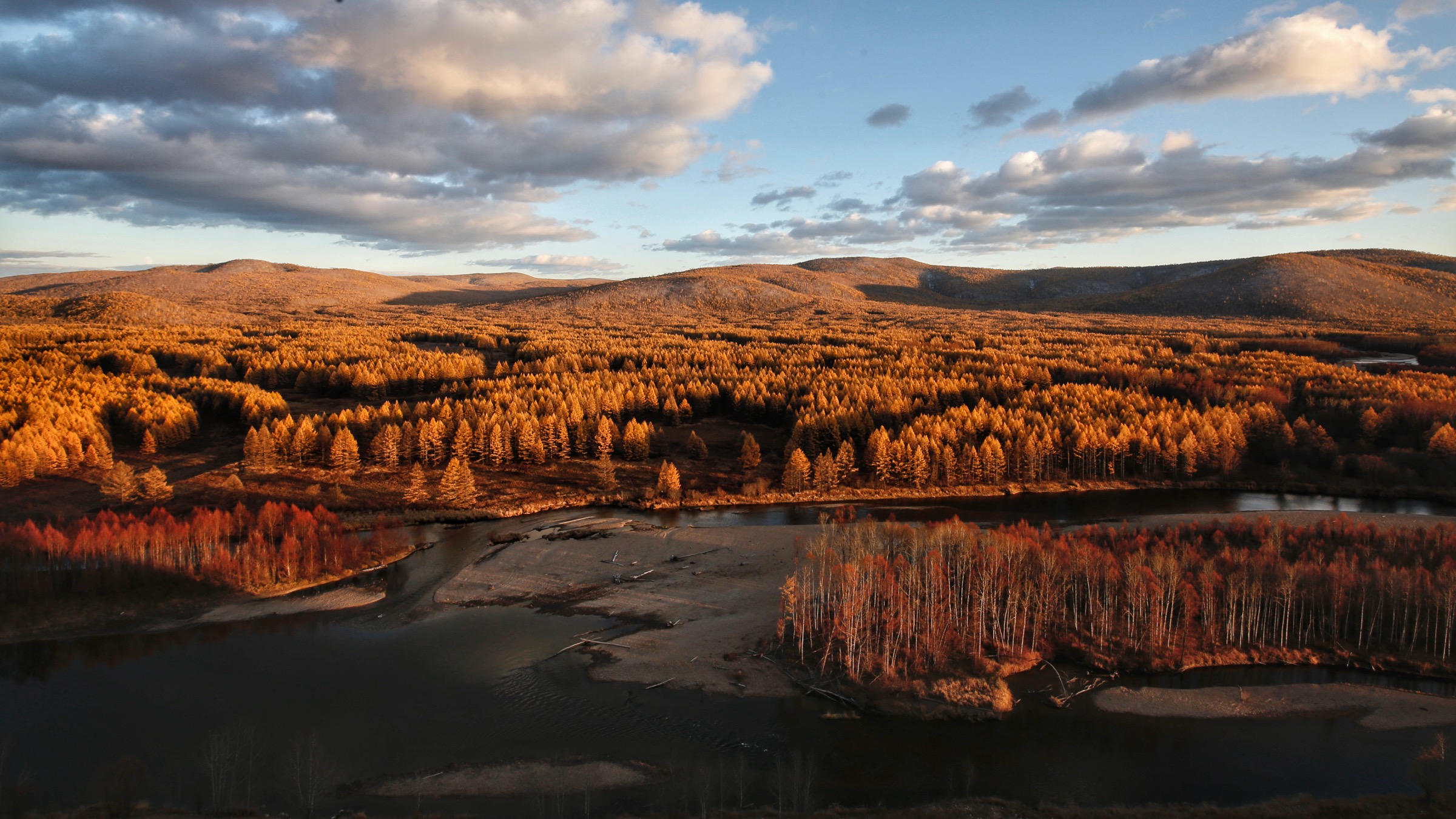
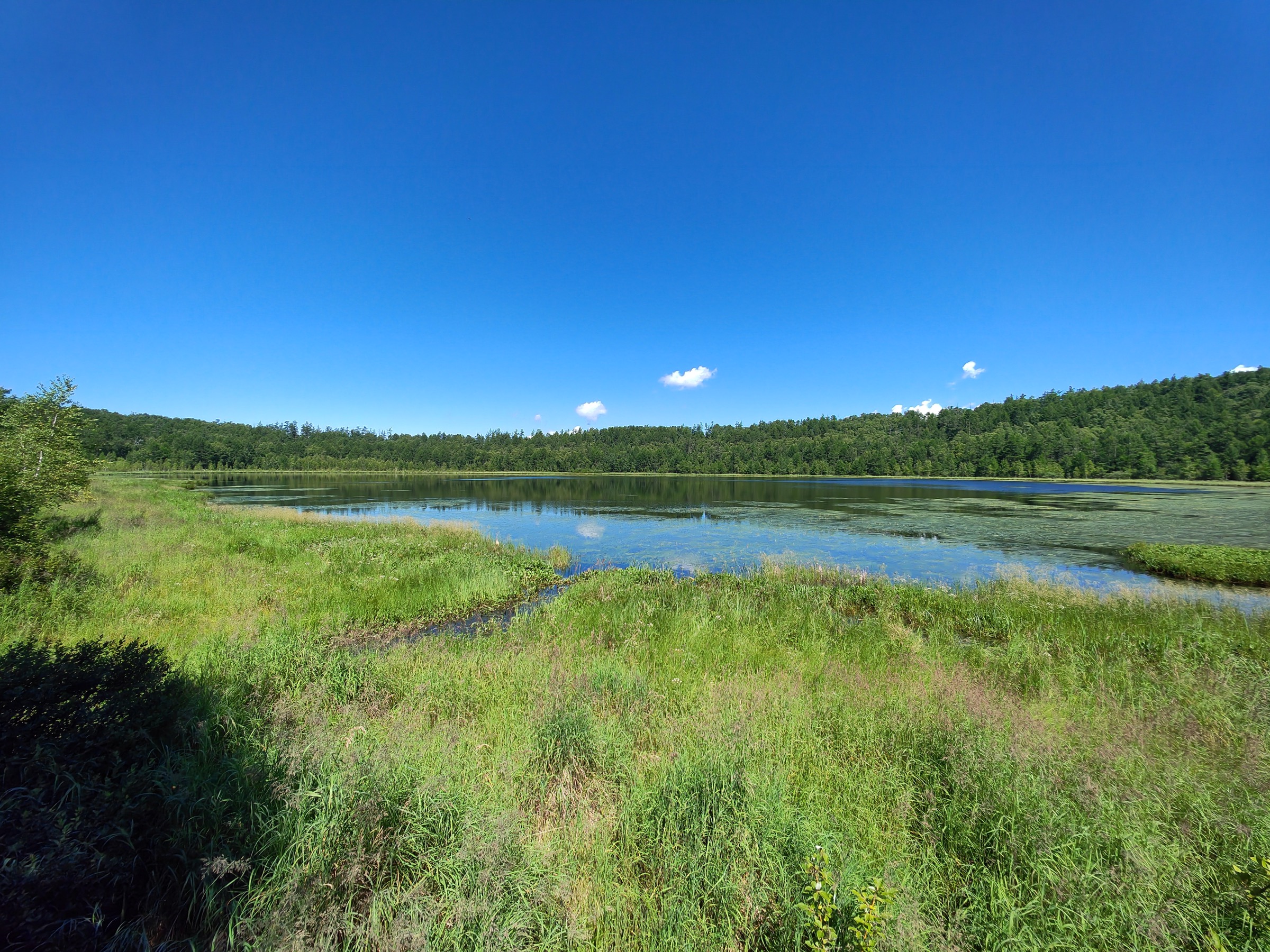
Dujuanhu — Azalea Lake — sits at roughly 1,244 m on the eastern arm of the park: an L-shaped flow-through lake with a surface area near 128 hectares. It is the largest of the field’s lava-dammed lakes, formed when basaltic flows blocked an upstream tributary of the Halaha. The lake remains a flowing-water body — the southwest outlet returns water to the Halaha system, the northeast inlet connects to the smaller Songye Hu (Pine-Needle Lake / 松叶湖) — with a mean depth of about 2.5 m and a maximum near 5 m.
From the shuttle stop a graded timber boardwalk approaches the lake through a fringe of Larix gmelinii and Betula platyphylla and joins the perimeter loop. The loop is reported as roughly 1.2 km, flat throughout, with multiple viewing platforms set on wooden piers over the water. Three principal platforms are usually photographed: the main south-shore platform (looking north over the long arm of the L), the lake-inlet platform at the northeast (looking down on the inflow channel where pine grows directly to the water) and the outlet platform at the southwest. The basalt-block lake bed is visible through clear water in the shallower zones; in winter the lake freezes hard enough that the perimeter boardwalk has functioned as the access track for informal natural skating.
The route can be walked in either direction; clockwise puts the main viewing platform at roughly the half-way mark and gives the best afternoon light.
Why it is essential
Dujuanhu is the textbook lava-dammed barrier lake of the entire Arxan field — much larger than any of the crater lakes — and is the only Arxan lake where the perimeter is walkable on a continuous flat boardwalk rather than a stair climb to a single rim platform. Late-May Rhododendron dauricum bloom, large open water and basalt-and-larch shoreline make it the most representative of the field’s barrier-lake landscape and a deliberate complement to the crater-lake stair walks (Arxan Tianchi, Tuofengling Tianchi) carried in the sibling article.
Equipment
- Trail shoes or light boots (boardwalk timber slick when wet or frosted)
- Weatherproof shell layer (afternoon thunderstorms common July–August)
- Warm mid-layer (sub-10 °C mornings even in summer at this elevation)
- Sun protection — the lake-edge boardwalk is largely exposed
- Water and snacks
- Mosquito and biting-fly repellent (essential mid-July to mid-August)
- Binoculars optional — waterfowl and migrating geese use the lake heavily in spring and autumn
Hazards and notes
The perimeter boardwalk is unfenced in places; do not attempt to descend into the water. Boardwalk timber may be icy from mid-October through early May; the park is open in winter but the boardwalk is not actively cleared and is most often walked as a snow surface. Lightning exposure on the open lake-edge platforms during summer thunderstorms is real. All access is via the park’s compulsory shuttle-bus system; the multi-day shuttle ticket is required to combine Dujuanhu with other stops. Drone use is generally restricted inside the geopark; check current signage at the gate.
Sources
- Arxan tourism authority — Dujuanhu page
- bytravel.cn — 杜鹃湖 guide
- Tour-Beijing — Dujuan Lake in Arxan National Forest Park
- China Discovery — Arxan UNESCO Global Geopark
2. Arxan Grand Canyon descent boardwalk — 大峡谷
Snapshot
Itinerary
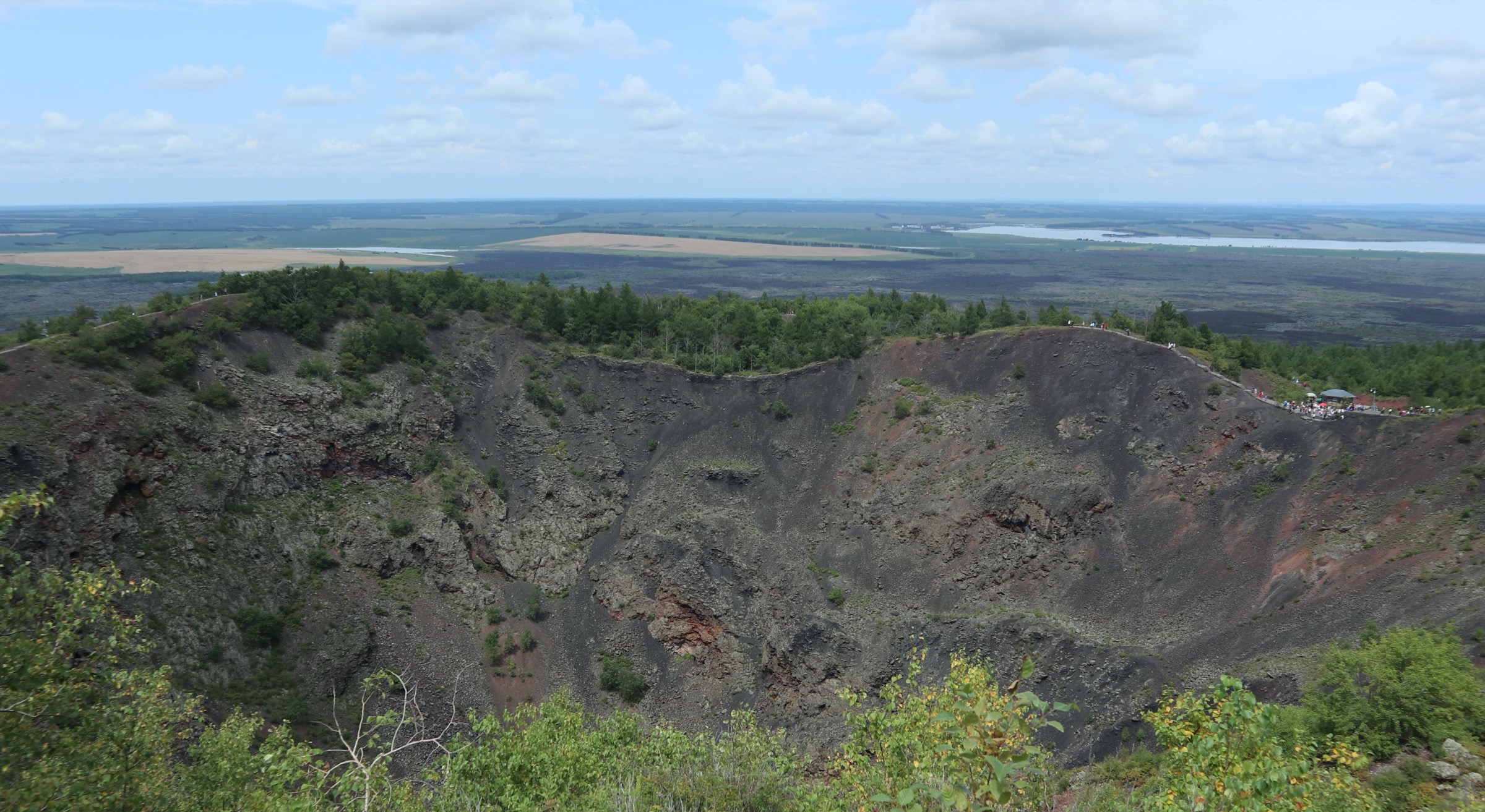
The Arxan Grand Canyon (Arxan Daxiagu / 阿尔山大峡谷) is a W-shaped basalt-and-granite canyon running roughly north–south through the southern park. Chinese-language sources give the total length as 11 km, the floor width as 30–150 m, and the depth as 30–130 m; the published opened section is around 3.5 km. The route begins at a rim viewing platform, then drops on a long wooden staircase down the steepest wall — the canyon’s signature engineered feature, often described in trip reports as “the long descent.” At the canyon floor a level boardwalk follows the small stream (mean depth 0.6 m) through alternating sun and shade, between sheer basalt cliffs on one side and tumbled volcanic boulders on the other. The boardwalk crosses the stream at intervals on short timber bridges. Larch and birch grow directly from clefts in the basalt; in late September the canyon walls catch the gold of larch needles against the dark rock.
The opened section ends at a turn-around platform; the route returns by the same boardwalk and the same staircase. The re-ascent of the entry stair is the only sustained effort on the walk and is the reason the route deserves “moderate” rather than “easy.”
Why it is essential
The Grand Canyon is the only walk inside the Arxan park with meaningful vertical relief — a true descent into a canyon rather than a stair climb to a rim. It is also the only walk that crosses the basalt–granite contact at close range: upper walls are Quaternary lava, lower walls expose the granite basement, and the contact is visible from the canyon-floor boardwalk. As the most dramatic vertical landscape in the park it is a deliberate complement to the boardwalk-level walks (Dujuanhu, Shitanglin, Guibei Yan) and to the short stair-and-platform crater walks carried in the sibling article.
Equipment
- Trail shoes or light boots with good sole grip (timber stairs and wet boardwalk)
- Weatherproof shell — the canyon floor traps drizzle
- Warm mid-layer (canyon floor stays cool even on hot days)
- Sun protection on the rim
- Mosquito repellent in mid-summer (the canyon-floor still air concentrates insects)
- Trekking pole optional but helpful on the long stair re-ascent
- Water and snacks — no water sources on the boardwalk
Hazards and notes
The rim staircase is steep and long; descend with care in the wet, and pace the re-ascent. Stay on the boardwalk — off-path basalt is razor-sharp and the canyon floor includes loose boulder slopes. Lightning exposure on the rim viewing platforms is the standard summer hazard; descend early in storm conditions. The route ends at the published turn-around platform; do not continue downstream into the closed section. The boardwalk and stair may be closed for repair after spring snowmelt — check at the park gate.
Sources
- Arxan tourism authority — Daxiagu page
- China Discovery — Arxan UNESCO Global Geopark
- bytravel.cn — 大峡谷 entry
3. Guibei Yan (Turtle Back Rock) boardwalk loop — 龟背岩
Snapshot
Itinerary
Guibei Yan — Turtle Back Rock — is a free-access section of the Arxan park (alongside the nearby Unfrozen River / 不冻河) and one of the strangest single landforms inside the geopark. The site is a 3 km² outcrop of cooled basaltic lava in which the contracting crust formed an orthogonal pattern of cracks that cut the lava sheet into a tiled mosaic, producing a surface that visually mimics a turtle’s shell. Chinese-language sources — including the Inner Mongolia Grassland Culture Protection Foundation entry and several published geology summaries — describe Guibei Yan as the only large-scale, well-developed and well-preserved turtle-back lava structure currently known in China; the formation is more commonly seen in Hawaiian-type pahoehoe flows internationally. At least three superimposed flow units make up the outcrop, with parallel and cross bedding visible at close range.
A short timber boardwalk loops around and through the most visited section. The boardwalk is essentially level, with low railings, and crosses a series of the polygonal lava plates with the cracks dropping into shadowed gaps below. Larix gmelinii and ground-cover grasses grow out of the cracks; the contrast between dark basalt plates and lichen-pale crack fill is the most photographed feature. The loop returns to the layby. Most visitors combine Guibei Yan with the Unfrozen River boardwalk a short distance away on the same shuttle stop.
Why it is essential
Guibei Yan is the single most geologically specific landform in the entire field. The “turtle-shell” lava-crust structure is rare globally and is the only feature on this scale documented in China. Even within Arxan’s already lava-rich landscape it is the only walk where the boardwalk passes directly over a single, scale-distinctive crust structure — Shitanglin showcases the broader lava-field, Guibei Yan the close-up surface morphology. As a short add-on walk on a free-access stop it balances the longer paid walks elsewhere in the selection.
Equipment
- Trail shoes or light boots (boardwalk timber slick when wet)
- Weatherproof shell
- Sun protection — the outcrop is exposed
- Mosquito repellent in mid-summer
- Water
Hazards and notes
Do not step off the boardwalk onto the lava plates. The cracks between plates are deep enough to break an ankle and the surface vegetation is fragile. Sample collection is prohibited under geopark rules. The site is open in winter but the boardwalk is not actively cleared; surfaces may be ice-covered. Combining with the adjacent Unfrozen River boardwalk is the standard visitor pattern.
Sources
- bytravel.cn — 龟背岩 guide
- Inner Mongolia Grassland Culture Protection Foundation — 龟背岩
- The Paper / 澎湃新闻 — 探秘阿尔山
4. Wuli Quan – Bingxue Quan – Halaha source linked walk — 五里泉 / 哈拉哈河源
Snapshot
Itinerary
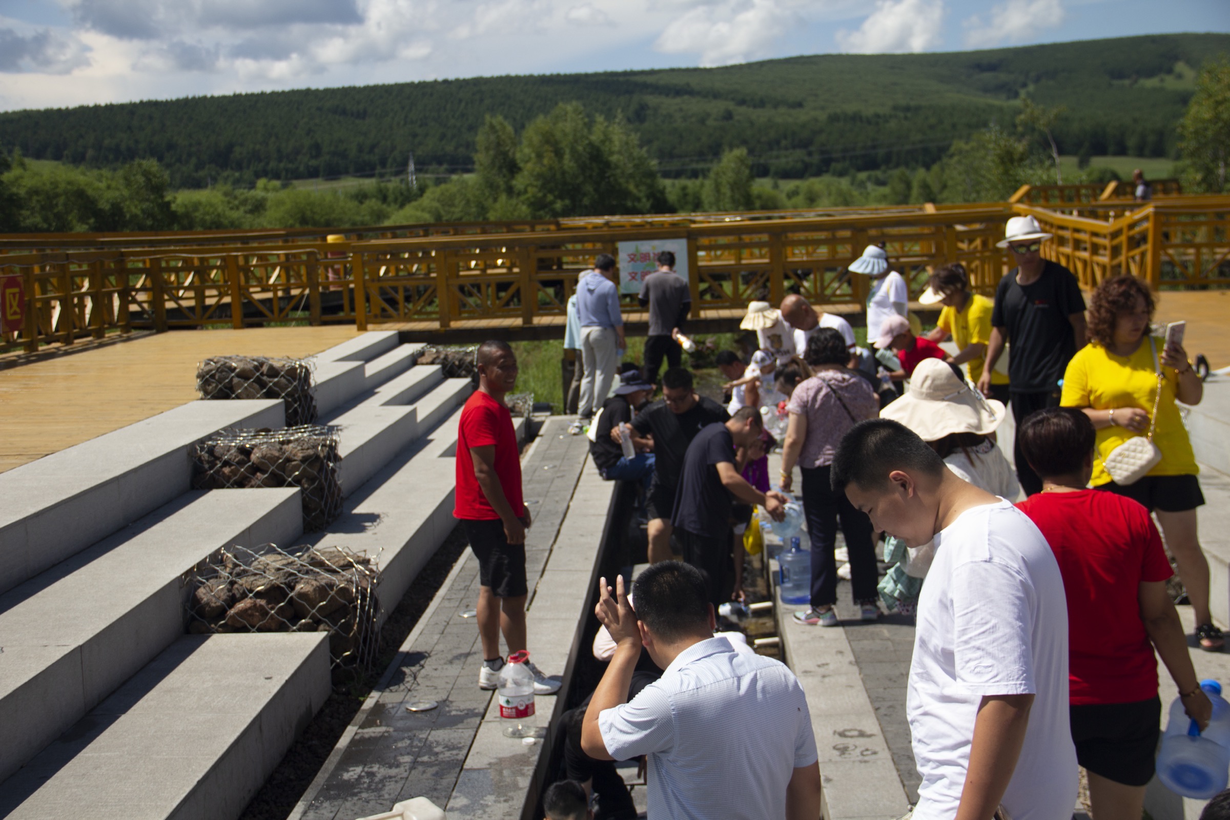
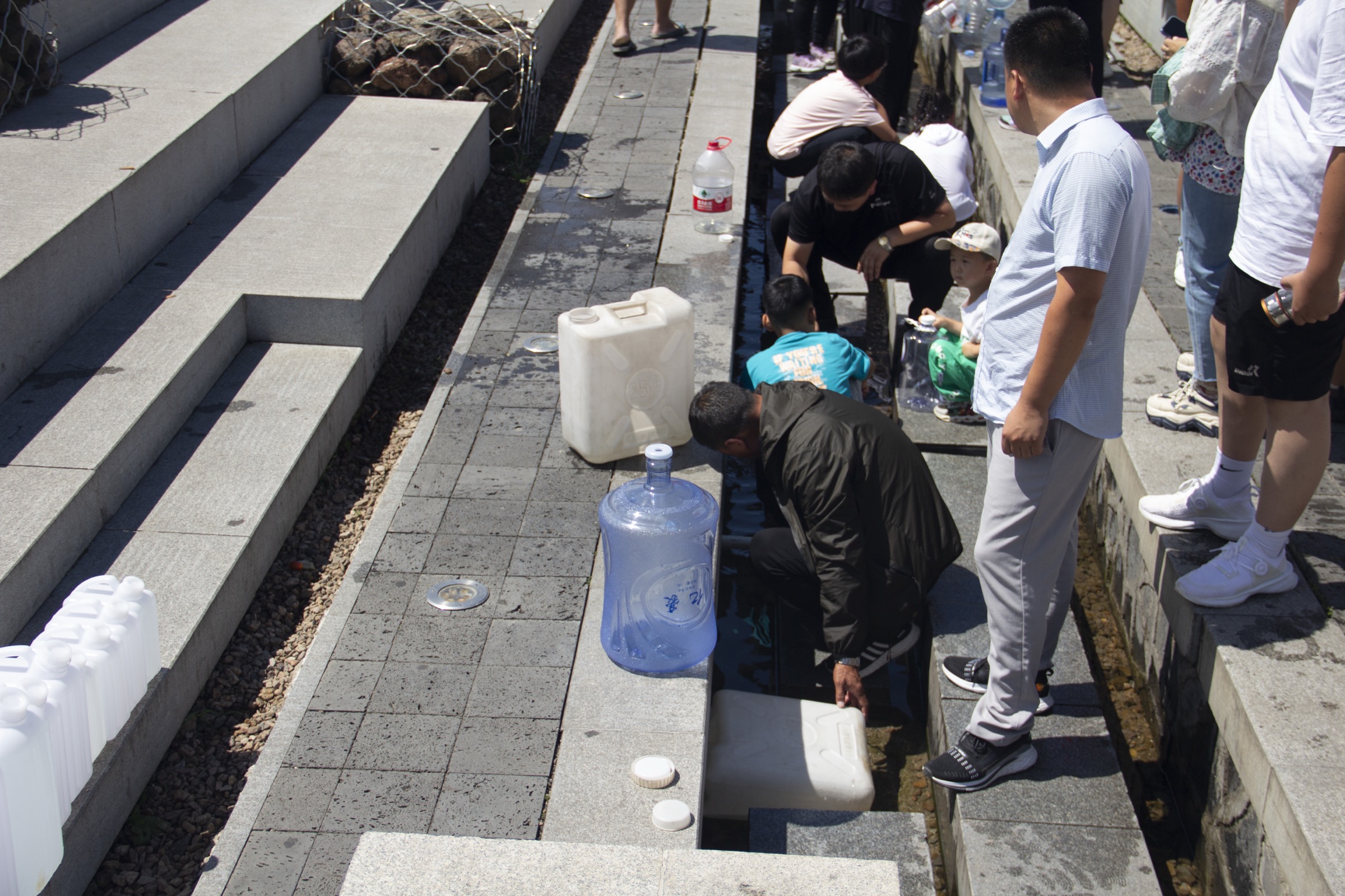
This walk links the most accessible features of the Arxan Hot Springs Geo-region away from the bathhouses. Wuli Quan — literally “Five-Li Spring” — takes its name from its distance (about five Chinese li, ~2.5 km) north of Arxan town; the spring rises at the intersection of two faults in Jurassic volcanic rock and discharges a constant-temperature cold-mineral water (Ctrip and tourism sources report 6.3–6.8 °C year-round, ~1,054 tonnes per day, with 13 trace elements). A short paved spur from the highway layby leads to the spring head, where a fenced collection basin is the canonical photograph; local visitors fill bottles directly from the outflow. A short footpath continues across the riparian birch belt to the spring fissure where the water emerges from the basalt-Jurassic contact.
A short drive — or, in season, a geopark-shuttle hop — reaches the Bingxue Quan (Ice-Snow Spring) spur, a smaller seasonal cold spring set deeper in the larch forest. A timber boardwalk of around 500–800 m connects the shuttle stop with the spring outcrop, then loops back to the road. The water here is colder than Wuli Quan and remains liquid through most of the winter — its name notwithstanding.
The third spur reaches the Halaha source monument (哈拉哈河源头), where a stone marker labels the published source of the river; the larch-fringed headwater is a few minutes’ walk from the road. The Halaha rises on the western flank of the Greater Khingan and runs for 399 km before forming a stretch of the China–Mongolia border (the Khalkhin Gol of the 1939 battles).
The three spurs are short individually and are typically walked as a single composite morning. The lay-out can be reversed if the day starts inside the park.
Why it is essential
This is the only walk in the selection that links the geothermal-water landscape of the Hot Springs Geo-region with the riverine landscape — and the only walk that delivers all three of the field’s hydrological signatures on the same morning: cold-mineral spring (Wuli Quan), seasonal ice-spring (Bingxue Quan) and the headwater of the river that defines the surrounding political and military geography (Halaha source). It also serves as a low-altitude, low-effort walk that complements the longer descent (Grand Canyon), the lake-edge boardwalk (Dujuanhu), the pavement walk (Guibei Yan) and the summit-style stair (Meigui Feng).
Equipment
- Trail shoes or light boots
- Weatherproof layer
- Warm mid-layer
- Sun protection
- Mosquito and biting-fly repellent (riparian zone heavy in mid-summer)
- An empty bottle for Wuli Quan if drawing water is intended; the local norm is to collect direct from the basin (visitors should make their own judgement on drinking)
- Tick protection sensible in the larch-grass margin
Hazards and notes
The springs are not chlorinated or formally certified for drinking; visitors who fill from the basin do so at their own risk. The Wuli Quan spur sits on a working highway layby — exit and enter carefully. The Halaha-source monument lies inside the broader geopark boundary; standard scenic-area rules apply. The lower Halaha further downstream forms the China–Mongolia border and is a restricted zone; this walk stays well upstream of any border area. Dogs are generally not permitted on scenic-area boardwalks; the roadside spring layby is more permissive.
Sources
- Ctrip — 阿尔山五里泉 attraction page
- Ministry of Culture / The Paper — 畅游冰雪季,童话阿尔山
- Wikipedia — Khalkhin Gol (downstream Halaha)
5. Meigui Feng (Rose Peak) granite stone-forest hike — 玫瑰峰
Snapshot
Itinerary
Meigui Feng — Rose Peak — is the granite counterpoint to the volcanic core of the Arxan field. The site is a granite stone-forest of ten-plus principal peaks rising abruptly above the lower Halaha valley, with rock bodies weathering to a reddish-brown shade that gives the cluster its name. The Arxan UNESCO Global Geopark dossier treats Meigui Feng as a discrete geo-region, paired with the Triangle Mountain Port to form the broader Halaha geo-region. Chinese-language sources record a stone-forest area of around 82 km², with rock bodies showing strongly developed horizontal and (especially) vertical joints — the vertical joints dipping at around 75° with an azimuth near 113° — and “rock-mortar” (yánjiù / 岩臼) wear pits in the flatter summit pavements where wind-driven water has hollowed out shallow basins.
The visitor path is a graded timber-and-concrete stair that climbs the eastern flank of the principal peak cluster, with platforms at intervals. The path is comparatively short — most visitors reach the principal summit platform in 30–40 minutes — and the round-trip is best treated as a layered walk in which each platform is visited in turn rather than a single turn-around point. In the foreground are the joint-controlled rose-coloured slabs; in the middle distance is the upper Halaha braided floodplain (the river is here a slow-flowing meander between larch and willow); in the far distance, in clear weather, the volcanic landscape of the main park appears as a low-angle horizon.
Historically the lower Halaha gap beneath the peak is identified in Chinese cultural-tourism materials as the route of Genghis Khan’s Köiten (阔亦田) campaign of 1201 — the battle between the proto-Mongol confederacy and the Jamukha-led alliance — and the path is part of the standard “Old Mongol Road” itinerary.
Why it is essential
Meigui Feng is the only walk in the selection that climbs above the surrounding landscape and the only one that crosses out of the volcanic field onto exposed granite basement. As a structural and visual counterpoint to the lava and lake walks, and as the most historically significant single site in the Arxan area, it rounds out the selection. The combination of a true (if short) summit, panoramic Halaha-valley view and the granite stone-forest landform makes it a distinct alternative to the other four walks.
Equipment
- Sturdy trail shoes (the stair surface alternates timber and concrete)
- Weatherproof shell
- Warm mid-layer for the summit platforms (windy, exposed)
- Sun protection — most platforms are fully exposed
- Trekking pole optional on the descent
- Water and snacks
- Mosquito repellent in mid-summer
- Tick protection sensible in the long grass at the foot of the stair
Hazards and notes
The stair platforms are exposed; descend before storms. Stay on the sanctioned path. Off-path scrambling on the joint-controlled granite is hazardous and is not permitted. The site is outside the gated park and has its own ticket; the park sightseeing bus does not stop here. Snow may persist into May and return from late October; the stair is not actively cleared in winter.
Sources
External links
| Source | URL |
|---|---|
| UNESCO IGGP — Arxan UNESCO Global Geopark | unesco.org |
| Global Network of National Geoparks — Arxan | globalgeopark.org |
| Arxan National Forest Park official site | aesly.com |
| Arxan UNESCO Global Geopark portal | aesdzgy.cn |
| Arxan municipal government tourism | aes.gov.cn |
| Smithsonian Global Volcanism Program — Arxan-Chaihe | volcano.si.edu |
| IntechOpen — Arxan-Chaihe Volcanic Field, NE China | intechopen.com |
| China Discovery — Arxan UNESCO Global Geopark | chinadiscovery.com |
| Beijing Hikers — A’ershan Forest National Park | beijinghikers.com |
| Wikimedia Commons — Category:Arxan | commons.wikimedia.org |
| OpenStreetMap (ODbL 1.0) | openstreetmap.org |