Regional overview
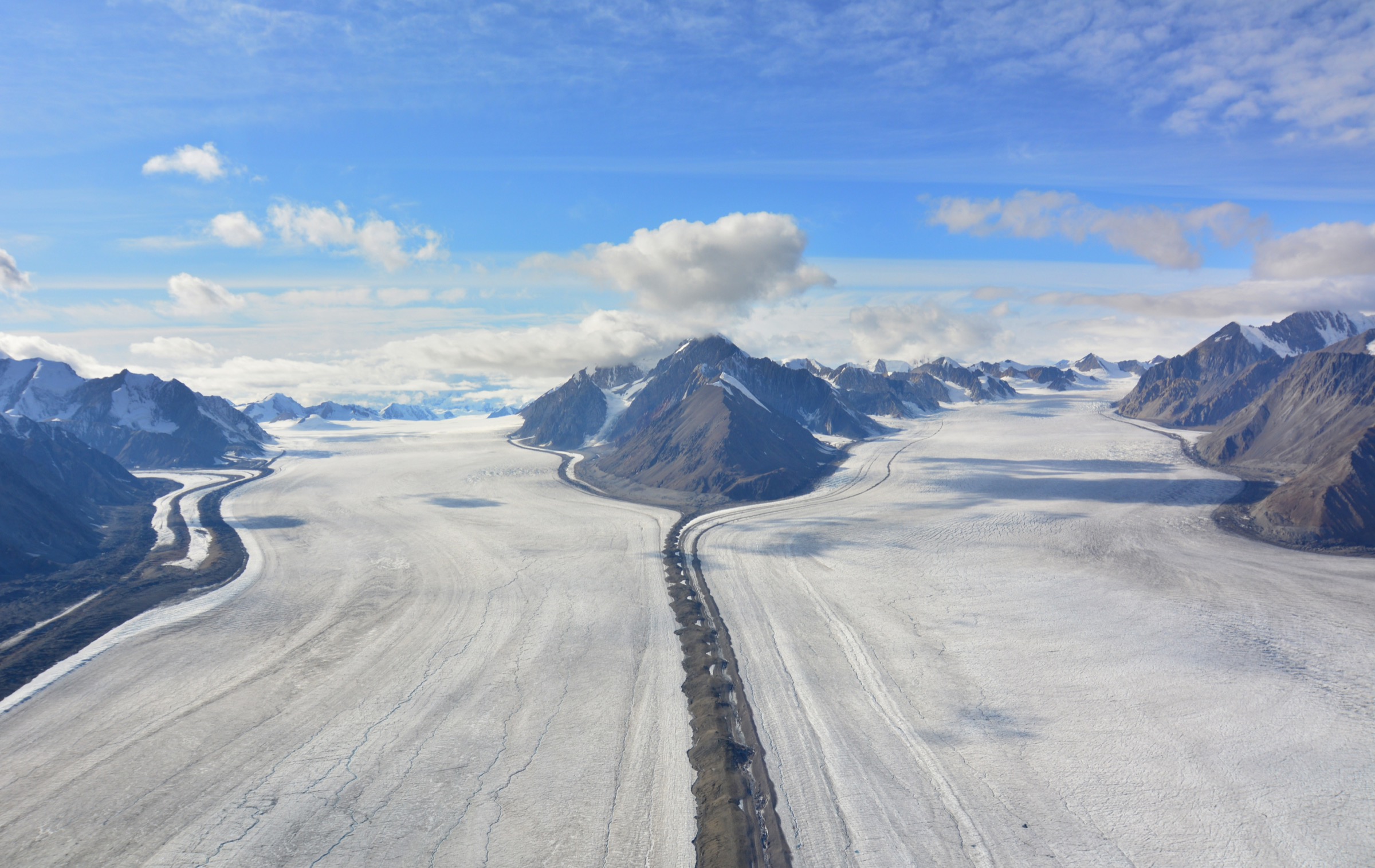
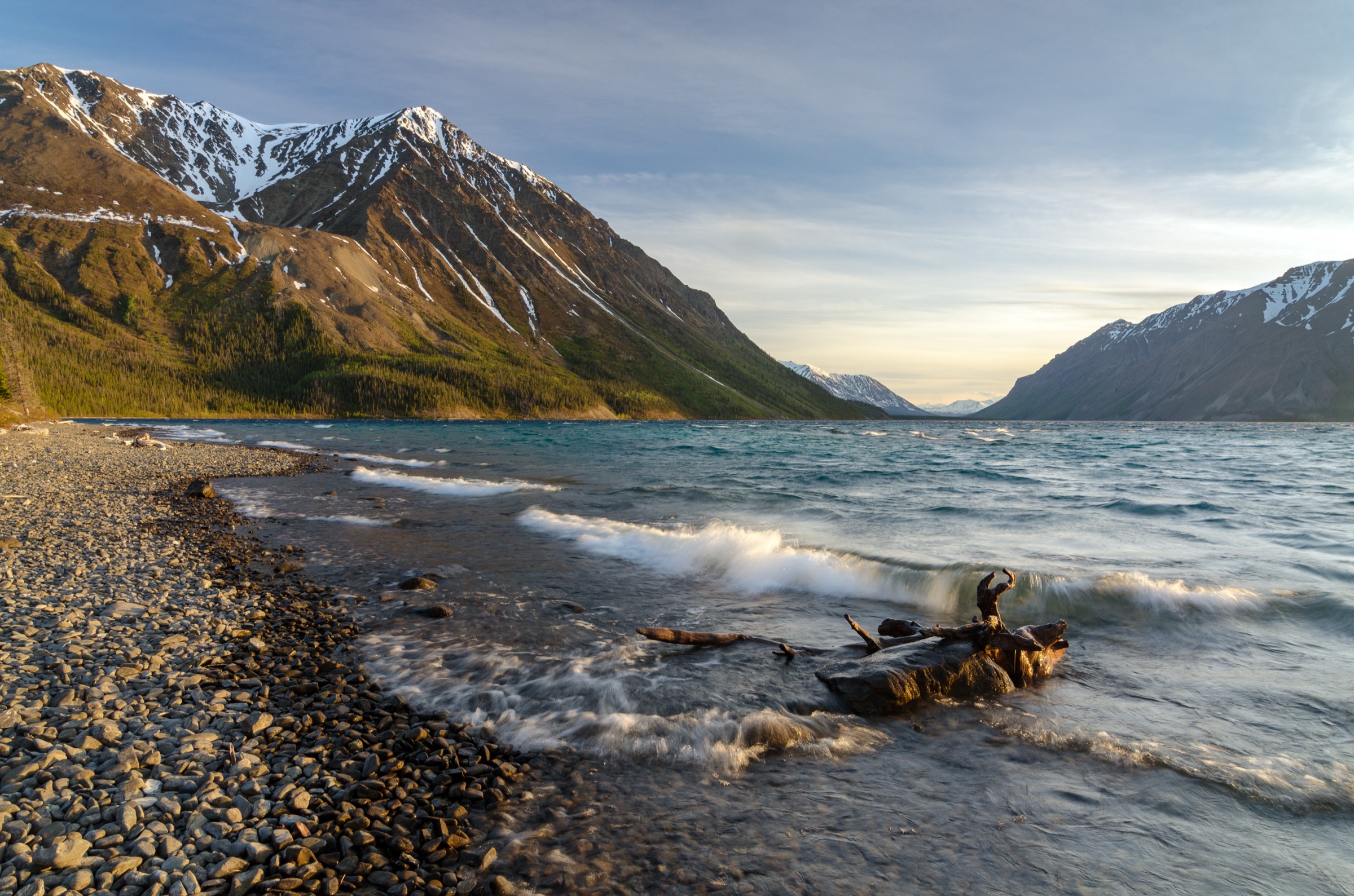
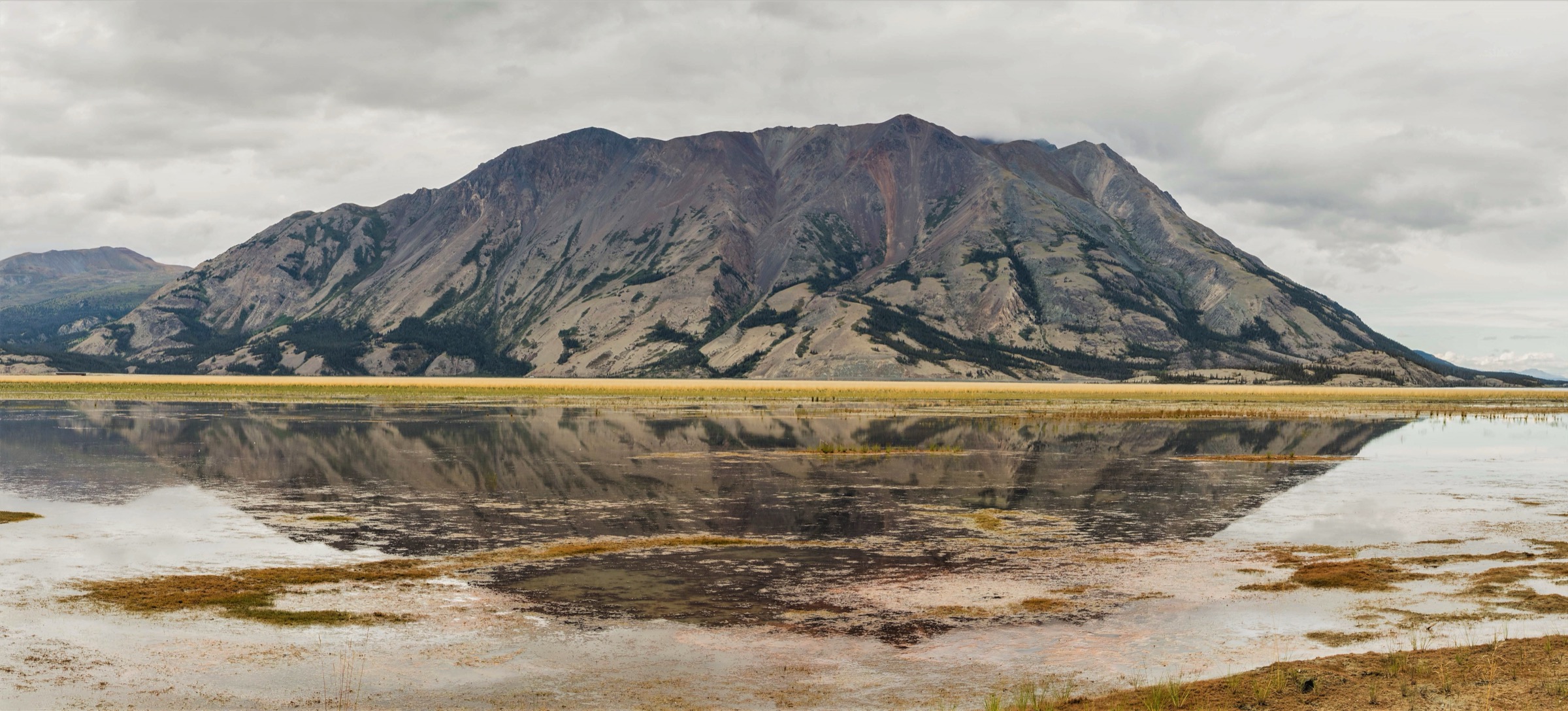
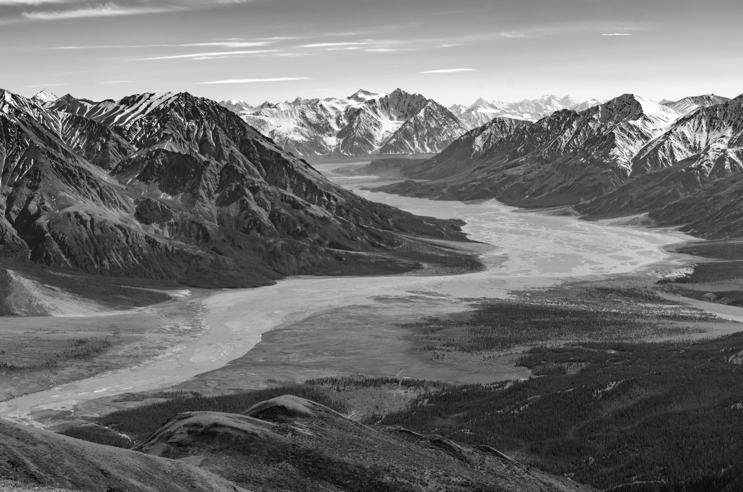
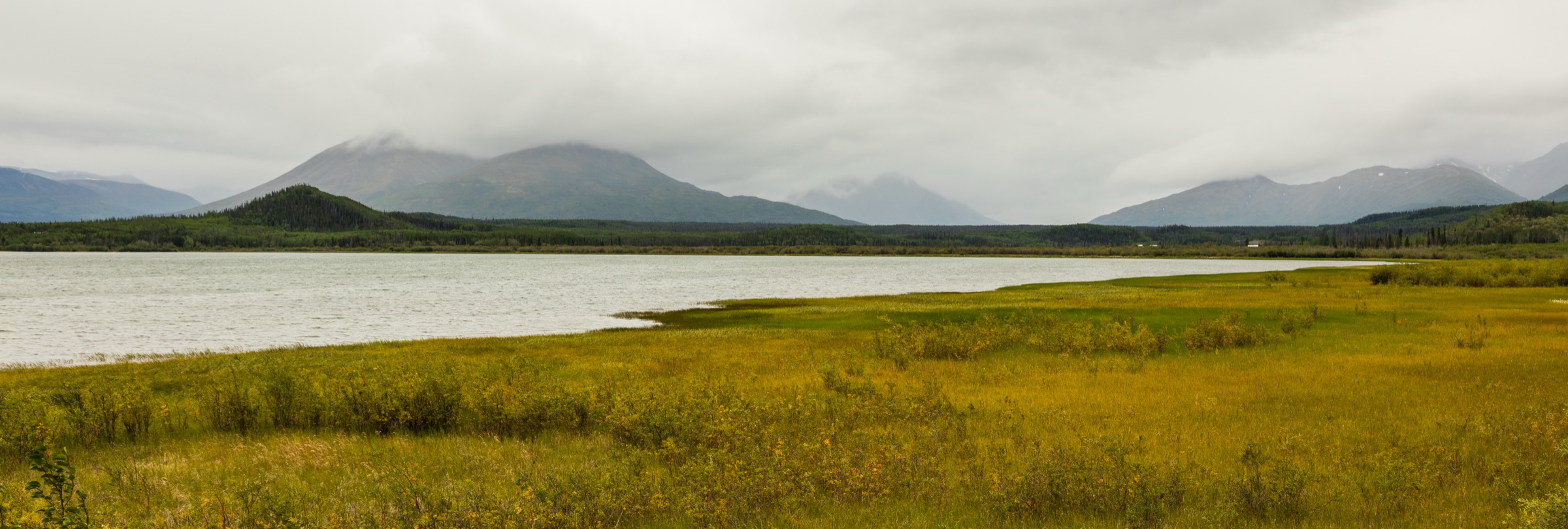
Kluane National Park and Reserve occupies 22,013 km² of southwestern Yukon, sandwiched between the Alaska Highway, the Haines Highway and the international border with Alaska. The park protects the eastern flank of the St Elias Mountains and, together with adjoining Wrangell–St Elias, Glacier Bay and Tatshenshini–Alsek, forms one of the largest internationally protected mountain landscapes on Earth. Inside the park boundary, the Kluane Ranges rise abruptly from the boreal foothills to peaks of 2,500–3,000 m, screening a vast interior of icefields and 5,000-m summits that includes Mount Logan (5,959 m), Canada’s highest mountain. The front-country trail network is the only part of this landscape accessible without aircraft or multi-day rafting logistics.
Three Parks Canada front desks anchor the trail menu. The Haines Junction Visitor Centre, co-located with the Da Kų Cultural Centre at the junction of the Alaska Highway and the Haines Highway, handles the central Auriol Range and Dezadeash River trails. The Thechàl Dhâl Visitor Centre, 70 km north on the Alaska Highway at the southern end of Kluane Lake, opens the Sheep–Bullion plateau hikes and the famous Dall sheep viewing slopes. Kathleen Lake, 27 km south of Haines Junction on the Haines Highway, gives access to the King’s Throne cirque and the Cottonwood backcountry. The Haines Highway itself runs south from Haines Junction along the eastern park boundary and serves the Rock Glacier and St Elias Lake trailheads en route to Million Dollar Falls and the British Columbia border.
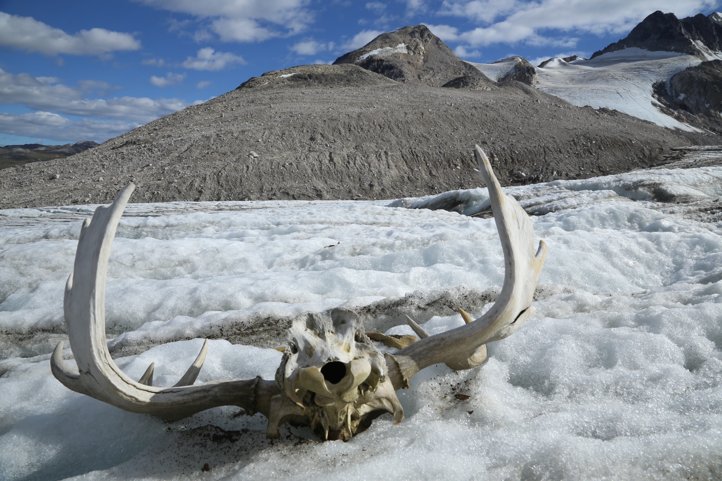
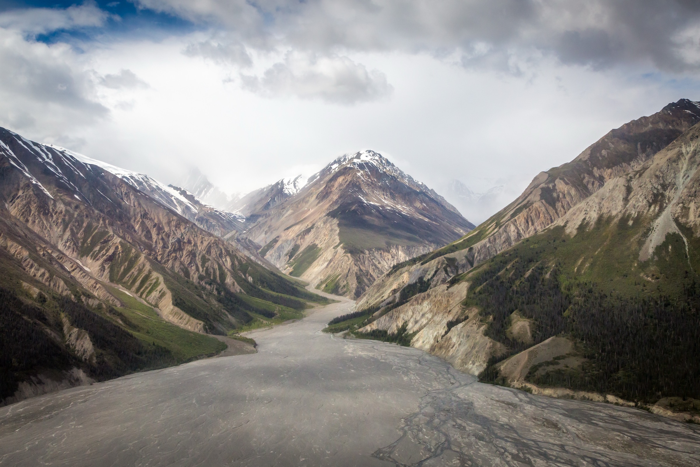
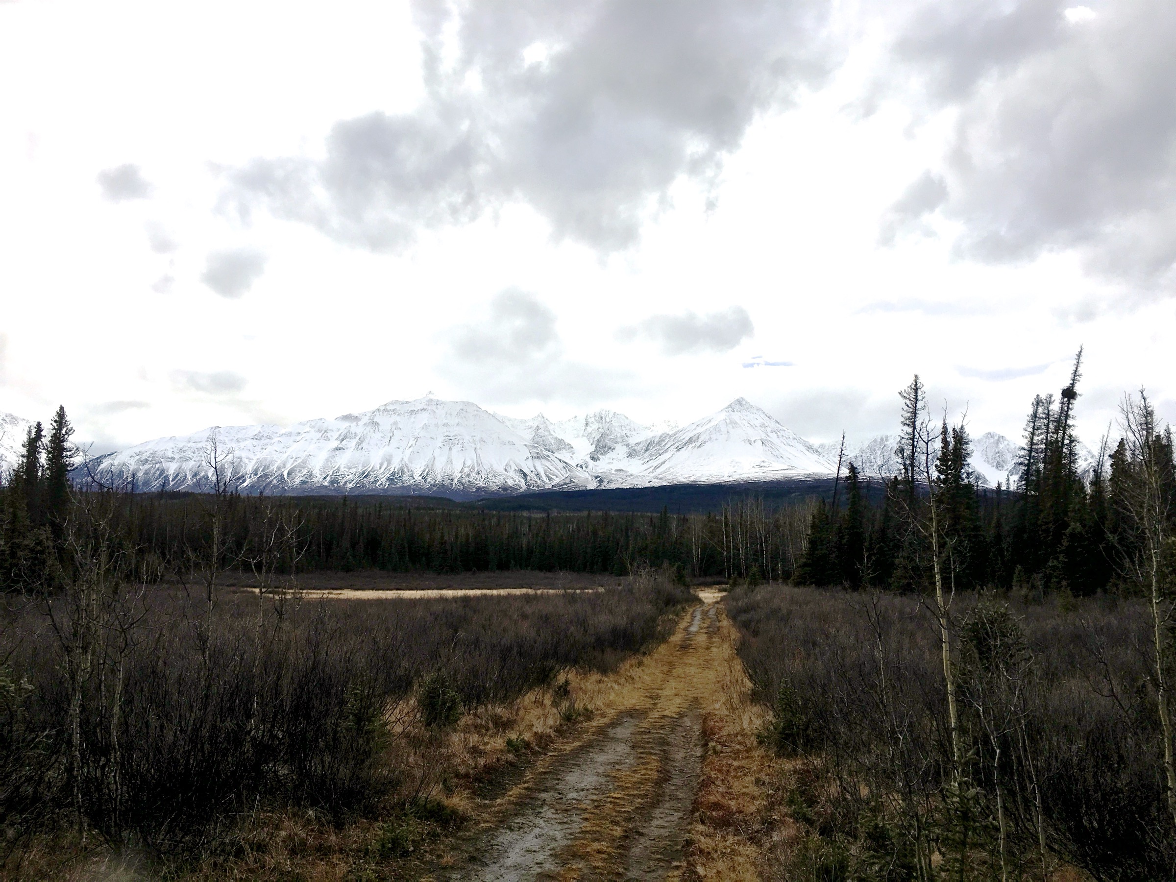
The hiking season is short and weather-driven. Lower forest trails normally open by mid-May, but subalpine and alpine routes are usually walkable only between late June and early September. Snow lingers on the King’s Throne col and the upper Thechàl Dhâl ridge into early July in most years, and shoulder-season cold snaps are common. The hydrology of the western park changed permanently in spring 2016, when the rapidly retreating Kaskawulsh Glacier rerouted its meltwater into the Kaskawulsh River. The Slims River dried out within days and the historic Slims River West trail to the Kaskawulsh Glacier toe is no longer the route to the icefields it once was; Parks Canada’s current Kaskawulsh-view options use different approaches and conditions vary year to year. Grizzly and black bears are present throughout the park, lambing closures protect the Thechàl Dhâl slopes from 1 May to 15 June, and backcountry overnight trips require registration and a National Park Pass.
Selection rationale
The five entries cover the canonical Parks-Canada-signed front-country day-hikes inside Kluane National Park and Reserve: the iconic glacial-cirque climb above Kathleen Lake (King’s Throne), the classic montane-to-subalpine loop near Haines Junction (Auriol), the steep open ridge above Kluane Lake with reliable Dall sheep viewing (Thechàl Dhâl Ridge), the long alpine plateau day from the same Sheep–Bullion trailhead (Bullion Plateau), and the short forest-and-subalpine-lake out-and-back from the Haines Highway (St Elias Lake). They draw on all three main visitor centres, span easy half-day to full-day strenuous commitments, and represent the range of terrain — cirque, montane forest, exposed alpine ridge, high plateau and remote sub-alpine lake — without overlapping with the icefield-fringe summits or the Haines Highway hikes south of the park boundary covered in sister articles.
Summary table
| # | Hike | Country | Route type | Distance | Gain | Max elevation | Difficulty |
|---|---|---|---|---|---|---|---|
| 1 | King’s Throne (cirque) from Kathleen Lake | Canada | Out-and-back | 10 km | 548 m | 1,450 m | Moderate-Hard |
| 2 | Auriol Trail loop from Haines Junction | Canada | Loop | 15 km | 400 m | 1,159 m | Moderate |
| 3 | Thechàl Dhâl (Sheep Mountain) Ridge | Canada | Loop | 11 km | 1,310 m | 1,922 m | Hard |
| 4 | Bullion Plateau from Thechàl Dhâl | Canada | Out-and-back | 24 km | 915 m | 1,700 m | Hard |
| 5 | St Elias Lake from the Haines Highway | Canada | Out-and-back | 7.6 km | 120 m | 1,000 m | Easy-Moderate |
1. King’s Throne (cirque) from Kathleen Lake
Snapshot
Itinerary
From the Kathleen Lake day-use area (665 m), the trail follows the lakeshore westwards for about 700 m before turning uphill at the signed King’s Throne junction. The path climbs steadily through aspen and white spruce, then breaks out of the trees onto an open scree slope that switchbacks up the south flank of the cirque headwall. The upper switchbacks gain height fast on shifting talus and reach the rim of the cirque — the natural “seat” of the throne — at about 1,450 m, with a sudden, vertical view down onto Kathleen Lake, the Dalton Range, and Louise Lake to the south. The marked trail ends here. Strong parties extend along an unmarked, unmaintained scramble line up the south ridge to the 1,990 m summit of Kings Throne Peak, adding around 6 km and 540 m of further gain.
Why it is essential
King’s Throne is the signature day-hike of Kluane’s southern sector and the only short route in the park that climbs from lakeshore to a true alpine cirque on a maintained trail. The summit variant adds an iconic ridge walk with views across the southern Icefield Ranges, but even the cirque-rim turnaround gives the classic Kluane image of glacial topography, lake and ice in a single panorama.
Equipment
Standard mountain hiking kit: sturdy boots with good grip for loose scree, trekking poles (strongly recommended for the descent), wind shell, warm layer, sun protection, and at least two litres of water (no reliable source above the lake). Bear spray is standard equipment everywhere in Kluane, not optional, including on this trail. Headtorch for the summit variant.
Hazards and notes
The upper switchbacks cross steep, loose scree that is unstable and slippery, especially on descent; trekking poles meaningfully reduce knee load and ankle strain. The ridge above the cirque is exposed to strong, gusty winds and afternoon thunderstorms in summer. Both grizzly and black bears use the Kathleen Lake corridor, and the campground operates a permanent electric fence; carry and know how to use bear spray, and make noise on the forested approach. Backcountry registration is required at Haines Junction for the summit ridge variant if any overnight component is involved. Kings Throne is sensitive lambing habitat for mountain goats above the cirque rim — stay on existing tread.
GPX / KML links
| Source | URL |
|---|---|
| AllTrails: King’s Throne Trail to Cirque | alltrails.com |
| Trailforks: King’s Throne Trail | trailforks.com |
| Trailforks: King’s Throne Summit Trail | trailforks.com |
2. Auriol Trail loop from Haines Junction
Snapshot
Itinerary
The signed loop leaves the Haines Highway at 670 m and climbs gently north-west through mixed white spruce and trembling aspen on a well-graded forest trail. After roughly 4 km it reaches a primitive backcountry campground at the head of a small creek, with a designated tent pad and outhouse. Above the campground, the trail breaks into a subalpine bench at the foot of the Auriol Range proper, with views over the rounded mass of Mount Decoeli to the north-east and the rocky towers of Mount Martha Black to the west. The standard loop closes back to the trailhead via a long descending traverse through the forest. A worthwhile, unsigned alpine extension follows obvious ridges from the bench up onto the alpine, adding around 5 km and 430 m of further gain for sweeping views across the Dezadeash valley.
Why it is essential
The Auriol Trail is the canonical introduction to Kluane’s montane forest belt and the most popular day-hike from Haines Junction itself. It samples the full boreal-to-subalpine gradient on a maintained loop, gives consistent views of the Auriol Range, and serves as either a long half-day from Whitehorse–Haines Junction road traffic or a gentle introductory overnight. No other Kluane trail offers the same balance of mileage, scenery and ease of access.
Equipment
Standard mountain hiking kit: trail shoes or light boots, weatherproof shell, warm layer, sun protection, plenty of water (no reliable source above the trailhead in dry summers), and bear spray as a baseline. Trekking poles help on the steeper descent sections. Headtorch and full overnight gear if camping at the backcountry tent pad.
Hazards and notes
The trail crosses excellent grizzly and black bear habitat — make noise on the wooded sections, travel in groups where possible, and store food at the backcountry campground in the provided lockers. Mosquitoes and blackflies are intense between mid-June and late July. The alpine extension is unmarked and can become disorienting in cloud; carry a map and a navigation backup. Overnight stays require a backcountry permit obtained at the Haines Junction Visitor Centre.
GPX / KML links
| Source | URL |
|---|---|
| AllTrails: Auriol Trail | alltrails.com |
| Trailforks: Auriol Trail | trailforks.com |
| Komoot: Auriol Trail (Kluane National Park) | komoot.com |
3. Thechàl Dhâl (Sheep Mountain) Ridge
Snapshot
Itinerary
From the Thechàl Dhâl Visitor Centre at 780 m on the Alaska Highway, the route leaves the signed Soldier’s Summit interpretive trail after roughly 600 m and breaks off onto a steep, mostly unmarked line up the south flank of the mountain. The ascent gains height directly on open tundra and broken talus, with occasional rock bands that are easily threaded. The upper ridge opens to wide views over Kluane Lake to the east, the Slims River valley and the inner Kaskawulsh approach to the south-west, and the snowfields of the high Kluane Ranges to the west. The high point sits at around 1,922 m. Most parties descend via a different draw further west, closing the loop back to the highway near the visitor centre. The face of Thechàl Dhâl itself is permanently closed to all travel as critical Dall sheep habitat — the route stays on the broader flanks and ridge to the west of the headwall.
Why it is essential
Thechàl Dhâl Ridge is the iconic Kluane Lake hike and the only short open-ridge day in the park that delivers truly alpine scenery with consistent Dall sheep viewing (mid-summer onwards, once lambing closures end). It is one of the steepest, most direct ascents on the front-country menu, and the panorama of Kluane Lake from the upper ridge is unmatched on the eastern side of the park.
Hard facts about the closures and the Slims River
The face of Thechàl Dhâl is closed year-round. The ridge route is additionally closed to all access — including foot travel — from 1 May to 15 June each year during the Dall sheep lambing period. Dogs are prohibited on the route at all times. The traditional Slims River West trail from the visitor centre area to the Kaskawulsh Glacier toe has been substantially altered since the Slims River dried up in 2016 (the Kaskawulsh Glacier rerouted its meltwater into the Kaskawulsh River drainage); confirm current access for any extension of this route directly with Parks Canada before departure.
Equipment
Mountain hiking kit at the strong end: sturdy boots with rigid soles for steep scree, trekking poles, wind shell and warm layer, a full litre and a half to two litres of water per person (no reliable source on the route), sun protection, headtorch for late returns, and bear spray. A map, compass and navigation backup are genuinely useful because the descent is route-found, not signed.
Hazards and notes
The ridge is fully exposed to wind, lightning and rapid weather changes. Steep, loose scree is the dominant terrain — falls on the upper section have caused serious injuries. The route demands route-finding on tundra and talus with no marked trail; do not attempt in low cloud or wet conditions. Both grizzly and black bears use the lower mountain. Strictly observe the 1 May–15 June lambing closure and the permanent face closure; both are critical to the survival of the Kluane Dall sheep population.
GPX / KML links
| Source | URL |
|---|---|
| AllTrails: Soldiers Summit (lower interpretive section) | alltrails.com |
| Yukon Hiking: Thechàl Dhâl (Sheep Mountain) route notes | yukonhiking.ca |
| Live Small Ride Free: Thachäl Dhäl Ridge route description | livesmallridefree.com |
4. Bullion Plateau from Thechàl Dhâl
Snapshot
Itinerary
The route follows an old mining access road that climbs from 780 m at the Thechàl Dhâl Visitor Centre into the broad valley of Sheep Creek, then traverses out onto the Bullion Plateau west of Thechàl Dhâl. The grade is consistently moderate but the route is long; the ascent is steady rather than steep, and the road surface is firm underfoot. At around the 12-km mark from the trailhead, an unsigned spur drops to Sheep Creek and links across the valley to the Sheep Creek Trail. The plateau itself rolls at roughly 1,650–1,700 m with views across the Kaskawulsh and Slims drainages, the inner Kluane Ranges, and on clear days the southern fringe of the Icefield Ranges. Most parties turn back at the plateau rim and reverse the road grade to the highway.
Why it is essential
The Bullion Plateau is the longest front-country day-hike inside Kluane and the only one that delivers sustained high-alpine plateau walking without technical scrambling. It complements the steep Thechàl Dhâl Ridge day by trading steepness for distance, and gives the best feel for the immense scale of the Sheep–Bullion country and the Kaskawulsh drainage from a maintained line.
Hazards and notes
Distance is the dominant challenge — the route is fully exposed for most of its length and shade is rare. Carry significantly more water than the height gain implies, and start early. Grizzly bears use Sheep Creek and the lower plateau heavily; group travel, bear spray and noise on blind corners are non-negotiable. Weather changes fast on the plateau; an afternoon thunderstorm can arrive within an hour, and there is no quick exit. The route shares a trailhead with the Thechàl Dhâl Ridge: confirm the 1 May–15 June Dall sheep lambing closure status before starting, as it may affect adjacent ridge lines.
Equipment
Standard mountain hiking kit, sized up for length: sturdy boots, trekking poles, wind shell, warm layer, sun protection (the route runs above tree line for most of its length), three or more litres of water, food for a full day, headtorch, and bear spray. Map and compass for navigation if low cloud closes in on the plateau.
GPX / KML links
| Source | URL |
|---|---|
| Trailpeak: Bullion Plateau, Kluane Park | trailpeak.com |
| Yukon Hiking: Bullion Plateau | yukonhiking.ca |
| Travel Yukon: Hiking in Kluane National Park (PDF map) | travelyukon.com |
5. St Elias Lake from the Haines Highway
Snapshot
Itinerary
The trail leaves the Haines Highway at 880 m and follows an old recreation road westwards through mixed white spruce and lodgepole pine forest. The gradient is gentle and the surface is mostly firm. After roughly 3.5 km the path drops to the eastern shore of St Elias Lake, a small sub-alpine basin cradled between roughly 1,370-m peaks of the southern Auriol Range. A short, signed loop around the lake links a designated backcountry campground with a sandy beach and a pair of cooking shelters. Return is by the same approach trail.
Why it is essential
St Elias Lake is the most accessible sub-alpine lake hike inside Kluane National Park and Reserve and the natural family or recovery day-hike in the regional menu. It samples the southern Haines Road forest belt without the height gain or mileage of the other front-country options, and the lake basin gives a representative slice of the quieter, lower Auriol foothills.
Equipment
Standard hiking equipment: trail shoes, weatherproof layer, sun protection, water, snacks, and bear spray. The trail is short enough that lighter kit is acceptable, but bear spray remains baseline for any walking in Kluane. Insect repellent for mid-summer.
Hazards and notes
The trail crosses prime grizzly and black bear habitat — make noise, especially on the forested approach, and consider group travel. The lake’s outflow stream can be high in early summer; bridges are maintained but check current conditions with Parks Canada in shoulder seasons. Mosquitoes and blackflies are heavy from mid-June into late July. Backcountry camping at St Elias Lake requires a permit obtained at the Haines Junction Visitor Centre.
GPX / KML links
| Source | URL |
|---|---|
| AllTrails: Saint Elias Lake Trail | alltrails.com |
| Trailforks: Saint Elias Lake Trail | trailforks.com |
| Yukon Hiking: St Elias Lake | yukonhiking.ca |
External links
| Source | URL |
|---|---|
| Parks Canada — Kluane National Park and Reserve | parks.canada.ca |
| Parks Canada — King’s Throne | parks.canada.ca |
| Parks Canada — Auriol Trail | parks.canada.ca |
| Parks Canada — Thechàl Dhâl (Sheep Mountain) Ridge | parks.canada.ca |
| Parks Canada — Soldier’s Summit Trail | parks.canada.ca |
| Parks Canada — Bullion Plateau Trail | parks.canada.ca |
| Parks Canada — Sheep Creek Trail | parks.canada.ca |
| Parks Canada — St Elias Lake Trail | parks.canada.ca |
| Parks Canada — Rock Glacier Trail | parks.canada.ca |
| Kluane National Park Management Board — Help protect Dall’s sheep | kluanenpmb.ca |
| Travel Yukon — Hiking in Kluane National Park (PDF) | travelyukon.com |
| Travel Yukon — Hiking Kluane National Park itineraries | travelyukon.com |
| Yukon Hiking — Kluane National Park region | yukonhiking.ca |
| Wikipedia — Kluane National Park and Reserve | en.wikipedia.org |
| Wikipedia — Kings Throne Peak | en.wikipedia.org |
| Wikipedia — Sheep Mountain (Yukon) | en.wikipedia.org |
| Wikipedia — Kathleen Lake | en.wikipedia.org |
| Wikimedia Commons — Kluane National Park category | commons.wikimedia.org |
| Wikimedia Commons — Kluane Lake category | commons.wikimedia.org |
| Wikimedia Commons — Saint Elias Mountains category | commons.wikimedia.org |
| Trailforks — Kluane National Park and Reserve trails | trailforks.com |
| AllTrails — Best trails in Kluane National Park and Reserve | alltrails.com |