Regional overview
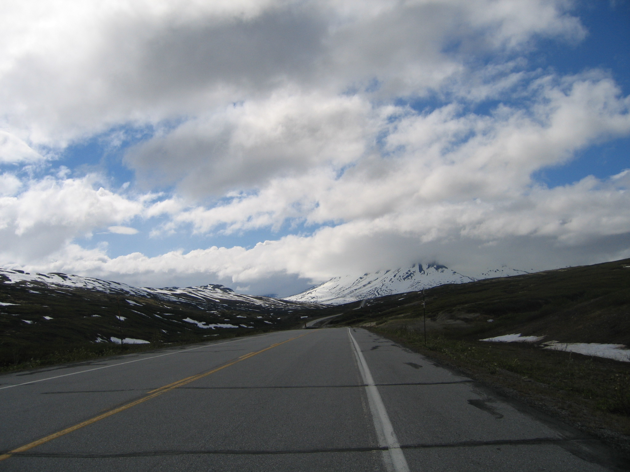
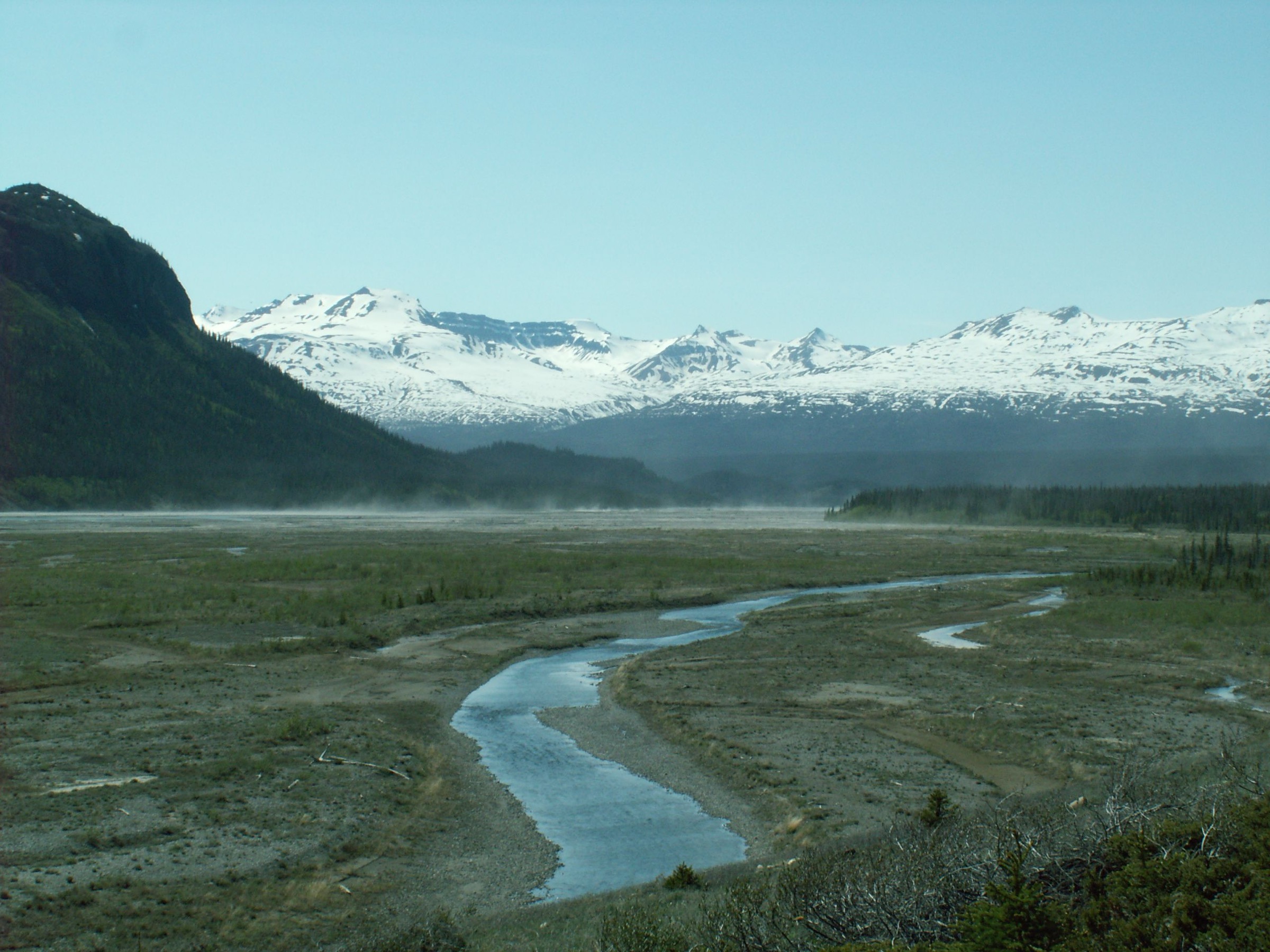
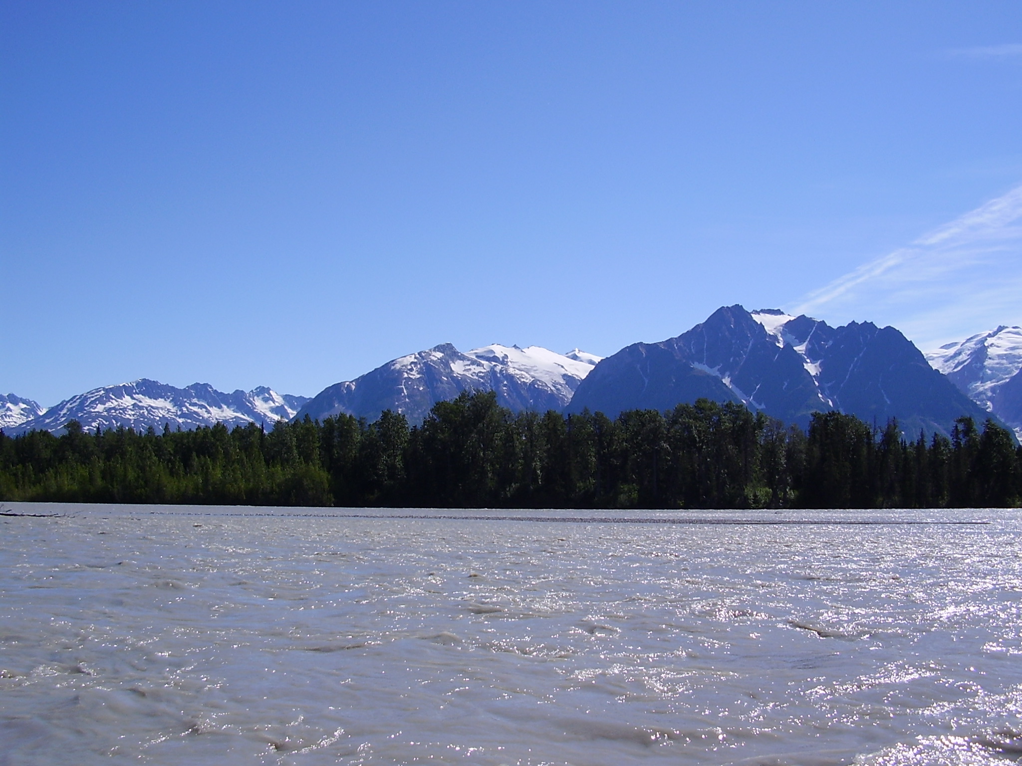
The southern flank of the St Elias Mountains straddles the Yukon-British Columbia border between Haines Junction and the head of the Lynn Canal at Haines, Alaska. The 246 km Haines Highway (Yukon Highway 3, BC unsignposted, Alaska Route 7) is the only road corridor through this country: it leaves the Alaska Highway at Haines Junction, runs south past Kathleen Lake along the boundary of Kluane National Park, crosses the wide alpine tundra of Chilkat Pass (1,070 m) at the Yukon-BC border, traverses the BC-side wilderness of Tatshenshini-Alsek Provincial Park, and crosses the Canadian-US customs post at Pleasant Camp before dropping to tidewater. East of the road, the country drains into the Alsek and Tatshenshini rivers, which carve southwest through the Coast Mountains into Glacier Bay National Park in Alaska.
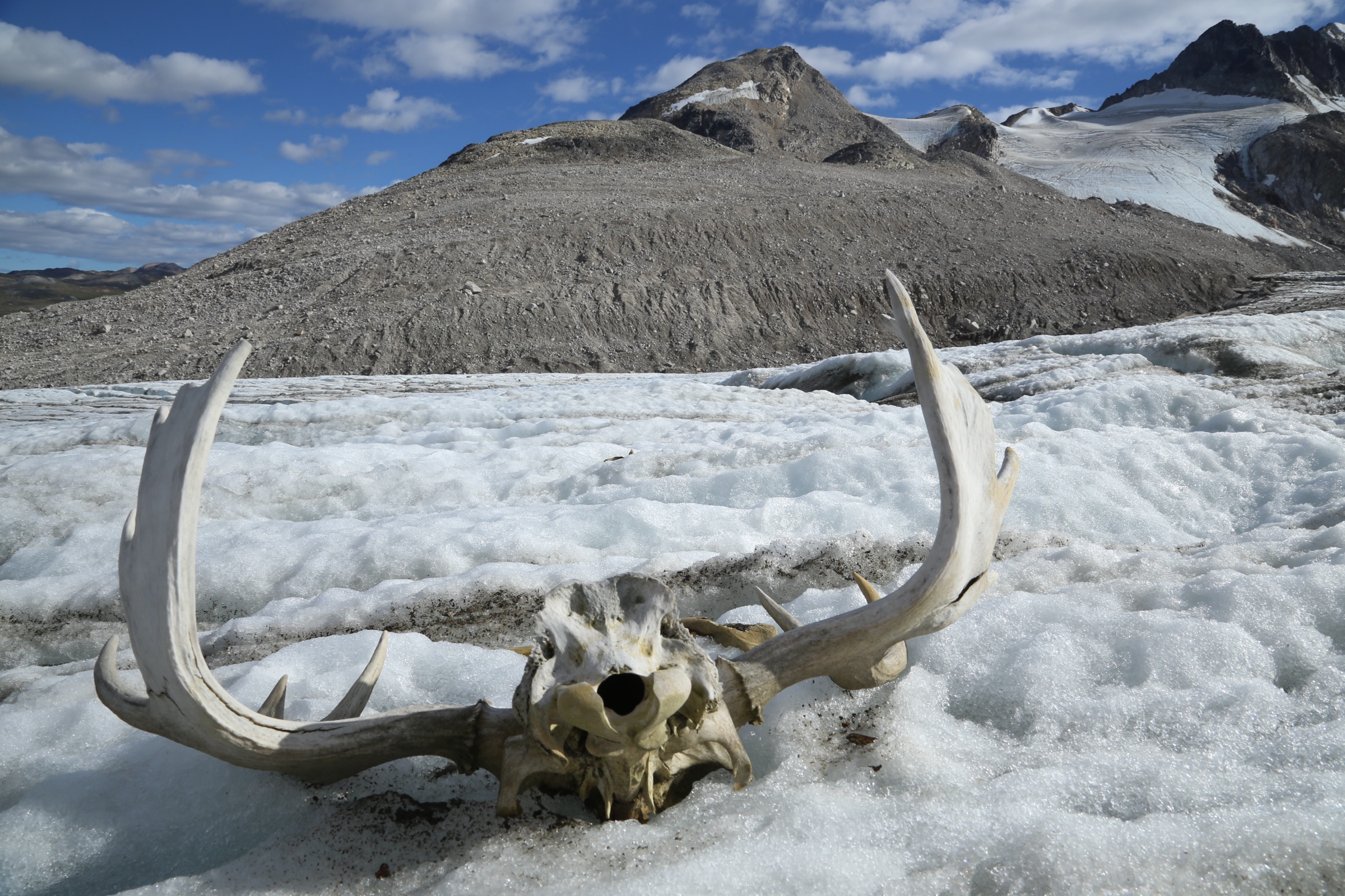
The four contiguous protected areas of Kluane National Park (Canada), Tatshenshini-Alsek Provincial Park (BC, established 1993), Wrangell-St Elias National Park (Alaska), and Glacier Bay National Park (Alaska) together form one of the largest internationally protected wilderness complexes on earth, covering roughly 98,000 km² and listed as a single UNESCO World Heritage Site. Tatshenshini-Alsek Park alone is just under 10,000 km² and was created by the Province of British Columbia largely to block a proposed open-pit copper mine on Windy Craggy Mountain. The Alsek Ranges between the two rivers hold what researchers describe as some of the most productive grizzly bear habitat in Canada.
Day-hike infrastructure here is sparse. The Chuck Creek Trail to Samuel Glacier is the only maintained hiking trail in Tatshenshini-Alsek Park, and the BC-side park has essentially no front-country other than highway pullouts and the Million Dollar Falls campground. Other routes are unmaintained game trails, old mining roads predating park establishment, and unmarked alpine scrambles from highway pullouts. The most spectacular objective in the region, Goatherd Mountain above the Lowell Glacier, is a day-hike from a river-rafting camp inside Kluane, accessed only by raft from the Dezadeash put-in. The Haines Highway between Haines Junction and the Alaska border carries no cell coverage, and the alpine sections are exposed to strong wind and rapid weather changes.
The practical hiking season runs from mid-June, when alpine snow has retreated enough to expose ridges and benches, into early September, when night frosts return. The road itself is plowed year-round but Chilkat Pass closes intermittently in winter storms.
Selection rationale
These five entries cover the four ways into the region: the BC Parks front-country trail in Tatshenshini-Alsek (Chuck Creek to Samuel Glacier), the most accessible Haines Highway alpine summit (Three Guardsmen Pass and cirque), the iconic raft-access Alsek viewpoint (Goatherd Mountain), the southern Kluane corridor accessed from the Haines Road (Mush Lake Road), and the regional interpretive walk on the Tatshenshini drainage (Million Dollar Falls). They span maintained boardwalk to exposed bouldering scramble, sit on both sides of the Yukon-BC border, and between them sample the Tatshenshini, Alsek, Takhanne, and Dezadeash drainages.
Summary table
| # | Hike | Country | Route type | Distance | Gain | Max elevation | Difficulty |
|---|---|---|---|---|---|---|---|
| 1 | Samuel Glacier via Chuck Creek Trail | Canada (BC) | Out-and-back | 19-21 km | 370 m | 1,290 m | Moderate |
| 2 | Three Guardsmen Pass and cirque | Canada (BC) | Out-and-back | 7 km | 780 m | 1,700 m | Hard |
| 3 | Goatherd Mountain from Lowell Glacier camp | Canada (YT) | Out-and-back | 10 km | 820 m | 1,420 m | Hard |
| 4 | Mush Lake Road to Mush Lake | Canada (YT) | Out-and-back | 22-44 km | Negligible | 750 m | Easy-Moderate |
| 5 | Million Dollar Falls boardwalk | Canada (YT) | Out-and-back | 1 km | Negligible | 660 m | Easy |
1. Samuel Glacier via Chuck Creek Trail
Snapshot
Itinerary
The trail leaves a signed pullout on the west side of the Haines Highway, equipped by BC Parks with an outhouse, kiosk, and bear-proof food caches for overnight users. The route follows an old mining exploration road across open subalpine tundra into the broad U-shaped valley drained by Chuck Creek, holding contour with very little net gain for the first 6 km before climbing gently towards the lateral moraine of Samuel Glacier. The upper section threads benches of dwarf willow, scree, and braided meltwater channels; the moraine viewpoint over the glacier and the icefall flowing off the Saint Elias divide is the conventional turnaround. Strong walkers extend onto the moraine itself for closer views before reversing the route.
Why it is essential
This is the only maintained hiking trail in Tatshenshini-Alsek Provincial Park and the single best day-hike approach to a Saint Elias-fed glacier on the BC side of the range. It delivers a representative cross-section of the park’s subalpine terrain, alpine tundra, and tidewater-bound icefield system without requiring a raft trip or air access.
Equipment
Mountain hiking equipment: sturdy boots, weatherproof shell, warm layer, hat and gloves, plenty of water, food, sun protection, map and GPS, and bear spray. Trekking poles help on the moraine and the creek crossings. Stream water is glacial silt-laden; carry from the highway or filter from clearer tributaries.
Hazards and notes
Grizzly bears are present throughout the valley; make noise on blind corners and carry bear spray. Weather changes rapidly at this elevation and the route offers little shelter once into the open valley. Several creek crossings can run high after warm afternoons or rain. No cell coverage on the Haines Highway south of Haines Junction. The trailhead pullout sits in BC; entry is free, no permit required for day use.
GPX / KML links
| Source | URL |
|---|---|
| Komoot: On the Chuck Creek Trail to Samuel Glacier | komoot.com |
| AllTrails: Samuel Glacier via Chuck Creek Trail | alltrails.com |
| Wikiloc: Samuel Glacier (Chuck Creek Trail) | wikiloc.com |
External links
- BC Parks — Tatshenshini-Alsek Park
- BC Parks Blog — Exploring the Chuck Creek Trail at Tatshenshini-Alsek Park
- Yukon Hiking — Samuel Glacier
2. Three Guardsmen Pass and cirque
Snapshot
Itinerary
The route leaves the Haines Highway near Three Guardsmen Lake and follows an old exploration road across open tundra for the first 2-3 km. Where the road fades, a steep direct climb gains the broad ridge between Three Guardsmen Mountain and the highway, with views opening east across the alpine basins of Tatshenshini-Alsek Park towards the Tatshenshini Plateau. Reaching the base of the main rocky ridge gives a striking foreground of the three jagged spires that name the mountain and a panorama back across Chilkat Pass towards the BC-Alaska border. Continuing along the ridge to Glave Peak (1,928 m) requires loose-boulder scrambling on exposed terrain and is the domain of confident scramblers only.
Why it is essential
This is the most accessible alpine summit objective on the Haines Highway alpine corridor, with a small parking pullout, no permit requirement, and a clean ascent line from road to ridge. It is the only standard day-hike in the immediate Haines Pass area that gains genuine alpine elevation and offers a direct visual link to both Tatshenshini-Alsek Park and the Coast Mountains.
Equipment
Mountain hiking equipment: sturdy boots, weatherproof shell, warm and windproof layer, hat and gloves outside midsummer, navigation backup, plenty of water, food, sun protection, and bear spray. Trekking poles are useful on the loose upper slope. No water on the upper route once off the road.
Hazards and notes
The upper slope is steep with persistently loose rock; a slip on the boulder field can cause significant injury. The exposed ridge is committing and not appropriate for novice hikers. The whole route sits in active grizzly bear habitat. The Haines Highway pullout is unsigned; navigation backup is essential. Cell coverage is non-existent.
GPX / KML links
| Source | URL |
|---|---|
| AllTrails: Three Guardsmen Trail | alltrails.com |
| Yukon Hiking: Three Guardsmen | yukonhiking.ca |
External links
- Peakbagger — Three Guardsmen Mountain
- Mountain Project — Glave Peak / Three Guardsmen
- ExploreNorth — Hiking to the Three Guardsmen Cirque
3. Goatherd Mountain from Lowell Glacier camp
Snapshot
Itinerary
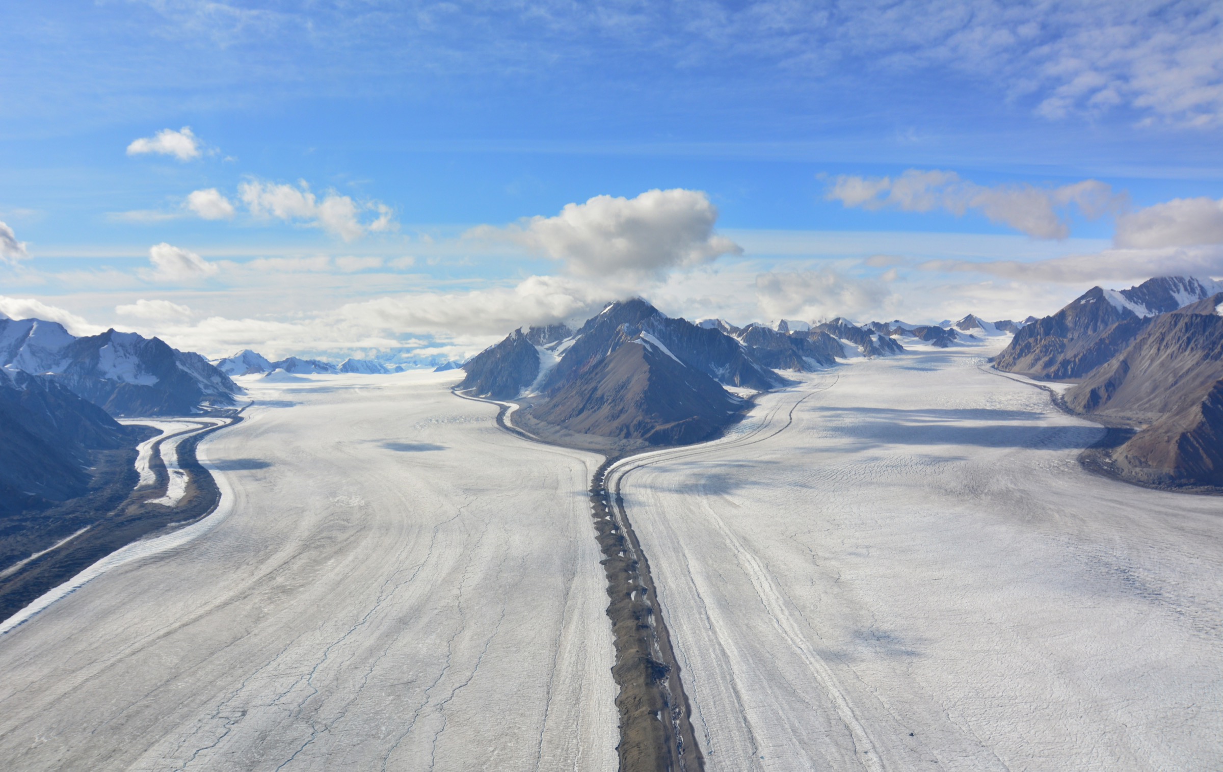
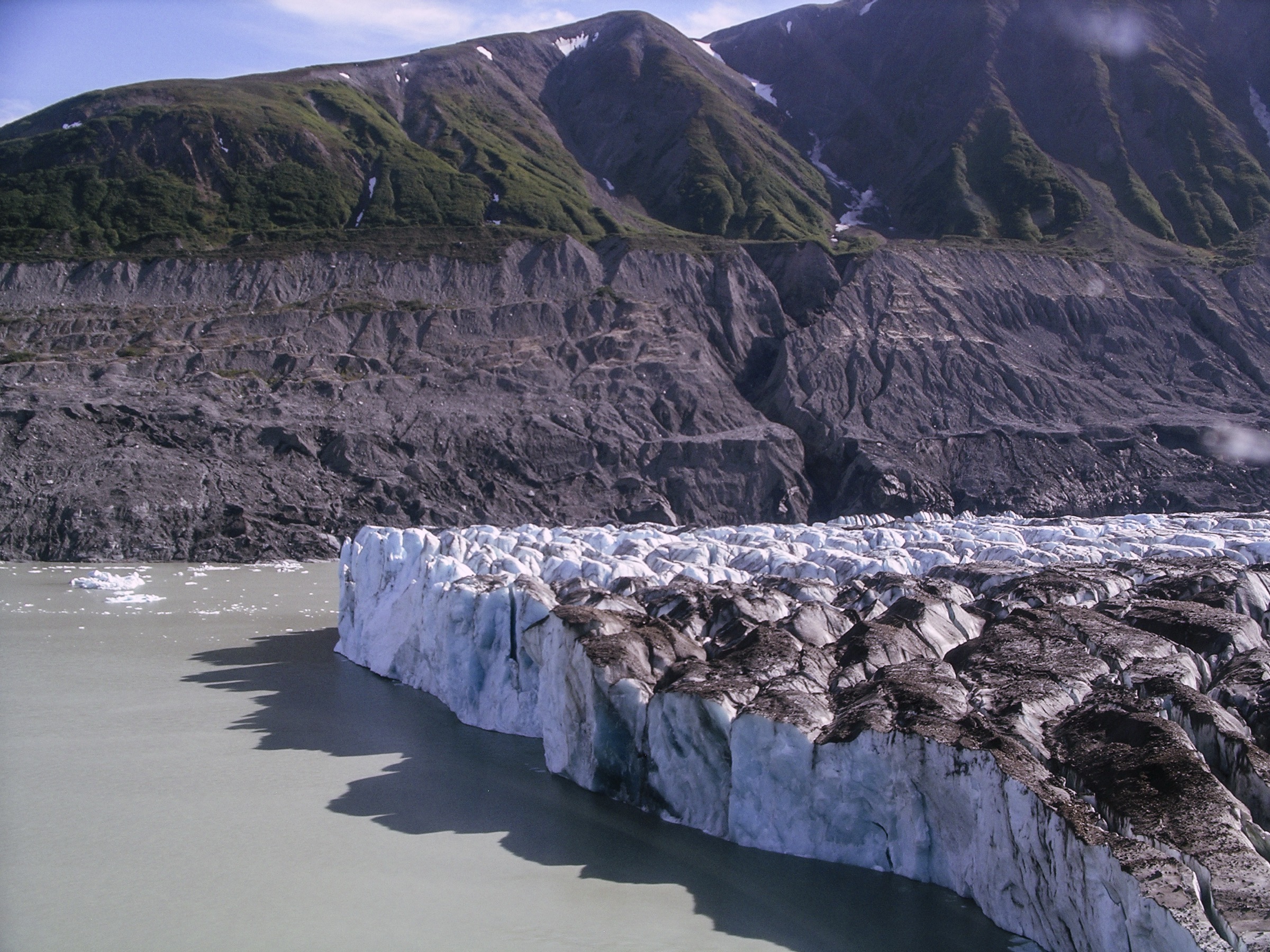
The hike leaves the river camp on the south side of Lowell Lake and climbs directly up the steep west flank of Goatherd Mountain through alpine scrub and scree, gaining the upper meadow band that gives the mountain its name. Mountain goats are routinely seen on the slopes above the lake. The upper section involves bouldering and a short exposed step on slick rock before levelling onto the broad summit ridge, where a 360-degree panorama opens over the calving face of Lowell Glacier, the iceberg-strewn surface of Lowell Lake, and, on clear days, the glaciated 4,500-5,000 m peaks of the inner Saint Elias / Wrangell-Saint Elias divide. Return is by the ascent line.
Why it is essential
Goatherd Mountain is the iconic Alsek day-hike and the single most published viewpoint of the lower Lowell Glacier. From its summit ridge, the entire scale of the Saint Elias icefield system and the calving front of one of the world’s most active surging glaciers becomes legible in a way no roadside hike in this region can match. It is also one of the few feasible day objectives within the interior of Kluane National Park.
Equipment
Mountain hiking equipment, with emphasis on sturdy boots for the exposed scramble, weatherproof shell, warm layer, sun protection, plenty of water carried from camp, and bear spray. River-trip permits and bear canisters are handled by the rafting expedition.
Hazards and notes
The summit step requires a head for heights and is genuinely dangerous in wet conditions. Grizzly bears are common at low elevations along the Alsek; the hike normally departs camp as a group with bear spray. Lowell Lake is iceberg-choked; the surrounding shoreline is not a safe rest area when the glacier is calving. The hike is reached only by river expedition, and every Alsek river trip requires permits issued through the Parks Canada Alsek lottery, the BC Parks Tatshenshini-Alsek permit system, and US National Park Service Glacier Bay permits; private permit applications are drawn in December for the following year, and most visitors join a commercial expedition.
External links
- Parks Canada — Alsek River permits and reservations
- Canadian River Expeditions — Rafting the Alsek River
- Haines Rafting Company — Upper Alsek sample itinerary
- Wikipedia — Lowell Glacier
4. Mush Lake Road to Mush Lake
Snapshot
Itinerary
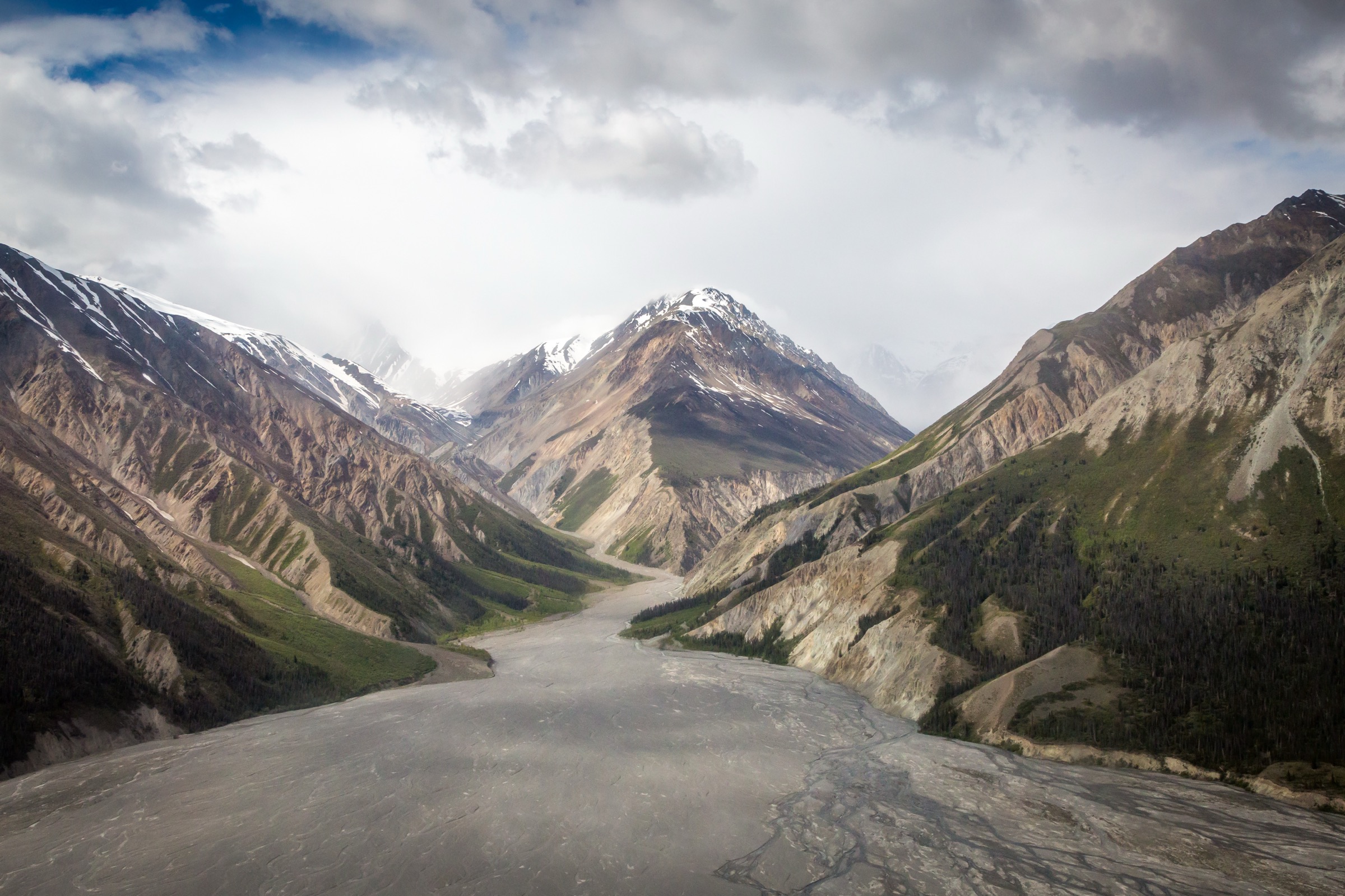
Mush Lake Road leaves the Haines Highway 52 km south of Haines Junction and traces an old single-lane mining road through spruce and poplar forest in the broad Dezadeash valley along the southeast boundary of Kluane National Park and Reserve. Two-wheel drive vehicles with clearance can typically reach the first creek crossing at roughly the 5 km mark in good conditions; 4WD vehicles with high ground clearance can continue further when the road is dry. Many walkers and mountain bikers leave their vehicle near Alder Creek and complete the remaining distance to Mush Lake on foot or by bike. The road crosses braided channels at Alder Creek (around the 5.5 km mark), then continues through level forest with sporadic views of the surrounding ridges before reaching Mush Lake, the start of the formal Cottonwood Trail backpacking loop. A small motorboat is kept on Mush Lake and a canoe on Bates Lake for paddlers continuing into the interior; day-hikers normally turn around at the lake.
Why it is essential
This is the principal southern Kluane access corridor and the only road-accessible point of entry to the inner Alsek drainage other than the Alsek put-in at the Dezadeash bridge. Walking or biking even the first segment gives a quiet, low-effort sample of Kluane’s boreal lowlands, with moose, black bear, and waterfowl regularly seen along the road. It complements the alpine and glacier objectives of the rest of the selection with an accessible valley-floor walk.
Equipment
Standard hiking equipment for short variants; mountain hiking equipment with overnight backcountry gear and a Parks Canada bear-resistant food canister for the full lake-to-lake itinerary. Bear spray essential. A mountain bike substantially reduces commitment for the full distance. Filter or carry water; standing water is common but should be treated.
Hazards and notes
The road passes through Kluane National Park and Reserve; overnight trips require a Wilderness Permit and a Parks Canada-approved bear-resistant food canister, obtainable at the Kluane Visitor Centre in Haines Junction. Bear sightings (both grizzly and black) are common in this drainage. The road can be very rough when wet and impassable in spring; check current conditions at the visitor centre before driving in. Several creek crossings on the road are unbridged. No cell coverage south of Haines Junction.
GPX / KML links
| Source | URL |
|---|---|
| Parks Canada: Mush Lake Road | parks.canada.ca |
| Yukon Hiking: Cottonwood Trail (continues from Mush Lake) | yukonhiking.ca |
| TrailPeak: Mush Lake | trailpeak.com |
External links
- Parks Canada — Hiking in Kluane National Park and Reserve
- Yukon Hiking — Kluane National Park region
5. Million Dollar Falls boardwalk
Snapshot
Itinerary
A short trail leaves the Million Dollar Falls Yukon Government campground and follows a purpose-built boardwalk through black spruce forest to a sequence of railed wooden platforms above the Takhanne River. The 60 m falls drop in two steps through a narrow rock slot, and the platforms give head-on, plan, and downstream perspectives across a span of a few hundred metres. The Takhanne is a tributary of the Tatshenshini, and the falls mark the upper limit of the Chinook salmon spawning run, with salmon visible in the lower pools through July. The name commemorates the US Army camp built nearby during the 1940s construction of the Haines-to-Fairbanks military pipeline, which was rumoured to have cost a million dollars and was never actually used.
Why it is essential
This is the regional interpretive walk and the only fully accessible viewpoint on the Tatshenshini drainage between Haines Junction and the BC border. It pairs the wildest of the candidate hikes (Goatherd, Three Guardsmen) with a built, easy, all-abilities counterpart that lets visitors see the river system without committing to backcountry travel.
Equipment
No special equipment needed. Comfortable footwear, sun protection, water, and insect repellent (mosquitoes are persistent through July). The boardwalk is well built but can be slippery when wet or icy.
Hazards and notes
Stay on the boardwalk and behind railings; the canyon walls beside the falls are sheer and unguarded outside the developed viewing area. The site is in active grizzly bear country and the campground occasionally closes for bear activity; check Yukon Government campground notices. The Haines Highway is plowed year-round but the falls are most accessible from late May to late September; in winter, the falls form ice climbs on the canyon walls.
External links
- Yukon Government — Million Dollar Falls Campground
- Travel Yukon — Million Dollar Falls Campground
- Alaska.org — Million Dollar Falls Campground
External links
| Source | URL |
|---|---|
| BC Parks — Tatshenshini-Alsek Park | bcparks.ca |
| BC Parks — Tatshenshini-Alsek rafting and kayaking | bcparks.ca |
| BC Parks Blog — Exploring the Chuck Creek Trail | engage.gov.bc.ca |
| Parks Canada — Mush Lake Road | parks.canada.ca |
| Parks Canada — Cottonwood Trail | parks.canada.ca |
| Parks Canada — Alsek River permits | parks.canada.ca |
| Travel Yukon — Hiking in Kluane National Park and Reserve (PDF) | travelyukon.com |
| Yukon Government — Million Dollar Falls Campground | yukon.ca |
| Yukon Hiking — Three Guardsmen | yukonhiking.ca |
| Yukon Hiking — Samuel Glacier | yukonhiking.ca |
| Yukon Hiking — Cottonwood Trail | yukonhiking.ca |
| Yukon Hiking — Kluane National Park region | yukonhiking.ca |
| Komoot — Chuck Creek Trail to Samuel Glacier | komoot.com |
| AllTrails — Samuel Glacier via Chuck Creek Trail | alltrails.com |
| AllTrails — Three Guardsmen Trail | alltrails.com |
| Wikiloc — Samuel Glacier (Chuck Creek Trail) | wikiloc.com |
| TrailPeak — Mush Lake | trailpeak.com |
| Canadian River Expeditions — Rafting the Alsek River | nahanni.com |
| Haines Rafting Company — Upper Alsek sample itinerary | hainesrafting.com |
| ExploreNorth Blog — Hiking the Three Guardsmen Cirque | explorenorthblog.com |
| Peakbagger — Three Guardsmen Mountain | peakbagger.com |
| Mountain Project — Glave Peak / Three Guardsmen | mountainproject.com |
| Wikipedia — Tatshenshini-Alsek Provincial Park | en.wikipedia.org |
| Wikipedia — Tatshenshini River | en.wikipedia.org |
| Wikipedia — Alsek River | en.wikipedia.org |
| Wikipedia — Lowell Glacier | en.wikipedia.org |
| Wikipedia — Chilkat Pass | en.wikipedia.org |
| Wikipedia — Three Guardsmen | en.wikipedia.org |
| Wikimedia Commons — Tatshenshini-Alsek Park category | commons.wikimedia.org |
| Wikimedia Commons — Alsek River category | commons.wikimedia.org |
| Wikimedia Commons — Lowell Glacier category | commons.wikimedia.org |
| Wikimedia Commons — Haines Highway category | commons.wikimedia.org |