Regional overview
The Dawson Range is a remote, rolling mountain belt of west-central Yukon with broad uplands, mining-access roads, spruce and aspen forest, open ridges, and long views across the Yukon Plateau. Compared with Kluane, Tombstone, or the Coast Mountains, it has few maintained public hiking routes and very limited published day-hike data.
For this pass, only two clearly documented day-hikes were found in the Carmacks / Mount Nansen road area that plausibly fit the Dawson Range edge: Miller Ridge and Plume Agate. To meet the required five-hike structure, three nearby Klondike / Dawson City walking routes are included as boundary candidates because they are the best-documented public trail options in the broader Dawson travel area. They should not be treated as strict Dawson Range mountain hikes without further regional review.
The normal hiking season is late spring to early autumn. Summer heat, smoke, storms, muddy gravel roads, insects, black and grizzly bears, and limited communications are the main practical issues. Trailheads outside Dawson City and Carmacks may have no services.
Selection rationale
The selection favours documented, legally accessible public routes over speculative wilderness lines. Miller Ridge and Plume Agate represent the Carmacks / Mount Nansen side of the Dawson Range. Midnight Dome, Crocus Bluff, and Five Finger Rapids are included because they are established Klondike-area viewpoints with historical or landscape value, but all three carry a region-boundary caveat.
Summary
| # | Hike | Country | Route type | Distance | Gain | Max elevation | Difficulty | GPX status | Photo status |
|---|---|---|---|---|---|---|---|---|---|
| 1 | Miller Ridge | Canada | Out-and-back | 5 km | 280 m | Unresolved | Moderate | Yukon Hiking GPX found | Regional photo found |
| 2 | Plume Agate | Canada | Out-and-back | 3 km | 239 m | Unresolved | Easy | Yukon Hiking GPX found | Regional photo found |
| 3 | Midnight Dome from Dawson City | Canada | Loop / out-and-back variants | 7.9 km AllTrails; about 5 miles by Dawson source | 561 m AllTrails | 880 m viewpoint source | Hard | Source map only | Commons image found |
| 4 | Crocus Bluff Loop | Canada | Loop | 5.8 km AllTrails | 289 m | Unresolved | Moderate | Source map only | Regional Commons image found |
| 5 | Five Finger Rapids Viewpoint Trail | Canada | Out-and-back | 1.4 km official; 1.6 km AllTrails | 80 m AllTrails | Unresolved | Easy–moderate | Official map / source map | Commons image found |
Hike 1: Miller Ridge
Snapshot
Itinerary
The route starts from the signed Miller Ridge and Mineral Trail parking area on Mount Nansen Road. It follows a rough trail below cliffs and through mixed aspen, black spruce, and white spruce forest, then climbs to rocky ridge viewpoints over Carmacks, the Yukon River corridor, the Nordenskiold River valley, and the rounded Yukon Plateau hills.
Why it is essential
Miller Ridge is the strongest documented Dawson Range-edge day hike found in this pass. It gives a short, accessible sample of the Carmacks uplands and the rocky ridges around the Mount Nansen road corridor.
Equipment
- Standard hiking equipment.
- Bear spray, navigation backup, and insect protection are recommended.
- Sturdy shoes or boots are useful on rocky or washed-out sections.
Hazards and notes
The Yukon Hiking page notes that the route can be confusing in places and user comments recommend carrying the provided GPS track. Bears have been reported near the trailhead in past comments. The road is gravel; check current road and wildfire conditions before departure.
GPX / route file
| Source | URL | Format | Licence / terms | Reuse status |
|---|---|---|---|---|
| Yukon Hiking GPX | yukonhiking.ca | GPX | Yukon Hiking terms not fully evaluated | Route file found; direct reuse unresolved |
| Yukon Hiking route page | yukonhiking.ca | Source route page | Website terms not fully evaluated | Route and stats checked |
Hike 2: Plume Agate
Snapshot
Itinerary
From the highway-side parking area, the route follows a dirt road and then a trail climbing through mixed forest and grassy slopes to rocky bluffs above the Nordenskiold River Valley. The viewpoint looks across wetlands, farms, the highway corridor, and rolling Carmacks hills.
Why it is essential
This is a short Carmacks-area hike with clear local landscape value: valley wetlands, dry grassy slopes, and the rounded hill country around the Dawson Range approach.
Equipment
- Standard hiking equipment.
- Bear spray and insect protection are recommended.
- Use care around the rocky bluffs.
Hazards and notes
The viewpoint bluffs are described as precarious by Yukon Hiking. The route passes near Tsawnjik Chu Habitat Protection Area; stay on the trail to reduce erosion and avoid disturbing sensitive habitat.
GPX / route file
| Source | URL | Format | Licence / terms | Reuse status |
|---|---|---|---|---|
| Yukon Hiking GPX | yukonhiking.ca | GPX | Yukon Hiking terms not fully evaluated | Route file found; direct reuse unresolved |
| Yukon Hiking route page | yukonhiking.ca | Source route page | Website terms not fully evaluated | Route and stats checked |
Hike 3: Midnight Dome from Dawson City
Snapshot
Itinerary
The hiking route climbs from Dawson City through the local trail network toward Midnight Dome, a prominent viewpoint above the Yukon and Klondike river confluence. Variants may use the Ninth Avenue Trail and steeper dome trails, with descent either by the same line, trail variants, or road depending on route choice.
Why it is essential
Midnight Dome is the classic Dawson viewpoint and the most recognisable short mountain-style climb in the Klondike visitor area. It is included as a documented boundary candidate rather than a strict Dawson Range hike.
Equipment
- Mountain hiking equipment for the full town-to-dome hike.
- Bear spray, water, and navigation are recommended; the trailhead can be unmarked.
Hazards and notes
The Dawson tourism page notes several ways to climb the mountain, ranging from moderate to difficult, and recommends using the map or asking Visitor Information staff. AllTrails reviews mention a scree/rock-slide crossing on one mapped loop variant. Access to the road viewpoint may be restricted by weather and conditions.
GPX / route file
| Source | URL | Format | Licence / terms | Reuse status |
|---|---|---|---|---|
| City of Dawson trail map | cityofdawson.ca | Official local map / PDF link | Municipal website terms not evaluated | Source map found; no GPX found |
| AllTrails route page | alltrails.com | Source route / app map | AllTrails terms apply | Secondary stats checked; GPX reuse unresolved |
Hike 4: Crocus Bluff Loop
Snapshot
Itinerary
The loop uses Dawson City’s local trail network to climb through forest and bluff terrain above town. Shorter Crocus Bluff nature-trail variants lead to easier viewpoints, while the longer loop gives a more substantial walk with river and town views.
Why it is essential
Crocus Bluff is included as a Dawson-area viewpoint and as a moderate alternative to Midnight Dome. It provides a local bluff-and-forest walk close to town, but it is a boundary candidate rather than a strict Dawson Range route.
Equipment
- Standard hiking equipment.
- Bear spray, water, and basic navigation are recommended.
Hazards and notes
City of Dawson describes the local trail map as a first edition and a work in progress. Trails are maintained to a limited extent and users assume their own risk. Confirm current routing locally.
GPX / route file
| Source | URL | Format | Licence / terms | Reuse status |
|---|---|---|---|---|
| City of Dawson trail map | cityofdawson.ca | Official local map / PDF link | Municipal website terms not evaluated | Source map found; no GPX found |
| AllTrails route page | alltrails.com | Source route / app map | AllTrails terms apply | Secondary stats checked; GPX reuse unresolved |
Hike 5: Five Finger Rapids Viewpoint Trail
Snapshot
Itinerary
From the recreation-site parking area, a maintained trail and long staircase descend to viewpoints over the Yukon River and the resistant rock islands that form Five Finger Rapids. Interpretive panels explain the Northern Tutchone name, river history, and sternwheeler-era channel work. The return climbs back up the same stairs and trail.
Why it is essential
Five Finger Rapids is a major Yukon River landmark and a historically important obstacle on the route between Whitehorse and Dawson. It is included as a documented Klondike corridor walk rather than a strict Dawson Range hike.
Equipment
- Standard hiking equipment.
- Carry bear spray despite the short distance, as recommended by Yukon government.
- Use care on stairs in wet, icy, or snowy conditions.
Hazards and notes
The Yukon page notes that the site is still wilderness despite the manufactured staircase. The recreation site is serviced from May 8 to October 1, 2026; confirm current service dates for later publication.
GPX / route file
| Source | URL | Format | Licence / terms | Reuse status |
|---|---|---|---|---|
| Yukon government recreation-site page | yukon.ca | Official page / map download | Government site terms not fully evaluated | Official route and map source found; no GPX found |
| Yukon government map PDF | yukon.ca | PDF map | Government site terms not fully evaluated | Source map found |
| AllTrails route page | alltrails.com | Source route / app map | AllTrails terms apply | Secondary stats checked; GPX reuse unresolved |
Missing data / follow-up work
- The strict Dawson Range has too few public day-hikes for a confident five-hike catalogue entry. Three of five routes are included as nearby Klondike/Dawson-area boundary candidates.
- Maximum elevations remain unresolved for Miller Ridge, Plume Agate, Crocus Bluff, and Five Finger Rapids.
- No official GPX was found for Midnight Dome, Crocus Bluff, or Five Finger Rapids; only source maps or AllTrails route pages were found.
- Public transport details are unresolved outside walkable Dawson City trailheads.
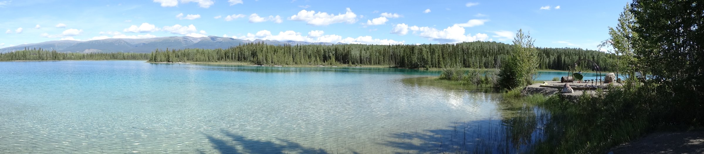
- Region-specific licence-compatible photos for Miller Ridge and Plume Agate were not found in this pass; regional Yukon images are used instead.
External links
| Source | URL |
|---|---|
| Yukon Hiking — Carmacks region | yukonhiking.ca |
| Yukon Hiking — Miller Ridge | yukonhiking.ca |
| Yukon Hiking — Plume Agate | yukonhiking.ca |
| Dawson City — Walking Trails | dawsoncity.ca |
| Dawson City — Midnight Dome | dawsoncity.ca |
| City of Dawson — Trail Map | cityofdawson.ca |
| Lonely Planet — Midnight Dome | lonelyplanet.com |
| Yukon government — Five Finger Rapids Recreation Site | yukon.ca |
| Yukon government — Five Finger Rapids map PDF | yukon.ca |
| AllTrails — Dawson City to Midnight Dome | alltrails.com |
| AllTrails — Crocus Bluff Loop | alltrails.com |
| AllTrails — Five Finger Rapids Trail | alltrails.com |