Regional overview
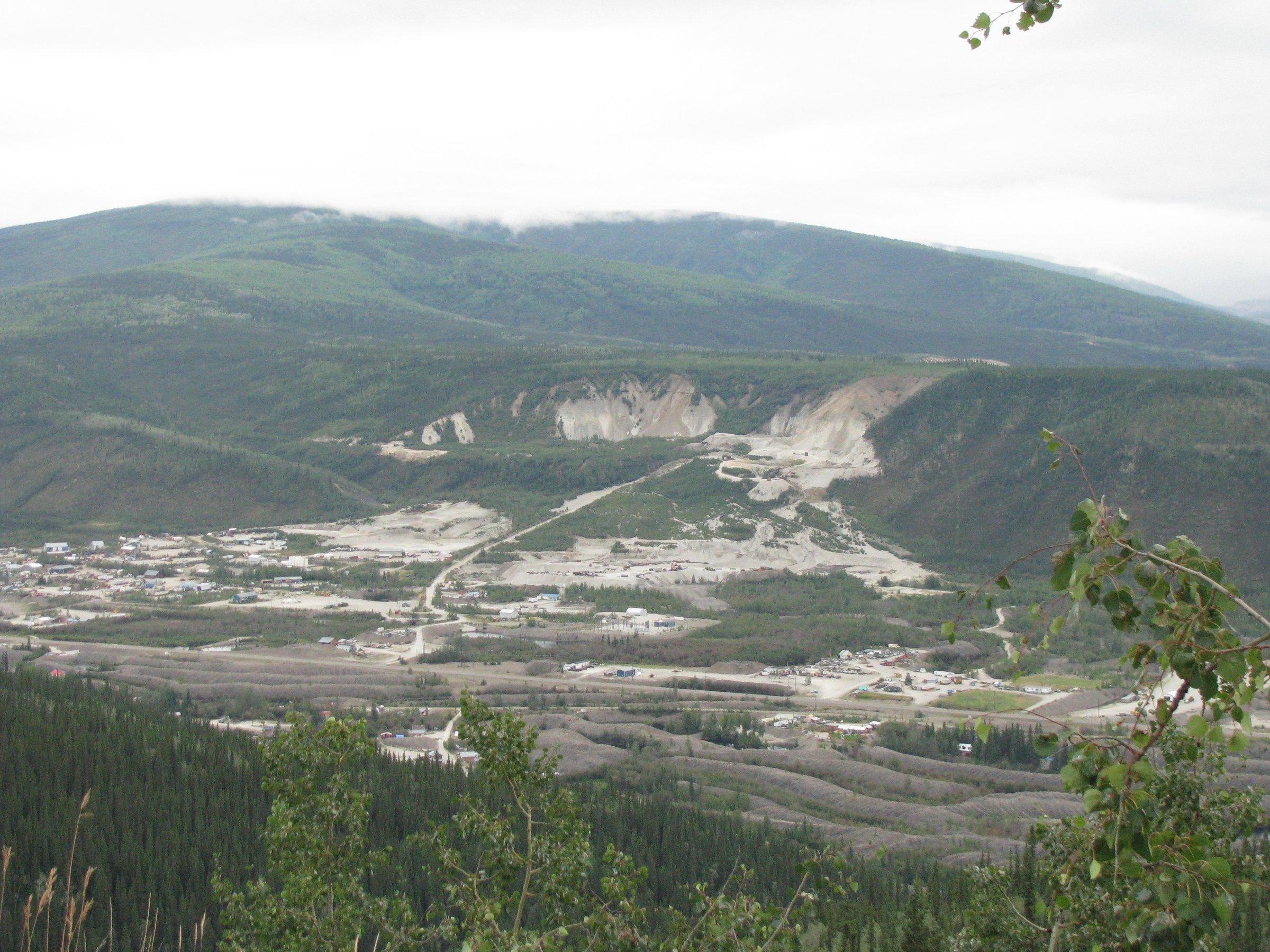
The Tombstone Range is the most accessible alpine block of the Ogilvie Mountains, in west-central Yukon roughly 100 km north-east of Dawson City. The range is protected as Tombstone Territorial Park, a 2,200 km² protected area established in 2000 under Chapter 11 of the Tr’ondëk Hwëch’in Final Agreement and co-managed by the Yukon Government and the Tr’ondëk Hwëch’in. The park lies between roughly km 50.5 and km 115 of the Dempster Highway (Yukon Highway 5), the only road into or through the area. The Tombstone Interpretive Centre at km 71.5 and the adjacent Tombstone Mountain Campground at km 71.5–72 are the de facto hub; the nearest fuel, food and reliable cellular service are at Dawson City, about 110 km south, and at Eagle Plains, about 298 km north.
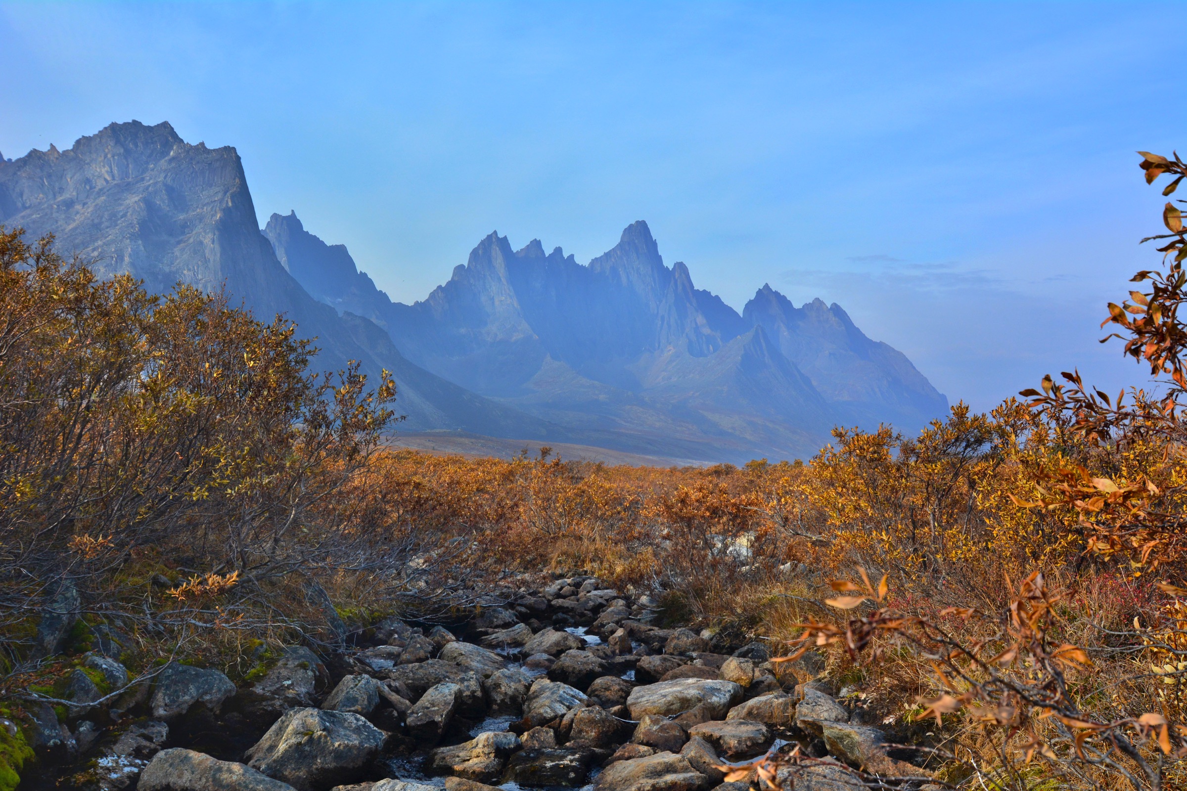
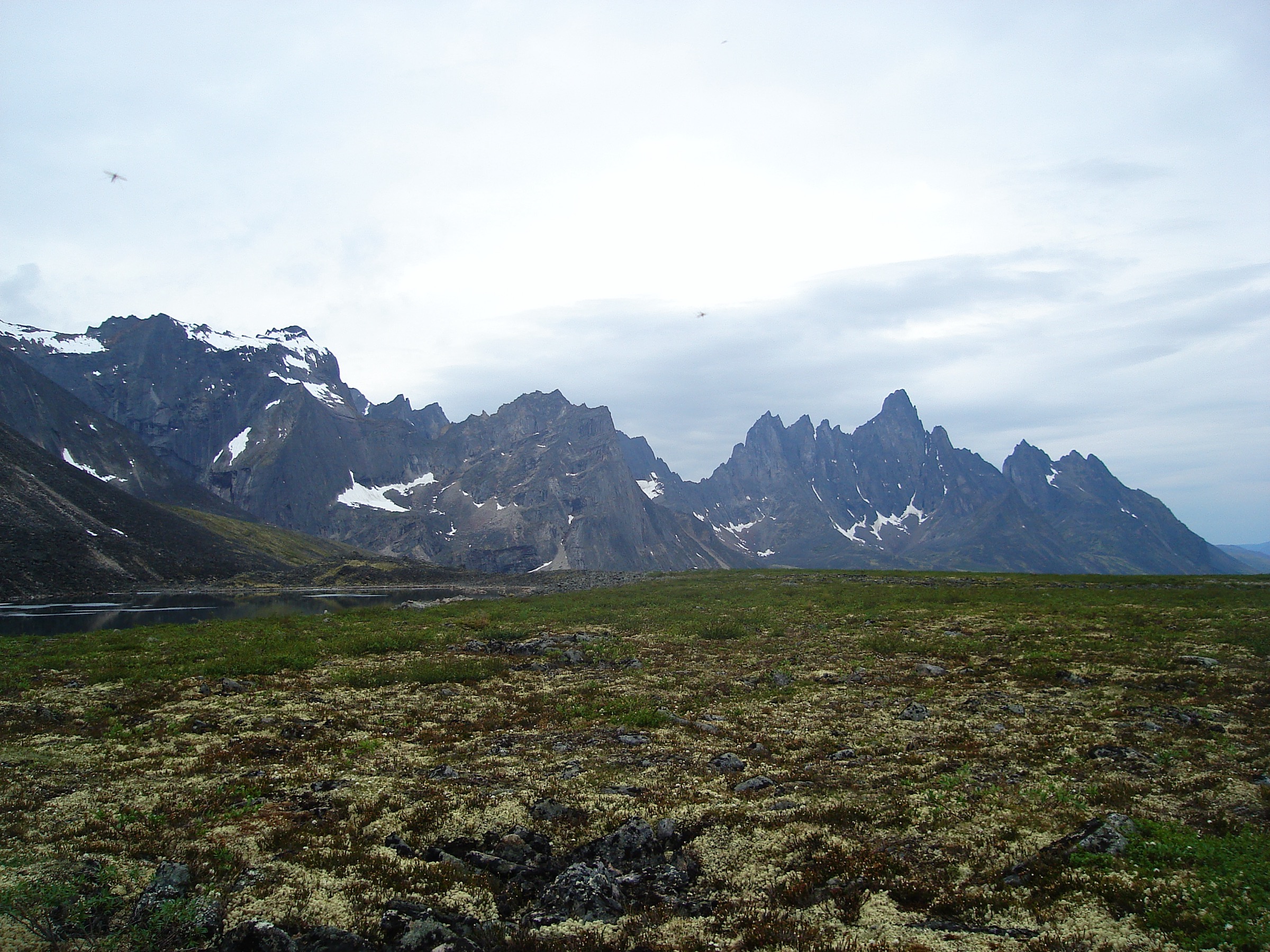
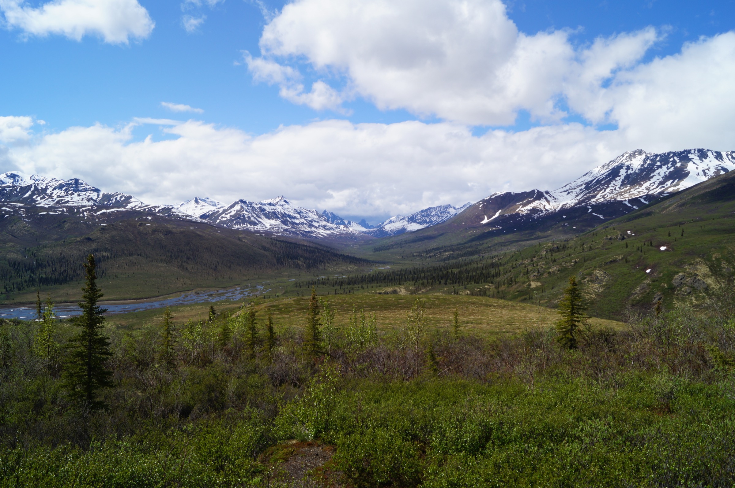
The “Tombstone” name applies in a narrow sense to Tombstone Mountain (2,192 m), whose blocky black peak resembles a grave marker, and in a wider sense to the surrounding cluster of jagged granitic and syenitic summits — Mount Monolith (2,165 m), the Cathedral, Mount Frank Rae (2,360 m, the highest point in the Ogilvies) — which together form the core of the park. These peaks were intruded into older sedimentary country rock as part of the mid-Cretaceous Tombstone Suite, an igneous belt that runs from interior Alaska to the Ross River. North of the granitic core, on the Blackstone Uplands around km 90–115, the landscape opens into rolling tundra-clad ridges, lake-dotted permafrost terrain and the Blackstone Range, with smaller summits such as Surfbird Mountain.
Almost all of the park’s interior is roadless and trail-less. Established routes are concentrated in a narrow corridor along the Dempster between roughly km 58 and km 98 and consist of a handful of short alpine trails from the highway, the interpretive walks near the campground, and a single graded backcountry trail to Grizzly Lake. From Grizzly Lake an unbridged but cairned route continues to Divide Lake and Talus Lake; the three-lake circuit is one of the iconic backpacking routes in the Canadian north. Off these lines, hiking is genuine off-trail wilderness travel through tussock tundra, talus and brush — physically demanding and committing, with no marked paths and no certainty of recovery in poor weather.
The practical hiking season is short: late June to early September. Snow lingers on the higher ridges into July, the alpine tundra colours peak in the last ten days of August into early September (the famous “Tombstone fall colour” period), and serious snow can return by mid-September. Mosquitoes and black flies are at their peak in late June and early July; conditions improve sharply by August. Daytime summer temperatures are typically 10–20 °C in the valleys but can drop near or below freezing on the ridges in any month, especially when the wind picks up off the Blackstone Plateau. Weather changes rapidly: clear mornings often give way to afternoon cloud, wind and showers.
The park is grizzly country, with one of the highest densities of grizzlies of any roadside park in Canada, and is also home to black bears, Dall sheep, moose, caribou (Hart River, Klaza and Porcupine herds in different seasons), wolves, wolverines and a strong bird fauna. Bear-resistant food canisters are mandatory for all overnight stays in the backcountry; bear spray and standard food-storage protocols are strongly recommended for day-hikers. The Angelcomb Peak ridge above North Fork Pass — historically a popular short ridge walk — has been formally closed by Yukon Parks because it sits within a sensitive Dall sheep lambing zone, and is therefore excluded from this catalogue.
Cultural protocols matter here. The Tombstone country (Ddhäl Ch’èl Cha Nän in Hän) sits within the traditional territory of the Tr’ondëk Hwëch’in, who have used these valleys for caribou hunting, fishing and berry gathering for thousands of years; at least 78 known archaeological sites lie within the park, with evidence of human use stretching back at least 8,000 years. Visitors are asked to leave cultural material in place, stay on established paths in sensitive tundra, and treat the area’s cultural and spiritual landscape with respect. The Interpretive Centre, staffed jointly by Yukon Parks and Tr’ondëk Hwëch’in staff, is the place to ask about current cultural and ecological protocols.
Selection rationale
The five hikes below cover what an honest catalogue of Tombstone day-hikes has to offer: the iconic short summit-ridge walk (Goldensides), the classic — and only — graded backcountry trail done as a long day (Grizzly Lake), a representative Blackstone tundra ridge in the northern half of the park (Surfbird), a short valley and sub-arctic interpretive loop straight off the Dempster (North Klondike River and Edge of the Arctic), and the accessible boardwalk introduction at the Interpretive Centre (Beaver Pond). Angelcomb Peak, often listed in older sources, is deliberately excluded because the trail is currently closed by Yukon Parks. Sapper Hill at km 194 sits in dolomite country well north of the Tombstone Range proper and is catalogued separately under the Ogilvie Mountains entry. The Twin Lakes / Mount Monolith Viewpoint side-trip is referenced as an extension of an overnight Grizzly Lake trip rather than a standalone day-hike, because reaching it in one day from the highway is impractical.
Summary
| # | Hike | Country | Route type | Distance | Gain | Max elevation | Difficulty |
|---|---|---|---|---|---|---|---|
| 1 | Goldensides Mountain | Canada | Out-and-back | ~4–6 km | ~210–220 m | ~1,615 m | Easy–moderate |
| 2 | Grizzly Lake (day-hike variant) | Canada | Out-and-back | ~22 km | ~900 m | ~1,615 m | Strenuous |
| 3 | Surfbird Mountain ridge | Canada | Out-and-back (off-trail tundra) | ~7–8 km | ~400–500 m | ~1,700 m | Moderate |
| 4 | North Klondike River and Edge of the Arctic | Canada | Out-and-back with loop | ~4 km | ~55 m | ~1,080 m | Easy |
| 5 | Beaver Pond interpretive trail | Canada | Out-and-back | ~2 km | <30 m | ~1,080 m | Easy / accessible |
1. Goldensides Mountain
Snapshot
Itinerary
From the small car park at the microwave tower, the trail leaves a signed trailhead and runs north-east through low subalpine willow and dwarf birch, climbing gently across the broad shoulder below Goldensides Mountain. After roughly 1.5 km the path forks. The right-hand branch heads to a rocky knoll topped by a distinctive vertical rock pinnacle, with views into the Cloudy Range to the east. The left-hand branch continues along the ridge crest to an open alpine viewpoint looking south-west, down the North Klondike River valley, with Mount Chester Henderson on the immediate right, Mount Robert Henderson further along the ridge, and the dark serrated profile of Tombstone Mountain itself standing at the head of the valley. On a clear day the upper crags of Mount Monolith and the Cathedral peaks are also picked out. Return is by the same route. Scrambling beyond the marked end of the trail towards the Goldensides summit is discouraged by Yukon Parks because the cushion tundra and lichen mats on the summit slopes are extremely fragile.
Why it is essential
Goldensides is the best short return on effort in the entire park: a true alpine viewpoint reached on a maintained trail in well under half a day, with a panorama that takes in most of the Tombstone Range’s iconic peaks. It is the standard introductory walk recommended by Yukon Parks and the Interpretive Centre and is usually the single most-walked trail in the park.
Equipment
- Sturdy footwear (the upper trail is rocky)
- Wind- and waterproof shell
- Warm midlayer (ridge temperatures can be 10 °C lower than at the highway)
- Sun and insect protection
- 1–1.5 L water (no reliable source on the route)
- Bear spray
Hazards and notes
- The viewpoint is exposed to wind and to fast-moving weather coming over the Blackstone Plateau; afternoon showers are common and there is no shelter on the ridge.
- The trail can hold snow into early July and ice in early September.
- Grizzly bears are present throughout the park, including the Goldensides ridge — make noise, carry spray, and do not approach wildlife.
- Stay on the established path: the surrounding cushion tundra recovers from foot traffic on a timescale of decades.
Routes and maps
| Source | URL |
|---|---|
| Yukon Hiking — Goldensides | yukonhiking.ca |
| Yukon government — Goldensides Trail map | yukon.ca |
| AllTrails — Goldensides Mountain | alltrails.com |
| OpenStreetMap — Goldensides / km 74 | openstreetmap.org |
External links
- Yukon Parks — Tombstone Territorial Park
- Yukon Parks — Hike and camp at Tombstone Territorial Park
- Hike Bike Travel — Goldensides Hike
2. Grizzly Lake (day-hike variant)
Snapshot
Itinerary
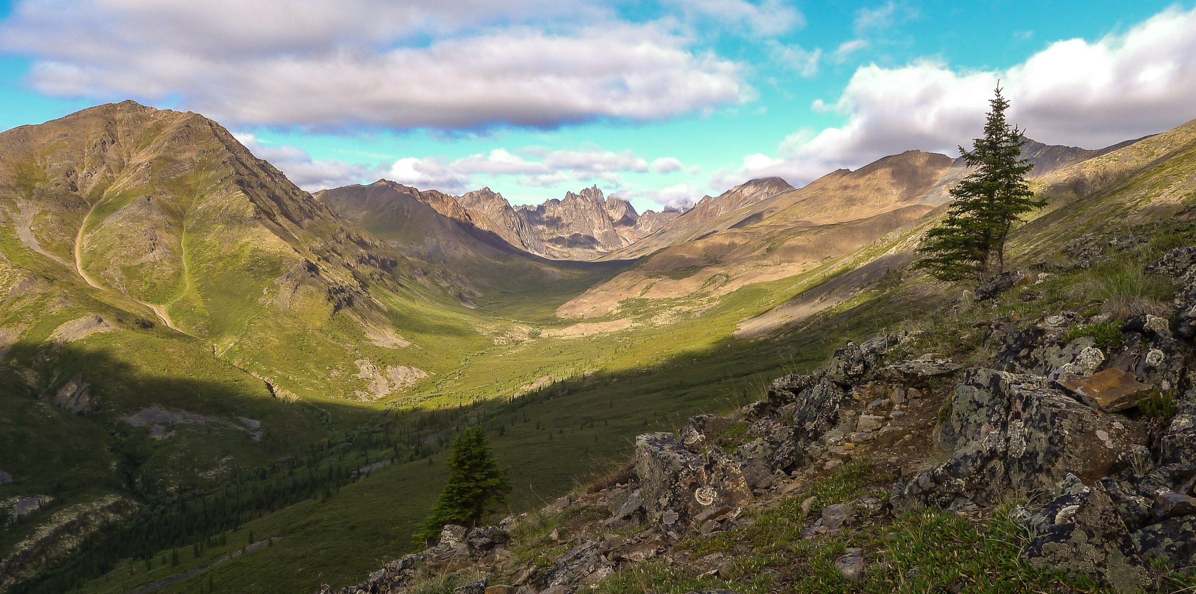
This is the only graded backcountry trail in Tombstone Territorial Park, and the only realistic way to reach the inner cirque around Mount Monolith on foot. From the highway car park at km 58.5 the trail climbs through dense subalpine willow and dwarf birch onto the eastern flank of Grizzly Creek valley. After roughly 4 km it gains the broad Grizzly Ridge, then traverses for several kilometres across alpine meadow and a long, exposed talus slope on the south-east side of the ridge — the crux for tired walkers, with loose rock underfoot and a long view down into the Grizzly Creek headwaters. The final 2 km drop steeply off the ridge into the bowl of Grizzly Lake, which sits at about 1,300 m beneath the black granite walls of Mount Monolith and its satellite spires. The designated backcountry campground sits on the lake’s outflow, with bear lockers, tent pads and a basic cooking shelter. Day-hikers turn around at the lake (or at the campground if water and a break are needed) and reverse the route to the trailhead.
This is overwhelmingly done as the first leg of an overnight trip to Grizzly, Divide and Talus Lakes; the day-hike variant is strenuous, exposes hikers to weather risk on the ridge for many hours, and leaves no slack for delays. Strong, experienced hill walkers complete it regularly in summer, but it should not be undertaken casually.
Why it is essential
Grizzly Lake is the iconic destination of Tombstone hiking: the only graded trail to the heart of the granite Tombstones, the standard photograph of the park, and the only way for hikers without expedition skills to walk into the cirque country beneath Mount Monolith. Yukon Parks singles out Grizzly Lake as the park’s signature backcountry route.
Equipment
- Stiff boots with grip for talus
- Trekking poles
- Full waterproofs, warm layer, hat and gloves
- 2–3 L water (refills from streams on the lower trail; treat or filter)
- High-energy food for 10+ hours
- Headtorch, first-aid kit
- Map and GPS with the route loaded
- Bear spray accessible on the belt or shoulder strap
Hazards and notes
- Sustained exposure on the ridge to wind, lightning and rapid weather change; turning back is the correct call if cloud lowers onto the ridge.
- The talus section is loose and tiring underfoot; ankle injuries are the most common cause of evacuation on this trail.
- The trail crosses an active grizzly area and the slow pace of returning parties in late afternoon is a real bear-encounter window — travel in audible groups and avoid solo travel where possible.
- No permit is required for day use, but Yukon Parks asks all day-hikers to watch the backcountry orientation video and to register at the Interpretive Centre.
- Overnight use requires an advance reservation through Yukon Parks (reservations typically open in early March for the July–September season) and the use of a hard-shell bear-resistant food canister.
Routes and maps
| Source | URL |
|---|---|
| Yukon Hiking — Grizzly Lake | yukonhiking.ca |
| Yukon Hiking — Grizzly Ridge | yukonhiking.ca |
| AllTrails — Grizzly Lake Trail | alltrails.com |
| OpenStreetMap — Grizzly Creek / Grizzly Lake | openstreetmap.org |
External links
- Yukon Parks — Grizzly Lake Campground reservations
- Yukon Parks — Tombstone backcountry reservations announcement
- Off Track Travel — Hiking the Grizzly Lake Trail
- Yukon Hiking — Twin Lakes and Mount Monolith Viewpoint
3. Surfbird Mountain ridge
Snapshot
Itinerary
From the small parking area at the end of the microwave-tower spur, the route leaves the access track and climbs directly onto open tundra heading west and then north-west, aiming for a broad pass in the Blackstone Range ridge ahead. There is no formal trail: walkers pick a line through cushion plants, lichen mats, dwarf birch and patches of waterlogged tussock, with intermittent boot-prints from previous parties. After roughly 2–3 km of steady climbing the ground levels off in a wide saddle that gives the first long views north over the Blackstone Plateau. From the saddle the route turns south or south-west along the open ridge crest, gaining further height onto an elevated shoulder of Surfbird Mountain that gives a 360° view: south to the granitic Tombstone summits, north into the rolling Blackstone country, and east across the East Blackstone River. The summit cone itself is rarely climbed; most parties turn around on the upper ridge.
Why it is essential
Surfbird is the most representative walk in the Blackstone half of the park — open tundra ridge with no trees, no path, no infrastructure, and panoramic views of both the granitic Tombstones to the south and the gentler tundra ranges to the north. It pairs naturally with Goldensides as a “south Tombstone summit, north Blackstone tundra” introduction to the range. It also fills the gap left by the indefinite closure of the Angelcomb Peak trail further south.
Equipment
- Boots with stiff soles and ankle support (tundra hides ankle-twisting holes)
- Waterproof gaiters in early summer when the ground is wet
- Full wind- and waterproof shell, warm layer, hat and gloves
- 2 L water (no reliable source on the ridge)
- Bear spray
- Map and GPS — there is no trail to follow back in poor visibility
Hazards and notes
- The ridge is fully exposed to weather sweeping off the Blackstone Plateau; afternoon storms develop quickly.
- Without a marked path, navigation in mist relies entirely on GPS — the cushion tundra looks the same in all directions.
- Walkers should choose their footfall carefully to minimise damage to slow-growing alpine plants.
- Grizzlies are common across the Blackstone country; open sightlines reduce surprise encounters but bear-safe travel rules still apply.
- Surfbirds (Calidris virgata) nest on rocky tundra in this area in summer — give nesting birds a wide berth.
Routes and maps
| Source | URL |
|---|---|
| Yukon Hiking — Surfbird Mountain | yukonhiking.ca |
| Yukon Hiking — Tombstone Territorial Park regional page | yukonhiking.ca |
| OpenStreetMap — Blackstone Uplands / km 98 | openstreetmap.org |
External links
- Yukon Hiking — Surfbird Mountain
- Off Track Travel — Hiking in Tombstone Territorial Park
- Komoot — Hiking in Tombstone Territorial Park
4. North Klondike River and Edge of the Arctic
Snapshot
Itinerary
Both trails leave the same trailhead at the north-west corner of the Tombstone Mountain Campground. The Edge of the Arctic Interpretive Trail is a short ~500 m sub-loop with five interpretive panels that describe the transition from subarctic boreal forest into open tundra — a useful primer for the wider park, especially for first-time visitors. From the loop, the North Klondike River Trail continues north-westwards into the woods alongside the river, then breaks out of the trees into the open shrub-tundra of the valley floor. The path follows the river for about 1.5 km to a recognised viewpoint where the open valley swings north and the granitic peaks of the Tombstone core — Mount Robert Henderson, the Cathedral, and on a clear day the upper crags of Tombstone Mountain — stand at the head of the valley. Return is by the same route.
Why it is essential
This is the single best short walk for visitors not heading onto the high ridges: a genuine alpine-valley experience reached on a flat, well-graded path that starts at the campground. It gives a head-on view of the central Tombstones from a low angle and pairs the geology and ecology panels of the Edge of the Arctic loop with an unhurried valley walk. For walkers who have already done Goldensides, it offers the complementary “from below” view of the same peaks.
Equipment
- Light footwear (trail shoes are sufficient)
- Wind shell
- Water bottle
- Sun and insect protection (the river-side section can be heavy with mosquitoes in early summer)
- Bear spray
Hazards and notes
- Grizzly bears use the valley regularly, especially in late summer when berries ripen on the open slopes above the trail — walkers should make audible noise, carry spray and not jog with earphones.
- The river-side section can be wet underfoot after rain.
- The walk is described as wheelchair-friendly in some sources, but only the initial paved section is genuinely accessible; the river-side trail itself has gravel, roots and uneven ground.
Routes and maps
| Source | URL |
|---|---|
| AllTrails — North Klondike River Trail | alltrails.com |
| AllTrails — North Klondike River and Edge of the Arctic | alltrails.com |
| OpenStreetMap — Tombstone Mountain Campground | openstreetmap.org |
External links
- Yukon Parks — Tombstone Mountain Campground
- ExploreNorth — North Klondike River Trail and Edge of the Arctic
- Wikivoyage — Tombstone Territorial Park
5. Beaver Pond interpretive trail
Snapshot
Itinerary
From the south end of the Interpretive Centre car park, a wide packed-gravel path leads gently south through subalpine forest of black spruce and willow, with sections of raised boardwalk over the wetter ground. Ten interpretive panels along the way explain how glaciation, climate, fire and beavers have shaped the surrounding landscape, with reference to Tr’ondëk Hwëch’in stories and uses of the land. The path ends at a viewing deck over an active beaver pond, with views back to the granitic ridges of the central Tombstone Range across the wet meadow. Return is by the same route, taking in the interpretive panels in reverse. The trail is the only formally wheelchair-accessible walking route in the park, although the boardwalk sections should be assessed in advance for snow or seasonal damage.
Why it is essential
This is the only walk in Tombstone that is genuinely accessible to visitors with limited mobility, to families with very young children, and to anyone with only an hour to spare while driving the Dempster. It also pairs naturally with a visit to the Interpretive Centre itself, which is the primary public-facing source for current trail conditions, cultural protocols and bear-safety briefings — and is therefore the practical starting point for any trip into the park.
Equipment
- Light footwear
- Water
- Sun and insect protection
Hazards and notes
- Mosquitoes can be intense in June and July.
- Beavers are active in summer; observe from the deck and do not approach the water.
- Bears occasionally pass through the wet meadow — the Interpretive Centre staff post current sightings.
Routes and maps
| Source | URL |
|---|---|
| Yukon government — Tombstone Interpretive Centre trail map | yukon.ca |
| OpenStreetMap — Interpretive Centre area | openstreetmap.org |