Regional overview
The Ogilvie Mountains form a broad, mostly unglaciated subarctic range north of Dawson City and the Tintina Trench, between the Tombstone Range and Blackstone Uplands (now protected within Tombstone Territorial Park) to the south-east and the Wernecke and Richardson mountains to the east and north-east. The range extends roughly 300 km east-west, includes the Nahoni Range as a major sub-block, and culminates in Mount Frank Rae (2,362 m). The northern Ogilvies sit within the Beringian refugium that escaped Pleistocene glaciation, which gives them their distinctive rounded, deeply weathered ridges, talus-mantled slopes and persistent permafrost — visibly different from the glacially carved granite spires of the Tombstone sub-range to the south. North of the Tintina Fault the bedrock is dominantly sedimentary: dolomite, limestone, shale and chert, often expressed as banded ridges, tors and dolomite cliffs.
Hiking access is almost entirely from the Dempster Highway (Yukon Highway 5), the only road crossing the range. The highway leaves the Klondike Highway about 40 km east of Dawson City, climbs through Tombstone Territorial Park (km 50.5–115), continues over Windy Pass (km 153), follows Engineer Creek to the Ogilvie River bridge (km 194.5) and then climbs onto the Eagle Plain escarpment at Ogilvie Ridge (km 258.8). The Tombstone Interpretive Centre at km 71.5, run jointly by Yukon Parks and the Tr’ondëk Hwëch’in, is the only staffed visitor facility on the corridor and is open mid-May to mid-September; there are no commercial services between Dawson City and Eagle Plains (km 369). Tombstone Mountain Campground (km 71.5) and Engineer Creek Campground (km 194) are the only formal vehicle-accessible campgrounds.
Outside Tombstone Park there are very few maintained trails in the Ogilvie Mountains proper. The Yukon Hiking guide (yukonhiking.ca) documents a small set of informal routes that exploit Dempster Highway pullouts for quick alpine access — most are unmarked tundra-and-ridge wanders with cairns at best, rather than constructed paths. The Yukon government’s Dempster Highway Travelogue describes scenic pullouts and short rambles along the corridor. Beyond these, almost everything in the wider Ogilvies is wilderness travel.
The realistic hiking season is mid-June to early September. Snow can linger in north-facing gullies into July; first snow on the high ground typically falls in late August or early September. Mosquitoes and black flies peak from late June through July. Weather is highly variable, and -5 to +25 °C can occur in the same week. Grizzly and black bears are present throughout the range. There is no cellular reception north of the Klondike Highway junction; the Tombstone Interpretive Centre and Eagle Plains Lodge are the only places to leave a trip plan. Fuel and tyre repair are available only at Eagle Plains, and flats are routine on the gravel surface.
Selection rationale
The five hikes below cover the Ogilvie Mountains proper — the broader unglaciated subarctic range outside the Tombstone sub-range, which is catalogued separately. Two routes (Windy Pass Peak at km 153 and Infant Peak at km 131) sit clearly north of the Tombstone Park boundary and are the most documented day-hikes in the central Ogilvies. Sapper Hill above Engineer Creek campground at km 194 is the standard hike in the Nahoni Range sub-block. The Ogilvie Ridge tower walk at km 258.8 captures the north-eastern escarpment overlooking the Eagle Plain. The fifth, the North Fork Pass tundra ramble, is included as a boundary candidate: it lies inside Tombstone Park at km 84.5 but on the Blackstone Uplands fringe that physically and ecologically belongs to the wider Ogilvie character, and it is the only roadside option that gives quick access to the open Hart River caribou range. Hikes inside the Tombstone Range proper are deliberately excluded here and appear in the Tombstone Range entry.
Summary
| # | Hike | Country | Route type | Distance | Gain | Max elevation | Difficulty |
|---|---|---|---|---|---|---|---|
| 1 | Sapper Hill from Engineer Creek | Canada | Out-and-back (informal) | ~4–6 km | ~310 m | ~920–940 m | Moderate |
| 2 | Windy Pass Peak | Canada | Out-and-back (informal ridge) | ~5 km | ~520 m | ~1,580 m | Easy–moderate |
| 3 | Infant Peak | Canada | Out-and-back (informal ridge) | ~7 km | ~610 m | ~1,575 m | Moderate |
| 4 | North Fork Pass tundra ramble | Canada | Open tundra wander | 4–8 km, walker’s choice | 100–250 m | ~1,400–1,500 m | Easy |
| 5 | Ogilvie Ridge tower walk | Canada | Out-and-back on service road and ridge | ~5–7 km | ~220–270 m | ~929 m | Easy |
1. Sapper Hill from Engineer Creek
Snapshot
Itinerary
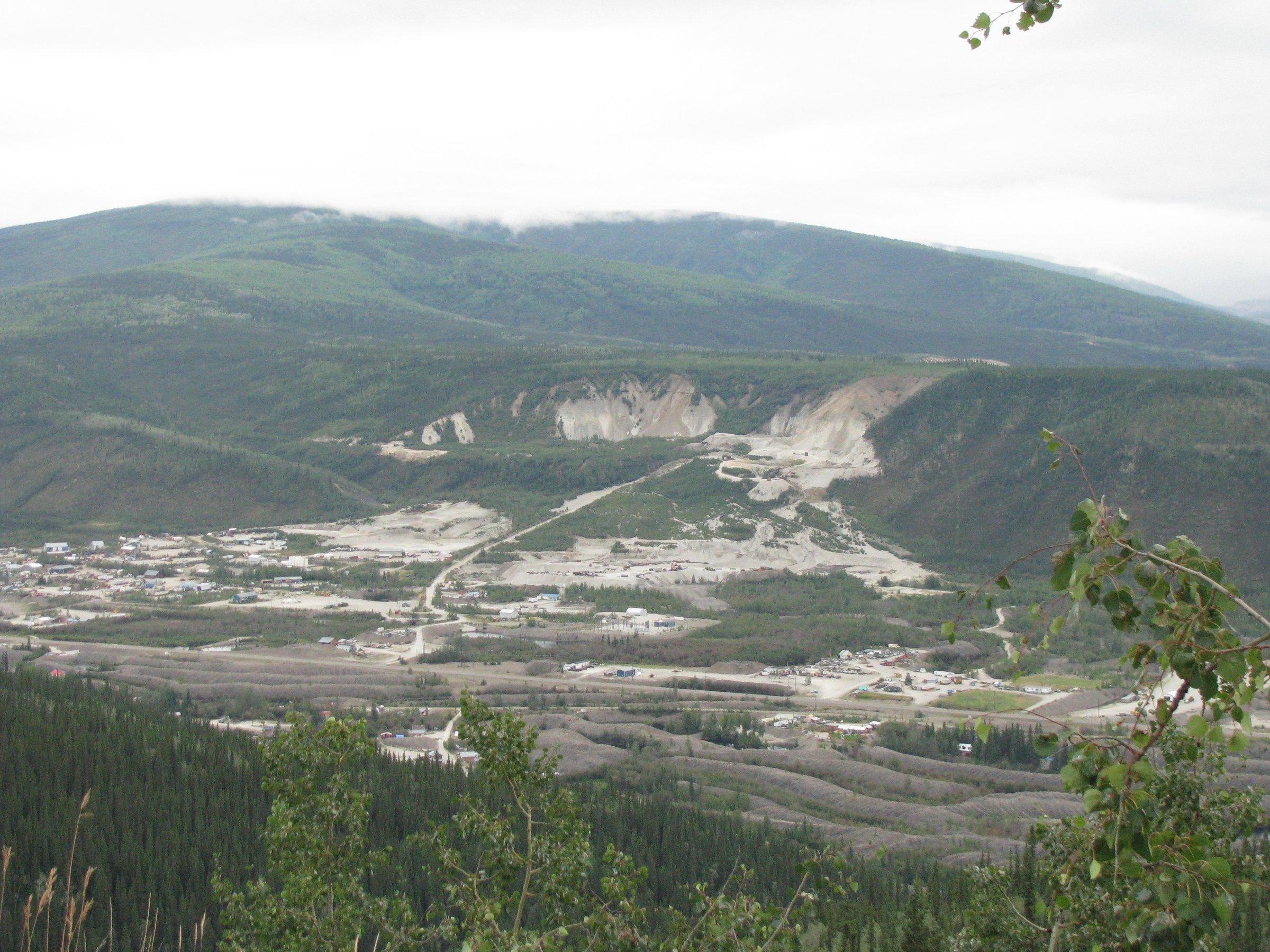
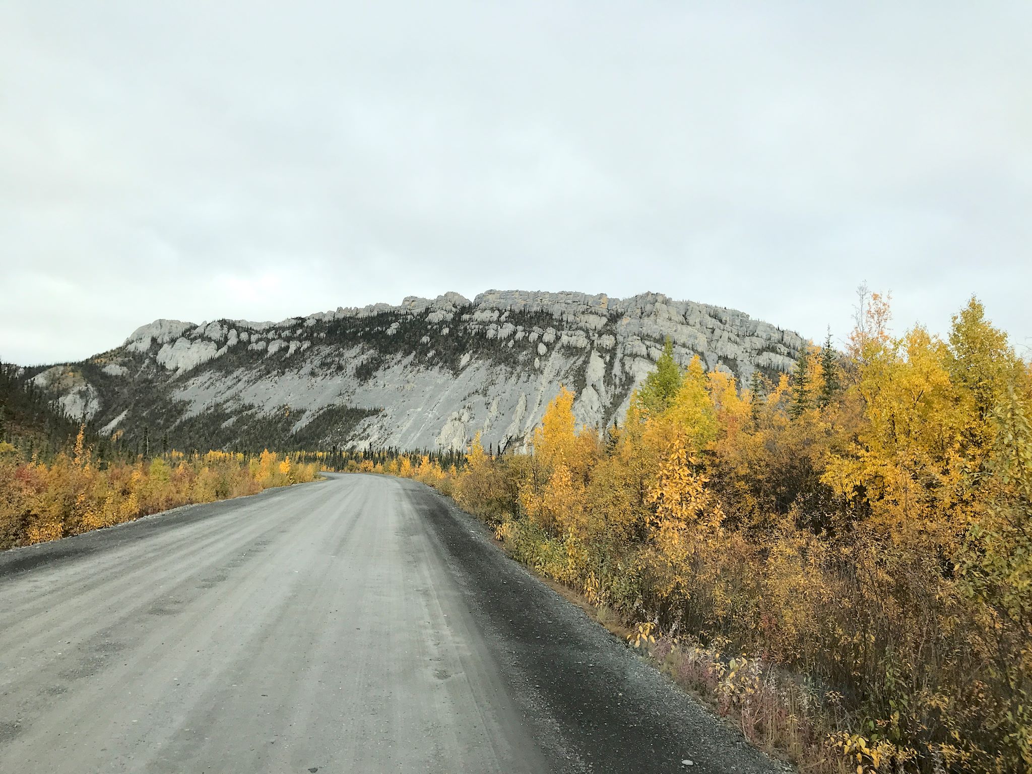
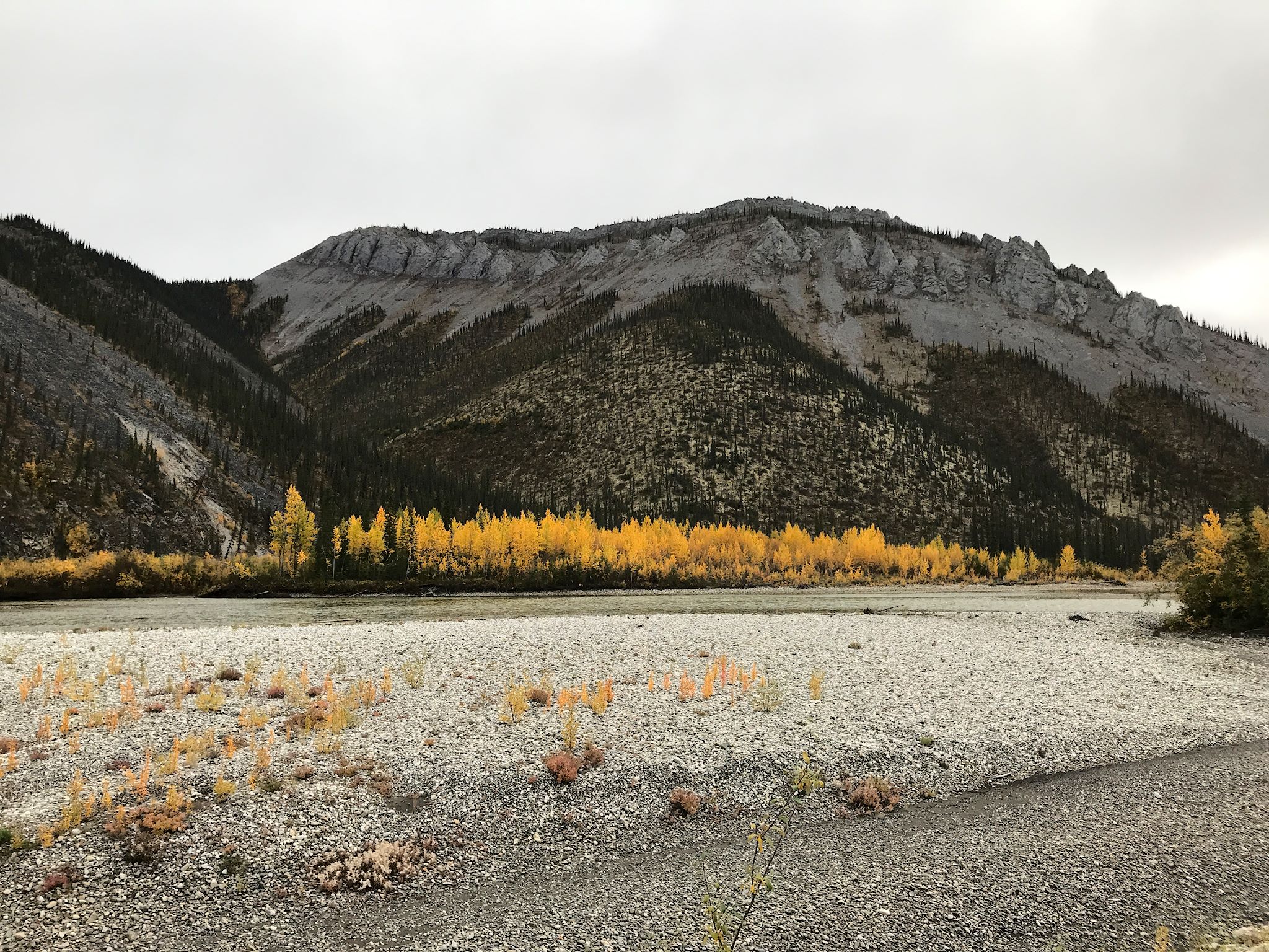
From a small pullout just past the Engineer Creek bridge, immediately north of Engineer Creek campground, the route enters white-spruce forest on the east side of the highway and climbs through tussocks on an informal but easily followed line. After roughly 1 km the trees thin and the gradient steepens onto open rock, bringing walkers onto the western end of the Sapper Hill ridge. The crest, more than a kilometre long, runs roughly east–west and is capped by a row of dolomite tors, castellations and pillars that give views in every direction: north-west down the Ogilvie River valley toward the Ogilvie bridge, south over Engineer Creek to the Mount Adney and Mount Boyle skyline of Tombstone Park, and east into the high Nahoni Range. Most parties wander out as far along the tors as they wish and return the same way; there is no formal summit. The Gwich’in name for the hill is Chü Akan (“beaver house mountain”).
Why it is essential
Sapper Hill is the single best low-effort hike in the Ogilvie Mountains proper, giving open-ridge tundra walking on classic Ogilvie dolomite within an hour or two of the road. It is the only formally documented day-hike along the Engineer Creek / Ogilvie River corridor and sits directly above the only public campground on this stretch of the Dempster.
Equipment
- Sturdy boots with grip for loose rock
- Wind shell and warm layer
- Bear spray
- ≥1.5 L water (no reliable water on the ridge; Engineer Creek itself is iron-stained and non-potable)
- Map or GPS for navigation in low cloud
- Insect protection in summer
Hazards and notes
- The lower tussock section is wet after rain; gaiters help.
- The ridge is fully exposed to wind and lightning; afternoon storms are routine.
- No signage and no official trail; in low cloud, navigation requires a map or GPS track.
- Grizzly and black bears occur throughout the Engineer Creek valley.
- Engineer Creek campground water is non-potable owing to iron content; carry water from Tombstone or the Ogilvie River.
- The cliffs at the western end of the ridge are nesting habitat for peregrine falcons and golden eagles — keep a wide buffer in nesting season.
Routes and maps
| Source | URL |
|---|---|
| Yukon Hiking — region index | yukonhiking.ca |
| AllTrails — Sapper Hill Trail | alltrails.com |
| Trailpeak — Sapper Hill | trailpeak.com |
| OpenStreetMap — Engineer Creek / Ogilvie River corridor | openstreetmap.org |
External links
- Yukon government — Engineer Creek Campground
- Travel Yukon — Engineer Creek Campground
- Wikipedia — Nahoni Range
2. Windy Pass Peak
Snapshot
Itinerary
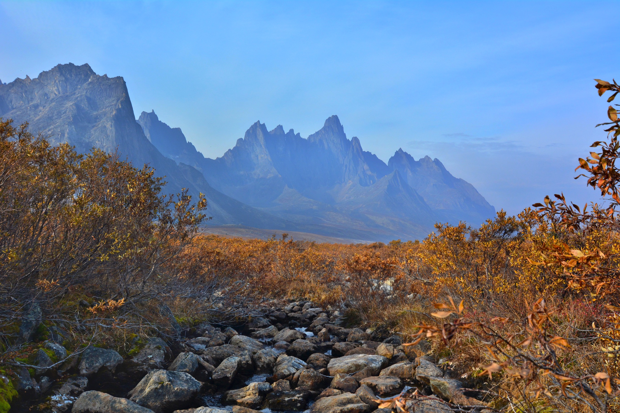
From the pullout at the top of Windy Pass on the Dempster Highway, walkers cross the road and head south-east toward the obvious ridge on the left of the highway. A short tussock section (about 100 m of elevation gain in roughly 20 minutes) leads to the base of a gentle limestone ridge, which then provides easy walking on a broad spine of pale, lichen-flecked rock. The crest gradually flattens; the final climb to the rocky summit is a little steeper but remains a walk. From the top, views open across the dramatic ridge system of Mount Distincta to the north-east, the Blackstone River valley to the south-west, and the rolling treeless uplands of the central Ogilvies in every direction. Strong parties sometimes continue toward Mount Distincta, but that extension involves a steep loss-and-regain across a ridge gap and converts the day into a substantially harder outing.
Why it is essential
Windy Pass Peak is the most accessible “true Ogilvie” summit on the Dempster: the trailhead sits at high elevation in open tundra, so almost the whole hike is alpine, and the limestone ridge is representative of the central Ogilvies’ unglaciated, deeply weathered character. The area is also the southern end of the Hart River caribou herd’s summer range, which is itself a key conservation feature of the central Ogilvies.
Equipment
- Sturdy walking boots
- Wind- and waterproof shell, warm layer
- Hat and gloves outside the warmest weeks
- ≥1.5 L water (no reliable water on the ridge)
- Bear spray
- Map / GPS
- Sun protection
- Mosquito head net in late June / July
Hazards and notes
- The route is fully exposed to wind and lightning; the ridge offers no shelter.
- Snow patches may persist into early July and the first new snow can fall by late August.
- No marked trail, no signage and no park infrastructure — open-mountain travel on the verge of the highway corridor.
- The Hart River caribou herd uses the area; hunting along the Dempster between km 77 and km 195 has been periodically closed for conservation. Check current Yukon regulations.
- Grizzly bears occur throughout the central Ogilvies.
Routes and maps
| Source | URL |
|---|---|
| Yukon Hiking — Windy Pass Peak | yukonhiking.ca |
| OpenStreetMap — Windy Pass area | openstreetmap.org |
External links
3. Infant Peak
Snapshot
Itinerary
From a small pullout at the highway culvert at km 131, the route picks its way through tussocks and low shrub on the west side of the road, working roughly west and then south-west toward the base of a clear rocky ridge. After about 1.2 km of mixed bush and tussock walking the ground opens into alpine rock and lichen; from there the line follows the ridge up over a foresummit, then dips and re-ascends ~1.5 km to Infant Peak itself, which is the next obvious peak along the ridge. Lightly worn footpaths and intermittent cairns are visible in places but the route is unmarked. The summit gives sweeping views of the Blackstone River valley to the south-east and the dramatic Mount Distincta ridge system to the north — Windy Pass Peak and Mount Distincta sit on the same backbone, around 20 km up the highway. The hike is outside Tombstone Park.
Why it is essential
Infant Peak is the only short, well-documented summit hike between the Tombstone Park boundary (km 115) and Windy Pass (km 153). Together with Windy Pass Peak it bookends the most easily reached “true Ogilvie” ridge walking from the road, and gives a different perspective on the Distincta ridge system that defines this part of the central Ogilvies.
Equipment
- Boots
- Wind shell, warm layer
- ≥1.5 L water (no reliable water on the route)
- Bear spray
- Map / GPS
- Gaiters useful for the tussock section
- Insect protection in summer
Hazards and notes
- Off-trail throughout — no marked path, no signage, no rescue infrastructure.
- The tussock section is awkward and tiring; the ridge is exposed.
- Sudden cold fronts, mist and lightning are routine; no shelter once on the ridge.
- Grizzly bears use the surrounding valleys.
- The Hart River caribou herd ranges through the area in summer; keep distance from any animals encountered.
- No cellular reception in this stretch of the Dempster.
Routes and maps
| Source | URL |
|---|---|
| Yukon Hiking — Infant Peak | yukonhiking.ca |
| OpenStreetMap — Dempster / Blackstone valley around km 131 | openstreetmap.org |
External links
- Yukon Hiking — Infant Peak
- Yukon government — Dempster Highway Travelogue (PDF)
- Wikipedia — Ogilvie Mountains
4. North Fork Pass tundra ramble
Snapshot
Itinerary
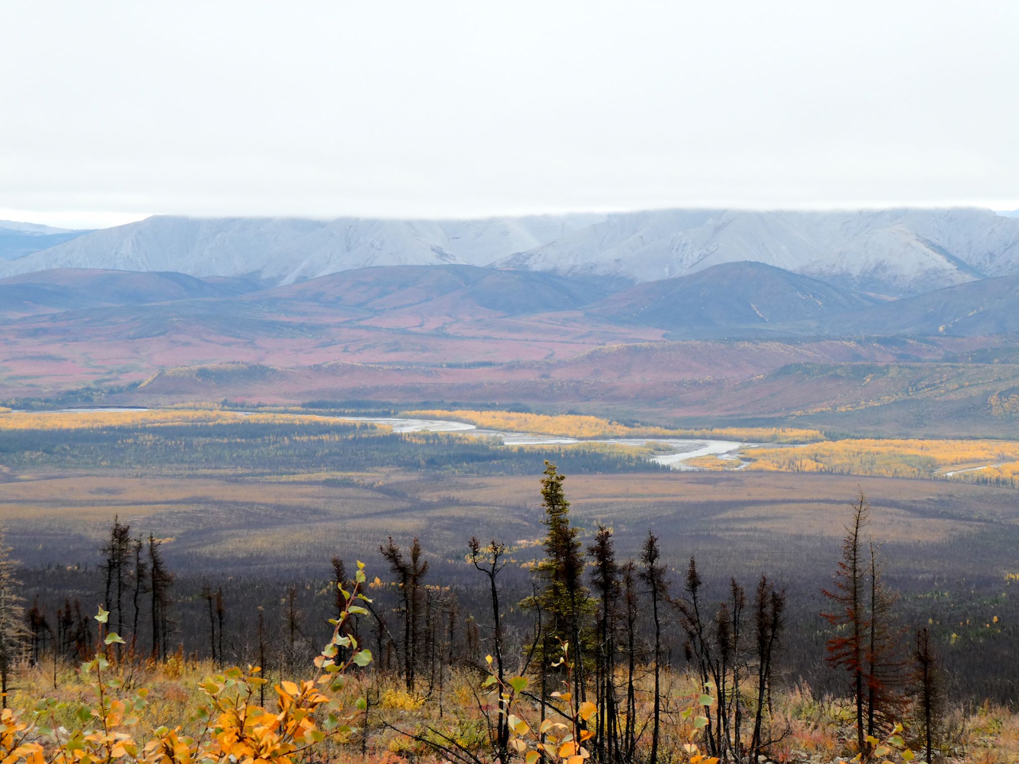
North Fork Pass is the highest point on the Dempster Highway at roughly 1,289 m and marks the continental divide between the Yukon and Mackenzie river systems. Yukon government materials describe it explicitly as a roadside ramble: there is no constructed trail, but the open, treeless terrain on either side of the highway invites walkers to leave the pullout and wander out across the Blackstone Uplands toward the small ridges and rock outcrops that frame the pass. Typical lines head east onto the gentle ridge above the highway for a 4–6 km loop, or north into open tundra dotted with tarns and willow, returning by the same line. The walk is treeless throughout; underfoot is a mix of cushion plants, dwarf birch, willow and cottongrass. Pikas, hoary marmots, ptarmigan, golden eagles and the Hart River caribou herd are all routinely seen. Autumn colours peak in late August.
Why it is essential
The North Fork Pass tundra is the only place along the Dempster where alpine tundra characteristic of the broader Ogilvie Mountains is reached without any climbing from the car. It is the standard entry point for short rambles into the Hart River caribou range and the only roadside experience that conveys the unglaciated, rolling subarctic character that defines the Ogilvies north of Tombstone Park.
Equipment
- Wind shell, warm layer
- ≥1 L water
- Sturdy boots
- Bear spray
- Compass or GPS — there are no landmarks once well away from the road
- Sun protection
Hazards and notes
- Although elevation gain is modest, the pass is fully exposed; temperatures can drop below freezing and visibility can collapse in minutes year-round.
- There is no path: walkers must navigate by sight.
- The Hart River caribou herd uses the area as summer range — give animals a wide berth and follow Yukon Parks guidance on wildlife distance.
- Grizzly bears occur.
- Inside Tombstone Territorial Park: no firearms, no off-road vehicles, and stay on hard surfaces or established lines to avoid trampling sensitive tundra.
- The pullout is small; parking can be tight in peak season.
Routes and maps
| Source | URL |
|---|---|
| Yukon government — North Fork Pass summit | yukon.ca |
| OpenStreetMap — North Fork Pass area | openstreetmap.org |
External links
- Yukon government — Hike and camp at Tombstone Territorial Park
- Travel Yukon — Dempster Highway road trip itinerary
- Wikipedia — Tombstone Territorial Park
5. Ogilvie Ridge tower walk
Snapshot
Itinerary
The Ogilvie Ridge rest area at km 258.8 sits at the south-eastern edge of the Eagle Plain escarpment, roughly 300 m above the Ogilvie–Peel valley floor, and is the most expansive scenic stop on the central Dempster. From the pullout the highway continues a short distance north to a service-road junction that climbs to a microwave tower on the Ogilvie Ridge crest at about 929 m. Walkers can park at the pullout and walk the service road, taking in views east across the Ogilvie River valley and the Peel watershed and west to the rolling north-eastern Ogilvies. From the tower the open tundra ridge offers easy off-trail extensions in either direction. There is no constructed walking trail; the route is the access road plus optional tundra ridge.
Why it is essential
Ogilvie Ridge is the visual high point of the northern Ogilvie Mountains as experienced from the road: it caps the long climb out of the Ogilvie River valley and gives the only widely accessible panorama of the northern half of the range and the transition from mountains to the Eagle Plain. The Yukon government Dempster Highway Travelogue treats it as one of the headline interpretive stops of the highway.
Equipment
- Walking shoes or boots
- Wind shell, warm layer
- ≥1 L water
- Sun protection
- Bear spray
- Camera
- Insect protection in summer
Hazards and notes
- The ridge and access road are fully exposed: wind chill can be severe even in summer.
- No reliable water on the ridge.
- The tower is active communications infrastructure; do not enter fenced compounds, and give way to maintenance vehicles on the service road.
- Tyre and fuel services are not available between Eagle Plains (km 369) and Dawson City; carry a spare and basic tools.
- Grizzly bears occur in the surrounding valleys.
- Snow can fall in any month above ~900 m.
Routes and maps
| Source | URL |
|---|---|
| Yukon government — Dempster Highway Travelogue (PDF) | yukon.ca |
| OpenStreetMap — Ogilvie Ridge / tower access road | openstreetmap.org |
| Geocaching — Ogilvie Ridge Earthcache | geocaching.com |
External links
- Yukon government — Dempster Highway Travelogue (PDF)
- The MILEPOST — Dempster Highway
- Wikipedia — Dempster Highway
Missing data / follow-up work
- Cover and inline photos for the corridor use 2,048 × 1,536 px Flickr images from the user “dvs”. These meet the project’s hard 2,000 px floor but sit below the 2,400 px preferred target. Higher-resolution alternatives (Yukon government media library, further Flickr CC searches) should be sought before any reprint.
- No licence-compatible image for Infant Peak or for the North Fork Pass tundra ramble was located in this pass.
- Yukon Hiking GPX downloads for Sapper Hill, Windy Pass Peak and Infant Peak could not be directly confirmed; the canonical track URLs on
yukonhiking.ca/gps/gpx/should be retrieved before the GPX section is finalised. - Sapper Hill distance figures vary between secondary sources (4–6 km); an official Yukon Parks figure would be preferable.
- North Fork Pass has no defined trail. If the Tombstone Range entry adds a Blackstone Uplands tundra ramble, this Ogilvie entry should consider swapping in a documented Ogilvie River walk near the bridge, a Mount Distincta extension from Windy Pass, or Churchward Hill (~875 m) further north.
- Hart River caribou hunting closures (km 77–km 195) should be confirmed against current Yukon government hunting regulations.