Regional overview
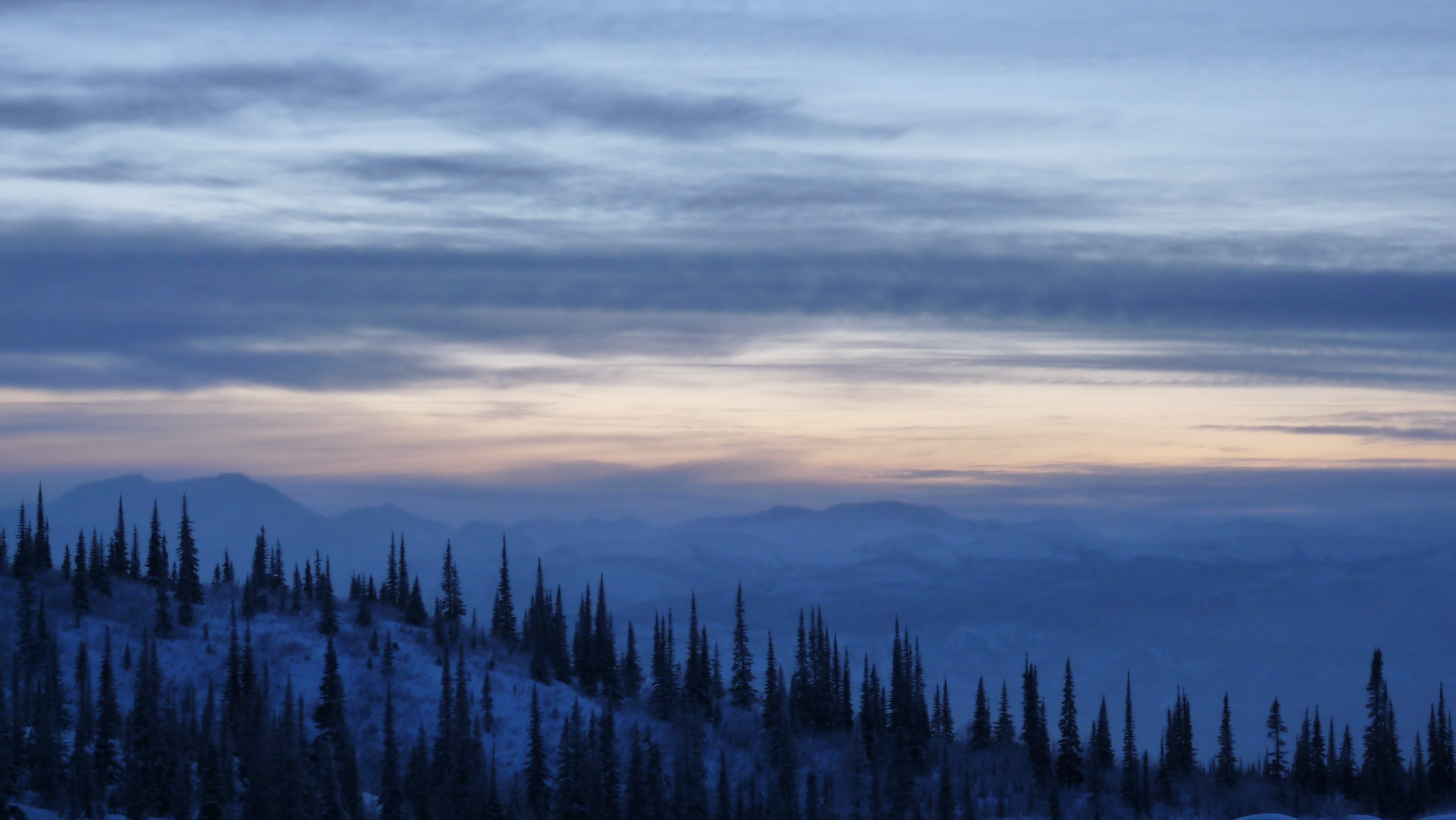
The Pelly Mountains form a wide belt of subarctic ranges across south-central Yukon, lying between the Tintina Trench to the north and the Liard lowlands to the south, broadly framed by the Robert Campbell Highway between Carmacks and Watson Lake and the South Canol Road between Johnsons Crossing and Ross River. The range covers a vast area — about 44,000 km² as a Yukon Ranges subdivision — and is split into the Big Salmon Range in the west, the Glenlyon Range and Anvil Range in the centre around Faro, and the Saint Cyr Range and Itsi Range in the east. The highest summits sit between 2,000 and 2,400 m: Fox Mountain (2,404 m) is published as the high point of the Pelly as a unit, although several peaks in the Anvil and Saint Cyr ranges are of similar elevation.
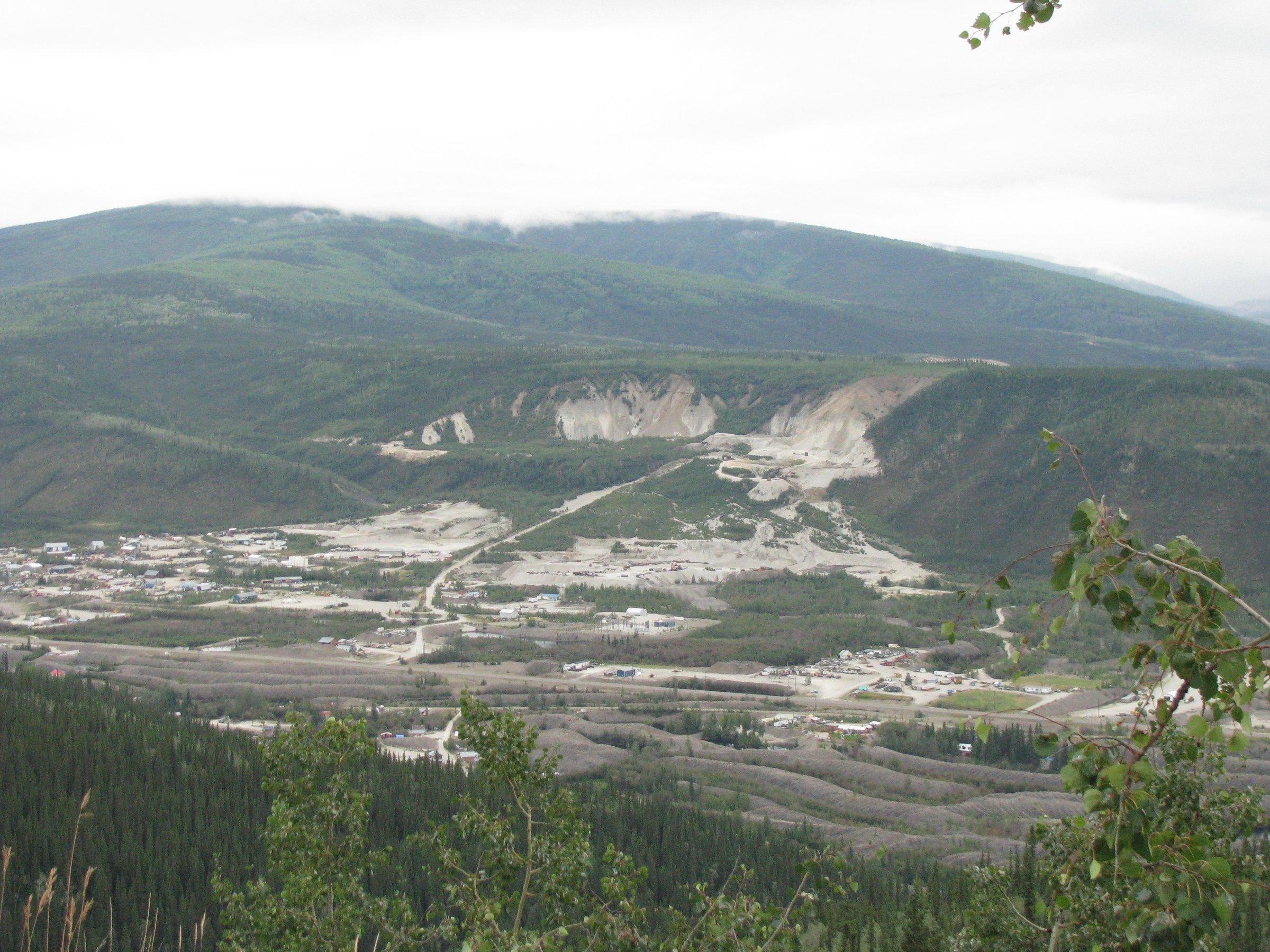
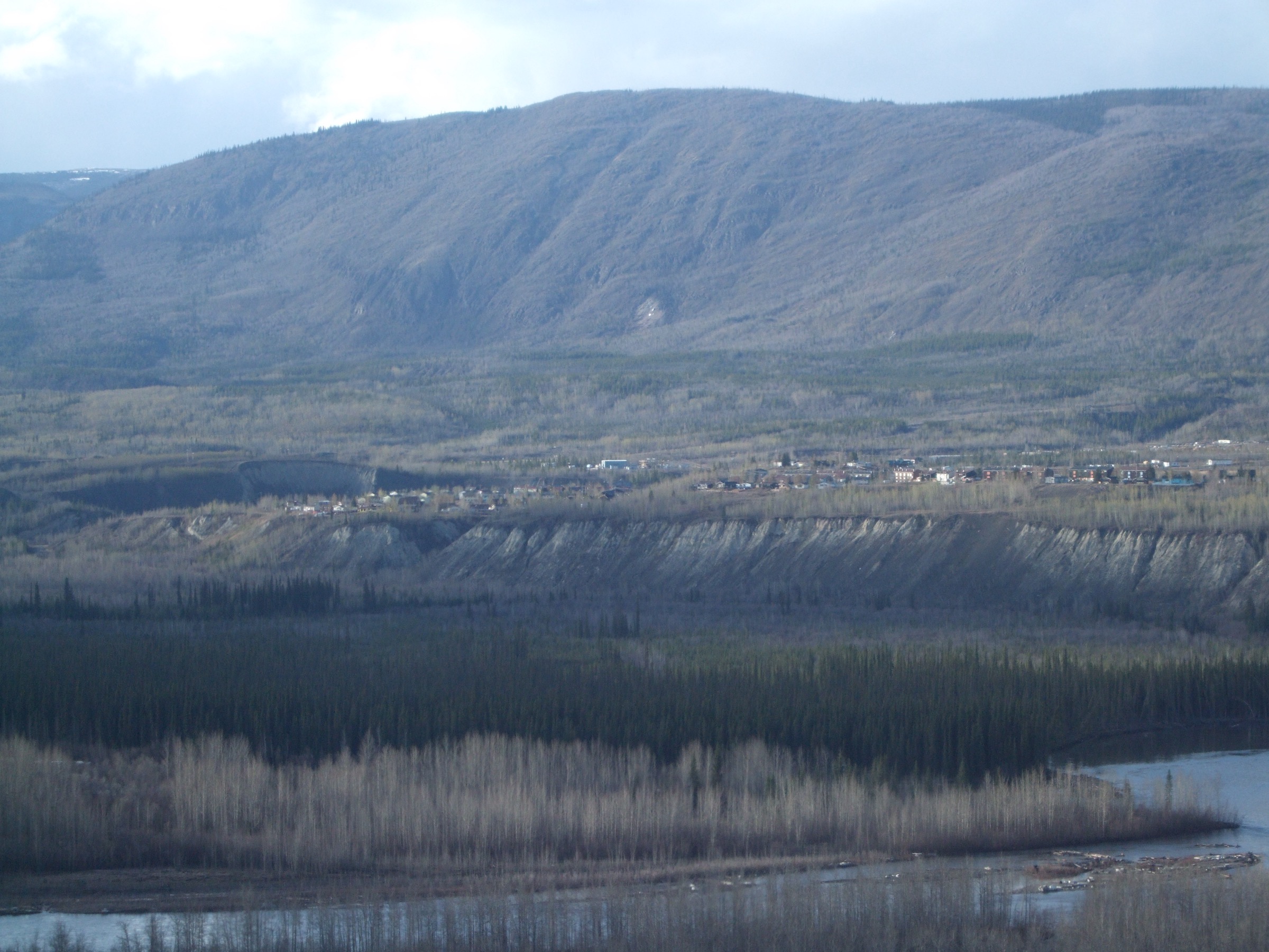
The three road-accessible bases are Faro (population around 420) on the Robert Campbell Highway, Ross River at the junction of the Robert Campbell and Canol Roads, and the Quiet Lake Recreation Site on the South Canol. Faro grew up around the former Anvil Range / Faro Mine — for a period one of the largest open-pit lead-zinc operations in the world — which closed in 1998 and is now under a long-term federal abandonment-and-reclamation programme. Several access roads around Faro (Vangorda, Grum, Faro pit, Rose Creek tailings) belong to the active reclamation site and can be signed as restricted; visitors are directed to check at the Campbell Region Interpretive Centre in Faro before driving any unmarked mining road. Faro itself maintains a small but well-marked network of community trails, including the Van Gorder Falls path on the edge of town, the Faro Arboretum (the most northerly arboretum in Canada), and access to the Mount Mye Sheep Viewing Centre via Blind Creek Road.
The Pelly is among the most sparsely visited parts of southern Yukon. There are very few maintained alpine trails: most documented “hikes” outside Faro are either short canyon and forest walks at roadside campgrounds, multi-day community trails, or unmarked tundra routes off the Robert Campbell Highway and South Canol Road. The principal practical hiking resource is yukonhiking.ca, which catalogues route descriptions for several Pelly walks and a small number of South Canol alpine routes; the Town of Faro and the Yukon government list the town trails (Van Gorder Falls, Wolf, Fox, Arboretum) and the Mount Mye Sheep Centre interpretive site. Travel Yukon and the Yukon road-trip pages cover regional logistics.
The reliable hiking season is short. Snow can linger on alpine ridges into late June and return by mid-September; most fit-walker day hikes are practical from late June to early September. The South Canol Road and the Robert Campbell Highway are gravel for long sections, can be washed out after heavy summer rain, and have no services for long stretches. The area is grizzly bear, black bear and Fannin sheep country — bear spray and noise-making are standard, food storage at backcountry campsites is mandatory, and the Mount Mye sheep slopes have wildlife-viewing protocols during the spring lambing season and the autumn rut. Cell coverage is essentially nil outside Faro and Ross River; satellite communication is sensible for any off-trail Pelly day.
Selection rationale
The Pelly is too thin on formal trails to fill a five-hike catalogue from one sub-range alone, so the picks below span the Faro / Anvil hub (Hikes 1, 2, 3), the South Canol corridor into the Saint Cyr Range (Hike 4) and the Robert Campbell Highway crossing of the Lapie River (Hike 5). Two are short interpretive or canyon walks; one is the standard sheep-viewing ridge above Faro; one is the only published “alpine route” inside the Saint Cyr range on yukonhiking.ca; and one is a short canyon-rim walk at a Yukon government campground. This is an honest reflection of what is realistically available as a single-day hike from a road in the Pelly: a couple of true trails, one practical alpine route, and short walks that double as wildlife-viewing or interpretive outings. Several plausible candidates — the full Mount Mye summit, Anvil Range ridge traverses, Glenlyon Range alpine wanders — were considered but cannot be supported with verifiable trail data and are noted at the end.
Summary
| # | Hike | Country | Route type | Distance | Gain | Max elevation | Difficulty |
|---|---|---|---|---|---|---|---|
| 1 | Van Gorder Falls Trail | Canada | Out-and-back | ~3 km return | ~50–80 m | ~750 m | Easy |
| 2 | Mount Mye Sheep Centre and ridge | Canada | Out-and-back | ~8–14 km | 400–700 m | ~1,500 m | Moderate (off-trail above tree line) |
| 3 | Faro Arboretum and Blind Creek viewpoint loop | Canada | Loop / out-and-back | ~3–5 km | 100–150 m | ~850 m | Easy–moderate |
| 4 | Groundhog Creek alpine route (Saint Cyr Range) | Canada | Out-and-back, alpine route | ~3.6–10 km | 360–700 m | ~1,700 m | Moderate |
| 5 | Lapie Canyon Trail | Canada | Out-and-back along canyon rim | ~1–2 km | minimal | ~700 m | Easy (cliff-edge caution) |
1. Van Gorder Falls Trail
Snapshot
Itinerary
The trail leaves the Campbell Region Interpretive Centre at the upper edge of Faro and winds through dry boreal forest of white spruce, lodgepole pine and aspen on the bench above the Pelly River. After about 1.5 km it reaches a wooden viewing deck above Van Gorder Creek, where the creek drops out of a small rocky canyon as a single ribbon waterfall. Most parties return on the same path. Two side loops branch off the route: the Wolf Trail extension on the return leg, and the Fox Trail, which climbs steeply through cranberry-rich forest and adds a short hill workout. The waterfall, creek and trail are named after Del Charles Van Gorder, a miner and trapper who ran the Taylor and Drury trading post at Pelly Banks from 1910 to 1944.
Why it is essential
The Van Gorder Falls Trail is the only short, signed, in-town hike anywhere along the Faro arm of the Pelly Mountains, and it doubles as the standard introduction to the Campbell Region Interpretive Centre, which is also the practical information hub for the Mount Mye Sheep Viewing Centre, the Dena Cho Trail and the Faro Arboretum. The waterfall itself is the area’s most-photographed natural feature and is feasible for visitors of any fitness level.
Equipment
- Trail shoes or light boots
- Water
- Sun protection
- Bear spray (Fannin sheep and bears use the slopes immediately east and north of the trail)
Hazards and notes
- Stay on the path approaching the falls; the canyon rim is loose and unfenced away from the deck.
- Bear sign is common; carry bear spray and make noise.
- The trail is regularly broken by wildlife traffic and may be slippery after rain.
- Brochures, current bear-activity notices, and trail extensions are available from the Interpretive Centre in summer.
Routes and maps
| Source | URL |
|---|---|
| Yukon Hiking — Van Gorder Falls | yukonhiking.ca |
| AllTrails — Van Gorder Falls Trail | alltrails.com |
| OpenStreetMap — Faro area paths | openstreetmap.org |
External links
2. Mount Mye Sheep Centre and ridge
Snapshot
Itinerary
From Faro, Mitchell Road leads onto Campbell Street and then onto the gravel Blind Creek Road, which climbs 7.5 km to the Mount Mye Sheep Viewing Centre at the foot of the south-facing slopes of Mount Mye. The Centre sits on a low bench with an all-season observation cabin and an isolated photographer’s blind looking onto the Fannin sheep range, where a small herd of Fannin sheep — a Dall–Stone hybrid — graze through autumn, winter and spring. The walking trail begins at the end of Aex Road, a branch off Blind Creek Road, and climbs gradually for about 3 km through open spruce forest to the base of the mountain. From here the route turns up a long ridge spur, ascending through dwarf birch and willow into a band of open subalpine and then onto tundra above tree line. The lower ridge crest gives a wide view over the Pelly River, Blind Creek, the Faro mine pits to the south, and the Anvil Range proper to the north. Fit walkers can continue along the ridge to higher points; the full Mount Mye summit sits well behind the ridgeline and is more than a day trip from the road. Return is by the same line.
Why it is essential
Mount Mye is the wildlife-viewing centrepiece of the Faro area and the only place in the Pelly Mountains where a roadside walk reliably gives access to a Fannin sheep range, alpine tundra and a long Pelly River viewpoint in one day. The Sheep Centre itself is a Yukon government interpretive site and the ridge above gives the most accessible Anvil Range overview from the Robert Campbell Highway.
Equipment
- Sturdy boots
- Weatherproof layer (wind on the ridge is significant even in summer)
- Warm layer, sun protection
- 2 L water, food, bear spray
- Map and GPS (no signed trail above tree line)
- Light gravel-road capability for Blind Creek Road
- Spotting scope or binoculars at the Sheep Centre
Hazards and notes
- Grizzly and black bear use this slope; the open subalpine is classic sight-line bear country. Carry spray and travel in a group where possible.
- Fannin sheep wildlife protocol: visitors should remain at the observation cabin and blind during winter / spring viewing, and avoid pushing onto the slopes during the May–June lambing window and the autumn rut. Local guidance is available from the Campbell Region Interpretive Centre.
- The route above tree line is unmarked. In low cloud the ridge becomes featureless; rely on GPS and turn back early.
- The Faro Mine reclamation site is immediately south. Some access roads in the Vangorda / Faro pit area are signed restricted; the Aex Road / Blind Creek Road approach is open to the public.
Routes and maps
| Source | URL |
|---|---|
| Trailpeak — Mount Mye Sheep Viewing Centre | trailpeak.com |
| Yukon government — Mount Mye Sheep Centre | yukon.ca |
| OpenStreetMap — Blind Creek Road and Mount Mye area | openstreetmap.org |
External links
- Yukon government — Viewing wildlife at Faro (Fannin sheep brochure)
- ehCanada Travel — Mount Mye Sheep Centre
- Wikipedia — Pelly Mountains
3. Faro Arboretum and Blind Creek viewpoint loop
Snapshot
Itinerary
The Faro Arboretum is described by the Yukon government as the most northerly arboretum in Canada. From the parking lot, a steep track climbs the bench above Mitchell Road through a transition from boreal forest into open subalpine birch and willow, where viewing decks and interpretive panels describe native trees, shrubs, lichens and wildlife of the central Yukon. Higher viewpoints open onto the Pelly River and the long line of the Anvil Range to the north-east, with the Faro mine reclamation works visible in the middle distance. The loop returns to the parking lot. Some visitors extend the walk on cut lines and informal paths that connect into the upper-town trail network and link towards the Van Gorder Falls Trail; the broader Faro trail brochure is available at the Campbell Region Interpretive Centre.
Why it is essential
The Arboretum provides the only short interpretive walk in the area that puts the subarctic vegetation, the Anvil Range and the mine context together at a single roadside-accessible viewpoint. For visitors who only have an hour or two in Faro, it is the practical pair to the Van Gorder Falls trail and a useful primer for the more remote walks farther east and south.
Equipment
- Trail shoes
- Water
- Sun protection
- Bear spray
- Trekking poles help on the descent
Hazards and notes
- The initial climb is steep and can be slippery after rain.
- The site sits at the boundary of the broader Anvil Range Mine reclamation footprint; visitors should not cross obvious mine-site fencing or signed roads.
- Bear activity is regularly reported in the upper-town fringe area; carry bear spray and make noise.
Routes and maps
| Source | URL |
|---|---|
| Yukon government — Faro Arboretum site page | yukon.ca |
| Yukon government — Faro trails | yukon.ca |
| OpenStreetMap — Faro townsite | openstreetmap.org |
External links
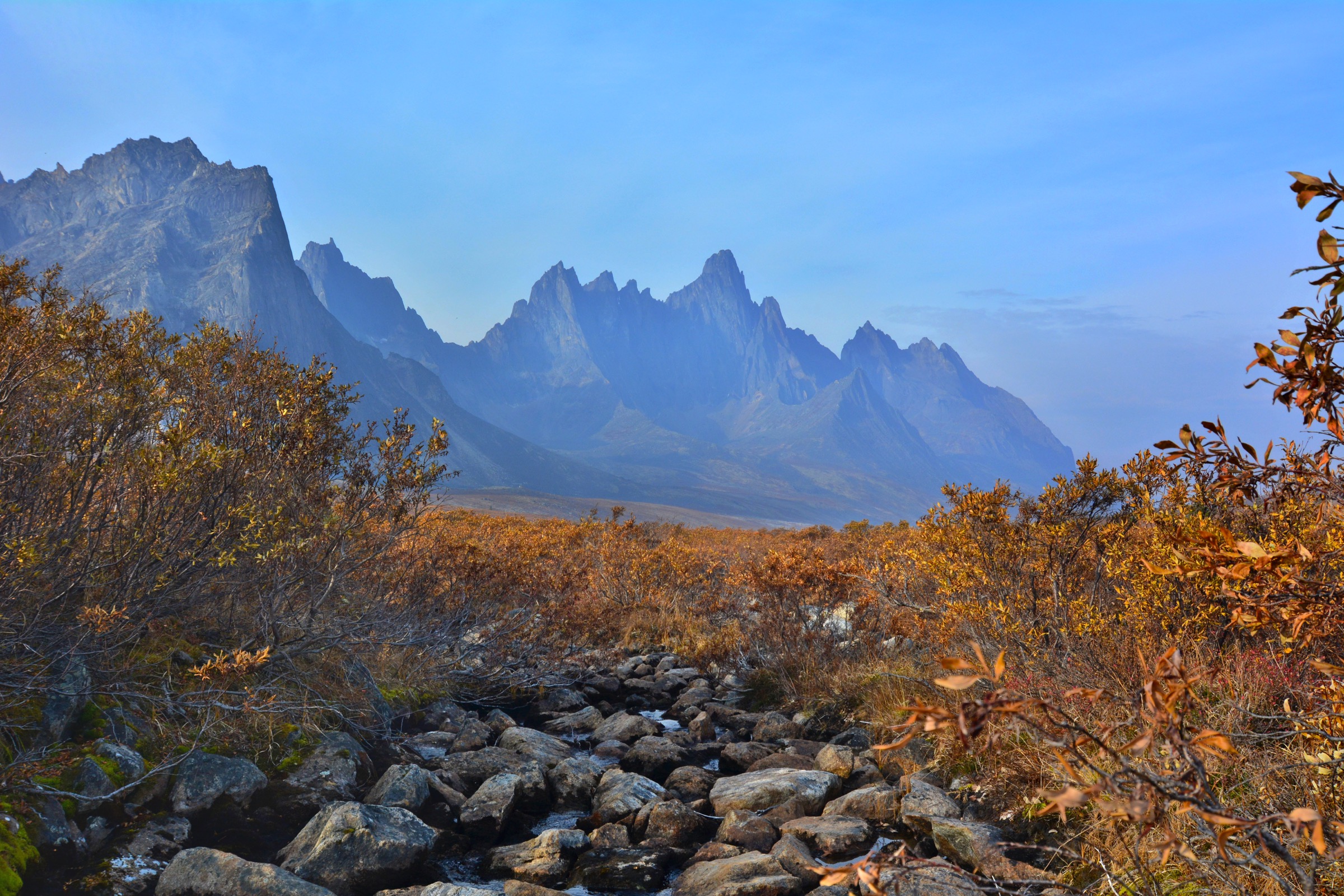
4. Groundhog Creek alpine route (Saint Cyr Range)
Snapshot
Itinerary
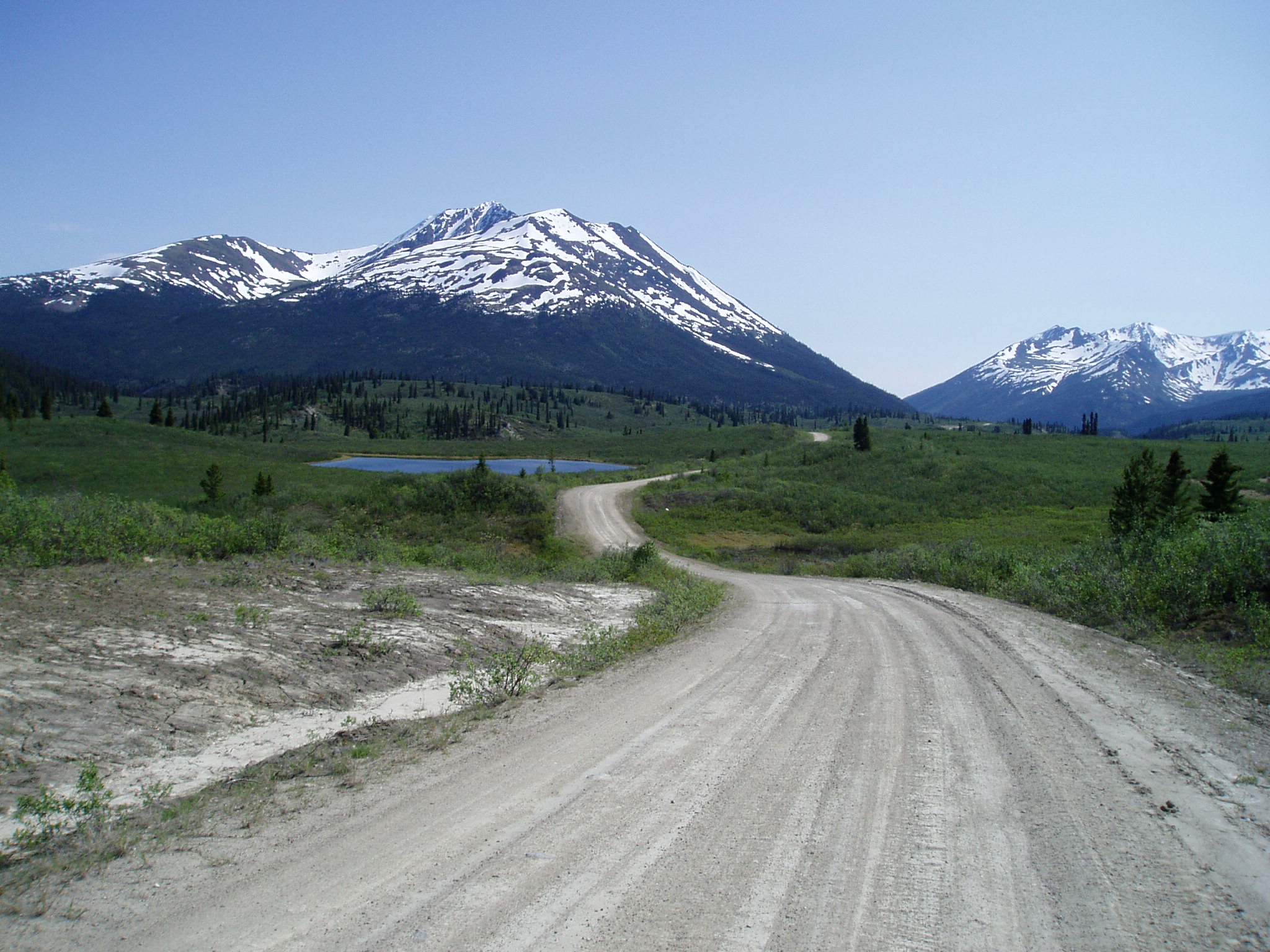
The Groundhog Creek Road leaves the South Canol Road at approximately km 161 and climbs north-west into the southern Saint Cyr Range. The driveable section is rough — high-clearance and ideally 4WD — and parties without such a vehicle park at the South Canol junction and walk the road up. The road eventually opens into the alpine basin around Groundhog Pass; from the parking pull-out near the pass, a short, mostly open walk of about 3.6 km return and 360 m gain reaches a high point on the ridge above, with views across the Saint Cyr Range and the upper Groundhog Creek catchment. Stronger parties continue south or north along the ridge over rolling tundra, gaining a second or third high point and adding 4–6 km and several hundred metres of cumulative ascent. There is no marked trail above the pass; route choice depends on weather and visibility. Yukon Hiking specifically names this as the most accessible alpine area along the South Canol Road and one of the few practical day-from-the-car alpine routes in the Pelly.
Why it is essential
The Saint Cyr Range is the most rugged sub-range of the Pelly Mountains and almost all of it is off-trail. Groundhog Creek is the single published route that allows a competent fit walker to reach Saint Cyr alpine terrain in a day without an expedition. It is the natural representative of the South Canol Road / eastern Pelly experience and the obvious high-mountain pick in any honest catalogue of Pelly day-hikes.
Equipment
- Sturdy boots with good ankle support
- Full waterproofs, warm insulating layer (wind chill at 1,700 m can be significant in any month)
- Sun protection (snow can persist into July)
- 2.5–3 L water (refill from streams above the pass), food
- Map and GPS, headtorch
- Bear spray, satellite communication device
- Vehicle capable on a rough gravel side road, or add 4–6 km of road walking each way
Hazards and notes
- South Canol Road has no services for long stretches; carry a full set of vehicle spares (two spare tyres recommended on Yukon government travel-route advisories).
- Grizzly habitat throughout; travel accordingly.
- Alpine ridges are exposed; afternoon thunderstorms in July and August are not uncommon, and snow showers are possible at any time in summer. Set a conservative turn-back time on the ridge.
- Off-trail navigation in low cloud is genuinely difficult; the tundra is featureless and ridge cairns are intermittent or absent.
- The route description is from Yukon Hiking and not from an official park brochure; statistics should be treated as best-available rather than exact.
Routes and maps
| Source | URL |
|---|---|
| Yukon Hiking — Groundhog Creek | yukonhiking.ca |
| Yukon Sights — Groundhog Creek Road on South Canol | yukonsights.ca |
| OpenStreetMap — Groundhog Creek / Saint Cyr Range | openstreetmap.org |
External links
- Yukon Sights — South Canol Road overview
- Johnsons Crossing Lodge — South Canol Road leaflet (PDF)
- Wikipedia — Saint Cyr Range
5. Lapie Canyon Trail
Snapshot
Itinerary
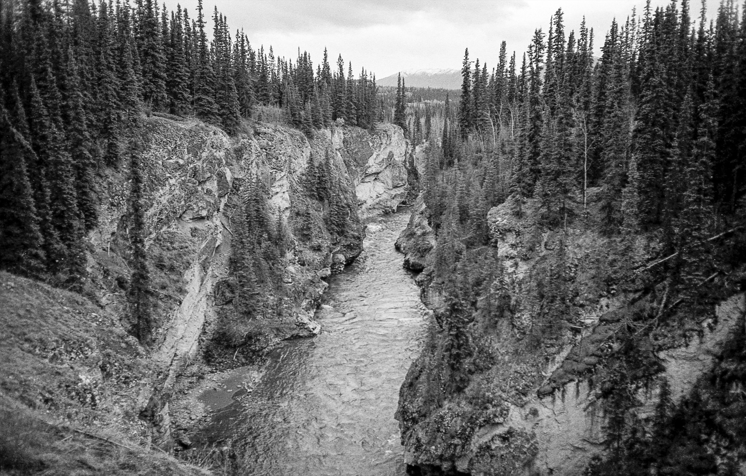
The Lapie Canyon Yukon government campground sits on a bench above the Lapie River where the Robert Campbell Highway crosses the canyon between Ross River and Faro. From the campground, a footpath leads to the south-west side of the bridge and then follows the canyon rim along the edge of a tight quartzite gorge cut by the Lapie River, which descends in a short series of whitewater rapids that are well known to expert kayakers. Ravens nest in the canyon walls. The path is rough and informal in places, and the cliff edge is steep and unfenced. Most visitors walk out for a viewpoint and return on the same line.
Why it is essential
The Lapie Canyon Trail is the only publicly documented short walk on the long Robert Campbell Highway / Pelly arc between Faro and Ross River, and the eastern entry to the Pelly Mountains. It gives the most accessible “named feature” along that road, pairs naturally with a camp stop on a Faro–Ross River–South Canol trip, and is one of very few short canyon walks in central Yukon.
Equipment
- Trail shoes
- Water
- Sun protection
- Bear spray
- Close supervision of children at the rim
Hazards and notes
- The canyon rim is steep, undercut and not fenced. Trip reports specifically warn to stay clear of the cliff edge.
- The river below is whitewater and unsuited to swimming or wading.
- The campground is in active bear country; carry spray and use the provided food-storage facilities if camping.
- No formal length or grading is published; figures above are inferred from secondary descriptions and should be verified locally.
Routes and maps
| Source | URL |
|---|---|
| Yukon government — Lapie Canyon Campground | yukon.ca |
| Yukon Info — Lapie Canyon Campground | yukoninfo.com |
| OpenStreetMap — Lapie Canyon | openstreetmap.org |