Regional overview
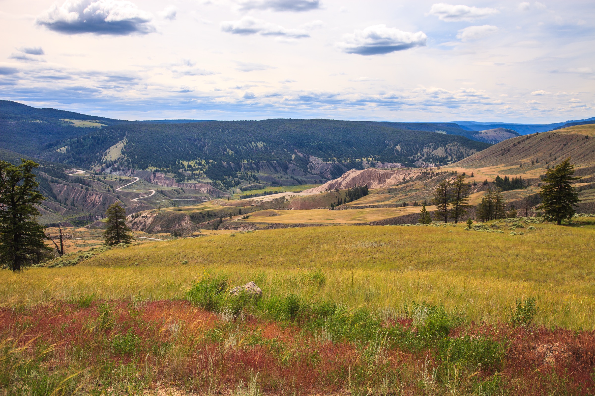
The Bulkley Ranges form the principal mountain block of the central Bulkley Valley in west-central British Columbia, rising sharply above the valley-floor towns of Smithers (population roughly 5,400), Telkwa and Houston along Highway 16. They are a subrange of the Hazelton Mountains within the broader Interior Mountains system, and include the Telkwa Range south of the Bulkley River and outliers of the Howson Range to the west. The signature peak is Hudson Bay Mountain (2,589 m), an ultra-prominent (1,609 m) summit immediately west of Smithers, with a small remnant glacier on its north face that feeds Twin Falls. Adjacent ground regularly grouped with the Bulkley hiking economy — and treated as part of this catalogue entry — is the Babine Range east of the valley, technically classified by the Canadian Geographical Names database as a southern subrange of the Skeena Mountains, but containing Babine Mountains Provincial Park and the daily horizon of Smithers walkers.
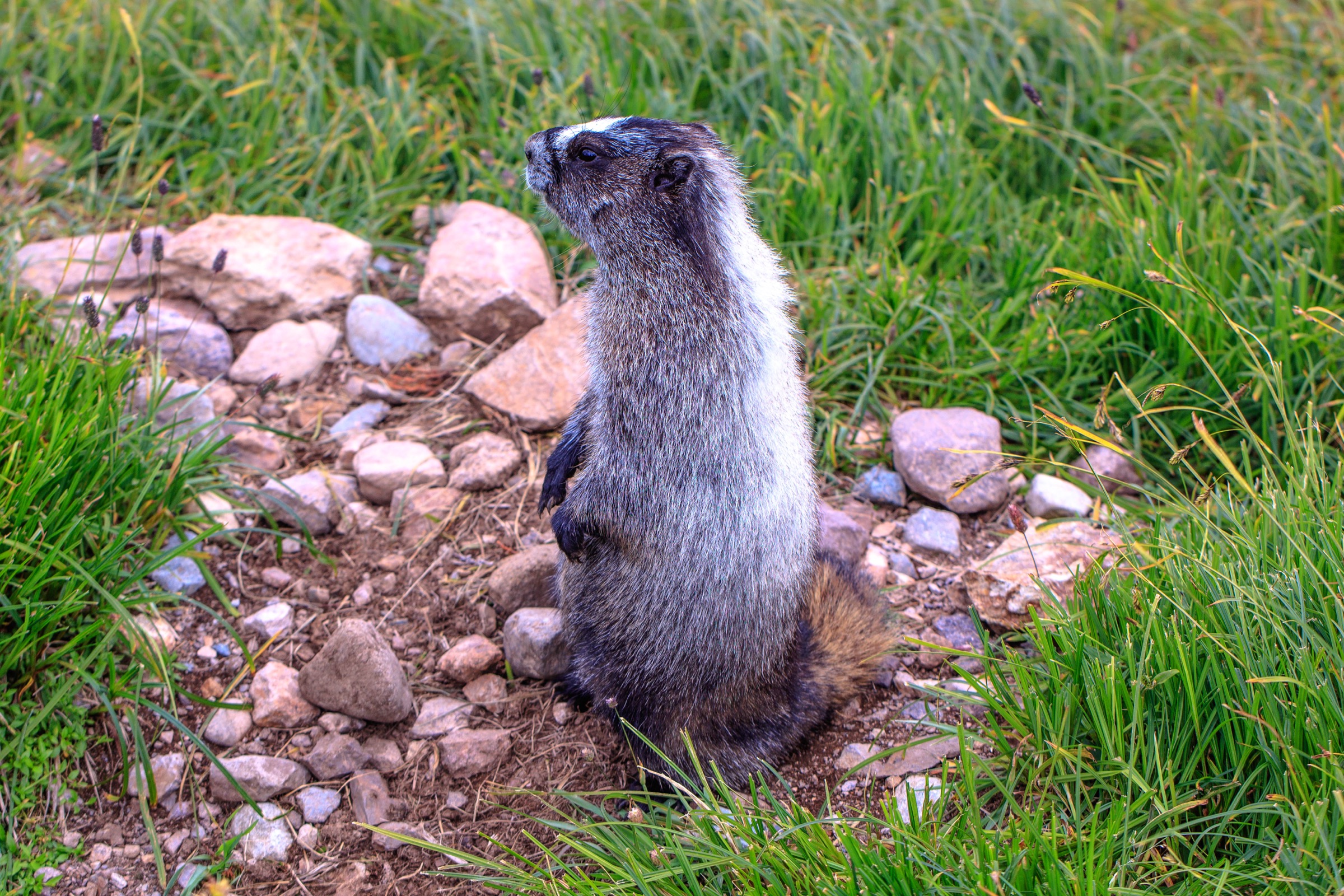
Terrain is mostly granitic and volcanic, glacially sculpted into broad U-shaped valleys, cirque basins (Silver King, Ganokwa, Hunter), serrated alpine ridges, and one significant remnant glacier on Hudson Bay Mountain. Treeline sits at roughly 1,500–1,600 m. Below treeline is mixed subalpine forest of Engelmann spruce, subalpine fir and lodgepole pine; above it, broad alpine meadows that bloom in July with lupine, arnica, valerian, paintbrush and false hellebore. The region is wildlife-rich: grizzly and black bears, moose, mountain goats, hoary marmots, and a critically endangered Telkwa caribou herd estimated at fewer than 20 animals — the basis for several access restrictions in the southern Telkwa Range.
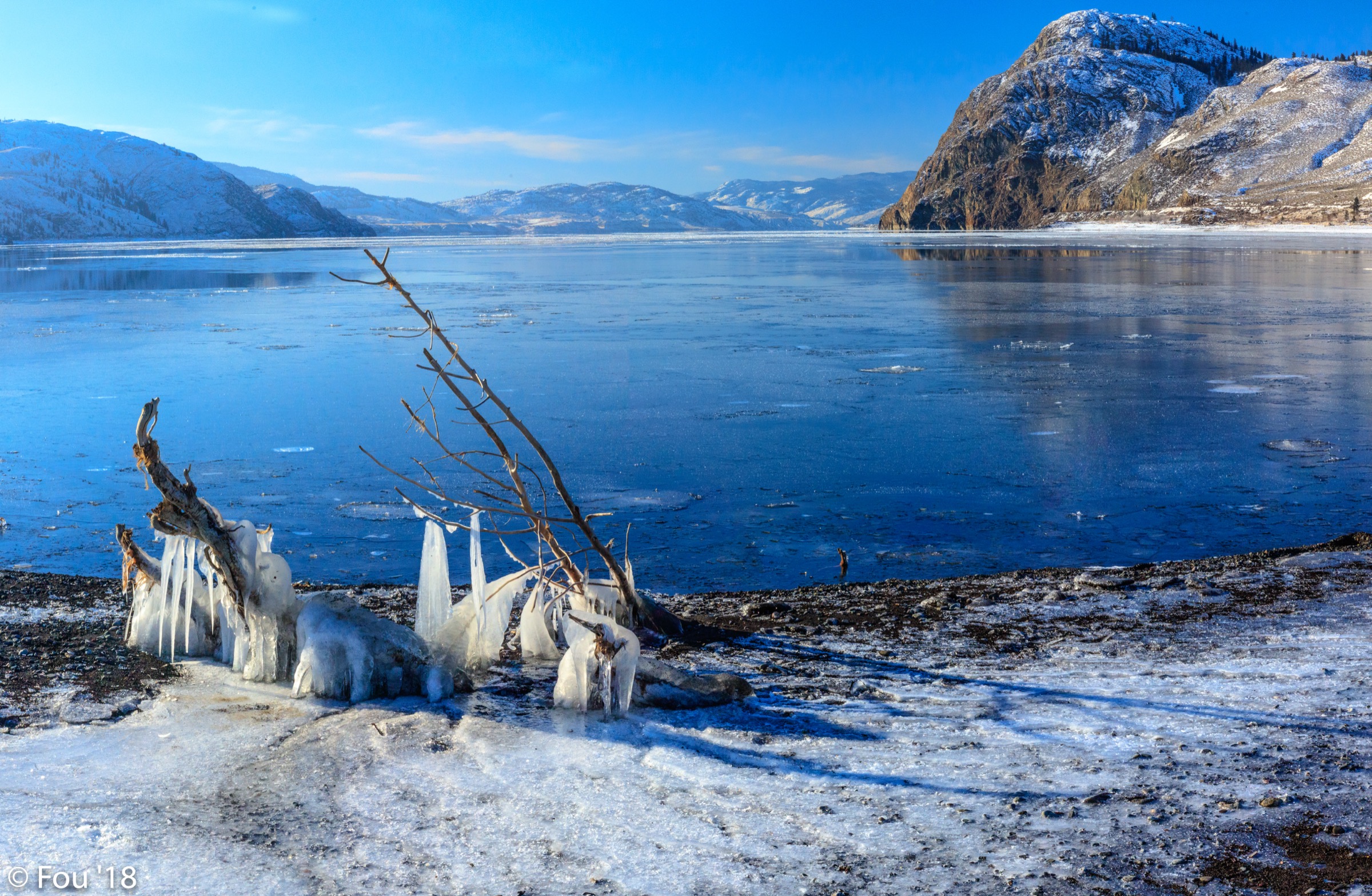
The hiking season is short. Most alpine trails are reliably snow-free only from mid-July to mid-September, occasionally late June in low-snow years on south aspects. Several access roads — notably Hudson Bay Mountain Road and the upper Driftwood Road — are gravel forestry roads, passable in dry summer to most vehicles but rough enough that local guidance is to check tyre and clearance suitability before committing. The Hunter Basin access in the southern Telkwa Range is gated annually 15 July to 30 September for caribou recovery; check the BC Recreation Sites and Trails alerts before driving in.
Access is highway-only. Highway 16 (Yellowhead) runs the length of the Bulkley Valley; Smithers Regional Airport (YYD) serves Air Canada Express flights to Vancouver. There is no scheduled inter-city bus in the valley after the closure of Greyhound’s BC routes in 2018; BC Bus North operates a limited weekly Yellowhead corridor service. Trailheads are generally a 15–45 minute drive from Smithers; no day-use parking fees apply to BC Parks lots or forestry-road trailheads. Bear-aware practice (spray, noise, food storage) is standard everywhere. The region has substantially less mainstream coverage than the Rockies or Selkirks, and several essential trails are signed and maintained by the volunteer Bulkley Valley Backpackers Society rather than by BC Parks staff.
Selection rationale
Coverage of the Bulkley Ranges is genuinely thinner than for major Canadian alpine destinations: BC Parks publishes only summary trail information, and there is no Parks Canada equivalent. Repeated cross-checking against BC Parks, Tourism Smithers, the Bulkley Valley Backpackers Society, Houston Hikers Society, AllTrails and Trailforks confirms a small set of trails that recurs across every credible source as the region’s essential day-hikes. Five are presented below, chosen for variety and to span the geographical breadth of the region: Hudson Bay Mountain in the Bulkley Ranges proper; three trails in Babine Mountains Provincial Park east of the valley; and one Telkwa-Range-adjacent viewpoint hike accessible from Houston. Hunter Basin (Telkwa Range), Onion Mountain and the Fletcher–Gardner Trail were considered as alternates: Hunter Basin is constrained by a strict 15 July–30 September caribou-recovery access window and difficult creek-crossing road access; Onion Mountain involves substantial road-walking; Fletcher–Gardner is most commonly hiked as an overnight to Reiseter Lake.
Summary table
| # | Hike | Country | Route type | Distance | Gain | Max elevation | Difficulty |
|---|---|---|---|---|---|---|---|
| 1 | Hudson Bay Mountain via Crater Lake | Canada | Out-and-back | 11–11.4 km | 1,022 m | 2,589 m | Strenuous |
| 2 | Silver King Basin (to Joe L’Orsa Cabin) | Canada | Out-and-back | 17–18 km | 530 m | 1,650 m | Moderate |
| 3 | Harvey Mountain | Canada | Out-and-back | 9.5 km | 780 m | 1,744 m | Strenuous |
| 4 | McCabe and Lyon Creek loop | Canada | Loop | 21 km | 900 m | 1,660 m | Strenuous |
| 5 | China Nose Mountain | Canada | Out-and-back | 4.7–6.5 km | 160–305 m | 1,420 m | Moderate |
1. Hudson Bay Mountain via Crater Lake
Snapshot
Itinerary
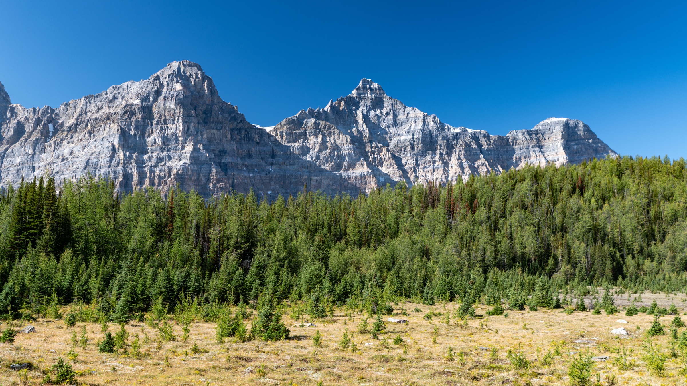
The trail leaves the upper parking area at the top of Hudson Bay Mountain Road, beside the Prairie T-bar at the ski resort. The first 1 km climbs steeply up the maintained ski piste — loose at the start of season, drier later — past a cluster of private alpine cabins. Above approximately 1,650 m the gradient eases and the route breaks above treeline onto a rolling alpine plateau of meadow and granite scree. A boot-beaten path traverses south-west across the plateau, passing a well-known local feature — a tarp-covered upright piano installed by volunteers — with steady views east over the Bulkley Valley to the Babine Range. Crater Lake is reached at roughly 3 km from the trailhead, sitting at 1,768 m in a small cirque beneath the steep north-east face of South Peak. Many parties turn around here.
To continue to the summit, the route climbs west and then south along the broadening south-east ridge of South Peak on loose talus and increasingly steep scree, finishing with a short, exposed 15–20 m rock scramble on blocky terrain to the 2,589 m summit cairn. The panorama takes in the Babine, Telkwa and Howson ranges, and on clear days the volcanic peaks of the Hazelton Mountains. Return is by the same route.
Why it is essential
Hudson Bay Mountain is the iconic skyline summit of Smithers and the only true ultra-prominent peak in the Bulkley Ranges. Crater Lake alone is the most-walked alpine destination in the valley; the optional continuation to South Peak makes this the only glaciated-summit day-hike objective in the region for non-mountaineers. The route is universally cited by Tourism Smithers, local hiking blogs and the Bulkley Valley Backpackers Society as the signature Bulkley Ranges hike.
Equipment
Mountain hiking equipment; sturdy boots with good edging for the upper scree and summit scramble; trekking poles strongly recommended for the descent; bear spray; extra warm and windproof layers (the plateau is exposed, the summit fully so); microspikes useful in early season for lingering north-aspect snow patches between Crater Lake and the summit; a helmet is sometimes carried for the loose summit block.
Hazards and notes
The final scramble to South Peak is exposed and unsuitable for those uncomfortable with heights or in poor visibility; turn around at Crater Lake if the summit is in cloud. Loose rock above Crater Lake brings rockfall risk if other parties are above. Hudson Bay Mountain Road is gravel, well-maintained in summer but rough; high-clearance vehicles are preferred. The piano on the plateau is a beloved local landmark but should be treated with respect — it is privately maintained. Bear habitat through the lower forest; hoary marmots are common in the meadows. Dogs permitted. No camping at Crater Lake.
GPX / KML links
| Source | URL |
|---|---|
| Trailforks: Hudson Bay Mountain area | trailforks.com |
| OpenStreetMap: Crater Lake trail | openstreetmap.org |
| Hesperus Arts: Hudson Bay Mountain / Crater Lake map (PDF) | hesperus-wild.org |
2. Silver King Basin (to Joe L’Orsa Cabin)
Snapshot
Itinerary
The route follows an old mining road, the historic access to the Silver King mine, up the Driftwood Creek valley. The first 4–5 km are easy grade through interior subalpine forest of spruce, fir and willow, with occasional views of Mount Hyland and the headwall of the basin. Past the lower parking lot (where most non-cyclists begin) the gradient stiffens but remains a wide, well-built track. The trail emerges from forest into the open Silver King Basin at roughly 7 km, a broad glacially carved cirque framed by Mount Cronin (2,621 m) to the north and Mount Hyland (2,500 m) to the south, with several small lakes, a waterfall, and the remains of the original mining operation.
The Joe L’Orsa Cabin, a publicly accessible BC Parks structure built in 1999 to replace a 1930s shelter, sits in the upper basin and is the standard turnaround at approximately 8.6 km from the upper parking lot. Bookings are not required for day use; a $10 per person per night fee applies for overnight stays. Strong parties continue past the cabin into the alpine to ascend the technical Hyland Pass connector trail (1.5 km, very rugged, technical descent on the Cronin Creek side); this extension turns the day into a serious traverse and is not part of the standard hike. Return is by the same route.
Why it is essential
Silver King Basin is the signature route of Babine Mountains Provincial Park and the most-cited day-hike destination east of Smithers. The basin combines a glacially sculpted amphitheatre, the highest peaks of the Babine Range, an open public hut, historic silver-mining remains, and — in late July to mid-August — wildflower meadows that match anything in the southern Rockies. The trail is the legacy of Joe L’Orsa, the local conservationist who campaigned successfully from 1973 until his death in 1997 to have all land above 1,300 m in the Babines protected as park.
Equipment
Standard mountain hiking equipment; sturdy hiking shoes or boots (terrain is gentle but the round-trip is long); bear spray; trekking poles helpful on the steeper middle section; insect repellent (mosquitoes can be intense in the basin meadows in early summer); $10 cash per person if planning to overnight in the cabin.
Hazards and notes
Driftwood Road access is gravel and unmaintained at the upper end; clearance vehicles are preferred. Active grizzly and black bear habitat throughout the basin and forest sections — make noise, carry spray. Dogs permitted on-leash; porcupines in the area regularly quill unleashed dogs (BC Parks-flagged hazard). A trapper operates in the park from November to mid-February; this is an off-season hazard but worth knowing. The Joe L’Orsa Cabin is first-come, first-served; expect company on weekends. Stream crossings are bridged; high water possible in early summer.
GPX / KML links
| Source | URL |
|---|---|
| Trailforks: Silver King Basin Trail | trailforks.com |
| OpenStreetMap: Silver King Basin Trail | openstreetmap.org |
| BC Parks: Babine Mountains brochure (PDF) | nrs.objectstore.gov.bc.ca |
3. Harvey Mountain
Snapshot
Itinerary
The trail follows an overgrown former mining road from the trailhead just south of the Silver King Basin parking area. The lower section climbs steadily through dense interior forest on a wide track; the gradient is unrelenting and shadeless on warmer days once the canopy thins. At approximately 3.5 km the road emerges onto the open south flank of Harvey Mountain and the route narrows into a boot-beaten trail across alpine meadow and broken scree. The final 1 km traverses the broad south ridge to the summit cairn at 1,744 m, with panoramic views east into Silver King Basin and the Cronin–Hyland headwall, west across the Bulkley Valley to Hudson Bay Mountain, and south to the Telkwa Range. Return is by the same route.
Why it is essential
Harvey Mountain is the highest-payoff alpine summit hike in the Babine Mountains for the time invested. BC Parks lists it as one of the park’s six published day-hike trails. It complements the Silver King Basin hike geographically (overlooking the basin from across the valley) and offers the only “true summit” experience in the park accessible without scrambling or off-trail navigation.
Equipment
Mountain hiking equipment; sturdy boots; trekking poles for the steep descent; bear spray; sun protection (the upper half is exposed); plenty of water (no reliable source above the trailhead).
Hazards and notes
Sustained steep gradient with limited shade; descent is hard on knees. Bear habitat throughout the lower forest. Lightning exposure on the open summit ridge. Driftwood Road access is gravel and rough at the upper end; standard-clearance vehicles can usually reach the trailhead in dry summer conditions. Dogs permitted on-leash. No camping on the summit ridge; alpine ground is fragile.
GPX / KML links
| Source | URL |
|---|---|
| Trailforks: Harvey Mountain | trailforks.com |
| OpenStreetMap: Harvey Mountain Trail | openstreetmap.org |
| BC Parks: Babine Mountains Park | bcparks.ca |
4. McCabe and Lyon Creek loop
Snapshot
Itinerary
The classic direction is to climb the McCabe Trail from the Driftwood Road summer parking area and descend via Lyon Creek to the lower Lyon Creek trailhead, requiring a two-vehicle shuttle (the two trailheads are roughly 6 km apart by road); single-vehicle parties either reverse the start at the end or use the unofficial connector road. The McCabe Trail climbs at an easy-to-moderate grade for 10 km, passing Copper Lakes at 8.3 km — a chain of small alpine tarns set in a broad open basin beneath Mount Harvey — before topping out at The Summit, a broad alpine pass-plateau at the divide of the Ganokwa, Driftwood and Little Joe watersheds. BC Parks describes the McCabe Trail as the “family and novice” approach.
From The Summit, the Lyon Creek Trail descends 11 km north-east on boardwalk sections through swampy alpine meadow, then via Ramrock Pass (1,660 m) and a long forested switchback down to the Lyon Creek trailhead near Driftwood Canyon Provincial Park. Both arms are signed and well-maintained by BC Parks and the Bulkley Valley Backpackers Society.
Why it is essential
The McCabe–Lyon Creek loop is the standard regional all-day classic — the route every fit Smithers walker considers a benchmark. It links the two most-used Babine Mountains trailheads, crosses The Summit alpine plateau (a defining landscape feature of the park’s interior), and demonstrates the connecting lattice of trails that BC Parks promotes as the park’s structure. BC Parks notes that the loop “is possible in one day” but recommends being in good shape.
Equipment
Mountain hiking equipment; sturdy boots (boardwalk sections can be slick); trekking poles; bear spray; plenty of water and food for a long day; headtorch for late-summer or contingency; navigation backup — the alpine plateau crossing is straightforward in good visibility but can be confusing in cloud.
Hazards and notes
Long day with limited bailout options once committed to the loop. Active bear habitat throughout. Lightning exposure on The Summit plateau. Boardwalks across swampy meadow can be slippery when wet; some sections may be in need of repair. Dogs permitted on-leash. Shuttle logistics require either two vehicles or a willingness to add roughly 6 km of road-walking. No caribou-recovery closures affect this loop (the Telkwa caribou herd is south of the Bulkley River).
GPX / KML links
| Source | URL |
|---|---|
| Trailforks: Babine Mountains Provincial Park | trailforks.com |
| OpenStreetMap: McCabe and Lyon Creek trails | openstreetmap.org |
| Tourism Smithers: McCabe and Lyon Creek trail story | tourismsmithers.com |
| Bulkley Valley Backpackers Society: trail map index | bvbackpackers.ca |
5. China Nose Mountain
Snapshot
Itinerary
The trailhead sits on an old logging block south-west of Houston, reached via Buck Flats Road and a series of forestry roads (Houston Hikers Society signage marks the final junctions). The trail begins as a steady climb through the regenerating fire scar of an old burn, with views opening early because of the lack of mature canopy. The middle section ascends a series of broken benches and short steep pulls to gain the south-east ridge. The final 500 m traces the open ridge to the broad summit, a dramatic cliff-edge perch with sheer drops to the north into the Buck Creek drainage. The named “nose” feature is the distinct cliff profile visible from Highway 16. The summit offers 360-degree views over the southern Bulkley Valley, the Telkwa Range to the north, the Nechako Plateau to the south, and a string of valley-floor lakes (Buck, Bulkley, Morice). Return is by the same route.
Why it is essential
China Nose Mountain is the signature day-hike of the Houston end of the Bulkley Valley and the only published route in this catalogue that gives a southern perspective on the Bulkley Ranges. The Houston Hikers Society maintains and signs the route. It is widely recommended by Tourism Smithers and West Coast Traveller as a representative half-day option for visitors based further south in the valley. The summit cliff is one of the most distinctive geographic features of the southern Bulkley Valley.
Equipment
Standard hiking equipment; hiking shoes; bear spray; sun protection (the open burn area has limited shade); water; map or GPS (forestry-road approach can be confusing without local signage).
Hazards and notes
The summit is a true cliff edge — keep well back, especially in wind or with dogs. Forestry-road access requires attention to active logging traffic; the road network changes year-to-year. Bear habitat throughout. Lower elevation means the trail is often hikable earlier in the season than the alpine routes north of Smithers, but black flies and mosquitoes can be intense in June. Dogs permitted but recommended on-leash near the summit.
GPX / KML links
| Source | URL |
|---|---|
| Trailforks: China Nose Mountain | trailforks.com |
| Houston Hikers Society: China Nose Mountain | houstonhikers.ca |
| AllTrails: China Nose Mountain | alltrails.com |
External links
| Source | URL |
|---|---|
| BC Parks — Babine Mountains Park | bcparks.ca |
| BC Parks — Babine Mountains brochure (PDF) | nrs.objectstore.gov.bc.ca |
| BC Recreation Sites and Trails — Alerts | sitesandtrailsbc.ca |
| Tourism Smithers — Hiking and Walking | tourismsmithers.com |
| Tourism Smithers — Maps and trails | tourismsmithers.com |
| Tourism Smithers — McCabe and Lyon Creek Trail | tourismsmithers.com |
| Bulkley Valley Backpackers Society | bvbackpackers.ca |
| Bulkley Valley Backpackers Society — Trail Map Index | bvbackpackers.ca |
| Bulkley Valley Backpackers Trail Finder | hesperusarts.github.io |
| Houston Hikers Society | houstonhikers.ca |
| Town of Telkwa — Summer Recreation | telkwa.ca |
| Visit Bulkley Nechako | visitbulkleynechako.com |
| BC Geographical Names | apps.gov.bc.ca |
| BC Government — Caribou recovery actions | www2.gov.bc.ca |
| Hesperus Arts — BV Trail Maps | bvtrailmaps.wordpress.com |
| Trailforks — Babine Mountains Provincial Park | trailforks.com |
| Trailforks — Hudson Bay Mountain | trailforks.com |
| Trailforks — Telkwa | trailforks.com |
| iHikeBC — Crater Lake (Hudson Bay Mountain) | ihikebc.com |
| iHikeBC — Silver King Basin | ihikebc.com |
| iHikeBC — Harvey Mountain | ihikebc.com |
| Rise & Alpine — Hudson Bay Mountain via Crater Lake | riseandalpine.com |
| Wikipedia — Bulkley Ranges | en.wikipedia.org |
| Wikipedia — Hudson Bay Mountain | en.wikipedia.org |
| Wikipedia — Babine Range | en.wikipedia.org |
| Wikipedia — Telkwa Range | en.wikipedia.org |
| Wikipedia — Bulkley Valley | en.wikipedia.org |
| Wikimedia Commons — Hudson Bay Mountain category | commons.wikimedia.org |