Regional overview
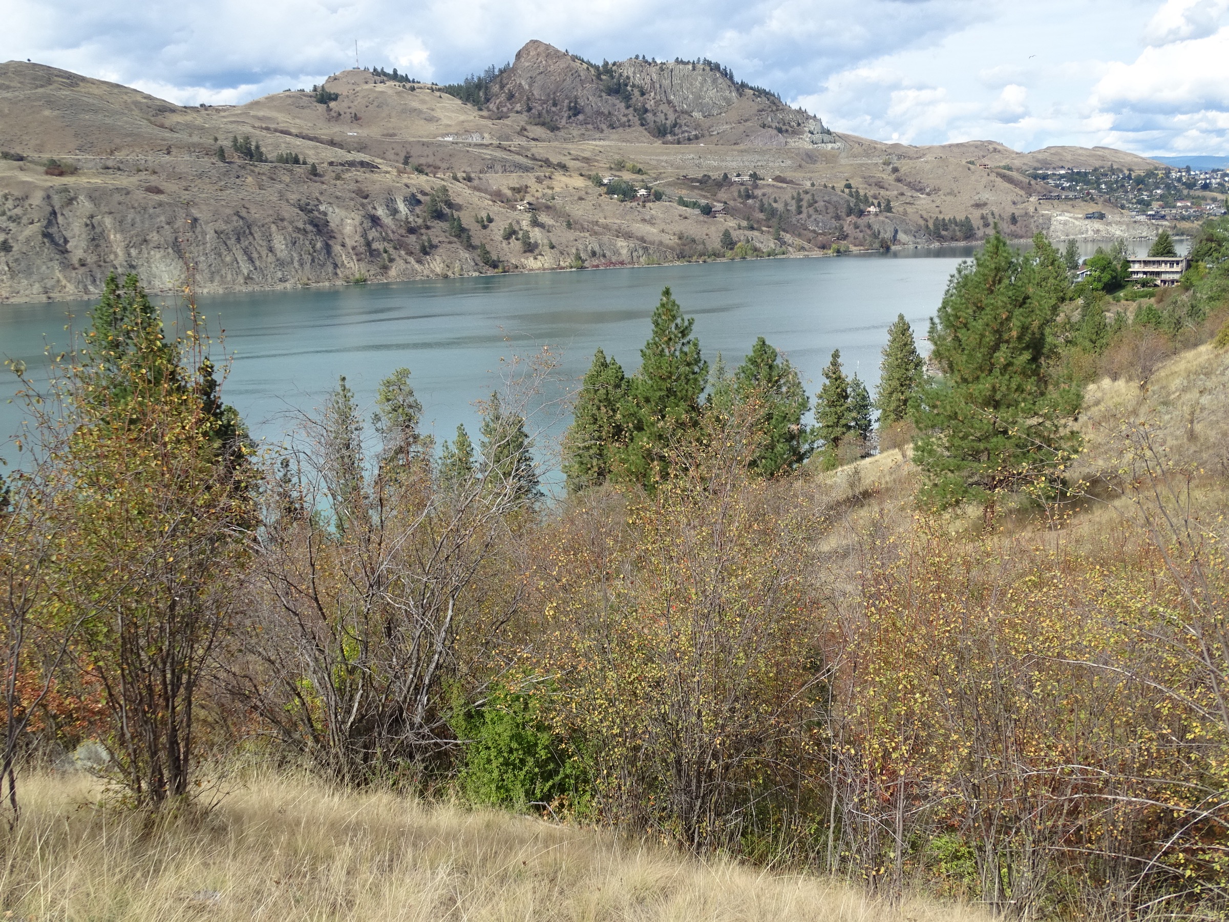
The Okanagan Highlands form the upland fringe of the Okanagan Valley in south-central British Columbia, sitting at the eastern edge of the Interior Plateau where it grades into the Monashee Mountains of the Columbia system. Rounded, glacially scoured plateaus, granite domes, columnar basalt cliffs and steep-walled creek canyons rise to roughly 2,170 m at Little White Mountain, set against Okanagan Lake’s 342 m surface. Vegetation runs through three contrasting belts: bunchgrass and ponderosa pine in the rain-shadowed lakeshore — the northern fringe of the Great Basin shrub-steppe — Douglas fir and lodgepole pine on the mid-slope, and subalpine fir and Engelmann spruce parkland with open meadows and small tarns above about 1,800 m. Western and Northern Pacific rattlesnakes, black bears, mule deer and California bighorn sheep are all routinely encountered on lower-elevation trails.
The principal hiking centres are Vernon and Kalamalka–Kal Park in the north, Kelowna and West Kelowna in the central valley, and Penticton, Naramata and Summerland in the south. Five large protected areas anchor most essential day-hikes: Kalamalka Lake Provincial Park, Okanagan Mountain Provincial Park, Myra-Bellevue Provincial Park (containing the Myra Canyon section of the former Kettle Valley Railway), Enderby Cliffs / Tplaqín Provincial Park, and Skaha Bluffs Provincial Park. The Kettle Valley Rail Trail, designated a National Historic Site of Canada in 2002, runs along the highlands above the lake from McCulloch through Myra Canyon to Penticton and forms part of the Trans Canada Trail.
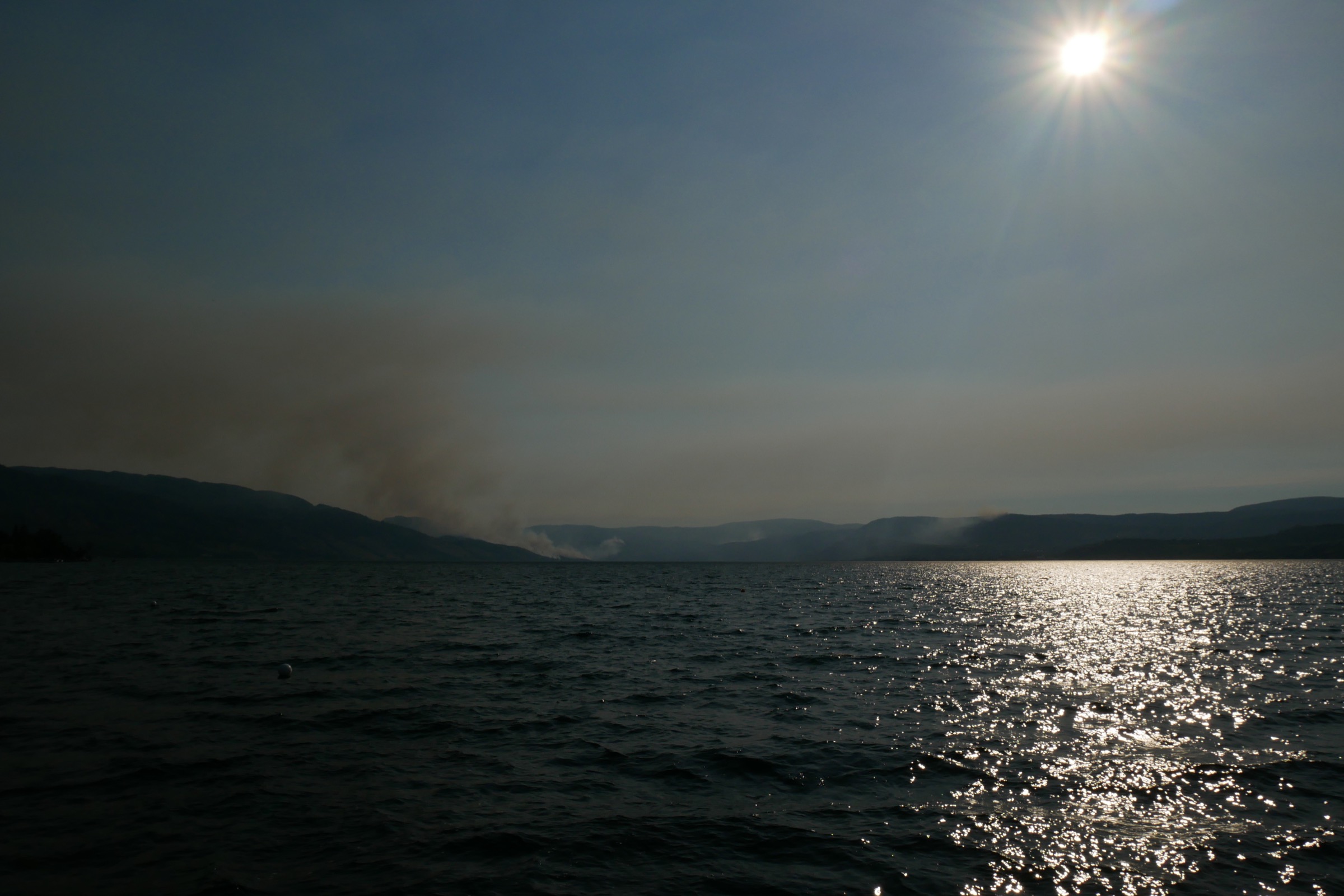
The hiking season is unusually long. Low-elevation grassland and lake-rim trails (Knox Mountain, Kalamalka Lake, KVR sections, Skaha Bluffs) are usable March to November and often year-round; midsummer heat above 35 °C and acute fire risk are the major constraints. Subalpine summits such as Little White Mountain and the higher reaches of Myra-Bellevue are typically snow-free only from mid-July to early October. The 2003 Okanagan Mountain Park Fire (25,000 ha) and subsequent wildfires (notably 2009, 2017 and 2023) have left long-lasting hazards on several trails: standing dead timber, root-rotted root balls in wind events, loose surface rock, and burned-out signage. Rattlesnake encounters are a real if rarely fatal hazard between April and October in all valley-bottom parks; long trousers and watching foot placement on rocky south-facing slopes are standard practice. BC Parks enforces leash rules in most protected areas, and several lakeshore parks have designated pet beaches.
Access is primarily by private vehicle. Highway 97 is the spine of the valley; Kelowna International Airport (YLW), Penticton Regional Airport (YYF) and Vernon all have car rental. Limited inter-city bus services operate Highway 97 (Ebus, FlixBus) between Vernon, Kelowna and Penticton; no scheduled public transport reaches any of the five trailheads in this catalogue. BC Parks day-use is generally free; Kalamalka Lake and Skaha Bluffs operate seasonal pay parking. Most hikes are on Crown land or provincial parks. Enderby Cliffs Park is co-managed with the Splatsin, the southernmost member nation of the Secwépemc, and the park is increasingly referred to by its Splatsin name Tplaqín (“cliffs”).
Selection rationale
The five hikes below were chosen to give geographic and character variety across the highlands: a culturally and historically essential rail-trail along the highland rim (Myra Canyon Trestles); an iconic columnar-basalt viewpoint with deep Indigenous significance (Enderby Cliffs / Tplaqín); the area’s highest accessible subalpine summit on the Okanagan–Monashee boundary (Little White Mountain); a classic bunchgrass-and-shoreline loop on one of British Columbia’s most photographed lakes (Kalamalka Lake via Cosens Bay and Rattlesnake Point); and a representative summit hike through the 2003-fire-regenerating forest on the eastern shore of Okanagan Lake (Coyote Peak). Shorter urban summits (Knox Mountain, Pincushion, Giant’s Head, Boucherie Rush) and the Skaha Bluffs climbing area were considered but dropped on length or duplication grounds.
Summary table
| # | Hike | Country | Route type | Distance | Gain | Max elevation | Difficulty |
|---|---|---|---|---|---|---|---|
| 1 | Myra Canyon Trestles (KVR Rail Trail) | Canada | Out-and-back | 12–24 km | ~50 m | 1,274 m | Easy |
| 2 | Enderby Cliffs / Tplaqín | Canada | Out-and-back | 14 km | 700 m | 1,150 m | Moderate–Difficult |
| 3 | Little White Mountain (Canyon Lakes) | Canada | Out-and-back | 10.2 km | 520 m | 2,171 m | Moderate–Difficult |
| 4 | Kalamalka Lake Loop (Cosens Bay & Rattlesnake Point) | Canada | Loop | 9.7–13.2 km | 330–430 m | 700 m | Moderate |
| 5 | Coyote Peak (Okanagan Mountain Park) | Canada | Out-and-back | 7.4 km | 640 m | ~1,150 m | Difficult |
1. Myra Canyon Trestles (Kettle Valley Rail Trail)
Snapshot
Itinerary
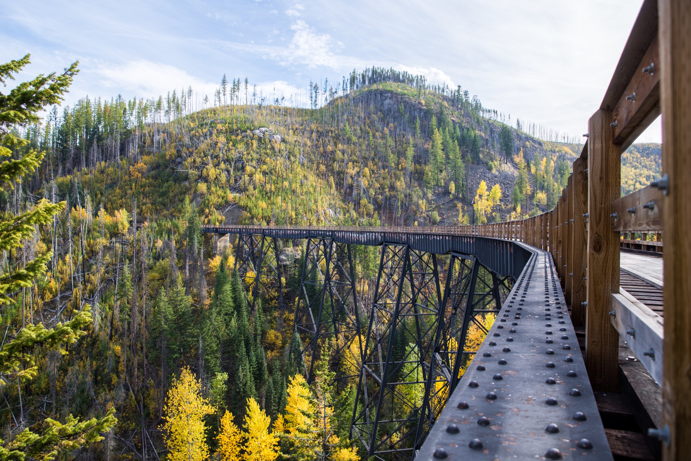
From the Myra Station trailhead the route follows the former Kettle Valley Railway grade westward along the south wall of the KLO Creek canyon at roughly 1,270 m. The grade is dead-flat by hiking standards (built to a maximum 2.2% railway gradient) and runs above the Okanagan Lake basin with continuous views west across the central valley. Within the first kilometre the path reaches the first of 18 wooden trestles and 2 steel bridges that span side gullies cut by tributaries of KLO and Pooley creeks. The trestles, reconstructed in Douglas fir between 2004 and 2008 after the 2003 wildfire destroyed 12 of the originals, retain the 1912–1914 alignment and bear plaque-mounted dates of original and replacement construction. Two short, unlit rock tunnels — head-torches helpful but not essential in daylight — punctuate the middle section.
The far end of the restored canyon corridor is at the Ruth Station trailhead, after which the trail continues toward Chute Lake and Penticton on the broader KVR alignment but leaves the dramatic trestle section. Most day hikers turn around at any trestle and return on the same grade.
Why it is essential
The Myra Canyon section is one of two engineering landscapes that define the human history of the Okanagan Highlands, the other being the orchard-irrigation networks of the lakeshore. It was designated a National Historic Site of Canada in 2002 specifically because the canyon traverse “constitutes an outstanding engineering achievement” — the densest concentration of high timber trestles on any preserved North American rail corridor. The restoration after the 2003 Okanagan Mountain Park Fire is itself a significant heritage-engineering project, approximately C$15 million completed in June 2008. The route also offers the only continuous level walking surface above 1,200 m in the southern interior plateau and is part of the Trans Canada Trail.
Equipment
Standard hiking equipment; sun protection (the grade is fully exposed for most of its length); plenty of water (no reliable potable source on the trail); a head-torch is useful for the tunnels; bear spray recommended; bicycle helmet if cycling. Microspikes are useful in shoulder season when shaded trestles can hold ice.
Hazards and notes
The trestles have plank decking with low railings to the post-2008 rebuild standard; a fall over the edge would be fatal — keep children and dogs under close control. The forest service road approach is steep, narrow and rough; in spring it can be muddy and in winter it is unploughed. Black bears are common throughout the Myra-Bellevue corridor. The trail is closed temporarily after wildfire events; check the Myra Canyon Trestle Restoration Society and the BC Parks bulletin for current status. Dogs permitted on-leash. Cycling and hiking share the corridor.
GPX / KML links
| Source | URL |
|---|---|
| Trails BC: Myra Canyon route (GPX + KMZ) | trailsbc.ca |
| Trans Canada Trail: Explore the Map | tctrail.ca |
| Trailforks: TCT/KVR Myra Canyon East to McCullough | trailforks.com |
| OpenStreetMap: Kettle Valley Rail Trail | openstreetmap.org |
2. Enderby Cliffs / Tplaqín
Snapshot
Itinerary
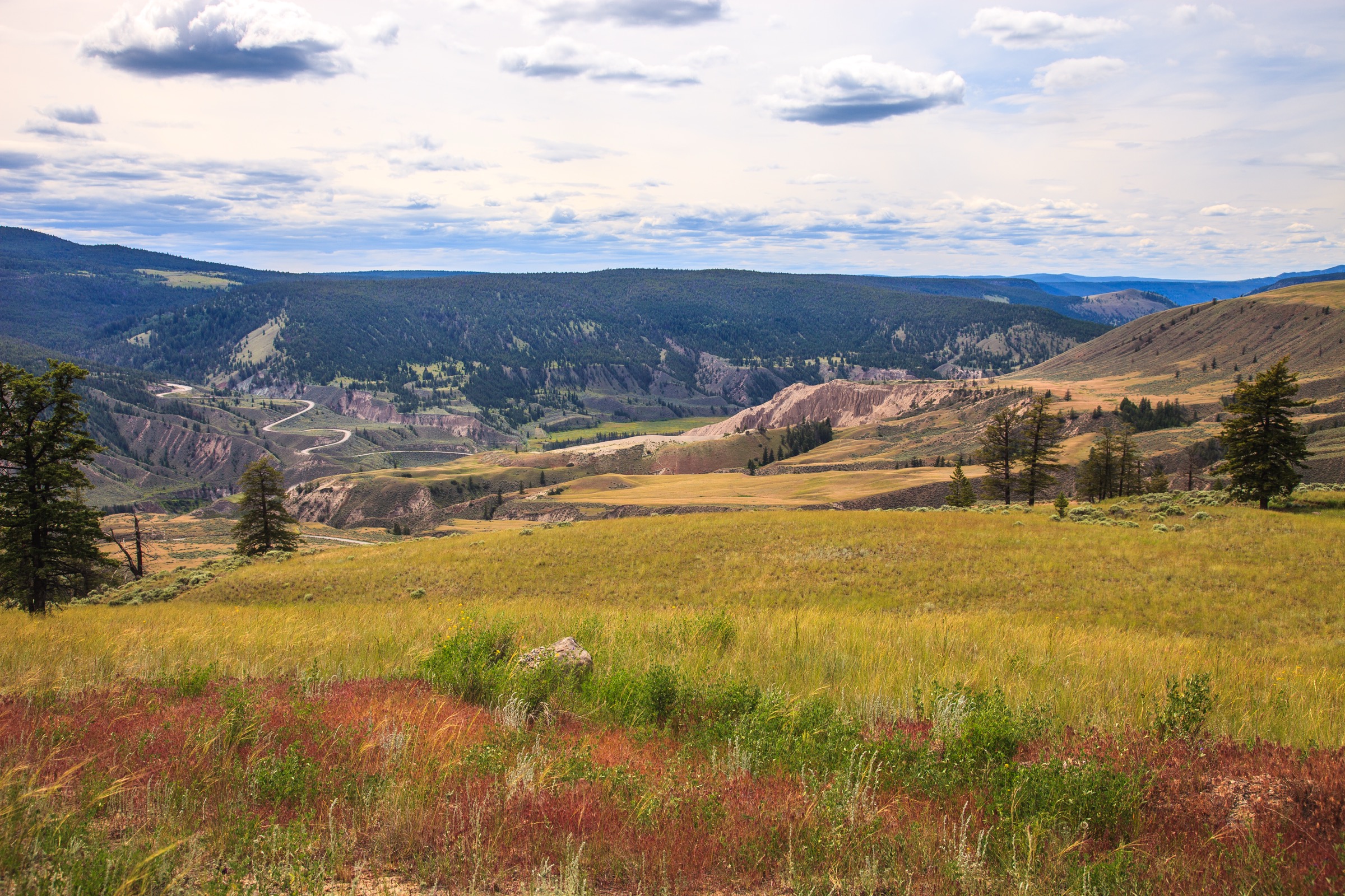
The trail begins at the upper parking area off Brash-Allen Road, climbs gently for the first kilometre on an old logging-road bench, then turns south-east and ascends through second-growth Douglas fir and birch on a sustained, well-graded path. The middle two-thirds gain elevation steadily through mixed forest with occasional bench-rest viewpoints toward the Shuswap River and the Monashee foothills.
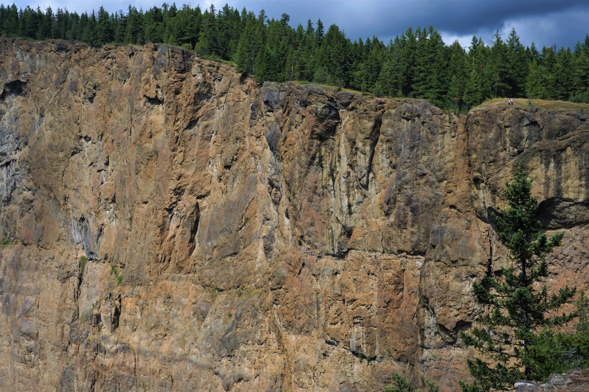
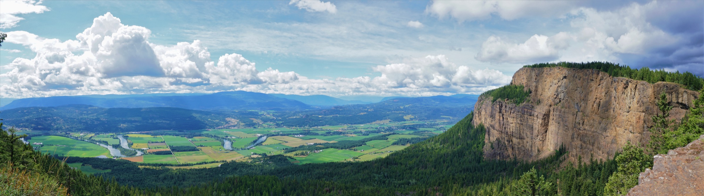
Above approximately 1,000 m the trail breaks out onto an open south-facing meadow ridge dotted with ponderosa pine, balsamroot in May, and bunchgrass; this section was reshaped by fire in the recent past and rewards visitors with rapidly opening views. The final 800 m traverse the clifftop plateau westward to a series of unfenced viewpoints at roughly 1,150 m, with vertical 600 m basalt drops below and 180-degree views over the Shuswap River, Enderby, Mara Lake, the Sicamous corridor and on clear days the southern Monashees. Return is by the same route.
Why it is essential
The Enderby Cliffs are the most prominent columnar basalt landform in the Okanagan and the defining skyline of the north end of the highlands. The cliffs are a registered cultural and spiritual site for the Splatsin, and the park was renamed Tplaqín / Enderby Cliffs in collaboration with the Splatsin (the word tplaqín meaning “cliffs”). The hike combines a major landscape feature, an important Indigenous cultural site, and one of the broadest single panoramas accessible from a half-day trail anywhere in the central interior of British Columbia.
Equipment
Standard hiking equipment; sturdy trail shoes or light boots; trekking poles useful for descent; sun protection (the upper meadow and clifftop are fully exposed); minimum 2 litres of water per person (no water on trail); bear spray. Microspikes are useful in shoulder season; the trail is hikeable in winter but icy.
Hazards and notes
Unfenced cliff edges with vertical drops of several hundred metres at the summit plateau — fatalities have occurred. Keep children and dogs under close control near the rim. Falling rock from the clifftop is a concern; stay on the marked trail. The trail crosses open south-facing slopes that can exceed 35 °C in July and August; start early. Black bears are present throughout; rattlesnakes are rare at this elevation but possible on the lower trail. Cultural respect is requested by the Splatsin — do not remove rocks, cairns or plants. Dogs permitted on-leash. No formal permit required.
GPX / KML links
| Source | URL |
|---|---|
| Trailforks: Enderby Cliffs Tplaqin Trail | trailforks.com |
| OpenStreetMap: Enderby Cliffs Trail | openstreetmap.org |
| BC Parks: Enderby Cliffs park map (PDF) | nrs.objectstore.gov.bc.ca |
3. Little White Mountain (via Canyon Lakes trailhead)
Snapshot
Itinerary
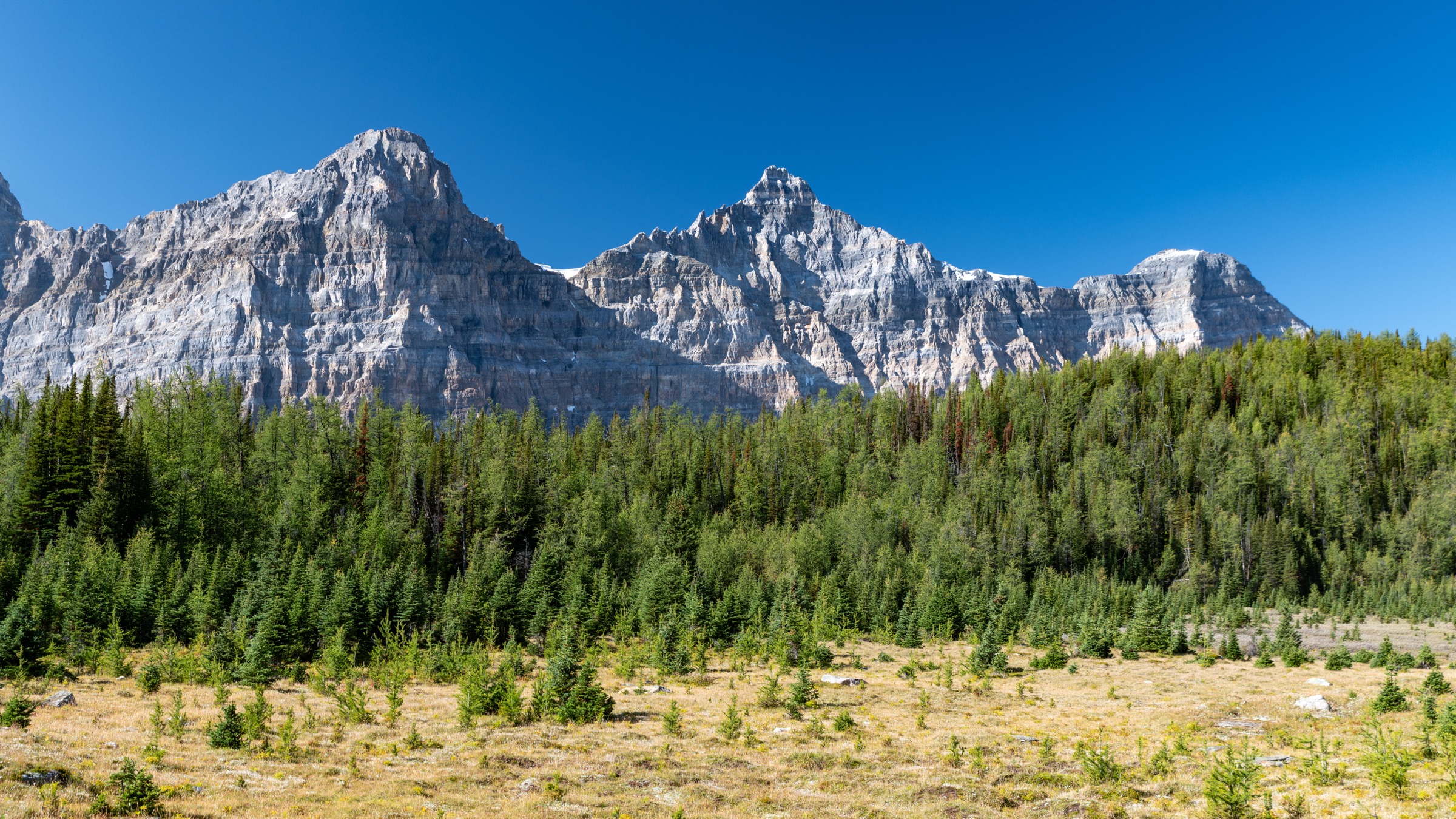
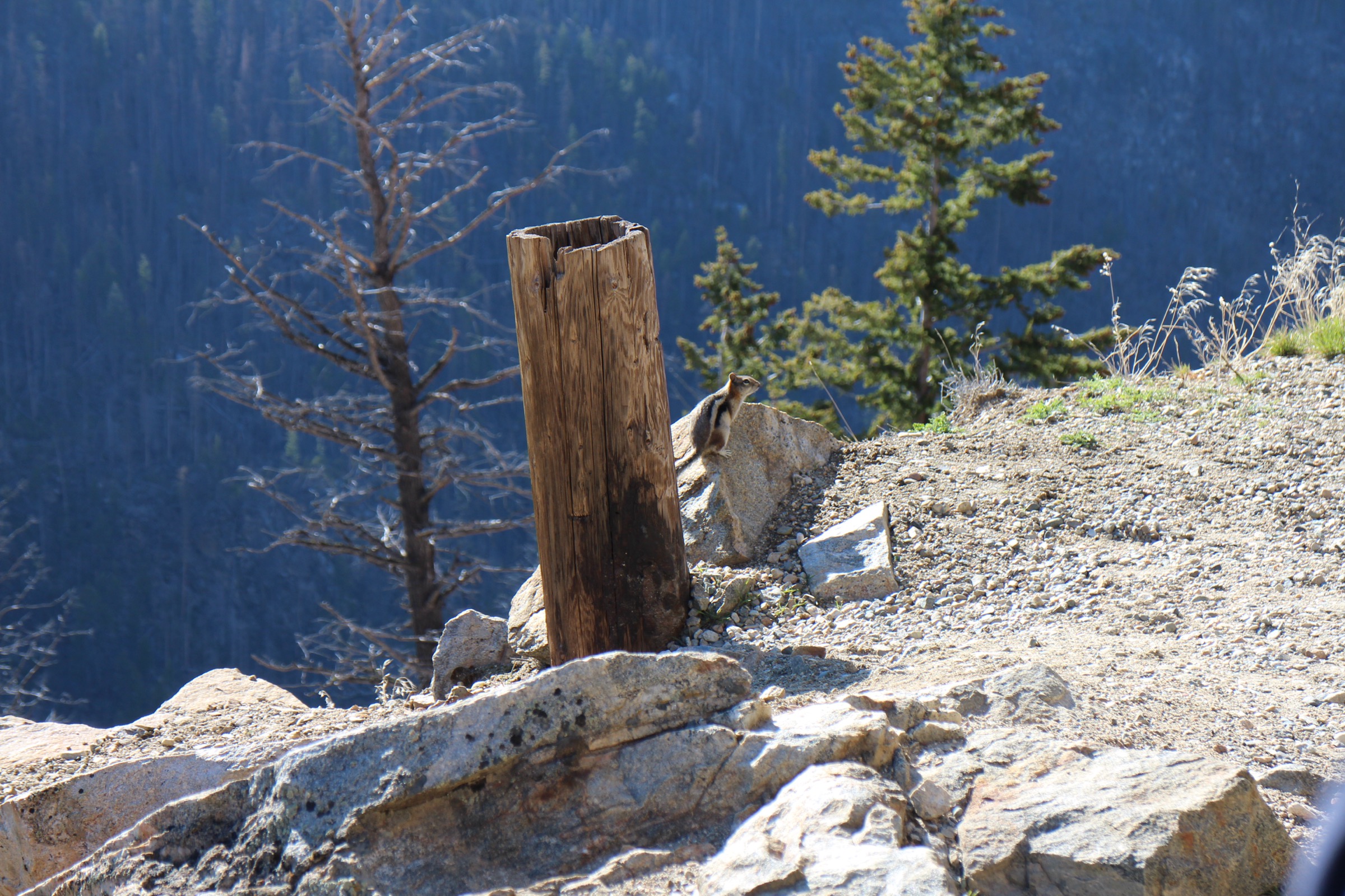
From the small clearing trailhead behind the Myra-Bellevue Park boundary sign, the trail climbs steeply through subalpine fir and Engelmann spruce on a rooted, switch-backed path. After approximately 1.7 km a signed junction marks the start of the upper traverse, which contours through pocket meadows, pond-dotted benches and scattered krummholz across the broad south flank of Little White Mountain.
The final 2 km cross a gently rising rocky plateau of weathered granite slabs and open subalpine tundra, with several small tarns and seasonal melt ponds. The summit at 2,171 m carries a cluster of radio repeater antennas and a broad 360-degree panorama: Okanagan Lake to the west, the Monashee summits to the east, the Big White ski resort plateau to the south, and the Shuswap and Mabel Lake basins to the north. Return is by the same route; an alternative descent via the Crawford Trail (the urban side, ~12 km return, 450 m gain) extends the day for parties willing to arrange a shuttle.
Why it is essential
Little White Mountain (2,171 m) is the highest accessible day-hike summit in the immediate Okanagan Highlands and stands at the transition between the interior plateau character and the Monashee subalpine. From its summit the entire central Okanagan, the Big White massif, the Monashees, the Skaha and Vaseux basins and on clear days the northern Cascades are visible in a single panorama. It is widely recognised by local guidebooks and the British Columbia backcountry community as the area’s essential alpine objective.
Equipment
Mountain hiking equipment; sturdy boots; trekking poles; extra warm and weatherproof layers (the summit plateau is exposed and 8–10 °C cooler than the valley); 2.5–3 litres of water per person (no reliable potable source); sun protection; bear spray. Microspikes are useful before mid-July or after late September. Navigation backup recommended — the upper plateau is featureless in cloud and the trail braids across granite slabs.
Hazards and notes
The forest service road approach (Canyon Lakes FSR) is rough, has cross-ditches and is not recommended for low-clearance two-wheel-drive vehicles. No cell service. Active logging traffic mid-week in summer. Above treeline, lightning exposure is significant; turn back if afternoon convective build-up is visible. Black bears and occasional grizzly bears use the area; cougars are present. Dogs permitted on-leash. Snowmobile and limited motorised use occur on adjacent road corridors in winter.
GPX / KML links
| Source | URL |
|---|---|
| Trailforks: Little White Mountain | trailforks.com |
| OpenStreetMap: Highland Trail / Little White | openstreetmap.org |
| BC Parks: Myra-Bellevue | bcparks.ca |
4. Kalamalka Lake Loop (Cosens Bay and Rattlesnake Point)
Snapshot
Itinerary
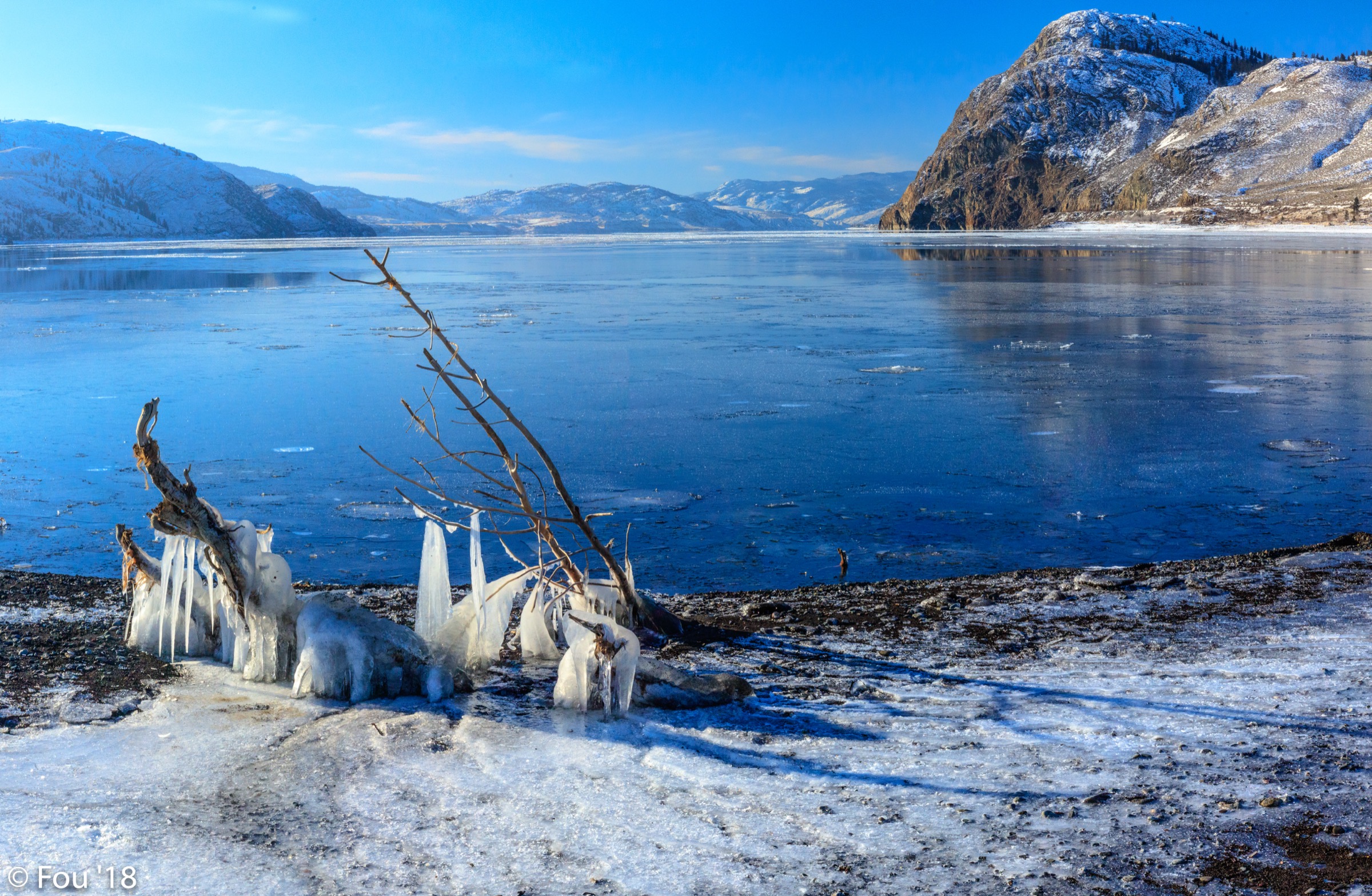
From the main parking area the trail climbs north-east onto the open bunchgrass benches of the Coming Round the Mountain ridge above the west shore of Kalamalka Lake. Within the first kilometre the path reaches a series of open viewpoints with sweeping panoramas south across the lake’s signature turquoise-and-emerald banded water — an effect produced by calcium-carbonate “marl” precipitation in summer. The trail then descends through ponderosa pine and antelope brush to Cosens Bay, where a quiet sand beach faces east into the lake.
From Cosens Bay the loop continues east-south-east along the lakeshore and climbs a short ridge onto the Rattlesnake Point (Turtle Head) peninsula — a rocky outcrop crowned by a centuries-old gnarled juniper and offering arguably the most photographed view of the lake. The return uses the Corral Trail through grassland benches back to the parking area. Several junctions allow shortening or lengthening; the full park perimeter (Strava route ~13.2 km) is the most complete day-hike variant.
Why it is essential
Kalamalka Lake is consistently named one of British Columbia’s most scenic lakes and is the dominant landscape feature of the North Okanagan. The provincial park preserves one of the largest intact areas of dry-belt bunchgrass and ponderosa pine ecosystem in British Columbia — a globally rare and provincially red-listed plant community. The loop captures both the headline lake view and the open grassland character of the highlands’ east-facing slopes. The Turtle Head juniper at Rattlesnake Point is a landmark referred to in regional literature.
Equipment
Standard hiking equipment; trail runners or sturdy shoes sufficient; sun hat and long-sleeve sun shirt (almost no shade); 2 litres of water per person; sun protection; bear spray. Long trousers and ankle-covering footwear strongly recommended April to October due to western rattlesnakes.
Hazards and notes
Western rattlesnakes are common on the warm rocky slopes — do not put hands or feet where they cannot be seen, and keep dogs on-leash. Ticks active April to June. Heat is the major hazard in midsummer; start at dawn. Cliff edges at Rattlesnake Point lack railings. Mountain biking is permitted on designated trails and shared use is the norm. Dogs must be on leash except at the three designated pet beaches. Designated camping is not permitted; this is a day-use park.
GPX / KML links
| Source | URL |
|---|---|
| Trailforks: Kalamalka Lake Park | trailforks.com |
| Gaia GPS: Kalamalka Lake Loop via Cosens Bay Trail | gaiagps.com |
| AllTrails: Coming Round the Mountain, Cosens Bay and Corral Trail Loop | alltrails.com |
| BC Parks: Kalamalka park map (PDF) | nrs.objectstore.gov.bc.ca |
5. Coyote Peak (Okanagan Mountain Provincial Park)
Snapshot
Itinerary
From the North parking lot at the end of Lakeshore Road, the route shares tread briefly with the Wildhorse Canyon and Boulder trails before forking south onto the Coyote Peak path. The first kilometre climbs steeply through a mosaic of regenerating ponderosa pine, Douglas fir and standing dead snags — visible evidence of the 2003 Okanagan Mountain Park Fire, which burned 25,000 ha including this slope. The middle two-thirds of the ascent traverse open south-facing benches with arrow-leaf balsamroot, lupines and bunchgrass dominating in May and June.
The upper 500 m of trail steepens onto a granite-and-loose-rock ridge with intermittent cairns; trail markings near the summit are poor and route-finding attention is required. The summit ridge offers a 270-degree panorama north over Okanagan Lake, west across the lake to West Kelowna and Mount Boucherie, and south-east into the upper Wildhorse Canyon drainage. Return is by the same route; descent on loose rock requires care.
Why it is essential
Coyote Peak is the most representative summit hike in Okanagan Mountain Provincial Park, the largest protected area entirely framing the eastern shore of Okanagan Lake. It is the only short-day summit that puts a walker above the 2003 fire scar and the regenerating bunchgrass–pine ecosystem that defines the modern landscape character of the central Okanagan Highlands. The view over Wildhorse Canyon is the essential geographic counter-image to the lakeside trails of Kalamalka and Knox.
Equipment
Mountain hiking equipment; sturdy boots with good edging for the loose rocky upper section; trekking poles for descent; minimum 2.5 litres of water per person (no water on trail); sun protection (almost no shade above the first kilometre); bear spray. Long trousers and gaiters recommended April to October for rattlesnake mitigation.
Hazards and notes
Western rattlesnakes are common on the warm south-facing slopes — watch foot placement on rocky ground, do not reach into rock crevices, and keep dogs on-leash and close. Standing burnt timber from the 2003 fire is still being shed; avoid the route in high wind. The upper trail markings are sparse and braided, especially in the final 500 m. Sun and dehydration are the most common emergency causes. Black bears and cougars are present. No camping permitted on this trail. Dogs permitted on-leash. No formal permit required.
GPX / KML links
| Source | URL |
|---|---|
| AllTrails: Coyote Peak | alltrails.com |
| Trailforks: Okanagan Mountain Park | trailforks.com |
| OpenStreetMap: Okanagan Mountain Park trail network | openstreetmap.org |
| BC Parks: Okanagan Mountain Park | bcparks.ca |
External links
| Source | URL |
|---|---|
| BC Parks: Kalamalka Lake Park | bcparks.ca |
| BC Parks: Okanagan Mountain Park | bcparks.ca |
| BC Parks: Myra-Bellevue Park | bcparks.ca |
| BC Parks: Enderby Cliffs / Tplaqín Park | bcparks.ca |
| BC Parks: Skaha Bluffs Park | bcparks.ca |
| Parks Canada: Myra Canyon Section of the Kettle Valley Railway NHS | pc.gc.ca |
| Trans Canada Trail: Explore the Map | tctrail.ca |
| Trans Canada Trail: Myra Canyon Restoration | tctrail.ca |
| Trails BC: Myra Canyon route (GPX + KMZ) | trailsbc.ca |
| Myra Canyon Trestle Restoration Society | myratrestles.com |
| Splatsin First Nation | splatsin.ca |
| Tourism Kelowna: Myra Canyon Trestles | tourismkelowna.com |
| Tourism Kelowna: Okanagan Mountain Provincial Park | tourismkelowna.com |
| Vernon Tourism: Must-Try Trails at Kalamalka Provincial Park | vernon.com |
| Vernon Morning Star: Enderby Cliffs renaming (2023) | vernonmorningstar.com |
| Visit Penticton: Kettle Valley Rail Trail | visitpenticton.com |
| Off Track Travel: Enderby Cliffs Trail | offtracktravel.ca |
| Off Track Travel: Little White Mountain | offtracktravel.ca |
| Off Track Travel: Okanagan Mountain Park | offtracktravel.ca |
| Hike the Okanagan: trail database | hiketheokanagan.com |
| Wikipedia: Okanagan Highland | en.wikipedia.org |
| Wikipedia: Kettle Valley Rail Trail | en.wikipedia.org |
| Wikipedia: Okanagan Mountain Park fire (2003) | en.wikipedia.org |
| Wikipedia: Little White Mountain | en.wikipedia.org |
| Trailforks: Okanagan trail database | trailforks.com |