Regional overview
The Blow Me Down Mountains are one of the four ophiolite massifs that flank the Bay of Islands on the west coast of Newfoundland — the others being the North Arm Mountains, the Table Mountain (Tablelands) block now inside Gros Morne National Park, and the Lewis Hills to the south. All four are slices of upper mantle and oceanic crust thrust onto the continental margin during the Taconic Orogeny roughly 480 million years ago, and they expose peridotite, serpentinite, gabbro and pillow basalt at the surface in a way that almost nowhere else on the planet does. The Blow Me Down massif itself forms the bare orange and grey upland between Lark Harbour, York Harbour and Frenchman’s Cove, rising abruptly from sea level to over 600 m above the south arm of the bay.
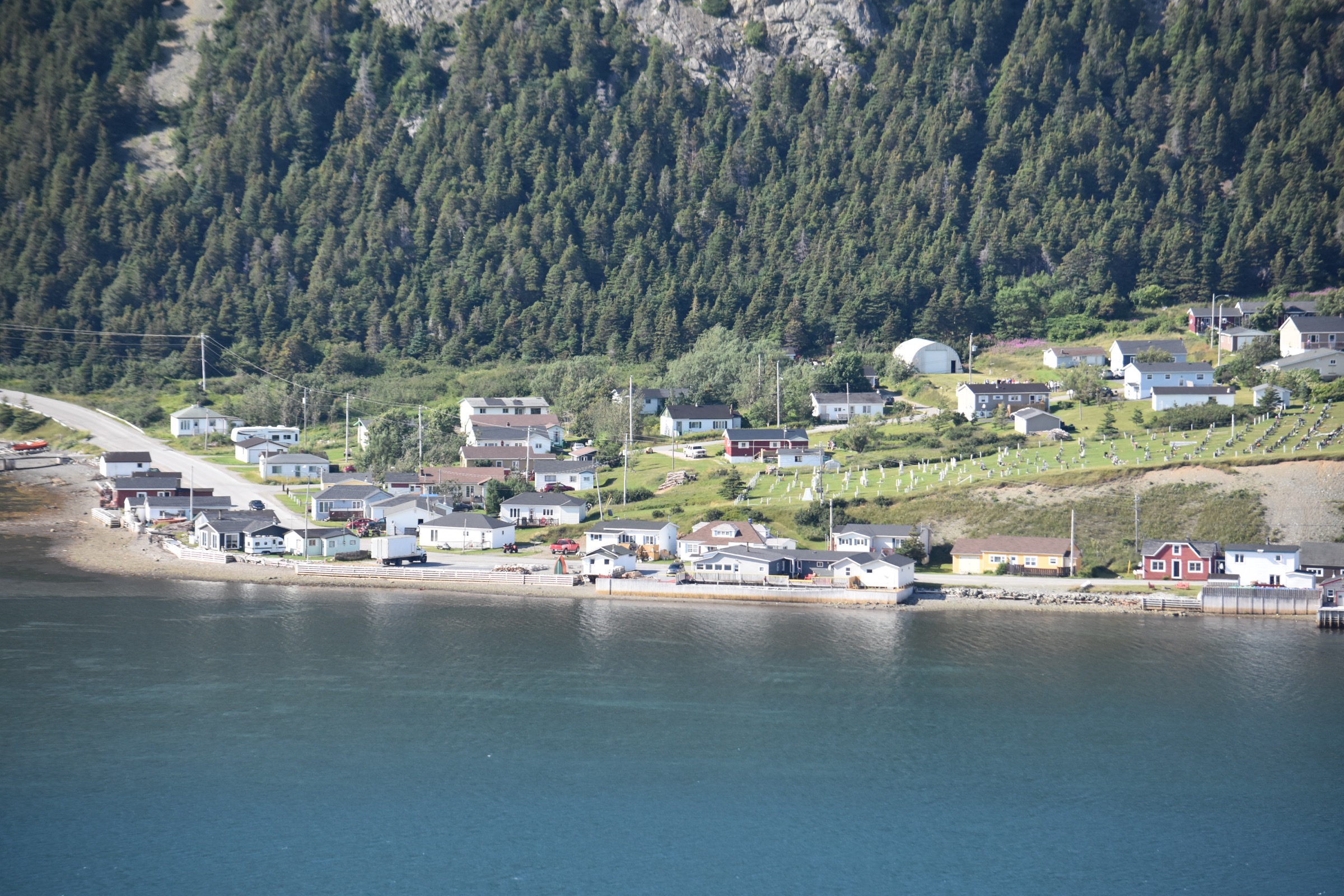
Hiking centres are tightly concentrated. Blow Me Down Provincial Park, on the headland at Lark Harbour, is the only formal park inside the massif and runs the short trails at the historic Governor’s Staircase and lookout tower. The longer mountain trails are managed by the International Appalachian Trail Newfoundland and Labrador (IATNL) and the Outer Bay of Islands Enhancement Committee (OBIEC), with the principal access points on Route 450 — the road that loops the south shore of the Bay of Islands from Corner Brook to Lark Harbour. The closest service centre is Corner Brook, about 45 minutes’ drive east of Frenchman’s Cove.
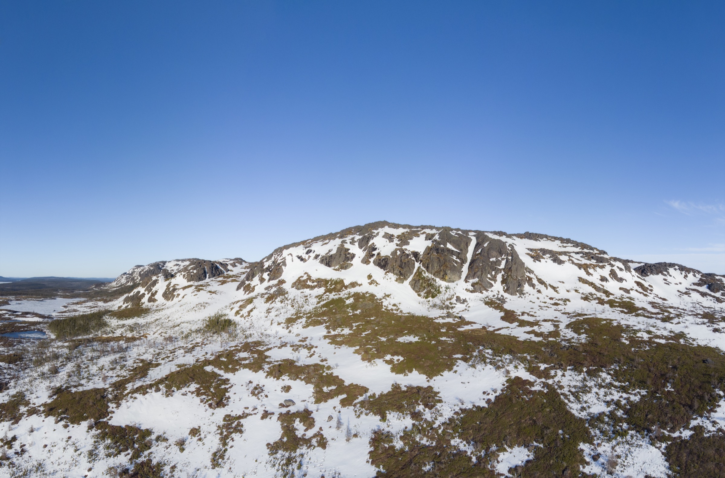
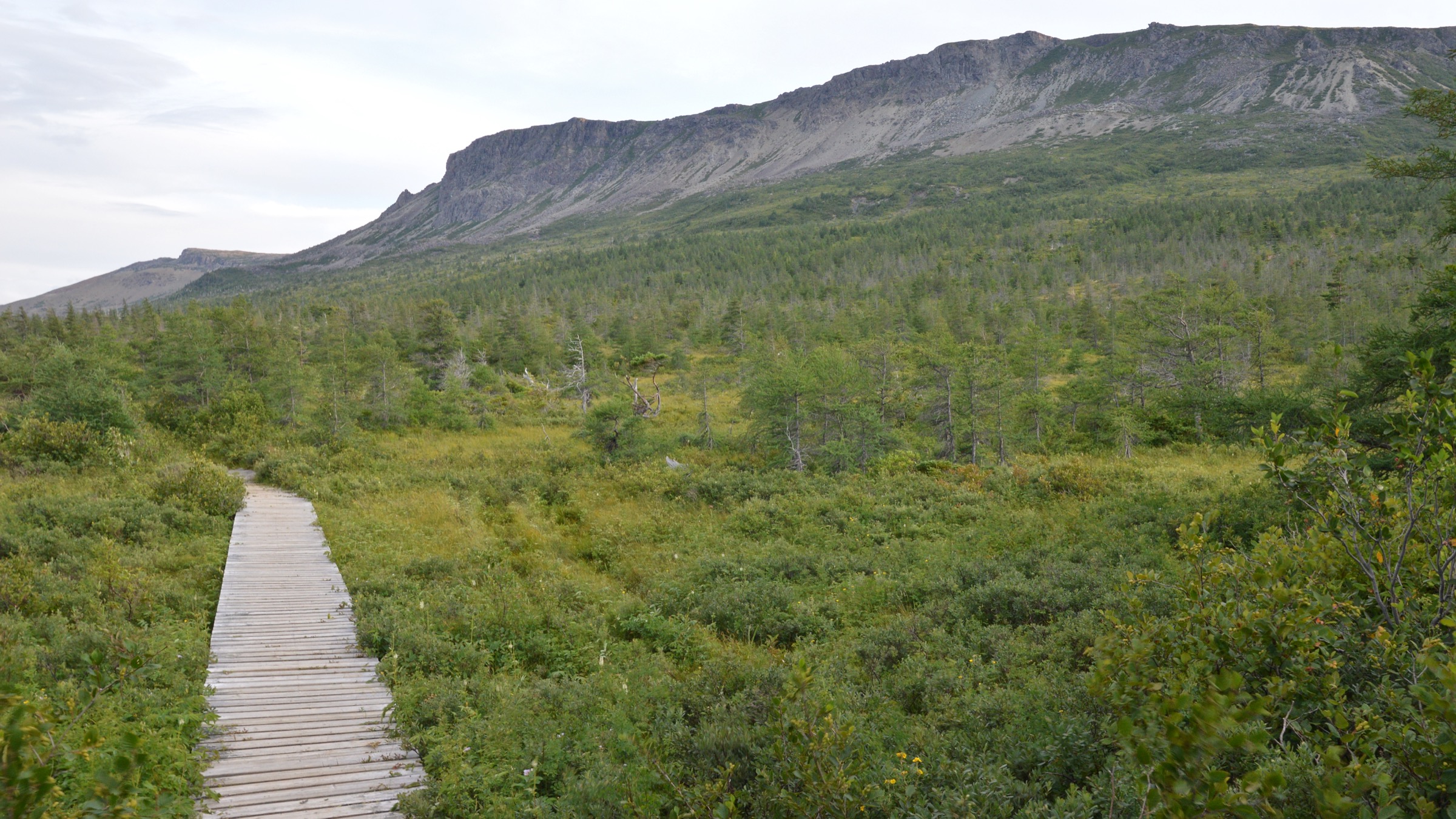
The walking character is open ophiolite barrens above a steep coastal escarpment. Above roughly 400 m the trees disappear and the upland becomes a stony, lichen-covered plateau of orange-weathering peridotite, dotted with small ponds and crossed by tundra-like vegetation. Below tree line the slopes are densely forested with balsam fir and white spruce, with several short waterfalls in the Copper Mine Brook and Blow Me Down Brook drainages. The IATNL Blow Me Down Mountain Trail follows much of the route of the Cabox UNESCO Aspiring Geopark’s UltramaTrex, a six- to eight-day traverse of all four Bay of Islands ophiolite massifs.
The hiking season is short: most upper routes are reliably snow-free from mid-June to mid-October, with peak conditions in late August and September. Atlantic-side weather is the dominant hazard — sea fog, strong onshore wind, and the absence of shelter on the plateau combine to make navigation and exposure the principal day-to-day issues. The Cabox summit and the high IATNL traverses are above tree line, with no reliable cell coverage and limited rescue. Black bear and moose are present on the lower forested approaches.
Selection rationale
These five hikes cover the canonical Blow Me Down day-hike experience: the Cape Blow Me Down (formerly Copper Mine to Cape) climb as the iconic summit route, the Tortoise Mountain headland walk in Blow Me Down Provincial Park, a day section on the IATNL Blow Me Down Mountain Trail from the Blow Me Down Brook trailhead, a long-day attempt on Cabox in the Lewis Hills as the regional high-point objective, and the short Governor’s Staircase / lookout tower combination in the provincial park as the cultural and historical bookend.
Summary table
| # | Hike | Country | Route type | Distance | Gain | Max elevation | Difficulty |
|---|---|---|---|---|---|---|---|
| 1 | Cape Blow Me Down (Copper Mine to Cape) | Canada | Out-and-back | 7.6 km | ~650 m | ~620 m | Difficult |
| 2 | Tortoise Mountain (Lark Harbour Head) | Canada | Out-and-back | ~5 km | ~250 m | ~250 m | Moderate |
| 3 | Blow Me Down Mountain Trail (IATNL day section) | Canada | Out-and-back / shuttle | ~12-18 km | ~600-700 m | ~620 m | Difficult |
| 4 | Cabox via the Lewis Hills (IATNL day section) | Canada | Out-and-back | ~22-27 km | ~750 m | 814 m | Strenuous |
| 5 | Governor’s Staircase and lookout tower | Canada | Loop | ~2 km | ~250 m | ~250 m | Easy |
1. Cape Blow Me Down (Copper Mine to Cape)
Snapshot
Itinerary
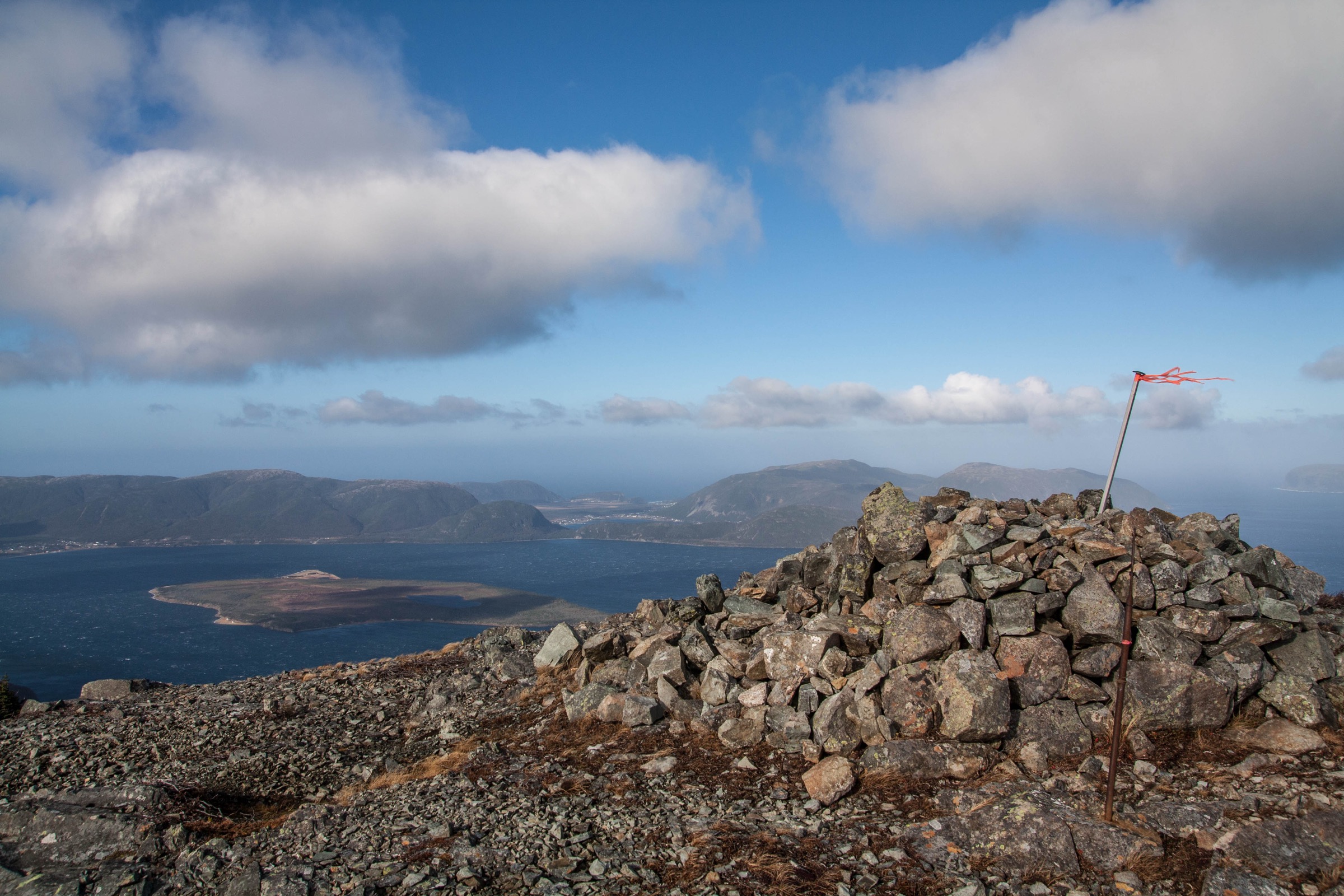
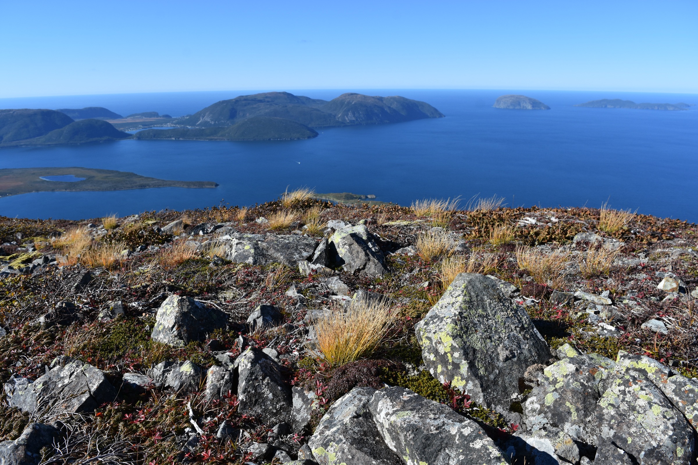
The route leaves the Cape Blow Me Down parking on Route 450 just past the entrance to York Harbour and ascends almost directly upslope through balsam fir forest. The lower kilometre passes the remains of the historic copper-mine workings — the trail’s older name, Copper Mine to Cape, refers to this 19th-century operation — and a short side path leads to Copper Mine Falls in the lower brook. From the falls the main trail climbs steadily through dense forest on a series of roots and rough rock steps, gaining about 500 m in roughly two kilometres. Above tree line at about 450 m the path emerges onto the orange-weathered peridotite barrens of the Blow Me Down plateau, where cairns mark the way to a broad viewpoint with a 360° panorama of the Bay of Islands, the North Arm Hills, the Lewis Hills to the south, and Corner Brook on a clear day. Return is on the same path.
Why it is essential
Cape Blow Me Down is the signature climb of the massif and gives the clearest single-day exposure to the Bay of Islands ophiolite at altitude. The combination of historic copper-mine landscape, waterfall, steep forested climb and high open barrens is unique to this part of the Newfoundland Appalachians.
Equipment
- Sturdy hiking shoes or boots; the rooty climb is slippery in any moisture.
- Wind shell and warm layer for the exposed plateau.
- Two litres of water; insect repellent in June and July.
- Map and offline GPS; the trail is well marked below tree line but cairned only on the plateau.
Hazards and notes
- Fog rolls in quickly on the plateau; turn back if the cairn line disappears.
- The descent is hard on knees; trekking poles help.
- Black bear range — make noise on the lower forest section.
GPX / KML links
| Source | URL | Format / access | Reuse status |
|---|---|---|---|
| IATNL — Copper Mine to Cape Trail | iatnl.org | Trail description; no open GPX | Reference only |
| AllTrails — Cape Blow Me Down Trail | alltrails.com | GPX (account download) | AllTrails proprietary; link only |
External links
2. Tortoise Mountain (Lark Harbour Head)
Snapshot
Itinerary
The route leaves the Blow Me Down Provincial Park day-use area at Lark Harbour and follows a coastal-forest path north and east along the Lark Harbour headland. The first kilometre passes through balsam fir and a small section of coastal meadow, before the trail climbs steeply onto the open spine of Tortoise Mountain. The summit ridge is a narrow, exposed grassy strip with views directly down into Lark Harbour, across to the open Bay of Islands, and back south toward the main Blow Me Down massif. The same path is used for descent. The trail is co-signposted in places as the James Cook Heritage Trail in reference to Cook’s 1767 survey of the Bay of Islands.
Why it is essential
Tortoise Mountain is the only formal headland walk inside Blow Me Down Provincial Park and gives the best low-effort overview of the Bay of Islands’ south arm geography. It is also the only short hike in the Blow Me Down area that gives an aerial view of Lark Harbour itself.
Equipment
- Standard hiking shoes; the climb is short and rooty.
- Wind shell at the headland.
- Sun protection on the open ridge.
Hazards and notes
- The headland spine is exposed and unfenced.
- The grassy strip is slippery when wet.
- Strong gusts from the Bay of Islands in afternoon.
GPX / KML links
| Source | URL | Format / access | Reuse status |
|---|---|---|---|
| ParksNL — Blow Me Down Provincial Park | parksnl.ca | Park page; no open GPX | Reference only |
| Newfoundland & Labrador Tourism — Lark Harbour Head Trail | newfoundlandlabrador.com | Trail page | Reference only |
External links
3. Blow Me Down Mountain Trail (IATNL day section)
Snapshot
Itinerary
The IATNL Blow Me Down Mountain Trail is a long traverse across the Blow Me Down massif that connects the Blow Me Down Brook trailhead in the north with the Copper Mine / Cape access in the south. A day-hike on this trail normally starts at the Blow Me Down Brook access on Route 450 (about 5 km past Frenchman’s Cove), climbs steeply through balsam fir forest to the plateau rim above 500 m, and follows the cairned IATNL line across the open peridotite barrens for as long as the party’s day allows before retracing. The plateau has scattered tarns, dramatic ophiolite colour banding underfoot, and an outlook over the South Arm of the Bay of Islands. The full trail is part of the multi-day UltramaTrex Geopark traverse and is more often walked as a one-night through-trip; the day-section described here is a turn-around variant.
Why it is essential
This is the only documented through-route across the Blow Me Down plateau and the principal way for fit walkers to experience the high ophiolite landscape at length in a single day. The trail also gives the most direct sense of why the Bay of Islands massifs were proposed for UNESCO Geopark status.
Equipment
- Mountain hiking equipment: sturdy boots, waterproofs, warm layer.
- Compass and offline GPS with topographic contours; cairn-following only on the plateau.
- Headtorch for late returns.
- Two to three litres of water; the plateau is largely dry.
Hazards and notes
- Plateau-level fog can erase the cairn line within minutes; turn back if visibility drops.
- No reliable cell coverage above tree line.
- Notify someone of your route and expected return.
- Black bear sign reported on the forested approaches.
GPX / KML links
| Source | URL | Format / access | Reuse status |
|---|---|---|---|
| IATNL — Blow Me Down Mountain Trail | iatnl.org | Trail description; no open GPX | Reference only |
| Cabox Aspiring Geopark — UltramaTrex | caboxgeopark.org | Geopark trail map | Reference only |
External links
- IATNL — Blow Me Down Mountain Trail (news)
- Newfoundland & Labrador — Blow Me Down Mountain Trail (IATNL)
4. Cabox via the Lewis Hills (long-day IATNL section)
Snapshot
Itinerary
The IATNL describes the Cabox Summit route as a 27 km looping trek on the south-east side of the Lewis Hills ophiolite massif, peaking at the 814 m summit of Cabox. Approach is normally from one of the IATNL access points on the eastern flank of the Lewis Hills, with the climb crossing dense forest to the plateau rim and then traversing the open peridotite uplands to the summit. The summit is a broad stony rise marked by a small cairn, with a view that on a clear day reaches across the Bay of Islands to Gros Morne National Park and south over the Long Range. Returning the same line gives the shortest day-objective; the full IATNL loop is normally tackled as an overnight. As a one-day route the Cabox climb is at the upper limit of what a fit walker can do in a single push — many parties take two days using a wild camp on the plateau.
Why it is essential
Cabox is the highest point on the island of Newfoundland and the regional high-point objective for any visit to the Bay of Islands ophiolites. The route gives the most complete single-day exposure to the upper Lewis Hills plateau and to the geological relationship between the Blow Me Down and Lewis Hills massifs.
Equipment
- Full mountain hiking equipment; trekking poles strongly recommended.
- Hard waterproofs and warm layer for the exposed plateau.
- Compass, map and offline GPS; cairn-following on the plateau.
- Headtorch and a bivy / emergency shelter for a day this long.
- Three litres of water; the upper plateau has limited reliable water.
Hazards and notes
- This is at the upper end of a day-hike and should only be attempted by fit, well-equipped parties in settled weather.
- Plateau fog and afternoon thunderstorms develop quickly.
- No cell coverage on the upper hills.
- The IATNL recommends consulting them for current trailhead and access information.
GPX / KML links
| Source | URL | Format / access | Reuse status |
|---|---|---|---|
| IATNL — Cabox Summit description | iatnl.org | Description; no open GPX | Reference only |
| IATNL — Lewis Hills Trail description | iatnl.org | Description; no open GPX | Reference only |
| Cabox Aspiring Geopark — Lewis Hills | caboxgeopark.org | Geopark page | Reference only |
External links
5. Governor’s Staircase and lookout tower
Snapshot
Itinerary
The Lookout Trail in Blow Me Down Provincial Park is actually two short branches that meet at a wooden lookout tower on the cliff above the park. One branch begins at the day-use parking area and climbs through a steep boardwalk and a long flight of stairs known locally as the Governor’s Staircase. The second branch climbs from the campground loop on a gentler grade. Both ascend roughly 250 m of vertical to reach the tower platform, which gives an open view down into Lark Harbour, across the South Arm of the Bay of Islands and east into York Harbour. The natural day-loop is to climb the Governor’s Staircase from the day-use area, photograph the view, and descend the gentler campground branch. The Governor’s Staircase is itself a cultural feature: the locally-built stair carved into the ancient volcanic and peridotite rock is the park’s signature constructed asset.
Why it is essential
This short loop is the only easy route in the Blow Me Down area that climbs to a recognised viewpoint without significant exposure, and the only one that combines the park’s historic stair construction with the standard Bay of Islands panorama. It is the natural family pairing for Tortoise Mountain or the southern Cape Blow Me Down approach.
Equipment
- Standard hiking shoes; the stairs can be slippery when wet.
- Wind shell for the tower platform.
- Sun protection.
Hazards and notes
- The Governor’s Staircase is steep and not suitable for unsteady walkers; the alternative campground branch is gentler.
- The tower platform is railed but exposed.
- The provincial park has a seasonal opening window; confirm with ParksNL.
GPX / KML links
| Source | URL | Format / access | Reuse status |
|---|---|---|---|
| ParksNL — Blow Me Down Provincial Park | parksnl.ca | Park page; no open GPX | Reference only |
External links
Missing data / follow-up work
- Per-route GPX or KML is not openly published by IATNL or the provincial parks system; AllTrails and Wikiloc tracks exist for Cape Blow Me Down and parts of the IATNL but are under proprietary licences and are listed for reference only.
- The Blow Me Down Mountain Trail (Hike 3) day-section turn-around point is route-by-route and depends on the party’s pace; the distance and gain ranges in the summary table reflect that variability rather than a published stat.
- The Cabox (Hike 4) one-day route is at the limit of what a fit party can do in a single push; many parties take it as an overnight. The route should be confirmed with IATNL for the current trailhead and any seasonal access closures.
- No licence-compatible image was located for the Governor’s Staircase or the lookout tower in Blow Me Down Provincial Park; the Hike 5 entry has no figure.
- The IATNL site is the principal trail-management point of contact for all higher routes and should be consulted before any trip into the Lewis Hills.
- 2026 Blow Me Down Provincial Park seasonal opening and amenities should be confirmed at ParksNL.
External links
| Source | URL |
|---|---|
| IATNL (International Appalachian Trail NL) | iatnl.org |
| IATNL — Copper Mine to Cape Trail | iatnl.org |
| IATNL — Cabox Summit | iatnl.org |
| IATNL — Lewis Hills Trail | iatnl.org |
| ParksNL — Blow Me Down Provincial Park | parksnl.ca |
| Cabox Aspiring UNESCO Geopark | caboxgeopark.org |
| Newfoundland & Labrador — Cape Blow Me Down Hiking Trail | newfoundlandlabrador.com |
| Newfoundland & Labrador — Lark Harbour Head Trail | newfoundlandlabrador.com |
| Wikipedia — Blow Me Down Provincial Park | en.wikipedia.org |
| Wikipedia — Lewis Hills | en.wikipedia.org |
| OpenStreetMap | openstreetmap.org |