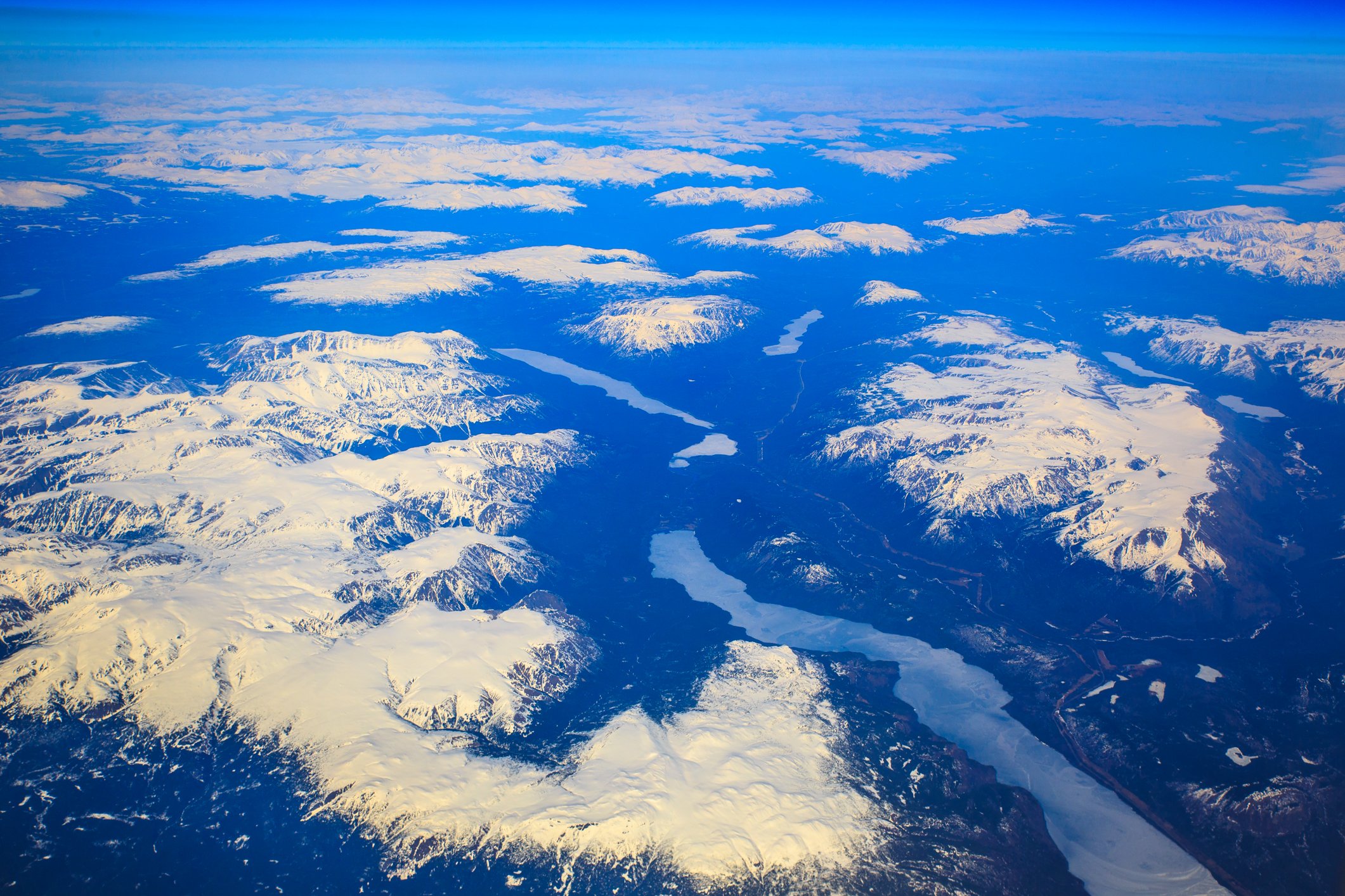
Regional overview
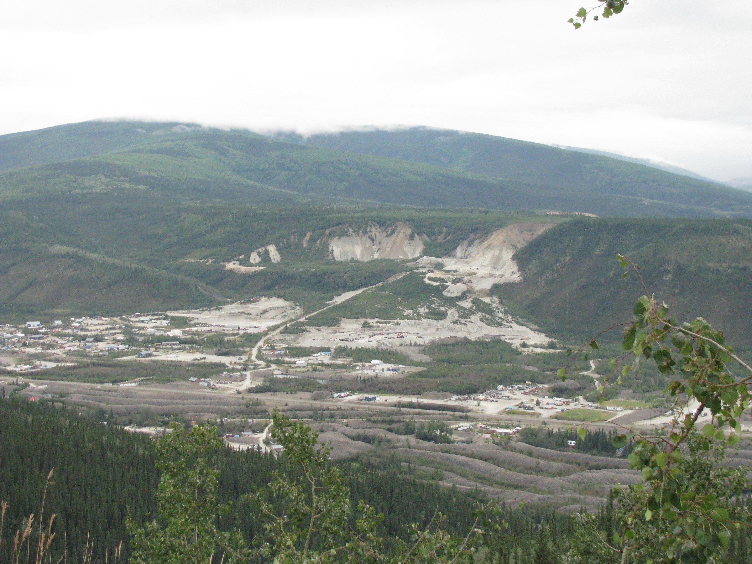
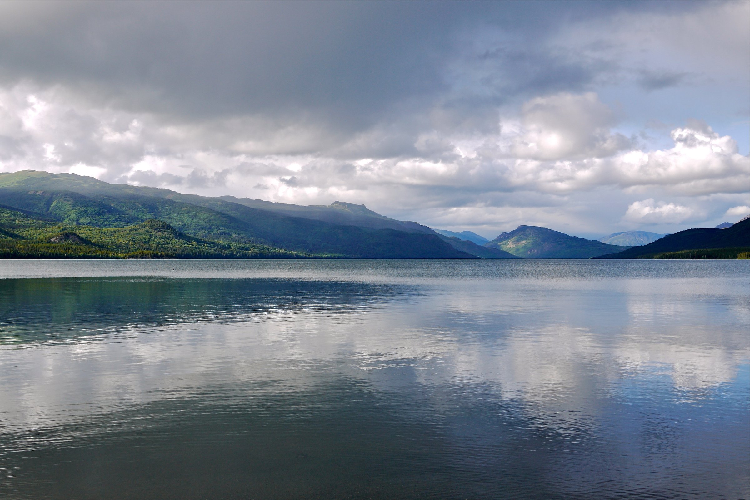
The Cassiar Mountains and the wider Stewart-Cassiar corridor are remote northern British Columbia hiking country: long highway distances, sparse services, glaciated and volcanic uplands, lake basins, boreal forest, alpine steppe, waterfalls, and wildlife-rich valleys. Published day-hike information is limited, and many routes are short park trails or remote wilderness approaches rather than maintained mountain footpaths.
The best-documented public access lies along Highway 37 near Tatogga, Kinaskan Lake, Iskut, Dease Lake, and Boya Lake. Mount Edziza, Denetiah, and other wilderness parks contain more dramatic mountain terrain, but many routes require floatplane, boat, horseback, or multi-day overland travel.
The practical hiking season is short. BC Parks notes for Mount Edziza that generally suitable backpacking weather occurs between July 1 and September 15, with snow and freezing rain possible any day of the year. Elsewhere in the Cassiar corridor, expect wet trails, rough or unmarked access, bears, limited medical services, and long stretches without phone service.
Selection rationale
The selection balances what is essential with what can actually be sourced: Todagin Mountain for alpine views, the Kinaskan Lake / Cascade Falls trails for highway-accessible volcanic-waterfall terrain, Boya Lake for the classic northern turquoise-lake landscape, and Eve Cone as the major volcanic-landscape candidate where day-hiking is feasible only from a remote base.
Summary table
| # | Hike | Country | Route type | Distance | Gain | Max elevation | Difficulty |
|---|---|---|---|---|---|---|---|
| 1 | Todagin Mountain Trail | Canada | Out-and-back | 6.6 km AllTrails; BC Parks describes route but not full distance | 680 m AllTrails | Hard | |
| 2 | Upper Cascade Falls Trail | Canada | Out-and-back | 5 km official / 5.0 km AllTrails | 140 m AllTrails | Easy | |
| 3 | Natadesleen Lake Trail and Lower Cascade Falls | Canada | Out-and-back plus paddle-assisted side hike | 2.1 km AllTrails for Natadesleen; lower falls adds 1 km hiking after lake crossing | 60 m AllTrails for Natadesleen | Easy, access-dependent | |
| 4 | Ta Ch’ila / Boya Lake Lakeshore and Beaver Lodge Trails | Canada | Two short out-and-backs | 3 km official combined; AllTrails variants 2.9-3.1 km each | 56-72 m AllTrails variants | Easy | |
| 5 | Eve Cone from Buckley Lake / Big Raven Plateau | Canada | Remote fly-in-base out-and-back candidate | Eve Cone lies about 11 km southeast of Buckley Lake | 1,740 m cone elevation | Hard / remote |
1. Todagin Mountain Trail
Snapshot
Itinerary
The trail begins from a short pullout road on the east side of Highway 37. BC Parks describes an unmaintained but generally well-defined trail climbing through mixed spruce/aspen forest, then subalpine fir, then subalpine meadows and open tundra. From the open slopes, a summit to the south gives views over Kinaskan and Eddontenajon Lakes; more remote continuation toward the plateau requires stronger navigation.
Why it is essential
Todagin is the best-documented road-accessed alpine hike found in the Cassiar corridor. It provides the clearest day-hike transition from highway forest to high northern tundra and Stone’s sheep habitat.
Equipment
- Mountain hiking equipment.
- Bear spray, navigation backup, warm layers, rain protection, and trekking poles are recommended.
- Carry water; BC Parks notes that water can be scarce on the upland plateau.
Hazards and notes
- BC Parks states the trail is unmaintained, has deadfall, and is continuously steep after the creek crossing.
- The trailhead is unmarked.
- The route described by BC Parks is not within Todagin South Slope Provincial Park, and any continuation across the plateau is more serious than the basic day-hike objective.
GPX / KML links
| Source | URL | Format / access | Reuse status |
|---|---|---|---|
| BC Parks: Todagin South Slope Park hiking | bcparks.ca | Official route description | BC Parks website terms not evaluated; no GPX found |
| AllTrails: Todagin Mountain Trail | alltrails.com | Source route / app map | AllTrails terms apply; GPX reuse unresolved |
External links
2. Upper Cascade Falls Trail
Snapshot
Itinerary
The trail starts at a Highway 37 pullout south of Kinaskan Lake campground and heads to the top of Cascade Falls, where the Iskut River drops through volcanic-influenced terrain. BC Parks lists this as the highway-accessible upper falls route.
Why it is essential
Cascade Falls is the main waterfall day-hike in Kinaskan Lake Park and a practical stop in an otherwise remote mountain corridor.
Equipment
- Standard hiking equipment.
- Bear spray, rain layer, and footwear suitable for wet boardwalk or muddy forest trail are recommended.
Hazards and notes
- BC Parks notes no service is available in Kinaskan and the closest medical/emergency services are Dease Lake or Stewart.
- Stay on designated trails.
- Recreational hunting is prohibited inside Kinaskan Lake Park.
GPX / KML links
| Source | URL | Format / access | Reuse status |
|---|---|---|---|
| BC Parks: Kinaskan Lake Park | bcparks.ca | Official route description | BC Parks website terms not evaluated; no GPX found |
| BC Parks: Kinaskan Lake trail and paddling map | nrs.objectstore.gov.bc.ca | Official PDF map | BC Parks / Government of BC terms not evaluated; source map found |
| AllTrails: Cascade Falls Trail | alltrails.com | Source route / app map | AllTrails terms apply; GPX reuse unresolved |
External links
- BC Parks — Kinaskan Lake Park
- BC Parks — Kinaskan Lake trail and paddling map (PDF)
- AllTrails — Cascade Falls Trail
3. Natadesleen Lake Trail and Lower Cascade Falls
Snapshot
Itinerary
The Natadesleen Lake Trail starts from a Highway 37 pullout and reaches the lake shore on a short portage trail. BC Parks notes that canoe carts up to 32 inches wide can use the upgraded trail and boardwalk. From the lake, a non-motorboat crossing to the southwest side gives access to a separate 1 km Lower Cascade Falls Trail to the base of Cascade Falls.
Why it is essential
This route combines short hiking, lake access, and the lower falls viewpoint, showing the water-linked character of Kinaskan Lake Park better than the highway-only trail.
Equipment
- Standard hiking equipment.
- Canoe/kayak safety gear if continuing to Lower Cascade Falls.
- Bear spray, rain layer, and dry bags are recommended.
Hazards and notes
- The lower falls section is only accessible by non-powerboat.
- The Iskut River connection is for more experienced paddlers, and BC Parks advises mandatory boating safety equipment.
- Do not proceed downstream beyond signed danger areas.
GPX / KML links
| Source | URL | Format / access | Reuse status |
|---|---|---|---|
| BC Parks: Kinaskan Lake Park | bcparks.ca | Official route description | BC Parks website terms not evaluated; no GPX found |
| BC Parks: Kinaskan Lake trail and paddling map | nrs.objectstore.gov.bc.ca | Official PDF map | BC Parks / Government of BC terms not evaluated; source map found |
| AllTrails: Natadesleen Lake Trail | alltrails.com | Source route / app map | AllTrails terms apply; GPX reuse unresolved |
External links
- BC Parks — Kinaskan Lake Park
- BC Parks — Kinaskan Lake trail and paddling map (PDF)
- AllTrails — Natadesleen Lake Trail
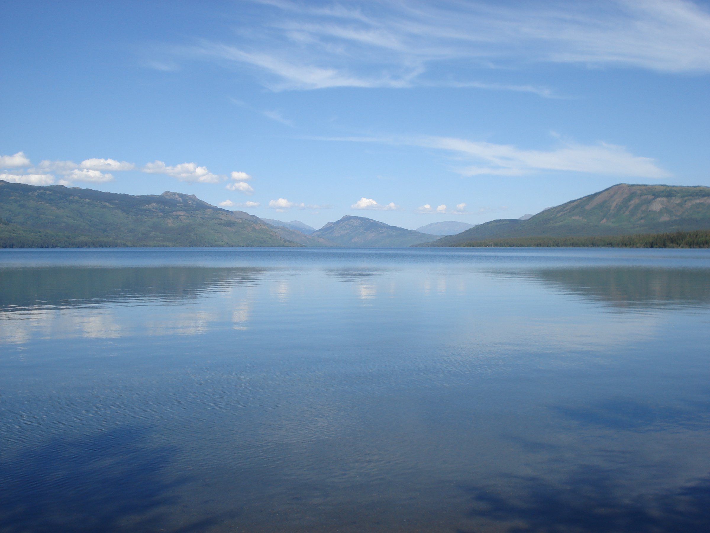
4. Ta Ch’ila / Boya Lake Lakeshore and Beaver Lodge Trails
Snapshot
Itinerary
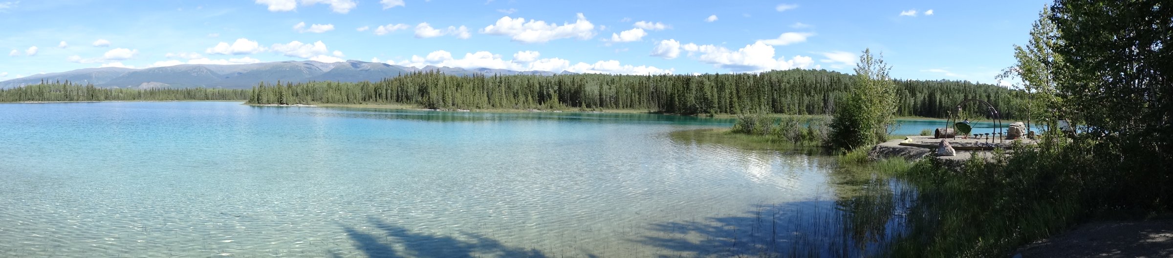
The Lakeshore Trail leaves from the north end of the campground, while the Beaver Lodge Trail leaves near the south end of the park by the boat launch. The walks explore the clear aquamarine lake, eskers, drumlins, forest, shoreline viewpoints, and wildlife habitat.
Why it is essential
Boya Lake is one of the most recognisable stops on the northern Stewart-Cassiar corridor. The trails are short, but the lake’s colour, clarity, and glacial landforms make it a representative low-elevation Cassiar-area walk.
Equipment
- Standard hiking equipment.
- Bear spray and insect protection are recommended.
- Keep pets on leash and away from beach areas where BC Parks restrictions apply.
Hazards and notes
- BC Parks states that the park has two short interpretive walking trails suitable for seniors and children.
- E-bikes are not allowed on the trails, drones require permission, and hunting is closed April 1 to September 30 inclusive.
GPX / KML links
| Source | URL | Format / access | Reuse status |
|---|---|---|---|
| BC Parks: Ta Ch’ila / Boya Lake | bcparks.ca | Official route description | BC Parks website terms not evaluated; no GPX found |
| BC Parks: Ta Ch’ila / Boya Lake campground map | nrs.objectstore.gov.bc.ca | Official PDF map | BC Parks / Government of BC terms not evaluated; source map found |
| AllTrails: Lake Shore Trail | alltrails.com | Source route / app map | AllTrails terms apply; GPX reuse unresolved |
| AllTrails: Beaver Lodge Trail | alltrails.com | Source route / app map | AllTrails terms apply; GPX reuse unresolved |
External links
- BC Parks — Ta Ch’ila Park / Boya Lake
- BC Parks — Ta Ch’ila / Boya Lake campground map (PDF)
- AllTrails — Lake Shore Trail
- AllTrails — Beaver Lodge Trail
5. Eve Cone from Buckley Lake / Big Raven Plateau
Snapshot
Itinerary
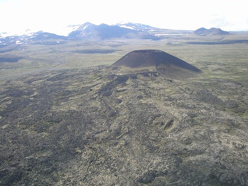
From a remote Buckley Lake or Big Raven Plateau base, the objective is Eve Cone, one of the young cinder cones on the northern side of the Mount Edziza volcanic complex. BC Parks asks visitors who climb Eve Cone or other cinder cones to stay on established routes and notes a designated route on Eve Cone’s northeast ridge.
Why it is essential
Eve Cone is one of the most distinctive volcanic features in northern British Columbia. It belongs in the catalogue as an essential landscape objective, but the available data is not strong enough to present it as a standard trailhead day hike.
Equipment
- Full remote mountain hiking equipment.
- Satellite communicator, topographic maps, navigation backup.
- Bear-proof food storage, emergency shelter, warm layers, waterproof layers.
- Creek-crossing judgement is required.
Hazards and notes
- BC Parks describes Mount Edziza as an isolated wilderness with no vehicle access, unmaintained overland access trails, lingering snow, possible freezing rain any day of the year, high winds, white-outs, sudden creek rises, and magnetic rock that may affect compass accuracy.
- Hiking shortcuts through lava fields is not recommended, and volcanic cones are fragile.
GPX / KML links
| Source | URL | Format / access | Reuse status |
|---|---|---|---|
| BC Parks: Mount Edziza Park | bcparks.ca | Official route / access notes | BC Parks website terms not evaluated; no GPX found |
| BC Parks: Mount Edziza prohibited aircraft zone | nrs.objectstore.gov.bc.ca | KMZ access/restriction file | BC Parks / Government of BC terms not evaluated; not a hiking route |
External links
External links
| Source | URL |
|---|---|
| BC Parks — Todagin South Slope Park hiking | bcparks.ca |
| BC Parks — Kinaskan Lake Park | bcparks.ca |
| BC Parks — Kinaskan Lake trail and paddling map (PDF) | nrs.objectstore.gov.bc.ca |
| BC Parks — Ta Ch’ila Park / Boya Lake | bcparks.ca |
| BC Parks — Ta Ch’ila / Boya Lake campground map (PDF) | nrs.objectstore.gov.bc.ca |
| BC Parks — Mount Edziza Park | bcparks.ca |
| BC Parks — Mount Edziza prohibited aircraft zone (KMZ) | nrs.objectstore.gov.bc.ca |
| AllTrails — Todagin Mountain Trail | alltrails.com |
| AllTrails — Cascade Falls Trail | alltrails.com |
| AllTrails — Natadesleen Lake Trail | alltrails.com |
| AllTrails — Lake Shore Trail (Boya Lake) | alltrails.com |
| AllTrails — Beaver Lodge Trail (Boya Lake) | alltrails.com |