Regional overview
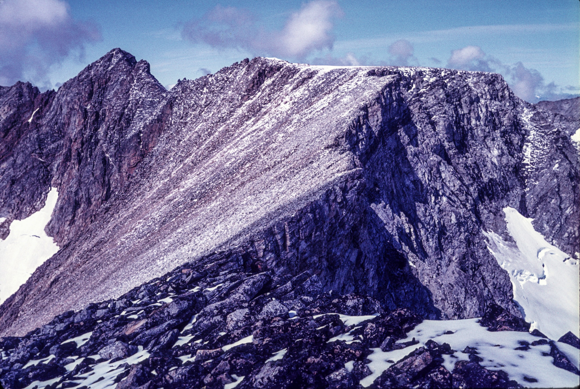
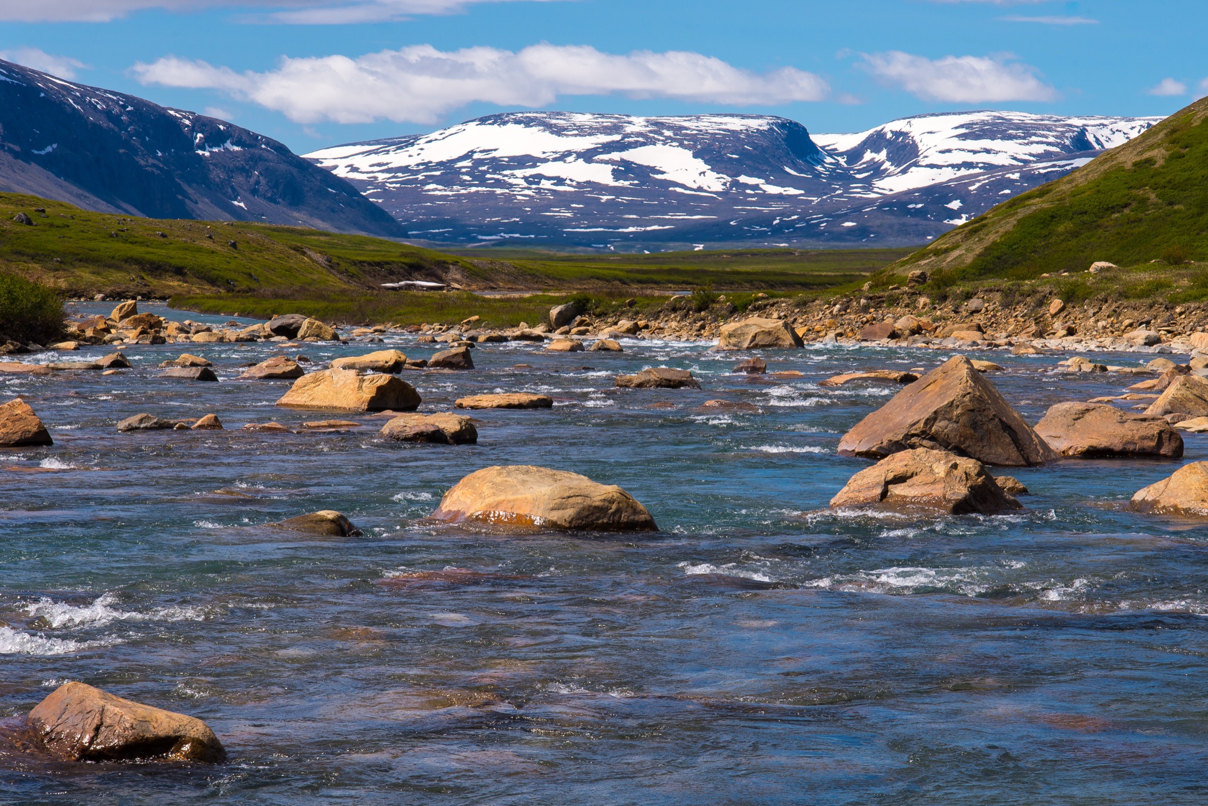
The Québec-side Torngats form the highest mountain rampart of mainland eastern Canada, rising abruptly from Ungava Bay east to the Labrador frontier in a single 200-kilometre wall of Precambrian gneiss. The range is geologically among the oldest in the world — the Torngat foothills first uplifted about 1.8 billion years ago at the Nain–Churchill collision zone — and the modern relief is a glacially recast remnant of those Proterozoic mountains. Mont D’Iberville / Mount Caubvick reaches 1,652 m, with the Québec summit (Pointe d’Iberville, 1,646 m) a few metres south-west of the Labrador summit point along the international ridge; it is the highest mountain in mainland Canada east of the Rockies. The entire Québec frontage of the range, plus the full 166 km Koroc River drainage, lies within Parc national Kuururjuaq, established in May 2009 and operated by Parcs Nunavik on behalf of the Administration régionale Kativik.
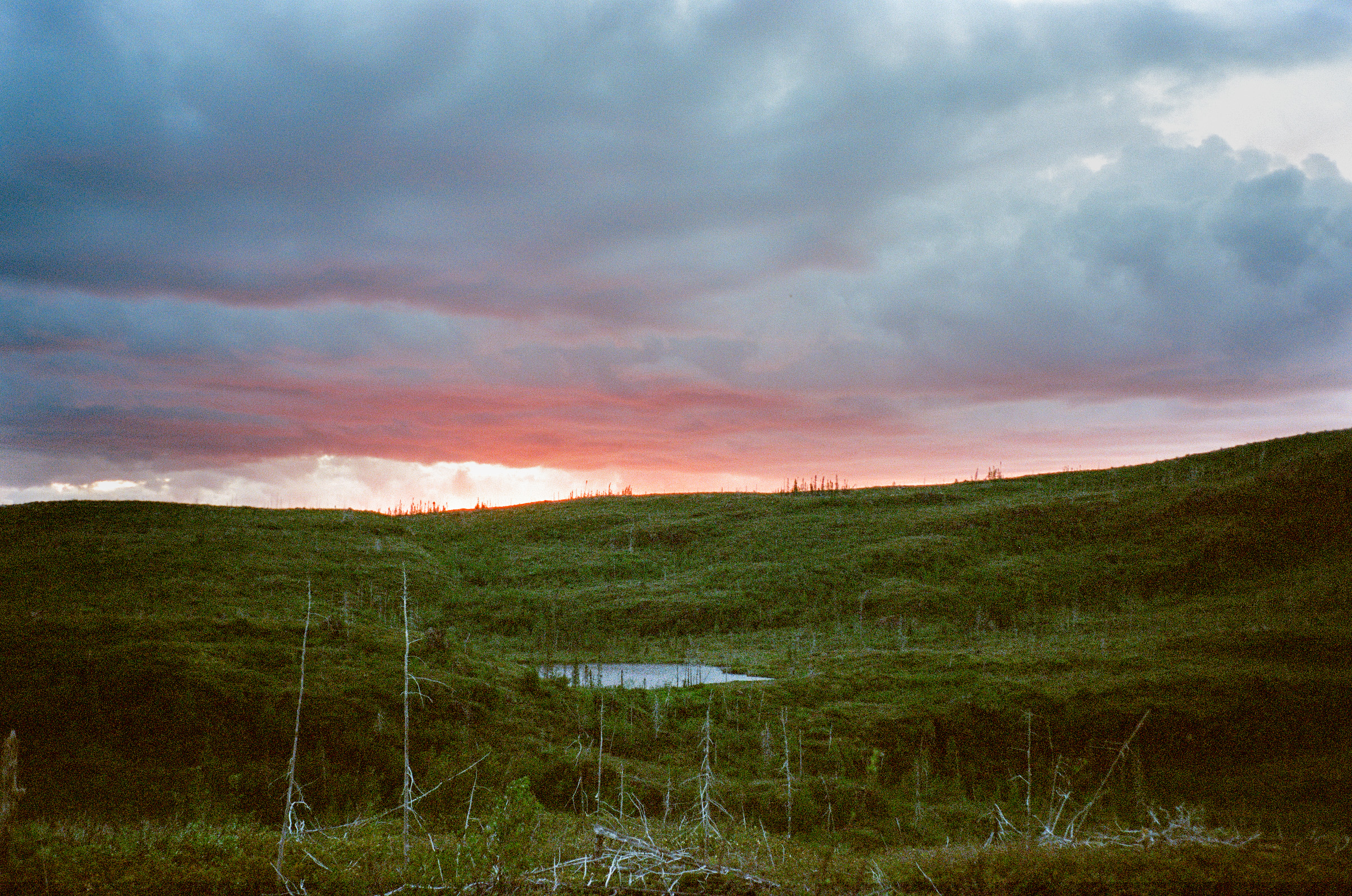
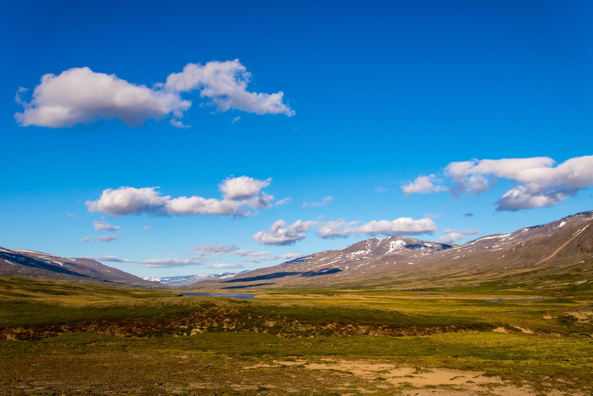
Landscape character is Arctic-alpine over almost the whole hiking zone: bare gneiss ridges and cirque headwalls above lichen-and-moss tundra, with a narrow boreal pocket of black spruce, tamarack and Québec’s northernmost stand of white birch in the lower Koroc valley below ~275 m. There is no road access; visitors fly from Montréal to Kuujjuaq (YVP) on Air Inuit, connect to Kangiqsualujjuaq (XGR — “George River”), and then proceed by Twin Otter, charter floatplane or, in the lower valley, by motorboat. Two operating base camps anchor virtually all hiking activity: Camp Qurlutuarjuq on the lower-middle Koroc (approximate position 58.6117 N, 64.5320 W), and the Kauvvik (Iberville) Base Camp at the head of the Koroc beneath Mont D’Iberville (58.8397 N, 63.7150 W), with an intermediate Upper Koroc Camp at 58.7692 N, 63.5811 W. A 12-kilometre packed trail link, the “Trail Basecamp,” joins the Upper Koroc tent platforms to the Kauvvik base camp.
The operating window is essentially mid-July to early September — Bonjour Québec lists the 2026 visitation period as 6 July to 6 September. Snow can linger in north-facing cirques to early August; sub-zero summit weather, rapidly forming cloud, and dense fog at any time of year are routine. All visitors must register with Parcs Nunavik, and for the Iberville sector and any of the more remote treks an Inuit guide is mandatory under the standard packages — independent expeditions are technically possible but require explicit park authorisation and an emergency-communications plan. The Qurlutuarjuq sector is closed to fishing for non-beneficiaries by joint decision of the park and the Qiniqtiq Landholding Corporation of Kangiqsualujjuaq. Polar bear and black bear are present; bear-aware food storage is mandatory. The land is overwritten with archaeological and historical Inuit use — about 30 catalogued sites — and the Koroc corridor is a thousand-year-old trade route for Ramah chert moving from the Labrador coast to Ungava Bay; cultural-protocol expectations apply throughout. Drones are prohibited in all Parcs Nunavik parks.
This entry covers the Québec (Nunavik) side of the Torngats and the immediately adjacent Québec highland country, principally within Parc national Kuururjuaq. It does not cover Torngat Mountains National Park (Newfoundland and Labrador) routes such as Nakvak Brook, Sallikuluk, or the Koroc–Palmer loop’s Labrador-side terminus; cross-border context is given where the standard Québec routes brush the border ridge.
Selection rationale
True one-day, trailhead-to-trailhead day-hikes do not exist in this region in the conventional sense — every route depends on a fly-in to one of the three serviced camps. The five hikes below were chosen because each is a named, officially mapped Parcs Nunavik route appearing on the park’s published GPX, is feasible inside a single hiking day from one of the established camps without ropework (the Iberville summit excepted), and represents a different facet of the Québec Torngat landscape: the Iberville summit traverse — the highest peak of mainland eastern Canada, included even though the final ridge is class-3/4 and requires a guide, because no equivalent regional catalogue can credibly omit it; a high alpine acclimatisation ridge (Bear Ridge); a fjord-view balcony from the Iberville cirque (Trail Nachvak); the principal cultural and waterfall walk at Qurlutuarjuq Falls in the lower-middle valley; and a boreal-fringe alpine loop from the same camp showing the Québec boreal-northernmost tree line. The Koroc–Palmer loop, although iconic, is omitted because its scenic portion terminates inside Torngat Mountains National Park (Labrador). The 12 km basecamp link itself is a porter-hike rather than a destination day, so it is folded into the access notes. Verification across all five hikes is Candidate only for route statistics (most figures are operator-stated, not from a contour-derived survey).
Summary table
| # | Hike | Country | Route type | Distance | Gain | Max elevation | Difficulty |
|---|---|---|---|---|---|---|---|
| 1 | Mont D’Iberville summit via Koroc Ridge | Canada | Out-and-back / horseshoe | ~14 km | ~1,170 m | 1,652 m | Very strenuous, class 3-4, guided |
| 2 | Bear Ridge acclimatisation | Canada | Out-and-back | 10.1 km | ~655 m | 1,174 m | Strenuous, one roped step |
| 3 | Nachvak / Palmer Viewpoint balcony | Canada | Out-and-back | ~24 km | ~700 m | ~1,000-1,100 m | Strenuous, navigation-serious |
| 4 | Qurlutuarjuq Falls walk | Canada | Out-and-back | ~4 km | ~80 m | ~150 m | Easy to moderate |
| 5 | Qurlutuarjuq Mountain Loop | Canada | Loop | 6.5 km | ~250 m | ~400 m | Moderate, off-trail |
1. Mont D’Iberville summit via the Koroc Ridge
Snapshot
Itinerary
The day starts before dawn at Kauvvik (Iberville) Base Camp, on a flat gravel apron at roughly 480 m beneath the western cirques of the massif. The route climbs north-northeast across tundra and rock pavement following the line of the Parcs Nunavik “Iberville via Koroc” segment, gaining steadily into the boulder field beneath the south flank of the Koroc Ridge. The walking line stays in Québec throughout the approach.
Above approximately 1,000 m the route gains the ridge proper. The Koroc Ridge — historically the “easiest” route to the summit, first climbed in 1973 by Adler and Goetze — is class 3-4 with some exposed scrambling and at least one roped pitch and a short rappel through a pinnacle notch on most variations. The Parcs Nunavik mountaineering guide ropes participants in two-person teams from this section upwards. The ridge tops out on the so-called “Football Field,” a small subhorizontal plateau at about 1,554 m, from which the final summit cone is gained over loose blocky rock to the Québec summit (Pointe d’Iberville, 1,646 m). The true high point (Mount Caubvick, 1,652 m) lies a few metres north-east along the ridge and is entirely in Newfoundland and Labrador; the standard guided line steps across to it.
From the summit the view sweeps east to Ramah Bay and the Labrador Sea, north along the Selamiut Range to Nachvak Fjord, and south down the entire Koroc valley. Descent normally follows the “Iberville via Minaret” segment off the east-south ridge back into the Québec-side basin and the base camp, making a horseshoe loop. Total moving time as stated by Parcs Nunavik is 12-15 hours.
Why it is essential
This is the highest summit of mainland Canada east of the Rocky Mountains and the high point of both Québec and Newfoundland-and-Labrador. No regional catalogue of essential Torngat-side Québec hikes can credibly omit it. It is also the only routinely available “day-summit” of a glaciated 1,600 m peak in eastern Canada, and the only one of the five hikes here that puts the visitor on the actual provincial border ridge.
Equipment
- Sturdy boots, gaiters
- Trekking poles
- Full waterproof shell and warm insulating layer (summit temperatures often near 0 °C in August)
- Hat, gloves, sun protection
- Headtorch (long day)
- Climbing harness and helmet — provided by Parcs Nunavik mountaineering guide
- Rope and anchors — provided by guide
- Microspikes recommended if early-season snow remains in the cirque
- Bear-aware food storage at base camp
- Permit / package registration via Parcs Nunavik mandatory; guide mandatory
Hazards and notes
- The summit ridge is technical: rated class 3-4 scrambling with rope-protected sections, exposed pinnacles and gendarmes. This is not a non-technical hike; it is included as an essential route only because Parcs Nunavik runs it within a guided expedition framework
- Weather: rapidly forming orographic cloud and freezing fog at any time of year
- Two climbers from Mississauga died on descent in August 2003 (bodies recovered August 2004); the accident remains the most-cited cautionary tale for the peak
- The standard package requires a mandatory Inuit cultural orientation in Kangiqsualujjuaq before flying in
- Drones are prohibited in all Parcs Nunavik parks
- Polar bear sightings on the upper massif are rare but possible; bear protocols apply
- The summit itself lies a few metres inside Newfoundland and Labrador and inside Torngat Mountains National Park (administered by Parks Canada). Parties cross the border on the summit but otherwise stay on the Québec side throughout the standard Parcs Nunavik itinerary
GPX / KML links
Official Parcs Nunavik GPX (PNK-all-GPX-2026.gpx) contains the named tracks “Iberville via Koroc,” “Iberville via Minaret” and “Trail Iberville Summit.” No explicit re-use licence on the file; treat as factual navigation data and contact Parcs Nunavik before redistributing verbatim.
External links
- Parcs Nunavik — Parc national Kuururjuaq
- Parcs Nunavik — Conquer Kauvvik Summit
- Wikipedia — Mount Caubvick
- Wikipedia — Kuururjuaq National Park
- PeakVisor — Mont D’Iberville
- American Alpine Club — Koroc Ridge first ascent
2. Bear Ridge acclimatisation hike
Snapshot
Itinerary
From Kauvvik Base Camp the route follows the Parcs Nunavik “Trail Bear Ridge” line westwards out of camp at about 480 m, traversing open boulder-and-lichen terrain to the foot of the south ridge. It climbs steeply onto the ridge crest in a sustained pull, gaining roughly 600 m in the first 4 km, with one short rope-protected step where the guide team typically teaches harness work. From the crest the GPX line traces the ridge undulating around the 1,000-1,170 m contour, with views across the Iberville cirque to Mont D’Iberville to the north-north-east and back down the entire upper Koroc valley to the south. The descent returns through a parallel gully back to the base camp lake.
Why it is essential
Bear Ridge is the single best alpine day from the Kauvvik camp that does not require summit-day commitment. It puts the hiker on a true 1,100 m+ Torngat ridgeline with full Iberville cirque exposure, while teaching rope mechanics and altitude tolerance. Within the suite of feasible day hikes from a Kuururjuaq base camp, it is the only one with both a published GPX elevation profile and a stated guide-led rope-handling element, making it the most thoroughly documented mid-altitude hike in the park.
Equipment
- Sturdy boots
- Trekking poles
- Waterproof shell and warm layer (ridge wind)
- Hat, gloves
- Harness — provided by Parcs Nunavik guide
- Short rope — handled by guide on the protected step
- Bear-aware food storage at base camp
- Microspikes for early-season cornice remnants if conditions warrant
Hazards and notes
- The rope-protected step is short but exposed; this is not an open self-guided trail — visits are within a guided Parcs Nunavik package
- Wind on the ridge crest is unrelenting; weather can turn in minutes
- Polar bear and black bear range overlap; bear-aware food storage required
- No surface water on the ridge — carry full water for the day
GPX / KML links
Official Parcs Nunavik GPX (PNK-all-GPX-2026.gpx) contains the “Trail Bear Ridge” track with a full elevation profile (1,975 trackpoints, 10.06 km, min 519 m / max 1,174 m). No explicit re-use licence on the file.
External links
3. Nachvak / Palmer Viewpoint balcony
Snapshot
Itinerary
The route departs Kauvvik Base Camp on the same line as the Iberville approach, climbing north-north-west into the cirque basin and then bending north-west along the Parcs Nunavik “Trail Nachvak” line. After roughly 2 km the line crosses the saddle between the Iberville group and the Palmer drainage and traverses high open tundra. It climbs gradually onto a north-trending ridge that forms the international watershed; the trail stays on the Québec side throughout. The terminus at the Viewpoint Nachvak Palmer waypoint is a tundra balcony at the rim of a steep drop into the Palmer River headwaters. From this perch the view reaches west down the Palmer River, north into the Tallek Arm of Nachvak Fjord, and east to the Iberville massif. Parcs Nunavik describes the view as “magnificent landscapes, bordered by steep mountains and vast Arctic land.” Return is by the same line.
Why it is essential
This is the only documented Kuururjuaq day-hike that delivers a full Nachvak Fjord and Palmer drainage panorama from the Québec side, and it does so without crossing into Labrador or entering Torngat Mountains National Park. It provides the cross-border Torngat fjord-edge experience that is otherwise only accessible from Parks Canada’s Nain-based Labrador tours.
Equipment
- Sturdy boots
- Trekking poles
- Waterproof shell and warm layer (exposed ridge for several hours)
- Hat, gloves
- Map and GPS — essential; Parcs Nunavik notes that trails are rare in the park and visitors must plan carefully
- Bear-aware food storage at base camp; bear bangers carried by guide
- Full day’s water — no reliable midway source on the ridge
Hazards and notes
- Undeveloped tundra: no marked path, no waymarks, no shelter at the viewpoint
- Weather: the ridge sits above 900 m and is fully wind-exposed; fog can cut visibility within minutes
- Round-trip distance: GPX (~22.8 km) and Parcs Nunavik narrative (24 km) differ slightly — likely reflects extra exploration around the viewpoint area
- Normally undertaken as the “weather-dependent” alternative to summit day in the standard 6-day or 9-day itinerary
- Black and polar bear range overlap; bear-aware practices required
- Guide effectively mandatory under standard packages
GPX / KML links
Official Parcs Nunavik GPX (PNK-all-GPX-2026.gpx) contains the “Trail Nachvak” track (11.38 km one way) terminating at the named waypoint “Viewpoint Nachvak Palmer.” No explicit re-use licence on the file.
External links
- Parcs Nunavik — 6-Day hiking in the Torngat
- Parcs Nunavik — Parc national Kuururjuaq
- Wikipedia — Mount Caubvick
4. Qurlutuarjuq Falls walk
Snapshot
Itinerary
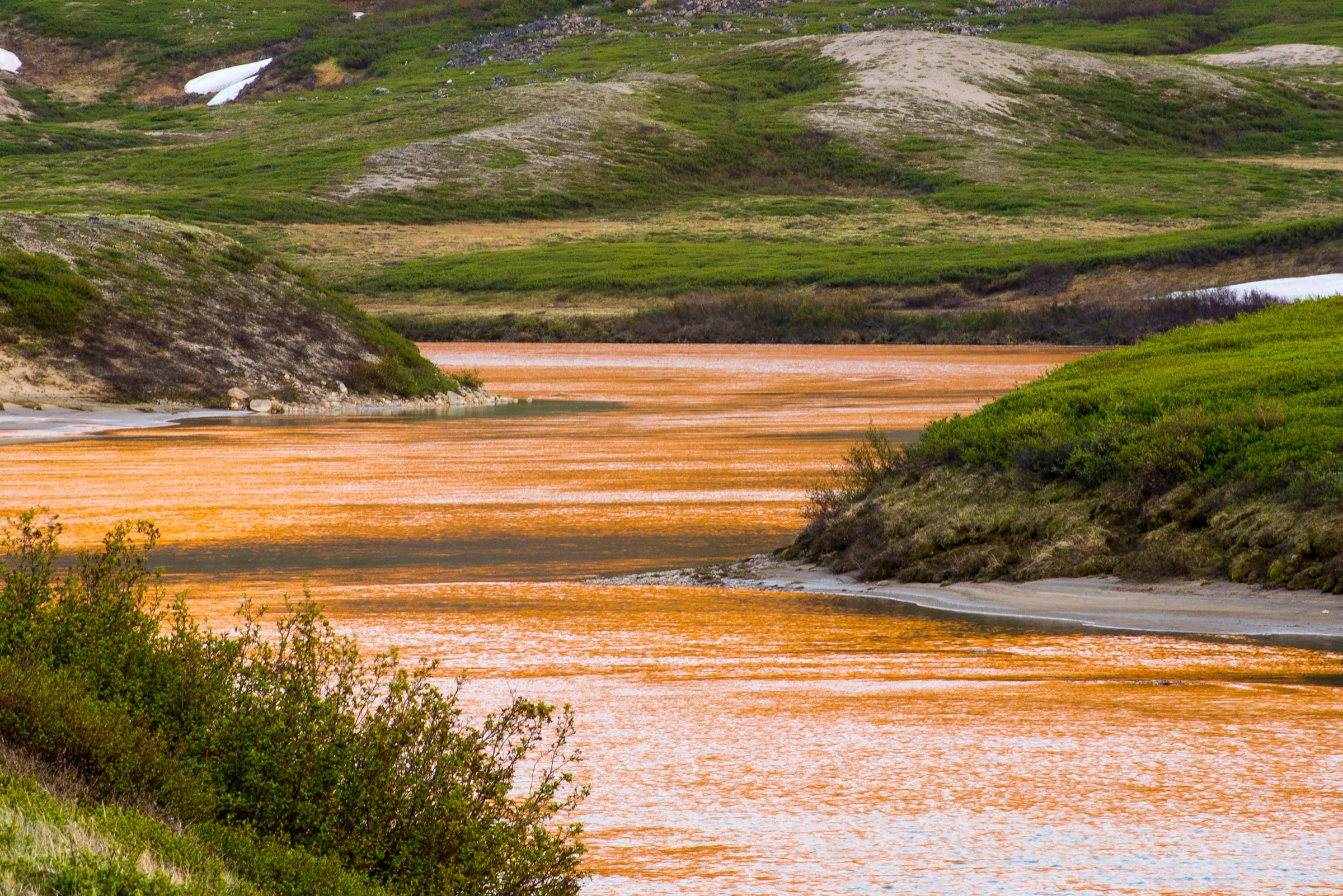
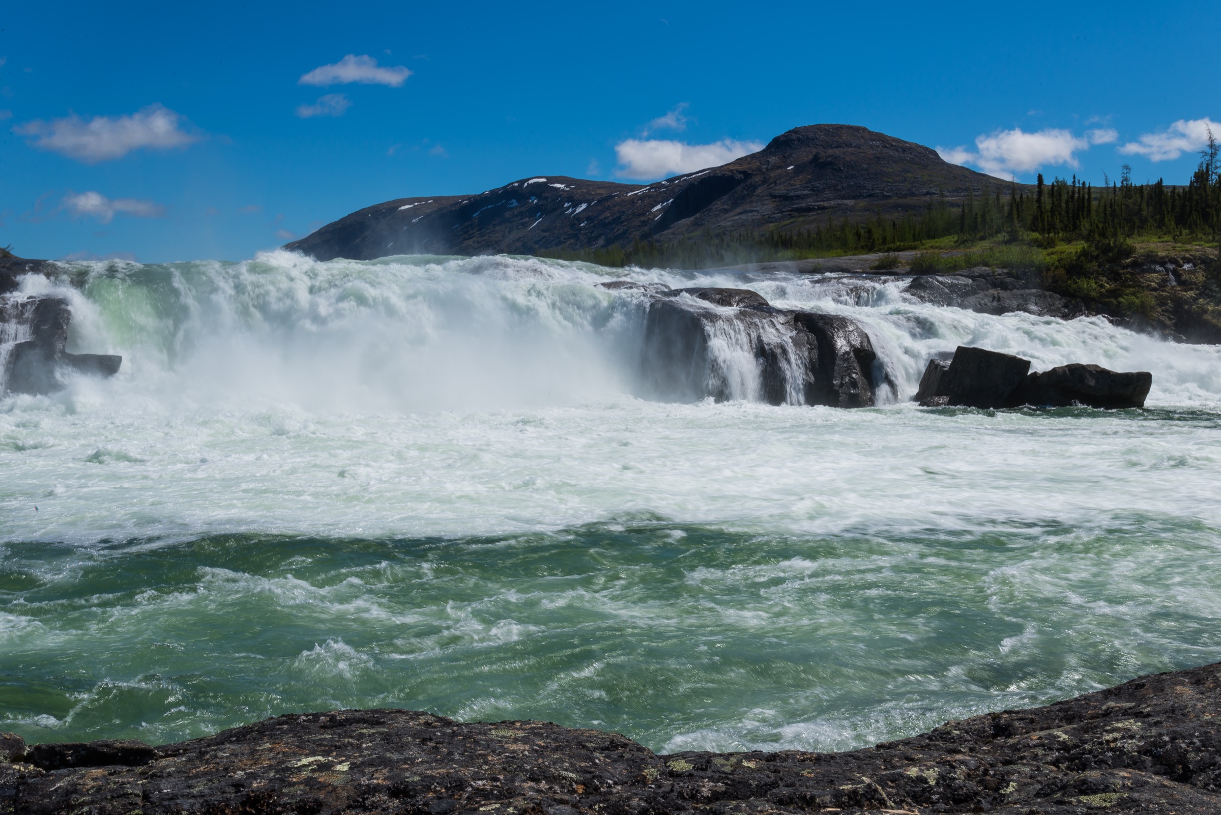
From Camp Qurlutuarjuq’s main pavilion the route drops to the Koroc River bank and follows the Parcs Nunavik “Trail Qurlutuarjuq Falls” line eastwards along a tributary side-stream. The line trends gently up-valley over bouldery moraine and a band of black-spruce and tamarack — the boreal pocket that survives in this sheltered section of the Koroc. After about 2 km the trail reaches a series of plunge pools and a stepped waterfall on the tributary stream (the named “Qurlutuarjuq Falls” waypoint at 58.6102 N, 64.5575 W). The downstream Koroc here is documented by Parcs Nunavik as “a char-rich area.” Return is by the same line.
Why it is essential
This is the principal short, accessible walk in the entire park and the cultural-ecological heart of the lower Koroc. It samples the boreal-pocket forest (black spruce, tamarack, and Québec’s northernmost white birch grove), Arctic char habitat, and a named Inuit place. Qurlutuarjuq is also the focus of a fishing-protocol partnership between Parcs Nunavik and the Qiniqtiq Landholding Corporation of Kangiqsualujjuaq. For visitors on the Parcs Nunavik weekend package it is the primary outing.
Equipment
- Hiking shoes or boots — waterproof preferred (boggy ground)
- Weatherproof layer
- Warm layer
- Water and food
- Map / GPS — Parcs Nunavik instructs that “trails are rare in the Park, visitors must plan their routes carefully”
- Insect repellent — black-fly and mosquito intensity is extreme in July; less so by mid-August
- Bear-aware food storage at camp
Hazards and notes
- Permit / camp booking required. Weekend reservations open on 13 May at 9 a.m. by phone (819-337-5454, two places per call); they sell out
- The Koroc River itself is fast and cold; do not attempt to wade above the camp
- Insects: black flies and mosquitoes peak in July; head net recommended
- Polar bear sightings inland are rare but possible; black bear are routine in the lower valley summer
- Non-beneficiaries are prohibited from fishing in the Qurlutuarjuq area by joint decision of the park and the Qiniqtiq Landholding Corporation
- The Parcs Nunavik camp has private bedrooms, dormitory area, propane stove, solar power and dry toilets — the only serviced camp open to weekend visitors
GPX / KML links
Official Parcs Nunavik GPX (PNK-all-GPX-2026.gpx) contains “Trail Qurlutuarjuq Falls” (2.01 km one way) and the waypoints “Qurlutuarjuq” (camp) and “Qurlutuarjuq Falls.” No explicit re-use licence on the file.
External links
- Parcs Nunavik — Weekend in parc national Kuururjuaq
- Parcs Nunavik — Parc national Kuururjuaq
- Bonjour Québec — Parc national Kuururjuaq listing
- Nunatsiaq News — Kuururjuaq, a Nunavik park developed and managed by Inuit
5. Qurlutuarjuq Mountain Loop
Snapshot
Itinerary
From Camp Qurlutuarjuq the loop traces the Parcs Nunavik “Trail Mountain Loop” line (6.53 km closed circuit) north and east of the camp. The route begins on the lower boreal terrace, weaves through stunted black spruce and tamarack, then climbs through a transitional krummholz zone onto open tundra on a low ridge above the Koroc valley. The loop swings clockwise, passing through a small lake basin in the upper section, before descending the eastern side of the spur back through scattered boreal cover to the river bank and camp. The 2.84 km “Trail Boreal Forest” line is a shorter variant from the same camp running entirely within the spruce-and-larch boreal pocket, and can be done as an out-and-back addition.
Why it is essential
This is the only published, mapped alpine-tundra loop hike available to weekend visitors without an Iberville-sector commitment. It samples three of the park’s main ecological zones in a single short circuit — boreal pocket (rare Québec northernmost forest), krummholz transition, and open Arctic-alpine tundra — and gives an overview of the lower Koroc valley landscape that the Iberville sector hikes simply do not.
Equipment
- Sturdy hiking shoes or boots (waterproof preferred)
- Waterproof layer
- Warm layer
- Map / GPS — essential
- Insect protection (head net in July)
- Bear-aware food storage at camp
Hazards and notes
- Off-trail navigation. The Parcs Nunavik “Trail Mountain Loop” is a recommended line on the published GPX, not a marked footpath on the ground
- Boggy ground in the boreal section
- Insects through July and early August
- Both species of bear are present
- Fishing is prohibited in the Qurlutuarjuq area for non-beneficiaries
GPX / KML links
Official Parcs Nunavik GPX (PNK-all-GPX-2026.gpx) contains “Trail Mountain Loop” (6.53 km closed loop) and the parallel “Trail Boreal Forest” (2.84 km). No explicit re-use licence on the file.
External links
External links
- Parcs Nunavik — Parc national Kuururjuaq
- Parcs Nunavik — Conquer Kauvvik (Iberville) Summit
- Parcs Nunavik — 6-Day hiking in the Torngat
- Parcs Nunavik — Weekend in parc national Kuururjuaq
- Bonjour Québec — Parc national Kuururjuaq listing
- Indigenous Tourism Quebec — Parc national Kuururjuaq
- Parks Canada — Torngat Mountains National Park
- Wikipedia — Kuururjuaq National Park
- Wikipedia — Mount Caubvick
- Wikipedia — Torngat Mountains
- PeakVisor — Mont D’Iberville
- American Alpine Club Publications — Koroc Ridge first ascent (1973)
- Highpoints of Canada — Mont d’Iberville / Mount Caubvick
- Outpost Magazine — Koroc valley and Iberville summit account
- Nunatsiaq News — Kuururjuaq, a Nunavik park developed and managed by Inuit
- Wikimedia Commons — Parc national Kuururjuaq photos by DavidKalant