Regional overview
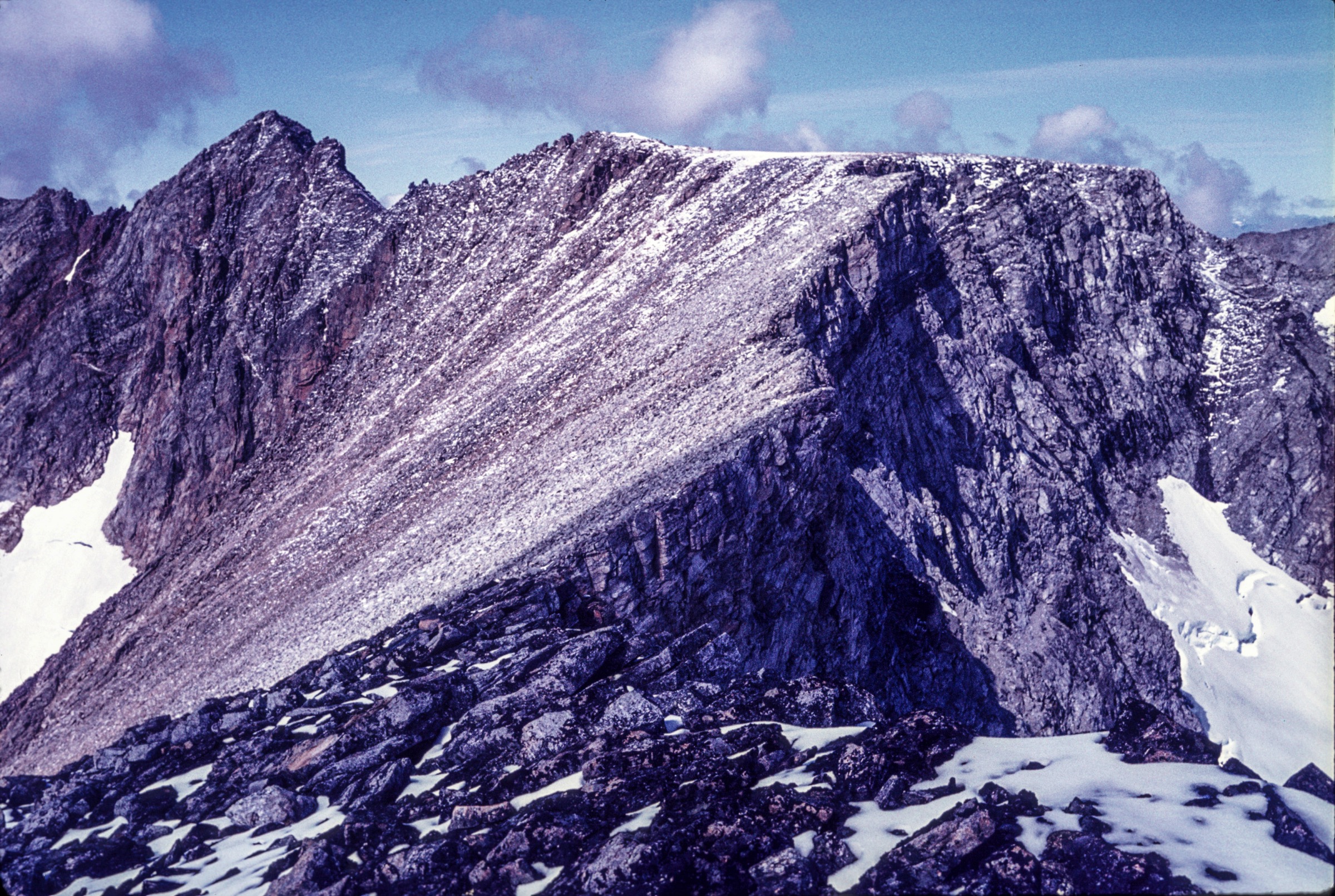
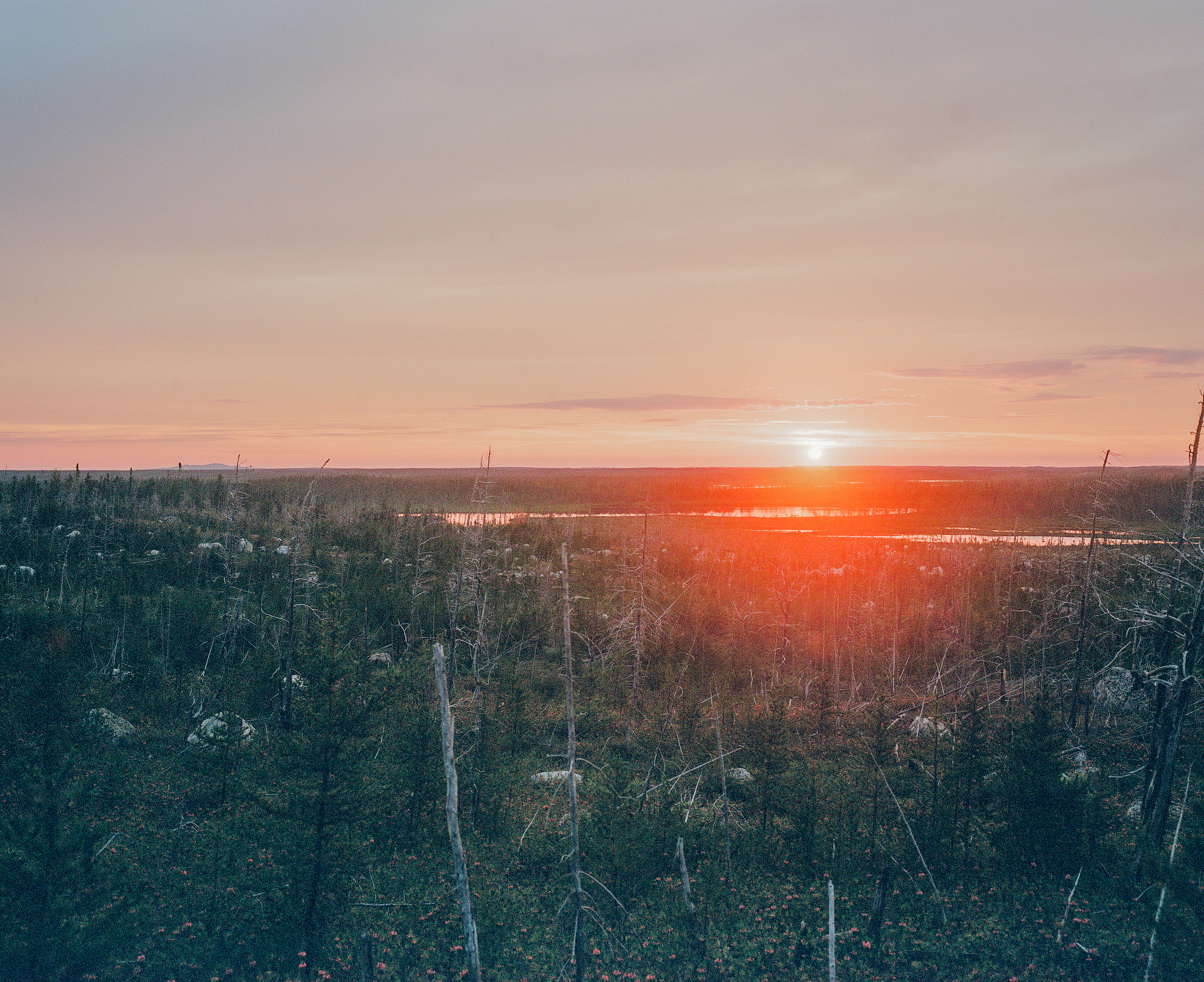
The Otish Mountains (Monts Otish; Cree/Innu Watshish, “little mountain”) form a remote quartzite massif near the geographic centre of Québec, lying roughly 250 km north of Chibougamau and 160 km north-east of Lake Mistassini at approximately 52°19′N, 70°27′W. The range is a tabular plateau averaging about 750 m, capped by rounded summits rising to Mont Yapeitso at 1,128 m (Toponymie Québec) — variously reported as 1,135 m on English Wikipedia and 1,144 m on PeakVisor. Yapeitso, whose name derives from the Naskapi yapeits (“male caribou”), is the highest point in central Québec north of the St Lawrence and the hydrographic hub of the province: the Eastmain, Témiscamie, Péribonka and aux Outardes rivers all rise here. The high country is exposed alpine tundra fringed by spruce-fir taïga in the valleys, with scattered woodland caribou.
The massif sits inside the new Parc national Nibiischii (12,175 km², gazetted 26 December 2024), the first Québec national park managed by a Cree First Nation — the Cree Nation of Mistissini — under a 2024-2034 agreement. Nibiischii (“land of waters”) subsumes the former Réserve faunique des Lacs-Albanel-Mistassini-et-Waconichi and the long-discussed Albanel-Témiscamie-Otish proposal. The park’s management plan rules out building any permanent hiking trail on the Otish summits because the alpine arctic flora is too fragile (Tourisme Autochtone Québec; SÉPAQ planning files). Infrastructure as of June 2026 is concentrated more than 200 km south of the Otish summit zone, at Lacs Albanel, Mistassini and Waconichi, where a new aerial boardwalk above Cliff Bay was inaugurated for summer 2026 by the Corporation Nibiischii.
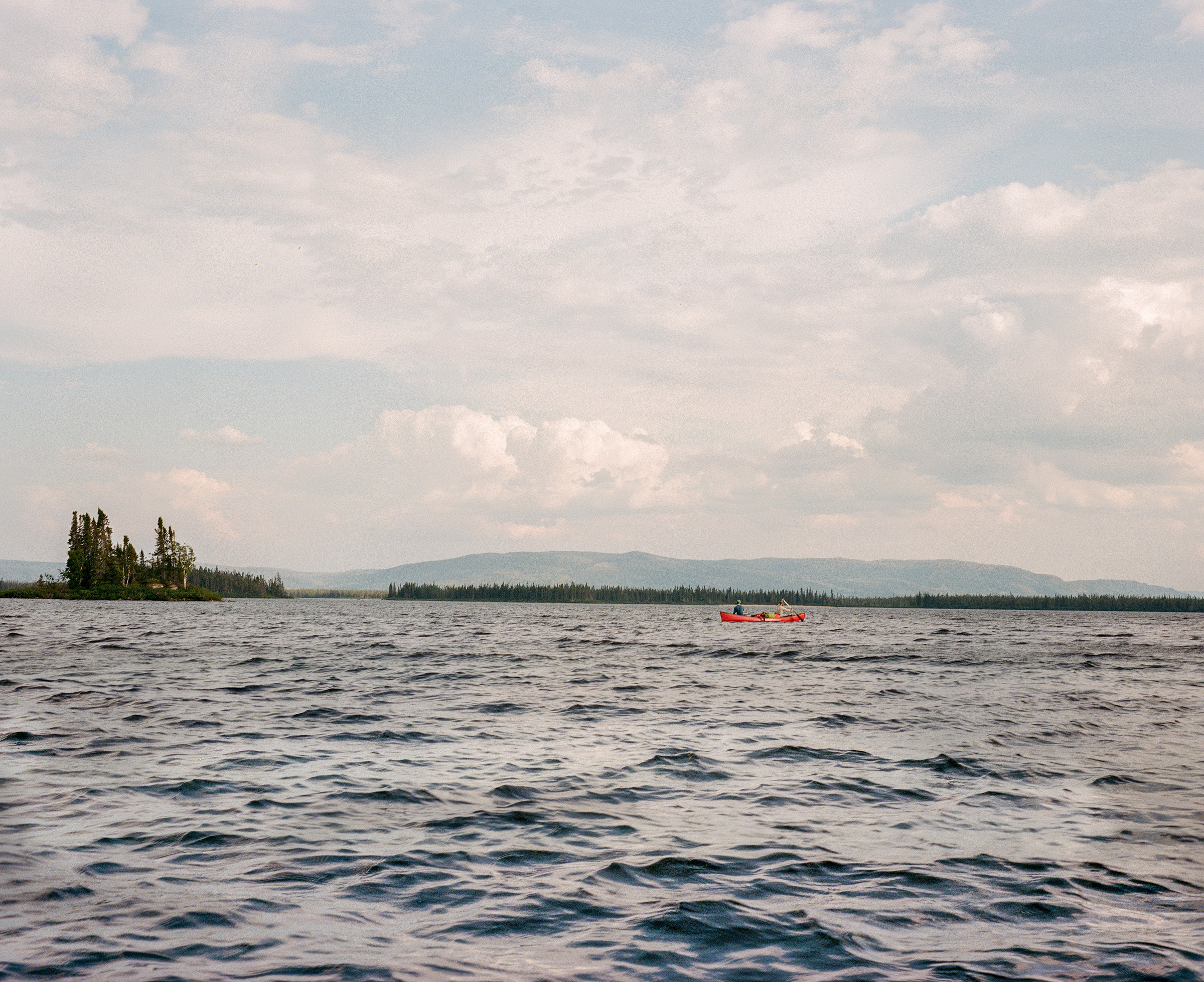
Access to the Otish proper is essentially fly-in only — float-planes from Mistissini or Chibougamau to suitable interior lakes (Lac Indicateur on the upper Témiscamie, Lac Témiscamie, Lac Naococane). The 240 km Route 167 extension (“Route des Monts Otish”), completed in 2014, runs up to the Renard diamond mine at the north-west edge of the range but is a private/industrial corridor without public hiking infrastructure. Any visit to the Otish involves Cree traditional territory (Eeyou Istchee) under active tallyman stewardship; protocol normally requires advance liaison with the Cree Nation of Mistissini, the Nibiischii Corporation, and the local tallymen before any independent travel. The typical season for walking on the plateau is mid-July to late August, when residual snow has cleared, days are long, and biting insects begin to ease.
There are no maintained, signposted hiking trails on the Otish summit plateau. The five entries below are therefore route concepts rather than trails: they reflect lines walked by Cree harvesters, surveyors, the 1949 Rousseau expedition, the 1980 Lycopode Group expedition, and modern fly-in canoe-and-walk parties. Distances, ascents and times are approximate and unsupported by any published topographic guidebook. Anyone attempting them needs full backcountry self-sufficiency: navigation by topographic map and GPS (NTS 1:50 000 sheets 23D, 23E, 23L), satellite communicator, bear-aware food storage, and a flexible weather-driven schedule.
Selection rationale
The Otish region has no curated trail list, so the five hikes below were selected to represent the range’s defining features within a fly-in / expedition context: the summit ascent of Mont Yapeitso — the iconic high point of central Québec; a representative high-plateau tundra walk — the characteristic terrain of the range; a canyon and lake-shore approach below the quartzite escarpment — the most dramatic relief in the massif; a culturally significant short walk to Waapushukamikw (Colline Blanche), the sacred Mistassini-quartzite quarry at the southern Témiscamie gateway to the Otish; and a high-lake ridge traverse from a typical fly-in camp on the upper Témiscamie. Every entry is labelled Candidate only because none has a verifiable, sourced route description, no GPX/KML is available from any reputable provider, and the protected-area regime is still being implemented by the Cree Nation of Mistissini and the Québec government.
Summary table
| # | Hike | Country | Route type | Distance | Gain | Max elevation | Difficulty |
|---|---|---|---|---|---|---|---|
| 1 | Mont Yapeitso summit (from fly-in basecamp) | Canada | Out-and-back | ~10-14 km | ~500-650 m | 1,128 m | Strenuous, off-trail |
| 2 | Otish plateau tundra traverse | Canada | Out-and-back / point-to-point | ~10-16 km | ~300-450 m | ~1,000 m | Off-trail, navigation-serious |
| 3 | Eastmain headwaters cliff-base walk | Canada | Out-and-back | ~8-12 km | ~200-400 m | ~900 m | Off-trail, exposed |
| 4 | Waapushukamikw / Colline Blanche cultural walk | Canada | Out-and-back | ~3-6 km | ~50-100 m | ~470 m | Easy (culturally protected) |
| 5 | Lac Indicateur ridge traverse | Canada | Point-to-point or loop | ~10-14 km | ~350-500 m | ~1,000 m | Off-trail |
1. Mont Yapeitso summit ascent
Snapshot
Itinerary
From a float-plane base on a lake at the south-east foot of the massif (Frank Bignell, late-19th-century assistant surveyor, reportedly climbed Yapeitso from this side, and the 1949 Jacques Rousseau party also approached the high point from a base camp in the same sector) the route leaves spruce-fir forest and climbs through krummholz to the gently rising tundra slopes of the south-east flank. Above roughly 900 m the cover becomes continuous alpine vegetation — lichen, dwarf birch, low ericads, and the rare disjunct Agoseris aurantiaca that Rousseau collected here. The summit dome is broad and stony, with views over Lake of the Ptarmigan to the north-east, the plateau lakes of the upper Témiscamie to the south, and the upper Eastmain valley west.
Return is by the ascent line. There is no cairned route and no trail; navigation by compass and GPS is essential, particularly in low cloud.
Why it is essential
Mont Yapeitso is the high point of the Otish Mountains and the highest summit in central Québec north of the St Lawrence. It is the only named peak in the range with any climbing record (Bignell, late 19th century; Rousseau, 1949) and is the obvious objective for any party reaching the massif. The ascent gives the most complete view available of the Otish plateau and its surrounding hydrographic divide.
Equipment
- Sturdy boots, trekking poles
- Full waterproofs, extra warm layer, hat and gloves even in midsummer
- Map and compass, GPS, satellite communicator
- Headtorch, food and water for a long day
- Bear-aware food storage in camp
- Insect protection (head net) effectively mandatory through mid-August
Hazards and notes
- Remote, roadless terrain: rescue depends on satellite communications and float-plane availability
- Weather sensitivity very high; low cloud, wind and cold rain are routine on the summit
- Off-trail navigation; map reading essential
- Black bears and lingering snow patches into early July
- Cree traditional territory: travel requires advance liaison with the Cree Nation of Mistissini, Nibiischii Corporation, and the relevant tallyman
- Parc national Nibiischii: management plan precludes any permanent trail being built; current permit/access rules for backcountry travel are still being finalised — confirm before departure
GPX / KML links
No public route file. OSM has no path tags on Mont Yapeitso. PeakVisor lists the summit (peakvisor.com/peak/mont-yapeitso.html) but offers no route geometry. Summit waypoint approximately 52.41°N, 70.45°W.
External links
- Wikipedia — Mount Yapeitso
- Wikipedia (fr) — Monts Otish
- Toponymie Québec — Monts Otish
- Corporation Nibiischii
2. Otish plateau tundra traverse
Snapshot
Itinerary
The Otish plateau is the dominant landscape feature of the range — a 750 m tabular surface of glacially scoured quartzite, peppered with lakes, broken by east-west oriented cuestas that present steep north-facing scarps, and clothed in continuous alpine tundra at and above ~900 m. A representative traverse from a typical plateau camp leaves the shoreline of a fly-in lake (an unnamed lake of the upper Eastmain or Témiscamie systems), climbs the gentle south slope of the nearest cuesta, gains the rim, and follows it east or west for several kilometres on open lichen-and-dwarf-birch ground. Cuestas typically drop in short cliffs to the north; the rim provides natural belvederes over a labyrinth of plateau lakes and the surrounding boreal taïga. Return is by descending a sloping flank back to the camp lake.
This is the kind of walking that the 1949 Rousseau party and the 1980 Lycopode Group expedition (after whose cloudberry harvest the nearby Mont du Chicouté, ~1,000 m, just north of the Otish proper, was named) did for plant collecting.
Why it is essential
The plateau, not the highest summit, is the defining landscape of the Otish. A traverse across the alpine tundra captures the range’s geology (Otish Group quartzite, dolomite and conglomerate), its biogeography (subarctic disjuncts including Agoseris aurantiaca), and its function as Québec’s hydrographic hub.
Equipment
- Sturdy boots and gaiters (boggy ground between rock pavements)
- Trekking poles
- Full waterproofs and warm layer
- Satellite communicator, GPS
- Head net and bear-aware food storage
Hazards and notes
- Fragile alpine arctic flora — the Nibiischii management framework cites flora fragility as the reason no summit trails will be built. Walk on rock pavements where possible and avoid concentrated trampling
- North-facing cuesta edges: short but real cliff exposure
- Navigation difficult in cloud on the flat plateau
- Tallyman / Cree liaison required
GPX / KML links
No public route file. OSM coverage of the Otish plateau is essentially limited to lake and river polygons; no paths or routes are tagged. Representative plateau waypoint approximately 52.30°N, 70.50°W.
External links
3. Eastmain headwaters cliff-base walk
Snapshot
Itinerary
The Eastmain River rises within the Otish massif and drains west to James Bay. Some of the lakes in the Otish are flanked by cliffs reaching roughly 650 m — these are the most dramatic relief features in the range and lie in the western and central plateau. A typical walk from an Eastmain-headwaters fly-in camp follows the shore north or south to the foot of a quartzite escarpment, then traces the scree foot beneath the cliff line. The going is mixed: bouldery scree at the wall foot, dry tundra on the plateau benches, and intermittent boggy ground in basins. Return is by the same line, or by climbing one of the easier gully-ramps to the rim and walking the plateau back to camp (turning the route into a small loop).
Why it is essential
The quartzite escarpments above the Eastmain headwaters are the closest the Otish come to a true mountain landscape and the visual signature of the range. They are the obvious counterpoint to the rounded summit dome of Yapeitso.
Equipment
- Mountain hiking equipment
- Helmet recommended for any party going close beneath the cliff line (natural rockfall)
- Trekking poles for scree
Hazards and notes
- Natural rockfall under the cliffs
- Off-trail navigation; no marked route
- Remote and weather-sensitive
- Cree tallyman liaison required
GPX / KML links
No public route file. Upper Eastmain headwaters approximately 52.35°N, 71.00°W.
External links
4. Waapushukamikw / Colline Blanche cultural walk
Snapshot
Itinerary
Waapushukamikw (Colline Blanche, “white hill”) is a quartzite outcrop on the Témiscamie River about 8 km north of the Lac Albanel campground. The hill is a roughly 40-50 m high, 400 m wide, 1,200 m long ridge of brilliant white Mistassini quartzite — the same lithic source that supplied Indigenous toolmakers across the Northeast for some 5,000 years. The walk leaves the river landing, crosses a short stretch of boreal forest, reaches the foot of the white outcrop, and follows the base around to the Antre de Marbre — a cave at the foot of the hill that is sacred to the Cree. The classified site covers about 1.5 km². The route is not a maintained trail but a short, low-elevation walk on already-trodden ground.
Why it is essential
This is the Otish region’s most important cultural site: a Cree sacred place, a National Historic Site of Canada (Waapushukamikw NHSC), and the geological source of Mistassini quartzite — itself the building block of the Otish Group rocks that make up the massif to the north. It is the only realistically accessible “essential” walk in the Otish region that does not require a float-plane charter.
Equipment
- Standard hiking equipment
- Insect protection
- Respect for the cultural site (no collection of stone, no entry of the cave without Cree guidance)
Hazards and notes
- Sacred site: the Antre de Marbre and the surrounding quarry are culturally protected. Visits are normally undertaken with a Cree guide (Nibiischii Corporation, Cree Nation of Mistissini). Independent unguided visits may not be appropriate; confirm protocol before going
- The site is classified under the Québec Loi sur le patrimoine culturel and is a National Historic Site of Canada
- Black bears in the area
- Boat access on Lac Albanel and the lower Témiscamie is weather-dependent
GPX / KML links
No public route file. Colline Blanche approximately 51.05°N, 72.85°W.
External links
- Parks Canada / Historic Places — Waapushukamikw NHSC
- Répertoire du patrimoine culturel du Québec — Sites archéologiques de la Colline-Blanche
- Corporation Nibiischii
5. Lac Indicateur ridge traverse
Snapshot
Itinerary
Lac Indicateur is a substantial elongated lake on the upper Témiscamie, traversed south to north by the river, at the south-eastern foot of the Otish high plateau. From a float-plane camp on a north-shore beach the route climbs west out of the boreal forest, gains the lower flanks of the plateau, and traces a north-trending ridge up to roughly 1,000 m. The line crosses lichen tundra and small alpine ponds; views open progressively over the cuesta-rim lakes to the west, the upper Témiscamie corridor to the south, and (in clear conditions) the Yapeitso cluster to the north-west. The descent rejoins the Témiscamie shore further north and follows the shoreline back to the camp.
Why it is essential
This is the closest the Otish region offers to a classic ridge-and-lake day hike. Lac Indicateur is well-known to fly-in fishing parties and provides a logistically realistic base for a one-day excursion onto the plateau without committing to a full Yapeitso ascent.
Equipment
- Mountain hiking equipment
- Satellite communicator, head net, gaiters
- Bear-aware food storage
Hazards and notes
- Off-trail and navigation-serious; no marked route
- Weather sensitivity; cloud on the plateau common
- Black bears, biting insects
- Cree tallyman liaison required
- Lac Indicateur is within the Parc national Nibiischii boundary as gazetted in December 2024; access rules being finalised
GPX / KML links
No public route file. Lac Indicateur approximately 51.95°N, 70.75°W.
External links
External links
- Corporation Nibiischii
- Tourisme Autochtone Québec — Parc national Nibiischii
- Cree Outfitting and Tourism Association
- Grand Council of the Crees / Cree Nation Government
- Wikipedia — Otish Mountains
- Wikipedia (fr) — Monts Otish
- Wikipedia — Mount Yapeitso
- Wikipedia (fr) — Parc national Nibiischii
- Toponymie Québec — Monts Otish
- Parks Canada / Historic Places — Waapushukamikw NHSC