Regional overview
The Annieopsquotch Mountains are a north-east trending ridge of bare, rock-ribbed barrens in the southwestern interior of insular Newfoundland, hemmed in to the north-west by Victoria Lake and to the south-east by Beothuk Lake (formerly known as Red Indian Lake’s southern lobe). The range rises out of the central Newfoundland highlands east of Bay St. George and reaches 687 m (2,254 ft) at its highest summit — modest in number, but a striking presence above the surrounding boreal forest and ponds. The name is Mi’kmaq for “terrible rocks”, a reference to the broken, knife-edged peridotite and gabbro that define the range and that record the closure of the Iapetus Ocean some 480 million years ago. The Annieopsquotch ophiolite belt is one of the most studied slices of Ordovician oceanic crust on Earth.
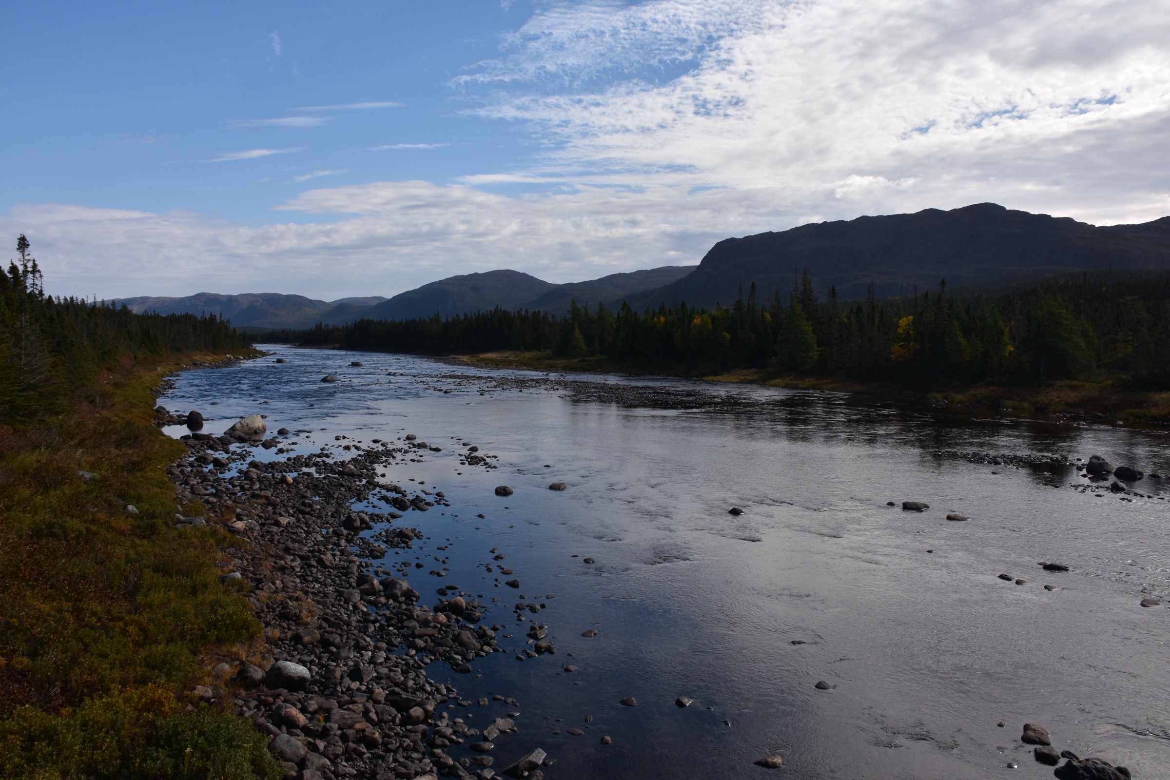
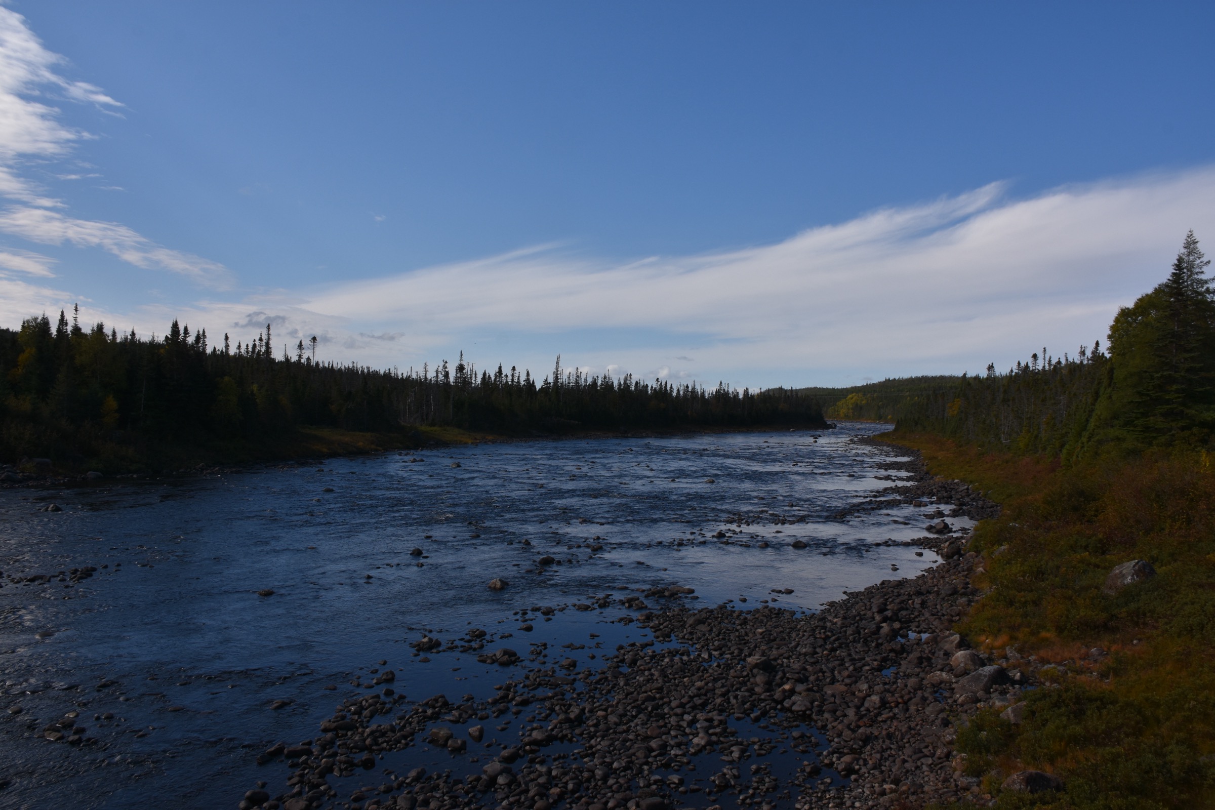
There is no formal trail infrastructure inside the range. The only road of any kind is Route 480 — the Burgeo Road, also known as the Caribou Trail — which leaves the Trans-Canada Highway at Stephenville Crossing and runs 148 km south through the highlands to the fishing town of Burgeo on the south coast. The trail head for the only documented hike on the range, the cairned route up Annieopsquotch Mountain, is a small gravel pit on the west side of Route 480 about 63 km south of the TCH and about 2 km past the Lloyds River bridge. The bridge itself, where the upper Lloyds River crosses Route 480, is the practical access point for all other walking on the range and for the King George IV Ecological Reserve, which protects the largest undisturbed river-delta system on insular Newfoundland 90 km north of Burgeo.
The walking character is open subarctic barrens above tree line and a low spruce-fir krummholz below. Lichen-covered peridotite slabs, frost-shattered scree, small tarns and tussocky bog dominate the upland. The lower slopes are dense black spruce and balsam fir on glacial till. The range is essential habitat for the Buchans woodland caribou herd — small groups are regularly seen on the open barrens along Route 480 — and supports moose, black bear, lynx and an active population of golden and bald eagles. Weather is the principal hazard: the highlands sit directly under Atlantic storm tracks, fog forms quickly above 400 m, and there is no shelter on the open ground. There is no cell coverage for tens of kilometres in any direction, no rescue infrastructure beyond the highway, and the nearest services are the truck stops at Stephenville Crossing and the village of Burgeo. The range is squarely off-grid country: parties must be entirely self-sufficient.
Selection rationale
These four hikes cover the realistic Annieopsquotch day-walking spectrum: the cairned Annieopsquotch Mountain route as the only documented established trail on the range, an exploratory walk on the open barrens immediately above the Lloyds River bridge as the simplest unguided introduction to the terrain, a foot-only approach into the King George IV Ecological Reserve as the canonical low-impact wilderness day-out, and an off-trail attempt on the 687 m range high point as the regional summit objective. Beyond Annieopsquotch Mountain itself, all routes are best treated as exploratory: there are no maintained trails, no signposted approaches and no published GPX tracks. A fifth canonical route does not exist in the open literature.
Summary table
| # | Hike | Country | Route type | Distance | Gain | Max elevation | Difficulty |
|---|---|---|---|---|---|---|---|
| 1 | Annieopsquotch Mountain (cairned route) | Canada | Out-and-back | ~7 km | ~250 m | ~510 m | Moderate |
| 2 | Lloyds River bridge barrens walk | Canada | Out-and-back | ~6-8 km | ~150-200 m | ~450 m | Moderate |
| 3 | King George IV Ecological Reserve approach | Canada | Out-and-back | ~16-20 km | ~150 m | ~330 m | Strenuous |
| 4 | Annieopsquotch range high point (687 m, off-trail) | Canada | Out-and-back | ~14-18 km | ~450 m | 687 m | Strenuous |
1. Annieopsquotch Mountain (cairned route)
Snapshot
Itinerary
From the gravel-pit pullout on the west side of Route 480 — roughly 63 km south of the Trans-Canada Highway and about 2 km past the Lloyds River bridge — the route starts by crossing the shallow ditch and entering open barrens. The first half-kilometre is gently undulating across clear, low-shrub country with a few small ponds and boggy patches. The trail is unsigned, but caribou paths beaten through the ground cover and small intermittent cairns mark the line up the west shoulder of Annieopsquotch Mountain. Elevation is gained rapidly in the final kilometre, the ground turning from tussock-bog to bare frost-shattered peridotite. The cairned high point of this western shoulder sits at roughly 510 m, with the true range high point lifting another 175 m to the north-east beyond a saddle (see Hike 4). The view opens north over Lloyds River to the King George IV Reserve, east into the heart of the range and south across the open Burgeo barrens. Most parties retrace the line of ascent. In settled summer weather the route is reportedly suitable for an average-fitness walker with basic map-reading skills.
Why it is essential
This is the only documented, navigationally straightforward route into the Annieopsquotch range. It gives a fit walker the quickest exposure to the open peridotite-and-tundra character of the range, the best chance of seeing caribou on the lower barrens, and a panoramic introduction to the geography that all the other day-hikes here depend on.
Equipment
- Waterproof boots — the lower barrens are wet even in summer.
- Wind shell and warm layer for the open summit shoulder.
- Topographic map (NTS 12A or Backroad Maps NFLD20) and compass; offline GPS strongly recommended.
- Two litres of water; the upper ground has no reliable source.
- Insect repellent in June and July.
Hazards and notes
- Fog and low cloud roll in fast over the upper barrens — turn back if the cairn line becomes invisible.
- No trail markers; route-finding is entirely on cairns and caribou paths.
- Black bear, moose and caribou range — make noise on the lower forest and bog sections.
- No cell coverage; leave a route and expected return time with someone off the range.
- The pullout is unsigned; pace the Lloyds River bridge as your distance reference.
GPX / KML links
| Source | URL | Format / access | Reuse status |
|---|---|---|---|
| Trailpeak — Annieopsquotch Mountain | trailpeak.com | Trail description with UTM trailhead | Trailpeak proprietary; reference only |
| Peakbagger — Annieopsquotch Mountains High Point | peakbagger.com | Peak metadata | Reference only |
External links
- Trailpeak — Annieopsquotch Mountain
- Wikipedia — Annieopsquotch Mountains
- Route 480 — The Caribou Trail
2. Lloyds River bridge barrens walk
Snapshot
Itinerary
This is an unprescribed off-trail walk for parties who want exposure to the Annieopsquotch barrens without committing to the longer Trailpeak route up Annieopsquotch Mountain. From a pullout near the Lloyds River bridge on Route 480, cross to the east side of the road and pick a line up the open western slope of the range on caribou paths. The terrain is gently rolling sub-alpine barrens — lichen, low Labrador tea, scattered tarns and exposed bedrock — and any open knoll above the road at around 400-450 m gives a long view over the Lloyds River, the ophiolite belt to the north-east and the King George IV Reserve in the distance. The walk has no fixed objective; it is a turn-around when the party has had enough, and it is an excellent place to see caribou on a clear day. Return by reversing the line, taking care to keep the road and the Lloyds River as ground-truth references.
Why it is essential
Most visitors to the Annieopsquotch country drive Route 480 without stopping, despite the open ground starting metres from the verge. This short, open-barrens day-walk is the lowest-commitment way to spend a day on the range, and is the canonical introduction for parties who would rather not commit to the steeper Hike 1.
Equipment
- Waterproof boots; the lower bog is consistently wet.
- Wind shell and warm layer.
- Compass and map; in fog the road and river are the only fixed references.
- Insect repellent in June and July.
- Bear spray is sometimes carried; black bear are present.
Hazards and notes
- No trail; navigation is entirely on the party.
- Sudden fog and low cloud over the barrens — keep the road within easy retreat range.
- Boggy ground hides deep wet pockets; test before committing weight.
- Hunting season runs in autumn — wear hi-vis or stay clear in October.
GPX / KML links
| Source | URL | Format / access | Reuse status |
|---|---|---|---|
| Backroad Maps — NFLD20 King George IV Lake topo | backroadmapbooks.com | Printed topographic map | Commercial; reference only |
| OpenStreetMap | openstreetmap.org | Vector map data | Open Database License |
External links
3. King George IV Ecological Reserve approach
Snapshot
Itinerary
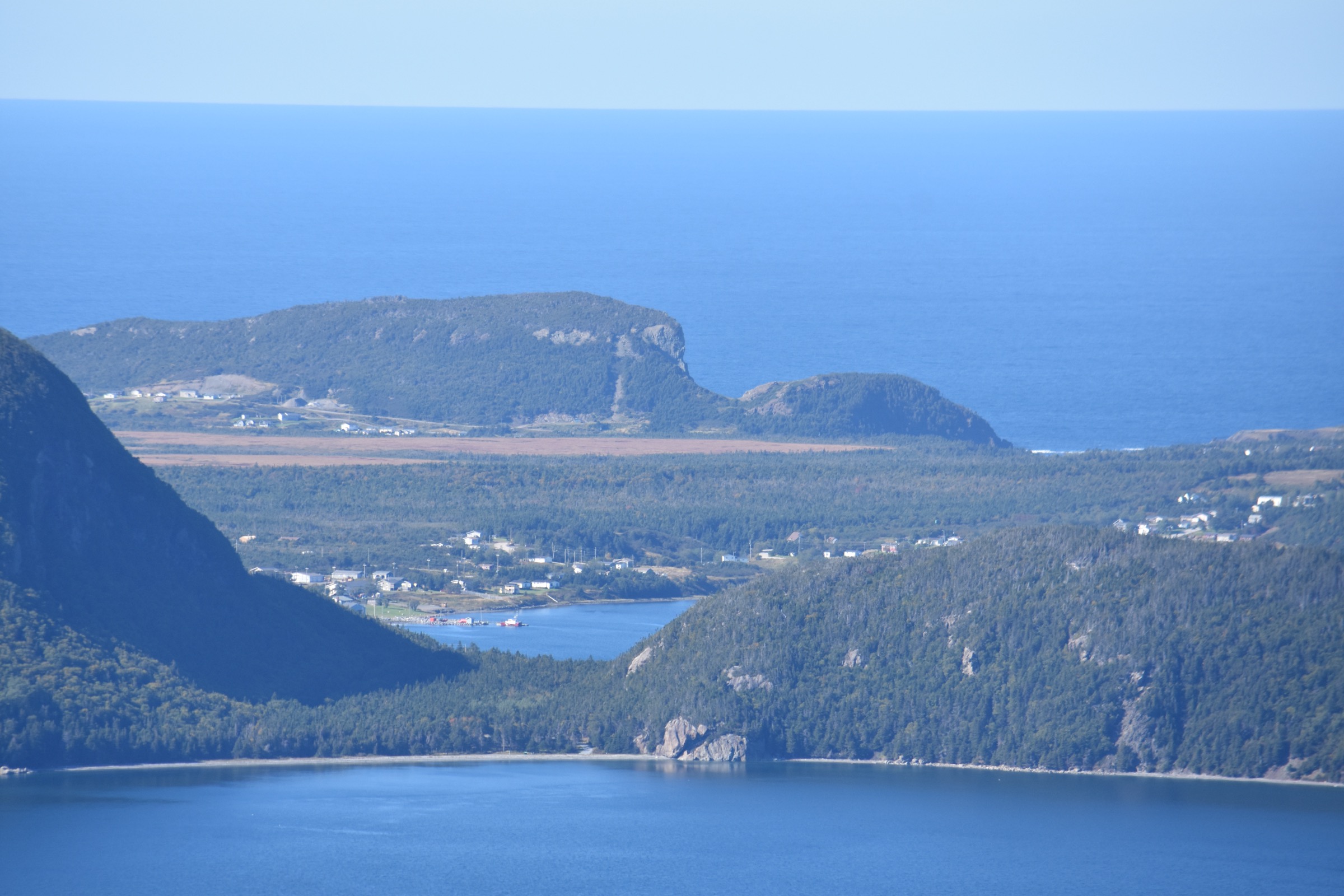
The King George IV Ecological Reserve protects the largest undisturbed river-delta system on insular Newfoundland — 18.4 km² of upper Lloyds River and an unnamed feeder stream entering the south-west corner of King George IV Lake — and is reachable only on foot or by canoe. No road runs into the reserve. The practical day-hike access leaves Route 480 at the Lloyds River bridge and follows an abandoned logging road that pushes north-east along the Lloyds corridor. The track is unmaintained and gradually deteriorates to a bush line, with frequent wet sections, blown-down trees and beaver-damned crossings. From roughly 8-10 km in, the river broadens and the delta becomes visible to the east through the spruce. The reserve boundary itself is unsigned on the ground — its position should be checked against a topographic map or OpenStreetMap. As a day-walk the most realistic objective is a viewpoint on the southern edge of the delta; further travel into the reserve is canoe country and is normally done as an overnight. No permit is required to visit the reserve, but the legal requirement is to leave no trace. Return the same way.
Why it is essential
This is the only day-walk in the Annieopsquotch country that brings the walker into a formally protected wilderness. The Lloyds River corridor is the most reliable place to see caribou on the range, and the delta is a key staging ground for migratory waterfowl in spring and autumn. It also gives the longest single-day exposure to the boreal forest character of the Annieopsquotch foothills, in contrast to the open barrens above.
Equipment
- Mountain hiking equipment: sturdy boots, full waterproofs, warm layer.
- Topographic map (NTS 12A/03, Backroad Maps NFLD20) and offline GPS — the reserve boundary is unsigned.
- Water purification (filter or tablets); the Lloyds River is the only reliable source.
- Bear-resistant food storage if pausing for any length of time.
- Insect repellent in summer; head net useful in June and July.
- Spare headtorch and a bivy / emergency shelter for a day this long.
Hazards and notes
- Logging-road condition varies year to year; a recent reconnaissance is helpful.
- No cell coverage; leave a route plan.
- Black bear and moose are routine; do not surprise either.
- The reserve is no-entry-permit but its rules are strict: leave no trace, no fires, no camping outside designated sites.
- Distances given assume the abandoned road is reasonably passable; if the track is heavily blown down it is easy to turn this into a 12-hour day.
GPX / KML links
| Source | URL | Format / access | Reuse status |
|---|---|---|---|
| Gov. NL — King George IV Ecological Reserve | gov.nl.ca | Reserve management page | Reference only |
| Wikipedia — King George IV Ecological Reserve | en.wikipedia.org | Reserve description | Reference only |
| OpenStreetMap | openstreetmap.org | Vector map data | Open Database License |
External links
- Gov. NL — King George IV Ecological Reserve
- Wikipedia — King George IV Ecological Reserve
- Newfoundland & Labrador — King George IV Ecological Reserve
4. Annieopsquotch range high point (687 m, off-trail)
Snapshot
Itinerary
The Annieopsquotch range high point — 687 m (2,254 ft) — sits on the crest of the range north-east of the Hike 1 cairned summit, and is most easily approached by extending the Hike 1 line. From the gravel-pit pullout on Route 480, climb the cairned shoulder to the ~510 m subsidiary summit (as Hike 1), then continue on the open ridge north-east, dropping into a shallow saddle at around 450 m before climbing the broad crest to the high point. The going is consistently on lichen-covered peridotite slabs and short tussock — there is no trail, no cairn line beyond the ~510 m shoulder, and no published GPX. Navigation is by compass on the ridge crest. The high point is a broad stony rise marked at most by a small cairn, with a view in clear weather that reaches across Beothuk Lake to the eastern Long Range and north to the Lloyds River valley and the King George IV Reserve. Return is by the same line; this is at the upper limit of what a strong party can manage in a single push, and many parties do the round trip with an open-ground bivy on the ridge.
Why it is essential
This is the regional high-point objective and the most ambitious legitimate day-hike on the range. It gives the most complete single-day exposure to the Annieopsquotch crest, and it is the canonical Peakbagger objective for the range.
Equipment
- Full mountain hiking equipment; trekking poles strongly recommended.
- Hard waterproofs and warm layer for the exposed crest.
- Compass, paper topographic map and offline GPS with downloaded contour data; navigation off the ~510 m shoulder is entirely off-trail.
- Three litres of water; no reliable source on the upper crest.
- Headtorch and emergency bivy shelter; this day is genuinely long.
- Personal locator beacon strongly recommended — there is no cell coverage and no rescue infrastructure on the range.
Hazards and notes
- The high point should only be attempted by experienced off-trail navigators in settled weather.
- Plateau fog and afternoon storms develop quickly and remove all reference points on the ridge.
- The total off-trail distance combined with no escape routes off the crest makes this a serious commitment — abandoning early is the right call if conditions deteriorate.
- Black bear and caribou range; moose are present on the lower forest.
- The Peakbagger metadata for the peak is the only published reference; treat the route notes here as a recommended line rather than a verified track.
GPX / KML links
| Source | URL | Format / access | Reuse status |
|---|---|---|---|
| Peakbagger — Annieopsquotch Mountains High Point | peakbagger.com | Peak metadata, summit coordinates | Reference only |
| Trailpeak — Annieopsquotch Mountain | trailpeak.com | Trail head and approach description | Trailpeak proprietary; reference only |
External links
Missing data / follow-up work
- The Annieopsquotch range has no maintained trails beyond the cairned Hike 1 route; all other day-hikes here are exploratory and rely on map, compass and judgement.
- No openly published GPX or KML tracks exist for any of these routes. Trailpeak holds the only narrative description for Hike 1; Peakbagger holds the metadata for Hike 4.
- Hike 4’s day-hike status is at the upper end — many parties take the range high point as an overnight trip with an open-ground bivy on the ridge.
- The King George IV Ecological Reserve (Hike 3) is reachable on foot but the abandoned logging road’s condition varies year to year; recent visitor reports through the IATNL or local tourism associations are helpful.
- The IATNL thru-hiker route does not currently pass through the Annieopsquotch Mountains; the range sits south of the IATNL Long Range corridor.
- No licence-compatible image was located for the Hike 1 cairned summit shoulder or for the Hike 4 range high point; those entries have no figure.
- The Burgeo Road (Route 480) is the only road access for tens of kilometres in any direction; confirm fuel and roadside services at Stephenville Crossing or Burgeo before driving.
External links
| Source | URL |
|---|---|
| Wikipedia — Annieopsquotch Mountains | en.wikipedia.org |
| Trailpeak — Annieopsquotch Mountain | trailpeak.com |
| Peakbagger — Annieopsquotch Mountains High Point | peakbagger.com |
| Gov. NL — King George IV Ecological Reserve | gov.nl.ca |
| Wikipedia — King George IV Ecological Reserve | en.wikipedia.org |
| Newfoundland & Labrador — The Caribou Trail (Route 480) | newfoundlandlabrador.com |
| Route 480 — The Caribou Trail community guide | route480.com |
| IATNL (International Appalachian Trail NL) | iatnl.org |
| Backroad Maps — NFLD20 King George IV Lake topo | backroadmapbooks.com |
| OpenStreetMap | openstreetmap.org |