Regional overview
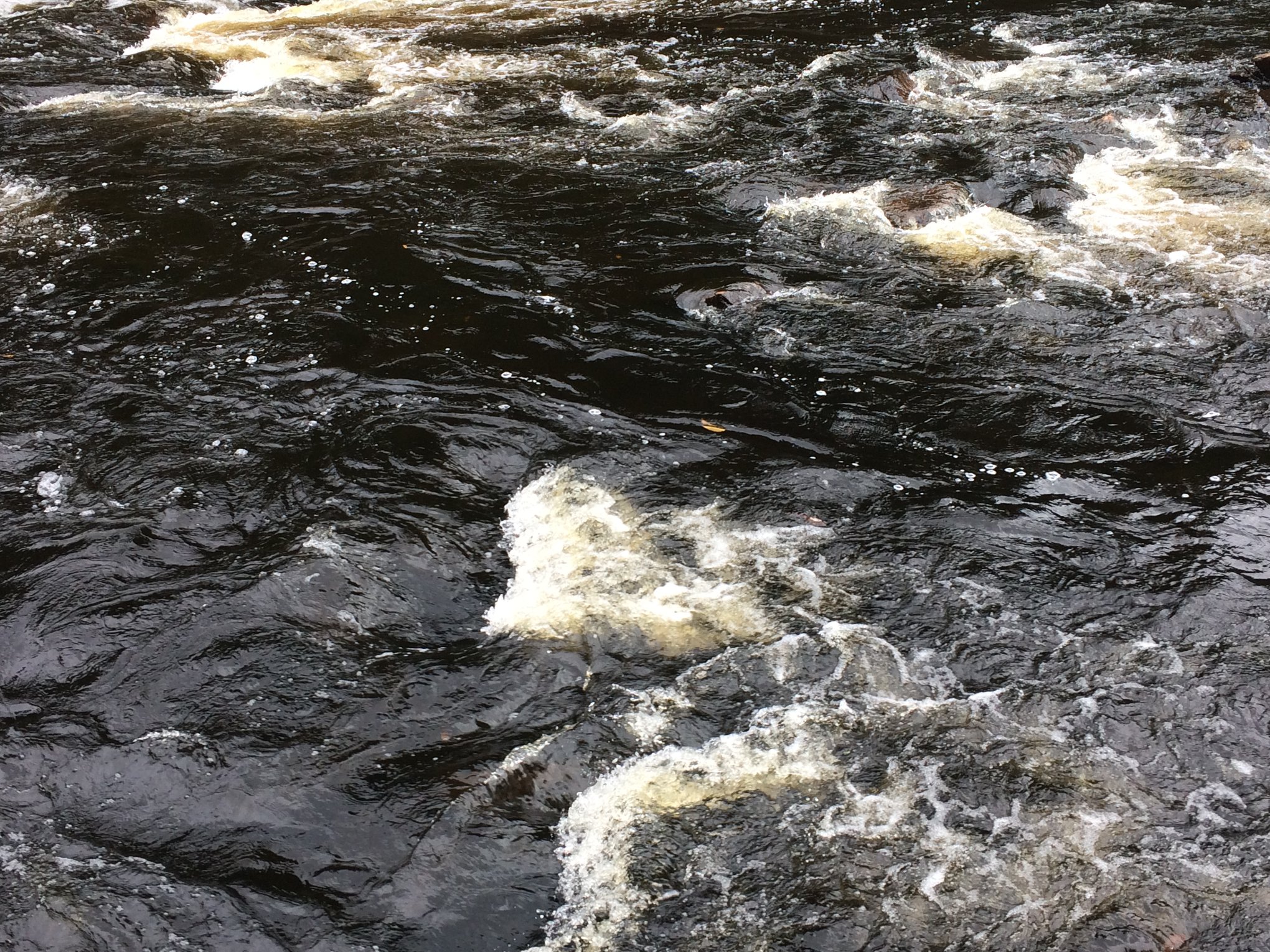
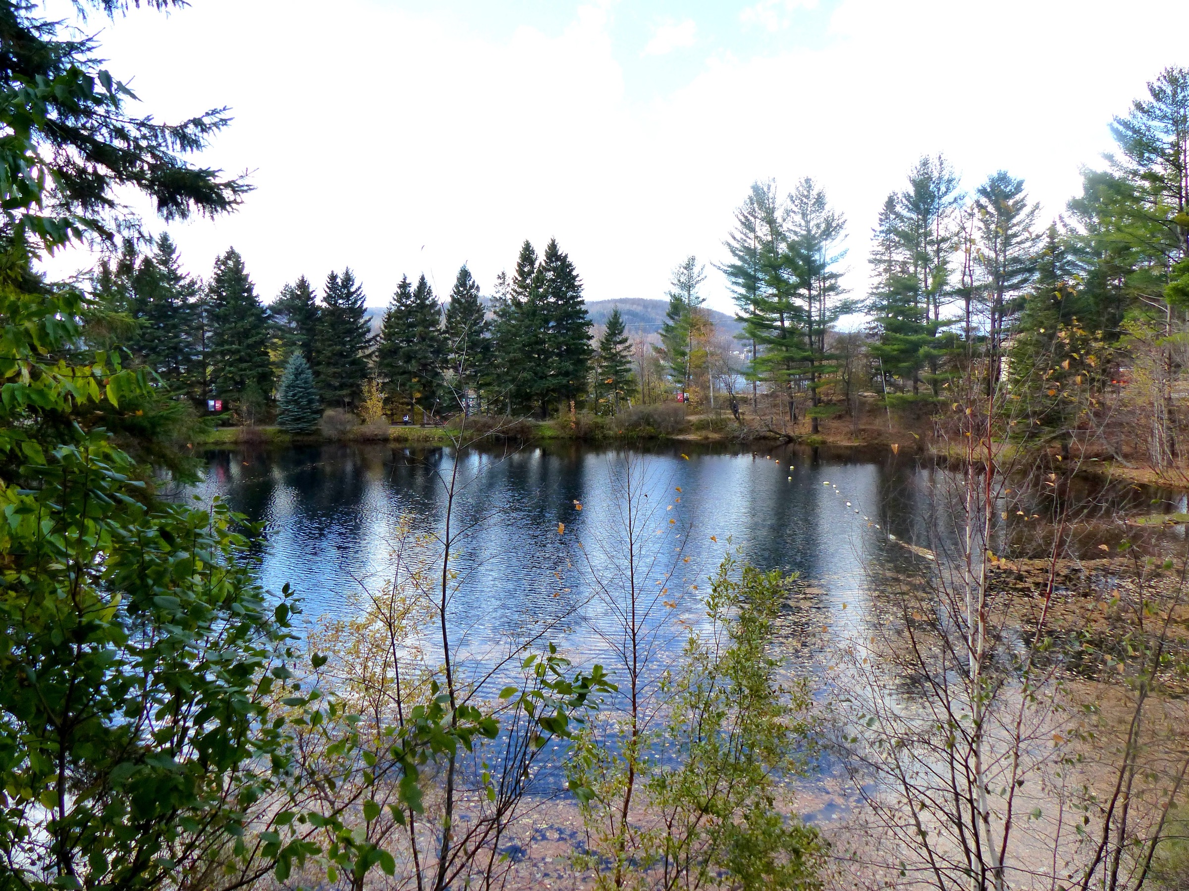
The Laurentides — Laurentian Highlands or Laurentian Mountains — form the south-eastern margin of the Canadian Shield, north of the St Lawrence Lowlands and the Ottawa–Outaouais valley. They are an old, deeply eroded Precambrian range of gneiss and granite rather than a young alpine chain. Summits are rounded, slopes are heavily forested with maple, yellow birch, hemlock, balsam fir and white spruce, and alpine terrain in the European sense is essentially absent. Within the Laurentides administrative region of Québec, elevations peak at Pic Johannsen on the Mont Tremblant massif (932 m), with Mont Sir-Wilfrid / Montagne du Diable (783 m) and Mont Kaaikop (838 m) as the principal secondary summits. The landscape is characterised by long lakes in glacial troughs (Monroe, Provost, Supérieur, Tremblant, Baskatong), short cliff-edged ridges (la Roche, la Corniche, Paroi de l’Aube), rivers cutting into bedrock (Rivière du Diable, Rivière Pimbina) and a dense network of resort, ski-touring and snowshoe infrastructure layered on top of the summer trail system.
The principal hiking centres are Parc national du Mont-Tremblant — the oldest national park in Québec, created in 1895 and now covering 1,510 km², managed by SEPAQ — the resort sector at Station Mont Tremblant, and the regional parks of Montagne du Diable (Ferme-Neuve, Hautes-Laurentides) and Poisson Blanc (Notre-Dame-du-Laus). Smaller volunteer-managed networks at Mont Kaaikop (Coopérative L’Interval, Sainte-Lucie-des-Laurentides), Mont Sourire (Saint-Donat) and the Sentiers Accès-nature Laurentides fill in the lower elevations. Trails are signed in French; SEPAQ park access requires a paid daily permit.
The reliable hiking season runs from mid-May at low elevations and late May to early June on the Mont-Tremblant and Diable summits through to mid-October, with the September to early October “couleurs” foliage period the busiest window of the year. Snow and ice can linger into May on north-facing aspects above 700 m and return in October. Black bears are present throughout the range; moose are common in Parc national du Mont-Tremblant and on the Diable plateau. Dogs are not permitted on hiking trails within Parc national du Mont-Tremblant or on most SEPAQ sites; rules vary in the regional parks. Cell coverage is patchy off the main valleys, and many backcountry trailheads sit at the end of gravel access roads.
Special safety issues are limited compared with the western Canadian ranges. There is no glaciated terrain, no required scrambling on the established hiking objectives, and most navigation is straightforward on signed trails. The principal risks are summer thunderstorms on exposed summits — notably the Sommet de Mont Tremblant and the four-summit ridge at Montagne du Diable — tick-borne disease in the lower forest from late spring, and biting insects (mosquitoes and black flies) from late May through early July.
Selection rationale
The five hikes were chosen to span the most important landscape signatures of the Laurentides as a day-hiking region and to spread geographically from the southern Saint-Donat front north to Ferme-Neuve. They cover a signature lake-and-cliff loop in the most-visited sector of Parc national du Mont-Tremblant (La Roche, La Coulée et La Corniche); a long forest-to-summit route to the highest peak in the Laurentian Mountains (Pic Johannsen / Le Toit-des-Laurentides); a strenuous, rocky climb to the most famous summit in the range from the resort base (Sommet du Mont Tremblant via Le Grand Brûlé and Les Caps); the long four-summit ridge of the second-tallest mountain in the Laurentides region (Boucle des Sommets, Montagne du Diable / Mont Sir-Wilfrid); and a compact volunteer-managed summit panorama on the southern Laurentides front (Mont Kaaikop). Between them they cover summit, cliff-edge viewpoint, lake basin, river-cut valley and northern reservoir landscapes without duplicating any one character.
Several other widely listed routes were considered and set aside. The Chute du Diable and Chutes Croches waterfall walks in the La Diable sector are short — under 2 km return — and function as add-ons rather than essential day-hikes. The Centenary Loop / Sentier du Centenaire is a strong alternative to La Roche and could be substituted in a longer catalogue. The Wild Cherry – Katimavik – Summit loop at Parc régional du Poisson Blanc is scenic, but the park’s character is dominated by reservoir paddling and island camping rather than hiking, and access requires a longer drive from the Mont-Tremblant corridor. Mont Sourire is a popular short hike (~2 km) in Saint-Donat but is too short to anchor an essential entry.
Summary
| # | Hike | Country | Route type | Distance | Gain | Max elevation | Difficulty |
|---|---|---|---|---|---|---|---|
| 1 | La Roche, La Coulée et La Corniche Loop | Canada | Loop | ~8.2–8.7 km | ~370 m | ~575 m | Moderate |
| 2 | Le Toit-des-Laurentides / Pic Johannsen | Canada | Out-and-back | ~14–16 km | ~580–720 m | ~932 m | Strenuous |
| 3 | Sommet du Mont Tremblant via Le Grand Brûlé and Les Caps | Canada | Loop | ~5.6–7 km | ~640 m | ~875 m | Strenuous |
| 4 | Boucle des Sommets — Montagne du Diable | Canada | Loop | ~17–21 km | ~700–800 m | ~783 m | Strenuous |
| 5 | Mont Kaaikop | Canada | Loop | ~6.5–9.8 km | ~340–450 m | ~838 m | Moderate–strenuous |
1. La Roche, La Coulée et La Corniche Loop
Snapshot
Itinerary
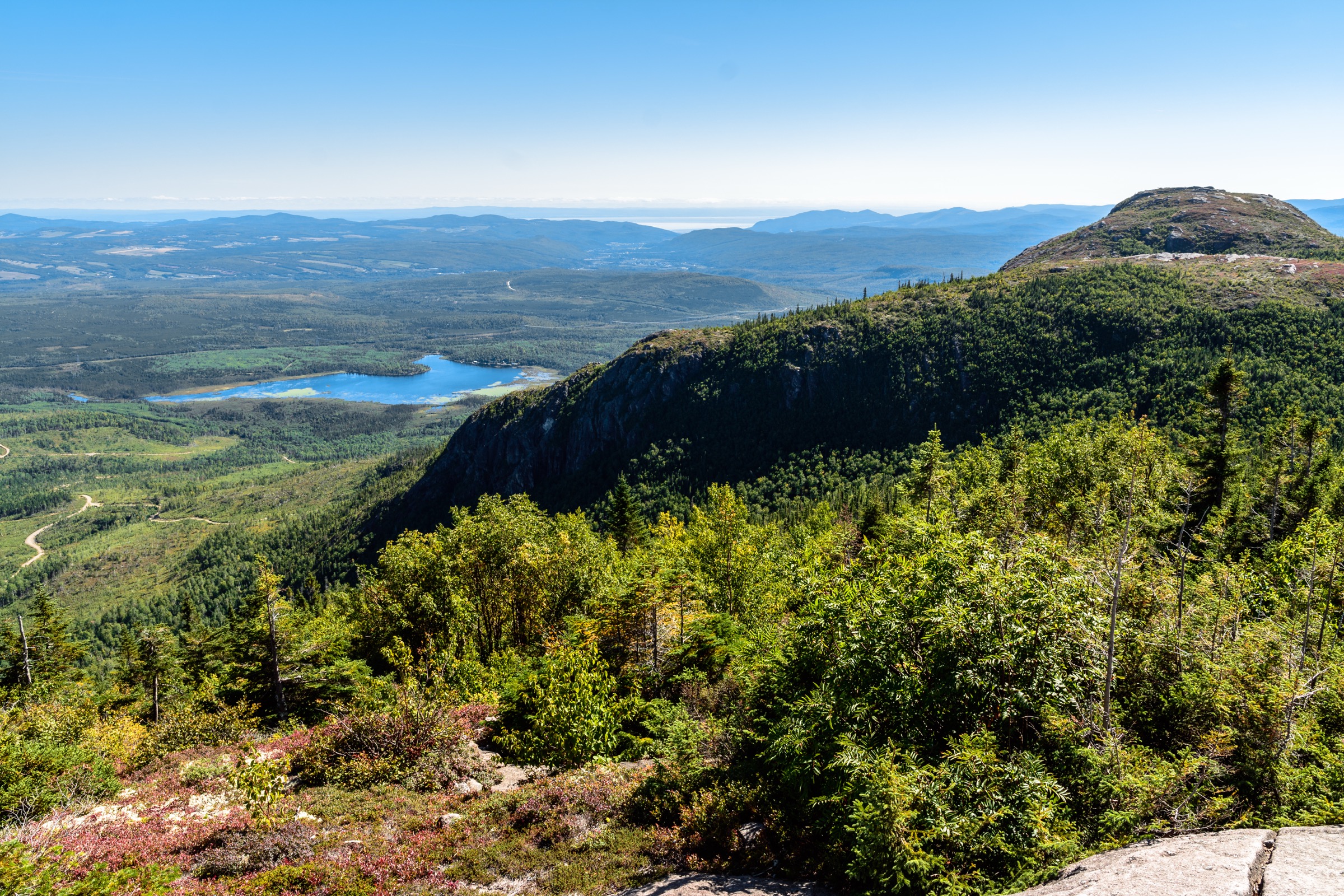
From the shared La Roche / La Corniche parking area in the La Diable sector, the loop is most commonly walked anti-clockwise, starting up La Corniche. The path climbs steadily on a wide, well-graded surface through mixed deciduous-conifer forest, gaining the cliff-top of La Corniche in approximately 1.5 km. The viewpoint sits directly above the broad glacial valley of the Rivière du Diable and Lac Monroe, with the Mont Tremblant massif on the western horizon. From La Corniche the trail descends briefly, then turns onto La Coulée — a narrower, root-and-rock singletrack link that crosses small streams and gains modest elevation through the forest before joining the La Roche trail. A short climb on La Roche leads to a second, slightly higher rock outcrop with a different angle across the lake basin and a clearer line of sight north along the Diable valley. The descent on La Roche follows a wide switchbacked path back down to the trailhead.
Why it is essential
The loop is the most widely walked summit-class route in Parc national du Mont-Tremblant and the standard introduction to the park’s signature combination of glacial lakes, river-cut valleys and cliff-edged Shield ridges. It is the highest-rated trail in the park on the major databases (AllTrails community rating 4.6 from more than 2,000 reviews) and is consistently recommended by SEPAQ, Tourisme Mont-Tremblant and Québec hiking publications as the defining short hike in the La Diable sector.
Equipment
- Standard hiking equipment: hiking shoes or boots, weatherproof layer, warm layer, water, food, sun protection, map
- Insect repellent — mosquitoes and black flies are heavy in June and early July
- Tick protection in spring and early summer
- Trekking poles useful on the descent
- Microspikes only if attempting the loop in shoulder season with icy belvederes
Hazards and notes
- The cliff edges at La Corniche and La Roche are unfenced; stay back from the rim in wet or icy conditions.
- The trail is busy on summer weekends and foliage weekends; midweek visits are noticeably quieter.
- Dogs are not permitted on hiking trails in Parc national du Mont-Tremblant.
- A SEPAQ daily access fee is required; the La Diable sector uses the standard Mont-Tremblant park permit.
- Black bear habitat; carry food in a sealed pack and pack out all food waste.
- Camping is permitted only at designated SEPAQ sites and requires advance reservation.
Routes and maps
| Source | URL |
|---|---|
| SEPAQ — Mont-Tremblant trail table | sepaq.com |
| SEPAQ — Mont-Tremblant visitor guide (PDF) | sepaq.com |
| AllTrails — Roche, Coulée and Corniche Loop | alltrails.com |
| OpenStreetMap — La Roche / La Corniche area | openstreetmap.org |
External links
- SEPAQ — Parc national du Mont-Tremblant, randonnée pédestre
- Versant plein air — Boucle La Roche, La Coulée et La Corniche
- Adventure Report — La Coulée (La Roche et La Corniche)
- Wikipedia — Mont-Tremblant National Park
2. Le Toit-des-Laurentides / Pic Johannsen
Snapshot
Itinerary
From the Le Centenaire trailhead in the La Diable sector, the route follows the Toit-des-Laurentides sentier — literally “Roof of the Laurentides” — for approximately 7 km to the summit of Pic Johannsen. The first kilometre is gentle, traversing mixed forest near the Rivière du Diable, before the trail joins the Centenaire loop and begins to climb. After the loop junction the Toit-des-Laurentides path turns steadily uphill, gaining most of its 580–720 m of elevation over a sustained 5–6 km on a rugged singletrack of bedrock, exposed roots and persistent mud sections. The forest transitions from maple-beech-yellow birch through to balsam fir and spruce as elevation increases. The summit area is broad and largely treed; a small clearing holds a commemorative plaque marking the 100th anniversary of the Québec national parks system, with views opening north and east across the Diable valley toward Pic Pangman, The Edge and Pic White (the Mont Tremblant Resort summit). A signed extension reaches Pic Pangman and the ridge connecting to the resort summit. Most parties return by the same route; combining the descent with the Le Centenaire loop is a popular option that adds 2–3 km but avoids retracing the lower trail.
Why it is essential
Pic Johannsen is the highest summit in the Laurentian Mountains at 932 m and the geographic high point of the Mont Tremblant massif. The Toit-des-Laurentides trail is the only non-resort hiking route to this summit, and reaching it from the SEPAQ side is the defining high-point objective of the region. The peak is named for Herman “Jackrabbit” Smith-Johannsen, the Norwegian-Canadian cross-country ski pioneer who opened many of the Laurentian ski trails in the early twentieth century and remains a major cultural figure in the region’s outdoor history.
Equipment
- Mountain hiking equipment: sturdy boots with good ankle support, trekking poles strongly recommended, weatherproof and warm layers
- 2–3 L water — reliable sources on the upper trail are limited in midsummer
- Map and GPS; the trail is signed but the upper sections cross interconnected ridges
- Insect repellent — heavy mosquitoes and black flies through early July
- Sun protection
- Headtorch for late-season starts; daylight drops quickly at 932 m in October
Hazards and notes
- Long sustained climb on rough tread; descent is hard on the knees.
- Spring mud is persistent and the trail can be wet into late June.
- Black bear and moose habitat; make noise, especially in early morning and at dusk.
- Dogs are not permitted in Parc national du Mont-Tremblant.
- A SEPAQ daily access permit is required.
- Cell coverage is intermittent in the La Diable sector.
- Early-season snow patches can linger on the upper trail and slow progress.
Routes and maps
| Source | URL |
|---|---|
| Trailforks — Le Toit-des-Laurentides | trailforks.com |
| Trailforks — Le Centenaire | trailforks.com |
| AllTrails — Pic Johannsen via Toit des Laurentides | alltrails.com |
| OpenStreetMap — La Diable sector | openstreetmap.org |
External links
- PeakVisor — Pic Johannsen
- Adventure Report — Toit-des-Laurentides
- Au-delà du paysage — Hiking Pic Johannsen via the Toit-des-Laurentides Trail
- Au-delà du paysage — Following the Centenary Loop
3. Sommet du Mont Tremblant via Le Grand Brûlé and Les Caps
Snapshot
Itinerary
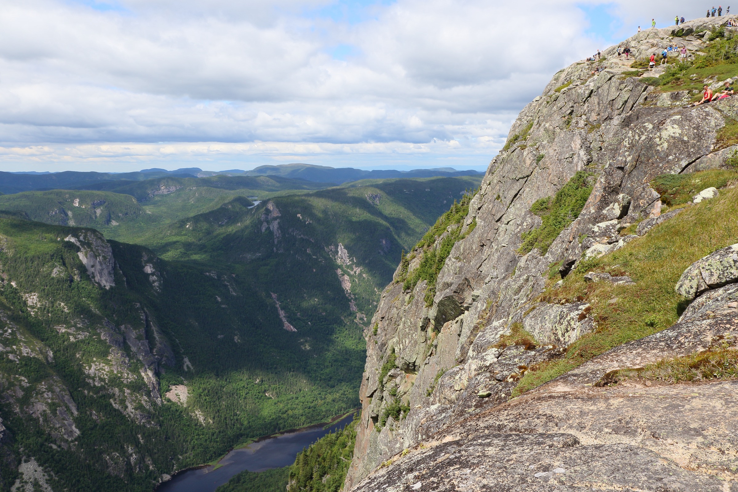
From the foot of the Tremblant gondola at the pedestrian village base, the Le Grand Brûlé trail (trail C in the Tremblant trail system) climbs the south face of the mountain through mixed forest. The lower kilometres follow a rock- and root-laced path past several short waterfalls, with frequent crossings of active downhill ski runs. The grade is unrelenting from the start, gaining most of the ~640 m of elevation over approximately 3 km. The forest thins as the trail crosses exposed granite outcrops and open ski-run cuts near the upper mountain; signage marks the junction with Les Caps for the descent option. The route emerges at the Sommet des Laurentides — the resort summit with the Le Grand Manitou observation building, a panoramic deck, a seasonal food kiosk and views east over Lac Tremblant and west across the Diable valley toward Pic Johannsen. The standard descent follows Les Caps (trail D) back to the village; alternatively, walkers may descend by the Tremblant gondola or the Cabriolet during their operating seasons (lift schedules should be verified in advance).
Why it is essential
Mont Tremblant is the most internationally recognised mountain in eastern Canada, the namesake of the entire massif and ski resort, and the focal summit of the Laurentides region. The Grand Brûlé / Les Caps loop is the only marked walking route to the resort summit and combines a genuinely strenuous Shield climb with the cultural centre of the regional hiking scene. The Algonquin Weskarini name for the mountain — Manitonga Soutana, loosely “trembling mountain” or “mountain of spirits” — is the source of both the French place name and the deepest layer of the region’s hiking identity.
Equipment
- Sturdy boots with good edging; the rock is polished by foot traffic and slick when wet
- Trekking poles strongly recommended for the descent
- Weatherproof and warm layers; the summit is significantly cooler and more exposed than the village
- 2 L water
- Sun protection on exposed ski-run sections
- Light pack; the summit has food service in operating season but is not always staffed
- Optional: lift ticket for one-way descent on the gondola, available at the village base in the operating season
Hazards and notes
- The lower trail crosses several active ski runs and service roads; in early or late season some routings are altered for maintenance work.
- The Grand Brûlé is one of the most physically demanding marked trails on the resort and is rated black diamond by Tremblant.ca.
- Rocky tread is slick when wet; afternoon thunderstorms can produce rapid surface runoff.
- Lift schedules for the gondola and Cabriolet vary by season and weather; do not commit to a lift-assisted descent without confirming current operating hours.
- Dogs are not permitted on the Grand Brûlé / Les Caps trails during the summer hiking season.
- Resort-managed trail; no SEPAQ permit required, but parking at the village is paid.
Routes and maps
| Source | URL |
|---|---|
| Tremblant.ca — Hiking trails (trail C, trail D) | tremblant.ca |
| AllTrails — Sommet du Mont Tremblant via Le Grand Brûlé and Les Caps | alltrails.com |
| Hiking Project — Grand Brûlé Trail | hikingproject.com |
| OpenStreetMap — Mont Tremblant Resort area | openstreetmap.org |
External links
- Adventure Report — The Grand-Brûlé Trail at Mont Tremblant Village
- Tremblant Living — The Ultimate Mont-Tremblant Hiking Guide
- Wikipedia — Mont Tremblant Resort
- Wikipedia — Mont Tremblant
4. Boucle des Sommets — Montagne du Diable (Mont Sir-Wilfrid)
Snapshot
Itinerary
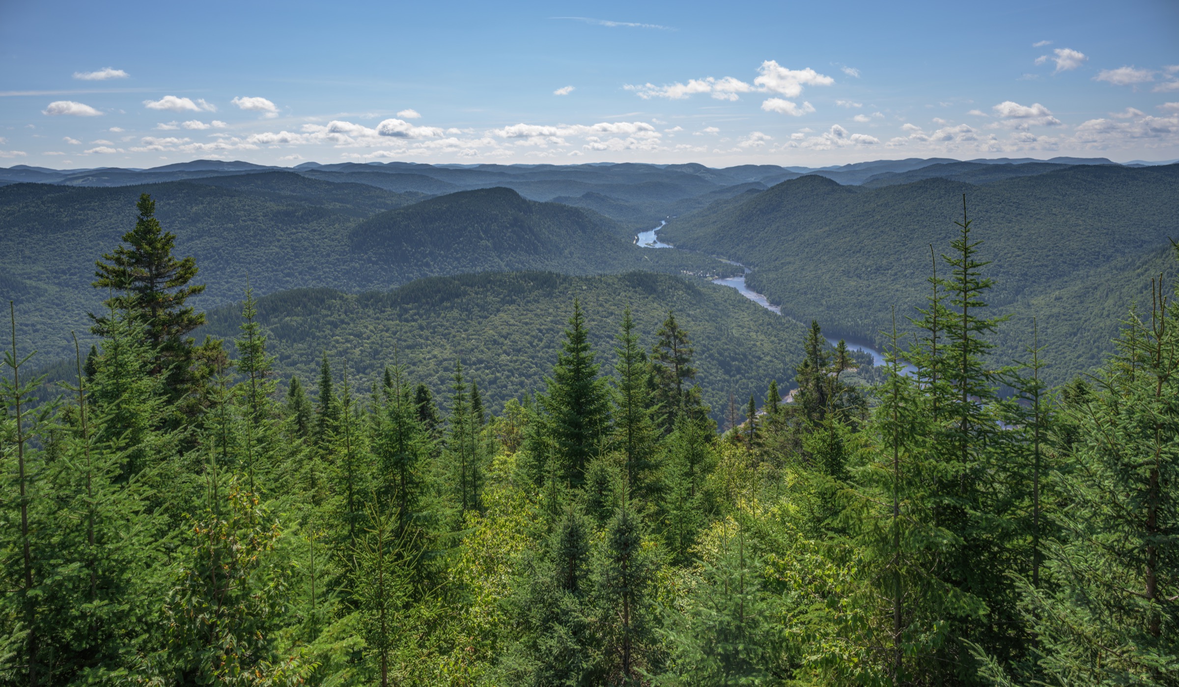
From the Village des Bâtisseurs reception on the shore of Lac de la Montagne, the route follows the Sentier des Sommets uphill on a graded singletrack. The first 4–5 km climb steadily through mature mixed forest to gain the summit ridge at the western end of the massif, with the first major viewpoint at Paroi de l’Aube (740 m). The path then traces the ridge eastward, with frequent small descents and re-ascents linking the summits of Garde-Feu (756 m), Belzébuth (749 m) and finally Sommet du Diable / Mont Sir-Wilfrid (783 m), the second-highest peak in the Laurentides administrative region. The viewpoints look west and south over the Baskatong reservoir and Windigo Bay; on clear days the Lièvre river valley is visible to the east. The standard Boucle des Sommets descends from the eastern summits back to Lac de la Montagne for a 17 km return. The full 21.2 km four-summit traverse adds the eastward continuation toward the Belvédère and the Lac Windigo trails before looping back; this longer variant is the standard listing on regional hiking sites.
Why it is essential
Montagne du Diable (Mont Sir-Wilfrid) is the second-tallest summit of the Laurentides region and the centrepiece of the Hautes-Laurentides hiking network. The Boucle des Sommets traverses all four named summits in a single long loop, providing the longest sustained ridge walk in the region and the only multi-summit traverse achievable as a day-hike in the Laurentides. The mountain’s cultural history — its Windigo / Devil naming from Algonquin mythology, the political naming as Mont Sir-Wilfrid for former Prime Minister Wilfrid Laurier — gives the route both landscape and historical weight. The park is widely recognised by Rando Québec, Québec Plein Air and Tourisme Hautes-Laurentides as the signature long day-hike of the northern Laurentides.
Equipment
- Mountain hiking equipment: sturdy boots, trekking poles, weatherproof and warm layers
- 3 L water, energy food for a full day
- Headtorch — the full 21 km traverse can run late; the park has summit camping if needed
- Map and GPS; the park provides an Ondago digital trail map (Parc Montagne du Diable Randonnée et raquette)
- Insect repellent in June and early July
- Bear-aware food storage
- Optional: hut reservation through the park (Refuge Sud or Camping des Sommets) for parties splitting across two days
Hazards and notes
- Long cumulative day; many parties underestimate the effort and finish in the dark.
- Multiple short, steep rock steps on the ridge; not technical but slippery when wet.
- Afternoon thunderstorms can be exposed on the summit ridge.
- Black bear habitat; moose are present in the surrounding lowlands.
- Dogs are permitted on the park’s hiking trails on leash; current park rules should be verified.
- A park access fee is required; the park is open year-round but the Sommets loop is hiked in summer and autumn.
- The Sentier des Sommets continues 31.8 km to Windigo Bay; do not confuse the day-hike loop with the longer point-to-point traverse.
Routes and maps
| Source | URL |
|---|---|
| Parc Montagne du Diable — Trail maps | parcmontagnedudiable.com |
| Ondago — Parc Montagne du Diable Randonnée et raquette | igloocreations.com |
| AllTrails — Montagne du Diable Regional Park | alltrails.com |
| Balise Québec — Boucle des Sommets (PDF) | baliseqc.ca |
External links
- Parc Montagne du Diable — Les sommets
- Québec plein air — Parc régional Montagne du Diable
- Dan en bottines — Paroi de l’Aube, Garde-Feu, Belzébuth et Diable
- Wikipedia — Mount Sir-Wilfrid
5. Mont Kaaikop
Snapshot
Itinerary
From the Coopérative L’Interval base at the foot of the mountain, walkers register at the reception — the trails cross cooperative land and a small voluntary access contribution is requested. The most direct ascent follows Trail 7, which climbs steeply for approximately 1.8 km through old-growth maple–yellow birch forest with sections of exposed bedrock, gaining roughly 340 m. The summit clearing is small but open, with a 360-degree panorama that takes in Mont Tremblant to the north-west, Montagne Noire to the south, Mont Ouareau to the south-east and, on exceptionally clear days, the Montréal skyline. The full loop combining Trails 1, 3, 4, 5, 6 and 7 takes a longer route up through the Maple Grove (l’érablière) and around Lac Legault before reaching the summit; it covers approximately 9.8 km with ~450 m of cumulative gain and gives a fuller introduction to the mountain’s forest mosaic. Descents commonly use a different trail combination to avoid retracing the steep upper section.
Why it is essential
Mont Kaaikop is the second-highest summit in the Laurentides region at 838 m and the most accessible high-elevation panorama in the southern Laurentides. The trail network is volunteer-managed by the L’Interval cooperative and protects one of the largest stands of mature maple forest still standing on the southern Laurentides front. The summit is widely cited by Québec hiking publications, Tourisme Laurentides and the local press as one of the defining viewpoint hikes of the range; the 360-degree summit panorama is the closest analogue in the region to a true alpine summit experience.
Equipment
- Standard hiking equipment: hiking shoes or boots, weatherproof layer, warm layer, water, food, sun protection, map
- Trekking poles useful on the steep direct ascent and on the rocky upper section
- Insect repellent — mosquitoes and black flies in June and early July
- Tick protection in spring and early summer
- Small access contribution to the L’Interval cooperative; current rate should be verified at reception
Hazards and notes
- Trail surface is rocky and root-laced; slippery when wet.
- Volunteer-maintained network with French-language signage; the trail-number system (1–7) is best understood with the L’Interval map collected at reception.
- Black bear habitat.
- Dogs are not permitted on the L’Interval trails; current cooperative rules should be verified.
- The summit is open and exposed; afternoon thunderstorms develop quickly in midsummer.
- No cell coverage on the upper mountain.
Routes and maps
| Source | URL |
|---|---|
| Coopérative L’Interval — Sentier du Mont Kaaikop | msldl.ca |
| AllTrails — Sentier du Mont Kaaikop (principal trail) | alltrails.com |
| AllTrails — Mont Kaaikop via Sentiers 1-3-4-5-6 et 7 | alltrails.com |
| AllTrails — Mont Kaaikop Trail and Tour du Lac | alltrails.com |
External links
- Au-delà du paysage — Hiking Mont Kaaikop in the Laurentians
- Cnotremonde — Mont Kaaikop, deuxième sommet des Laurentides
- IntervalCoop — Randonnée au Mont Kaaikop
- Wikipedia (French) — Mont Kaaikop
External links
- SEPAQ — Parc national du Mont-Tremblant
- Tremblant.ca — Hiking trails (resort)
- Tourisme Mont-Tremblant — Hiking
- Parc Montagne du Diable
- Parc régional du Poisson Blanc — Hiking
- Tourisme Laurentides — Outdoor hiking
- Québec Plein Air — Sentiers pédestres, Laurentides
- PeakVisor — Laurentides range
- Wikipedia — Mont-Tremblant National Park
- Wikipedia — Montagne-du-Diable Regional Park