Regional overview
The Charlevoix Highlands form the most easterly culmination of the Laurentian Mountains, occupying a roughly 6,000 km² block of the Canadian Shield along the north shore of the St Lawrence between Cap Tourmente and the Saguenay. The block is anchored by the Charlevoix impact structure, a 56 km-wide astrobleme formed roughly 342 million years ago, which gives the region its semicircular Bouclier-rim profile from Baie-Saint-Paul east to La Malbaie. From a coast that drops 700 m into the river at the Massif de Charlevoix and the Caps east of Petite-Rivière-Saint-François, the terrain climbs north into a plateau of rounded summits between 800 and 1,100 m: Mont du Lac des Cygnes (980 m), Mont du Dôme (~960 m), Mont des Morios (~950 m), Mont Élie (1,021 m), and the inner peaks of Hautes-Gorges-de-la-Rivière-Malbaie, where l’Acropole des Draveurs rises to 1,048 m. UNESCO designated the whole sector a World Biosphere Reserve in 1989.
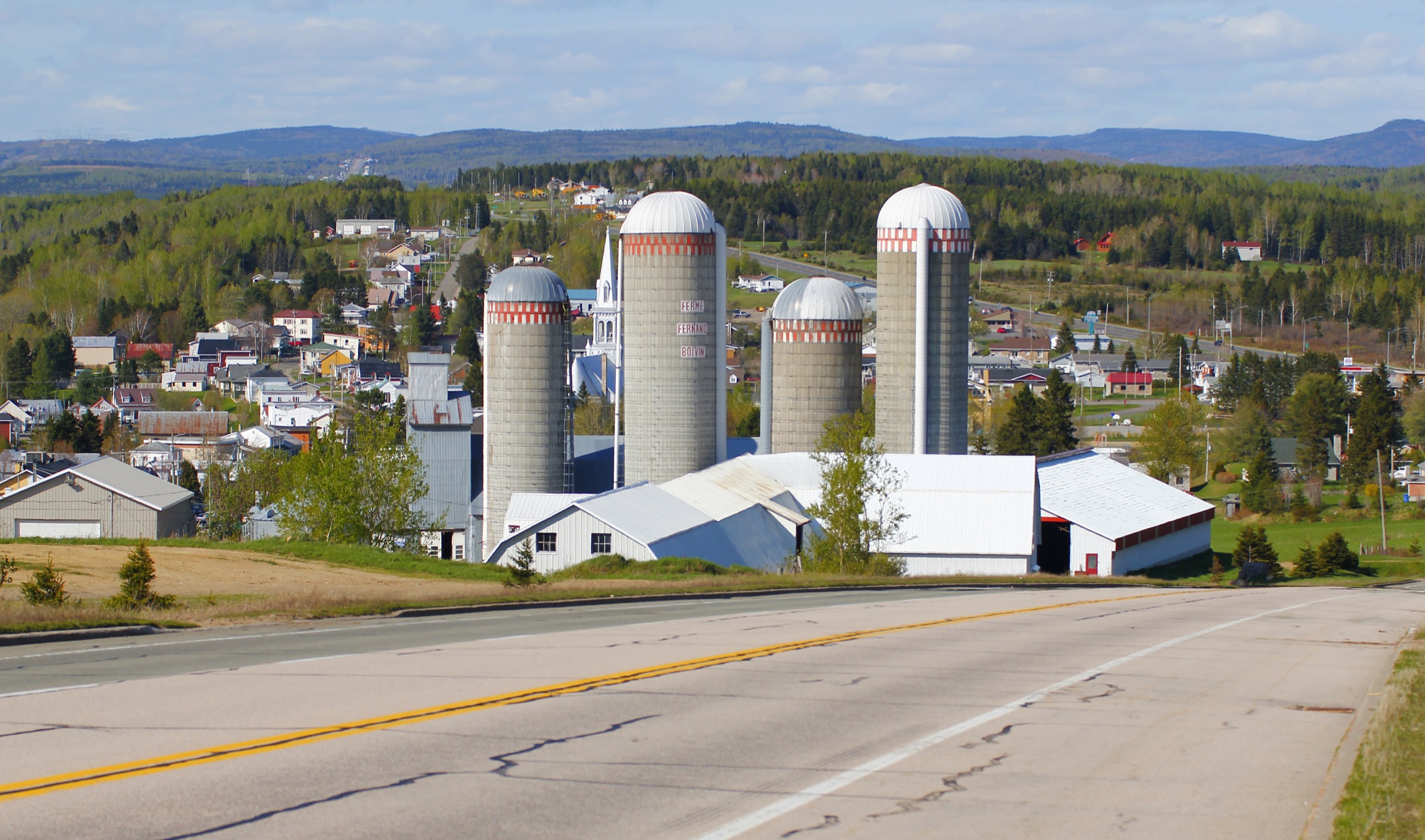
Hiking access is structured around three nodes. Baie-Saint-Paul and Saint-Urbain serve the central plateau (Parc national des Grands-Jardins, Sentiers Québec-Charlevoix and the Traversée de Charlevoix system, Mont du Dôme, Mont des Morios). La Malbaie and Saint-Aimé-des-Lacs serve the eastern parks (Parc national des Hautes-Gorges-de-la-Rivière-Malbaie, Mont Grand-Fonds, Mont Élie). Petite-Rivière-Saint-François, Saint-Tite-des-Caps and the Côte-de-Beaupré edge of the region serve the coastal cliffs (Le Massif de Charlevoix, Sentier des Caps de Charlevoix, Sentier Mestachibo, Cap Tourmente National Wildlife Area). Highway 138 along the coast and Route 381 over the rim from Baie-Saint-Paul to Saguenay are the two principal access corridors.
The reliable walking season runs from mid-May at low elevation and along the coastal cliffs through to late October. The higher inland summits — Lac des Cygnes, Dôme, Morios, Acropole — typically clear of snow only by late May or early June and may receive significant snowfall again in mid-October. Black bear is present range-wide and standard food-storage practice applies. Moose and white-tailed deer are common; in autumn, the inland sectors overlap active rifle hunting on ZEC and outfitter lands (notably ZEC des Martres around Mont du Dôme), so hunter-orange clothing and local season checks are appropriate. Cell coverage is patchy off Highway 138 and absent on most inland approaches. Many of the best summits sit on volunteer-managed or co-operative trail networks — Sentiers Québec-Charlevoix and La Traversée de Charlevoix, the Association du Sentier des Caps, Mestachibo, the Coopérative Mont des Morios — that depend on small per-day contributions or pass purchase to remain open.
Selection rationale
Two of the region’s most famous day-hikes — Mont du Lac des Cygnes in Parc national des Grands-Jardins and l’Acropole des Draveurs in Parc national des Hautes-Gorges-de-la-Rivière-Malbaie — sit inside the two SEPAQ parks treated in a separate catalogue entry. This entry therefore deliberately concentrates on the wider Charlevoix landscape outside those parks: the coastal cliffs, the inland summits managed by non-profit trail organisations, and the river-canyon corridor that connects the Côte-de-Beaupré to the Charlevoix rim. The five hikes span the region west to east from Cap Tourmente to La Malbaie and cover coastal cliff, rounded inland summit, granite ridge, river canyon and ski-resort lookout: a long coastal cliff loop on the St Lawrence (Sentier des Caps de Charlevoix — Cap Gribane loop); the signature Traversée de Charlevoix summit closest to Baie-Saint-Paul (Mont du Dôme); the most dramatic standalone inland summit between Notre-Dame-des-Monts and the Hautes-Gorges (Mont des Morios); the canyon-and-suspension-bridge corridor on the Rivière Sainte-Anne-du-Nord (Sentier Mestachibo); and the lookout-summit immediately above La Malbaie (Mont Grand-Fonds via La Trappeur).
Summary
| # | Hike | Country | Route type | Distance | Gain | Max elevation | Difficulty |
|---|---|---|---|---|---|---|---|
| 1 | Sentier des Caps — Cap Gribane loop | Canada | Loop | ~12–14 km | ~600–800 m | ~620 m | Moderate–strenuous |
| 2 | Sentier du Mont du Dôme | Canada | Loop | 7.8–10.3 km | ~360–418 m | ~960 m | Intermediate |
| 3 | Mont des Morios (boucle L’Expert + Morios Nord) | Canada | Loop | 10.6–11.9 km | ~600–637 m | ~950 m | Strenuous |
| 4 | Sentier Mestachibo — full traverse | Canada | Point-to-point | 11.6–22.2 km | ~500–700 m | ~440 m | Strenuous |
| 5 | Mont Grand-Fonds — La Trappeur to summit | Canada | Out-and-back / loop | 7.6–9 km | ~315–335 m | ~735 m | Moderate–strenuous |
1. Sentier des Caps de Charlevoix — Cap Gribane loop
Snapshot
Itinerary
From the Saint-Tite-des-Caps reception, the route follows the main Sentier des Caps north-eastwards toward the escarpment of the St Lawrence, climbing through mixed boreal forest of balsam fir, yellow birch and white spruce. The first lookout is reached after roughly 100 m of climb, where the path opens onto the long cliff line above the river with views east to Île aux Coudres and the Montmagny Archipelago. The trail rolls along the cliff-edge bench past a series of named viewpoints and reaches the Cap Gribane refuge at approximately the 6.2 km mark, set on a granite outcrop above the river. The recommended return is via the Cap Rouge variant, which loops back through interior forest and rejoins the Sentier des Caps near the trailhead. A worthwhile side spur on the outbound leg follows the La Chute trail to an additional lookout on the St Lawrence before rejoining the main path. The full operator-managed network in this sector contains seven interconnected trails ranging from 4 to 12.8 km, allowing multiple loop variants.
Why it is essential
The Cap Gribane loop is the signature day-hike option on the Sentier des Caps de Charlevoix network, which protects nearly 70 km of trails along the most spectacular cliff edge on the north shore of the St Lawrence. It delivers the defining Charlevoix combination of granite Bouclier cliff and tidal estuarine view without leaving the cliff-top for more than a few minutes at a time, and is the most accessible way to experience the coastal sector of the highlands as a day-walker.
Equipment
- Sturdy hiking boots; the cliff-bench trail has roots and rock steps
- Trekking poles for the rolling descents
- Sun protection and a windproof layer; the cliff edge is exposed
- 1.5–2 L water; few reliable filtering points along the bench
- Reception entry fee in cash or card (adults around $7, family around $21 per recent operator data, taxes additional)
- Insect protection in June and early July
Hazards and notes
- The cliff-edge sections are unfenced; keep clear of the rim, particularly in wet or icy conditions.
- Trails close annually from mid-April to mid-June for spring conditions.
- Access purchase is mandatory and reception office hours (08:30–16:00, closed weekdays 12:00–13:00) constrain late starts.
- The trailhead is shared with the multi-day Saint-Tite-des-Caps to Petite-Rivière-Saint-François traverse; shelters along the network are reserved for booked hikers.
- Black bear habitat; standard food-storage practice.
- Dogs are not permitted on the Sentier des Caps network; confirm current rules with the operator.
Routes and maps
| Source | URL |
|---|---|
| Sentier des Caps de Charlevoix — Le Sentier | sentierdescaps.com |
| AllTrails — Sentier des Caps de Charlevoix | alltrails.com |
| AllTrails — Caps, Chute Trails and Refuge du Cap Gribane | alltrails.com |
| Trailforks — Sentier des Caps de Charlevoix | trailforks.com |
| OpenStreetMap — Sentier des Caps de Charlevoix | openstreetmap.org |
External links
- Sentier des Caps de Charlevoix — official site
- Tourisme Charlevoix — Le Cap Gribane trail
- Bonjour Québec — Sentier des Caps de Charlevoix
2. Sentier du Mont du Dôme
Snapshot
Itinerary
From the self-service registration parking on Route 381, the trail enters mixed boreal forest dominated by birch and balsam fir, ascending in a gentle switchback pattern that softens the climb. After approximately 1.5 km a marked junction divides the easier intermediate ascent from a shorter, steeper alternative; the standard loop is hiked counter-clockwise via the more gradual line. The trail steepens through krummholz toward the summit dome, opening onto open bedrock outcrops with panoramic views west across Baie-Saint-Paul, the Île aux Coudres and the lower St Lawrence, and north into the inner Charlevoix plateau. The descent returns via the second arm of the loop through similar terrain. The 10.3 km extended variant continues across a low connecting ridge to traverse Mont l’Orignal and Mont Saint-Michel, two adjacent summits with comparable elevation and additional viewpoints, before rejoining the main loop.
Why it is essential
Mont du Dôme is the most prominent summit on the Route 381 corridor outside Parc national des Grands-Jardins, with an open subalpine summit cap and an exceptional bonus view of Baie-Saint-Paul and the St Lawrence estuary that the higher but more interior Lac des Cygnes does not provide. It is the flagship day-hike of Sentiers Québec-Charlevoix and La Traversée de Charlevoix and a routine inclusion in regional “best hikes” lists.
Equipment
- Trail-running shoes adequate in dry summer; sturdier boots better when wet
- Warm and weatherproof layers for the exposed summit
- Sun protection
- 1.5–2 L water
- Cash or card for the suggested $5 per person contribution at the parking lot
- Hunter orange in autumn rifle-hunting season; ZEC des Martres is active hunting territory
Hazards and notes
- Registration is mandatory at entry and exit of the ZEC des Martres territory, either at the Sentiers Québec-Charlevoix office on Route 381 km 10.6 or at the self-service box at the trailhead parking.
- The summit ridge is exposed and weather can change rapidly; snow patches can linger into early June.
- The trail can be muddy in spring and after heavy rain.
- ZEC des Martres overlaps active moose and deer hunting seasons, typically late September to mid-November; check current dates.
- Black bear habitat; standard food-storage practice.
- Dogs are permitted on leash; confirm current ZEC rules.
Routes and maps
| Source | URL |
|---|---|
| Sentiers Québec-Charlevoix — Sentier du Mont du Dôme | sentiersquebeccharlevoix.com |
| La Traversée de Charlevoix — Dôme Trail | traverseedecharlevoix.qc.ca |
| AllTrails — Sentier du Dôme | alltrails.com |
| AllTrails — Mont du Dôme, l’Orignal, Mont Saint-Michel | alltrails.com |
| OpenStreetMap — Mont du Dôme | openstreetmap.org |
External links
- La Traversée de Charlevoix — Dôme Trail
- Tourisme Charlevoix — Mont du Dôme blog
- Pleinairalacarte — Mont du Dôme trail
3. Mont des Morios (boucle L’Expert + Morios Nord)
Snapshot
Itinerary
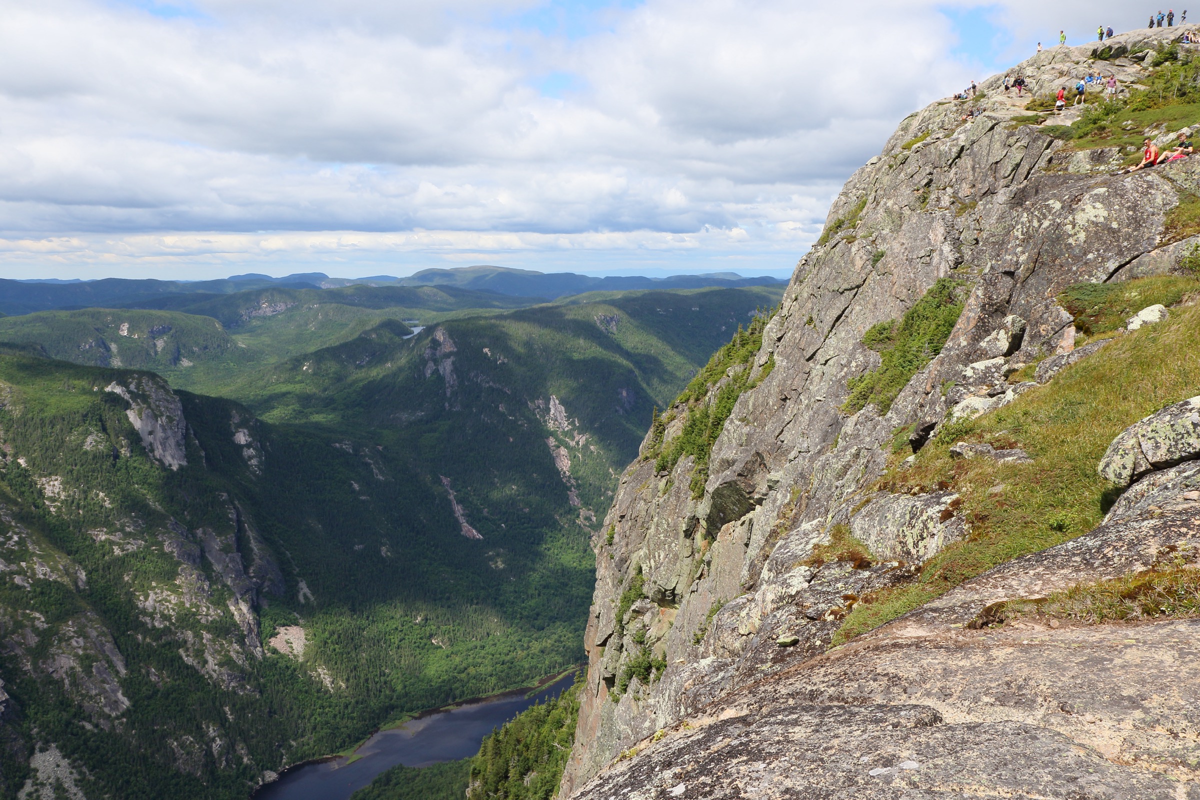
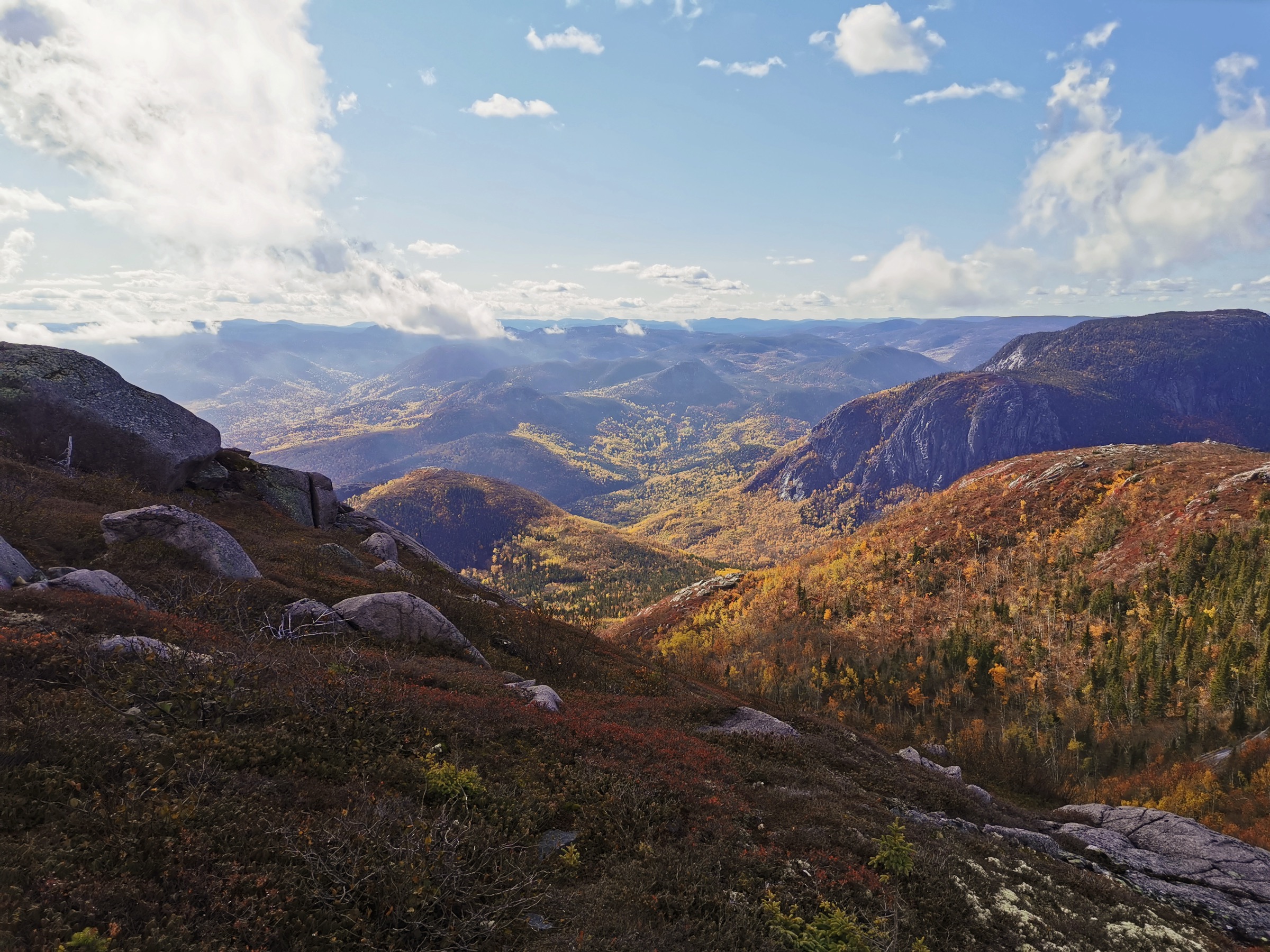
From the Lac Boudreault parking, the trail follows the gentle Sentier des Chutes north-east along a stream, passing several waterfalls and small cascades over the first ~3 km. The L’Expert variant breaks left and climbs steeply through subalpine fir and yellow birch, gaining roughly 600 m in under 2 km on a relentless, root-laced single-track. The trail emerges onto the open summit ridge of Mont des Morios at approximately 950 m, where exposed bedrock and dwarfed conifer offer a full 360-degree panorama: the Hautes-Gorges-de-la-Rivière-Malbaie to the south-east, the St Lawrence estuary and Île aux Coudres to the south, and the inner Laurentian plateau to the north and west. The recommended descent follows the longer, more gradual Morios Nord trail, completed in 2014, which contours north before descending in switchbacks back to the chutes corridor and the trailhead. Strong parties can extend via the linking Morios Nord connector to traverse Mont du Gros Castor as part of a 25 km circuit.
Why it is essential
Mont des Morios offers the most rewarding short-effort summit experience in the eastern Charlevoix plateau and is repeatedly cited as one of the most spectacular standalone summits in the wider region. It pairs a sustained subalpine climb with a true 360-degree summit ridge in a sector lightly touched by the major SEPAQ park network, and has become a staple of regional “5 summits of Charlevoix” challenge lists.
Equipment
- Sturdy boots; the L’Expert ascent is steep, rocky and root-laced
- Trekking poles strongly recommended for the descent
- Weatherproof and warm layers; the summit is exposed
- Insect protection (heavy blackfly and mosquito pressure in June)
- 2 L water; treat from streams
- Cash or card for the access fee, paid online or at the Marché des Montagnes co-op in Notre-Dame-des-Monts, or at a dépanneur in Saint-Aimé-des-Lacs
- Spare tyre and basic vehicle kit for the gravel approach
Hazards and notes
- The L’Expert ascent is consistently steep and not recommended in descent; loop counter-clockwise, climbing L’Expert and descending Morios Nord.
- The summit ridge is exposed to wind and lightning; descend promptly in storms.
- Snow lingers on the upper trail into late May or early June.
- The 14 km gravel approach road is generally manageable in passenger cars in dry conditions; check after rain.
- Black bear habitat; standard food-storage practice.
- Hunting is permitted on adjacent ZEC and outfitter lands; wear hunter orange in season.
- No cell coverage at the trailhead or on the summit.
Routes and maps
| Source | URL |
|---|---|
| Tourisme Charlevoix — Mont des Morios | tourisme-charlevoix.com |
| Association Pied-des-Monts — Morios Nord trail | association-pieddesmonts.com |
| AllTrails — Morios Mount | alltrails.com |
| AllTrails — Morios Mount Loop | alltrails.com |
| OpenStreetMap — Mont des Morios | openstreetmap.org |
External links
- Tourisme Charlevoix — Mont des Morios (French)
- Pleinairalacarte — Mount Morios, Notre-Dame-des-Monts
- Dan en bottines — Boucle des monts Morios
- Wikipédia (fr) — Mont des Morios
4. Sentier Mestachibo — full traverse
Snapshot
Itinerary
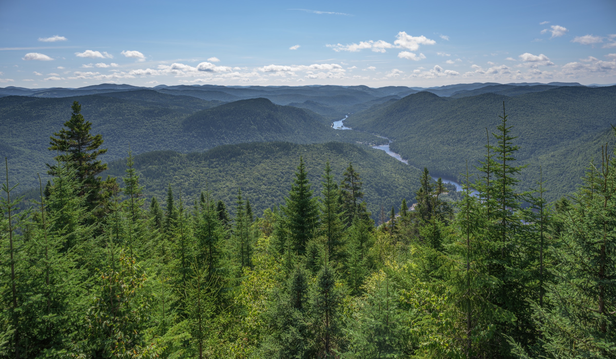
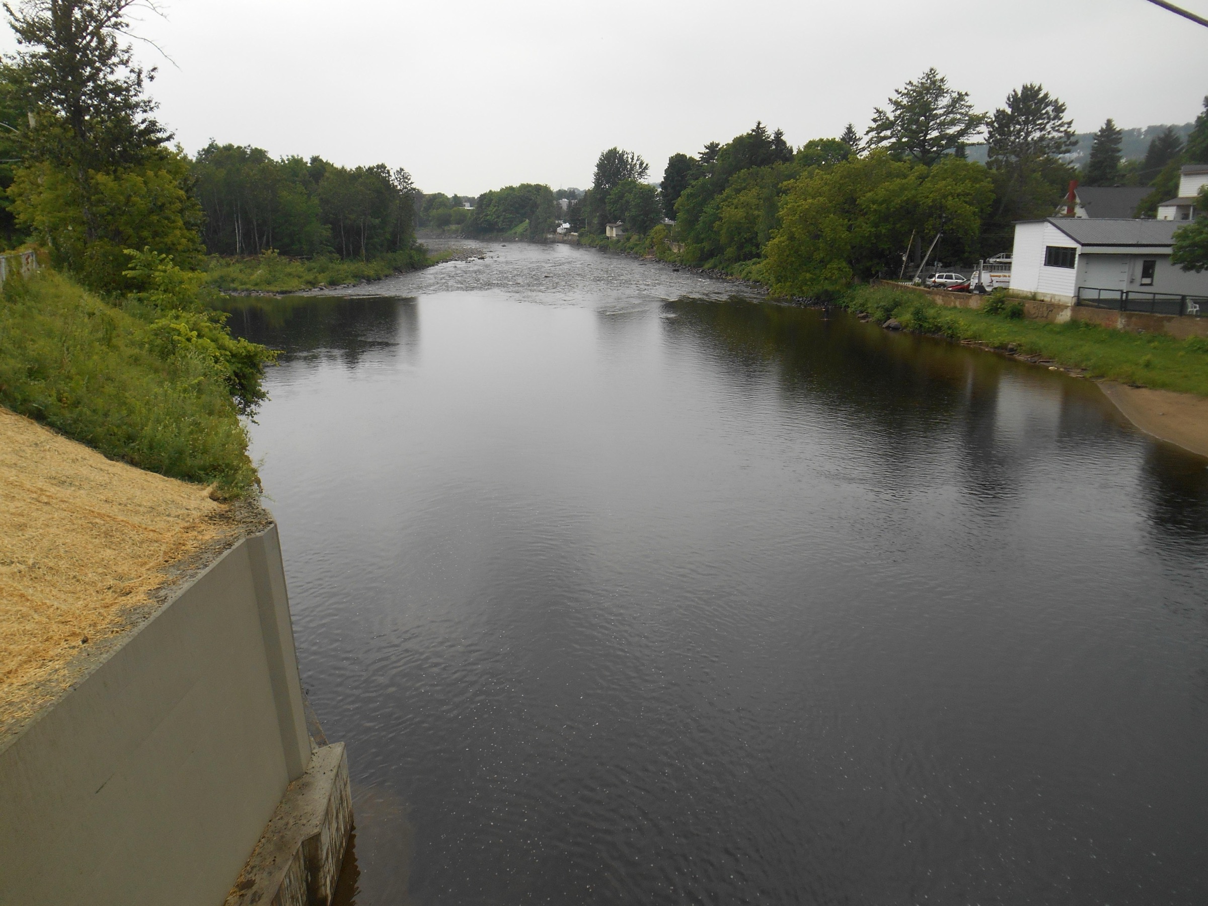
From the village church of Saint-Ferréol-les-Neiges, the east section descends to the Rivière Sainte-Anne-du-Nord and follows its left bank downstream through mature mixed forest of yellow birch, sugar maple and balsam fir. The trail is uneven throughout, alternating rocky ridges, scree slopes and forest benches above the river canyon. Two 70 m suspension footbridges cross the river, allowing the route to sample both banks and to access two midway lookouts above the canyon. Near the eastern end, the trail climbs above the river to gain the higher ground of the Saint-Tite-des-Caps plateau before reaching the Accueil Sentier des Caps. The 13.8 km western section runs in the opposite direction from the Mont-Sainte-Anne ski resort upstream to the Saint-Ferréol village church and is similar in character: river-canyon traverse on uneven terrain with bridge crossings and lookouts. Walking the full 22.2 km traverse requires either an early start or strong pacing.
Why it is essential
The Mestachibo is the only sustained river-canyon traverse in the Charlevoix–Côte-de-Beaupré transition, and arguably the finest canyon hike accessible as a day walk on the north shore of the St Lawrence outside Hautes-Gorges. Its two suspension bridges, mature deciduous forest and consistent canyon views make it a distinct counterpoint to the summit and coastal hikes of the rest of the region, and it functions as the natural pedestrian link between Mont-Sainte-Anne and the Sentier des Caps network.
Equipment
- Sturdy boots; the terrain is rocky, rooty and slippery when wet
- Trekking poles for the uneven ground
- Weatherproof layer
- Sun protection on the open ridges and insect protection (intense blackfly in June, mosquitoes through July)
- 2 L water; refill possible at the river with treatment
- Shuttle arrangement or two vehicles
- Cash or card for the Sentier des Caps reception access purchase, if finishing at Saint-Tite-des-Caps
Hazards and notes
- River crossings are by suspension bridge only; the Sainte-Anne carries strong, cold flow year-round and should not be forded.
- Bridges are removed or closed in unstable shoulder-season conditions; the official trail access window is 15 May to 30 November.
- Sections of the trail include scree and exposed rocky ridges that can be hazardous in wet or freezing conditions.
- No cell coverage in the canyon.
- Black bear habitat; standard food-storage practice.
- Mountain bikes are not permitted on the Mestachibo trail.
- Shuttle planning is essential; the operator recommends arranging it before starting the walk.
Routes and maps
| Source | URL |
|---|---|
| Mestachibo — Parcours | mestachibo.com |
| Mestachibo — Planification | mestachibo.com |
| AllTrails — Sentier Mestachibo | alltrails.com |
| FastestKnownTime — Mestachibo Trail | fastestknowntime.com |
| OpenStreetMap — Sentier Mestachibo | openstreetmap.org |
External links
- Mestachibo — official site
- Pleinairalacarte — Mestachibo trail
- Visit Québec City — Sentier Mestachibo
- Côte-de-Beaupré tourism — Jean-Larose Fall
5. Mont Grand-Fonds — La Trappeur to Belvédère du Lac Gravel and summit
Snapshot
Itinerary
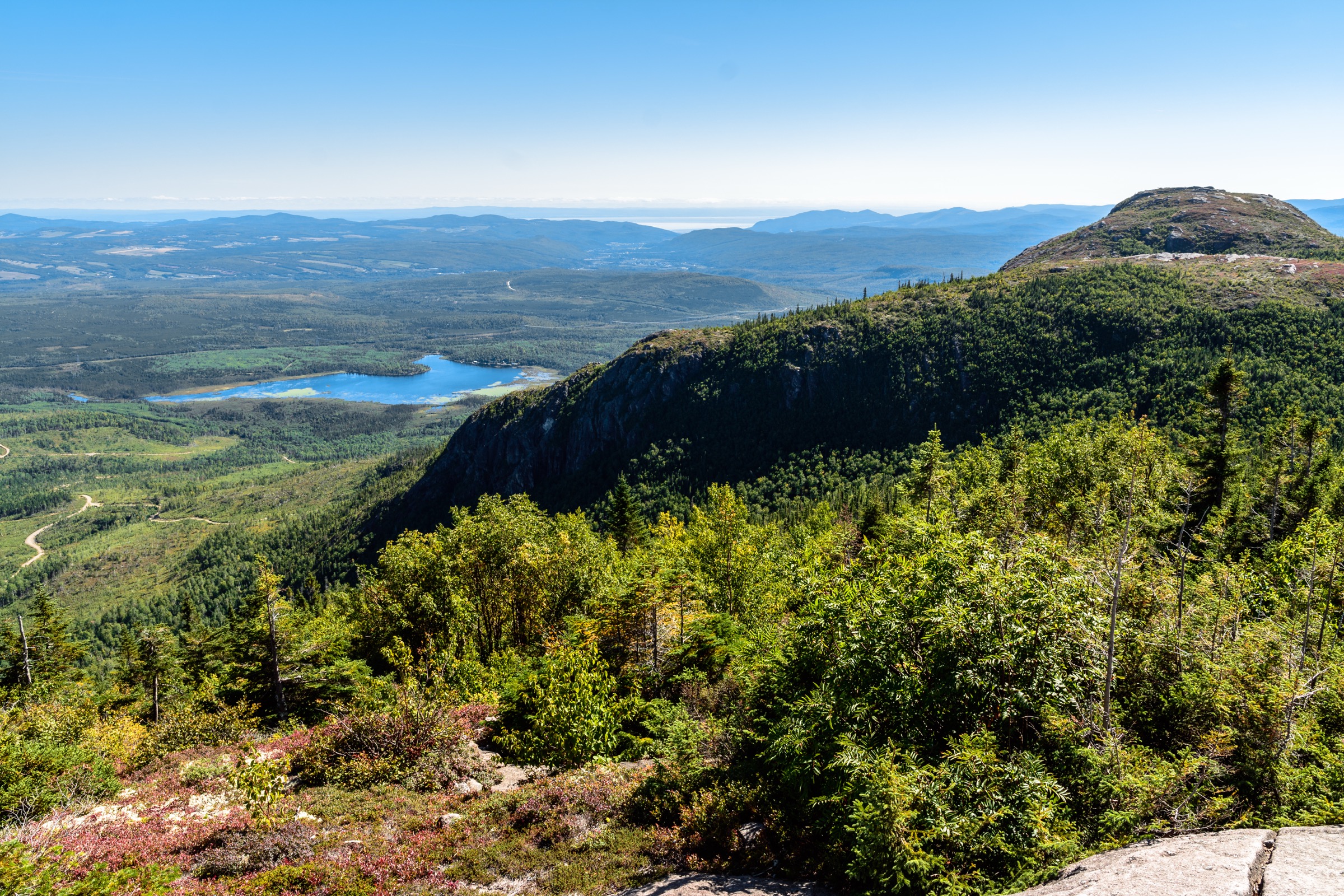
From the base chalet of the Mont Grand-Fonds ski resort, the route follows the signed La Trappeur trail eastward, climbing steadily through dense boreal forest of balsam fir and white birch on a narrow forest single-track. The grade is sustained — 315 m of gain over 3.8 km — without significant flats, climbing the eastern flank of the mountain. The trail emerges at the Belvédère du Lac Gravel, a wooden observation deck overlooking Lac Gravel and the surrounding plateau. A short additional walk of a few hundred metres gains the true summit at approximately 735 m, where views open south-west to the St Lawrence and east toward the Charlevoix-Est plateau. The simplest return is back down La Trappeur; an alternative is to descend La Sommet, an intermediate trail in the western sector that loops back to the base by a slightly longer line, giving a more varied round-trip. Mont Grand-Fonds maintains 21.5 km of hiking trails in total, including the easy ski-slope-line Familiale, allowing a wide range of loop combinations.
Why it is essential
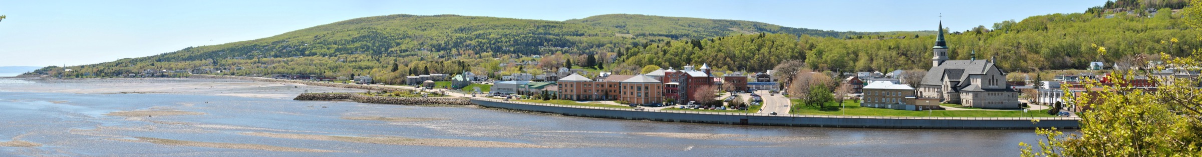
Mont Grand-Fonds is the principal day-hike summit immediately above La Malbaie and is the easternmost stop on the regional “Défi des 5 sommets” challenge, alongside Lac des Cygnes, Mont du Dôme, l’Acropole des Draveurs and Mont Élie. It provides a panoramic view of the St Lawrence and the central Laurentian plateau with the shortest approach drive from a major town centre in the region, making it the most accessible Charlevoix summit for visitors based in La Malbaie or the Pointe-au-Pic and Cap-à-l’Aigle area.
Equipment
- Trail-running shoes or hiking shoes in dry conditions; boots better when wet
- Trekking poles for the sustained La Trappeur descent
- Sun protection at the summit lookout
- 1.5 L water; treat from any sources
- Insect protection through June and early July
Hazards and notes
- The trail can be wet and muddy after rain; root systems are slippery.
- The summit area is exposed; descend promptly in storms.
- Black bear habitat; standard food-storage practice.
- The trails share terrain with the resort’s mountain-bike network; expect cyclists on intersecting trails.
- Trails are free of charge for hiking; check operator hours for chalet facilities (washrooms, water).
- Dogs are permitted on leash; confirm current resort rules.
- No cell coverage guaranteed on the summit.
Routes and maps
| Source | URL |
|---|---|
| Mont Grand-Fonds — Randonnée pédestre | montgrandfonds.com |
| Tourisme Charlevoix — Mont Grand-Fonds | tourisme-charlevoix.com |
| Trailforks — Mont Grand-Fonds | trailforks.com |
| Balise Québec — Mont Grand-Fonds | baliseqc.ca |
| OpenStreetMap — Mont Grand-Fonds | openstreetmap.org |
External links
- Mont Grand-Fonds — official site
- Tourisme Charlevoix — La Trappeur, Mont Grand-Fonds
- Wikipedia — Mont Grand-Fonds
- Zone.Ski — Défi des 5 sommets: le Mont Grand-Fonds
External links
- Tourisme Charlevoix — main site
- Tourisme Charlevoix — mountain sector
- Réserve mondiale de la biosphère de Charlevoix
- SEPAQ — Parc national des Grands-Jardins
- SEPAQ — Parc national des Hautes-Gorges-de-la-Rivière-Malbaie
- Sentier des Caps de Charlevoix
- La Traversée de Charlevoix
- Sentiers Québec-Charlevoix
- Mestachibo
- Mont Grand-Fonds
- Le Massif de Charlevoix
- Cap Tourmente National Wildlife Area
- Rando Québec
- Balise Québec
- Espaces — Défi des 5 sommets de Charlevoix
- Wikipedia — Charlevoix
- Wikipedia — Laurentian Mountains